South Kaibab Trail to Ooh Aah Point
View Photos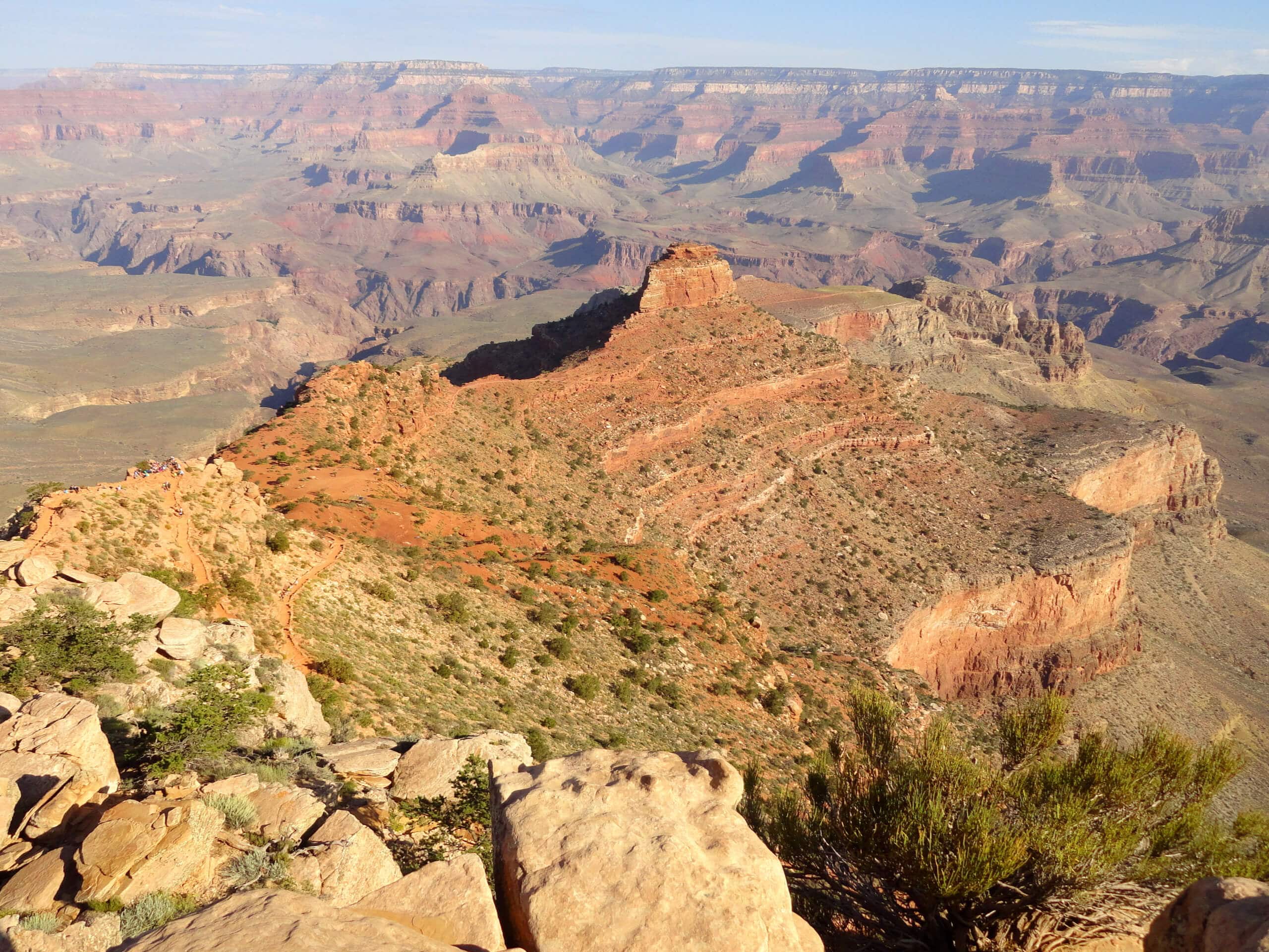
South Kaibab Trail to Ooh Aah Point
Difficulty Rating:
The South Kaibab Trail to Ooh Aah Point hike is one of the easiest hikes around the canyon, but it doesn’t compromise at all on views. This route is only a mile or so each way and those with a basic level of fitness should find it manageable, including younger adventurers. The views you’ll get from the lookout are ones you won’t soon forget, so make sure you’ve got a camera with you to capture the moment.
This hike is at the South Rim of the Grand Canyon, which is the area most tourists visit during their time at the canyon. It’s located near Yaki Point, and while you won’t be able to park right at the trailhead, you can take one of the shuttles there for easy access.
Getting there
The trailhead for the South Kaibab Trail to Ooh Aah Point is on Yaki Point Road.

About
| Backcountry Campground | No |
| When to do | September-May |
| Pets allowed | No |
| Family friendly | Yes |
| Route Signage | Average |
| Crowd Levels | High |
| Route Type | Out and back |
South Kaibab Trail to Ooh Aah Point
Elevation Graph
Weather
South Kaibab Trail to Ooh Aah Point Description
Hiking in the Grand Canyon? You don’t need to be an expert! The South Kaibab Trail to Ooh Aah Point hike is one of the easiest hikes around the canyon, but that doesn’t mean you’ll be missing anything when it comes to the views. This route is an excellent option if you want one hike that’s doable for most skill levels, has great views, but isn’t very difficult. This trail also provides the opportunity to go further if you get to the point and want more.
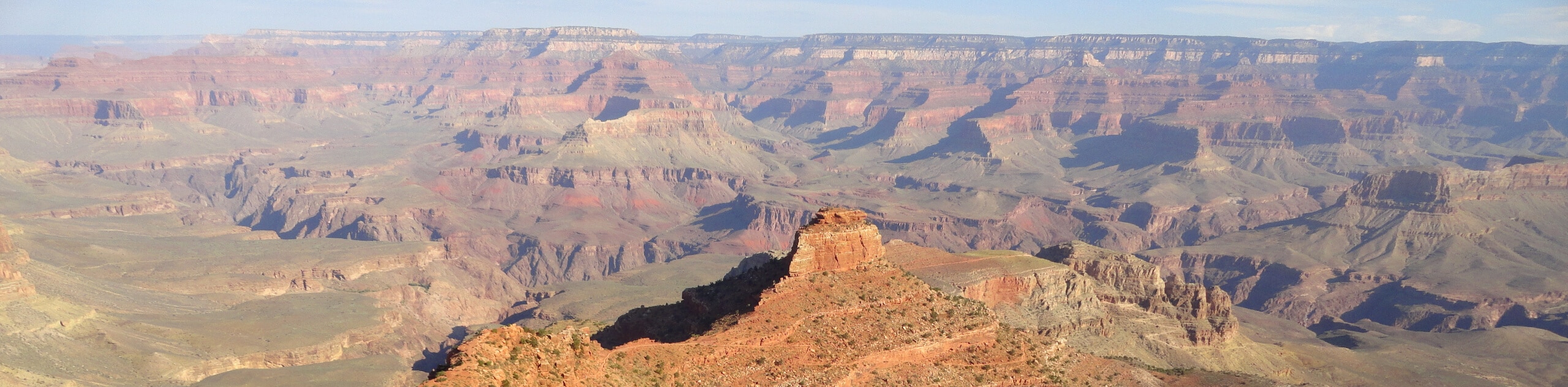
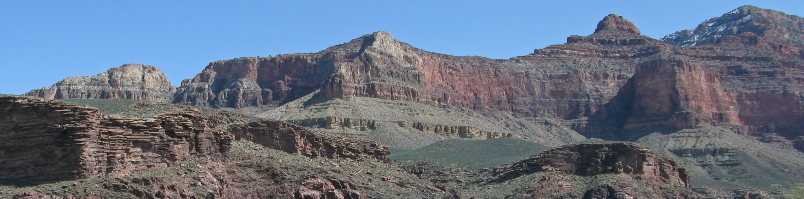
The South Kaibab Trail to Ooh Aah Point hike shows off the Grand Canyon from the South Rim, which is where most visitors to the canyon go. South Kaibab Trail is the second most popular trail in the canyon after Bright Angel Trail, but thanks to its average 10% gradient, it’s a bit easier to complete. It’s also not too bad for hikers who are afraid of heights thanks to its lack of narrow sections.
There may be mules on this trail packing out trash from Phantom Ranch. Should you come up to mules, listen to the handler’s directions on how to pass them. If you come up from behind, just announce yourself and listen for instructions on how to pass once it’s safe to do so.
The trailhead isn’t accessible by private vehicle, so you’ll need to take the orange shuttle or the hiker’s express shuttle. There’s a lot just east of Yaki Point Road that you can use to access the trailhead as well.
From the trailhead, you’ll hike out along the ridge. Aout a half-mile into the outbound trip, you’ll pass Yaki Point on your right, a popular viewpoint. Ooh Aah Point is less than half a mile past Yaki Point.
At the point, look out over the amazing view to the east. Ahead of you is O’Neill Butte, with Skeleton Point beyond that. Of course, there’s plenty of canyon to appreciate in almost all directions. Once you’re ready to head back, you’ll simply retrace your steps back to the trailhead and either walk back to where you parked or take the shuttle back.
Once you’re done, consider a stop into the Yavapai Museum of Geology on the South Rim to learn more about the fascinating geological history of the canyon.
Hiking Route Highlights
Grand Canyon
Revealing millions of years of geological history, the layered and massive Grand Canyon is a 3060 square mile canyon in Arizona. The canyon is 277.0mi long, up to 18.0mi wide and is over 6000ft at its deepest point. Carved by the Colorado River over millions of years, the canyon is now one of the world’s top natural attractions, bringing about 5 million visitors to its rim every year. Indigenous people have inhabited the canyon for many years, some considering it to be a holy site.
Frequently Asked Questions
Where do you park for the South Kaibab Trail?
The best way to access the trailhead is to park in the visitor parking at the South Rim and take the orange shuttle to the trailhead, which is not accessible by private vehicle.
How scary is the South Kaibab Trail?
While further sections of the trail might be intimidating to hikers who have a fear of heights, the section you’ll hike to Ooh Aah Point is quite tame in this regard.
How far is Ooh Aah Point?
It’s just under a mile to Ooh Aah Point.
Insider Hints
You’ll need a pass to visit the Grand Canyon. Passes can be purchased ahead of time online or at the park gates.
It can take a long time to get through the park gates during normal visiting hours, so we recommend planning to arrive a bit early.
The shuttles are free to use and run on a frequent, consistent schedule.
Similar hikes to the South Kaibab Trail to Ooh Aah Point hike
Waldron Trail
Waldron Trail is a hiking trail on the South Rim of the Grand Canyon that’s a bit of a hidden…
Powell Plateau Trail
Powell Plateau Trail is a hiking trail in the northwestern arm of the Grand Canyon. This spot in the canyon…
Indian Garden Campground via Bright Angel Trail
Of all places to camp, the Grand Canyon is a pretty hard one to beat, to say the absolute least.…
Comments