Grand Canyon Rim Trail
View Photos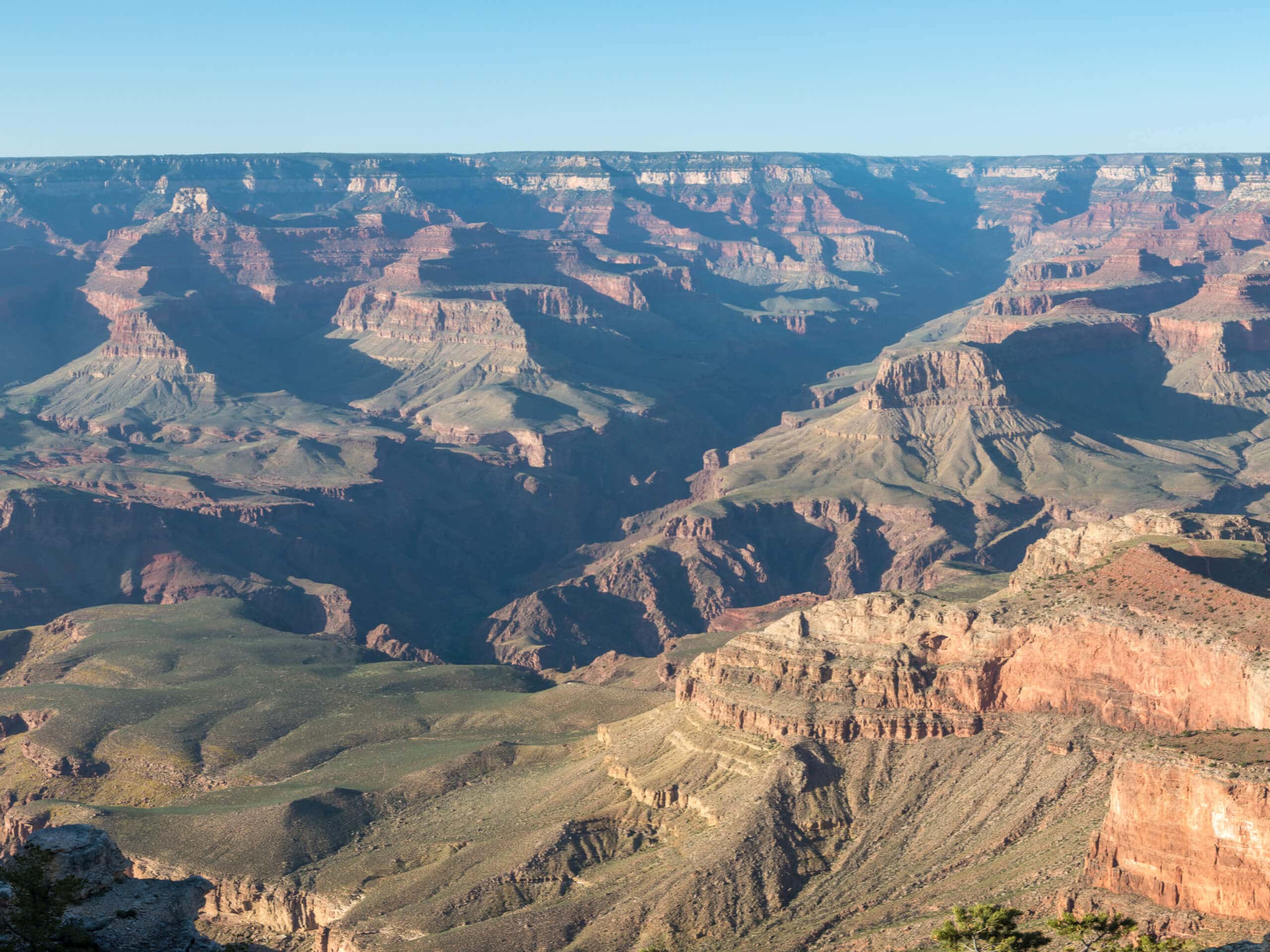
Grand Canyon Rim Trail
Difficulty Rating:
If you plan to visit the Grand Canyon, you’ll almost certainly find yourself on the Grand Canyon Rim Trail at one point or another. This trail covers almost 13.0mi from the eastern end to the western end, spanning across the best viewpoints on the South Rim. The route is easy and suitable for all ages and skill levels. It’s paved, so aside from steeper or rockier paths to viewpoints, the Rim Trail is perfect for all visitors to the park.
You can hop onto this trail at any point and hike as far as you like. This guide will detail the route from one end to the other, and while hiking the whole trail is an amazing experience, most visitors enjoy a shorter section or use it to access other routes into the canyon. Expect heavy traffic.
Getting there
There is no formal trailhead for this route, but you can access it easily from the Grand Canyon Village.

About
| Backcountry Campground | No |
| When to do | April-October |
| Pets allowed | No |
| Family friendly | Yes |
| Route Signage | Good |
| Crowd Levels | High |
| Route Type | One Way |
Grand Canyon Rim Trail
Elevation Graph
Weather
Grand Canyon Rim Trail Description
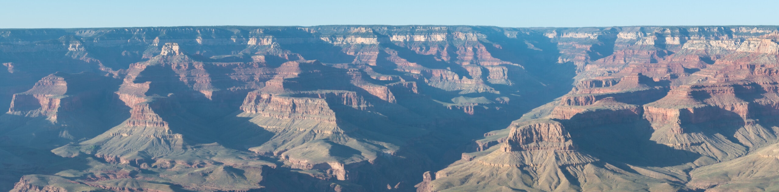
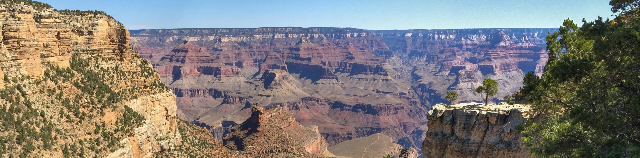
90% of visitors to the Grand Canyon come to the South Rim, and almost all of those visitors will hike along the Grand Canyon Rim Trail whether they realize it or not. This is the name of the walkway that stretches along the South Rim from Hermits Rest to near Yaki Point. The entire route is almost 13.0mi long, but most visitors just walk a portion of it to enjoy the most popular viewpoints.
Viewpoints along the Rim Trail from east to west include Pipecreek Vista, Mather Point (the first viewpoint you’ll see coming from the Village), Yavapai Point, Grandeur Point, Mary Jane Coulter Viewpoint, Trailview Overlook, Maricopa Point, Powell Point, Hopi Point, Mohave Point, Monument Creek, and Pima Point.
The trail is paved and inclines and declines are very gentle. This makes the route suitable for all skill levels and ages. Take care in colder weather as the trail can become snowy and icy. Additionally, some viewpoints are right on the trail, but some require climbing down rocky, rugged steps to get to. Not all viewpoints are suitable for those with mobility challenges, but the views are excellent throughout the hike, so you won’t be missing too much by staying on the paved trail if necessary.
If you want to cut down on the amount of hiking required but still see as much of the canyon as possible, you can take advantage of the park’s free shuttle service. The shuttles run frequently throughout the day to several different stops along the Rim Trail. The shuttles are color-coded, making it easy to figure out which ones to take where.
From the village, we recommend hiking west first. Hopi Point is the viewpoint that extends furthest into the canyon, so it’s a great spot to prioritize should you not want to hike the entire route. Yavapai Point is a popular viewpoint to the east. Mather Point is the first viewpoint most will see as they come into the park, and it’s just past Yavapai Point.
You can DIY your day at the canyon, or you can just stroll as far as you like before turning back or hopping on the shuttle. That’s the beauty of the Rim Trail- the views are so good, you’ll just want to keep going.
Wherever you end up, retracing your steps should return you to the village. Downloading the GPS route ahead of time can also help you keep track of where you are and how far you’ve gone.
Hiking Route Highlights
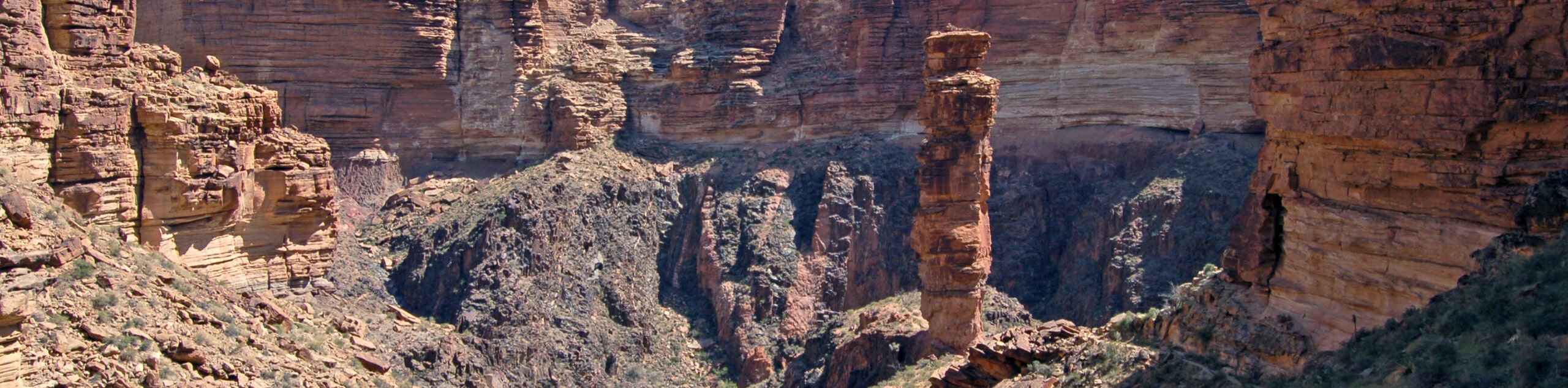
Grand Canyon
Revealing millions of years of geological history, the layered and massive Grand Canyon is a 3060 square mile canyon in Arizona. The canyon is 277.0mi long, up to 18.0mi wide and is over 6000ft at its deepest point. Carved by the Colorado River over millions of years, the canyon is now one of the world’s top natural attractions, bringing about 5 million visitors to its rim every year. Indigenous people have inhabited the canyon for many years, some considering it to be a holy site.
Frequently Asked Questions
Which rim of the Grand Canyon is best for hiking?
The South Rim is the more popular hiking destination for its services, maintained trails, and slightly more favorable weather.
Can you hike to the bottom of the Grand Canyon?
You sure can! Most hikers bound for the bottom of the canyon take Bright Angel Trail or South Kaibab Trail.
Is there a trail on the North Rim of the Grand Canyon?
The North Rim doesn’t have a comprehensive rim-side trail the way the South Rim does, but there are hiking trails on the North Rim.
Insider Hints
You’ll need a pass to visit the Grand Canyon. Passes can be purchased ahead of time online or at the park gates.
It can take a long time to get through the park gates during normal visiting hours, so we recommend planning to arrive a bit early.
The park shuttles run frequently and consistently throughout the day and there’s no charge to use them.
Similar hikes to the Grand Canyon Rim Trail hike
Powell Plateau Trail
Powell Plateau Trail is a hiking trail in the northwestern arm of the Grand Canyon. This spot in the canyon…
1.5-Mile Resthouse via Bright Angel Trail
The hike to the 1.5-Mile Resthouse on Bright Angel Trail is a nice compromise for hikers who want a little…
Hermit Camp to Monument Creek Camp via Tonto Trail
This guide follows a portion of Tonto Trail from Hermit Camp to Monument Creek Camp. This is a 6.3mi
Comments