Cape Final hike
View Photos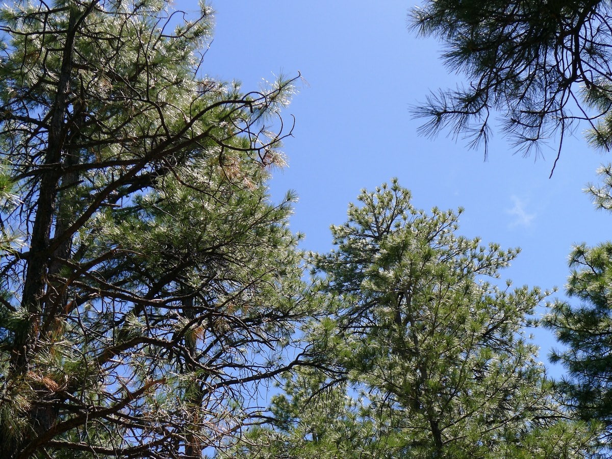
Cape Final hike
Difficulty Rating:
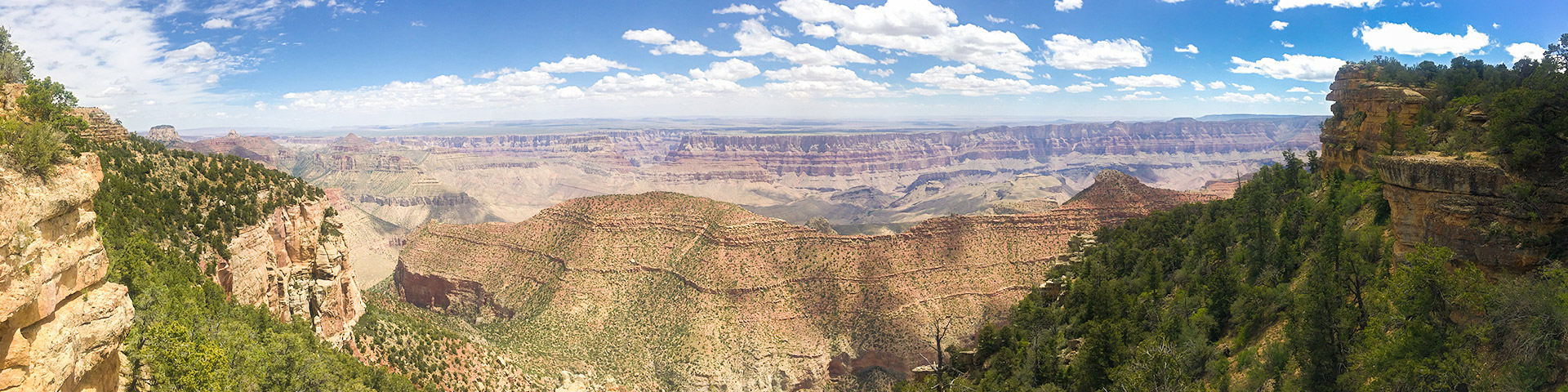
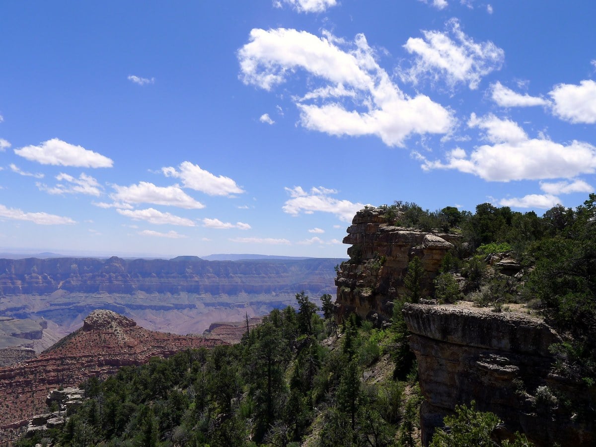
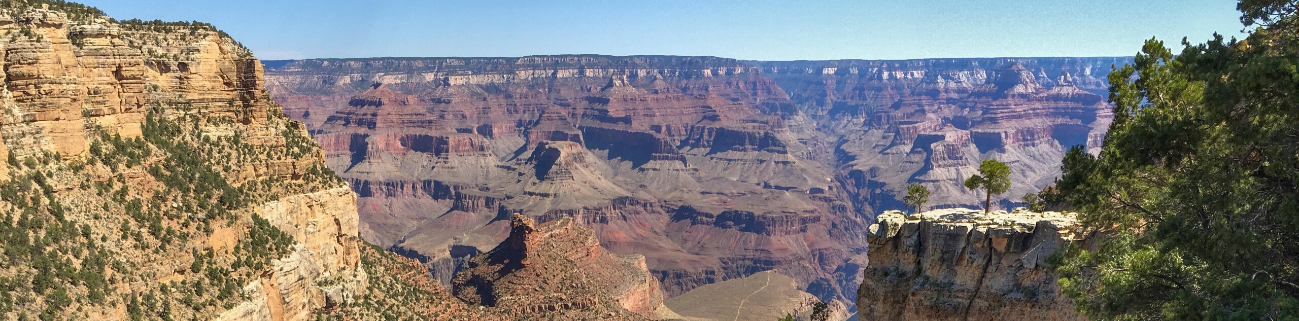
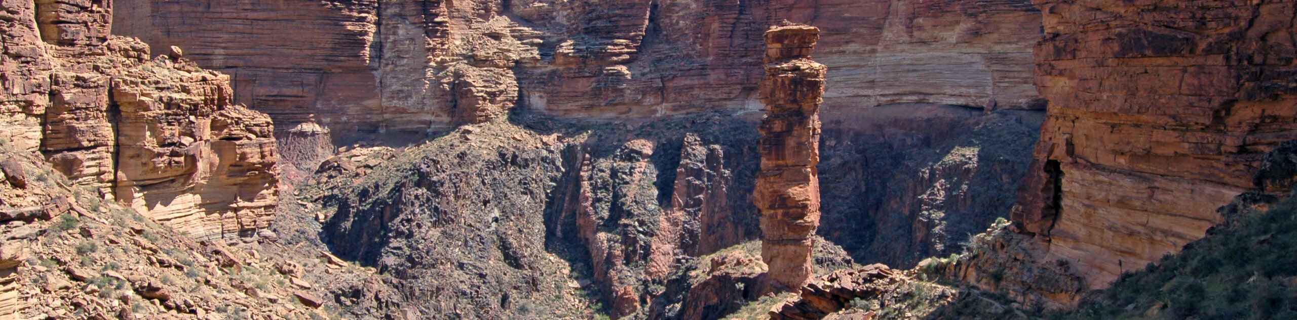
The mostly flat trail leading out to the rim of the stunning Cape Final isn’t the most well known, but it’s definitely well worth it. Here you will get absolutely fantastic panoramas of the Grand Canyon as well as views down to the Colorado River.
Getting there
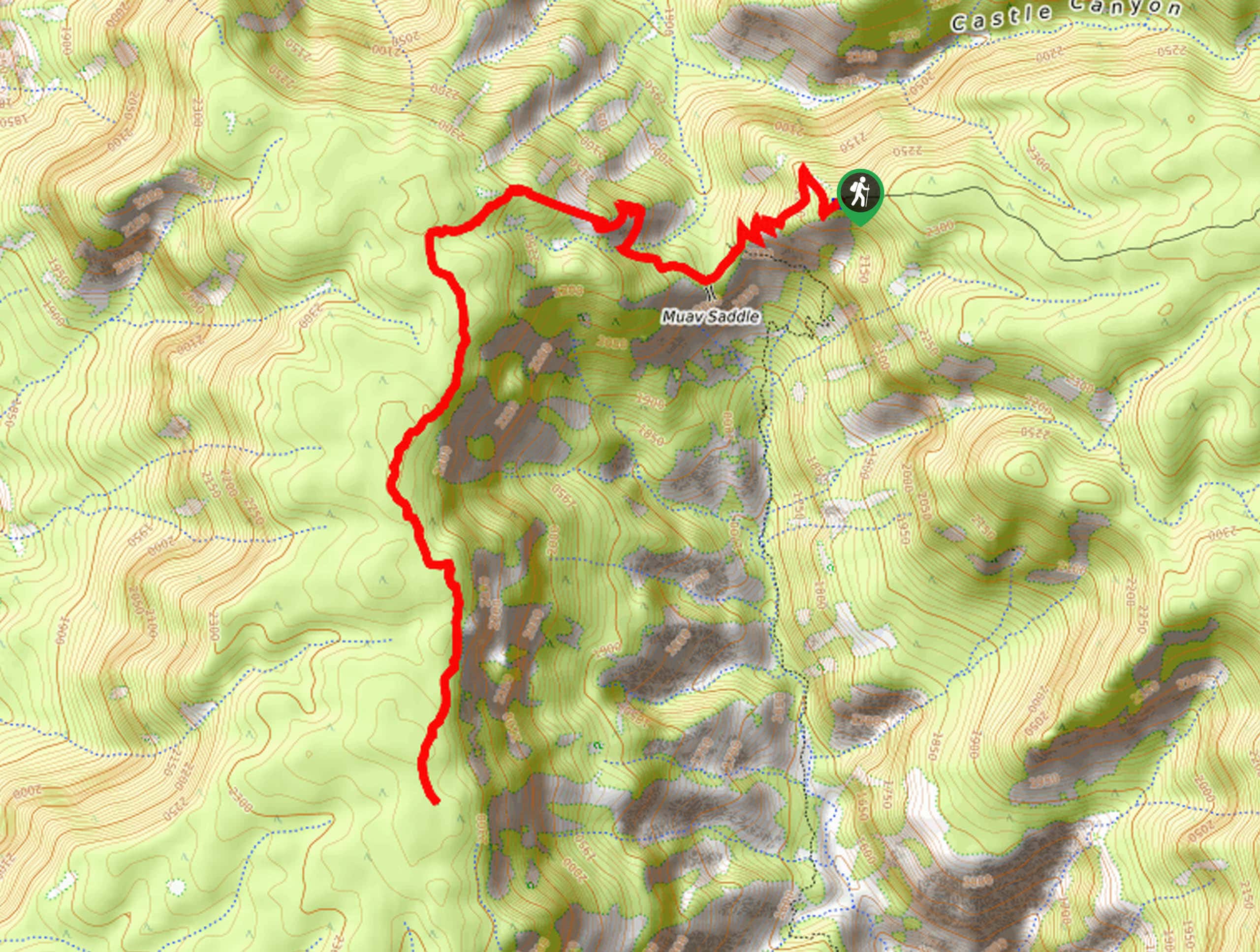
From the north entrance to Grand Canyon National Park continue until you reach the first junction. From here turn left onto the extremely narrow and winding Scenic Drive, with signs for Cape Royal. This road is not recommended for large vehicles and RV’s, because it is incredibly tight! Follow this road for most of its length until you reach a small sign for the Cape Final parking lot on the left. This small lot is easy to miss! If you reach the Cape Royal parking area at the end of the road you’ve gone approximately 3.0mi too far.

About
| When to do | Spring and Fall, avoid summer heat. Access Road closed Oct-May |
| Backcountry Campsites | None |
| Toilets | None |
| Family friendly | Yes |
| Route Signage | Average |
| Crowd Levels | Low to Moderate |
| Route Type | Out and back |
Cape Final
Elevation Graph
Weather
Route Description for Cape Final
From the small, wooded parking lot follow the unmarked, but very obvious trail as it snakes through the forest. This trail is extremely similar to Shoshone Trail on the South Rim, however is approximately twice as long. By that we mean that it is a wide, mostly flat trail going through a forest towards secluded yet scenic view of the canyon.
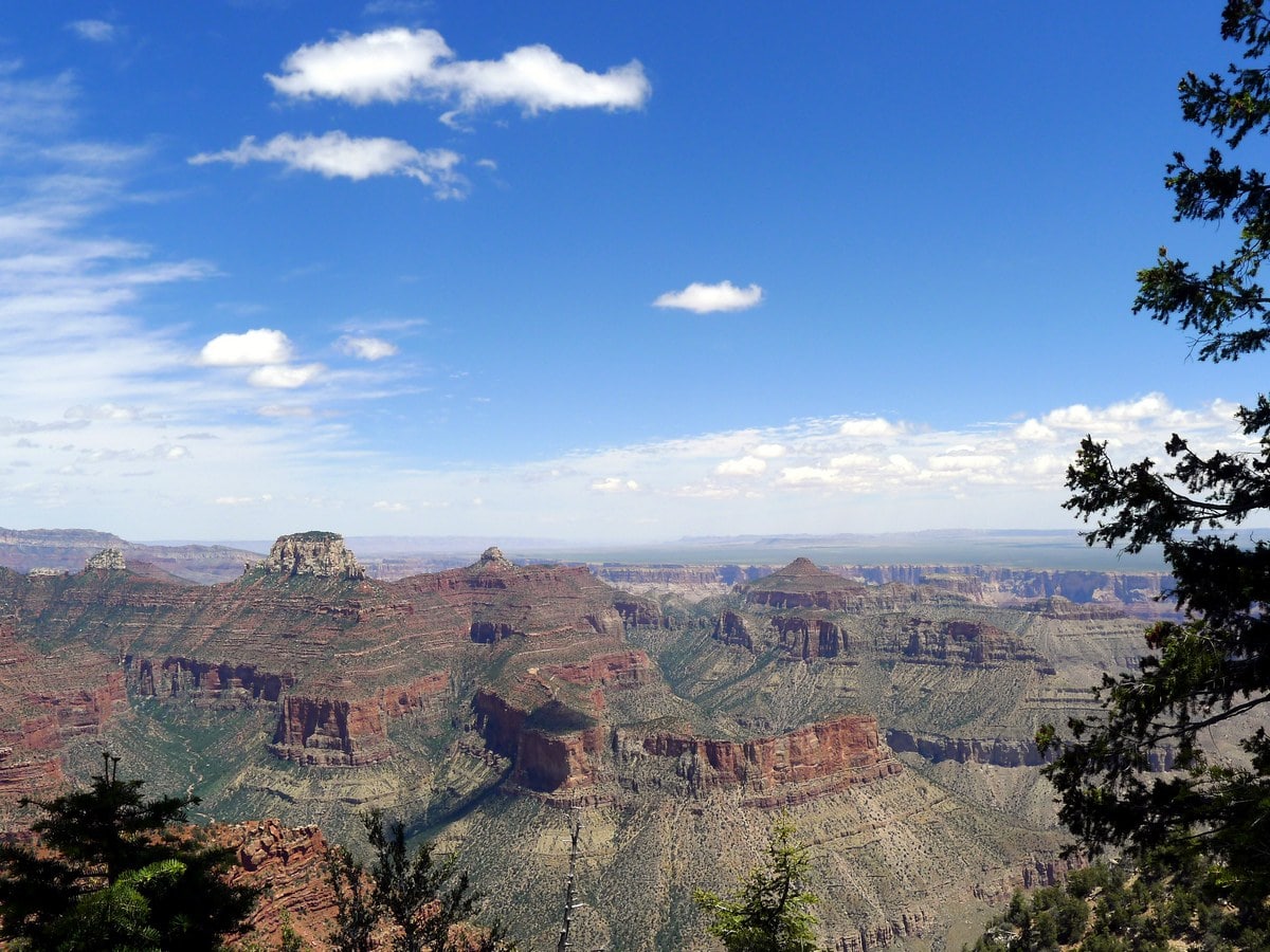
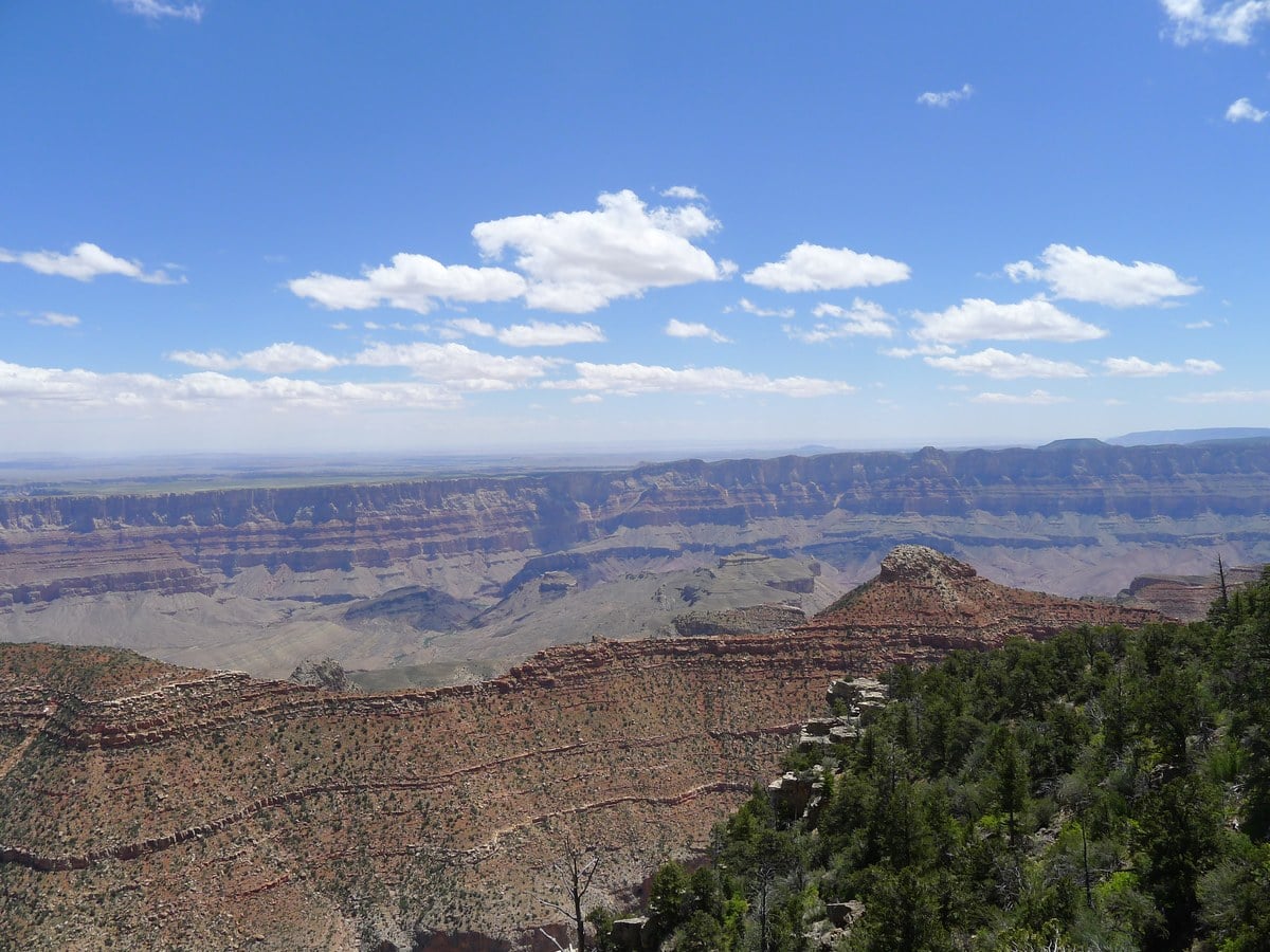
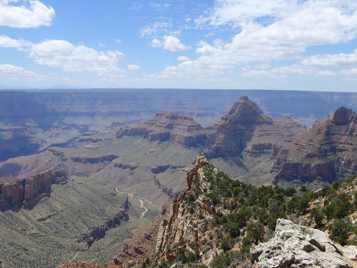
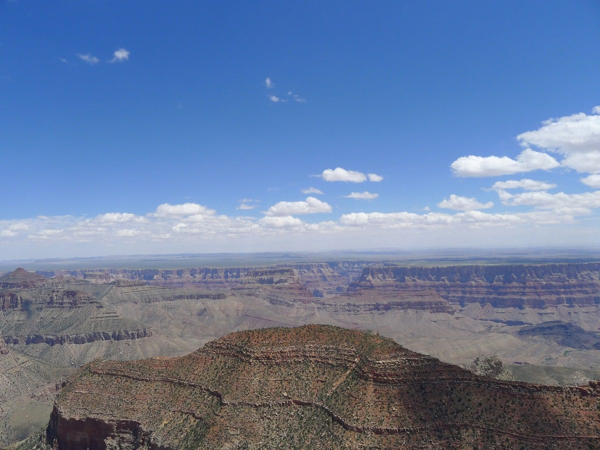
As the path continues you will have a handful of small hills to climb, but they shouldn’t pose any physical challenge. After just over a mile you will reach your first view of the Canyon. This is the eastern-most trail we list, so you will get fantastic views of the deserts lining the east rim as well as the earlier sections of the Colorado River.
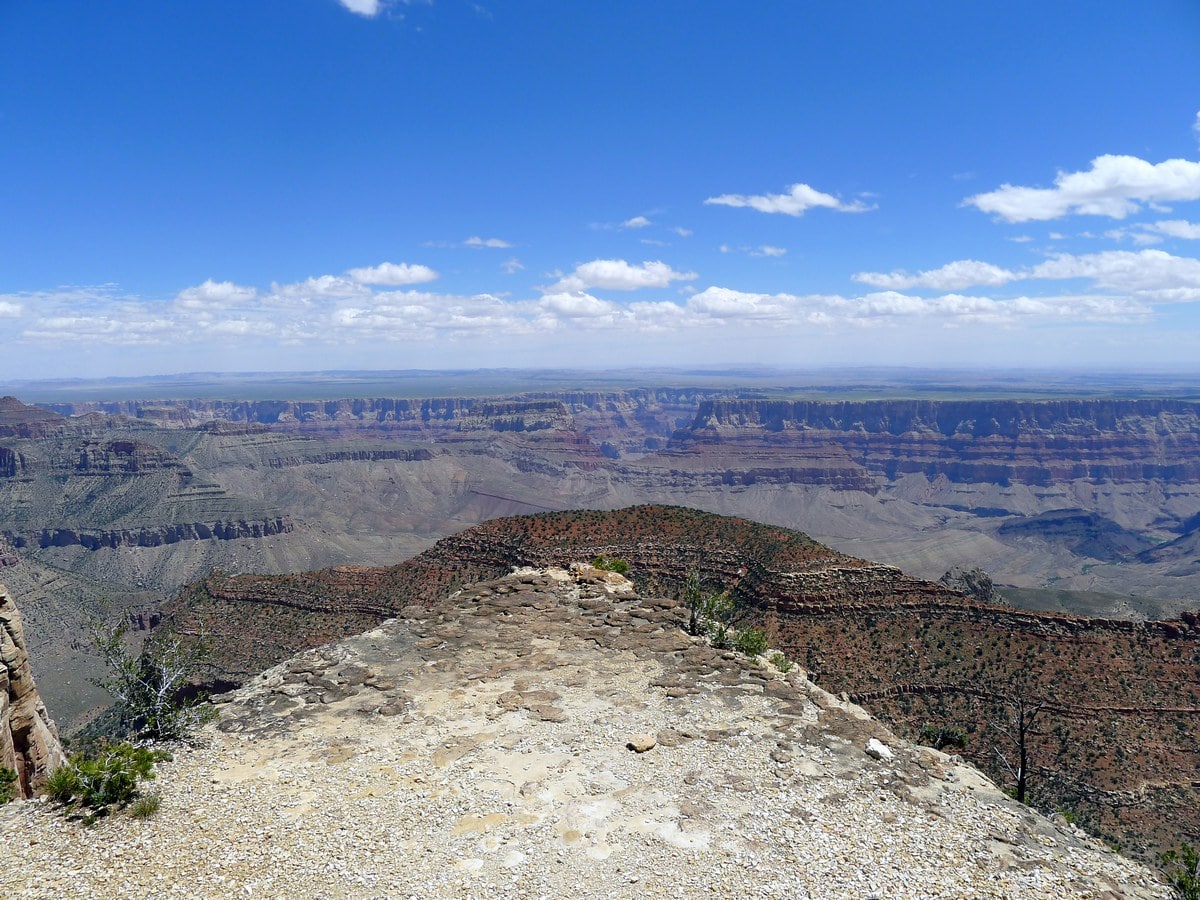
The trail then veers right and continues along the side of the rim, still undulating up and down before you finally reach a sign identifying Cape Final. Here you will also find a few backcountry campsites. Clamber up the rocky point to admire the fantastic views of the eastern section of Grand Canyon National Park. If you peer directly across you will mostly likely be able to see a small smudge on the horizon. This is the tower of Desert View on the South Rim! Return the way you came.
Insider Hints
Inquire at the backcountry permit office to get a camping permit for Cape Final. It is a fantastic, easy backpacking trip!

Similar hikes to the Cape Final hike
Powell Plateau Trail
Powell Plateau Trail is a hiking trail in the northwestern arm of the Grand Canyon. This spot in the canyon…
1.5-Mile Resthouse via Bright Angel Trail
The hike to the 1.5-Mile Resthouse on Bright Angel Trail is a nice compromise for hikers who want a little…
Hermit Camp to Monument Creek Camp via Tonto Trail
This guide follows a portion of Tonto Trail from Hermit Camp to Monument Creek Camp. This is a 6.3mi
Suzy TQ 4 years ago
When we started to walk the trail, we were skeptical about keep-going. But we made it and kept the beautiful views and experience in our heart. Mesmerizing views!
TwoBoots 4 years ago
It was breathtaking and we were all speechless. Amazing views!
Anabelle Clyde 4 years ago
We're really mesmerized by the views! Beautiful!
Jill J. 4 years ago
Easy come, easy go. Can't help but compare the views from the previous hikes I've done in the same park. The views were pretty decent but I'm not that impressed.
Jason Bin 4 years ago
Hiking here was so much fun. The short and easy trail was very easy to do.
Sina f. 5 years ago
Took over 2 hours to complete it. Views were simply stunning. I highly recommend it.
Brian F. 5 years ago
A good hike you can combine with other short hikes. Views were simply refreshing.
Irene G. 5 years ago
Love the 360-degree views from the top. It was very secluded and we were only 10 people at the top.
Prince Ng 5 years ago
Would like to do the Cape Final next time! Fantastic hike!
Laurie G. 5 years ago
Honestly, the views were not as rewarding. But I enjoyed the panoramic views.