Lorna Doone Valley Trail
View Photos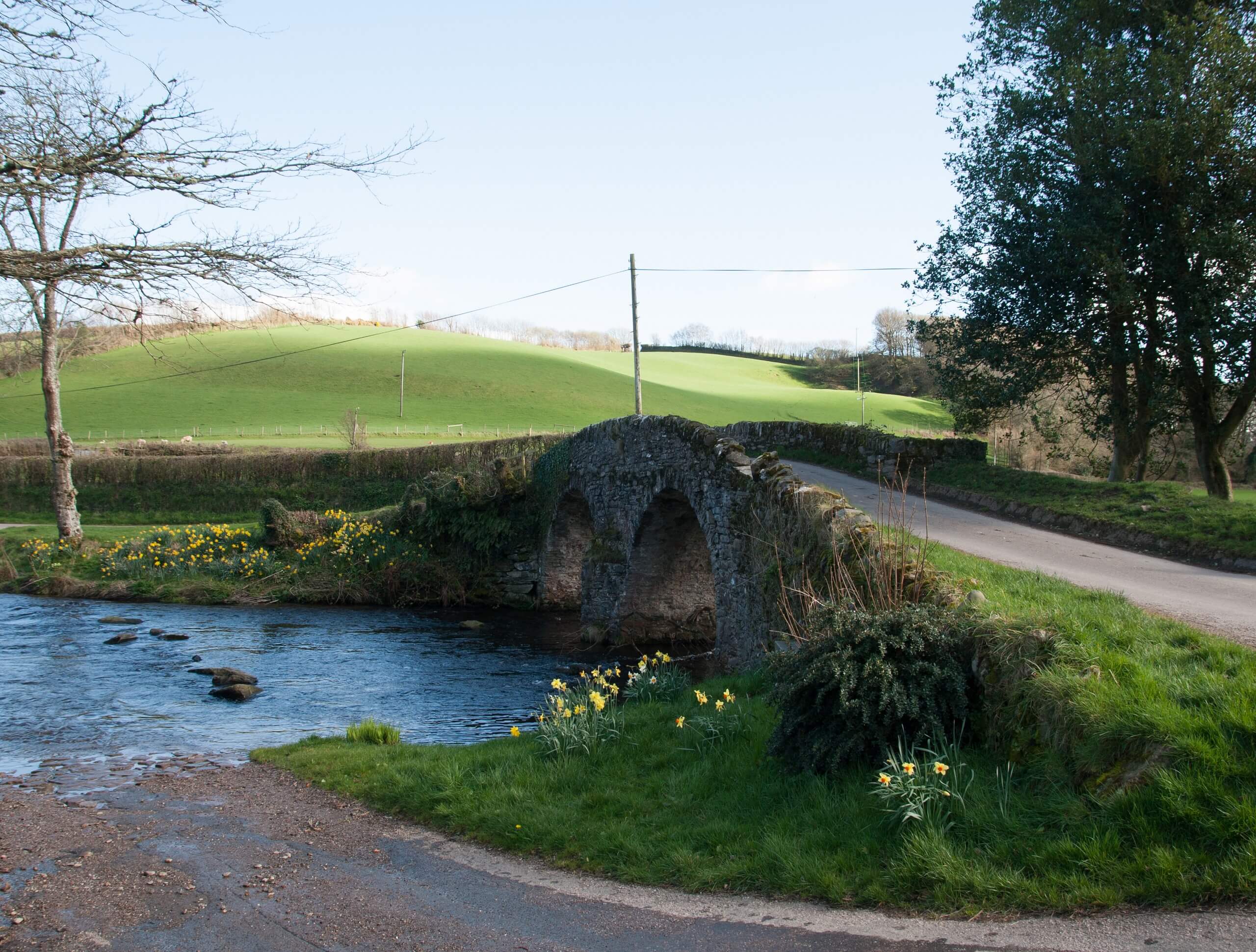
Lorna Doone Valley Trail
Difficulty Rating:
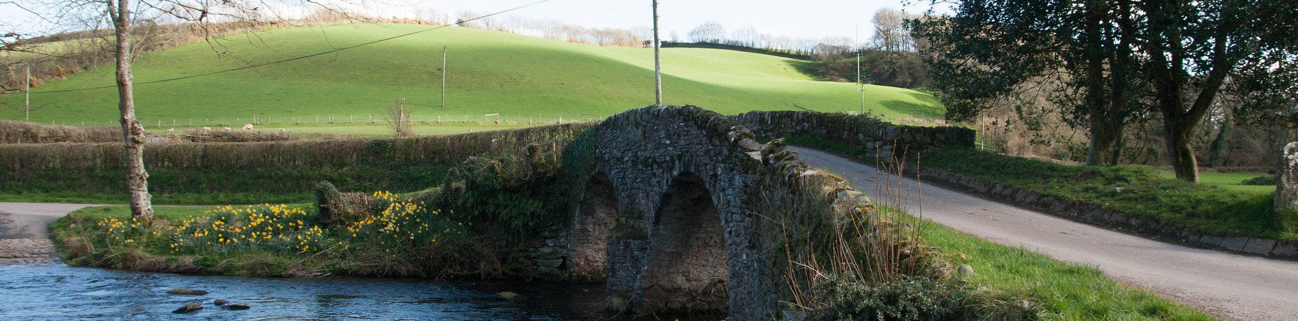
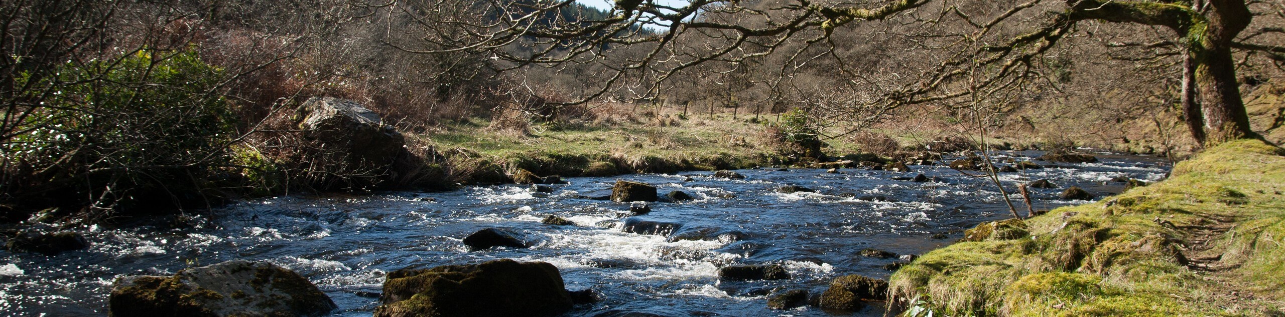
Walking the Lorna Doone Valley Trail is a fun and scenic experience that will expose you to some charming countryside views set in Exmoor National Park. While out walking the trail, you will pass through picturesque fields and serene forests, as you follow along the winding banks of Badgworthy Water. This is a lovely route that is perfectly suited for a relaxing weekend stroll.
Getting there
To reach the trailhead for the Lorna Doone Valley Trail from Porlock, drive west on High Street/A39 for 7.9mi and make a slight left onto Hall Hill, following it for 0.8mi. Turn left and continue on for 190ft before making another left. After 115ft, make a third left turn onto Leeford Lane and follow it for 2.0mi to find the car park on the left.

About
| Backcountry Campground | Lorna Doone Campsite, Cloud Farm Campsite |
| When to do | Year-Round |
| Pets allowed | Yes - On Leash |
| Family friendly | Yes |
| Route Signage | Average |
| Crowd Levels | Moderate |
| Route Type | Out and back |
Lorna Doone Valley Trail
Elevation Graph
Weather
Lorna Doone Valley Trail Description
Featuring only a small amount of elevation gain and an easy to navigate out and back route, the Lorna Doone Valley Trail is a pretty straightforward adventure without many drawbacks. You will still want to wear comfortable footwear though, as there will be some areas with rugged terrain underfoot, such as roots or rocks.
If you are after a relaxing stroll through the countryside that still features a variety of scenery and terrain types, then this route will be a perfect fit for you. While on the trail, you will meander along the banks of Badgworthy Water, while taking in stunning views of rolling green hills, open fields, and peaceful woodlands that make the area such a picturesque place. This is a great walk to bring the whole family on to enjoy a fun excursion outdoors.
Setting out from the car park next to the campground, you will make your way south to head past the pub and arrive at a T-intersection in the road. Follow the road straight ahead to the southeast for only 40ft, where you will find a footpath branching off to the left. Follow this past the remaining buildings to meet up with the tree-lined banks of Badgworthy Water, following them to the southeast. Continue along this route for the next 0.6mi, enjoying the views of the countryside until you arrive at a junction.
Turn left here and continue south along the trail, following it for the next 0.92mi as it cuts through a wonderful stretch of forest known as Badgworthy Wood. Once you have arrived at another junction, you have reached the end of the trail. From here, turn back along the trail to retrace your steps, experiencing the beautiful views of the countryside from the opposite perspective until you arrive back at the car park having completed the Lorna Doone Valley Trail.
Insider Hints
Wear proper walking shoes in order to stay comfortable on the trail.
The Lorna Doone Inn and The Buttery are both great options at the trailhead for pre/post walk refreshments.
Try pairing this walk with a fun weekend of camping at the Lorna Doone or Cloud Farm Campsites along the trail.
Similar hikes to the Lorna Doone Valley Trail hike
South West Coast Path: Minehead to County Gate
Walking the South West Coast Path: Minehead to County Gate is a wonderful long-distance route that will provide stunning views…
Valley of the Rocks and Lynton Outer Loop
The Valley of the Rocks and Lynton Outer Loop is a wonderful excursion in Exmoor National Park that will lead…
Badgworthy Water and Doone Country Loop
The Badgworthy Water and Doone Country Loop is an amazing trail that will allow you to experience a variety of…
Comments