
Upper Upper Loop Trail
View Photos
Upper Upper Loop Trail
Difficulty Rating:
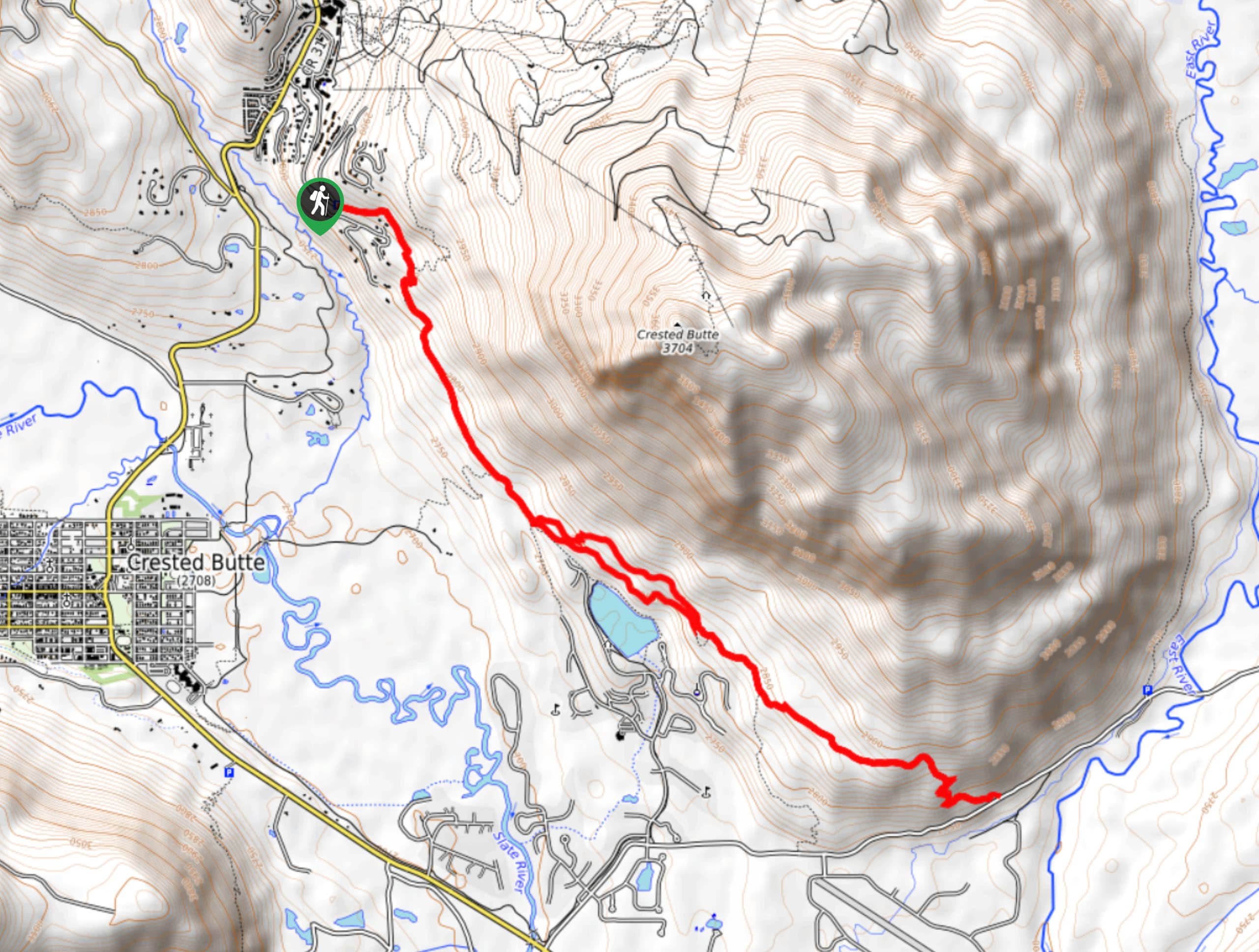
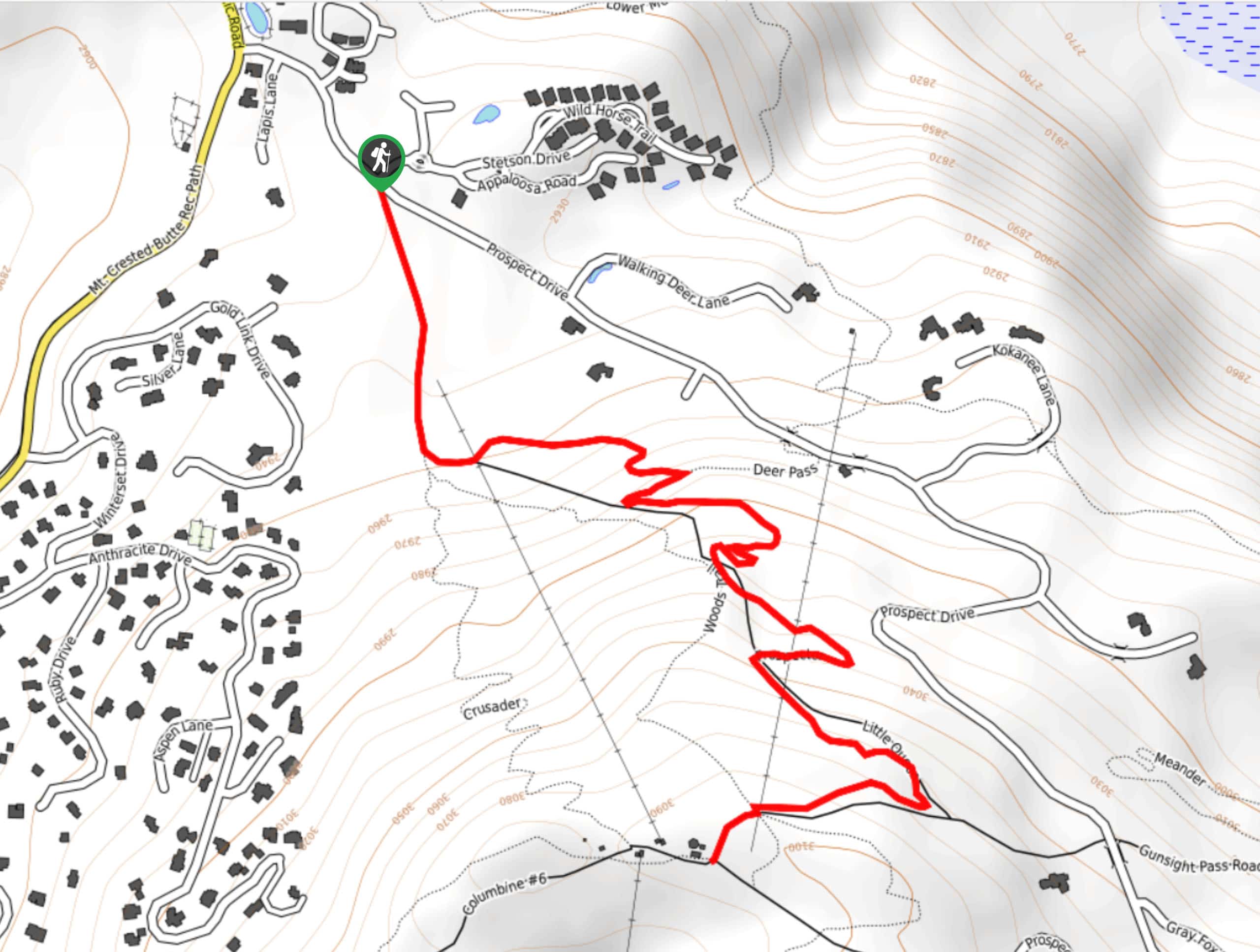
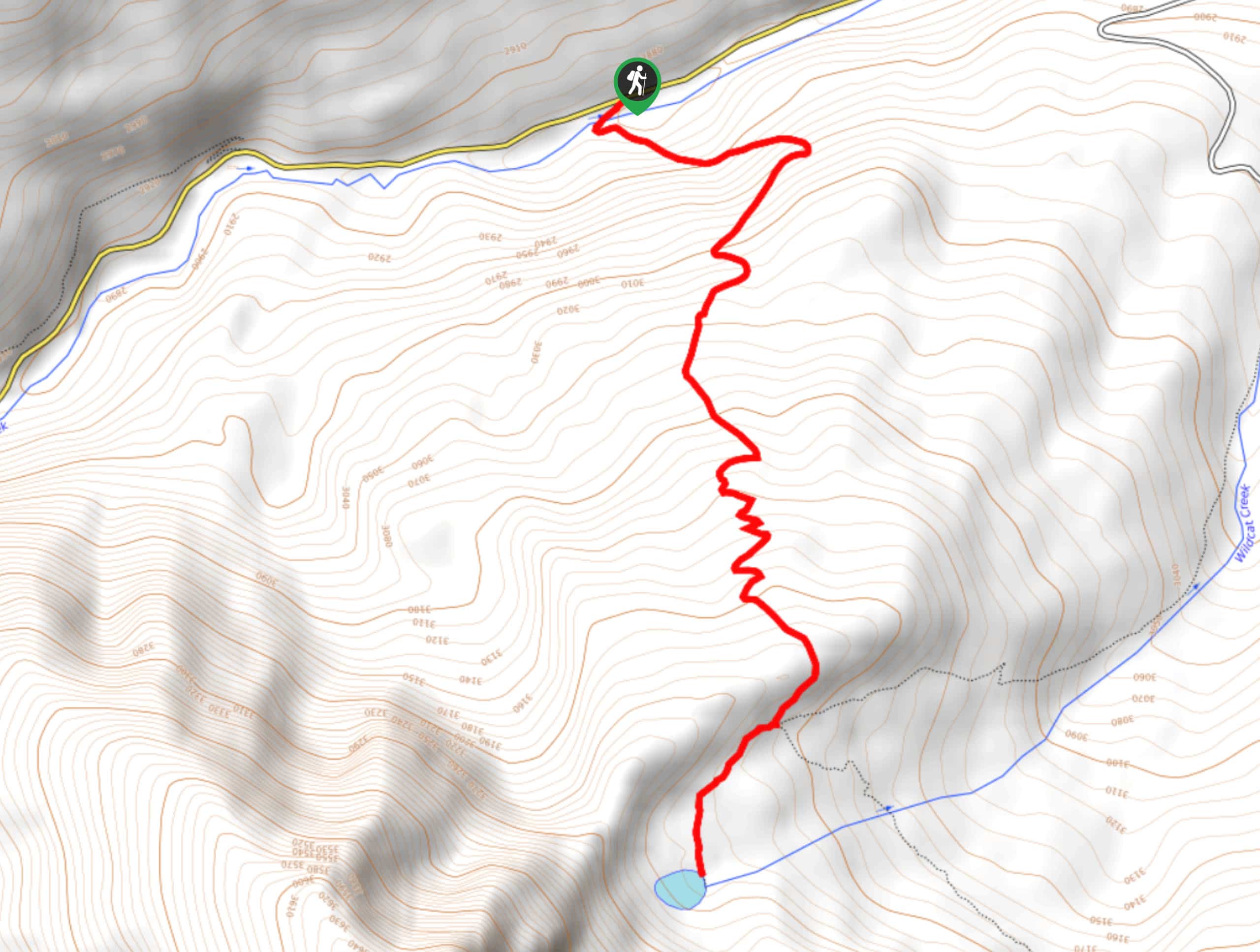
The Upper Upper Loop Trail is a great hiking route outside of Crested Butte Colorado that will take you along the lower slopes of the mountain of the same name for scenic views. While out on the trail, you will traverse the woodlands and meadows along the hillside, before passing by Grant Lake and taking in the scenic views overlooking the town of Crested Butte. Hikers should take note that the parking at the trailhead is limited to about four vehicles, so be sure to arrive early or else you will need to walk from further out.
Getting there
The trailhead for the Upper Upper Loop Trail can be found at the roadside car park along Hunter Hill Road, just northeast of Crested Butte.

About
| Backcountry Campground | No |
| When to do | May-October |
| Pets allowed | Yes - On Leash |
| Family friendly | Older Children only |
| Route Signage | Average |
| Crowd Levels | Moderate |
| Route Type | Lollipop |
Upper Upper Loop Trail
Elevation Graph
Weather
Upper Upper Loop Trail Description
If you are based in the town of Crested Butte and are looking for a fun hiking route that isn’t overly challenging, but still provides a great workout and scenic views of the surrounding landscape, then the Upper Upper Loop Trail will be a great option for you to explore the natural beauty of the Elk Mountains.
Setting out from the car park on the side of Hunter Hill Road, you will head to the southeast and traverse the lower slopes of crested Butte Mountain, passing through open meadows and stretches of forest along the way. Although there are some aspens that provide protection from the sun, a good portion of the route is exposed, so make sure to wear sunscreen.
After arriving at the charming shores of Grant Lake, take some time to rest and enjoy the views, before continuing along the trail to the east. Here, you will climb slightly further uphill through the forest, before descending the hillside to the terminus of the route at the edge of Brush Creek Road. From here, you will turn back along the trail to relive the views of Crested Butte and the surrounding valley, before arriving back at the trailhead where you started.
Similar hikes to the Upper Upper Loop Trail hike
Prospector Trail
The Prospector Trail is a fun hiking adventure near Crested Butte, Colorado that will take you uphill for beautiful views…
Lily Lake Trail #639
The Lily Lake Trail #639 is an easy-going hiking route in the Elk Mountains of Colorado that will lead you…
Green Lake via Carbon Trail
The Green Lake via Carbon Trail is an amazing experience in Crested Butte, Colorado that will take you to a…
Comments