
Highline Creek Trail
View Photos
Highline Creek Trail
Difficulty Rating:
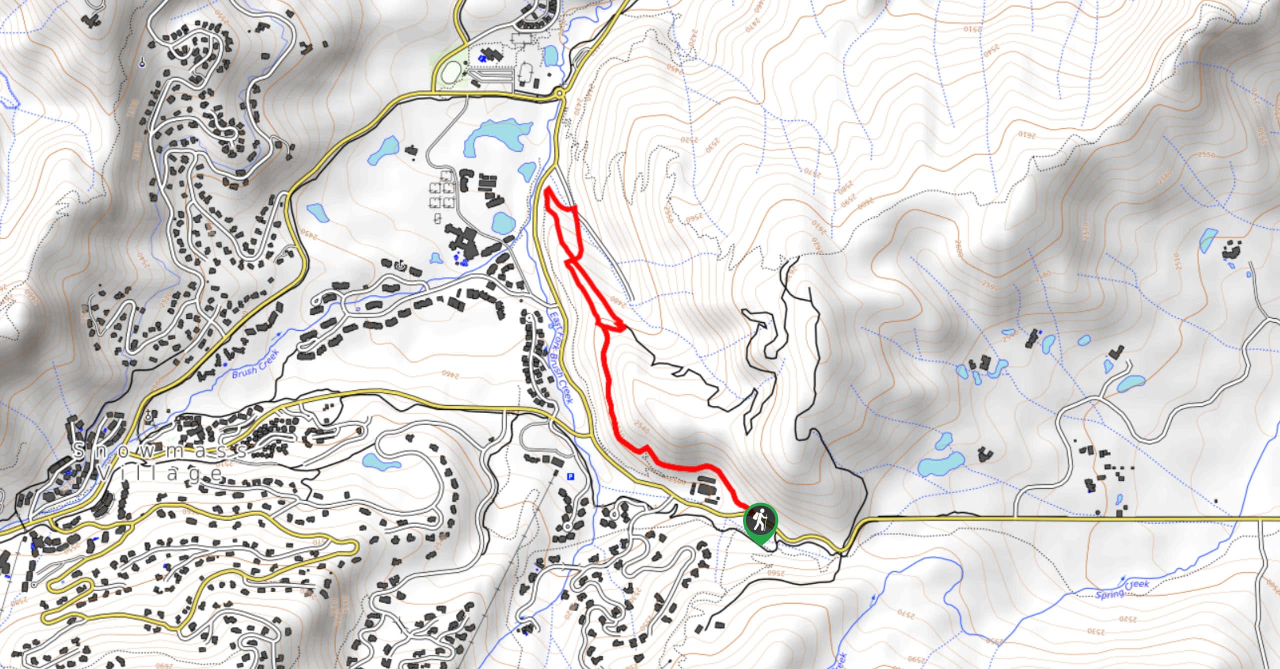
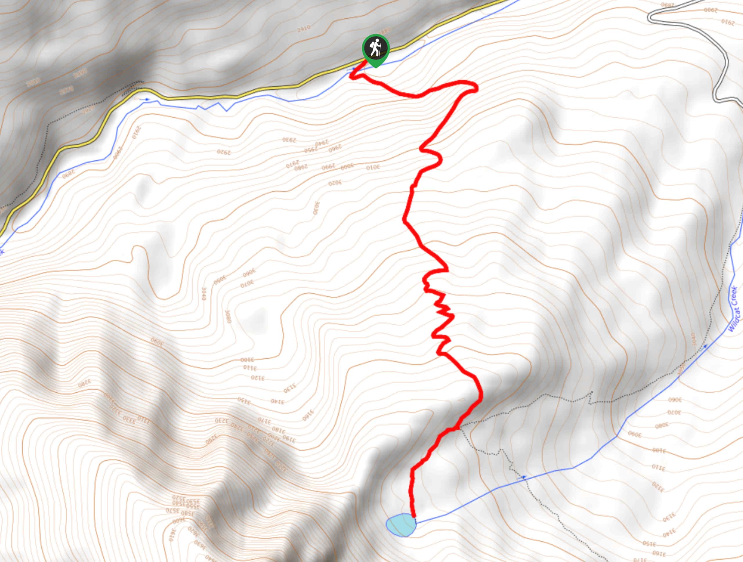
The Highline Creek Trail is a laidback route in Snowmass Village, Colorado that traverses a hillside with views of the surrounding ski resort. While out hiking the trail, you will make your way along the slope of the hill and pass through some forest cover, while taking in the views of the surrounding alpine landscape. Hikers should take note that this route is also used by mountain bikers, so make sure to keep an eye out and share the trail.
Getting there
The trailhead for the Highline Creek Trail can be found along Owl Creek Road, just 3ft southeast of the Cathy Robinson Playground.

About
| Backcountry Campground | No |
| When to do | April-October |
| Pets allowed | Yes - On Leash |
| Family friendly | Yes |
| Route Signage | Average |
| Crowd Levels | Moderate |
| Route Type | Lollipop |
Highline Creek Trail
Elevation Graph
Weather
Highline Creek Trail Description
If you find yourself in the Snowmass Village area and need to get out on an easy trail to stretch your legs, then you should check out the Highline Creek Trail. This route isn’t the most scenic in the area, but it does offer some nice views overlooking the golf course and Snowmass Village.
Setting out from the trailhead along Owl Creek Road, you will make your way to the northwest along the hillside and pass through some areas of light tree cover. Here, you will have some nice views over Brush Creek, the Snowmass Golf Club, and the village further afield. As you loop around the trail and begin the return leg, take some time to appreciate the beauty of the landscape and breathe in the fresh mountain air, before arriving back at the trailhead where you began.
Similar hikes to the Highline Creek Trail hike
Prospector Trail
The Prospector Trail is a fun hiking adventure near Crested Butte, Colorado that will take you uphill for beautiful views…
Lily Lake Trail #639
The Lily Lake Trail #639 is an easy-going hiking route in the Elk Mountains of Colorado that will lead you…
Green Lake via Carbon Trail
The Green Lake via Carbon Trail is an amazing experience in Crested Butte, Colorado that will take you to a…
Comments