Crystal City Road #314
View Photos
Crystal City Road #314
Difficulty Rating:
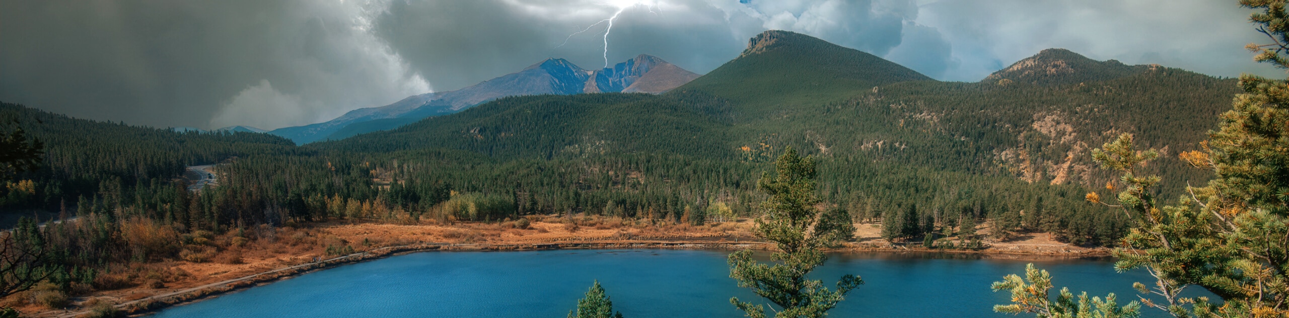
The Crystal City Road #314 is a great hiking route in Marble, Colorado that follows along a mountain road to reach a historic site. While out hiking the trail, you will gain elevation along the rugged road as it runs parallel to the Crystal River, passing through the mountains to arrive at the site of an old mill dating to 1892. Walkers should take note that this route is not accessible during the winter months due to dangerous conditions.
Getting there
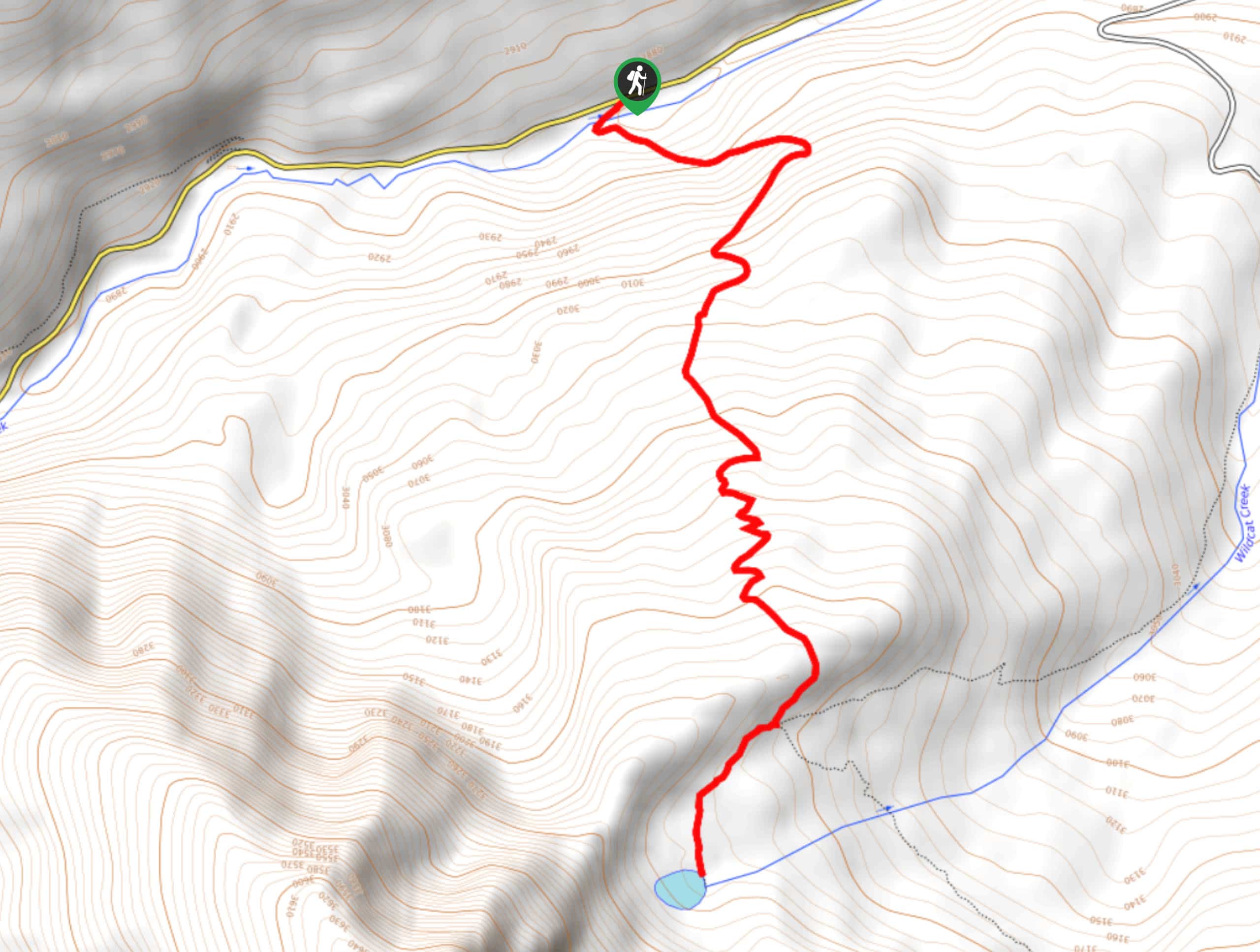
The trailhead for the Crystal City Road #314 can be found at the car park near the junction of CR3 and Marble Village Drive.

About
| Backcountry Campground | No |
| When to do | June-October |
| Pets allowed | Yes - On Leash |
| Family friendly | Yes |
| Route Signage | Average |
| Crowd Levels | Moderate |
| Route Type | Out and back |
Crystal City Road #314
Elevation Graph
Weather
Crystal City Road #314 Description
The Crystal City Road #314 Trail may offer some beautiful scenery, but you will need to remember that it is still a road and that there will likely be passing off-road vehicles. Keep an eye out and allow enough room for vehicles and bikers to safely pass, especially if you are travelling with children or dogs. Additionally, you will want to wear proper hiking boots, as this is still a rugged adventure that features a moderate amount of elevation gain.
Although this route utilizes a road for its entirety, the stunning views of the surrounding mountains and forests as you pass through the valley are truly exceptional. When combined with the chance to visit the historic Old Crystal Mill that dates back to 1892, this route has all the makings of a great adventure in the Elk Mountains of Colorado.
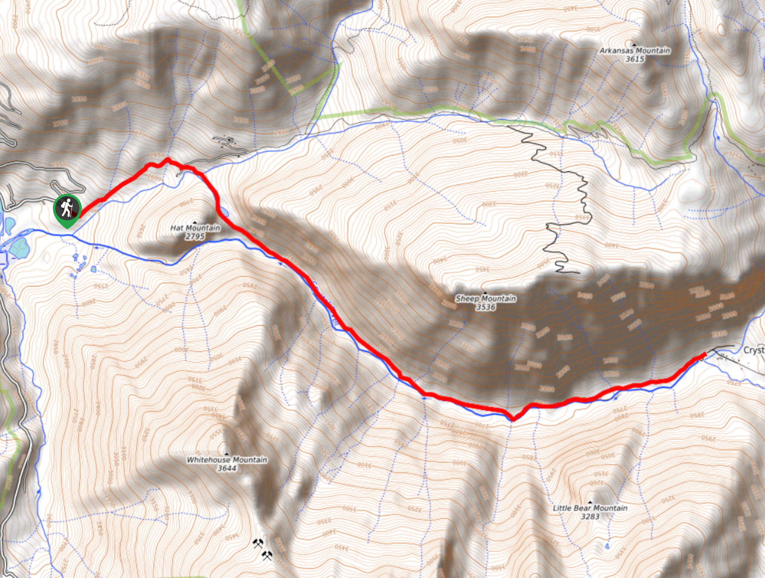
Setting out from the parking area, you will follow the CR3 to the southeast for a short distance, before it bends in a northeastern direction around Hat Mountain. Here, the road will come to a fork and you will need to take the route on the right in order to cross over The Lost Trail Creek at the cascading waters of Anu Falls.
Following the road to the southeast, you will quickly pass by Lizard Lake and meet up with the banks of the Crystal River, which you will hike parallel to for the remainder of the journey. Here, you will enjoy some beautifully scenic views of the surrounding mountains, with Sheep mountain on your left flank and the White Horse and Little Bear Mountains across the valley to the south.
Keep an eye out for off-road vehicles and mountain bikes along this portion of the walk, as they are likely to pass by. Eventually, you will reach the end point of the hike at the Crystal Mill, an old wooden powerhouse from 1892 that is situated precariously above the river. If you so wish, you can pay a $10 fee to get a better vantage point of the structure from the water’s edge, although it is also visible from the road. After taking in the views, simply head back down the road along the same route in order to return to the trailhead for the Crystal City Road #314 Hike.
Trail Highlights
Crystal Mill
Located along the Crystal River, the Crystal Mill, or Old Mill as it is sometimes called, is an old powerhouse dating back to 1892. The mill utilized a waterwheel to power an air compressor, which in turn powered various machinery related to the mining industry. IOt is now a popular tourist destination, thanks largely to its precarious position above the river.
Frequently Asked Questions
Can you drive to Crystal Mill?
The best methods of reaching Crystal Mill are to hike, mountain bike, or ATV; however, you can reach the site if you have a proper 4×4 vehicle with high clearance.
Is Crystal Mill open?
The road leading up to Crystal Mill is impassable during the winter months, and access depends entirely on when the snow falls/melts each year.
Insider Hints
Wear proper hiking boots with good support.
Keep an eye out for any passing vehicles, as this route does follow along a road.
After reaching the mill, you can pay a $10 fee to reach a viewpoint at the edge of the water.
Similar hikes to the Crystal City Road #314 hike
Prospector Trail
The Prospector Trail is a fun hiking adventure near Crested Butte, Colorado that will take you uphill for beautiful views…
Lily Lake Trail #639
The Lily Lake Trail #639 is an easy-going hiking route in the Elk Mountains of Colorado that will lead you…
Green Lake via Carbon Trail
The Green Lake via Carbon Trail is an amazing experience in Crested Butte, Colorado that will take you to a…
Comments