
Crag Crest National Recreation Trail
View Photos
Crag Crest National Recreation Trail
Difficulty Rating:
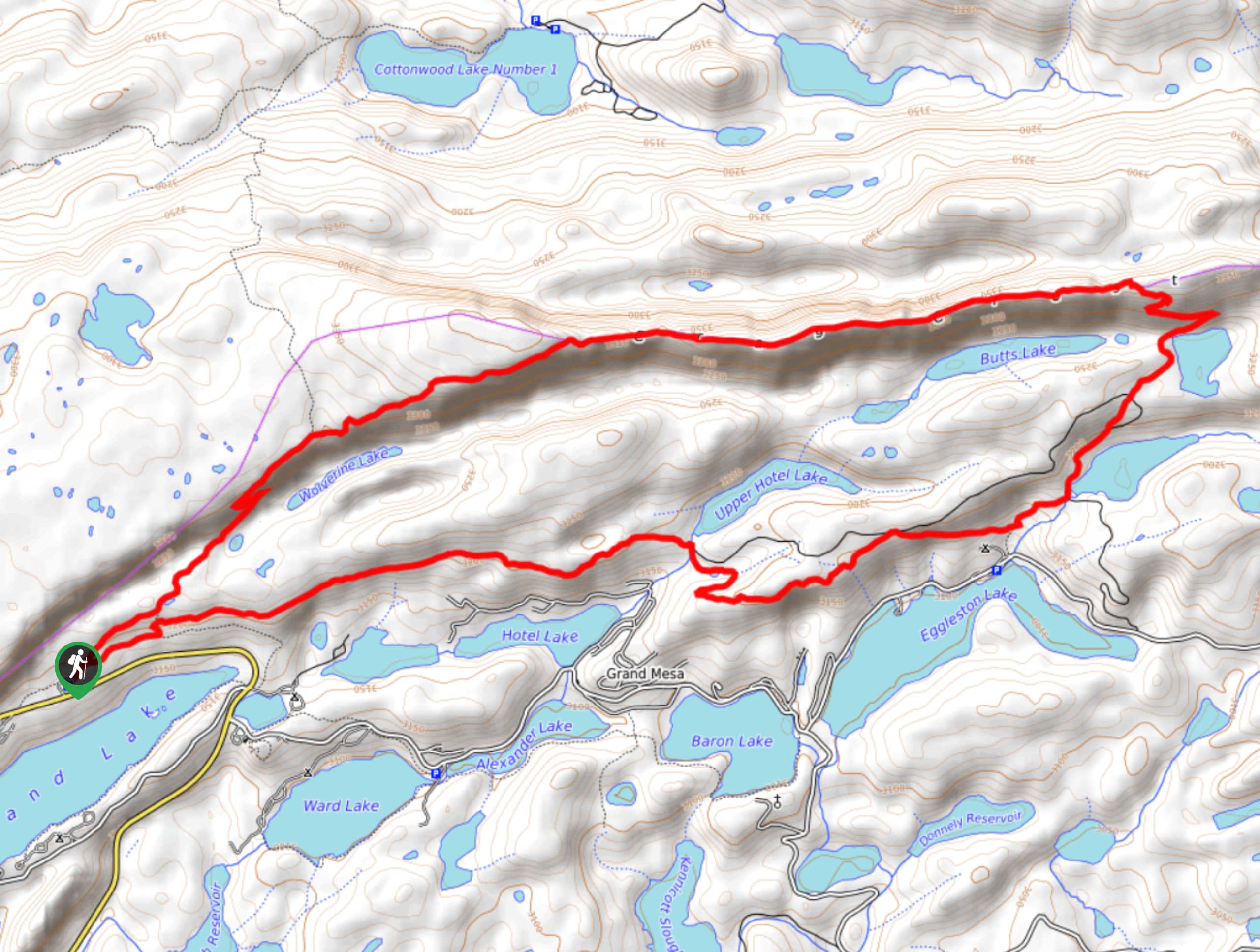
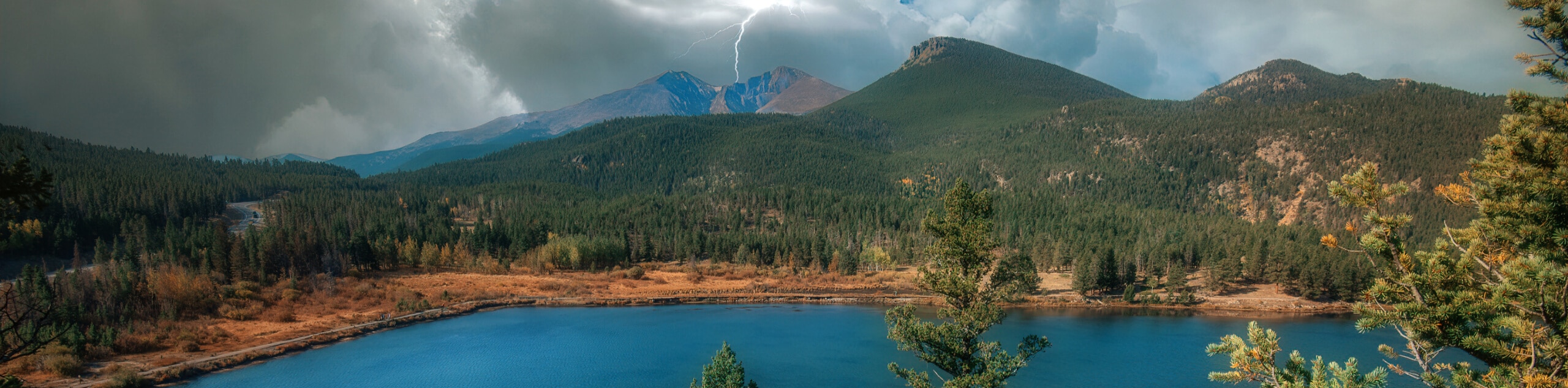
The Crag Crest National Recreation Trail is an amazingly scenic hiking route in the Elk Mountains of Colorado that will take you uphill for sweeping views of the surrounding landscape. While out on the trail, you will climb uphill to traverse a long ridge that offers an amazing sightline over the surrounding forests and lakes, before looping around through the terrain that you had just surveyed from above. The undulating terrain and beautiful lakeside scenery make for a fun day on the trails near Grand Mesa, Colorado.
Getting there
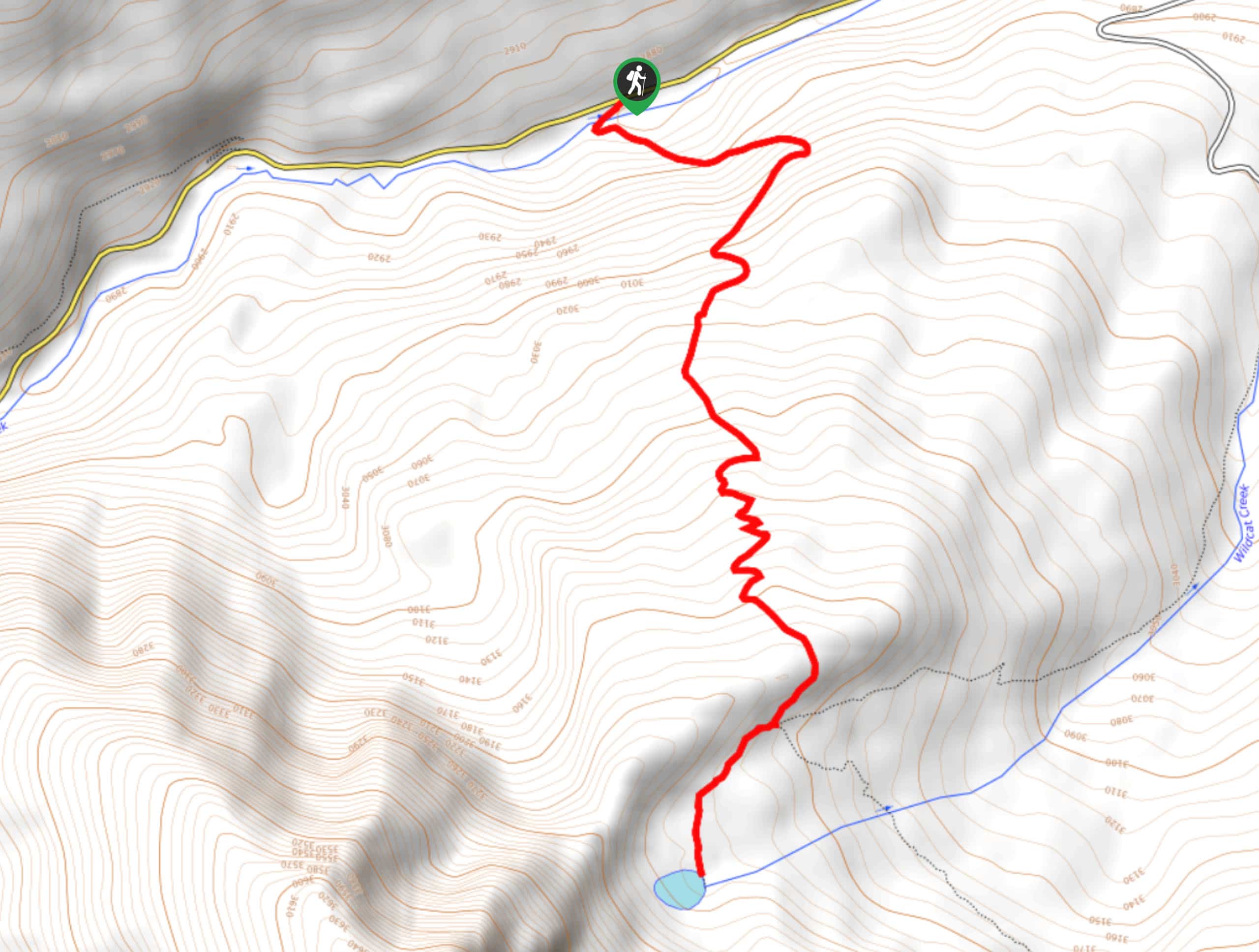
The starting point for the Crag Crest National Recreation Trail can be found along CR65 at a parking lot 0.9mi west of the Grand Mesa Visitor Center.

About
| Backcountry Campground | Crag Crest Campground |
| When to do | June-October |
| Pets allowed | Yes - On Leash |
| Family friendly | Older Children only |
| Route Signage | Average |
| Crowd Levels | Moderate |
| Route Type | Circuit |
Crag Crest National Recreation Trail
Elevation Graph
Weather
Crag Crest National Recreation Trail Description
For those adventurers that are looking for a solid day hike that isn’t overly challenging but still offers plenty of surreal views, the Crag Crest National Recreation Trail will be the perfect route. Featuring some short but intense climbs and sweeping views of Grand Mesa, there are certainly less rewarding climbs that can be experienced in Colorado.
Setting out from the trailhead, you will make your way to the northeast through intermittent meadows and forests, before making a short but steep climb up to the top of the ridge known as Crag Crest. Here, you will continue on to the northeast along this elevated position, enjoying breathtaking views over the countless lakes and vast woodlands that make up Grand Mesa.
Reaching a point near the edge of the ridgeline, you will head downhill along a wide switchback path, before making your way to the southwest through the forest. Here, you will pass by a number of scenic lakes that are strewn throughout the area, such as Eggleston Lake and Baron Lake. As you approach Island Lake on your left, you will complete the final stretch of the hike that will return you to the trailhead where you began your adventure.
Similar hikes to the Crag Crest National Recreation Trail hike
Prospector Trail
The Prospector Trail is a fun hiking adventure near Crested Butte, Colorado that will take you uphill for beautiful views…
Lily Lake Trail #639
The Lily Lake Trail #639 is an easy-going hiking route in the Elk Mountains of Colorado that will lead you…
Green Lake via Carbon Trail
The Green Lake via Carbon Trail is an amazing experience in Crested Butte, Colorado that will take you to a…
Comments