Anthracite Pass Trail
View Photos
Anthracite Pass Trail
Difficulty Rating:
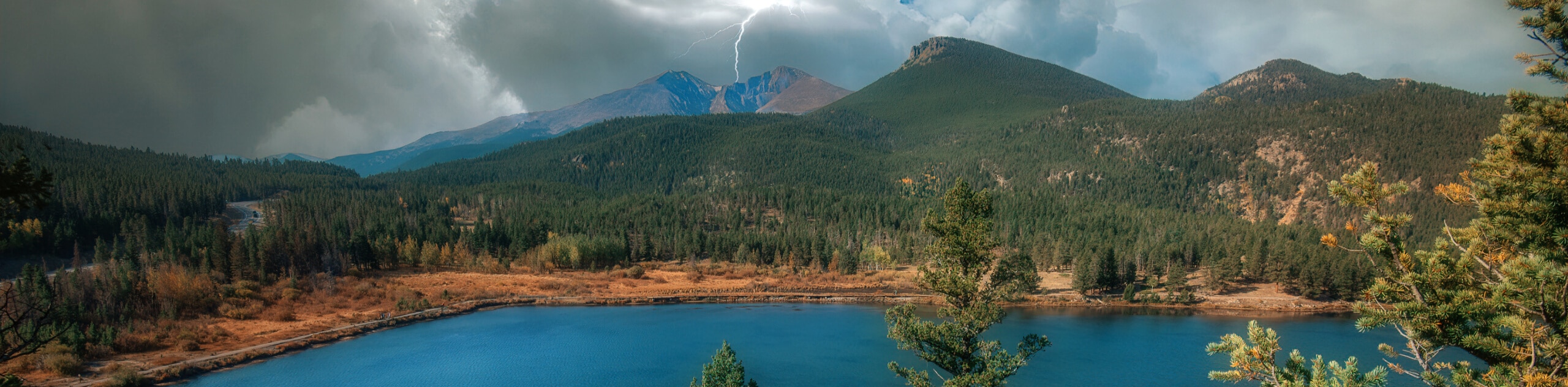
The Anthracite Pass Trail is a gorgeous hiking route in the Raggeds Wilderness Area of Colorado that will take you uphill through the forest for stunning views of the valley. While out on the trail, you will leave the banks of the Crystal River behind, climbing uphill through beautiful aspen trees and several steep inclines for views of the impressive mountains nearby. The best time for this hike is during the fall, when the changing colors of the leaves blanket the surrounding landscape in a myriad of reds, oranges, and yellows.
Getting there
The starting point for the Anthracite Pass Trail can be found at the Raspberry Creek Trailhead along Marble Quarry Road, just south of the town of Marble.

About
| Backcountry Campground | No |
| When to do | June-September |
| Pets allowed | Yes |
| Family friendly | Older Children only |
| Route Signage | Average |
| Crowd Levels | High |
| Route Type | Out and back |
Anthracite Pass Trail
Elevation Graph
Weather
Anthracite Pass Trail Description
Hiking the Anthracite is a beautiful, but challenging, adventure that will take you through some rough and rugged terrain with steep inclines in places. Be sure to wear proper hiking boots with great support for this journey. Additionally, you should always bring bear spray and observe all best bear safety practices when hiking in this area.
Although parts of this hiking route are certainly on the tougher side, the stunning views of the surrounding Elk Mountains and the countless aspen trees are most definitely worth the effort. Upper portions of the trail will also see you traverse picturesque alpine meadows that are blanketed with wildflowers in the summer, making this an ideal route to take in the breathtaking landscape views of the Rockies.
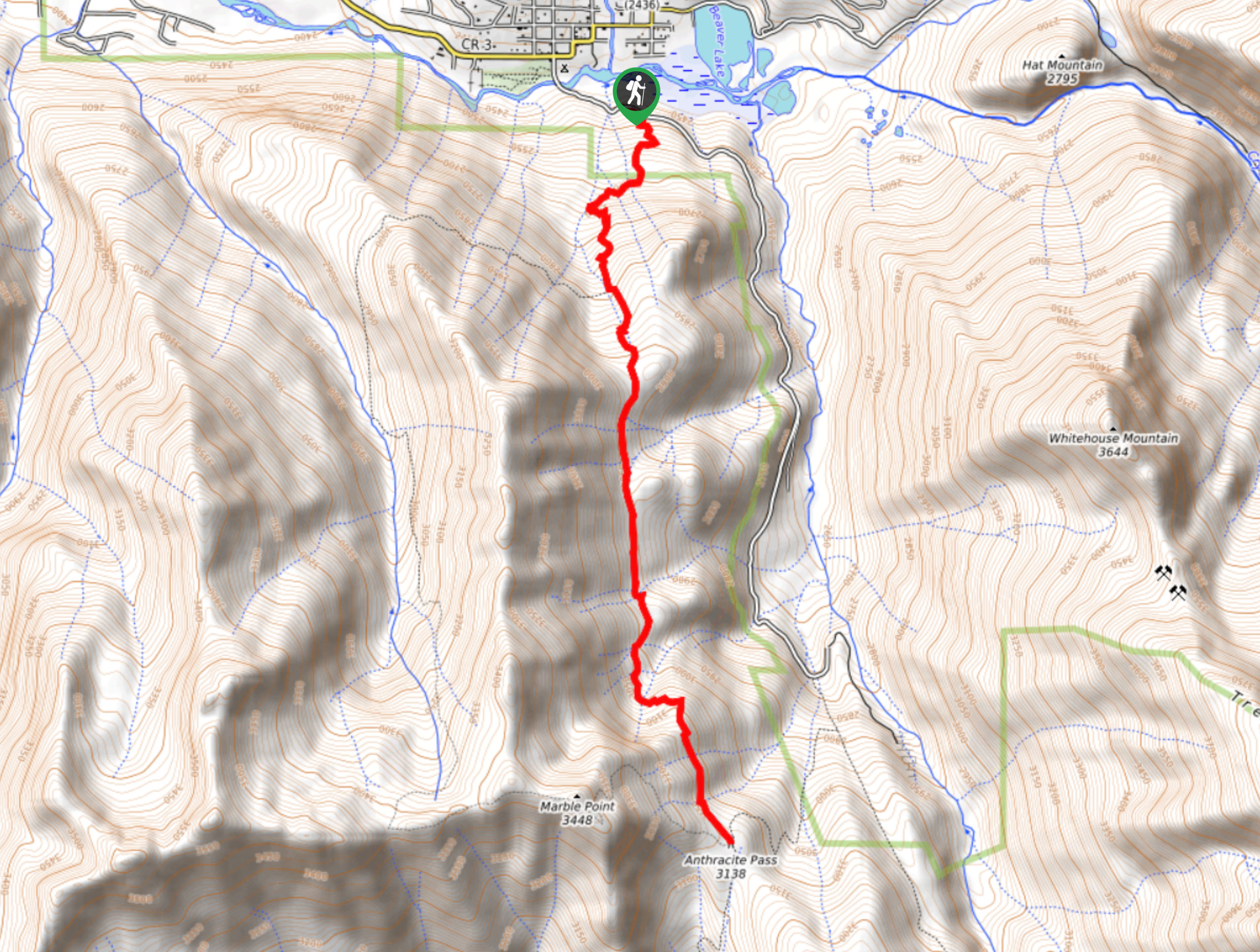
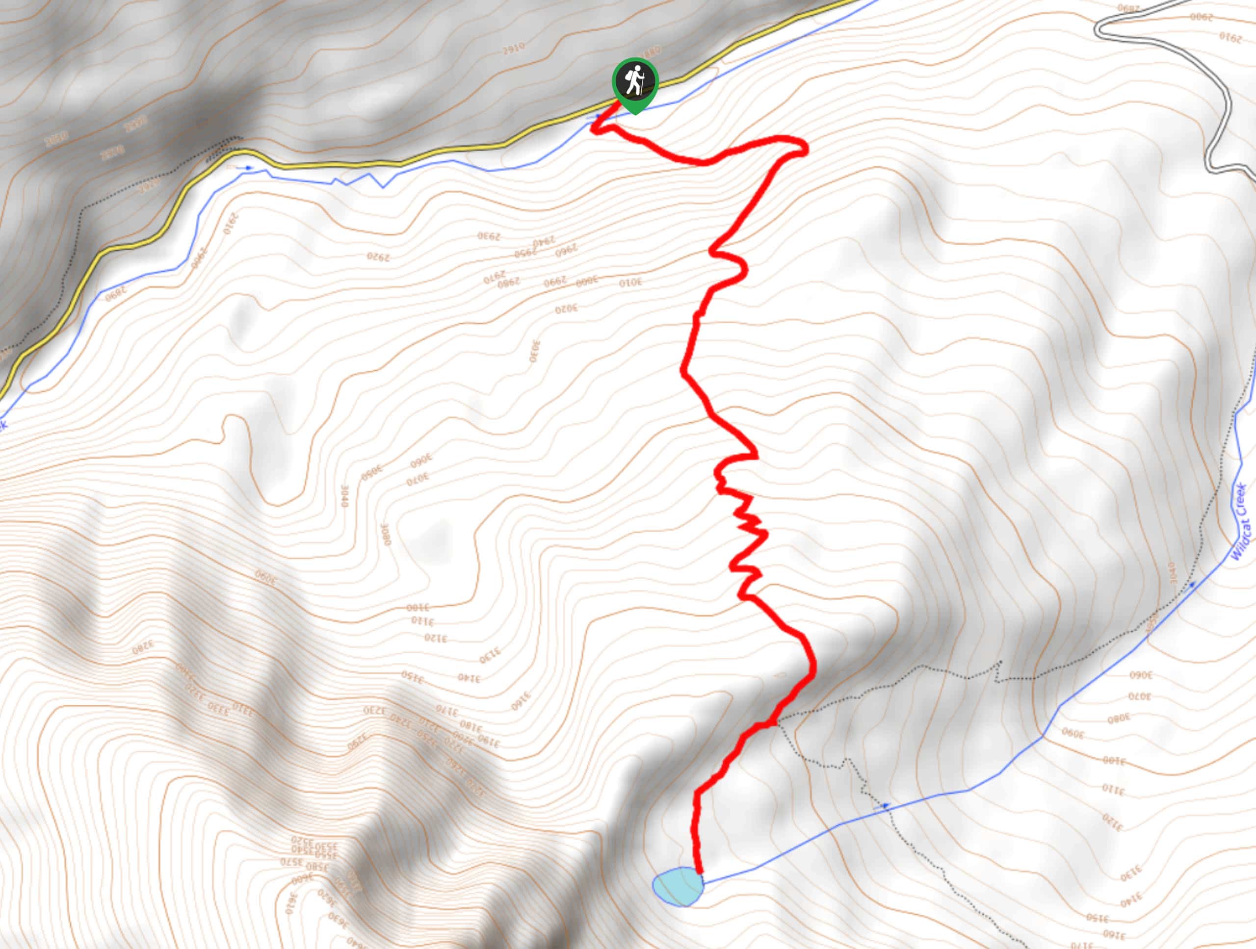
Setting out from the trailhead, you will follow the raspberry Creek Trail as it heads to the south and begins immediately to climb uphill through the forest. As you work your way past the mature trees and surrounding wildlife, you will also cross over several streams flowing down the hillside. Navigation along this route is fairly easy, as there are few junctions in the trail and you will only need to keep left in order to reach the final destination of Anthracite Pass.
After 1.0mi of uphill hiking, you will come to the only junction along the route, where the Raspberry Creek Trail joins the Anthracite Pass Trail. Taking the path on the left, you will continue working your way uphill through the forest to the south, before breaking free of the tree cover. Here, you will keep straight across the meadow and enjoy beautifully scenic views of the surrounding alpine terrain, before arriving at Mud Gulch.
Once you have crossed over the gulch, you will continue uphill for a short distance and pass through a small stretch of woodland terrain, before arriving at Anthracite Pass. Here, you will enjoy some beautiful views of the surrounding mountains, or can take a detour if you like along a path leading west that will take you to the summit of Marble Point for an elevated view of the Elk Mountains. After taking in the breathtaking scenery, simply head back along the same route to return to the trailhead having completed the Anthracite Pass Trail.
Trail Highlights
Mount Daly
Situated in the Maroon Bells-Snowmass Wilderness Area, Mount Daly has an elevation of 13300ft and is the most prominent peak visible from the village of Snowmass. Often climbed alongside nearby Capitol Peak, Mount Daly and 11 other peaks are tied as the 339th tallest mountains in Colorado.
Insider Hints
Wear proper hiking boots for this adventure.
Bring bear spray and make plenty of noise along the trail to avoid an encounter.
Time your hike for the fall season, when the colors will be most striking.
Similar hikes to the Anthracite Pass Trail hike
Prospector Trail
The Prospector Trail is a fun hiking adventure near Crested Butte, Colorado that will take you uphill for beautiful views…
Lily Lake Trail #639
The Lily Lake Trail #639 is an easy-going hiking route in the Elk Mountains of Colorado that will lead you…
Green Lake via Carbon Trail
The Green Lake via Carbon Trail is an amazing experience in Crested Butte, Colorado that will take you to a…
Comments