Three Falls Trail
View Photos
Three Falls Trail
Difficulty Rating:
The Three Falls Trail is an awesome 2.4mi out-and-back hiking route in E.C. Manning Provincial Park that takes hikers on a fun trek to see three unique waterfalls. Scenic forest views, relatively easy terrain, and of course, the picturesque waterfalls all make this trail a great option for hikers of all skill levels. Time your hike for late July and you’ll be able to snack on the wild strawberries that grow along the trail- just make sure to keep an eye out for any bears that might not want to share them!
Getting there
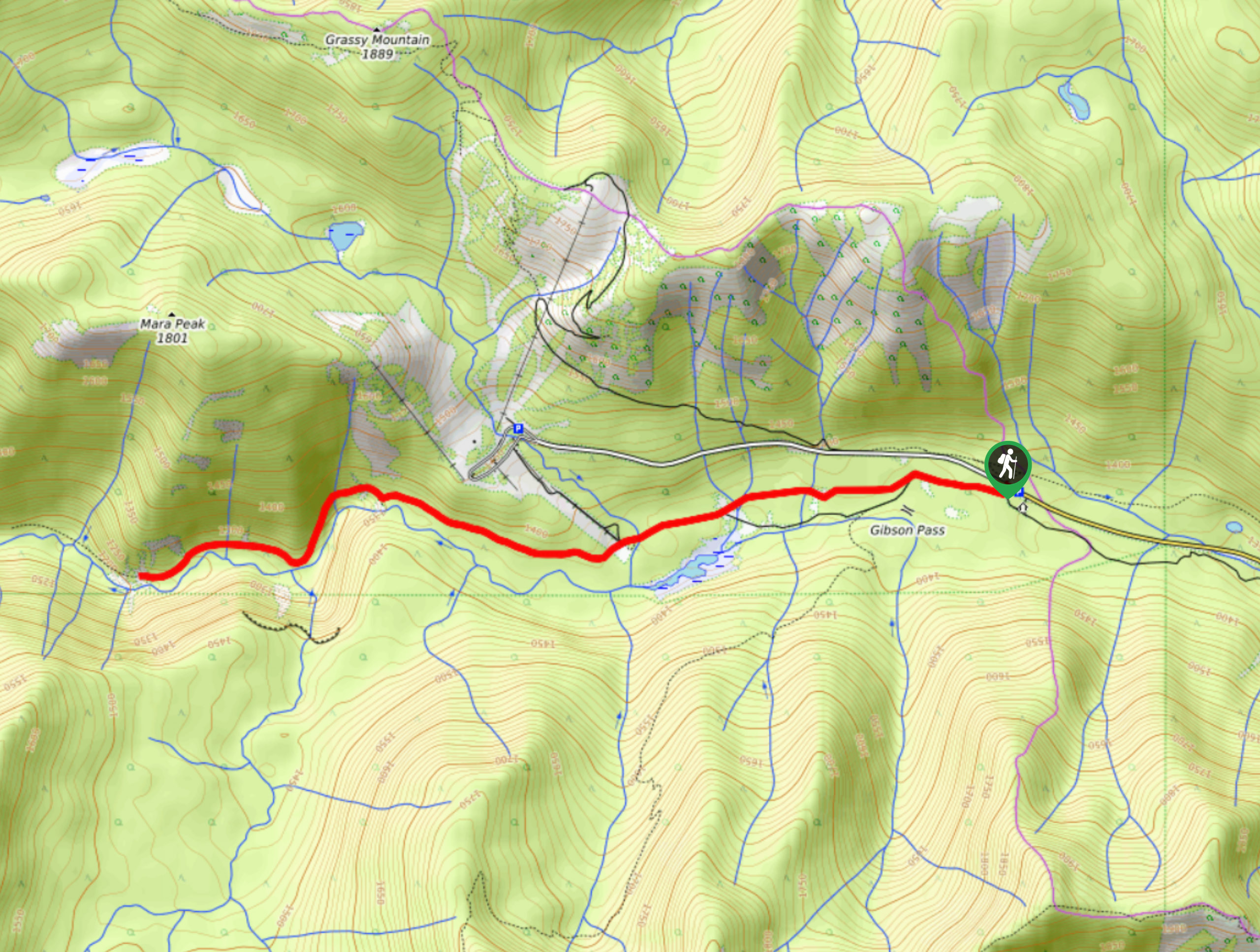
To access the Three Falls trail from Hope, drive east on BC-3 E for 37.3mi and make a right turn onto Gibson Pass Road. Continue on for 5.0mi, where you will find parking and the trailhead on your left.

About
| When to do | July-September |
| Backcountry Campsites | No |
| Pets allowed | Yes |
| Family friendly | Older Children only |
| Route Signage | Average |
| Crowd Levels | Moderate |
| Route Type | Out and back |
Three Falls Trail
Elevation Graph
Weather
Three Falls Trail Description
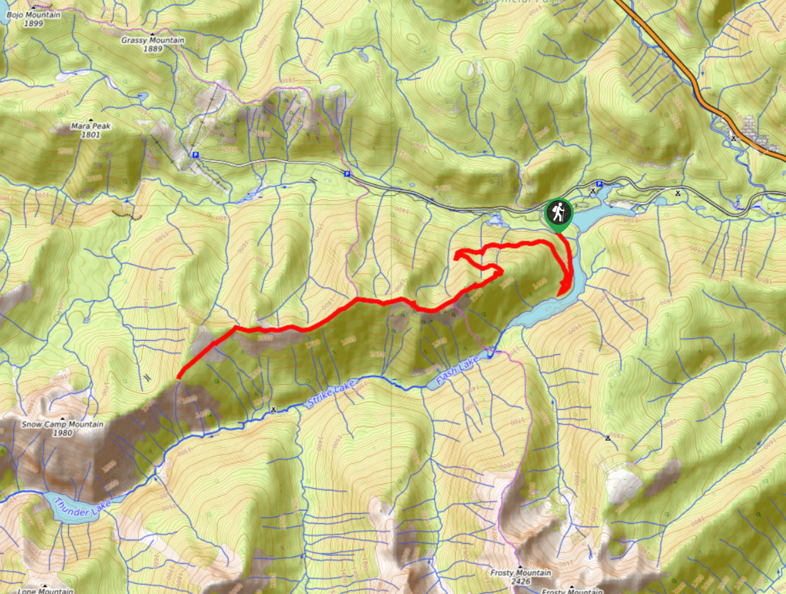
The Three Falls Trail is a unique hike in that it has three different and equally beautiful waterfalls- Shadow Falls, Nepopekum Falls, and Derek Falls- all packed into a hike of only 5.8mi. The route sets out on the Strawberry Flats Loop, a trail that will provide you with a wealth of wild strawberries for snacking if you happen to hike in late July. From here, the trail follows fairly closely alongside Nepopekum Creek until you reach each of the three successive viewpoints along the trail that overlook the falls.
The trail itself is well-groomed and, although it gets a bit narrow in places, it is still wide enough to travel on with children or dogs. Towards the end of the trail near the falls, the route becomes a bit more steep and technical, with several small boulders that hikers will need to traverse. These are easily manageable and offer a nice variation in terrain along the trail. After you’ve witnessed the beauty of the falls, head back along the Three Falls Trail to return to your car, making sure to pocket a few extra strawberries for the ride home.
Similar hikes to the Three Falls Trail hike
East Skyline Trail
The East Skyline Trail is a 12.3mi out-and-back hiking route through the forests west of Lightning Lake that…
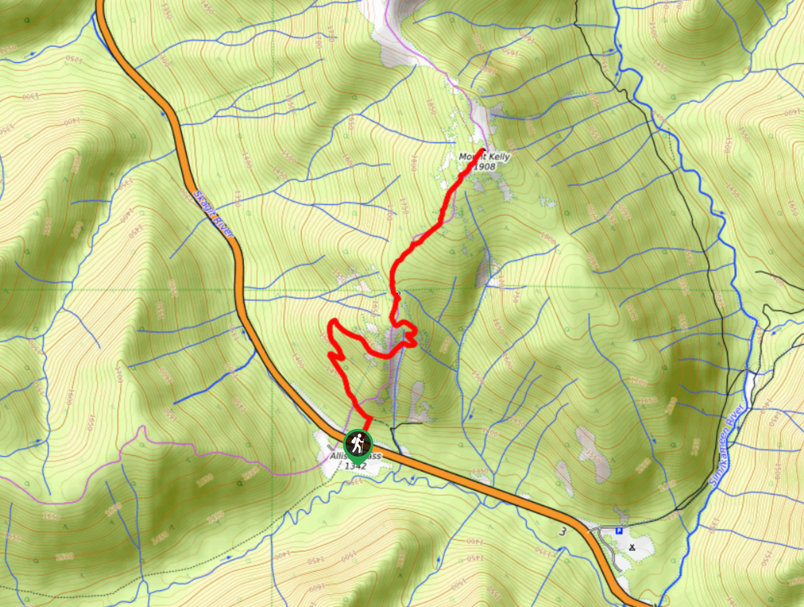
Mount Kelly Trail
The Mount Kelly Trail is a beautifully scenic 4.6mi out-and-back hiking route that climbs along the undulating ridges…
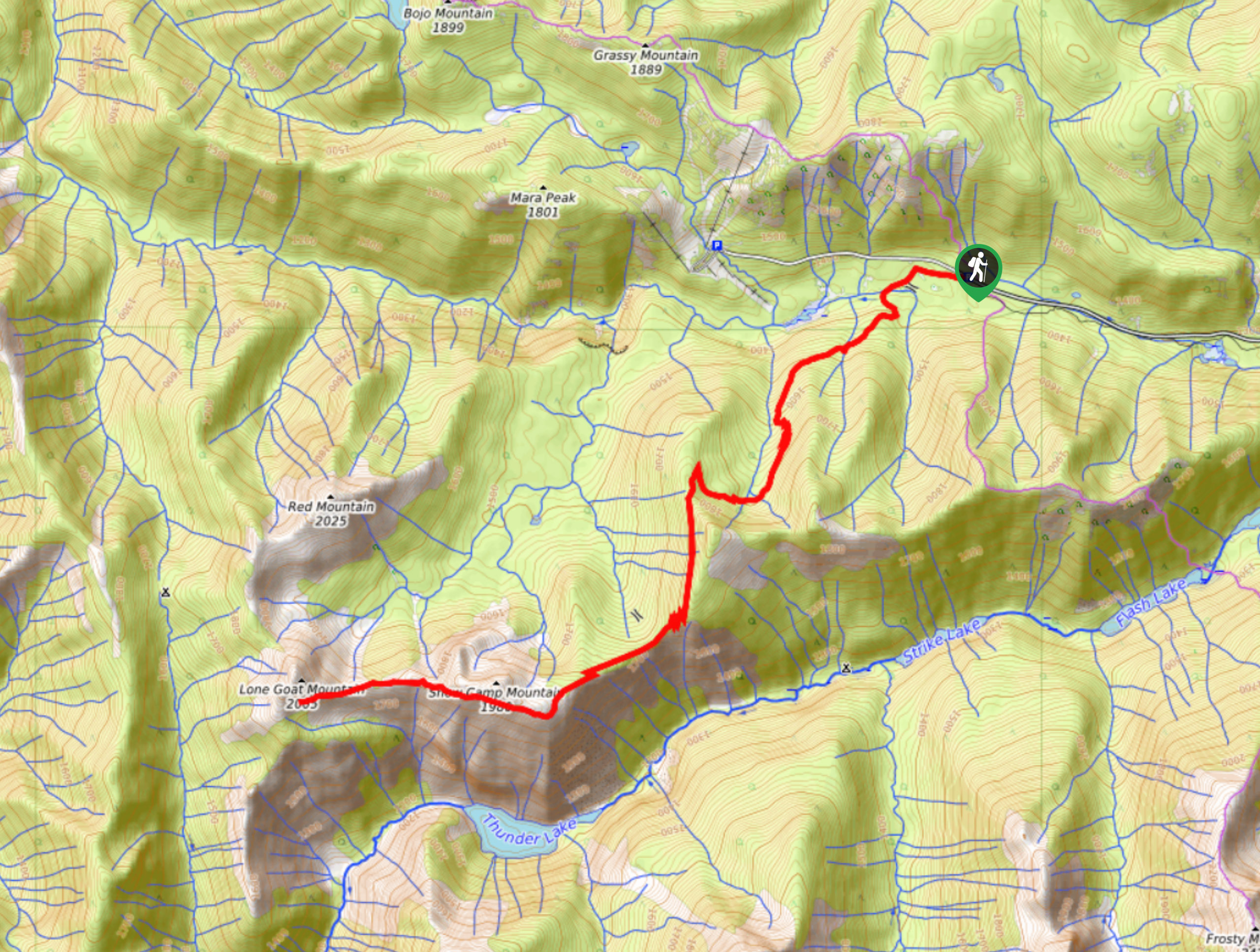
Lone Goat and Snow Camp Mountain Trail
The Lone Goat and Snow Camp Mountain Trail is a 12.3mi out-and-back hiking route within E.C. Manning Provincial…
Comments