Mount Kelly Trail
View Photos
Mount Kelly Trail
Difficulty Rating:
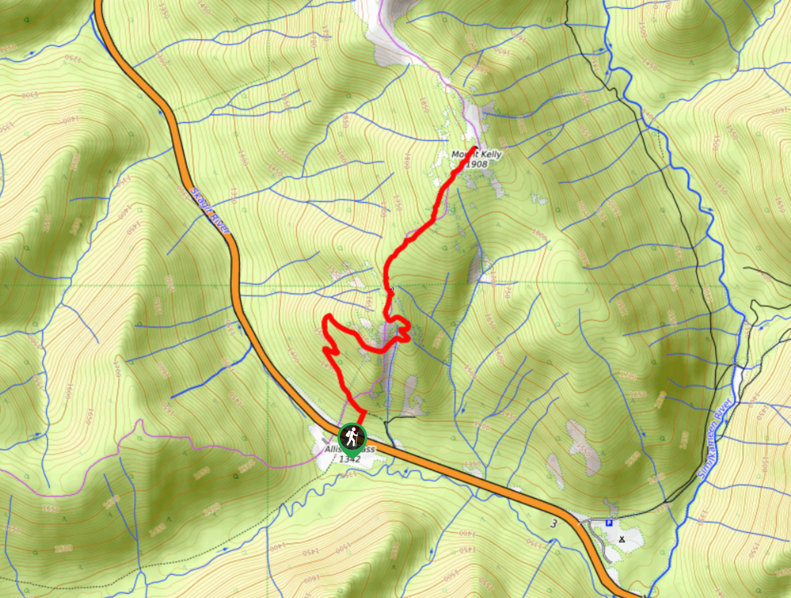
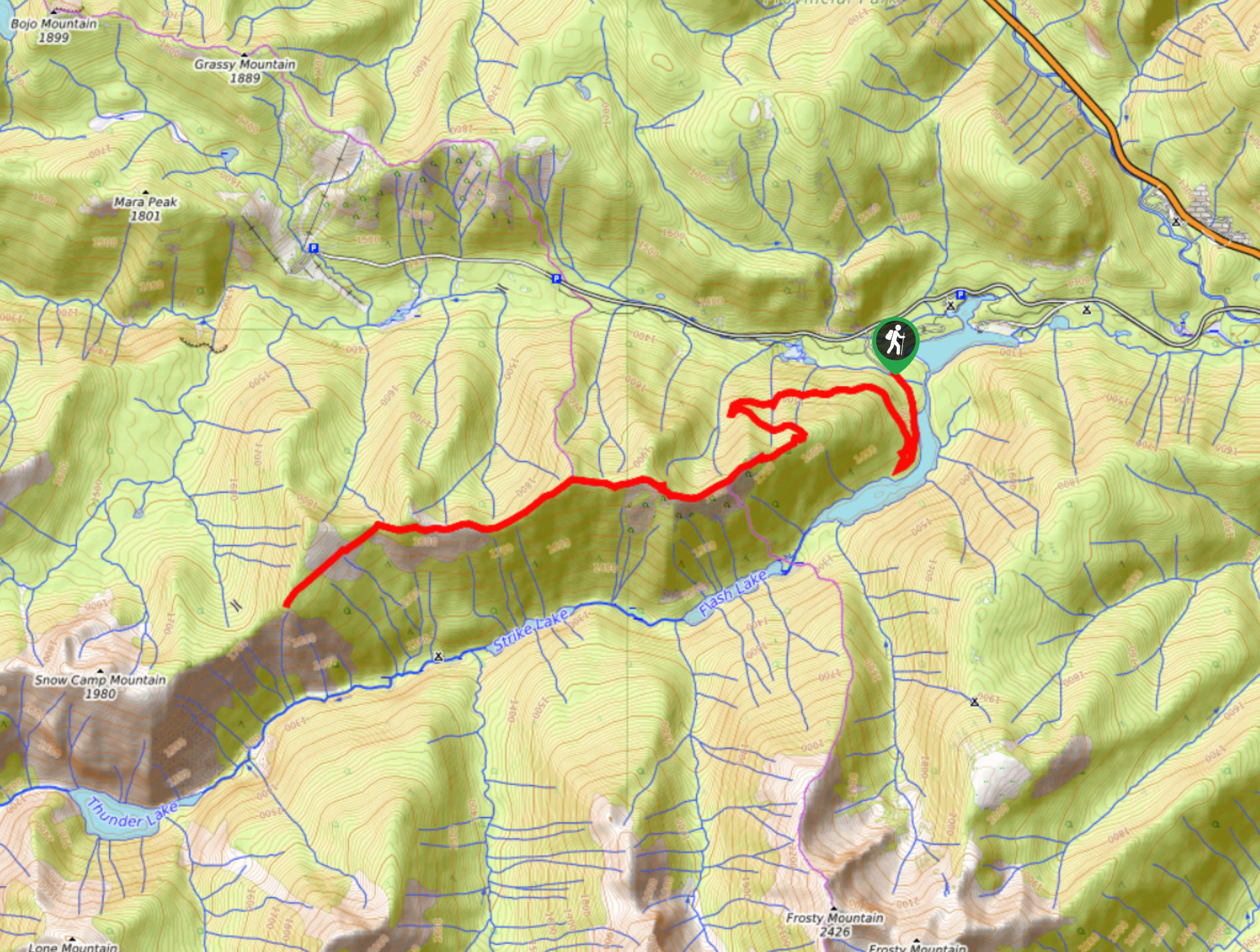
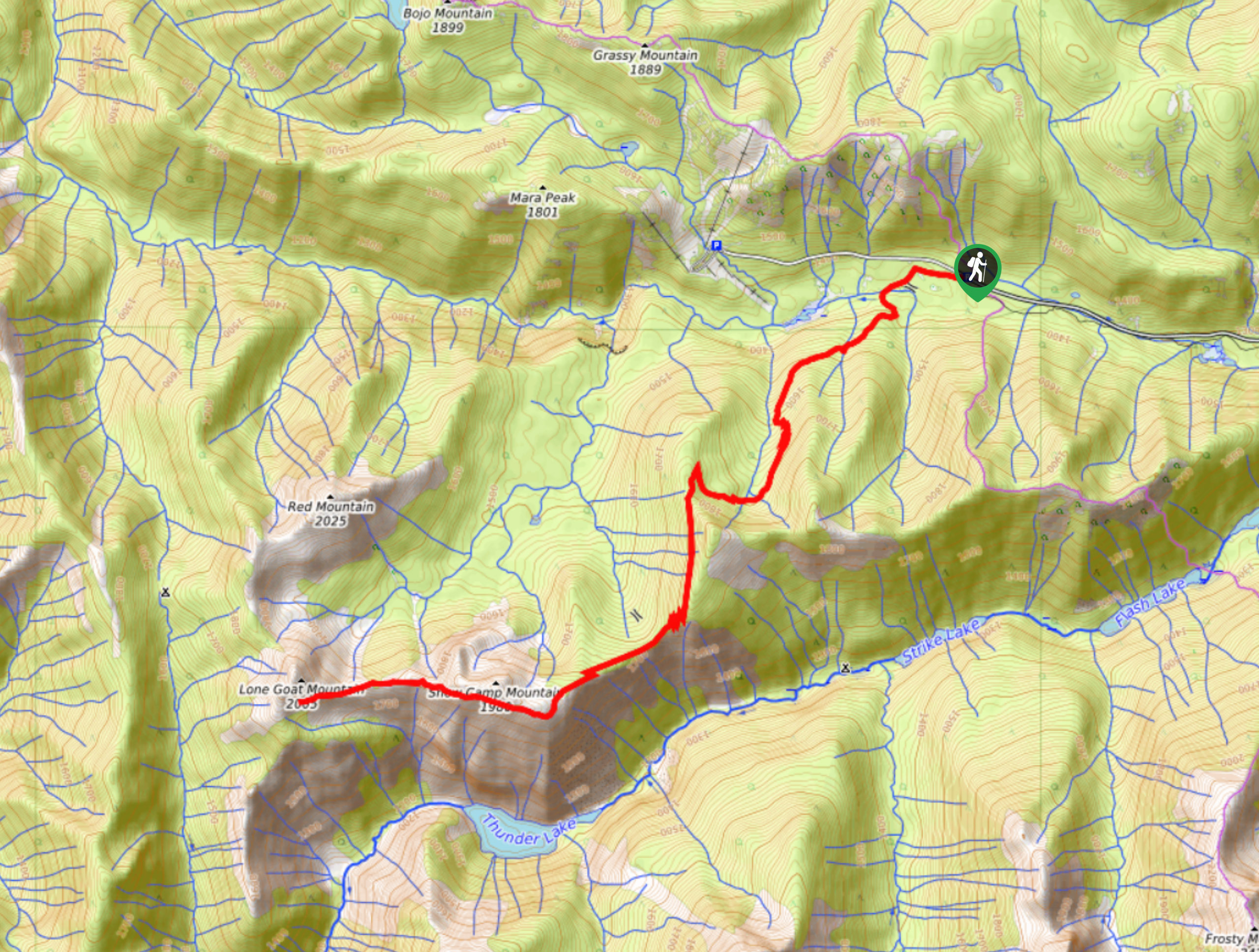
The Mount Kelly Trail is a beautifully scenic 4.6mi out-and-back hiking route that climbs along the undulating ridges of E.C. Manning Provincial Park to summit Mount Kelly at 6260ft. From here, hikers will have commanding views of the entire region, enabling them to gaze out over the surrounding mountains and woodland valleys. With a moderate elevation gain and fairly easy to navigate terrain, this hike is a perfect option for experiencing the beauty of the park without the long grind of some other nearby routes.
Getting there
To access the Mount Kelly trailhead from Hope, drive east on BC-3 E for 31.3mi and make a right turn to park your vehicle at the entrance to the road service yard. From here, hike across the highway to pick up the trail on the other side.

About
| When to do | July-October |
| Backcountry Campsites | No |
| Pets allowed | Yes - On Leash |
| Family friendly | No |
| Route Signage | Average |
| Crowd Levels | Low |
| Route Type | Out and back |
Mount Kelly Trail
Elevation Graph
Weather
Mount Kelly Trail Description
The Mount Kelly Trail is an amazingly scenic but lightly travelled hiking route that will provide hikers with beautiful views overlooking the peaks and valleys of E.C. Manning Provincial Park. Containing fairly easy terrain and a moderate uphill climb along a ridgeline, this trail is accessible to hikers of nearly all skill levels. From the summit of Mount Kelly, you will be able to gaze across the sweeping view that stretches out before you to encompass mountain peaks on both sides of the Canada-United States border. For the minimal level of effort needed to complete this hike, you will be hard pressed to find better views.
Similar hikes to the Mount Kelly Trail hike
Three Falls Trail
The Three Falls Trail is an awesome 2.4mi out-and-back hiking route in E.C. Manning Provincial Park that takes…
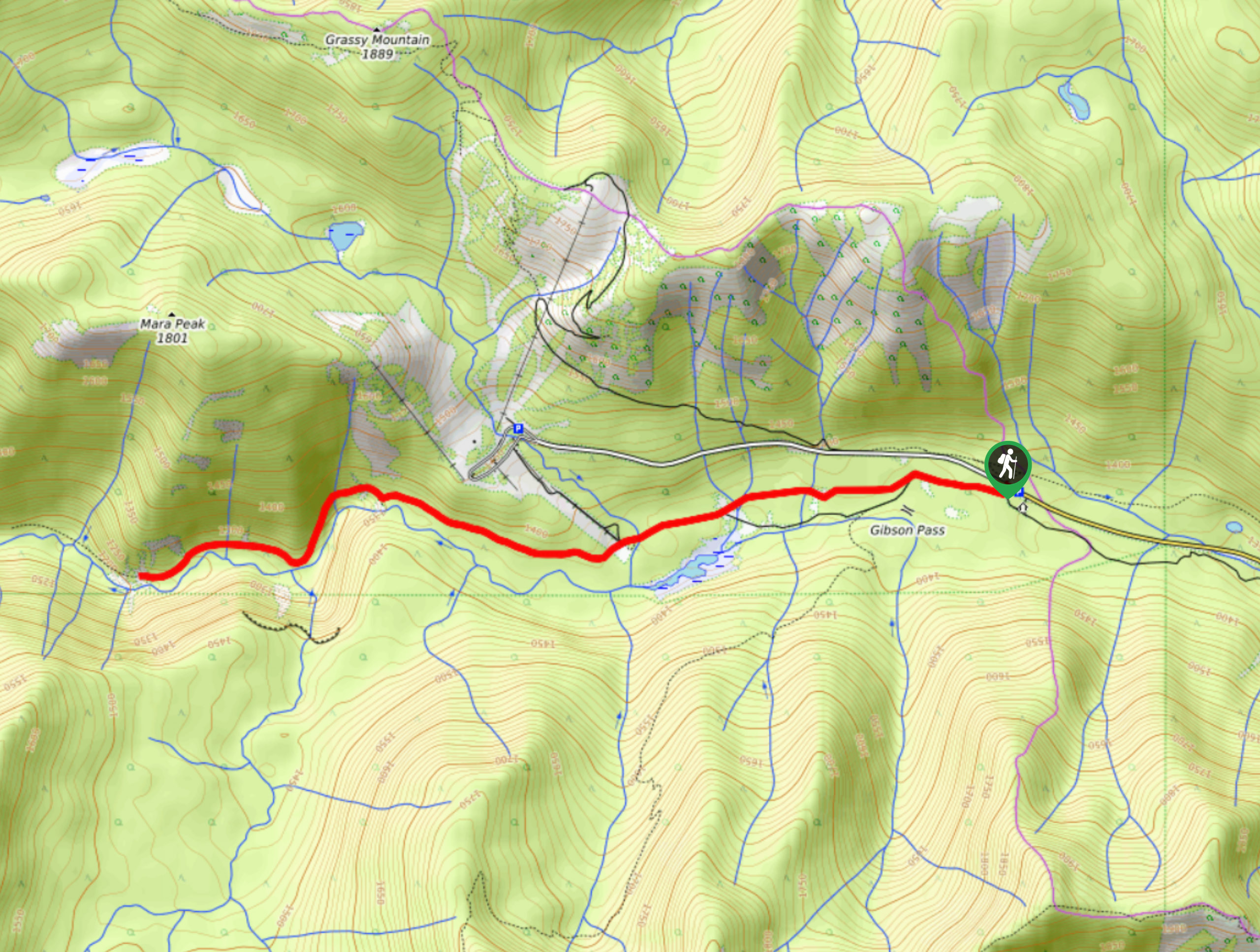
East Skyline Trail
The East Skyline Trail is a 12.3mi out-and-back hiking route through the forests west of Lightning Lake that…
Lone Goat and Snow Camp Mountain Trail
The Lone Goat and Snow Camp Mountain Trail is a 12.3mi out-and-back hiking route within E.C. Manning Provincial…
Comments