Dry Island Buffalo Jump
View Photos
Dry Island Buffalo Jump
Difficulty Rating:
The Dry Island Buffalo Jump trail is a stunning circuit that travels through the provincial park. This route features a landmark that was once a place where indigenous people drove buffalo over the cliffs in numbers to provide food for their community. There is a famous archaeological site here that is known for the discovery of Albertosaurus bones.
Getting there
To get to Dry Island Buffalo Jump trail from Drumheller, travel northbound on Highway 56 for 38.5mi before turning left onto AB-590 and left again onto Range Road 215. Turn right onto Township Road 350, left onto Range Road 221, and left again onto Township Road 344 following signs to Dry Island Buffalo Jump Provincial Park.

About
| When to do | May-October |
| Backcountry Campsites | No |
| Pets allowed | Yes - On Leash |
| Family friendly | Yes |
| Route Signage | Average |
| Crowd Levels | Low |
| Route Type | Circuit |
Dry Island Buffalo Jump
Elevation Graph
Weather
Dry Island Buffalo Jump Trail Description
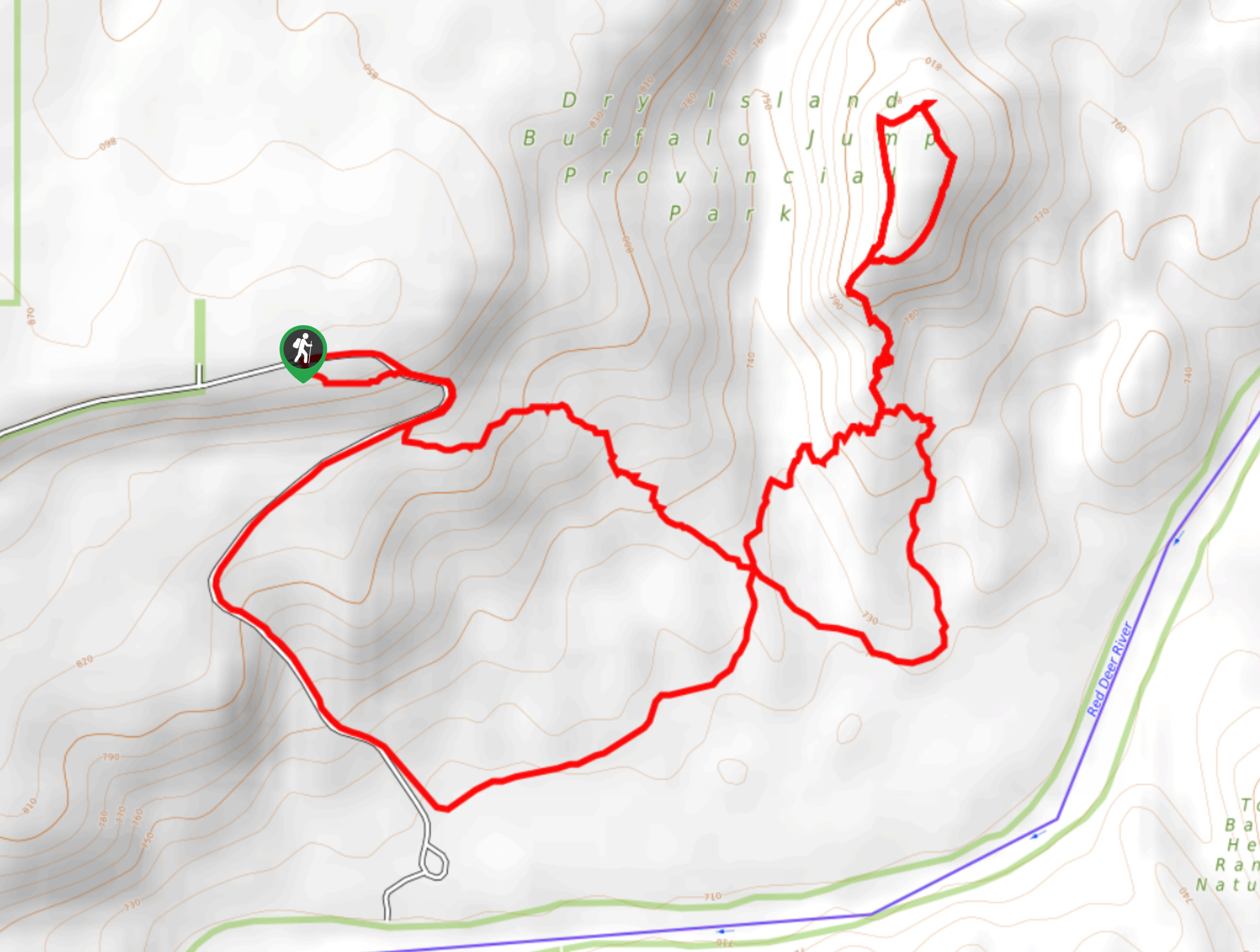
The Dry Island Buffalo Jump trail is a circuit that follows a figure eight pattern with plenty of options to shorten or lengthen the trip. It is very infrequently visited compared to some other nearby regions as it is located in a remote area. This is best visited when in transit between two areas where a short detour is manageable.
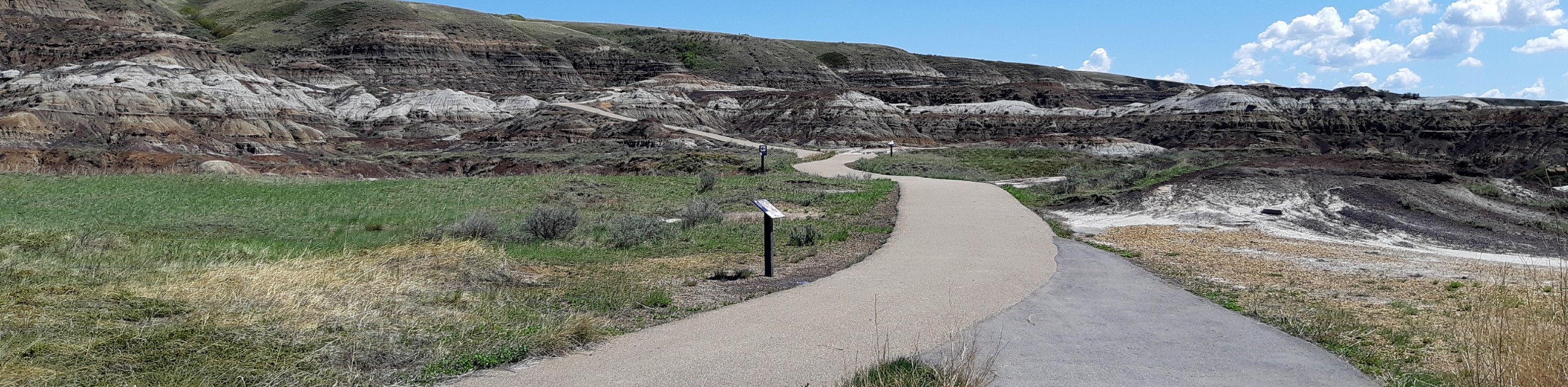
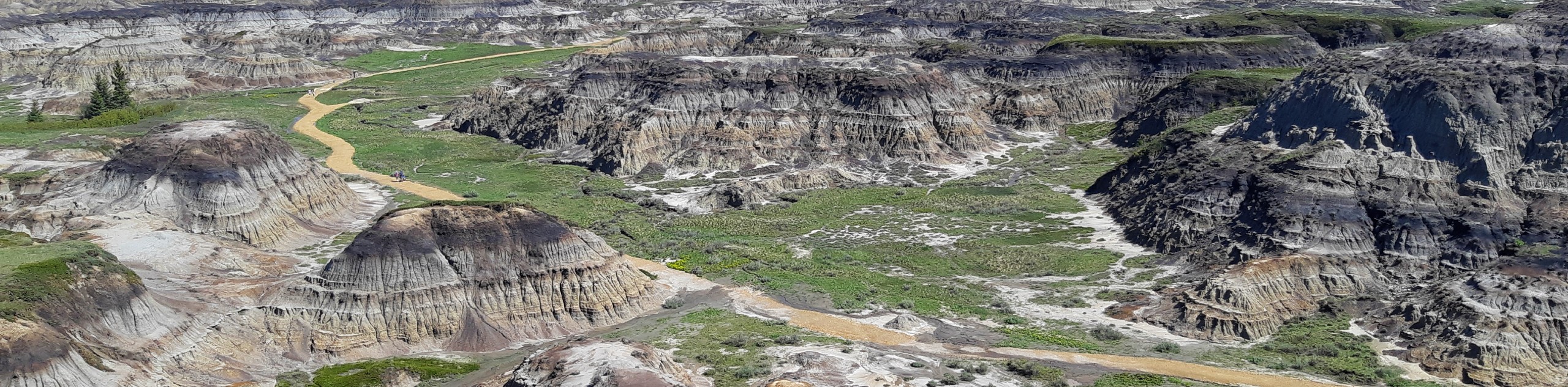
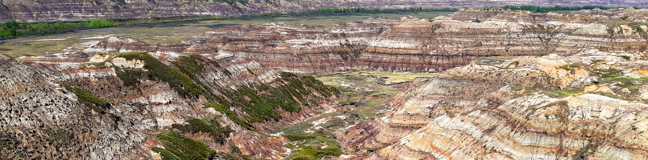
The Dry Island Buffalo Jump park is considered the desert of Alberta. It is a unique destination with interesting grasslands and plateaus. The trail is near the Red Deer River and sits above the cliffs that were historically used to drive buffalo over the edge in large numbers as an indigenous hunting method.
Starting at the trailhead and main parking area, begin your trip on the clearly marked path, staying to the left side. Within 1312ft you will be greeted with expansive views of the grasslands and the cliff bands that descend into the lower canyon. Come to a junction and stay right, descending below the cliffs that surround you. Travel along the edge of Township Road 344A before splitting off to the left into the grasslands. 1.4mi from your last junction you will come to the crossing point of the figure eight shape. Stay straight at this intersection continuing on the trail as it begins to ascend some slight switchbacks.
In 2297ft, come to a junction with a side trail to the left. Take this trail to the left and find yourself at some incredible viewpoints that show off the unique landscape this park has to offer. Return to the junction, taking a left to complete the circuit. Enjoy the diverse desert flora and fauna here as you explore the scenic area. You won’t feel like you’re still in Canada when travelling along this trail.
Insider Hints
Bring cameras and binoculars as this is a popular bird watching region
Make sure to read up on the interpretive signs to learn about the history of this noteworthy area
Explore the region’s multitude of water activities by fishing, paddling, and swimming
Similar hikes to the Dry Island Buffalo Jump hike
Drumheller Pedestrian Trail
The Drumheller Pedestrian Trail is a great cycling and hiking path in the centre of Drumheller. The trail travels along…
Horseshoe Canyon Loop Trail
Hiking the 2.4mi loop that makes up the Horseshoe Canyon Trail is the best way to see Horseshoe…
Horsethief Canyon Trail
The short and easy Horsethief Canyon is just outside of Drumheller and is only 2625ft long. It is…
Comments