Stoke Point Trail
View Photos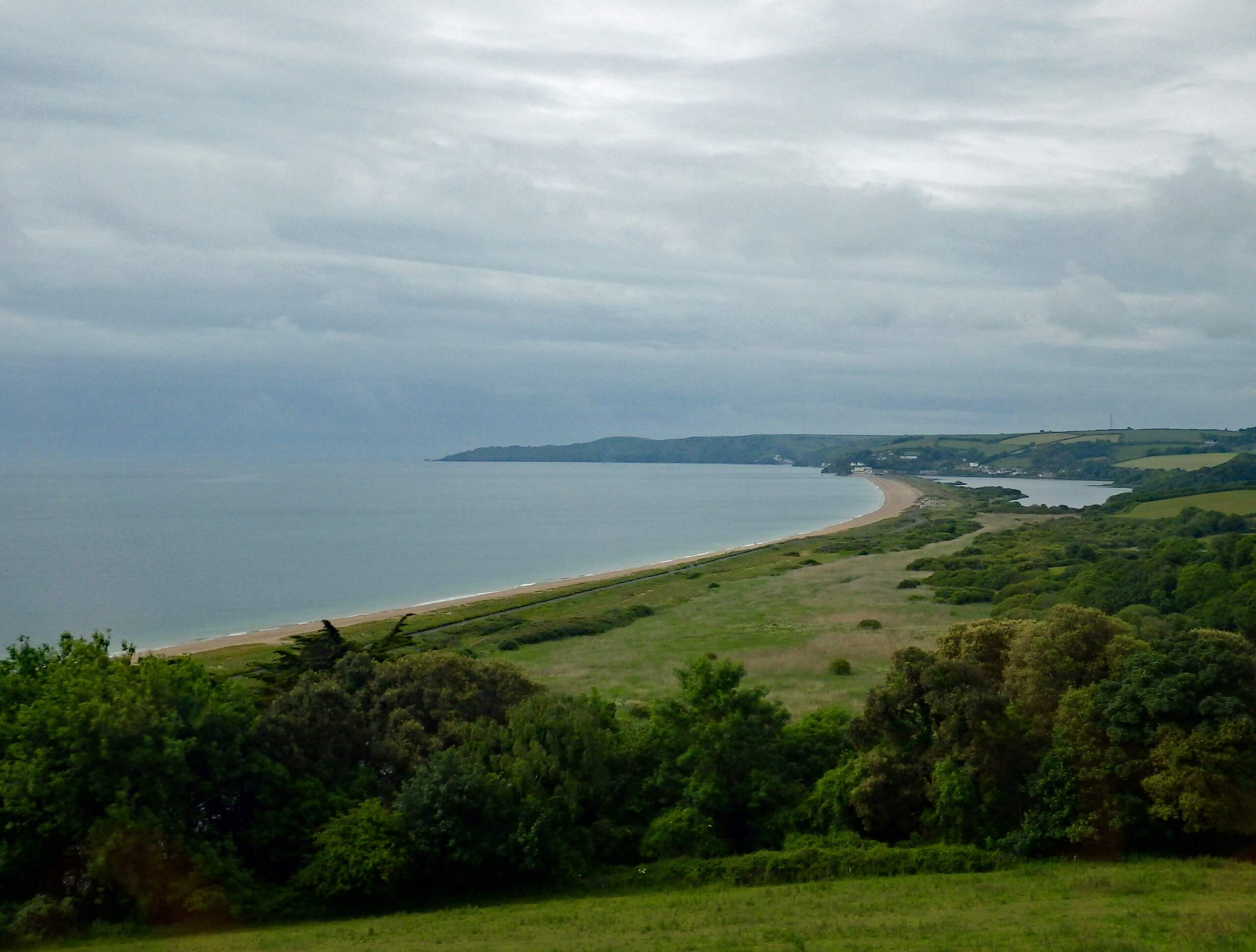
Stoke Point Trail
Difficulty Rating:
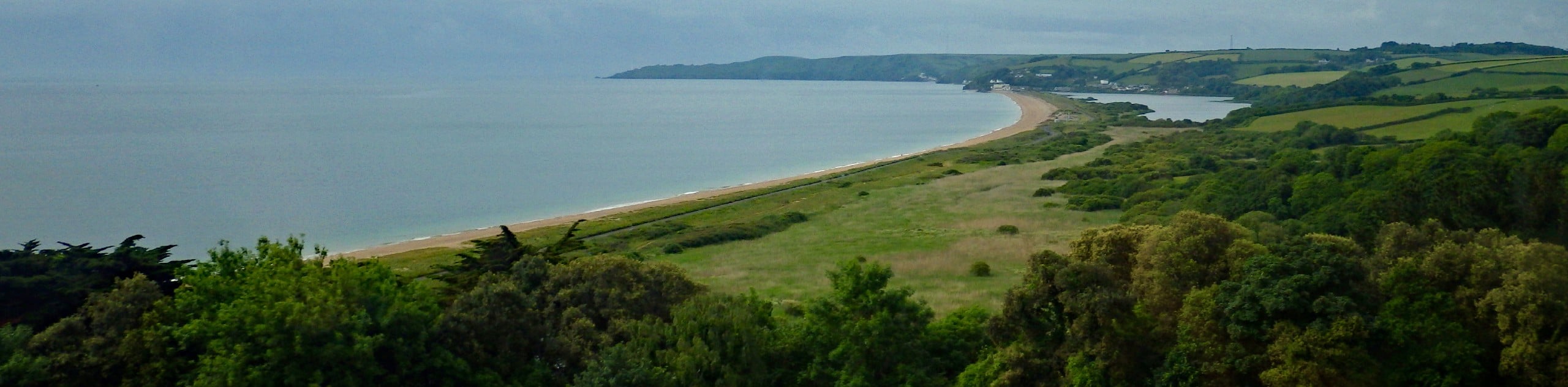
Walking the Stoke Point Trail is a fantastic outdoor experience in Devon that will allow you to witness the natural beauty and rugged nature of the coastal terrain. While out walking the trail, you will stroll along the top of a cliff while enjoying views overlooking a number of secluded coves and the English Channel before traversing Stoke Point on the return leg of the journey. This is a great adventure that can be enjoyed by all; just make sure to exercise caution after a good rainfall, as the trail can be fairly muddy/slippery.
Getting there
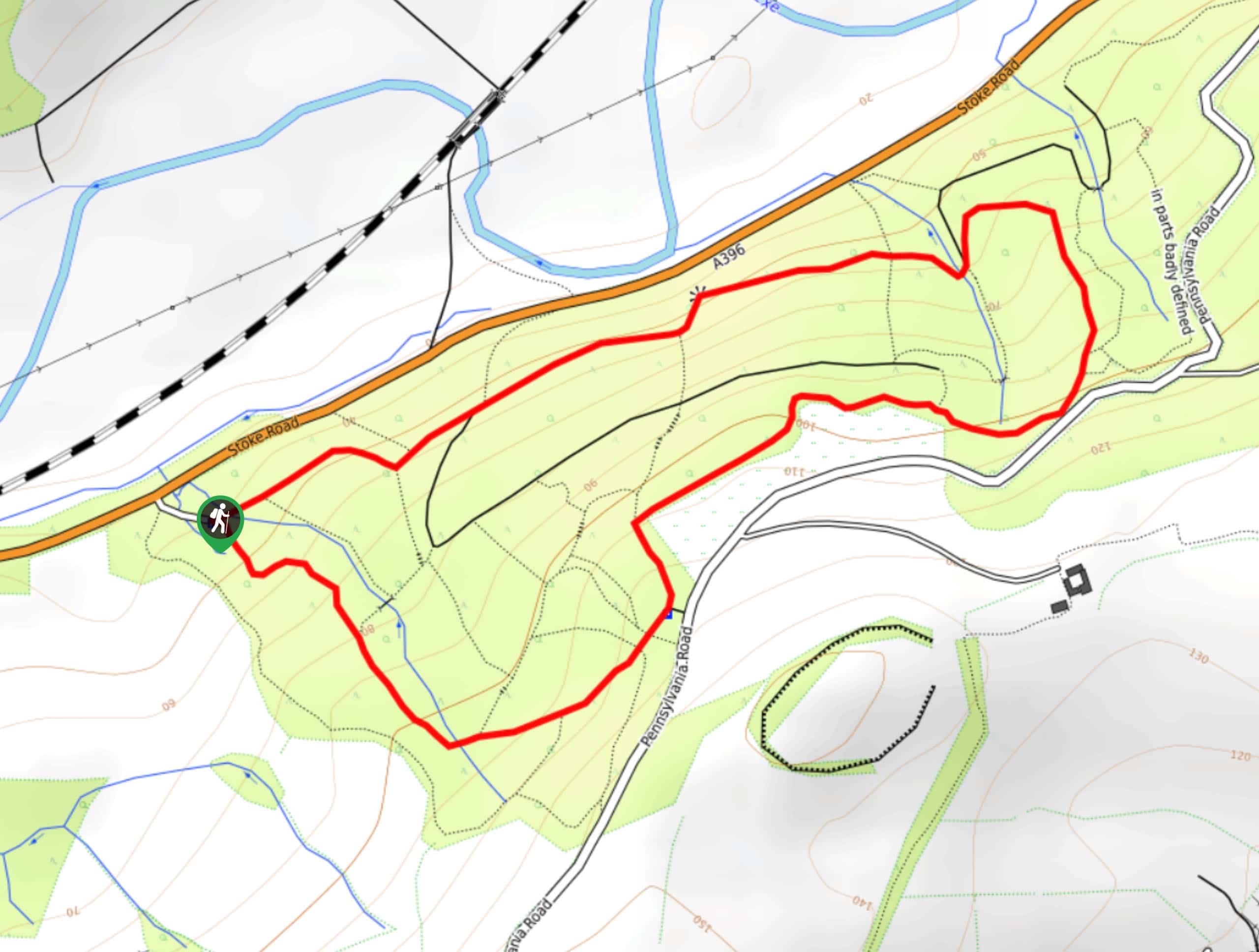
To get to the trailhead for the Stoke Point Trail from Noss Mayo, head southwest on Stoke Road for 0.5mi and turn left to stay on the same road for another 0.5mi. Continue straight for 0.2mi to find the car park on the right.

About
| Backcountry Campground | No |
| When to do | Year-Round |
| Pets allowed | Yes - On Leash |
| Family friendly | Yes |
| Route Signage | Average |
| Crowd Levels | Moderate |
| Route Type | Lollipop |
Stoke Point Trail
Elevation Graph
Weather
Stoke Point Trail Description
Rugged coastal terrain and gorgeous views across the English Channel await on the Stoke Point Trail along the South Devon Coast. This popular trail sets out from the car park and heads south towards Stoke Point, turning towards the west to walk along the edge of the cliff for some stunning views overlooking small, secluded coves that are continuously crashed upon by the gentle waves of the English Channel. After reaching the terminus of the trail, you will turn back and keep to the right, making your way downhill to explore the rugged terrain along Stoke Point before heading back up to the trailhead where you began.
Similar hikes to the Stoke Point Trail hike
Stoke Woods Circular Walk
The Stoke Woods Circular Walk is a quick and fairly easy adventure near Exeter that will expose you to some…
Ottery Saint Mary Woodland Walk
The Ottery Saint Mary Woodland Walk is a great excursion in Devon that features some relatively easy to manage terrain…

Exe Valley Way
The Exe Valley Way is a long distance walking route in Devon that will expose you to the picturesque countryside.…
Comments