
Stroud Trail
View Photos
Stroud Trail
Difficulty Rating:
Walking the Stroud Trail is a fun experience that will expose you to some of the beautiful landscapes that can be found within The Cotswolds AONB. While out on the trail, you will make your way through the charming villages, peaceful forests, and picturesque farmland pastures that surround the elevated position of the Selsley Common. This is a fantastic adventure to save for a weekend of great weather.
Getting there
To reach the trailhead for the Stroud Trail from Stroud, head west along Cainscross Road/A419 for 0.8mi and take the first exit at the roundabout onto Dudbridge Road. After 0.4mi, take the second exit at the next roundabout and continue on for 0.6mi before turning right on The Grove. You will find a parking area on the left in 450ft.

About
| When to do | Year-Round |
| Backcountry Campsites | No |
| Pets allowed | Yes - On Leash |
| Family friendly | Yes |
| Route Signage | Average |
| Crowd Levels | Moderate |
| Route Type | Circuit |
Stroud Trail
Elevation Graph
Weather
Stroud Trail Description
Although it is a fairly easy-going experience, the Stroud Trail does feature small amounts of elevation gain along steep hillsides and some rugged terrain that can become muddy in the spring. Be sure to wear proper walking boots when setting out on your adventure. Additionally, you will likely encounter some cows, sheep, or horses grazing in the pasture while out on your walk. Keep an eye on children in these areas and be sure to keep your canine friends on a lead. Other than that, strap on your walking boots and have a fantastic time out on the trails!
Setting out from the parking area, the path will lead you toward the southwest to climb uphill along the slopes of Selsley Common. Reaching the summit, take some time to appreciate the views of the breathtaking Gloucestershire countryside. From here, the trail will head to the south and turn east to pass through a lovely stretch of forest before descending the hillside towards the village of South Woodchester. As you approach the edge of the village, the route will turn to the north and take you past the lovely Church of St. Mary set within the village of North Woodchester. After making your way through the quaint village, continue along the path to the northwest and climb back uphill to arrive at the parking area where you began your adventure.
Consider a Walking Holiday in the Cotswolds
One of the best ways to experience this stunning Area of Outstanding Natural Beauty is by booking a pre-planned adventure tour in the Cotswolds. Find the famous self-guided Cotswolds Way and other amazing guided and self-guided tours on 10Adventures Tours.
Similar hikes to the Stroud Trail hike

Stanton, Snowshill, and Stanway Circular Walk
The Stanton, Snowshill, and Stanway Circular Walk is a fantastic adventure for those who enjoy leisurely strolls through the country,…
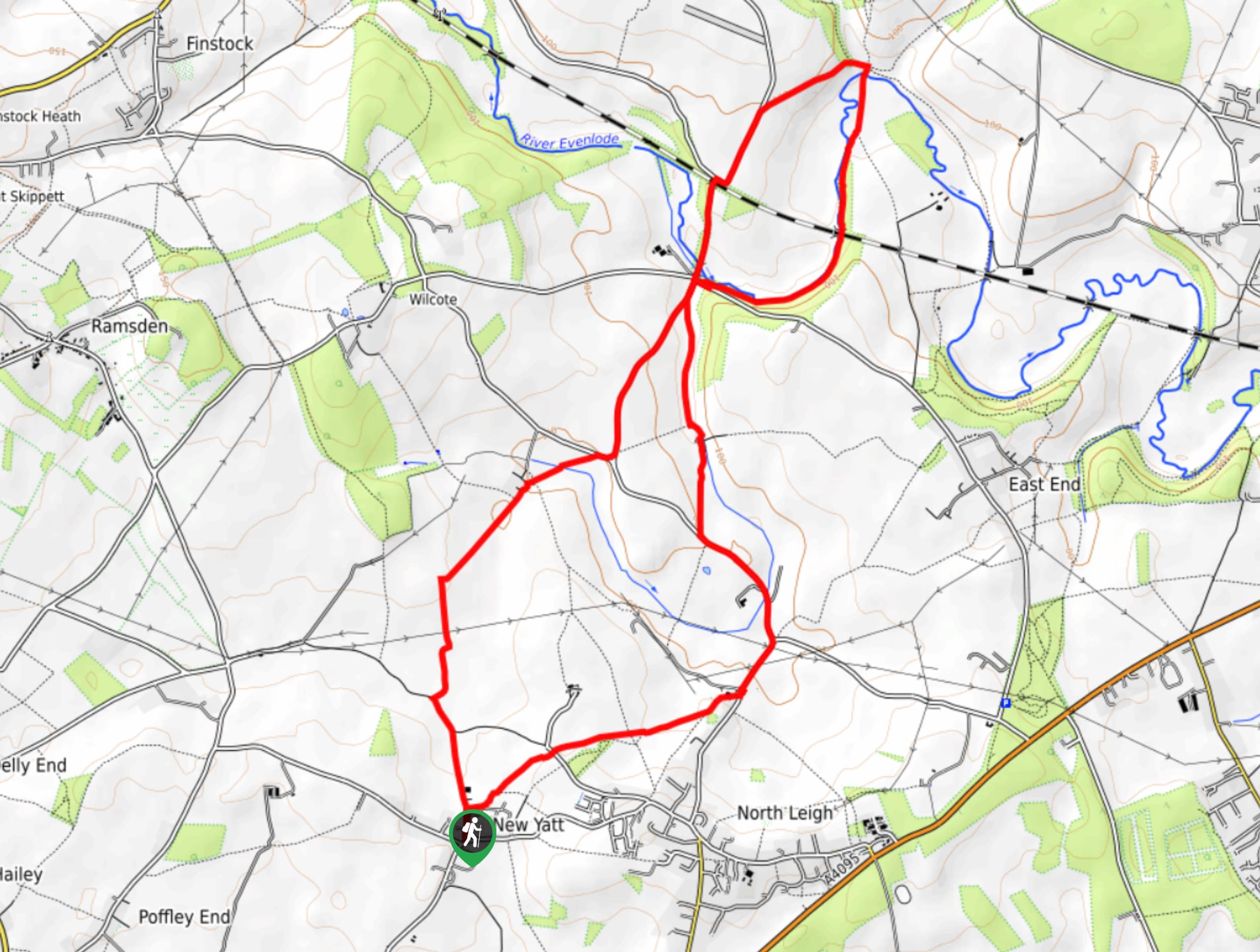
New Yatt Circular Walk
The New Yatt Circular Walk is an amazing, family-friendly adventure that will allow you to experience the beautiful landscapes that…
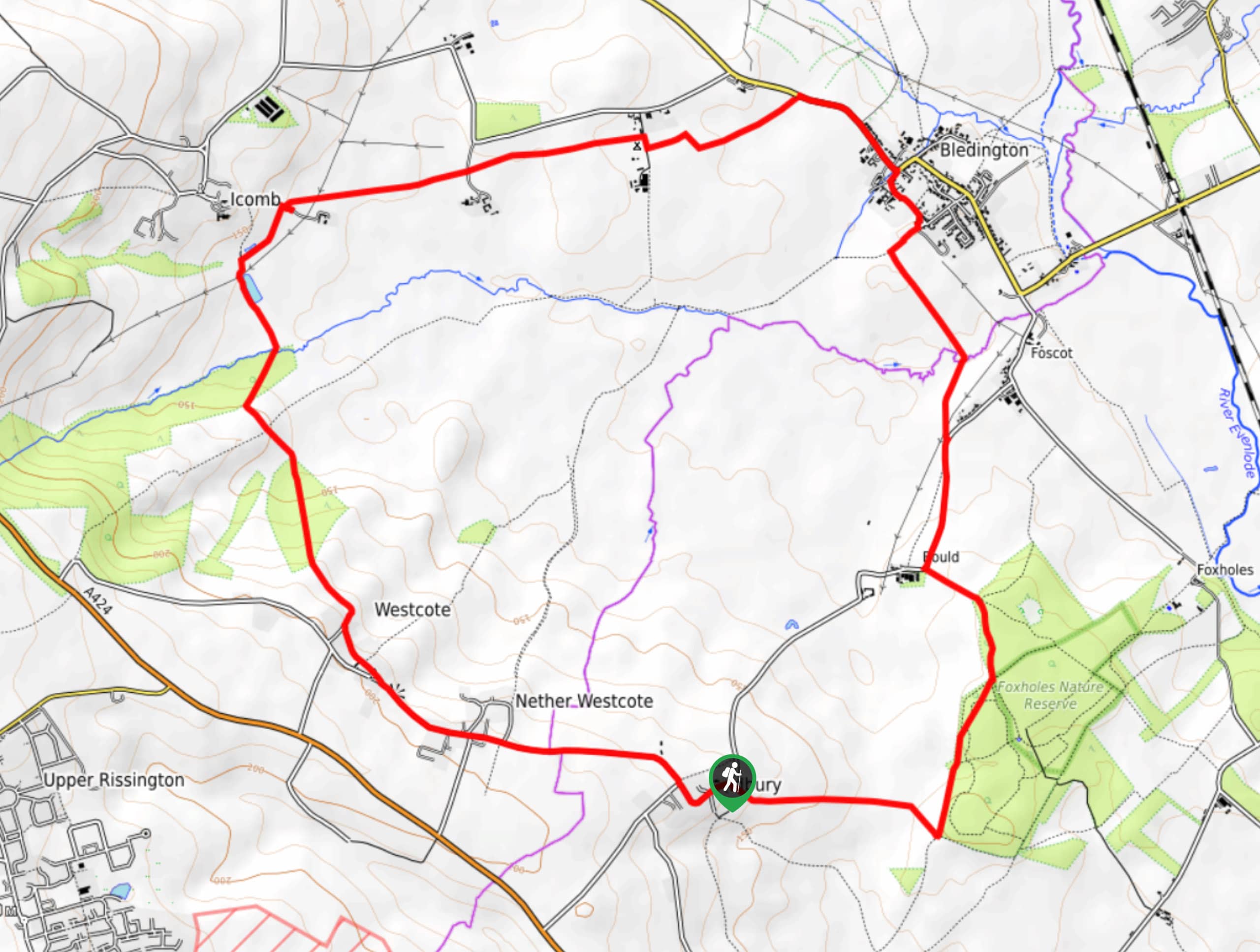
Idbury Circular Walk
Walking the Idbury Circular is a lovely adventure that will not only take you through the beautiful terrain of The…
Comments