Slad Valley Circular Walk
View Photos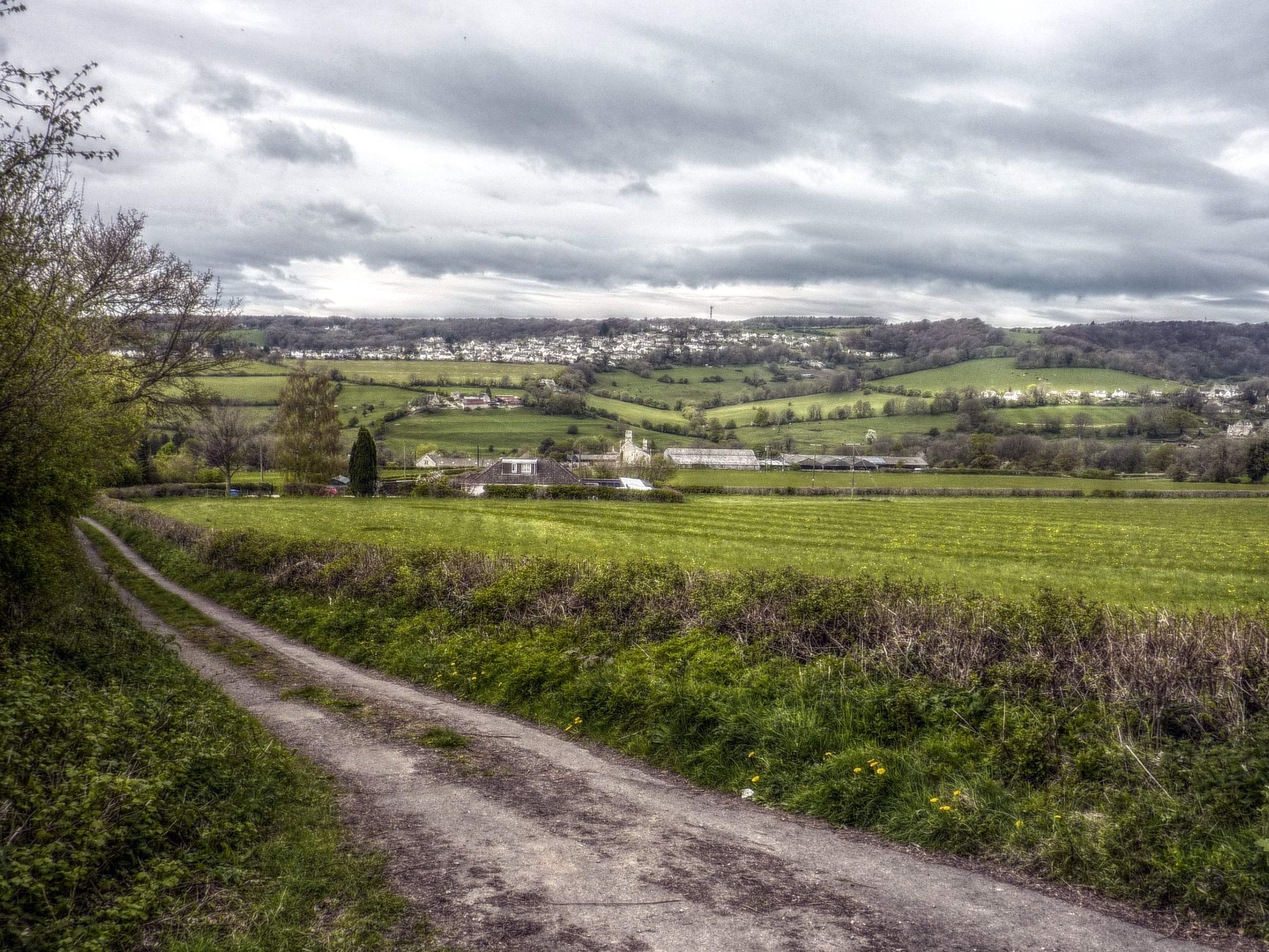
Slad Valley Circular Walk
Difficulty Rating:
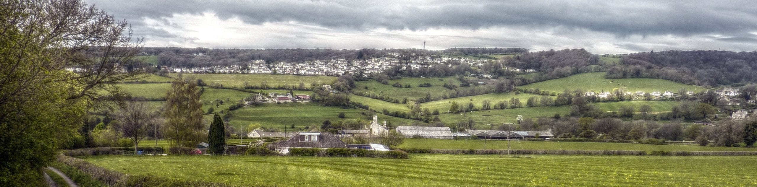
Walking the Slad Valley Circular is a fascinating outing in The Cotswolds AONB that features some challenging terrain and provides beautiful views of the surrounding hills. While out on the trail, you will make your way through undulating woodland terrain while crossing over winding brooks and traversing beautiful stretches of open pasture. Parts of the trail are a bit difficult, but this is still a fantastic day-walk that the entire family can enjoy.
Getting there
To reach the trailhead for the Slad Valley Circular Walk from Stroud, head to the northeast omn Slad Road/B4070 for 3.0mi and you will find a layby for parking on the right.

About
| When to do | March-October |
| Backcountry Campsites | Cherry Tree Glamping |
| Pets allowed | Yes - On Leash |
| Family friendly | Older Children only |
| Route Signage | Average |
| Crowd Levels | Moderate |
| Route Type | Circuit |
Slad Valley Circular Walk
Elevation Graph
Weather
Slad Valley Circular Walk Description
While the Slad Valley Circular Walk can be utilized for a fun family outing, there are some steep portions of trail along the undulating hillside that may prove troublesome for very young adventurers. Exercise caution when exploring these areas. Additionally, there are some sections of uneven/rugged terrain underfoot that will require some good walking footwear. Mobile service can also be a bit spotty in the area, so make sure to take a screenshot of the route to use as a secondary reference if need be.
All of these minor inconveniences considered, the Slad Valley Circular Walk offers a great chance to leave the hustle and bustle of everyday life behind while reconnecting with the beauty of the natural world. Setting out from the parking layby, the trail will take you to the east to descend the hillside through the tranquil expanse of Longridge Wood. From here, you will cross over Slad Brook and climb back uphill to the northeast to traverse a lovely stretch of open pasture. Eventually, you will head to the southeast and make a descent through Down Wood, crossing over Dillay Brook and walking along its winding banks to the southwest. After climbing uphill through Catswood, follow the trail north to cross back over each of the brooks once more and traverse Down Hill, before arriving back at the trailhead where you began.
Consider a Walking Holiday in the Cotswolds
One of the best ways to experience this stunning Area of Outstanding Natural Beauty is by booking a pre-planned adventure tour in the Cotswolds. Find the famous self-guided Cotswolds Way and other amazing guided and self-guided tours on 10Adventures Tours.
Similar hikes to the Slad Valley Circular Walk hike
Stanton, Snowshill, and Stanway Circular Walk
The Stanton, Snowshill, and Stanway Circular Walk is a fantastic adventure for those who enjoy leisurely strolls through the country,…
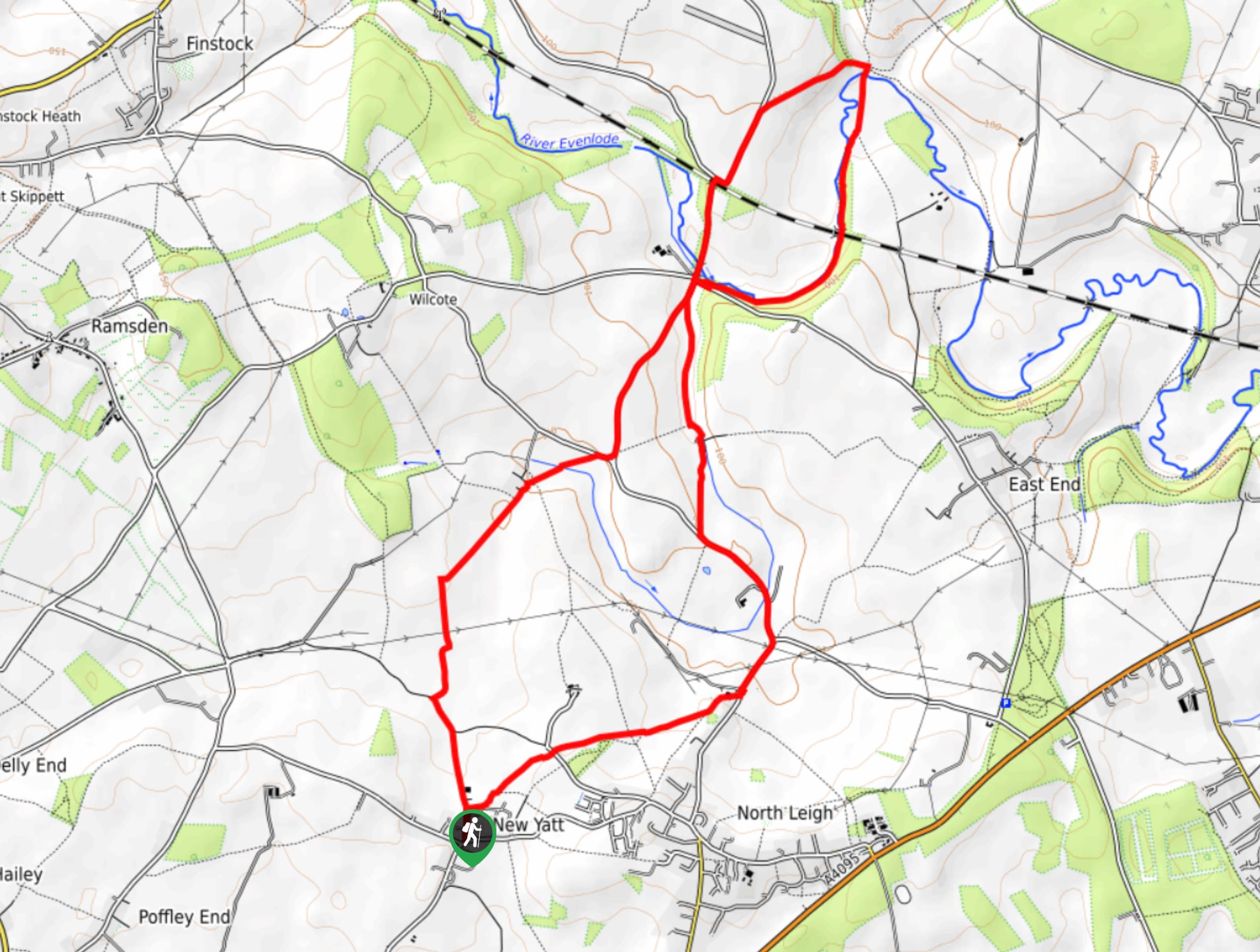
New Yatt Circular Walk
The New Yatt Circular Walk is an amazing, family-friendly adventure that will allow you to experience the beautiful landscapes that…
Idbury Circular Walk
Walking the Idbury Circular is a lovely adventure that will not only take you through the beautiful terrain of The…
Comments