Columbine Trail
View Photos
Columbine Trail
Difficulty Rating:
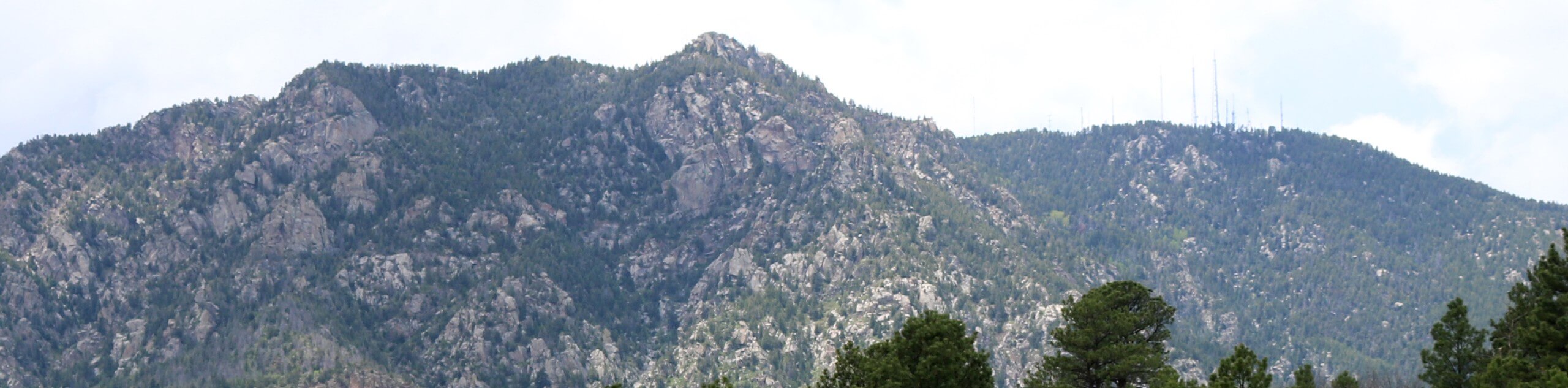
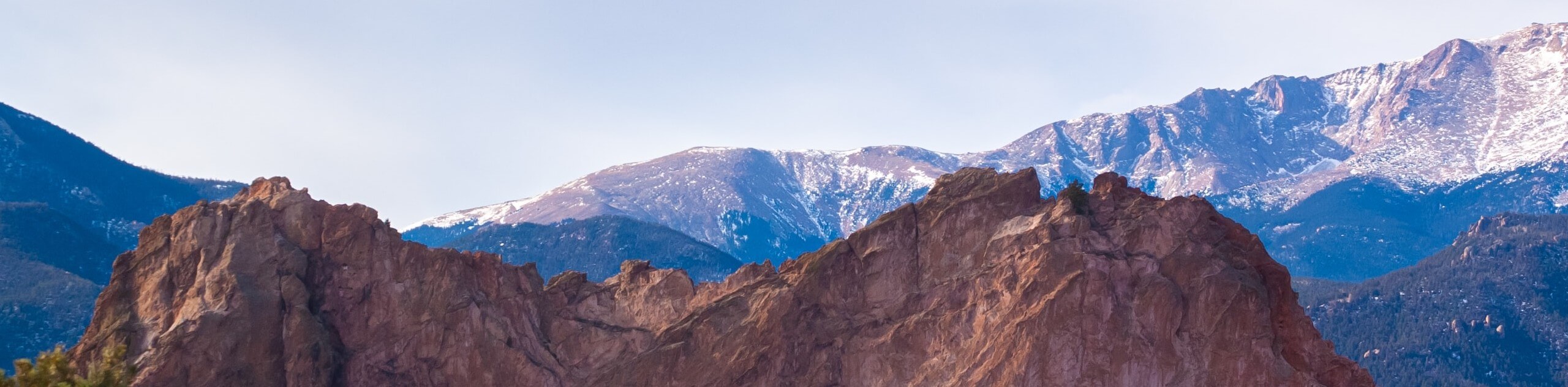
The Columbine Trail is a stunning nature walk that exhibits the beauty and diversity of the area’s terrain. Travel through lush forests, along babbling tributaries, and past granite massifs on this extremely rewarding hike.
Getting there
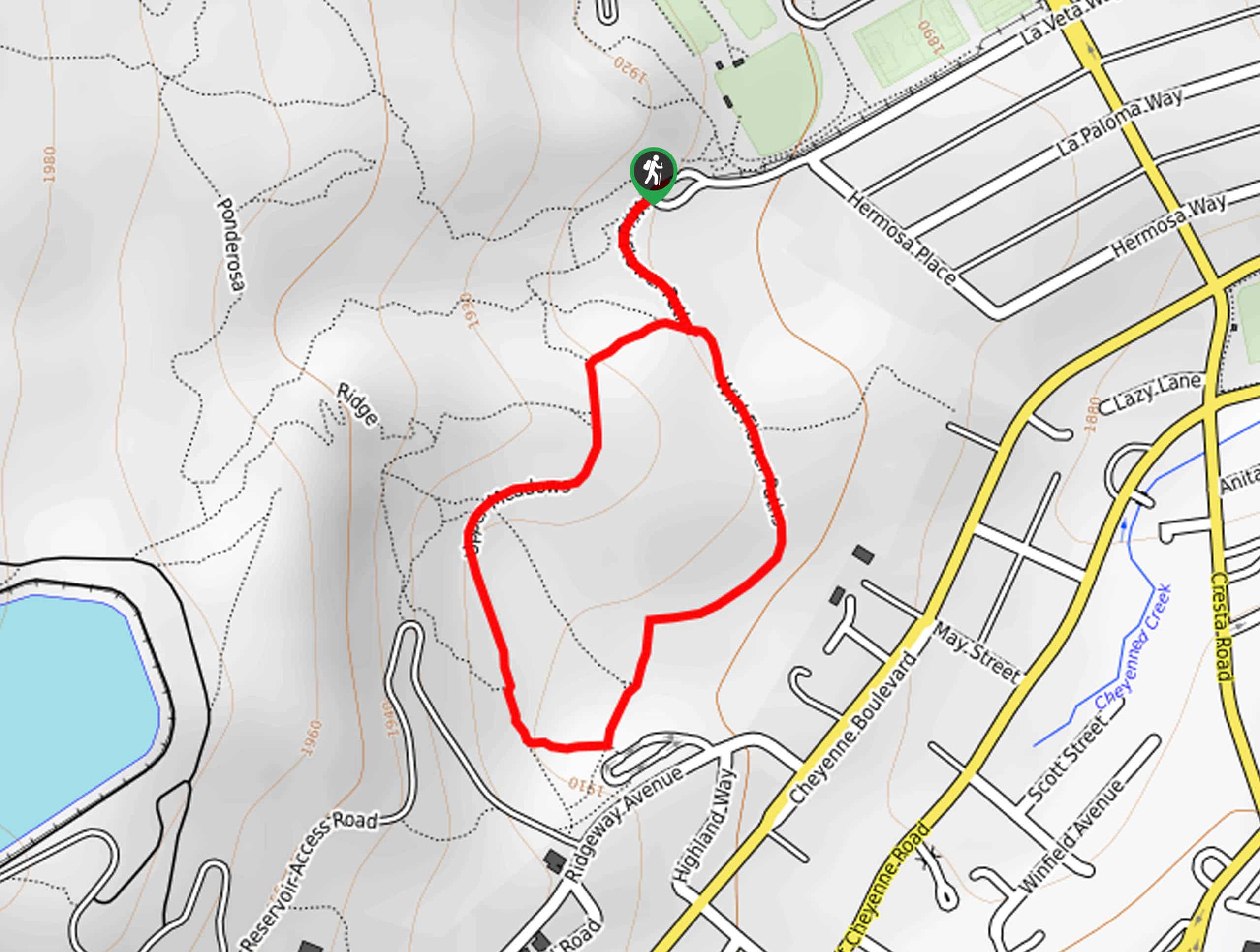
The Columbine Trail departs from the Columbine Trailhead at the Starsmore Discovery Center off South Cheyenne Canyon Road.

About
| Backcountry Campground | No |
| When to do | Year-round |
| Pets allowed | Yes - On Leash |
| Family friendly | Older Children only |
| Route Signage | Good |
| Crowd Levels | Extreme |
| Route Type | Out and back |
Columbine Trail
Elevation Graph
Weather
Columbine Trail Description
The Columbine Trail is a great option for those seeking a scenic adventure without the exertion that a summit hike demands. Traveling through the North Cheyenne Canyon and up the craggy ridges, this trek provides awe-inspiring views with every step of the way. This revered route is often quite busy, versatile, open year-round, and picturesque. If you seek a secluded experience, we suggest an early morning, weekday adventure to beat the crowds. Additionally, the sections of this path are quite rocky and, at times, muddy—wear sturdy, water-resistant footwear to avoid rolled ankles and wet feet!
Explore the area’s local flora and fauna as you venture through several terrains along the Columbine Hike. Disengage from the real world and reconnect with nature as you wander through the forested canyon bounded by impressive granite cliffs. Open-year around and accessible to mountain bikers and equestrians alike, this stunning trail can be enjoyed by outdoor enthusiasts of all sorts. Not to mention there are three trailheads along the path, making it super easy to customize the hike to suit your desires and ability levels! With ample scenery to explore and many adventurers to connect with along the way, the Columbine Trail packs a punch!
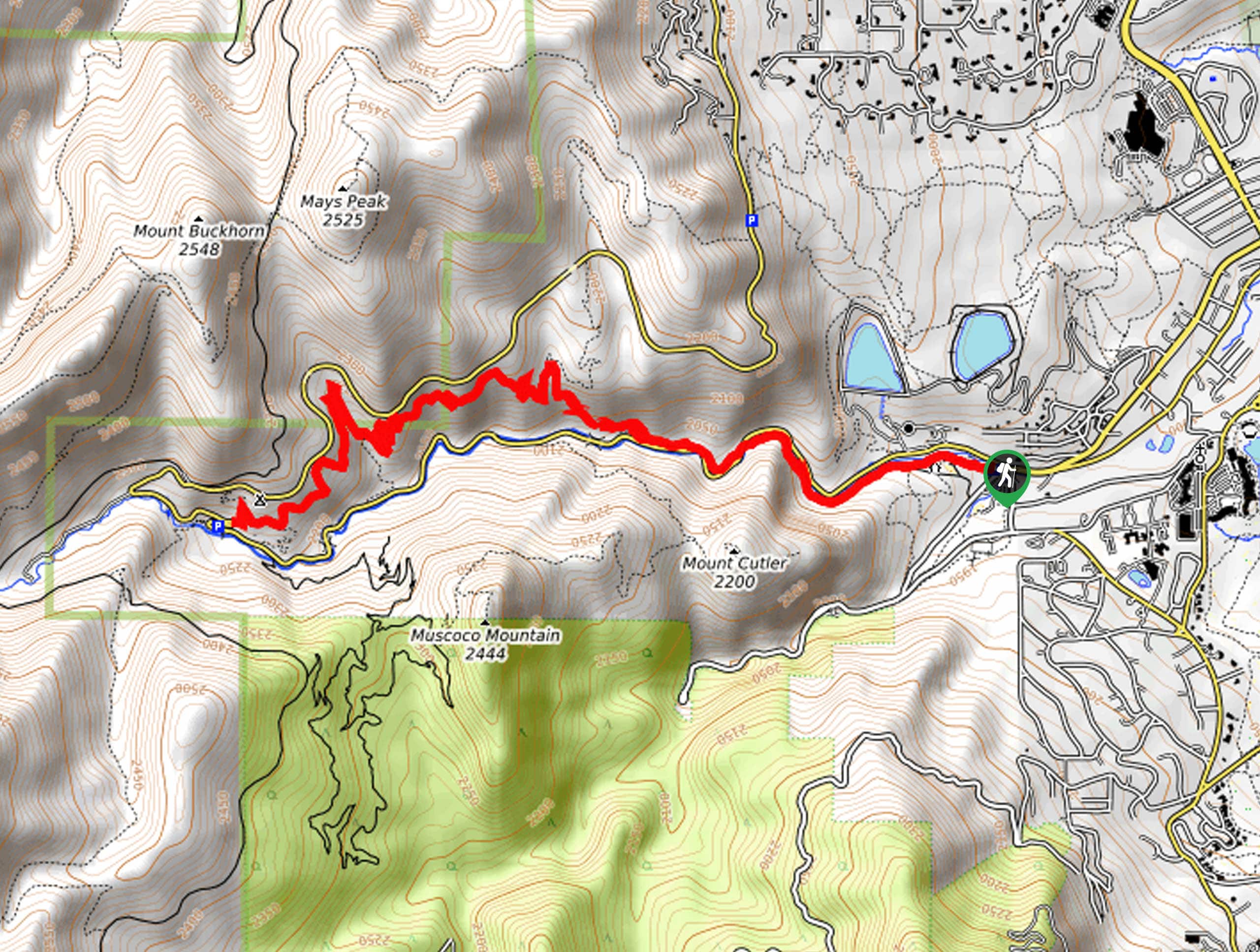
Embark on your adventure along the Columbine Trail from the trailhead at the Starsmore Discovery Center. Hikers will have to pass through a gate behind the discovery center to access the trail. From here, the Columbine Trail tracks west along the North Cheyenne Creek, through the canyon. As you wander along the southern side of the North Cheyenne Canyon Road, you will be granted sights of Mount Cutler and Mount Muscoco in the southwest. Continue hiking through the sparse mixed pine forest, and you will eventually meet a picnic area and parking lot. Trek past this area, around a looming granite massif, and you will reach an intersection. Here you will have to cross over to the north side of the North Cheyenne Canyon Road.
Now trekking along the northern side of the road, the Columbine Trail, the path will become increasingly rocky and exposed. After passing the Middle Columbine Trailhead, the route will begin to climb more intensely as you venture along the path bounded by craggy granite cliffs dotted with pines. Soon you will encounter an intersection; keep left here. As you climb higher, you will be granted impressive views of the encompassing mountains, including Mays Peak and Mount Buckhorn in the north.
Continue heading west along the Columbine Trail, noticing sights of the cityscape in the east. Eventually, you will reach the path’s end at the Upper Columbine Trailhead, which mark’s your turnaround point. If you still have some extra energy left in the tank, then cross over the Gold Camp Road and revel in the sights of Helen Hunt Falls. Then, when you are ready to return, retrace your footing along the Columbine Trail back to the trailhead.
Frequently Asked Questions
Is the Columbine Trail family-friendly?
Yes, the Columbine Trail is an easy-going trek that most older children should be able to manage.
Are dogs permitted on the Columbine Trail?
Yes, dogs on-leash are allowed on the Columbine Trail.
Insider Hints
Enjoy this trek in the winter months with a pair of snowshoes
Wear sturdy footwear, sections of the path are quite rocky
Have a picnic overlooking the Helen Hunt Falls at the halfway point
Grab a refreshment at Storybook Brewing after your adventure
Similar hikes to the Columbine Trail hike
Zook Loop
The Zook Loop is an awesome family-friendly nature walk that exhibits breathtaking panoramas of Cheyenne Mountain looming above. Explore the…
Wildflower Path and Upper Meadows Loop
The Wildflower Path and Upper Meadows Loop is a lovely nature walk through the Stratton Open Space. Immerse yourself in…
Ute and Niobrara Loop Trail
The Ute and Niobrara Loop Trail is an awesome adventure in the Garden of the Gods. Traveling along the outskirts…
Comments