
Grand Balcon Nord hike
View Photos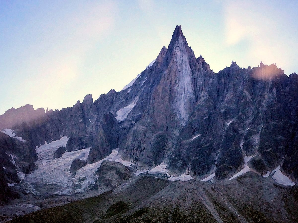
Grand Balcon Nord hike
Difficulty Rating:
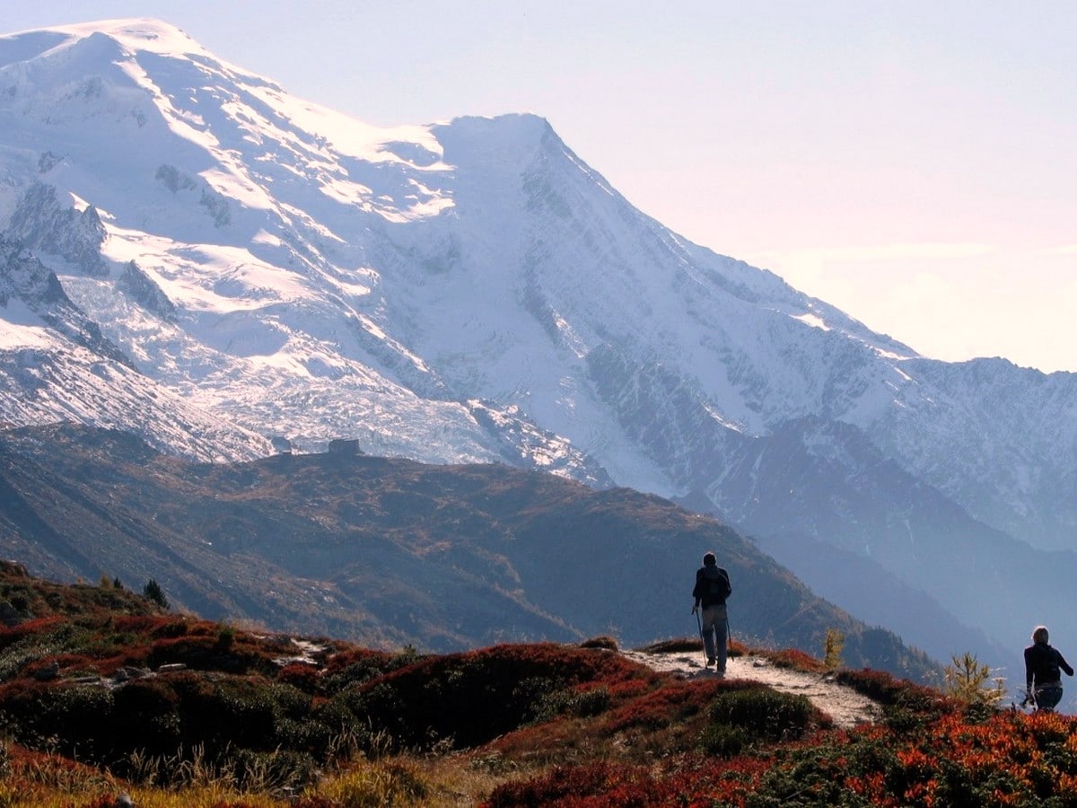
The Grand Balcon Nord hike is a classic Chamonix trail. This spectacular and panoramic Alpine hike is a must-do hike when in Chamonix. This variant of the Grand Balcon Nord trail takes in the high point of Forbes Signal for a truly high-mountain feel. Look down at the Mer de Glace glacier and into Italy’s Grands Jorasses while on this wonderful hike.
Getting there
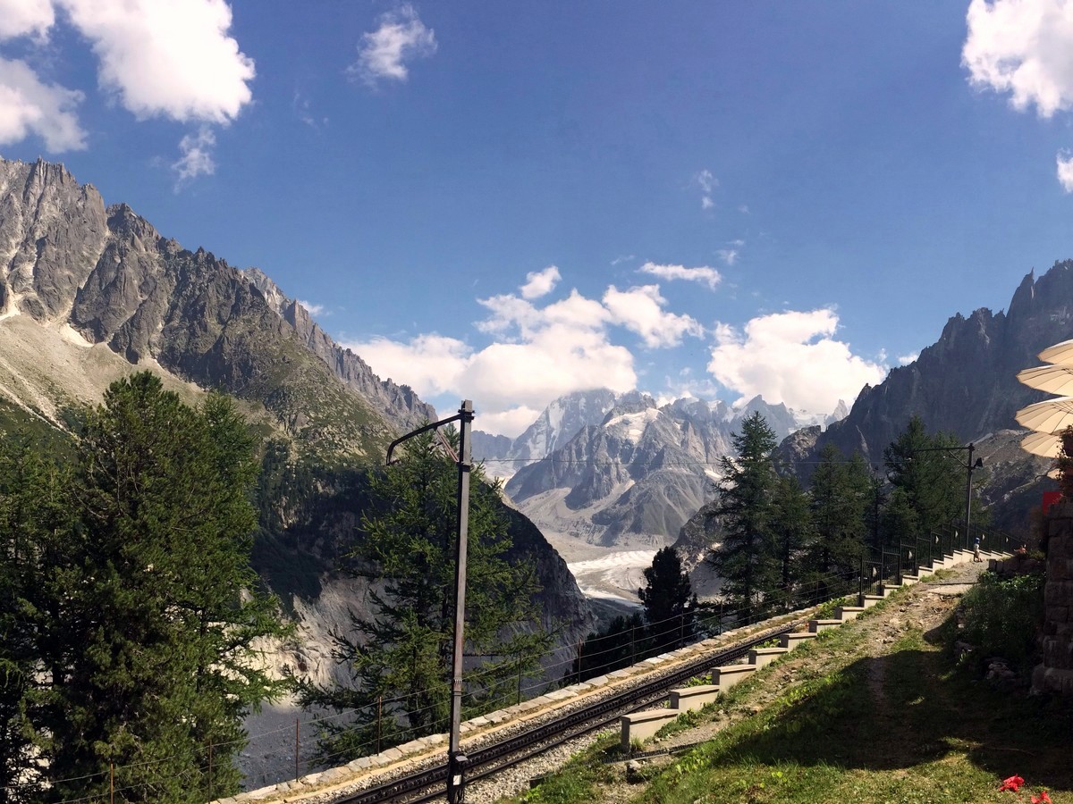
Take the rack railway up to Montenvers. On the edge of the town centre, Montenvers has its own separate station over a pedestrian bridge near the entrance of the main Chamonix railway station.

About
| When to do | July - October |
| Backcountry Campsites | No |
| Toilets | Yes, at train and lift stations |
| Family friendly | No |
| Route Signage | Average |
| Crowd Levels | High |
| Route Type | One Way |
Grand Balcon Nord
Elevation Graph
Weather
Route Description for Grand Balcon Nord
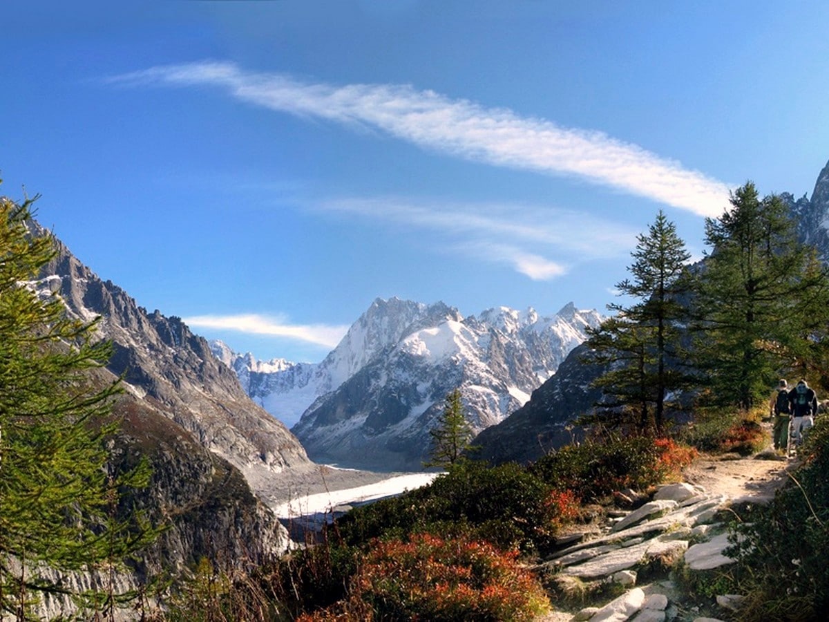
On arrival at Montenvers, it’s worth taking a few minutes to enjoy the setting. You are overlooking the stunning Mer de Glace, a tremendous and retreating glacier. The awe-inspiring south-west face of the Dru looms above the sinuous line of the glacier. Panels on the viewing platform trace historic climbing routes such as the American Direct and the remains of the Bonatti Pillar.
Now it’s time to start the wonderful Grand Balcon Nord hike. The route we recommend is a variant on the regular Grand Balcon Nord route. We like the variant for two reasons. First of all, the Grand Balcon Nord variant takes you to the wonderful Forbes Signal viewpoint, and is worth the extra effort. Secondly, the regular route has some exposure, which we aren’t a fan of. While the variant is a bit tougher, it’s totally worth the extra effort as far as we are concerned.
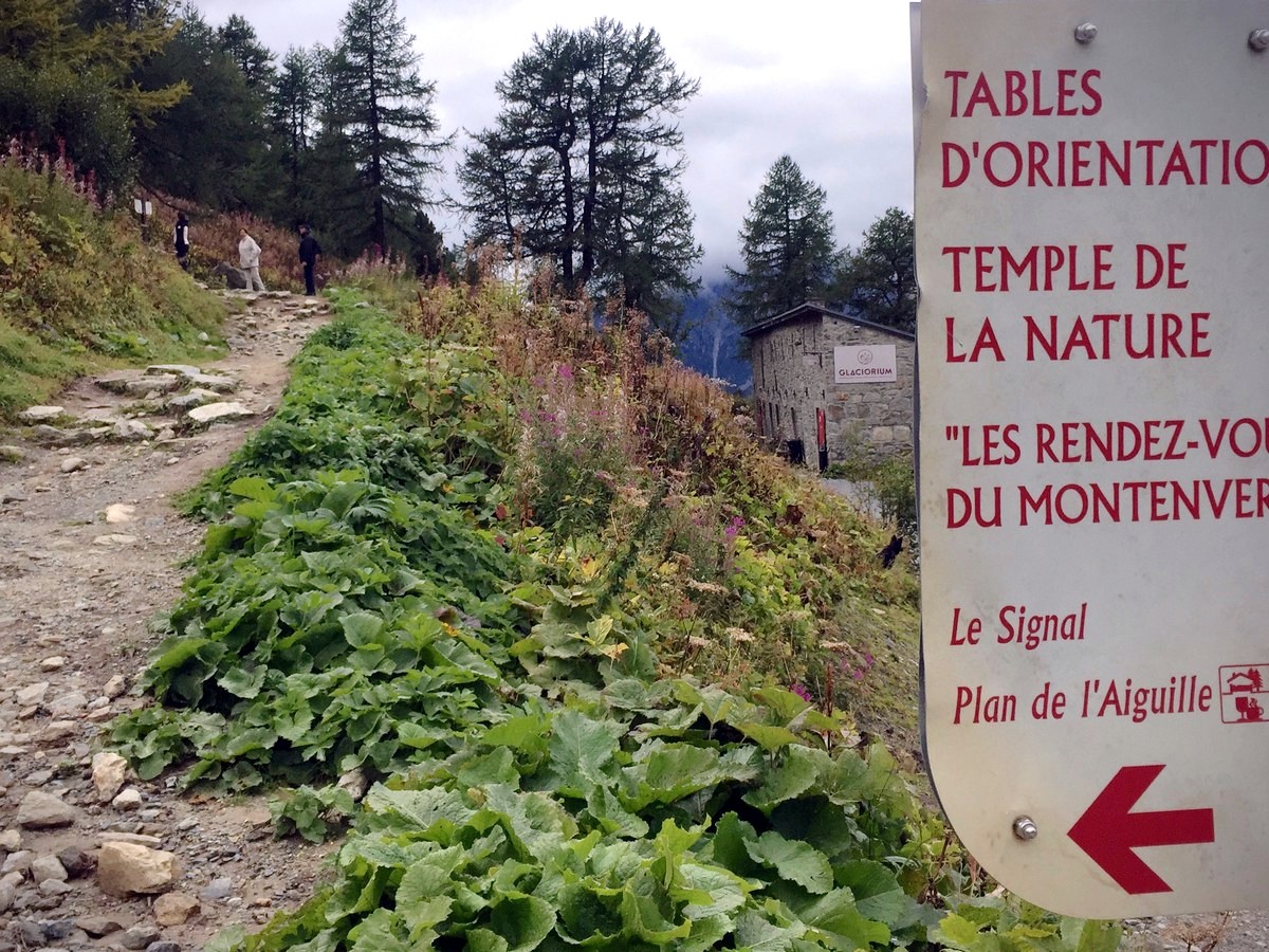
Head left out of the station towards the Grand Hôtel du Montenvers, a wonderful historical hotel situated in one of the most beautiful places on earth. Leaving the hotel on your right, you’ll see rather ornate signs pointing out the trail to Le Signal and Plan de l’Aiguille.
Continue to a second sign, pointing right to Plan de l’Aiguille, or left to Le Signal and Plan de l’Aiguille. Take the left-hand route to Le Signal.
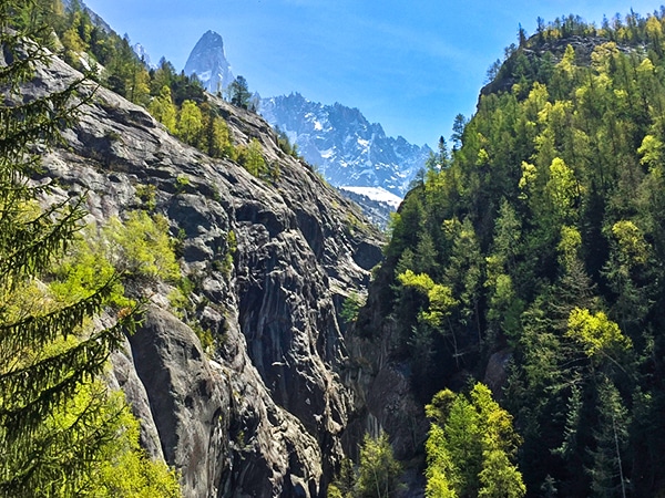
Zig-zag up behind the station, gaining height quickly as you ascend above the tree-line on a lovely path with amazing views over the Mer de Glace and towards the Grands Jorasses. The sharp spike of the Aiguille de la Republique – famous in many a mountaineering photo – is clearly visible above you. The Grand Balcon Nord path heads steadily up for around 45 minutes, turning to give gorgeous views on every side.
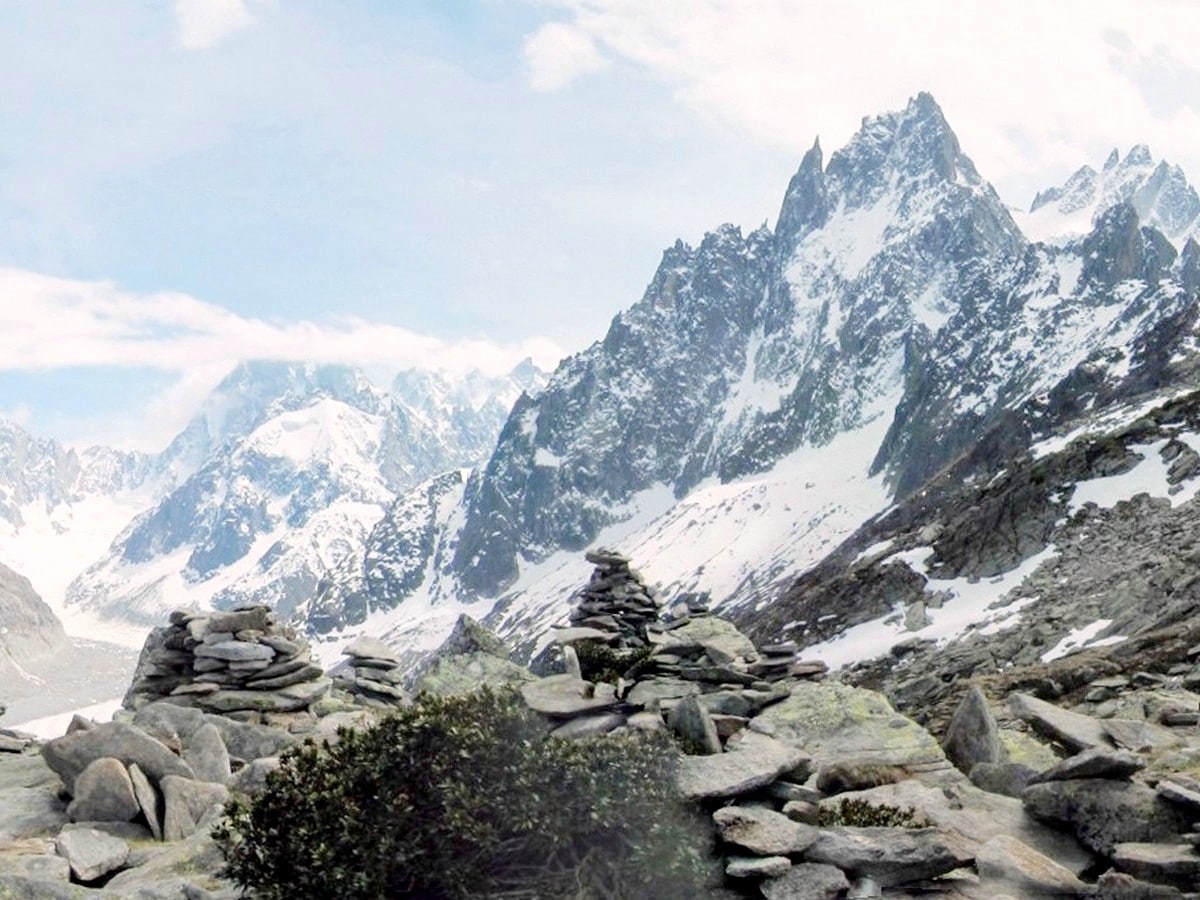
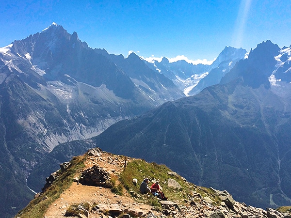
At the top, Forbes Signal is marked by a signpost and vast quantities of cairns. Walk around the cairns for fantastic photo-ops amongst the rocks, with the peaks and the glacier as a jaw-dropping background. This point is named after the Scottish Dr. Forbes, who discovered many principles of glacial movement by placing rocks on the glacier and measuring them from here. To this day it is one of the finest viewpoints over the Mer de Glace.
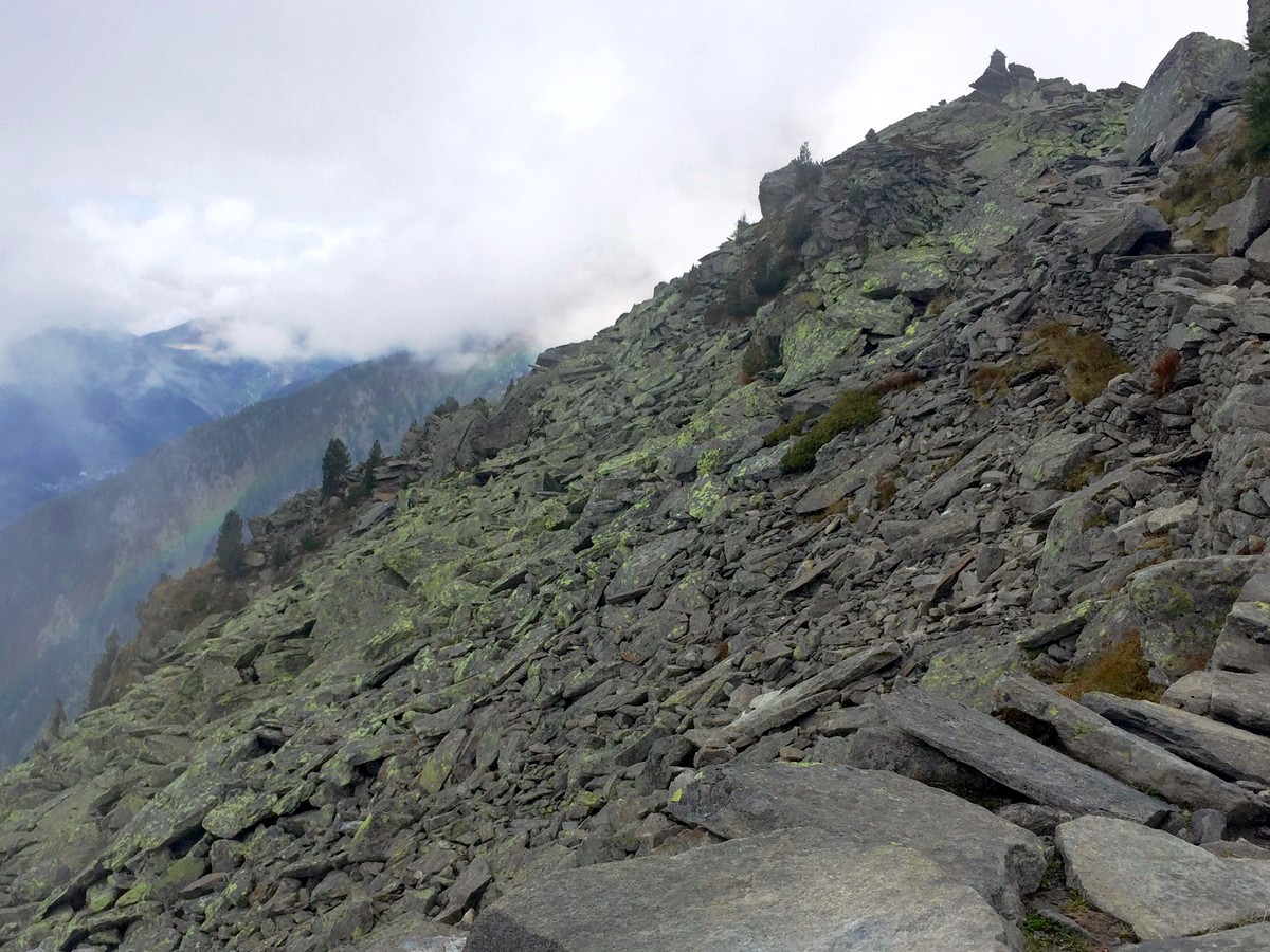
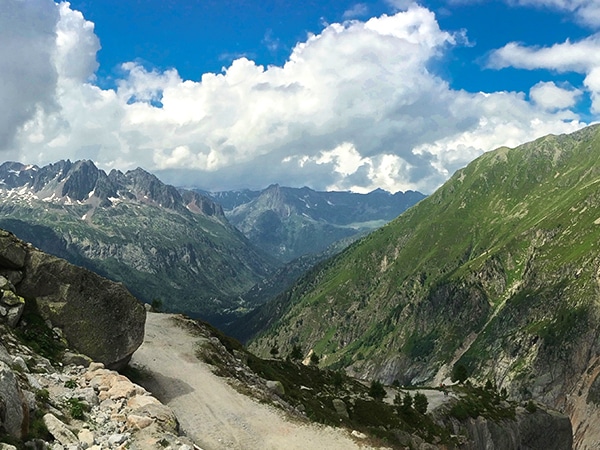
The hike along the Grand Balcon Nord continues through the wild, rocky landscape following signs to the Plan de l’Aiguille. The walk takes you on a skilfully crafted path made from the surrounding rocks, past the old stone avalanche barriers on a high balcony, before dipping down through a series of steep bends to rejoin the main Grand Balcon Nord hiking trail. Once on the main trail, continue heading towards Mont Blanc, following signs for Plan de L’Aiguille.
From here on, the hike is a pure Alpine delight. The path, gently undulating, takes you in and out of trees, around rocks and lastly through a wide basin in which a colony of marmots live. They are very well camouflaged so listen for their whistling and see if you can follow the sound. If you sit quietly (or have lunch here) you’ll usually see them.
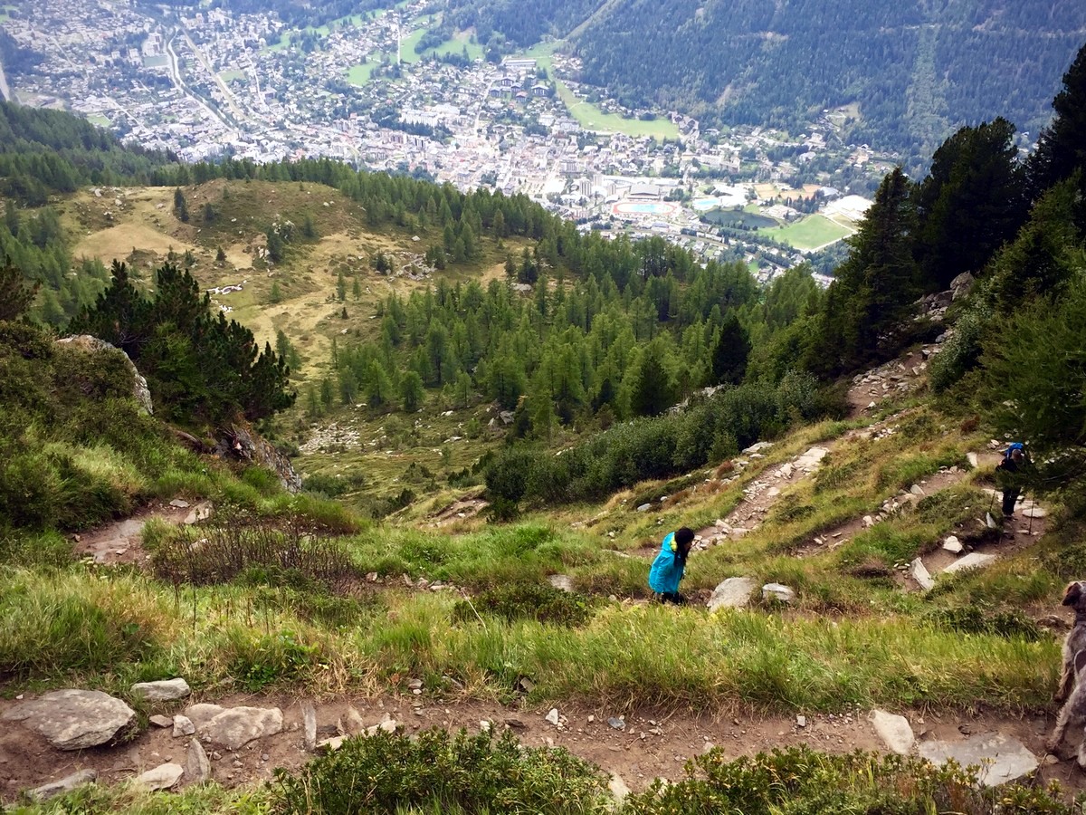
The final stretch of the Grand Balcon Nord is a bit of a pull uphill to the Plan de l’Aiguille lift station. If it’s a clear day, we can’t recommend enough to head up to the top of the Aiguille du Midi.
If you’d like a bit more walking or if you’d like to dip your toes in some cool water, there is a lovely little Alpine lake, Lac Bleu, about fifteen minutes away to the East. The route there is well signposted.
Finally, to get back to Chamonix we prefer to take the lift down. There is a signposted path down, however it’s a knee-jarring one and has 1km walking along a motorway, it’s just not worth it. Also, the lift is faster and much more pleasant!
Hiking up the Grand Balcon Nord in Chamonix in 2024
In 2024, there are no major new infrastructure updates for the Grand Balcon Nord trail in Chamonix. This trail remains one of the most accessible high-altitude hikes in the region, with both its starting and ending points well-served by existing lift systems. In 2024, this popular trail is expected to become quite busy, particularly from mid-June to the end of October when the lift systems are operational. To ensure a more tranquil experience, consider starting early in the day or hiking during the shoulder months when fewer tourists are present.
Insider Hints
Although there is less vertical if you hike the Grand Balcon Nord in reverse from our direction, you are not facing Mont Blanc. We think the views, while still lovely, are not as good.
This variant, taking in Le Signal, adds more vertical but is well worth it for the better views. Note also that if you do not take the Signal variant, the other, flatter path to Plan de l’Aiguille has some significant exposure with quite big drops at some points, and is not suitable for young children.
Walking from Montenvers to Plan de l’Aiguille also gives you the opportunity to maximize your (expensive) day pass by going to the top of the Aiguille du Midi on the way back if you have time. You need to start the walk early for this, but we highly recommend taking advantage of the pass.
Although the cafe and restaurant at Montenvers are recently renovated and much improved, it’s best to bring sandwiches and drinks with you from the town, as the café can get very busy!
Consider tackling the complete self-guided Tour du Mont Blanc route for an unforgettable hiking experience.
If you’d like a longer walk, the route up to Montenvers via the Mottets is a beautifully scenic climb of around 2.5 hours.
We do not recommend walking down from Plan de l’Aiguille. It is long, not very interesting, largely in forest, and ends with nearly a kilometre back to town beside the motorway
This hike can often be done out of season as the Midi and Montenvers have longer openings than the rest of the lifts. Check with the Maison de Montagne for conditions. This walk can sometimes even be done in early December if the snow is late. But equally, it’s often inaccessible well into June: it is north facing so snow lingers late.
After you come back down, relax with a well-deserved drink and snack in Elevation 1904, a lively bar next to the Chamonix railway station, which gets the last of the sun.

Similar hikes to the Grand Balcon Nord hike
Pointe de Vue
Pointe de Vue Hike is an easy Chamonix hike. You trek through the high alpine flowers to an astonishing viewpoint…
Le Chapeau via the Sources de L’Arveyron
Hiking to Le Chapeau via the Sources de l’Arveyron is a beautiful walk that takes you through the larch forests,…
Lac Cornu
The Lac Cornu Hike takes you away from Chamonix valley’s villages and lift systems for a higher, wilder, and quieter…
Antoanette Lavroutte 4 years ago
It's a popular hike not only the because of the easy trails but because of the view you can't just see elsewhere!
Felix Legrand 4 years ago
The walk on the Grand Balcon Nord from Plan l'Aiguille to Montenvers is adventurer walk
SnowdonLover 4 years ago
This is an easy hike with fantastic views. Great for beginners.
Neli 4 years ago
Hi all, one question to those who do hikes and this route. We will visit Chamonix in April (9-15th) and planned to do this hike. Are there some of you who can advise on the right shoes? I assume there might be snow, but how much and are 3 season hiking (gortex/vibram) hiking boots good enough for this hike?
J Rice 5 years ago
Stunning hike. We got stuck behind a very large group at one point but were eventually able to squeeze by. We must not have followed it exactly because my GPS watch said it was 4.21 miles.
Vincent V. 5 years ago
Stunning vistas and mountain views with genuinely unique features!
Kim Pillar 5 years ago
We started at 10 am, and it was very busy. Lots of people, taking selfies, using selfie sticks... they can't be bothered. Sometimes we need to wait for our turn, especially when the background looks nice.
Adel Hamdani 5 years ago
Awe-inspiring scenery around every corner. This is a spectacular hike. There are some minimal challenges, that might be too hard for beginners.
Grendy Noire 5 years ago
It was a great hike! All-in-all the views are spectacular and is place is perfect for nature lovers.
Mustafa P. 5 years ago
This hike offers grand views from the top. This is a not-to-be-missed hike!