
Le Chapeau via the Sources de L’Arveyron hike
View Photos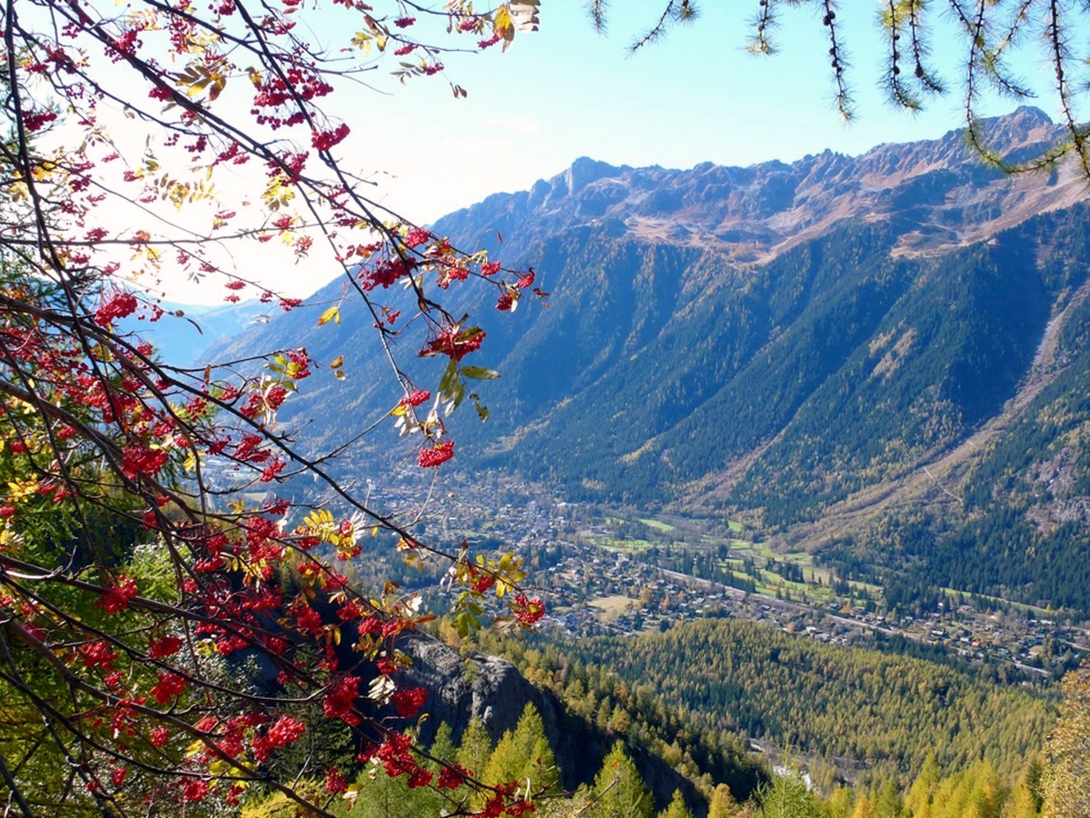
Le Chapeau via the Sources de L’Arveyron hike
Difficulty Rating:
Hiking to Le Chapeau via the Sources de l’Arveyron is a beautiful walk that takes you through the larch forests, above the valley, and past a waterfall. You’ll hike to the glacial overlook of Les Grands Morasses and Le Dent du Geant. It’s quite a lot of elevation, but it’s at an easy gradient. As a reward, near the top, there is a lovely refuge serving food and drink.
Getting there
From Chamonix, take the train to Les Praz and walk to the level crossing by the Eden hotel. Or take the bus to Les Praz-Flegere, cross the roundabout past the church and walk to the level crossing by the Eden hotel.

About
| When to do | June - November (according to snow conditions) |
| Backcountry Campsites | No |
| Toilets | Yes, at refuge |
| Family friendly | Yes |
| Route Signage | Average |
| Crowd Levels | Moderate |
| Route Type | Out and back |
Le Chapeau via the Sources de L’Arveyron
Elevation Graph
Weather
Route Description for Le Chapeau via the Sources de L’Arveyron
Cross the level crossing and walk along the Route des Gaudenays for five minutes until you reach the helipad – this is for rescue services only – you may often see the brave mountain rescuers flying out or returning here.
Turn left at the helipad and walk by the river. At the top of the open area, bear towards the left and you will see signs for “Sources de l’Arveyron” and “Le Chapeau”. A wide track leads up through the forest, keeping the river on your right. After around ten minutes, you’ll see a small path signed to the right for “Sources d’Arveyron”.
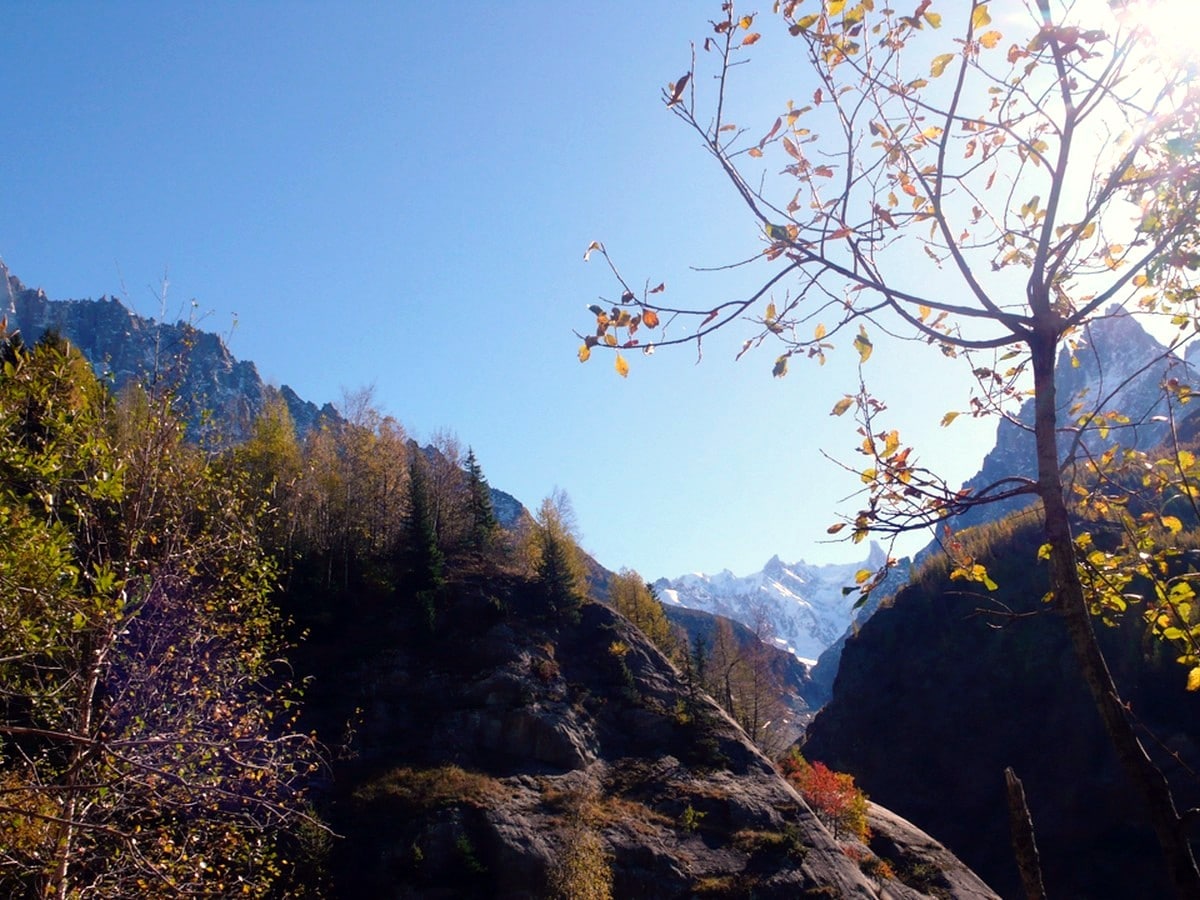
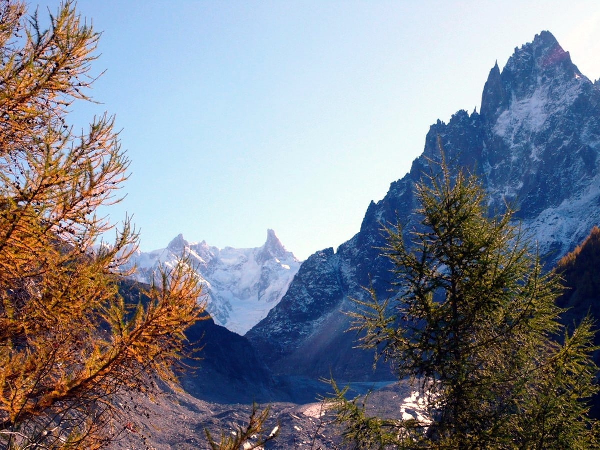
This narrow, winding path twists up through a lovely shady pine forest, with the noise of the river always on your right. After around half an hour, you’ll come to a right turn, again signed for “Sources d’Arveyron”. After a short time, you’ll emerge at the viewpoint itself – a huge prow of rock juts out over the gorge, giving a spectacular view down to the river far below, over the valley in one direction, and the granite spire of the Dru in the other. It’s fenced, but definitely a place to keep an eye on kids and dogs.
Retrace your steps briefly to leave the viewpoint, and after a few hundred metres, you’ll see the sign you already passed – this time follow it to Le Chapeau. You’ll pass a climbing crag that rises on the right-hand side of the path.
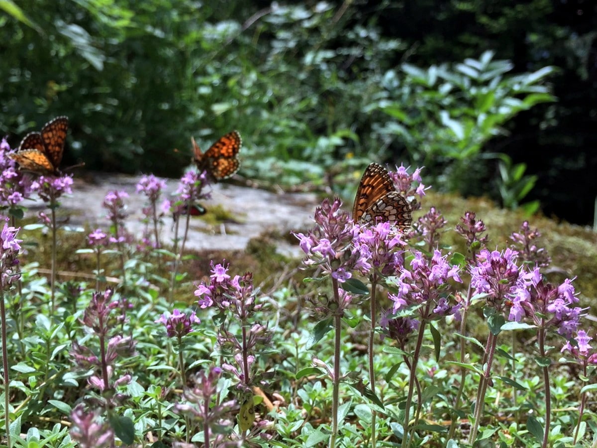
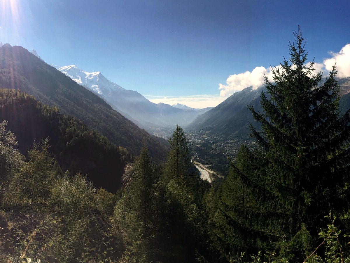
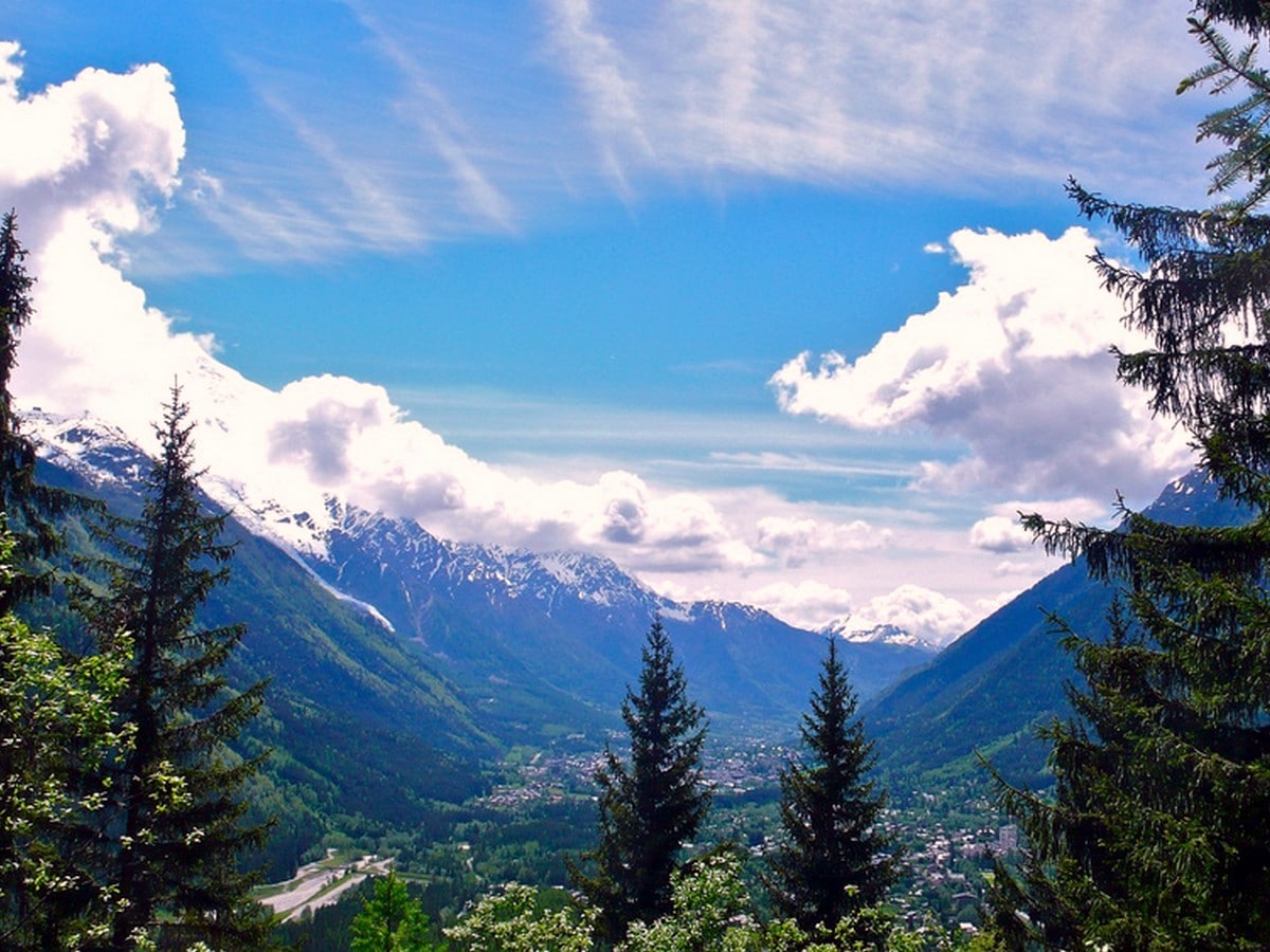
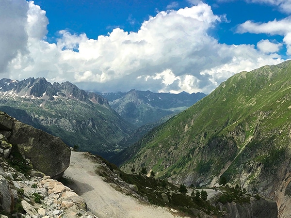
The path turns twice more to the right, both are clearly signed to Le Chapeau, before beginning to climb up and start to open, giving views back down the valley towards Chamonix. From here, it gets more open and beautiful, winding around widely spaced larches and alpine roses that frame the Aiguilles du Chamonix and Mont Blanc exquisitely. You’ll sometimes see Chamois around here, and the path has lovely little bridges over the stream that flows around it.
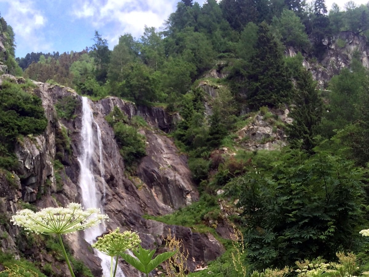
Up to the left you’ll see a big waterfall – look out for the refuge overlooking it, just right of the top. The refuge, La Buvette du Chapeau, is a nice stop for a drink, but the path to the viewpoint bears right (clearly signed).
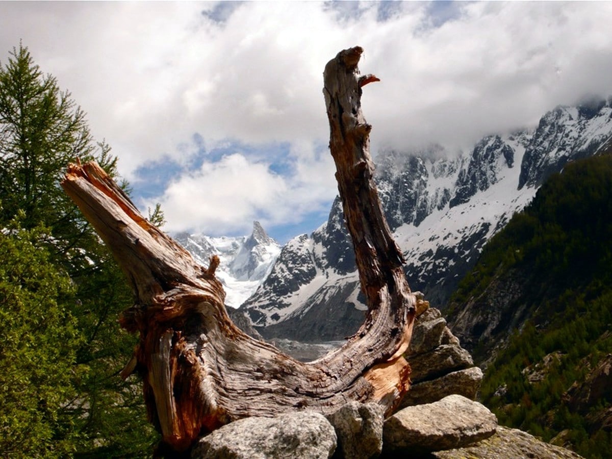
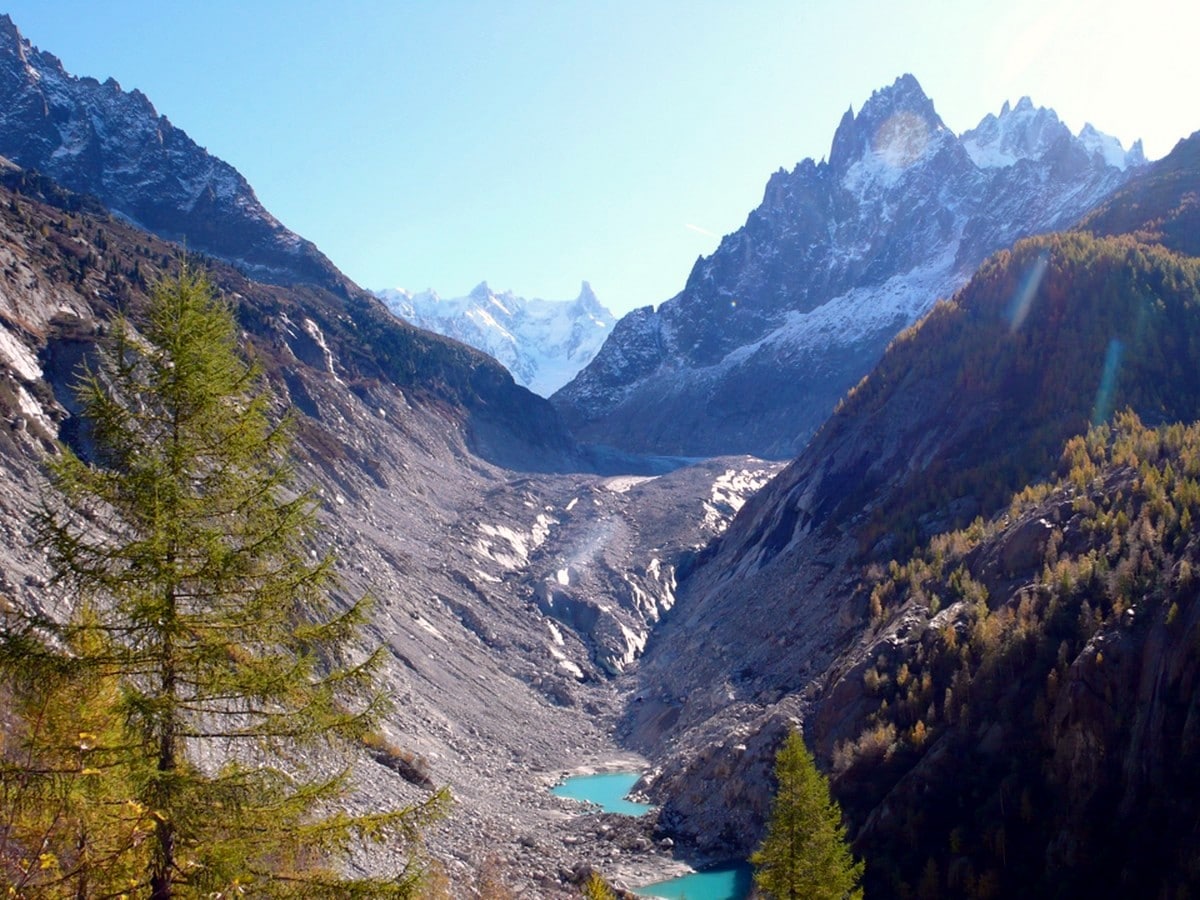
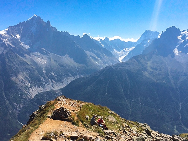
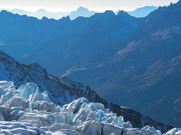
The trail ends here in a fenced area that gives you a wonderful panorama over the Mer de Glace with the blue-green glacial lakes forming at its snout. You can see the twin points of the Dent du Geant and the Grands Jorasses and the spiky ridges of the Aiguilles de Chamonix – it’s the most amazing viewpoint.
Turn and descend the same way – follow signs to Chamonix and Les Praz and they will take you a more direct route back, rather than via the Source de l’Arveyon.
Insider Hints
The hike to La Chapeau can be made much easier. Simply drive to Le Lavancher and park near the Chalets de Phillippe. From there it is a clearly signed 45 minute walk with much less ascent.
There are no lifts to get to Le Chapeau or Source de l’Arveyon, so this is an ideal hike for low season. It is very beautiful in Autumn and spring, and even possible with light snow in the early winter only.
Seek out the tranquil old-fashioned gem La Prairie in Les Bois for a cool drink to wind down after the walk (10 minutes from lift) or get the bus back into town and stop at the MBC for a microbrewed beer and nachos.

Similar hikes to the Le Chapeau via the Sources de L’Arveyron hike
Pointe de Vue
Pointe de Vue Hike is an easy Chamonix hike. You trek through the high alpine flowers to an astonishing viewpoint…
Lac Cornu
The Lac Cornu Hike takes you away from Chamonix valley’s villages and lift systems for a higher, wilder, and quieter…
Albert Premiere
The Albert Premiere hike has steep slopes, a dramatic winding path, and a high alpine ambience which all add up…
Dolores S. 4 years ago
We had a peaceful walk through the larch forest! We saw plenty of unnamed waterfalls!
Vincent V. 5 years ago
Great payoff for moderate effort. There are lots of scenery to discover.
Kenneth D. 5 years ago
It was like a dream unfurled. Majestic views!
Karina M. 5 years ago
It was an incredibly sunny day when I visited it, yet the air still gave me chills.
Glorious Gloria 5 years ago
Le Chapeau was a beautiful moderate hike. Done it with my partner. Had an amazing time.
HappyTina 5 years ago
This was a great and rewarding hike that both my husband and I really enjoyed. We have great photos from here.
Ramesh Patel 5 years ago
Awesome views...Good place for both hiking and taking things slowly.
Abraham W. 5 years ago
A great hike with beautiful views of forests, valleys, and waterfalls. Overall easy hike, with a few elevations. There's also a refuge serving food and drinks at the top.
Lorde P. 5 years ago
Lovely views of the valleys and waterfalls. Great food and drinks.
Aiza S. 5 years ago
Majestic views of the surroundings! A moderate hike that rewards your effort. I had an amazing time on this trail.