Lady MacDonald Tea House hike
View Photos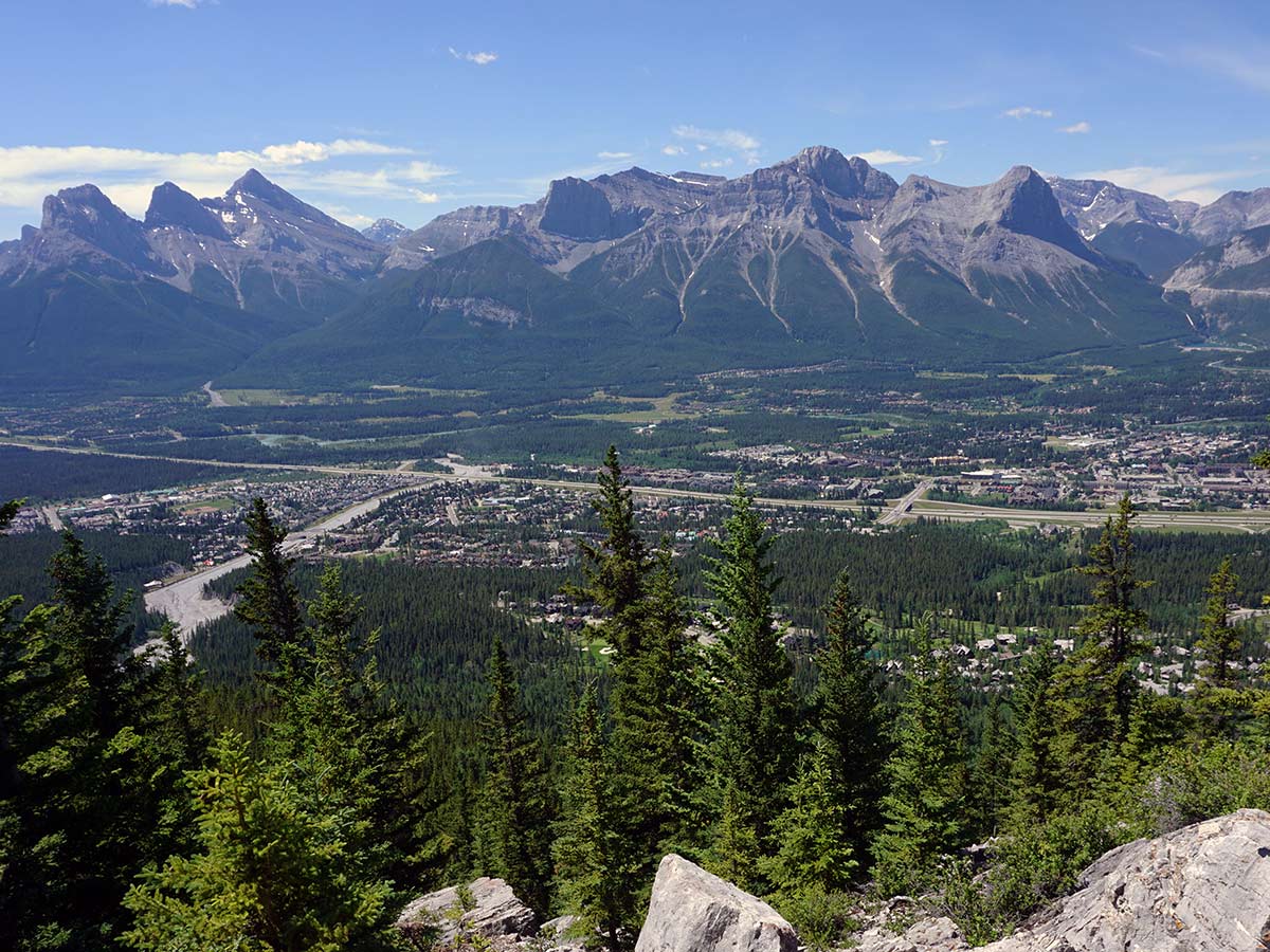
Lady MacDonald Tea House hike
Difficulty Rating:
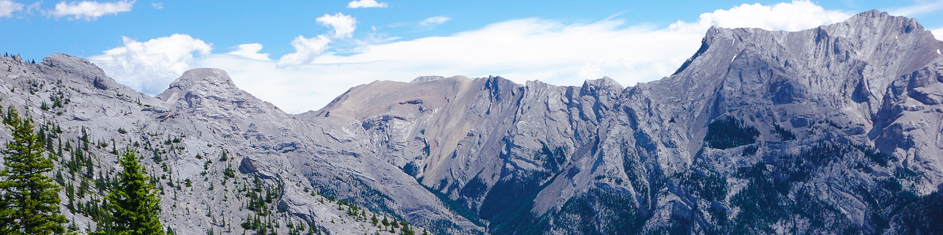
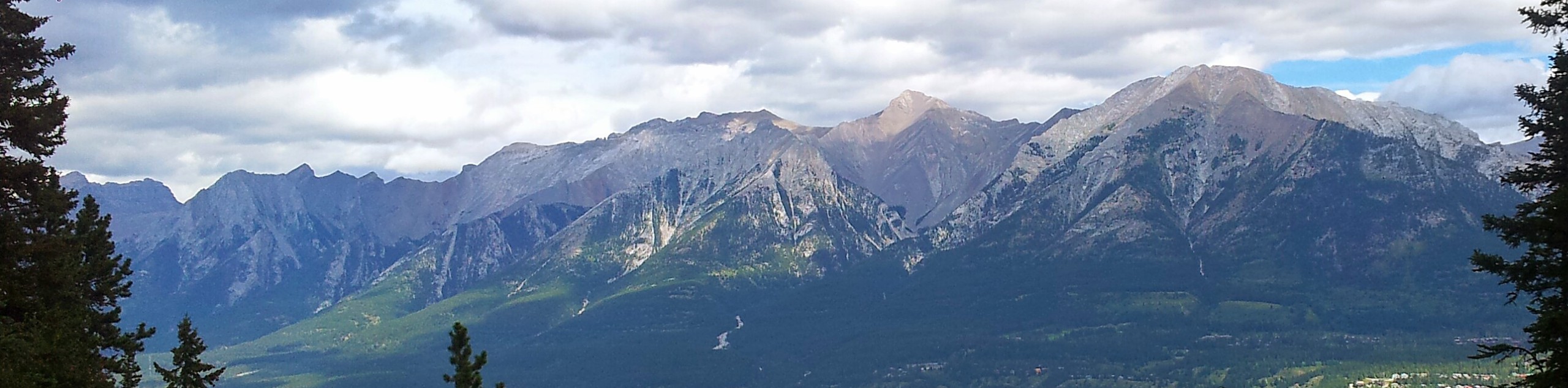
Hiking to the Lady MacDonald Tea House is a great hike in Canmore, but beware, you won’t get a Tea House, as it was never built. The Lady MacDonald Teahouse Trail gives great views of Canmore and has wonderful views almost the entire way.
IMPORTANT: This trail is currently closed due to blasting works in Cougar Creek. The route is expected to re-open by the end of 2022.
Getting there
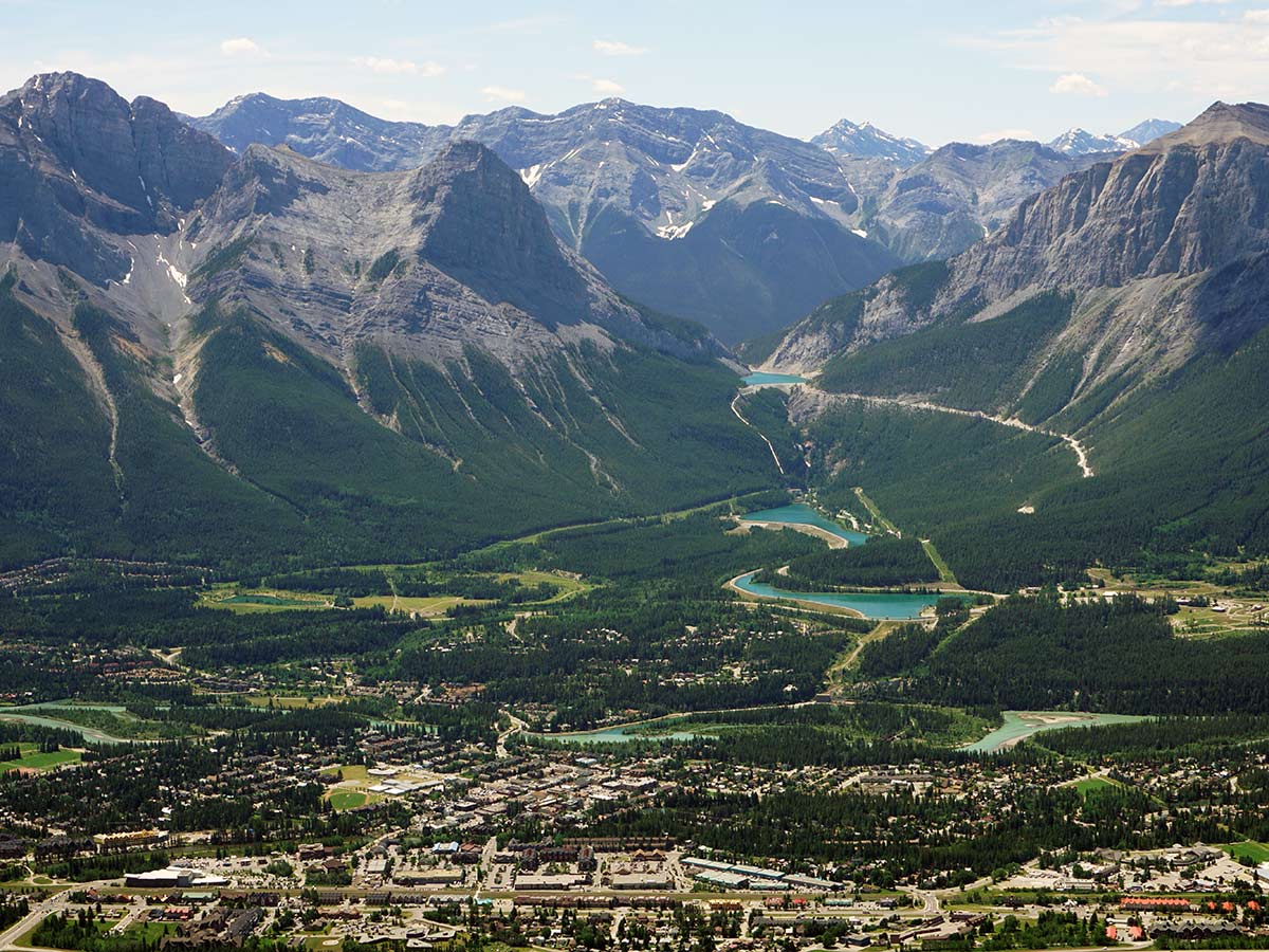
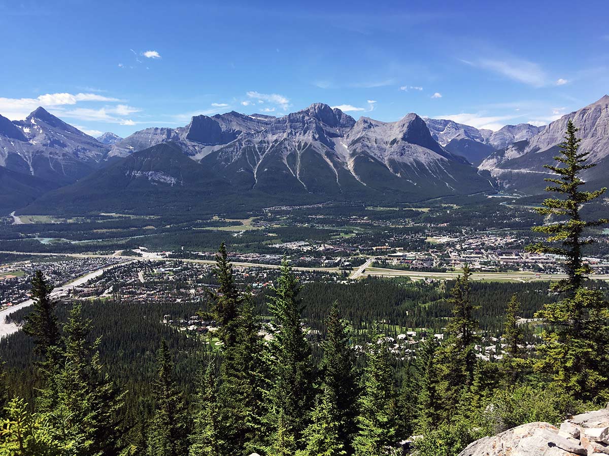
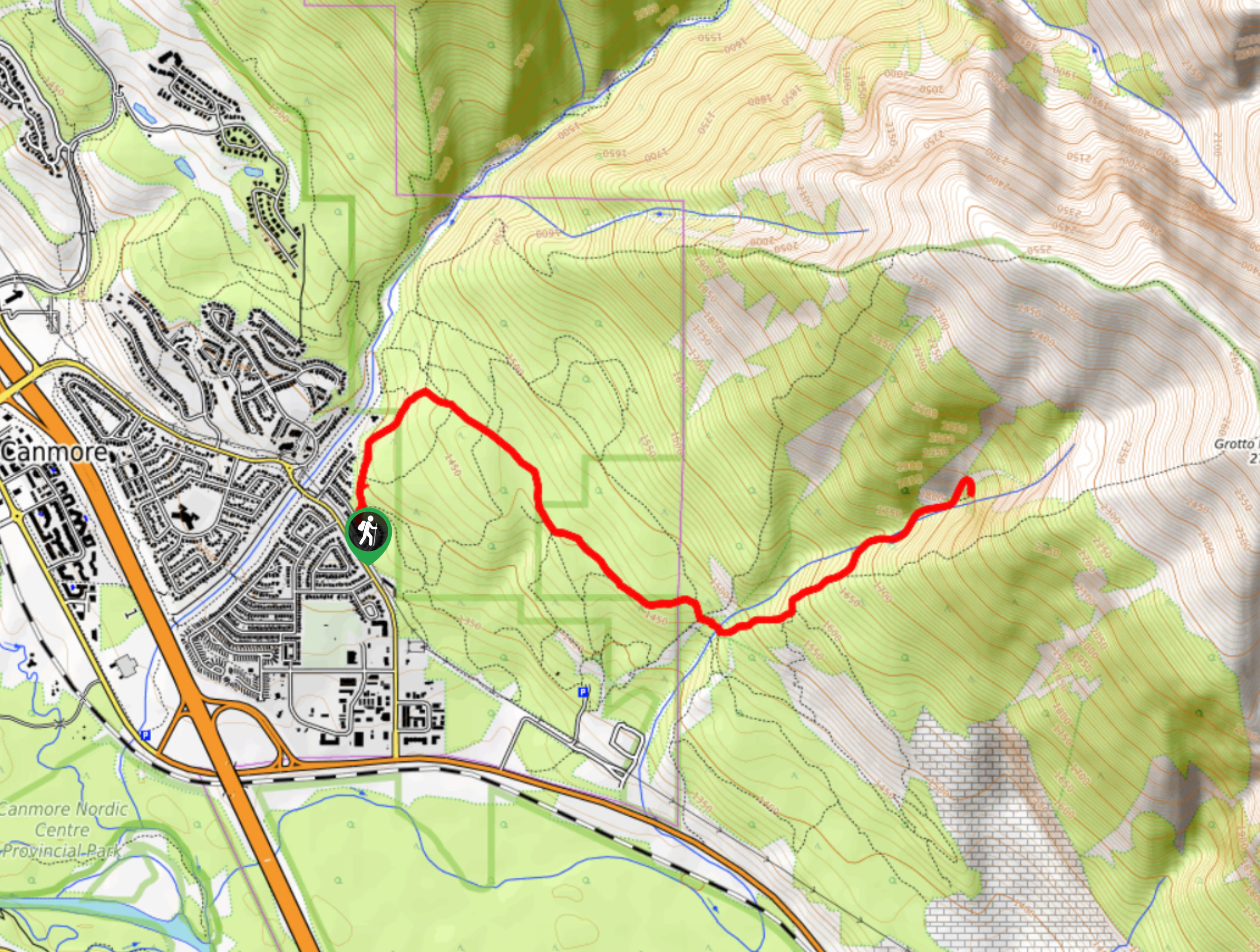
From Main Street in Canmore, cross the Trans-Canada Hwy and follow Benchlands Trail as it snakes uphill. Just before the Iron Goat Pub, take the left onto Elk Run Blvd and park in the Cougar Creek / Mount Lady MacDonald parking lot just before Cougar Creek.

About
| When to do | When dry |
| Backcountry Campsites | No |
| Toilets | At trailhead |
| Family friendly | No |
| Route Signage | Poor |
| Crowd Levels | Moderate |
| Route Type | Out and back |
Lady MacDonald Tea House
Elevation Graph
Weather
Route Description for Lady MacDonald Tea House
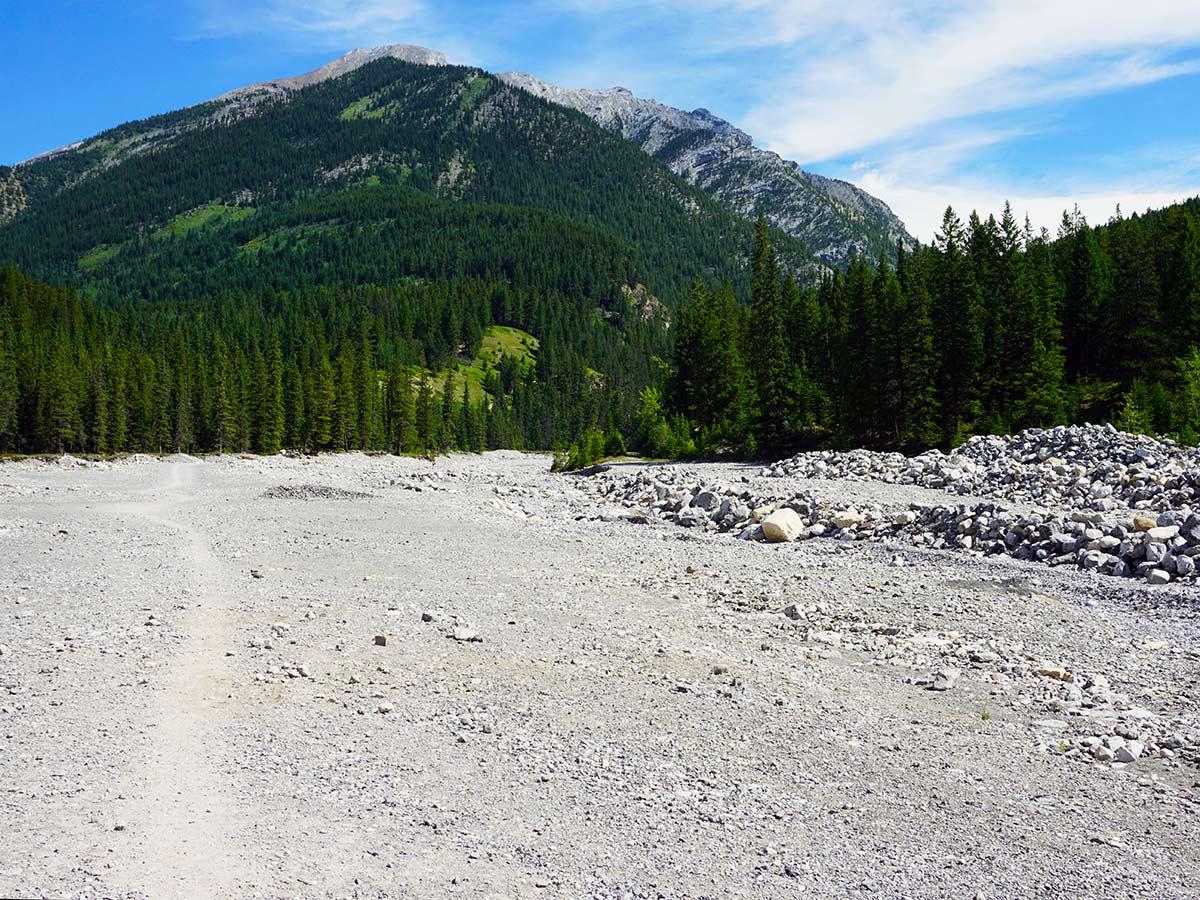
This parking lot can get pretty busy, so try and start this hike early.
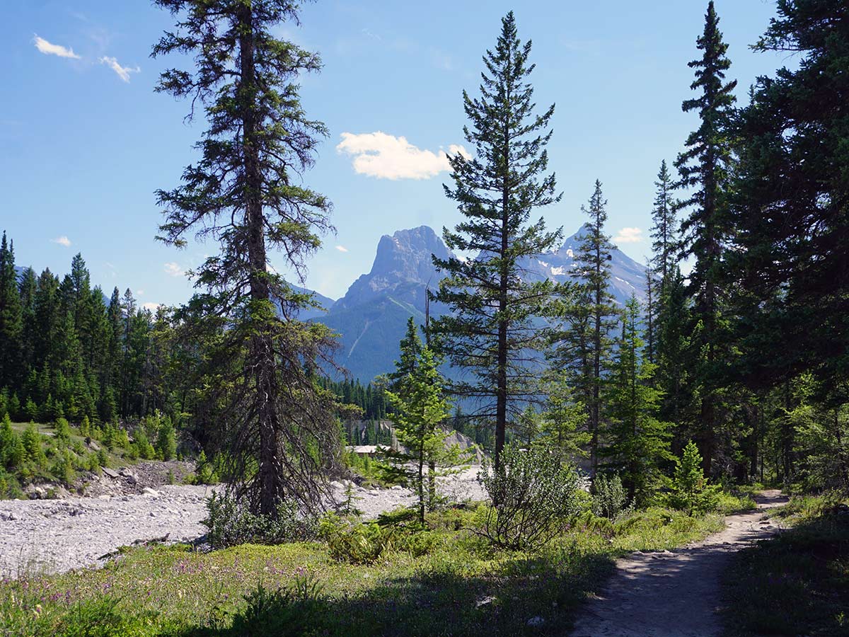
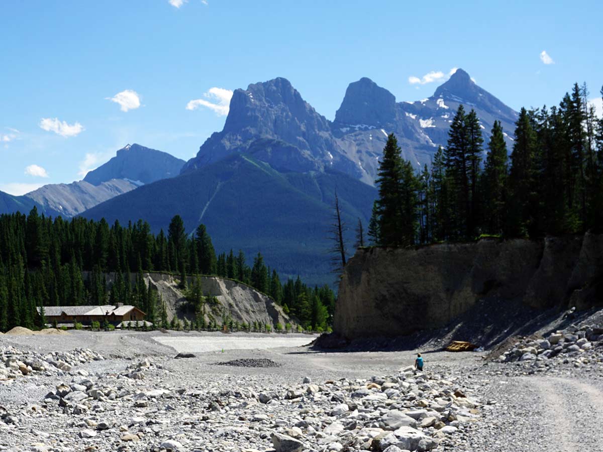
From the parking lot, head up, walking with Cougar Creek on your right. This area was devastated by the 2013 Alberta Floods, and you’ll notice a lot of work has been done trying to ensure future floods won’t cause the same level of destruction.
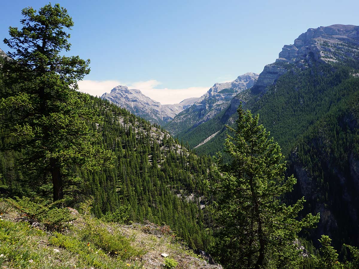
After ten minutes or so of walking along Cougar Creek (and just as the creek trends right), take a path off to the left. You’ll be hiking on a dirt trail that starts to rise.
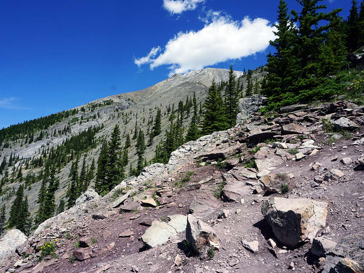
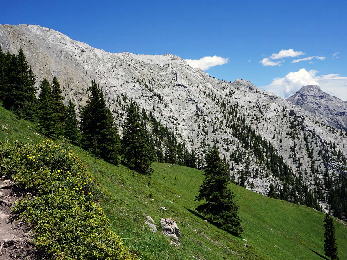
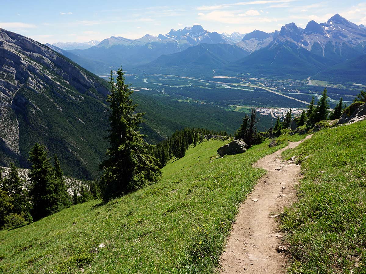
The hike up Mount Lady MacDonald is short and steep, so you will find yourself zig-zagging up the mountain. Great views will peek out regularly, so be prepared to stop and enjoy these wonderful views.
As you rise, you will notice smaller paths go off at times. We don’t follow these smaller paths, preferring to stay on main trail.
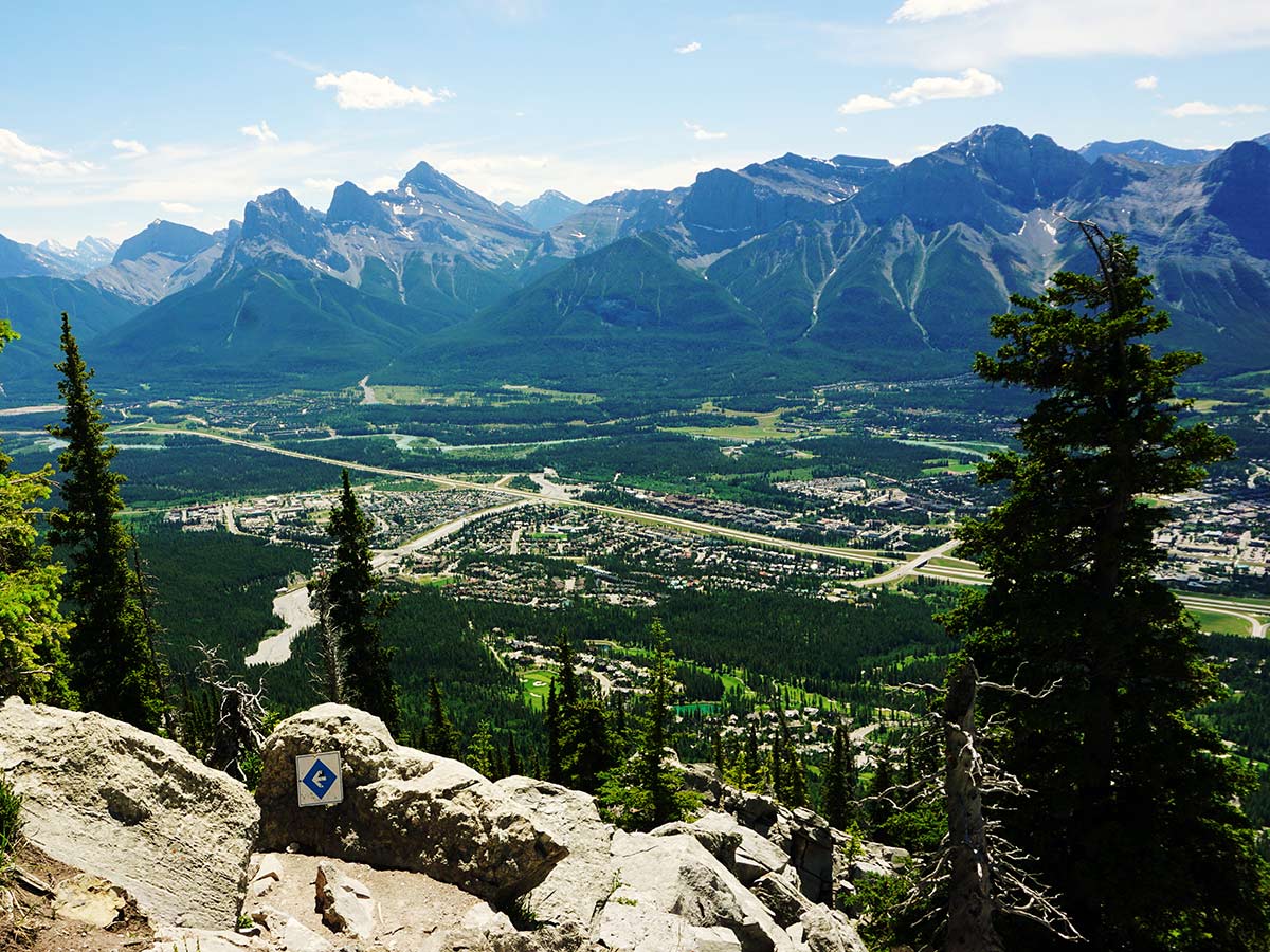
Eventually you enter a rocky area, where the trail gets much harder to follow. The best bet here is to keep on the look-out for orange tape put on tree branches and follow these.
Soon you will reach a split in the path. You can go either way here, but we usually go right on the way up and left on the way down. There is no real reason to do this, so the choice is yours!
After roughly 2.5h you’ll come to a weather station and a place where a concrete tea house once stood. The site was leased in 1986 for a helicopter-supported teahouse, however by 2002 the teahouse had been abandoned. Up until 2013 there was still an abandoned wooden helipad, incomplete wooden structure for the teahouse with a wooden platform and railings and a gazebo. All this was demolished for public safety
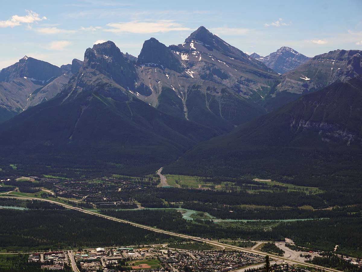
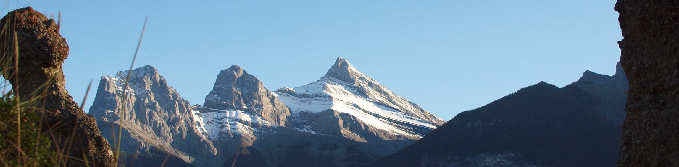
This is the perfect place for a break, with a large wooden platform to enjoy the stunning views. From here you can look west into Banff National Park, down towards Canmore and across the valley towards Rundle, Ha Ling and Grassi. The mountains are truly all around!
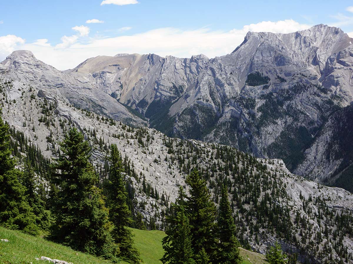
From this break point you can see a path going up higher. The route to the first bump is steep but doable, but right after that the route gets very steep. Our GPS doesn’t show the route past the tea-house.
From the break point, descend the way you came. After 15 minutes the path will split. You can take the path to the left (you came up on this one) or go right and continue along the ridge, which is much steeper. If you take the ridge, then make sure to follow the blue and white arrow pointing to the left back to the main trail.
Once back at your car, wander over the Iron Goat Pub & Grill for a pint and one of the best patio’s in Canmore!
Looking for more amazing hikes near Canmore? Check out the Grassi Lakes hike, Grotto Canyon hike or the Ha Ling Peak hike.
Insider Hints
The parking lot gets very busy on weekends and holidays, especially if it is nice out. Get there early to get a parking spot.
The Iron Goat Pub & Grill is a great pub and is home to one of our favourite views in Canmore. Consider a late-afternoon hike and finish with dinner and drinks at the Iron Goat.
This is a great shoulder-season hike, as the snow and ice melt very early. Consider trying this in Spring and Autumn, once the snow has melted.

Similar hikes to the Lady MacDonald Tea House hike
Echo Canyon Trail
The Echo Canyon trail in Canmore is accessible from the Cougar Creek area and is close to local amenities. It…
Canmore Hoodoos Trail
The Canmore Hoodoos Trail is a quick trip from downtown to explore the bench above the valley. It has outstanding…
Highline Trail
The Highline Trail is a multi-use trail in Canmore that travels westbound to Quarry Lake and the Powerline Trail before…
Allanhoward 4 years ago
We visited this few years ago, and It's just perfect during Autumn!
MartiniC 4 years ago
The views are incredible. So many great hikes here in Canmore.
Grant Ko. 4 years ago
Stunning views along the way. This is absolutely one of the best hike I've ever done!
kelsih_99 4 years ago
well there might not be a tea house, but we liked this one! harder than we thought it would be but nice views
LyleM 4 years ago
Trail is so dry and ready to be climbed! Amazing views.
SebClyde 4 years ago
Take your time, relax, drink some tea, and take pictures.
JMC 4 years ago
This trail is not recommended for beginners, if you decide to hike this trail bring lots of water and take rests along the way but the view at the top is definitely worth the 5 hr hike.
Jackson C. 4 years ago
After the hike we ordered foods from the nearby Pub and it was the best! My favorite was their Alberta beef burger!
Jacob AM 4 years ago
It was a relaxing hike. A great place to visit.
Jacob AM 4 years ago
The views were incredible but It took me some time to get a parking space even though I went early.