
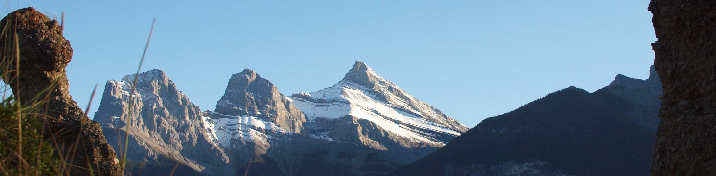
Ha Ling Peak Hike
View Photos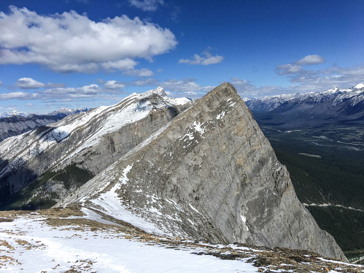
Ha Ling Peak Hike
Difficulty Rating:
The amazing Ha Ling Peak hike rewards you with some stunning views over the Canmore area. This particular Ha Ling Peak trail takes you past Miners Peak and the Three Humps, offering better views and extending the hike. This popular hike near Canmore is a great way to feel like a mountaineer only 20 minutes from the town.
Getting there
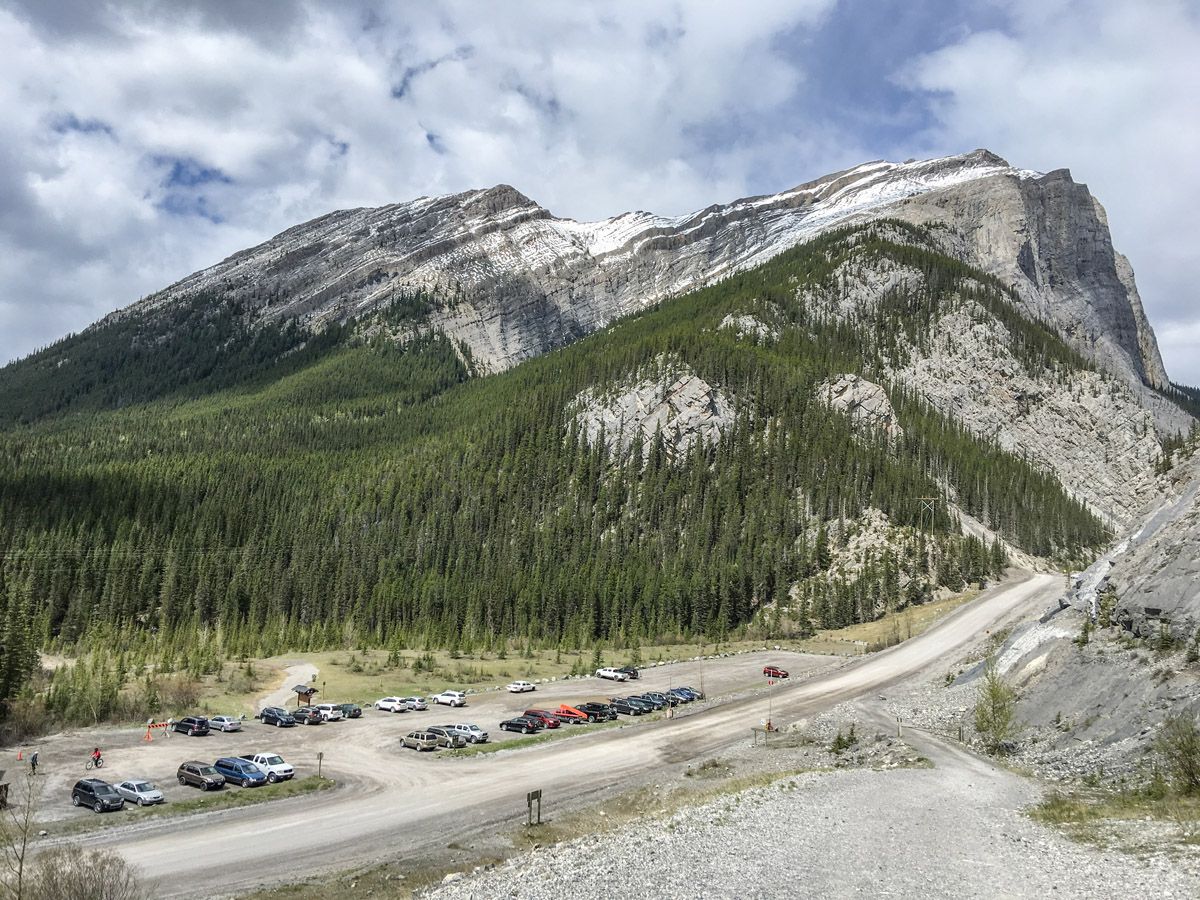
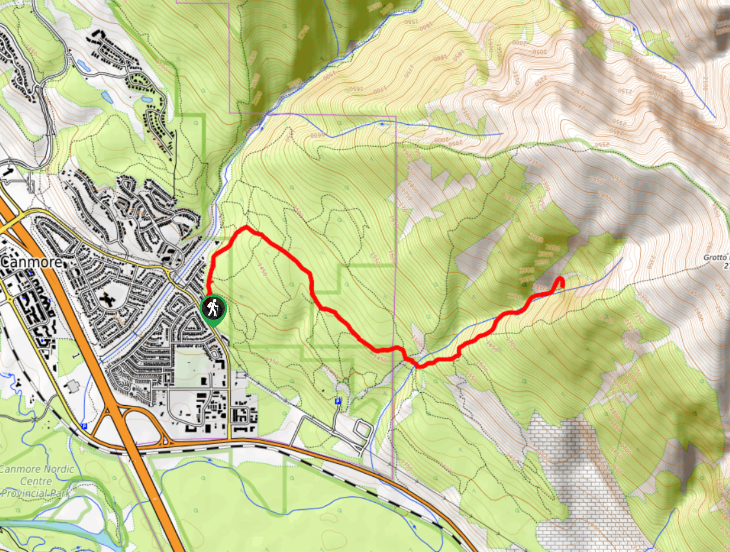
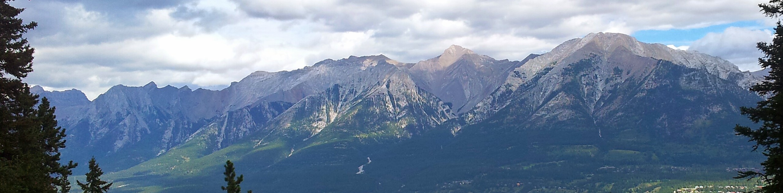
To get to the Ha Ling Peak trailhead from Canmore, head past the Nordic Centre and continue on Highway 742. This turns into a gravel road, known as the Smith-Dorrien Highway. Keep your eyes open for a parking lot on your right named “Goat Creek”.

About
| When to do | May through October |
| Backcountry Campsites | No |
| Toilets | Trailhead |
| Family friendly | No |
| Route Signage | Poor |
| Crowd Levels | High |
| Route Type | Out and back |
Ha Ling Peak Hike
Elevation Graph
Weather
Ha Ling Peak Route Description (via Miners Peak & The Three Humps)
The Ha Lang Hike has recently been improved, with a slightly new route and a series of stairs, that make the hike easier than before. But make no mistake, hiking up Ha Ling is not an easy hike.
Note that this route includes a trip after Ha Ling to Miner’s Peak and the Three Bumps. It is strongly recommended you make the short hike to these two viewpoints, as they are not busy and have great views.
To get to the Ha Ling Peak trailhead, take the Smith Dorrien highway from the Canmore Nordic Centre to the Goat Creek parking lot. From here, cross the road and climb up the embankment to the canal. Take the bridge across the canal, pass a stone marker and enter the forest.
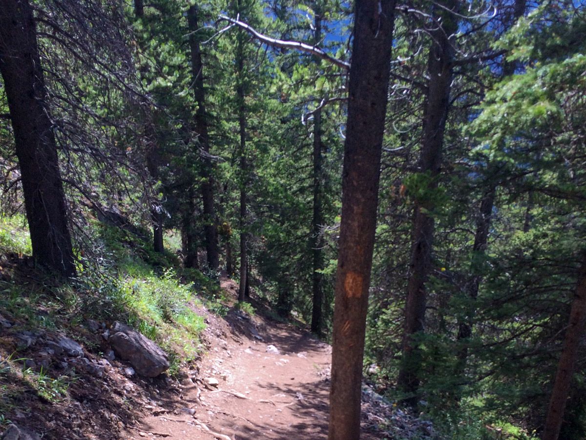
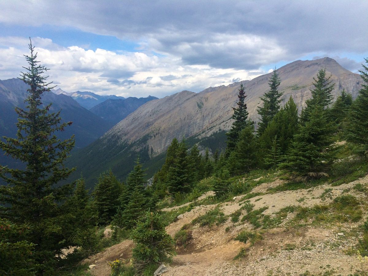
The path through the forest is changed, having been widened and taking a better route at times. You also get occasional views out from the forest as you hike up. Ha Ling is a popular hike, traveled virtually every month of the year. Follow the path up the slope, making sure to stay on the path. Thankfully the new trail up Ha Ling no longer has the large slippery tree-root systems to navigate and/or slippery rocks.
Most of the early part of this trail does not offer many views and at times the trail is very steep, gaining 1148ft quite quickly. Thankfully, after about 1.2mi, you will start to get glimpses of the surrounding peaks through the trees. There is a nice viewpoint to the side of the trail at approximately 1.3mi, at this point, you will have climbed over 1640ft.
From the viewpoint you will head roughly east with one little switchback, soon coming to some innovative stairs. Unlike most stairs, these stairs aren’t individually fixed to the ground, and move a bit as you go up. Obviously, stick to the right side of the stairs, the left-hand side is for descending.
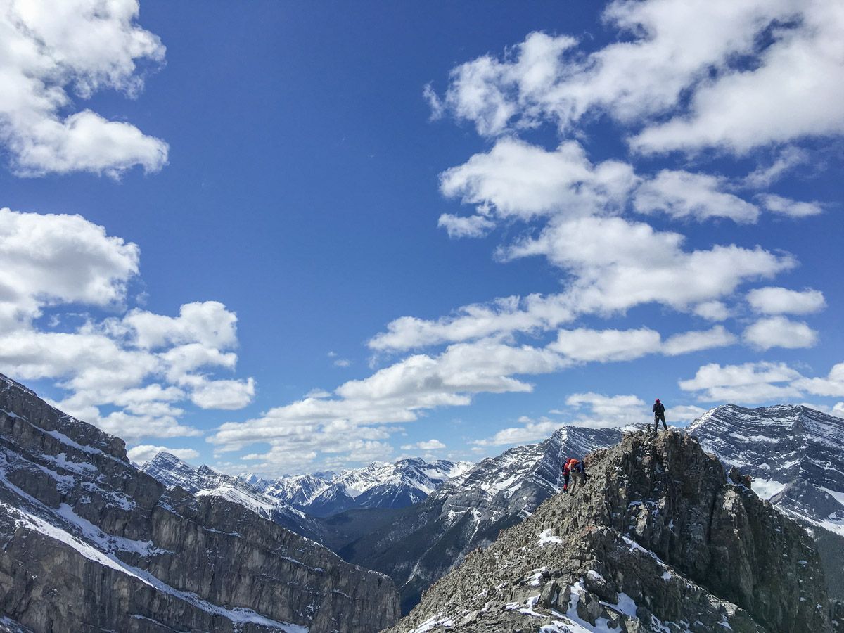
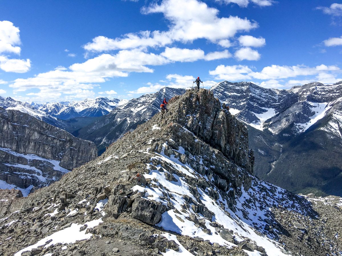
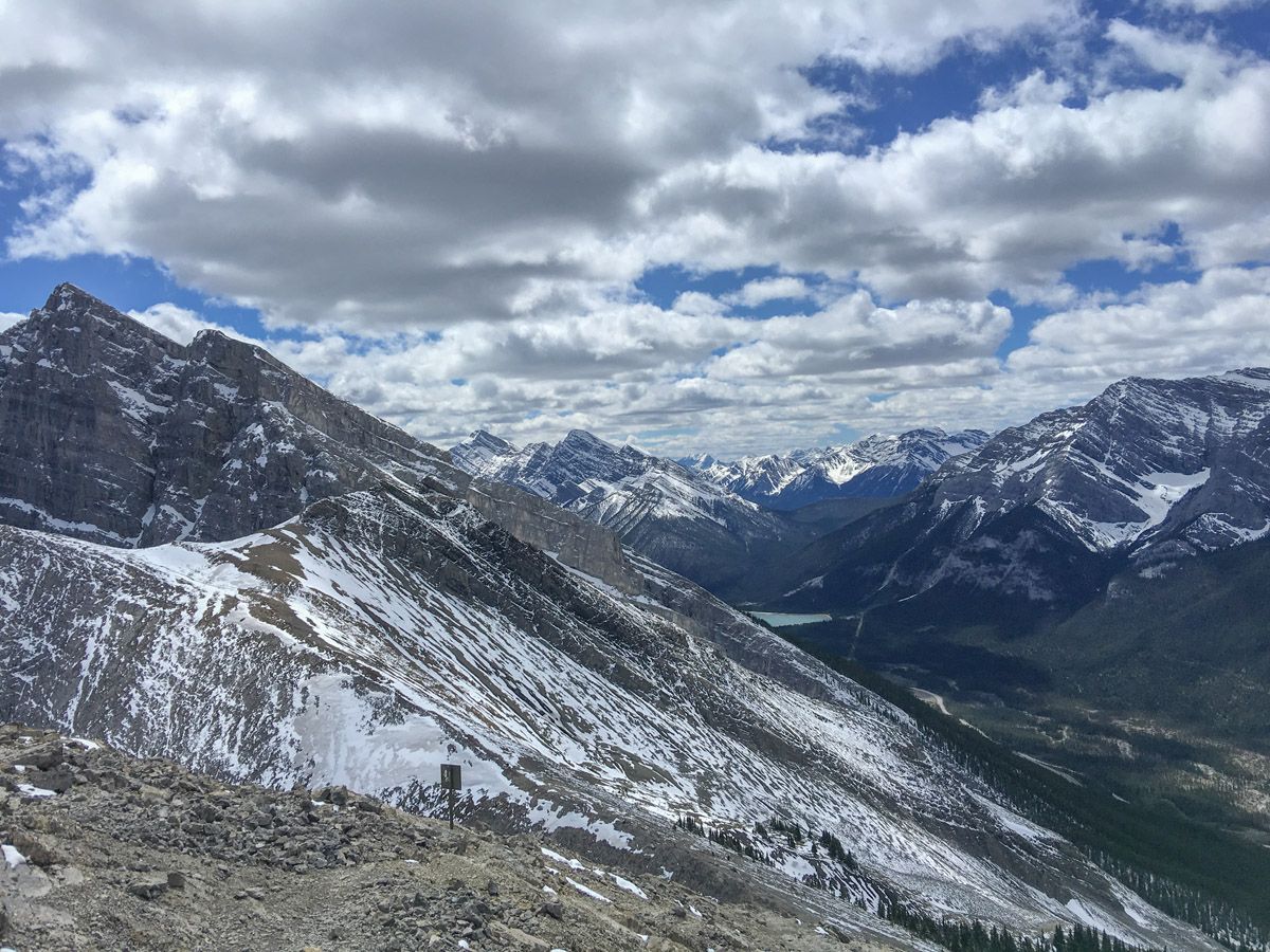
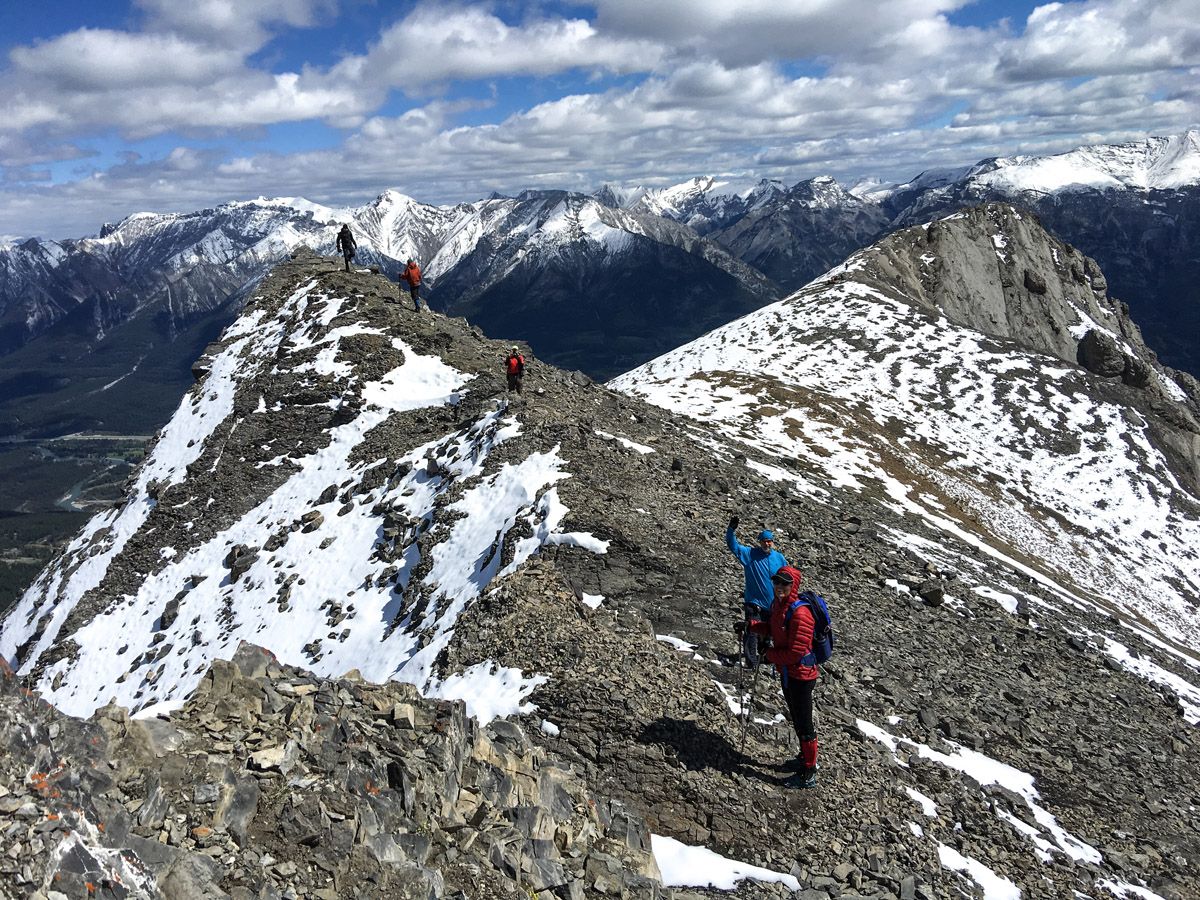
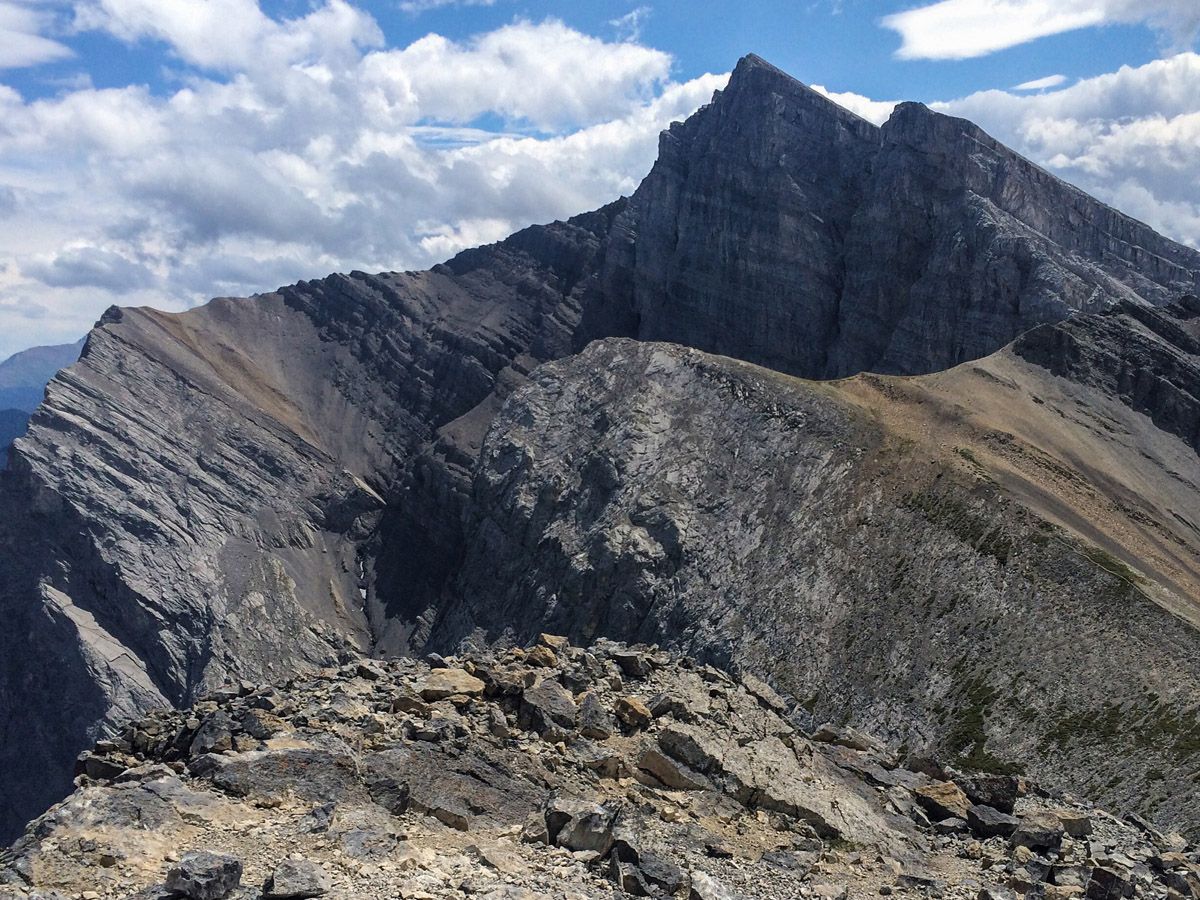
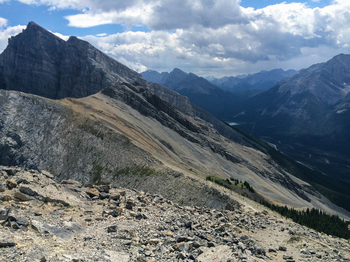
Soon the trees start to thin and you can see the saddle. You have a long set of stairs to climb and then before you know it you’re on the saddle. To your left is Ha Ling, and there should be a steady stream of hikers getting to the top of Ha Ling. To your right is Miner’s Peak and the Three Humps. The views from these two viewpoints are great, and while there are often hundreds of hikers heading up Ha Ling, you can often have Miner’s Peak and the Three Humps to yourself.
We like to start early and get up and down Ha Ling before the crowds are too heavy. Note that the trail up Ha Ling is not maintained, and the route is much trickier than the rest of the hike. Poles really help with balance.
To get to Ha Ling Peak, from the saddle go left and head up towards the daunting Ha Ling Peak. Follow the most well-defined trail, making sure to not get too close to the edge. The wind is typically much stronger here than it is in the trees. Trekking poles are handy to help with the scree and rocks. Finally, at the top, there are some rock windbreaks to the far left. Take care on the edge, as it is a long fall down the other side. You may see a few climbers pop their heads over, as this is a popular climbing spot. Please don’t throw anything over the side.
After enjoying the view, head back down towards the saddle. We strongly recommend then continuing up the other side to ascend Miners Peak and the Three Humps. On windy days you can usually find a good lunch spot out of the wind over here. We particularly like this route, as the views are so unique. Also, from the vantage point of Miners Peak, Ha Ling appears formidable, though Ha Ling Peak at 7897ft is only 79ft higher than Miner’s Peak.
The way back down can be done by retracing your steps, taking care while descending the stairs as they can move and shift as you descend. The remainder of the way downhill is a steep, toe-jamming affair. A few people will likely ask you on the ascent “how much farther?”
Hiking Trail Highlights
Ha Ling Peak
Ha Ling Peak is a 7897ft peak near Canmore. Ha Ling is roughly 3ft above the town of Canmore, in the heart of the Canadian Rockies. It occupies the northwestern edge of Mount Lawrence Grassi, a striking, craggy peak with a characteristic gray ridge. Ha Ling Peak has been the subject of controversy over the years, undergoing a number of name changes.
Originally known as the Beehive, the mountain was renamed locally following the ascent of Ha Ling, a Chinese cook for the Canadian Pacific Railway in 1896. Ha Ling responded to a wager that said that he could not ascend the peak in less than 10 hours. He successfully summited the mountain, but when local residents refused to believe him, he returned to the peak with a party of onlookers and planted an enormous flag at the top, which could be seen from the town. The mountain was later officially named Chinaman’s Peak in his honor, but was renamed as Ha Ling Peak in 1987 as this name was considered to be somewhat offensive.
Ha Ling Peak has recently reopened after a year-long closure in which the paths were fully renovated, with the addition of railings, staircases and rock steps to prevent erosion and make the trial safer. It’s now easier than ever before to enjoy this iconic Canmore hike.
Want to find more great hikes in Canmore? Check out the Grassi Lakes Hike, Mt Yamnuska Hike and the Grotto Canyon hike.
Planning a Trip to Canmore?
Insider Hints
BRING TREKKING POLES. This is a popular, eroded hike that is also very steep, gaining almost 2625ft in 1.8mi. Poles will help with balance on the way up and take the strain off of your knees on the way down.
Pick-up some French pastries or a baguette at Le Fournil for your snack break. You will feel like you are in the Alps as you savor a delicious treat on the summit.
Prepare for a windy summit and bring a jacket. Even if the weather is great in Canmore, expect a gusty peak.
This trail is often snow free, so if others are snowbound, give this a go.

Similar hikes to the Ha Ling Peak Hike hike
Echo Canyon Trail
The Echo Canyon trail in Canmore is accessible from the Cougar Creek area and is close to local amenities. It…
Canmore Hoodoos Trail
The Canmore Hoodoos Trail is a quick trip from downtown to explore the bench above the valley. It has outstanding…
Highline Trail
The Highline Trail is a multi-use trail in Canmore that travels westbound to Quarry Lake and the Powerline Trail before…
zero2ultra 4 years ago
Great hike. The wind at the top can be pretty intense. Hiking at the end of August we could have used gloves and a toque at the top, even though lower down was t-shirt weather. Poles will definitely help you, especially at the top where there's a lot of scree. The only thing taking from this hike is the number of people. Even during the week, it was fairly packed. But when a hike this beautiful is this accessible, that will be the trade-off.
DesireeD. 4 years ago
It takes time before you get to see the incredible views, but worth it!
MartiniC 4 years ago
Fantastic hike! Great winds await at the summit even when the weather is good.
Greenlife 4 years ago
This beauty is incomparable! I'm never gonna exchange this experience for anything! going back again soon.
Atlanta R. 4 years ago
I really love the glimpses of the surrounding peaks through the trees. Don't forget your trekking poles. This is a strenuous and challenging hike.
Nigel F. 4 years ago
This hike rewards you with some stunning views over the Canmore area. The trail takes you past Miner's Peak and the Three Humps, offering better views and extending the hike. Hiking up Ha Ling is not an easy hike.
Ewen P. 4 years ago
This is a popular, eroded hike that is also very steep. The snacks at Le Fournil is delicious. Also, bring a jacket with you because the peak is kinda windy.
kelsih_99 4 years ago
wow it was windy!! much easier up the steep bits (which is like, the whole thing haha) with the stairs in there now
Zina SW. 4 years ago
It looks spectacular! sad it's not open all year-round! I understand that public safety is the top priority though!
oskareglq 4 years ago
It was moderately challenging due to the steep trail but it was an amazing hike