Stanley Park to River Park
View Photos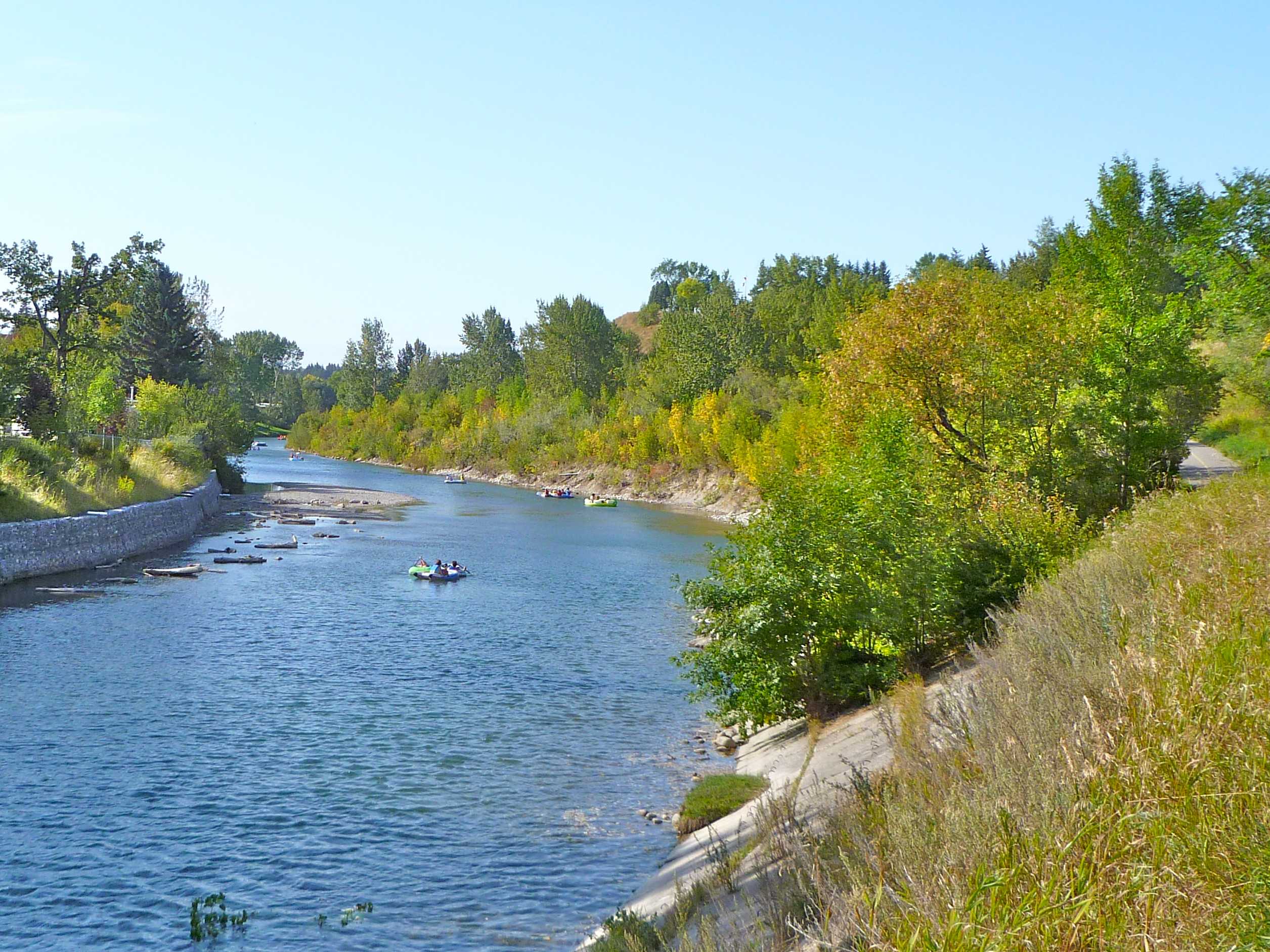
Stanley Park to River Park
Difficulty Rating:
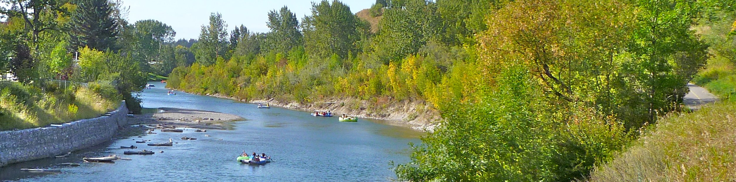
The trail from Stanley Park to River Park is a beautiful trail that follows the Elbow River. It is possible to hike or bike this trail, but we prefer to hike. Once you reach River Park, there are extensive trails that intertwine through the park if you would like to add some distance to your route by checking out more of what River Park has to offer. Enjoy both river views and beautiful houses along your way.
Getting there
To get to Stanley Park, travel southbound on Macleod Trail from the city centre and take the exit for 42 Ave SW. Turn right onto 42 Ave and follow this street past the roundabout before turning right onto 4a St SW, which turns into 4 St SW. This will lead you to the Stanley Park parking lot.

About
| When to do | Year-round |
| Backcountry Campsites | No |
| Pets allowed | Yes - On Leash |
| Family friendly | Yes |
| Route Signage | Average |
| Crowd Levels | Moderate |
| Route Type | Out and back |
Stanley Park to River Park
Elevation Graph
Weather
Stanley Park to River Park Trail Description
The Stanley Park to River Park Trail is a great out-and-back in the SW quadrant of the city. If you are looking for something new or planning to skip Glenmore Reservoir, this is a great place to go. The trails are open to bikes and dogs, so you can choose your own adventure, especially when you get to the intersecting trails at River Park.
Starting in the Stanley Park parking lot, find signs for the trail to River Park. You’ll want to pass by the outdoor pool and make your way north to the river. Turn left onto the path at the river and follow this to River Park. The 2.0mi distance to River Park is mostly on the edge of the river, which is nice on a hot day. Enjoy the cool breeze as you stroll alongside the water on your way to the next park.
Cross Elbow Drive by continuing straight on the Elbow River Pathway and continue onwards, walking westbound. You will be on a path parallel to Riverdale Ave for 984ft beyond the first bridge where you will turn right onto 8 Ave SW, then left onto Riverdale Ave again. There is a smaller bridge here that leads to an interpretive area about the floods of 2013. Cross the bridge to check it out if you are looking for a detour.
Continue on Riverdale Ave for 2297ft before reaching the River Park parking area. From here there are many intersecting trails that wind through the small park. There is plenty of signage in the parking area, and you will be able to choose a trail here to explore the park before heading back along the river to Stanley Park.
Our route stays to the right, hugging the river and making an out-and-back by the water. If you would like to stop for a picnic, feel free to cross the pedestrian bridge over the river to Sandy Beach Park, a popular spot with dog owners. There are plenty of picnic areas and places to play here.
Insider Hints
Cross the bridge at 8 Ave to check out the 2013 floods interpretive exhibit.
Head over to Sandy Beach Park from River Park. It is an easy stroll over a pedestrian bridge to a nice beach and picnic area.
Similar hikes to the Stanley Park to River Park hike
Nose Creek Park Loop
The short and easy Nose Creek Park Loop Trail is a good trail for families looking for fresh air. This…

Griffith Woods Perimeter Loop
Griffith Woods Park is located at the southwest edge of the city, making it feel like you have completely escaped.…
Eagle Lake Trail
The hike to Eagle Lake is a great flat and easy trail to a remote lake. Eagle Lake is just…
Comments