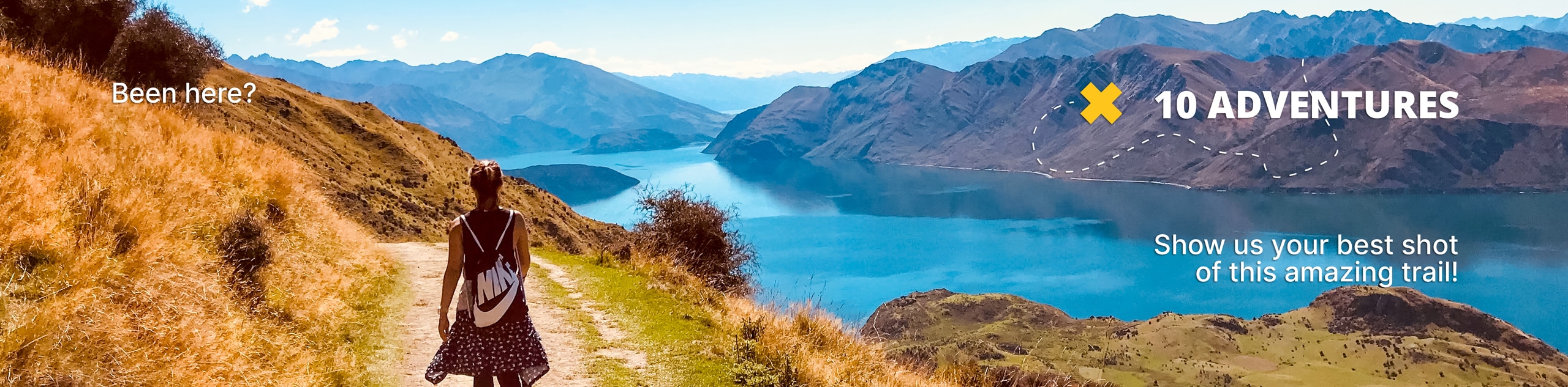
Pen Cerrig-Calch and Black Mountains Walk
View Photos
Pen Cerrig-Calch and Black Mountains Walk
Difficulty Rating:
The Pen Cerrig-Calch and Black Mountains Walk is a fantastic adventure in Brecon Beacons National Park that will allow you to explore the lesser-known Black Mountains in the eastern part of the park. While out walking the trail, you will climb uphill through the mountainous terrain for stunning views overlooking the Welsh landscape, before traversing the summit of Pen Allt-Mawr, Pen Cerrig-Calch, and Crug Hywel. This is a great mountain adventure if you are looking to get away from the crowds on the central beacons.
Getting there
The trailhead for the Pen Cerrig-Calch and Black Mountains Walk can be found 3.2mi NE of Crickhowell along Llanbedr Road.

About
| Backcountry Campground | No |
| When to do | April-September |
| Pets allowed | Yes - On Leash |
| Family friendly | Older Children only |
| Route Signage | Average |
| Crowd Levels | Moderate |
| Route Type | Circuit |
Pen Cerrig-Calch and Black Mountains Walk
Elevation Graph
Weather
Pen Cerrig-Calch and Black Mountains Walk Description
If you are looking to enjoy the natural beauty of South Wales and Brecon Beacons National Park without the crowds that can usually be found on more popular routes like Pen-y-Fan, then the Pen Cerrig-Calch and Balck Mountains Walk is the perfect route.
Setting out from the roadside layby, you will head to the northeast across the open farmlands for a short distance, before the trail bends to the northwest and begins to climb up the mountainside. Here, you will gradually gain elevation and experience some beautiful views overlooking the eastern portion of Brecon Beacons NP, before reaching the northernmost point of the route. Continue along the trail as it bends to the south and climbs further uphill to the summit of Pen Allt-Mawr for some more amazing views that extend to the west towards the Brecon Beacons.
After traversing the summit, continue on to the southeast for some panoramic views of the rugged landscape from Pen Cerrig-Calch, where you will also be able to spot Sugar Loaf Mountain to the southeast. Heading downhill along the trail, you will traverse the hill known as Crug Hywel, before turning to the northeast to traverse the slope on a route that will return you to the trailhead.
Insider Hints
If you're looking to explore the area a bit more, consider staying at the Cwmdu Campsite, which is situated in the scenic mountains near Crickhowell. Their local village Cwmdu has an excellent pub and cafe within walking distance and plenty of walks around for you to explore.
Similar hikes to the Pen Cerrig-Calch and Black Mountains Walk hike
Hay Bluff and Lord Hereford’s Knob Circular Walk
The Hay Bluff and Lord Hereford’s Knob Circular Walk is a great outdoor adventure in Brecon Beacons National Park that…
Carmarthen Fans Walk
The Carmarthen Fans Walk is a beautifully scenic, albeit long and difficult, walking route in Brecon Beacons National Park that…
Crickhowell Skyline Circular Walk
The Crickhowell Skyline Circular Walk is a lengthy adventure in Brecon Beacons National Park that will take you up into…
Comments