South Saint Vrain Figure 8 Loop
View Photos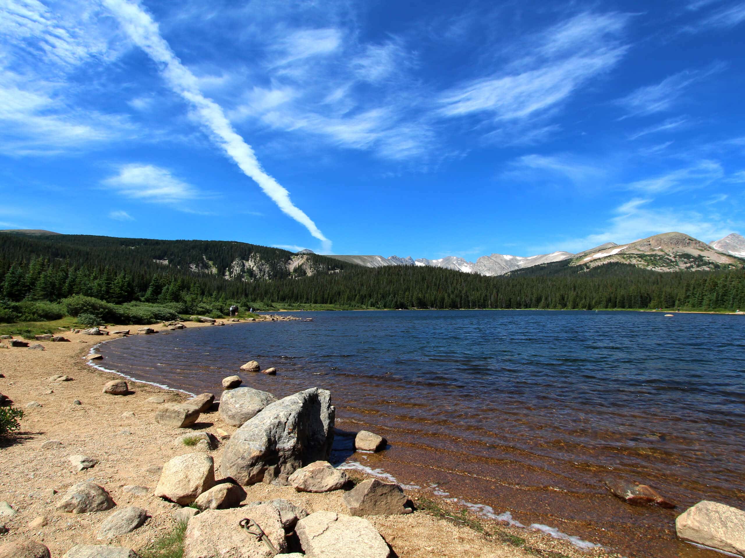
South Saint Vrain Figure 8 Loop
Difficulty Rating:
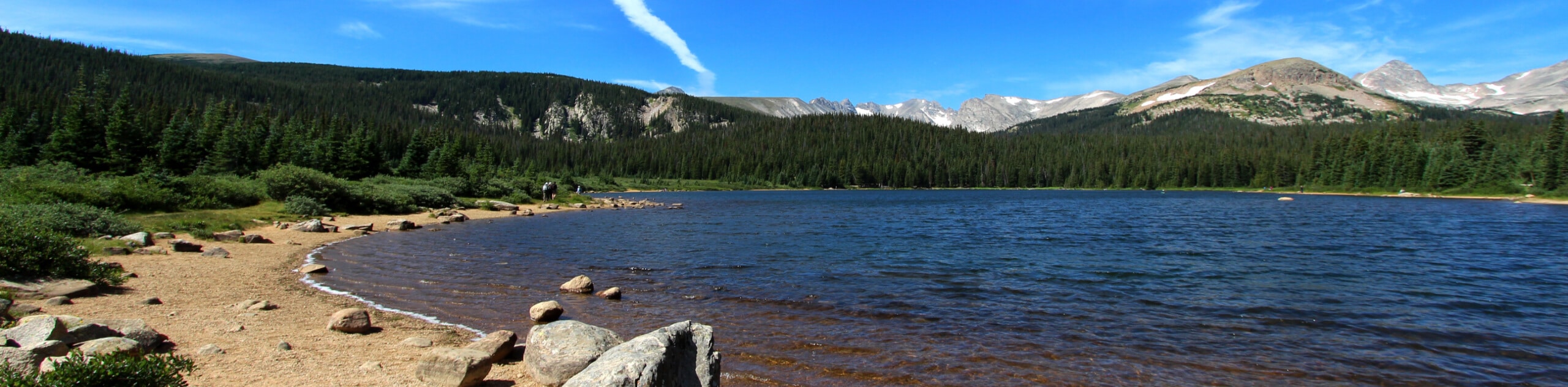
The South Saint Vrain Figure 8 Loop is an enchanting woodland adventure into the Indian Peaks Wilderness. Walk alongside the gurgling waters of the Saint Vrain Creek and enjoy the sights and smells of the towering aspens and ponderosa pine trees. Though lengthy, this is a wonderful day hike near Boulder.
Getting there
The South Saint Vrain Figure 8 Loop is accessed via the trailhead off County Road 96 near Tumblesom Lake.

About
| Backcountry Campground | |
| When to do | Year-round |
| Pets allowed | Yes - On Leash |
| Family friendly | Older Children only |
| Route Signage | Average |
| Crowd Levels | Low |
| Route Type | Circuit |
South Saint Vrain Figure 8 Loop
Elevation Graph
Weather
South Saint Vrain Figure 8 Loop Description
The South Saint Vrain Figure 8 Loop is a magical forestland hike near the Indian Peaks Wilderness. Though this path is accessible year-round, we love venturing the South Saint Vrain Figure 8 Loop in the autumn, when the aspens are at their peak vibrance. Traveling deep into the wilderness, be mindful of wildlife and consider wearing a bear bell to deter any unwelcome encounters. When the snow starts to fall, trade your hiking boots for snowshoes or microspikes.
Embark on your adventure along the South Saint Vrain Figure 8 Loop from the trailhead off County Road 96. From here, track southwest along the South Saint Vrain Trail along the waters of the babbling creek. Passing several routes and intersecting paths, follow along the South Saint Vrain Creek through vibrant aspens to a junction with the Waldrop Trail. Follow this path briefly before merging onto the Brainard Lake Cutoff Trail. Hike around the eastern shore of Brainard Lake before hooking onto the Little Raven Trail.
The Little Raven Trail will guide hikers east past Lefthand Reservoir, merging onto the Lefthand Reservoir Road soon after. Hike along this road to its end at the Brainard Lake gateway. At this point, track north along the Sourdough Trail. This path will guide hikers over the South Saint Vrain Creek and up to Beaver Reservoir. Here, track southeast along County Road 96 back to the trailhead, marking the end of your South Saint Vrain Figure 8 Loop adventure.
Similar hikes to the South Saint Vrain Figure 8 Loop hike

NCAR to Fern Canyon Hike
The NCAR to Fern Canyon Hike is an awesome but challenging adventure up to the summit of Nebel Horn. Put…
Bear and South Boulder Peaks Loop
Looking for a demanding but rewarding hike near Boulder? We’ve got you covered. The Bear and South Boulder Peaks Hike…

Rattlesnake Gulch Trail
The Rattlesnake Gulch Trail is an epic adventure through the Eldorado Canyon State Park. Ascend the steep cliffs of Eldorado…
Comments