Chautauqua and Bluebell Loop Trail
View Photos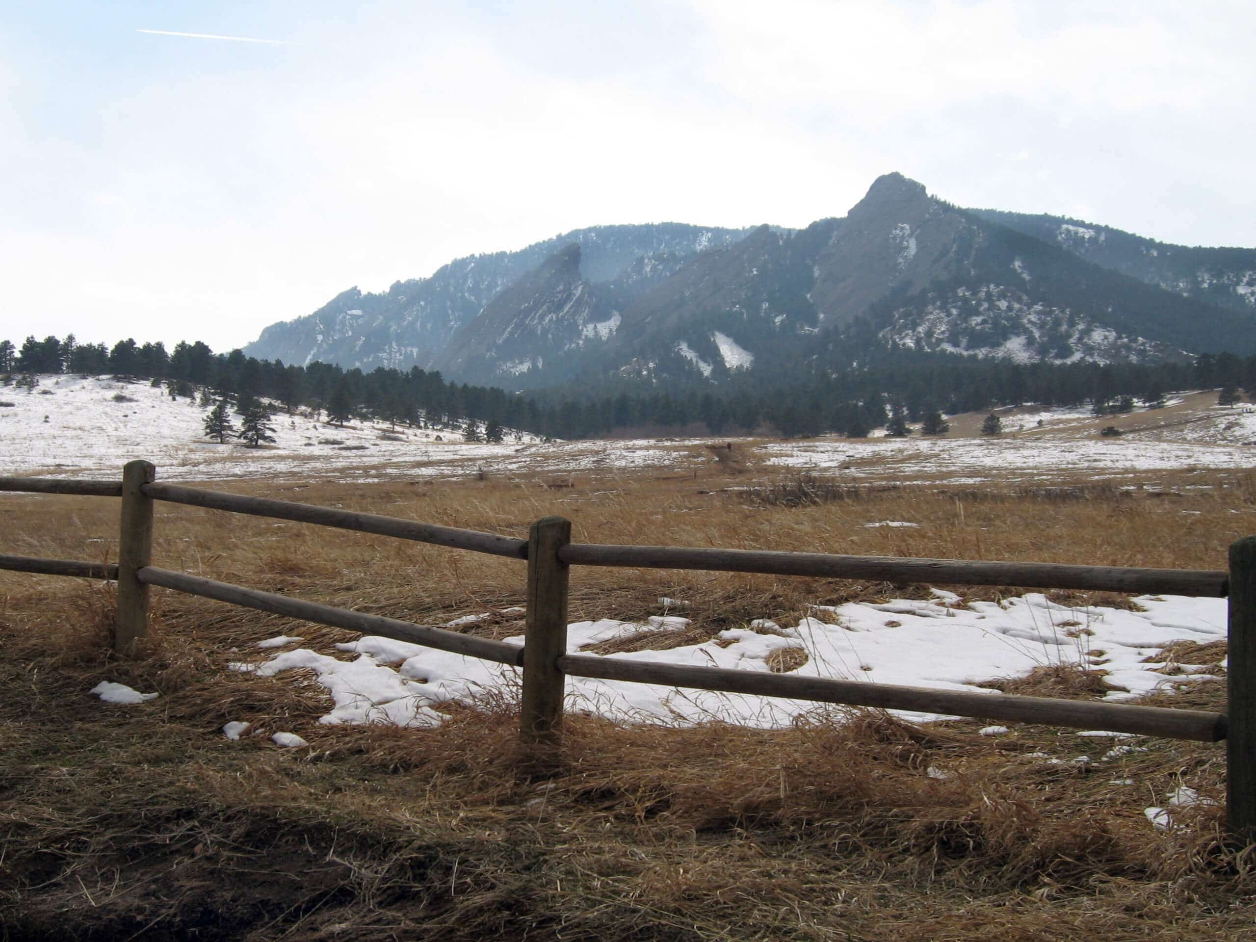
Chautauqua and Bluebell Loop Trail
Difficulty Rating:
The Chautauqua and Bluebell Loop Trail is a charming nature walk that exhibits the diversity of the Colorado wilderness. Track through enchanting grasslands, dense ponderosa pine forest, and along the base of the Front Range foothills. Perfect to escape the chaos of the real world, reconnect with nature along the Chautauqua and Bluebell Loop Trail.
Getting there
The Chautauqua and Bluebell Loop Trail is accessed via the Chautauqua Trailhead off Kinnikinnick Road.

About
| Backcountry Campground | No |
| When to do | Year-round |
| Pets allowed | Yes - On Leash |
| Family friendly | Yes |
| Route Signage | Average |
| Crowd Levels | Extreme |
| Route Type | Circuit |
Chautauqua and Bluebell Loop Trail
Elevation Graph
Weather
Chautauqua and Bluebell Loop Trail Description
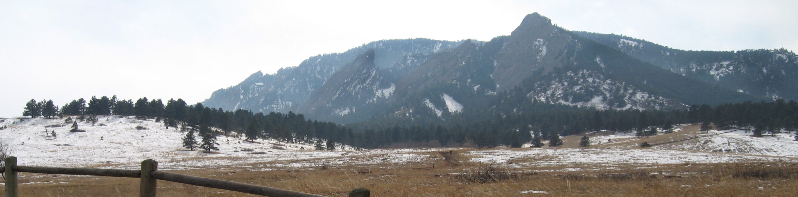
The Chautauqua and Bluebell Loop Trail is an epic family-friendly adventure through Chautauqua Park. Located at the foot of the quintessential Boulder landmarks, the Flatirons, the Chautauqua and Bluebell Loop Trail reveals epic sights of the sandstone slabs. Though the exposed grasslands expose amazing views of the Flatirons and surrounding mountains, it also warrants unbearably hot conditions in the summer months. If you venture this path on a summer afternoon, make sure to wear sunscreen and pack plenty of water to avoid overexposure. Additionally, there are rattlesnakes in the area, so keep an eye and ear out as you travel through the arid terrain. Note that parking in the Chautauqua Park is challenging as parking is extremely limited, so consider walking or biking from the city or utilize the free Park-to-Park bus shuttle in the summer months.
Chautauqua Park is an extremely popular tourist destination, notably in the summer months, so be prepared to share the trails with fellow outdoor enthusiasts. We think that the crowds are a great indicator of how awesome the trails within the park are. The Chautauqua and Bluebell Loop Trail may just be our favorite, but there are plenty of other hikes within the park’s network of trails to appease all sorts of adventurers. Perfect for families and those seeking a relaxing nature walk, the easy hike presents awe-inspiring views of the Flatirons looming above. With interpretive signs to line the path, wildlife, and amazing views, this stimulating trail is a must-add to your Boulder adventure list.
Embark on your adventure along the Chautauqua and Bluebell Loop Trail from the trailhead off Kinnikinnick Road. Adventurers can choose to complete the loop from either direction, but we prefer to track counterclockwise along this path to get the best vistas of the Flatirons. From the trailhead, take the Chautauqua Trail southwest. As you trek along the Chautauqua Trail, there will be plenty of merging and connecting paths, ignore these until you reach the intersection with the Bluebell Baird Trail. Hike along the Chautauqua Trail through the enchanted grasslands, which reveal dumbfounding vistas of the sandstone blades towering above. As you near the base of the Flatirons, the terrain will become increasingly forested.
Enjoy the shade of the ponderosa pines and make sure to take the time to read the interpretive signs which explain the area’s flora and fauna. Eventually, you will encounter the intersection with Bluebell Baird Trail. From here, turn left and trek along the Bluebell Baird Trail to the Bluebell Shelter, which is a great spot to take a break and rehydrate before commencing your final push back to the trailhead. At this point, take the Bluebell Road Trail northeast before merging onto the Bluebell Hiking Trail. This route will guide you back through the meadowland, revealing views of the Boulder skyline. Wander alongside a gurgling creek before the route diverts north back to the trailhead, marking the end of your adventure.
Frequently Asked Questions
How long is the Chautauqua and Bluebell Loop Trail?
The Chautauqua and Bluebell Loop Trail is a 1.6mi hike.
Are dogs permitted on the Chautauqua and Bluebell Loop Trail?
Yes, on-leash dogs are permitted on the Chautauqua and Bluebell Loop Trail.
Do you have to pay to park in Chautauqua Park?
In the summer months parking in the Chautauqua Park costs $2.50USD, but in the off-season parking is free.
Insider Hints
Keep an eye out for rattlesnakes along the Chautauqua and Bluebell Loop Trail
Consider an early morning adventure to avoid the afternoon crowds
Pack lunch and have a picnic on the Chautauqua Greens, overlooking the Flatirons
Take the free Park-to-Park bus to avoid the trouble of trying to find a parking spot
Similar hikes to the Chautauqua and Bluebell Loop Trail hike

NCAR to Fern Canyon Hike
The NCAR to Fern Canyon Hike is an awesome but challenging adventure up to the summit of Nebel Horn. Put…

Bear and South Boulder Peaks Loop
Looking for a demanding but rewarding hike near Boulder? We’ve got you covered. The Bear and South Boulder Peaks Hike…

Rattlesnake Gulch Trail
The Rattlesnake Gulch Trail is an epic adventure through the Eldorado Canyon State Park. Ascend the steep cliffs of Eldorado…
Comments