Adelmann Mine Hike
View Photos
Adelmann Mine Hike
Difficulty Rating:
The Adelmann Mine Hike is a great adventure that beckons the exploration of history buffs and outdoor enthusiasts alike. Located just a few miles outside Boise’s city center that attracts plenty of adventurers—just like you!
Getting there
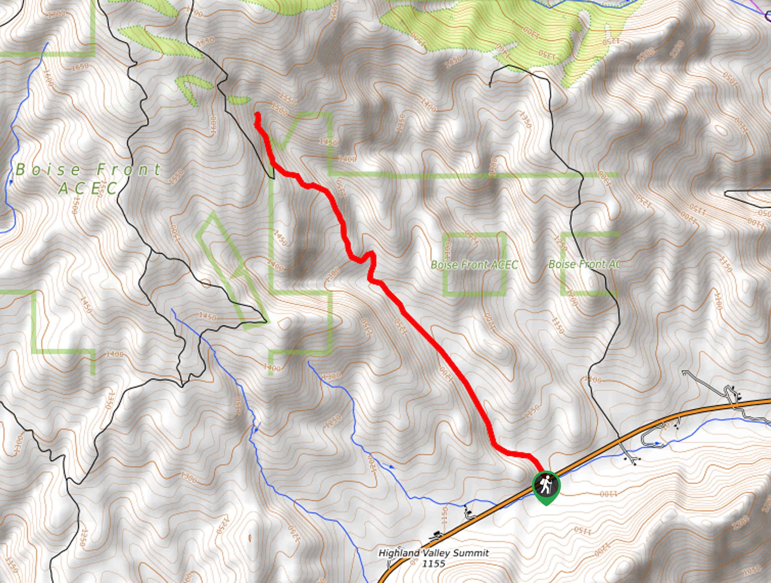
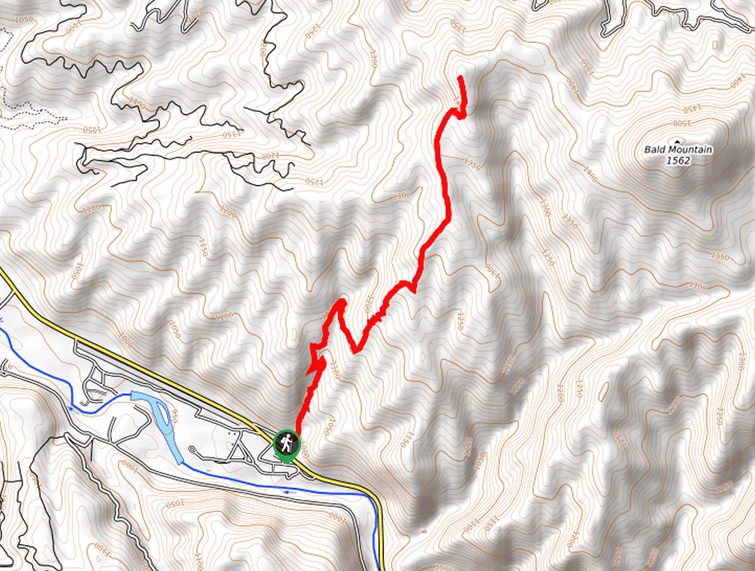
The Adelmann Mine Hike departs from the parking lot off East Highway 21.

About
| Backcountry Campground | No |
| When to do | May-October |
| Pets allowed | Yes - On Leash |
| Family friendly | Older Children only |
| Route Signage | Poor |
| Crowd Levels | Moderate |
| Route Type | Out and back |
Adelmann Mine Hike
Elevation Graph
Weather
Adelmann Mine Hike Description
Explore the scenic slopes of Lucky Peak along the Adelmann Mine Trail. This pleasant hike exhibits a diversity of flora and fauna, including elk, deer, blooming wildflowers, and sagebrush. While this unshaded route offers incredible views, it also warrants extreme conditions, so wear SPF and pack plenty of water to stay hydrated. We encourage hikers to head out in the early morning to beat the heat—and as an added bonus, to avoid the afternoon crowds! Note the path is easy to follow, but there are no signposts.
Setting out from the parking lot you will follow the dirt path northwest. From here the route gently climbs up the slopes of Shaw Mountain (Lucky Peak), alternating through communities of sagebrush and moorlands blossoming with wildflowers. As you ascend the mountainside you will be granted impressive views of the peak looming above, the surrounding Boise Mountains, and the impressive Sawtooth Mountains in the far east. After some hiking, the historic mine will come into view.
Diverting northeastwardly, you will reach the Adelmann Mine. Respecting the historic site, explore the eerie mine that adorns the slopes. Enjoy the scenery and the charm of the building before beginning your return, retracing your footing back down to the parking lot.
Similar hikes to the Adelmann Mine Hike hike
Moondipper Hot Spring and Pine Burl Hot Spring Hike
The Moondipper Hot Spring and Pine Burl Hot Spring Hike is a family-friendly adventure beckoning your exploration. Wander along the…
Station Creek Trail
The Station Creek Trail is a hidden treasure in the Boise National Forest. This lovely path explores shaded pine forests…
Around the Mountain Hike
Enjoy a different perspective of Bogus Basin along the Around the Mountain Hike. What is a bustling ski resort in…
Comments