Valley of the Waters to Wentworth Falls Walk
View Photos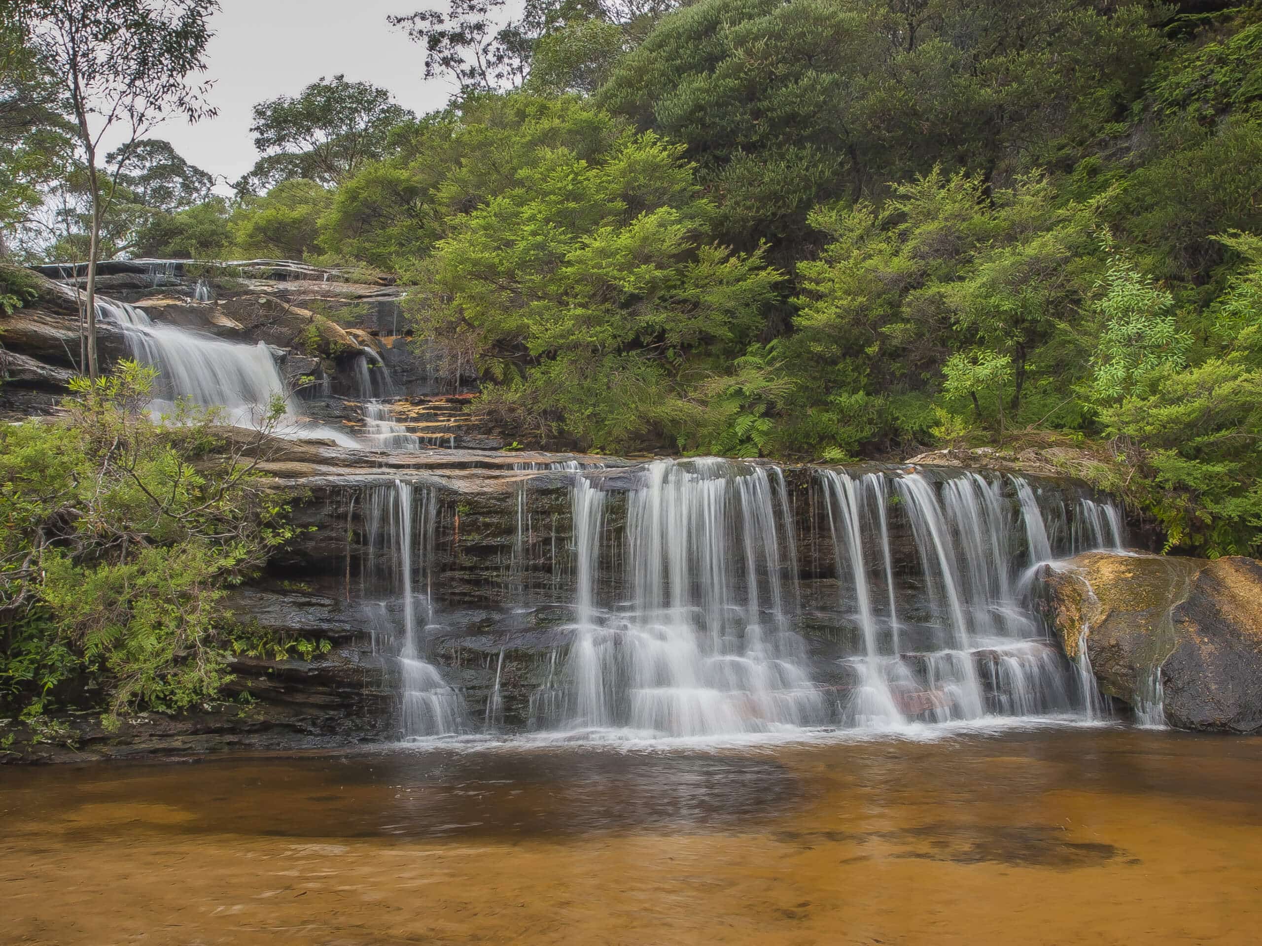
Valley of the Waters to Wentworth Falls Walk
Difficulty Rating:
Want to elevate your heart rate and enjoy a montage of unreal views? The Valley of the Waters to Wentworth Falls Walk in Blue Mountains National Park deserves to sit atop your must-do hiking list. You can take your entire family along, but pack snacks to boost your little ones' energy. This is a moderately challenging hike!
Getting there
To get to the start of the Valley of the Waters to Wentworth Falls Walk, head to the Conservation Hut along Fletcher Street.

About
| Backcountry Campground | No |
| When to do | Year-round |
| Pets allowed | No |
| Family friendly | Yes |
| Route Signage | Average |
| Crowd Levels | Moderate |
| Route Type | Lollipop |
Valley of the Waters to Wentworth Falls Walk
Elevation Graph
Weather
Valley of the Waters to Wentworth Falls Walk Description
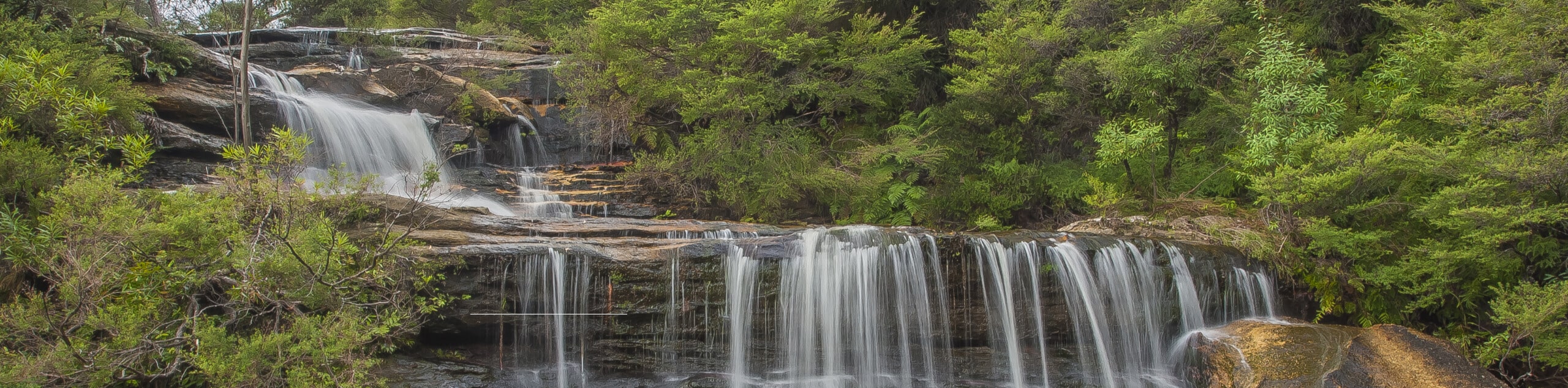
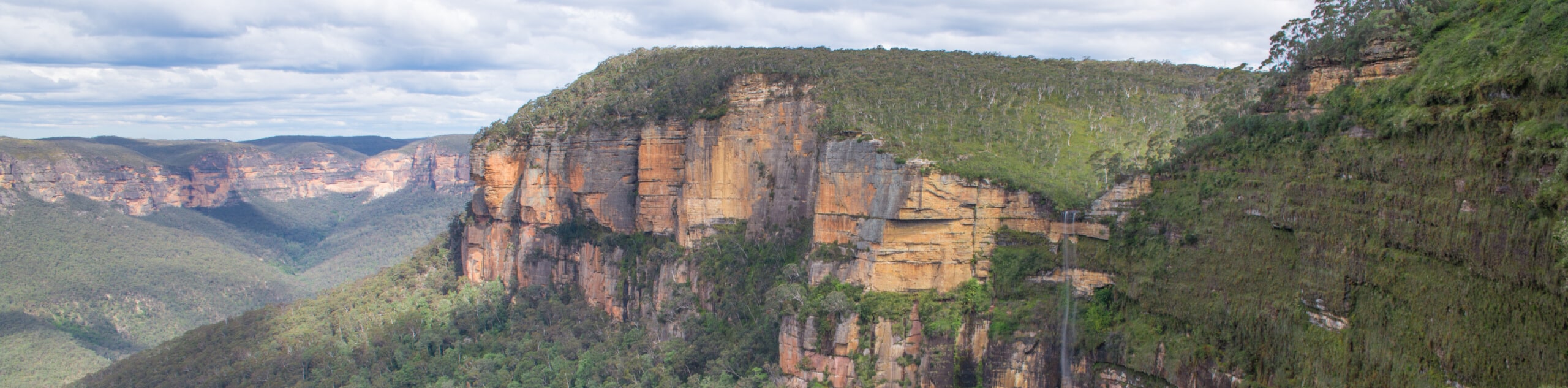
The Valley of the Waters to Wentworth Falls Walk is a must-do hiking adventure in Blue Mountains National Park, Australia. This entertaining excursion travels by a range of picturesque falls: Sylvia Falls, Empress Falls, Lodore Falls, and Wentworth Falls. But that’s not all! Pass by some lookouts: Princes Rock, Rocket Point, Breakfast Point, and Lyrebird, to name a few. So be sure to pack snacks and water! This is a moderately challenging adventure, and you won’t want tired legs prohibiting you from enjoying the unforgettable scenery.
The Valley of the Waters to Wentworth Falls Walk travels in an area that boosts a network of trails, making it ideal to download a GPS before you go. Expect to make some quick out-and-backs, such as when you set out to Sylvia and Edith Falls at either the start or end of your adventure. For most of the journey, you’ll follow the Overcliff Track to Princes Rock Lookout. You’ll kickstart a loop from here, stopping at Fletchers Lookout and Rocket Point Lookout before meeting with Princes Rock again and following the Overcliff Track back toward the Conservation Hut, where the walk began.
Similar hikes to the Valley of the Waters to Wentworth Falls Walk hike
Cliff Top Track and Grand Canyon Walk
Want a hike that promises unreal views and a decent workout? The Cliff Top Track and Grand Canyon Walk in…
Lockleys Pylon Walk
Looking for unforgettable views? Put Lockleys Pylon Walk at the top of your must-do adventure list in Blue Mountains National…
Sassafras Gully, Victory Track, and Magala Gully Loop Walk
The Sassafras Gully, Victory Track, and Magala Gully Loop Walk immerses you in a lush, shaded area while taking you…
Comments