Burramoko Fire Trail to Hanging Rock
View Photos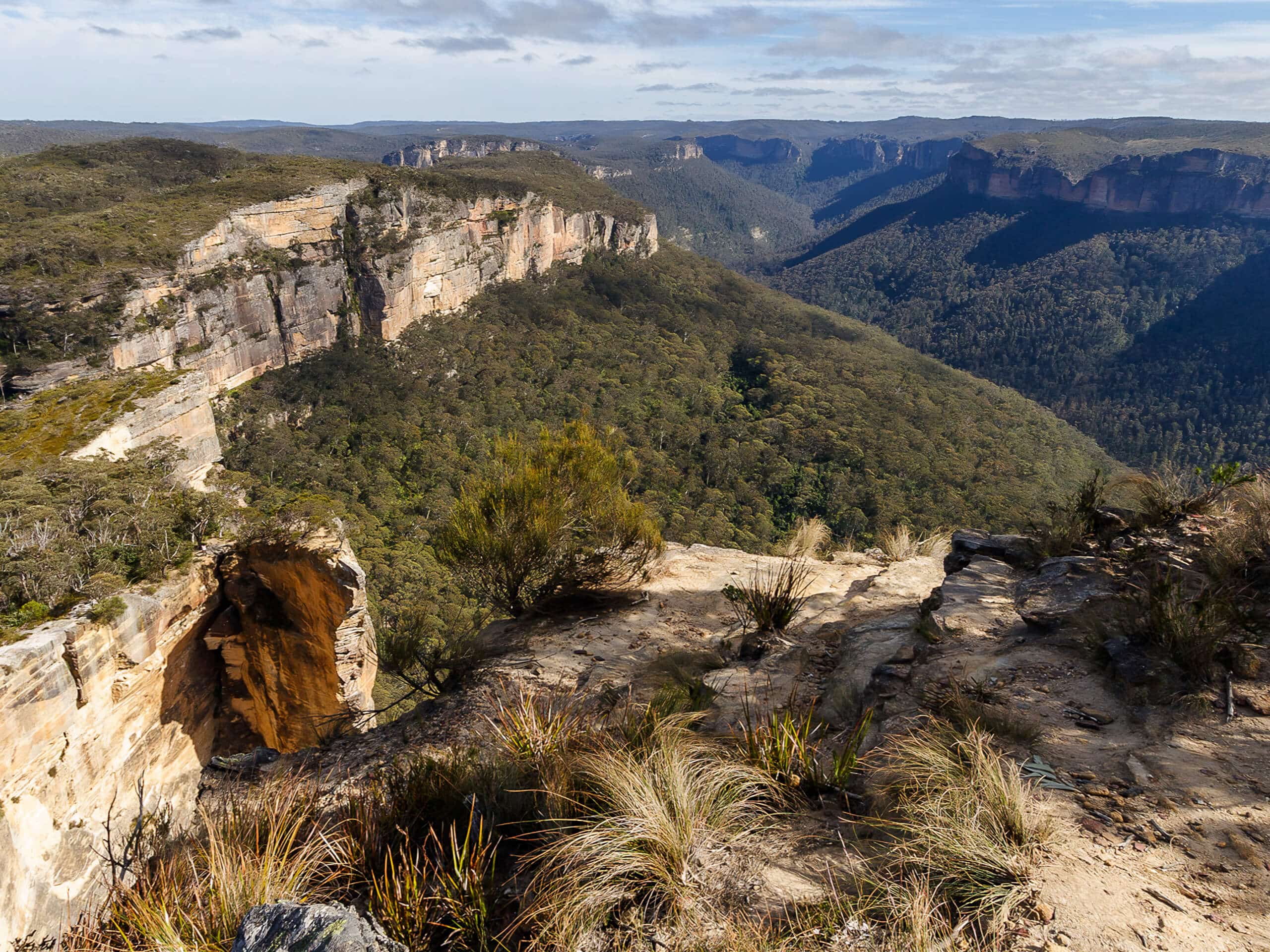
Burramoko Fire Trail to Hanging Rock
Difficulty Rating:
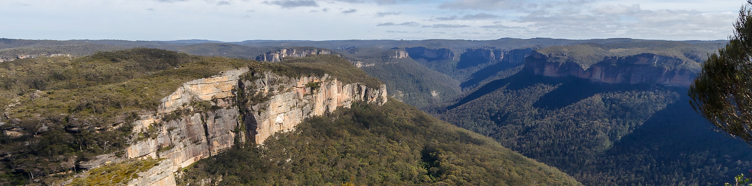
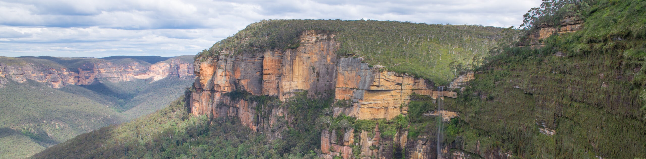
The Burramoko Fire Trail to Hanging Rock follows an eventful, decently flat path to Hanging Rock, where incredible views of Hanging Rock itself leaning into the valley below create one of the more picturesque images in Blue Mountains National Park. Thanks to the vista, the boring path to and from the viewpoint will be the last thing on your mind after completing this moderate adventure!
Getting there
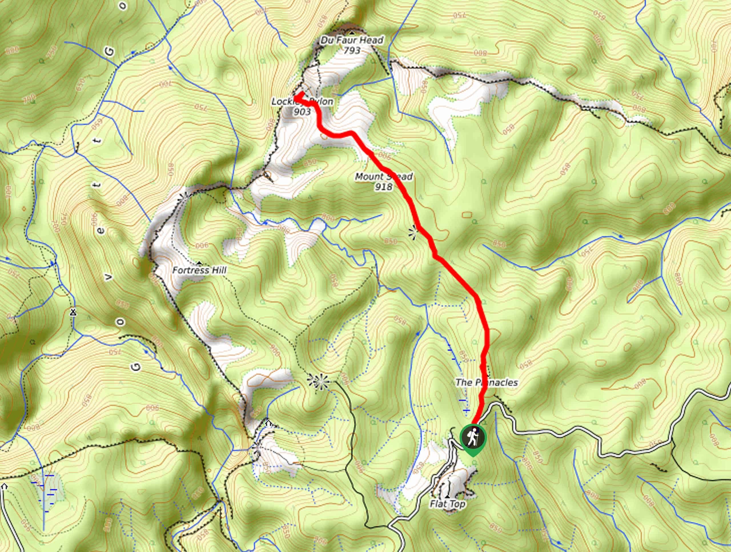
To get to the Burramoko Fire Trail to Hanging Rock, head to Blackheath, off Govetts Leap Road.

About
| Backcountry Campground | No |
| When to do | Year-round |
| Pets allowed | No |
| Family friendly | Older Children only |
| Route Signage | Average |
| Crowd Levels | Moderate |
| Route Type | Out and back |
Burramoko Fire Trail to Hanging Rock
Elevation Graph
Weather
Trail Description:
Looking for an incredible viewpoint? Lace up your shoes and head to the Burramoko Fire Trail to Hanging Rock, which snakes along an eventful, relatively flat section before opening up to one of the best views in Blue Mountains National Park, Australia. You might see some people scrambling to stand on Hanging Rock, but it’s best to keep this side-trip for experienced hikers as there are sketchy cliff drops. Plus, the image of Hanging Rock from the designated viewpoint is photo-worthy enough! Another thing to note is that this trail can experience partial closures for many reasons.
Despite the boring fire trail to and from the viewpoint, the outstanding image at the end makes up for the “blah” trail! So revel in Hanging Rock suspended over Grose Valley. Pack some snacks and a charged camera (or phone), and get ready for a remarkable viewpoint!
Setting out from Blackheath, you’ll follow the Burramoko Fire Trail to Hanging Rock. The trail is wide, attracting mountain bikers as well as hikers. Pack a hat and sunscreen, as the shade can be limited. Once you reach the end, admire the view of Hanging Rock before turning around and heading back the same way you came.
Frequently Asked Questions
How long is the Burramoko Fire Trail to Hanging Rock?
It takes the average hiker around 2-3 hours to complete the Burramoko Fire Trail to Hanging Rock.
Can I bring my dog on the Burramoko Fire Trail to Hanging Rock?
Unfortunately, dogs are not allowed on the Burramoko Fire Trail to Hanging Rock.
Insider Hints
Check here for closures along the trail: https://www.nationalparks.nsw.gov.au/visit-a-park/parks/blue-mountains-national-park/local-alerts
Pack a hat and sunscreen, as there is limited shade along the trail.
Similar hikes to the Burramoko Fire Trail to Hanging Rock hike
Cliff Top Track and Grand Canyon Walk
Want a hike that promises unreal views and a decent workout? The Cliff Top Track and Grand Canyon Walk in…
Lockleys Pylon Walk
Looking for unforgettable views? Put Lockleys Pylon Walk at the top of your must-do adventure list in Blue Mountains National…
Sassafras Gully, Victory Track, and Magala Gully Loop Walk
The Sassafras Gully, Victory Track, and Magala Gully Loop Walk immerses you in a lush, shaded area while taking you…
Comments