Triangle Peak Hike
View Photos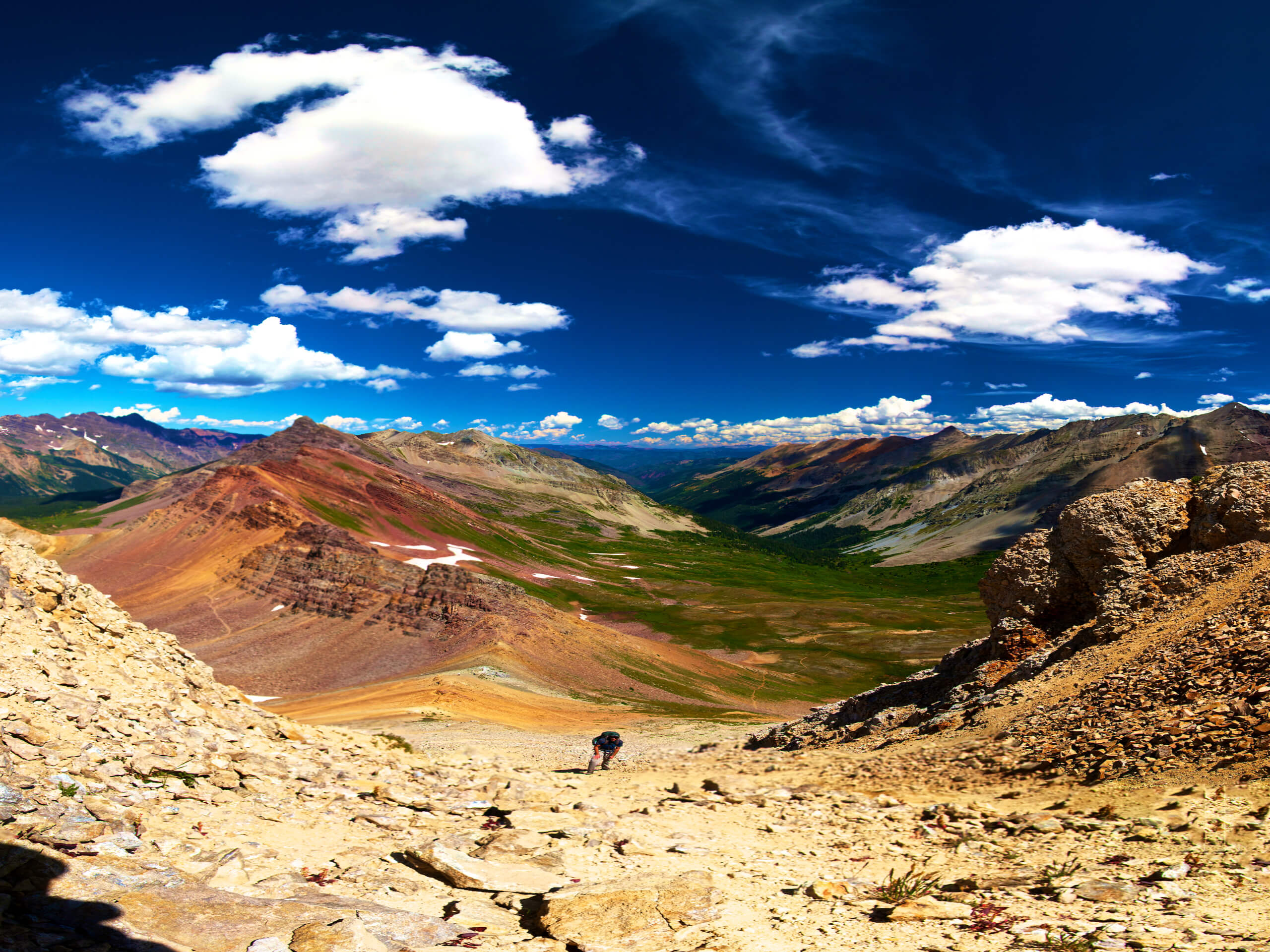
Triangle Peak Hike
Difficulty Rating:
The Triangle Peak Trail summits a small, but impressively scenic peak near Aspen. Though not the highest mountain, it delivers the same awe-inspiring alpine views that a more technical summit ascent would. Condition for your next big adventure or simply enjoy the scenery along the Triangle Peak Hike. While dogs are allowed on the trail, it is not recommended due to the sharp rocks throughout the route.
Getting there
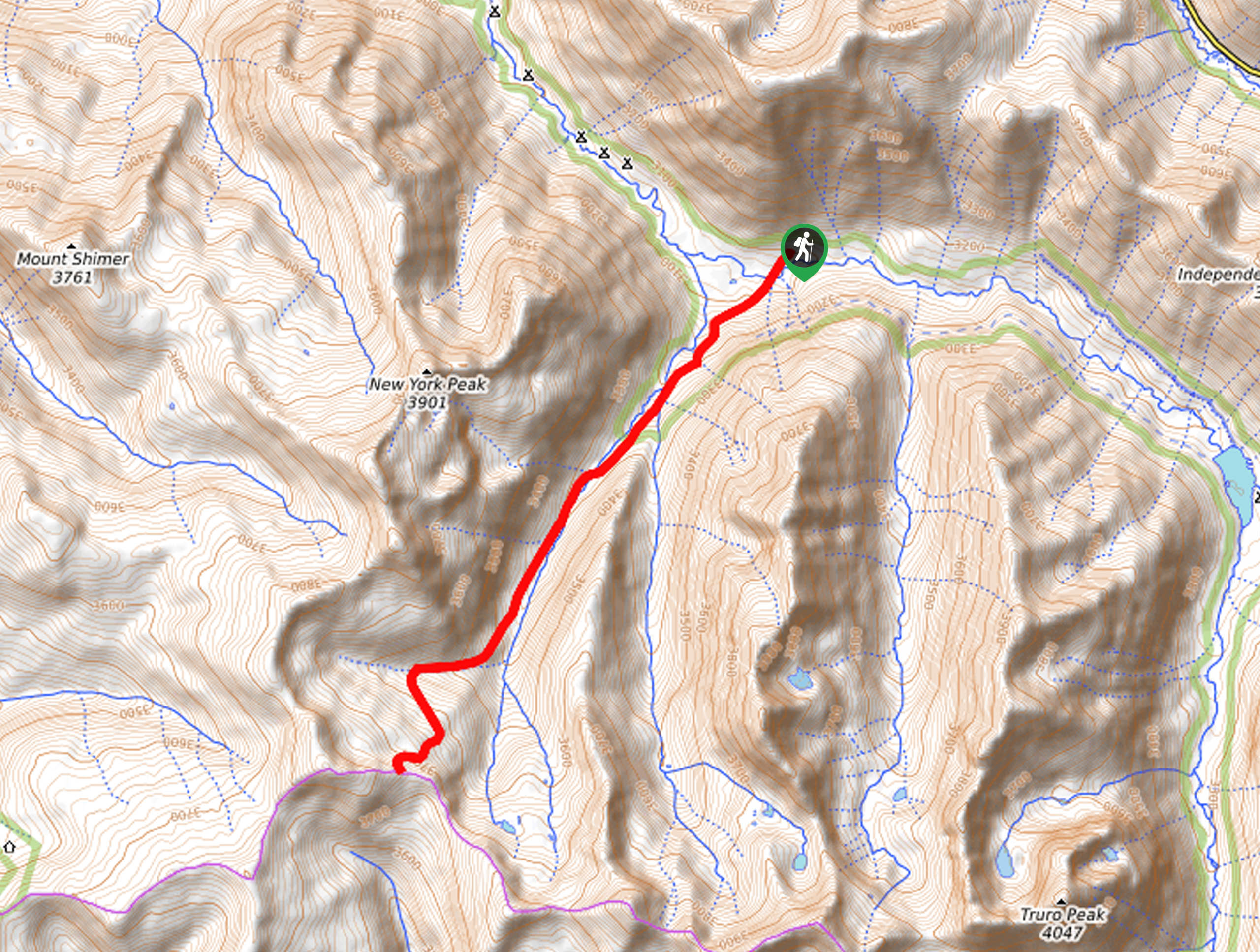
The Triangle Peak Hike leaves from the trailhead off Upper River Road.

About
| Backcountry Campground | No |
| When to do | May-October |
| Pets allowed | Yes - On Leash |
| Family friendly | Older Children only |
| Route Signage | Average |
| Crowd Levels | Low |
| Route Type | Out and back |
Triangle Peak Hike
Elevation Graph
Weather
Triangle Peak Hike Description
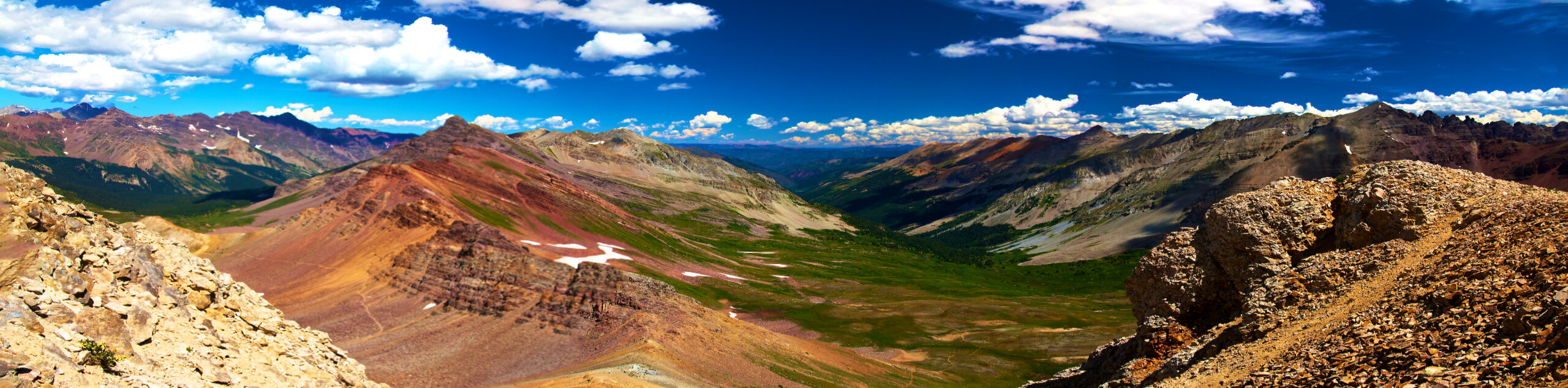
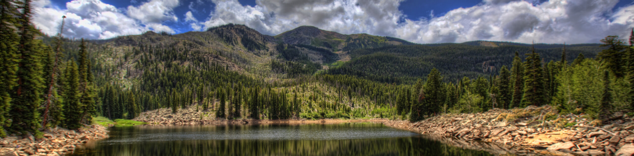
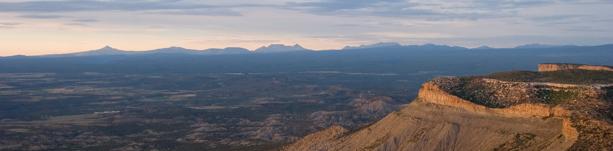
Following a dirt road, the Triangle Peak Hike is an accessible alpine adventure that is manageable my most. Shared with off-road vehicles and mountain bikers, this route attracts outdoor enthusiasts of all sorts, so it is important to be mindful of passers-by. Traveling through exposed terrain to the peak brings epic views, but also extreme weather conditions. We encourage you to check the forecast before your climb and try to summit before noon!
Embark on your adventure along the Triangle Peak Trail from the trailhead off Upper River Road. From here, track the Red Rim Road northeast through an initial segment of the trek that will guide you through several sets of switchbacks. As you navigate the winding terrain, let the anticipation of the epic alpine views motivate you. The switchback will subside briefly, climbing through a patch of pine trees before heading back out into the exposed meadowlands.
Eventually, you will confront an intersection. Here, veer right and you will be diverted along the Triangle Peak Overlook Road tracking east. Soon, you will reach the summit of Triangle Peak, where you can revel in the panoramic views of Colorado’s snow-capped peaks that stretch for miles, lining the horizon. After you are through admiring the views, retrace your footing along the path back to the trailhead.
Similar hikes to the Triangle Peak Hike hike
New York Creek Trail
The New York Creek Hike is a stunning adventure through Colorado’s high country. Featuring lush woodlands, expansive meadows, and mountain…
East of Aspen Trail
The East of Aspen Trail is a great escape into nature. Conveniently located near the city center, this trek is…
Montezuma Basin Trail
The Montezuma Basin Trail is an epic hike that attracts outdoor enthusiasts of all sorts. Hike, bike, or drive the…
Comments