Tabour Creek Trail
View Photos
Tabour Creek Trail
Difficulty Rating:
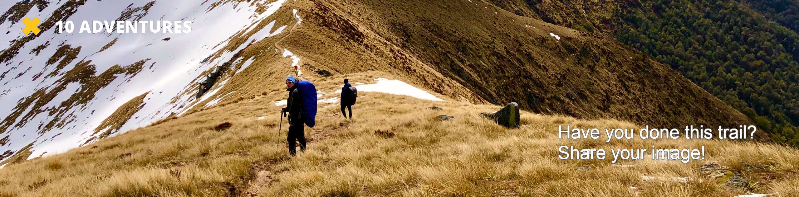
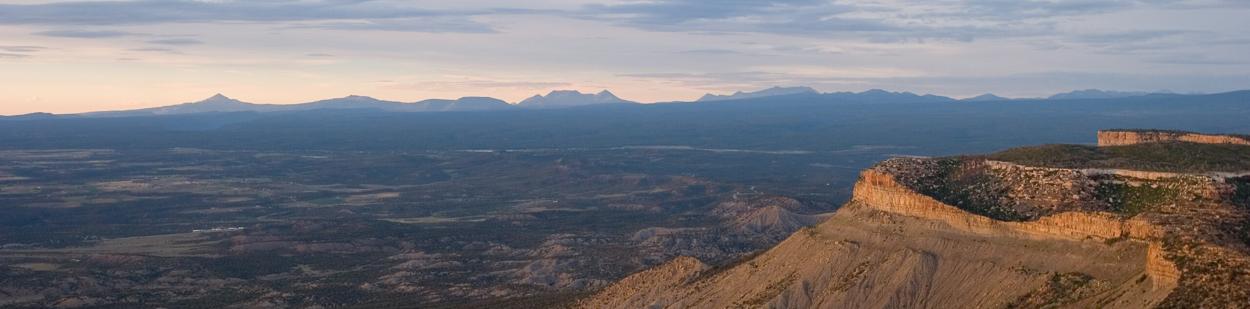
Explore what the alpine terrain of Colorado has to offer along the Tabour Creek Trail. This amazing adventure into the high country is a great introductory or conditioning hike for those hoping to soon tackle a more technical ascent up a Colorado 14er.
Getting there
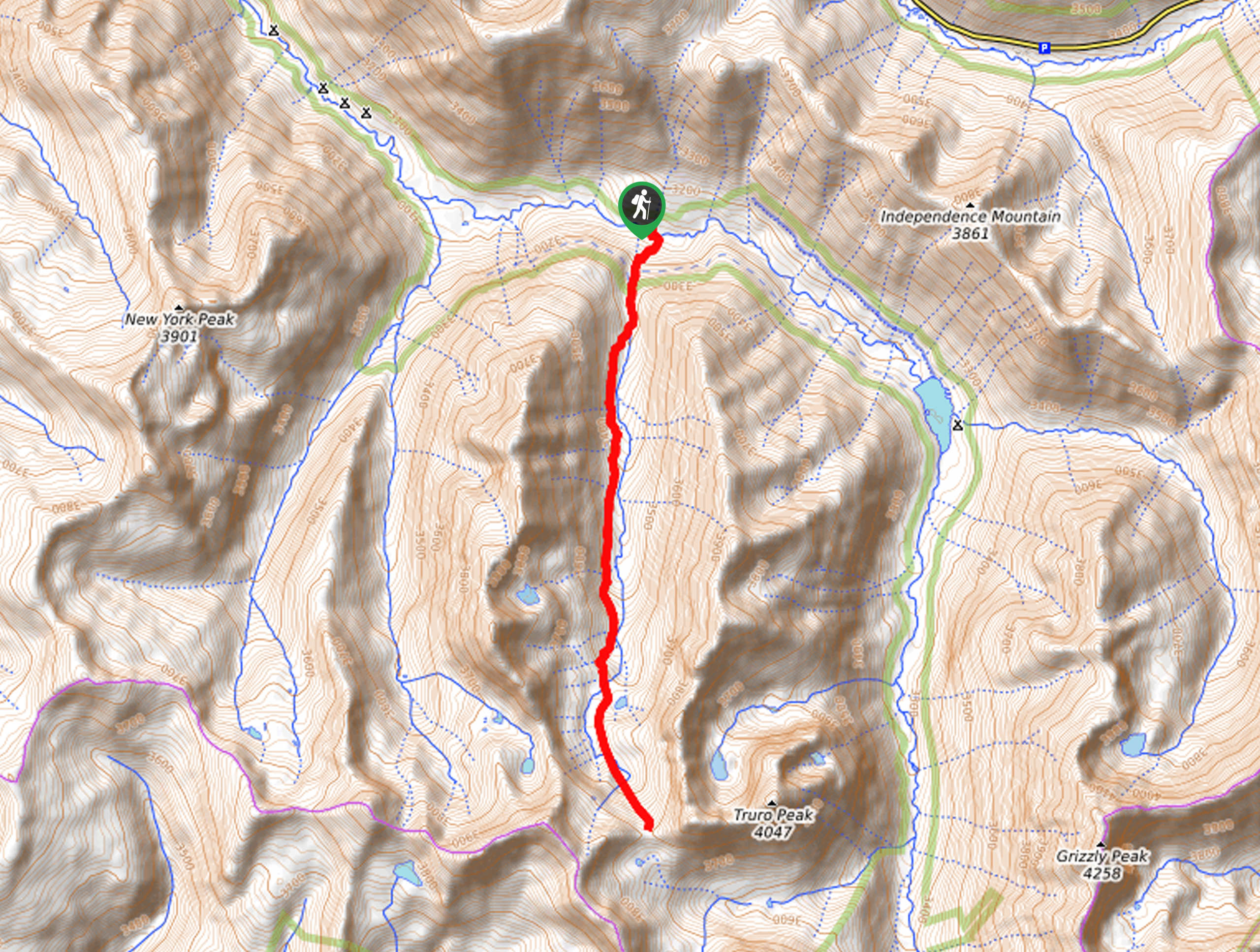
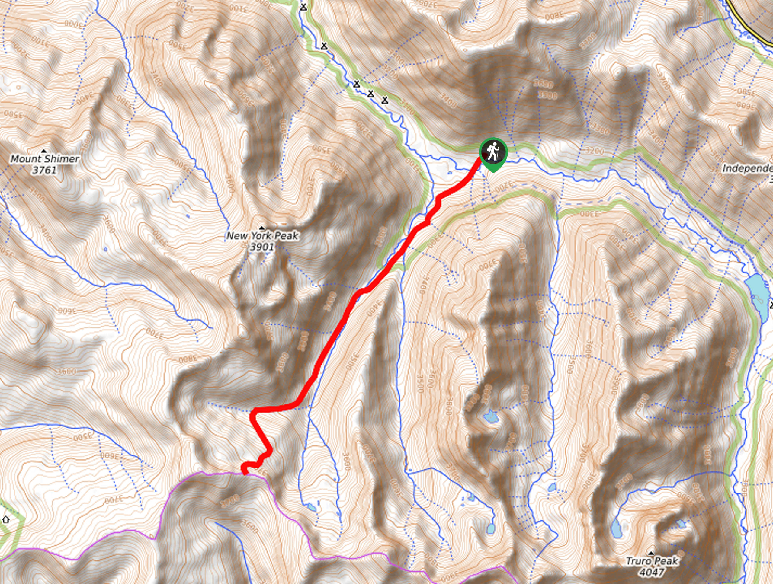
The Tabour Creek Trail departs from the trailhead off Lincoln Creek Road.

About
| Backcountry Campground | Dispersed Backcountry Camping |
| When to do | June-September |
| Pets allowed | Yes - On Leash |
| Family friendly | Older Children only |
| Route Signage | Average |
| Crowd Levels | Moderate |
| Route Type | Out and back |
Tabour Creek Trail
Elevation Graph
Weather
Tabour Creek Trail Description
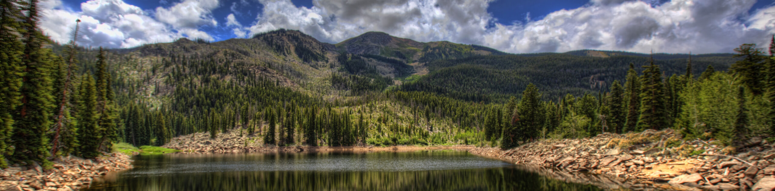
Revel in the diversity and grandeur of the Colorado wilderness as you trek the Tabour Creek Trail. Departing from the trailhead you will be guided through dense pine woodlands, before graduating the timberline into the vibrant alpine tundra. Traveling to high elevations, it is important to be acclimatized to the area’s altitude prior to your hike. Additionally, be sure to keep an eye on the skies as you make your way to the exposed mountain pass. Note the road to the trailhead is rough and rugged, demanding a vehicle with high ground clearance and 4-wheel drive.
Departing from the trailhead on Lincoln Creek Road, hikers will follow the Tabour Creek Trail south through pine woodlands. Enjoy the tree shade while you can, as it won’t last long. Soon you will top the treeline and begin your journey through the lush alpine tundra. Enjoy the impressive panoramas of the surrounding peaks as you make your way along Tabour Creek. Eventually, you will pass Tabour Lake in the west—feel free to head up and explore the lakeshore if you have the time and energy. If not, continue along the wildflower lined path to the mountain pass.
From the trail’s end you will be granted an up close and personal view of Truro Peak in the east and Larson Peak in the south. Revel in the expansive mountain scenery from the pass and when you are ready, backtrack along the path to return to the trailhead.
Similar hikes to the Tabour Creek Trail hike
New York Creek Trail
The New York Creek Hike is a stunning adventure through Colorado’s high country. Featuring lush woodlands, expansive meadows, and mountain…
East of Aspen Trail
The East of Aspen Trail is a great escape into nature. Conveniently located near the city center, this trek is…
Montezuma Basin Trail
The Montezuma Basin Trail is an epic hike that attracts outdoor enthusiasts of all sorts. Hike, bike, or drive the…
Comments