Turbine Canyon backpacking trail
View Photos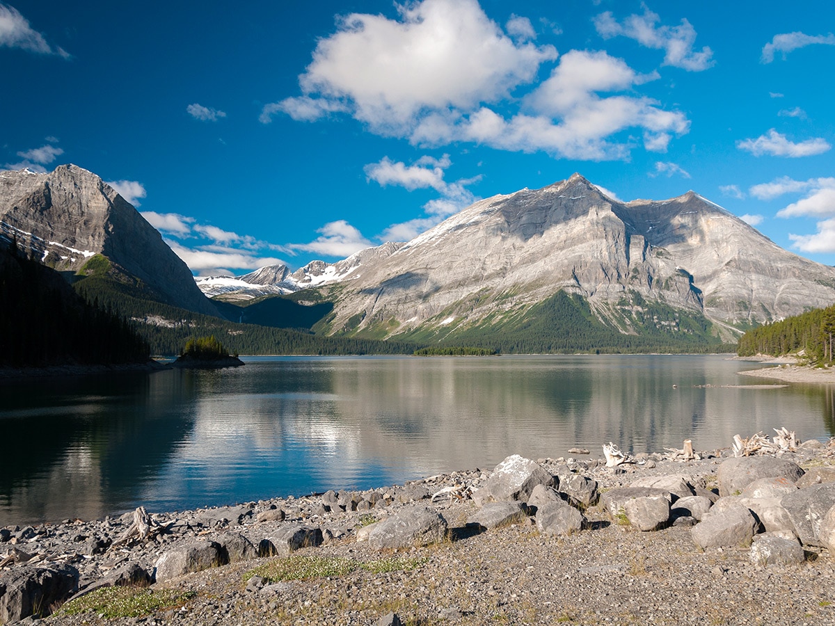
Turbine Canyon backpacking trail
Difficulty Rating:
The backpack to Turbine Canyon and Three Isle Lake leads you through two alpine passes, canyons, glaciers, and alpine lakes. This classic Kananaskis trip offers a bit of everything for an avid Rockies backpacker.
Getting there
Take Highway 40 south from the Trans-Canada Highway for 39.4mi. Turn right at the “winter gate” onto Highway 742. Keep straight at the junction with the Smith-Dorrien Trail and follow this road for roughly 7.8mi, past the “Upper Lake” sign. Follow the road down the hill, then left around to the North Interlakes Day Use Area.

About
| When to do | Mid July - September |
| Mountain Huts | No |
| Backcountry Campsites | Yes |
| Toilets | At trailhead |
| Pets allowed | Yes - On Leash |
| Accommodation Type | Tent |
| Family friendly | No |
| Route Signage | Average |
| Crowd Levels | Moderate |
| Route Type | Out and back |
Turbine Canyon
Elevation Graph
Weather
Route Description for Turbine Canyon
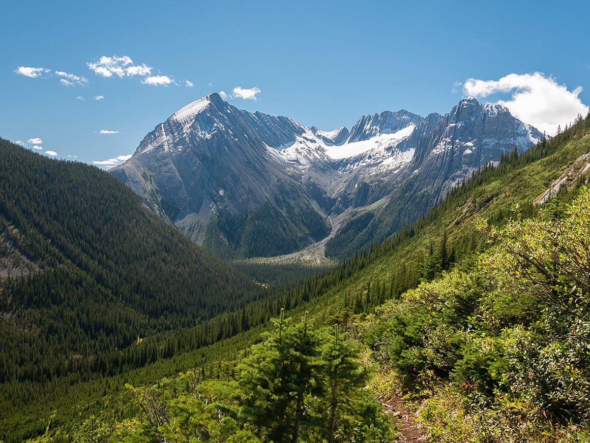
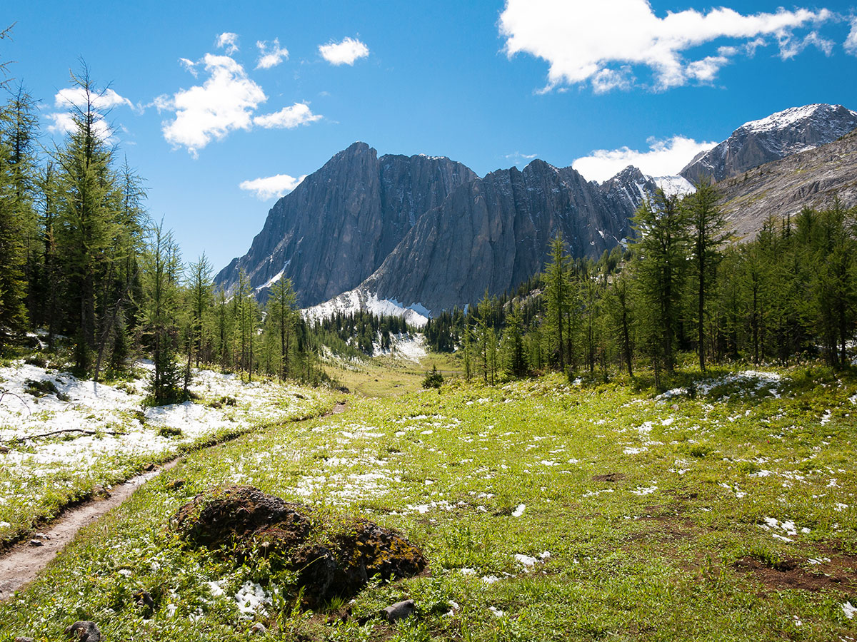
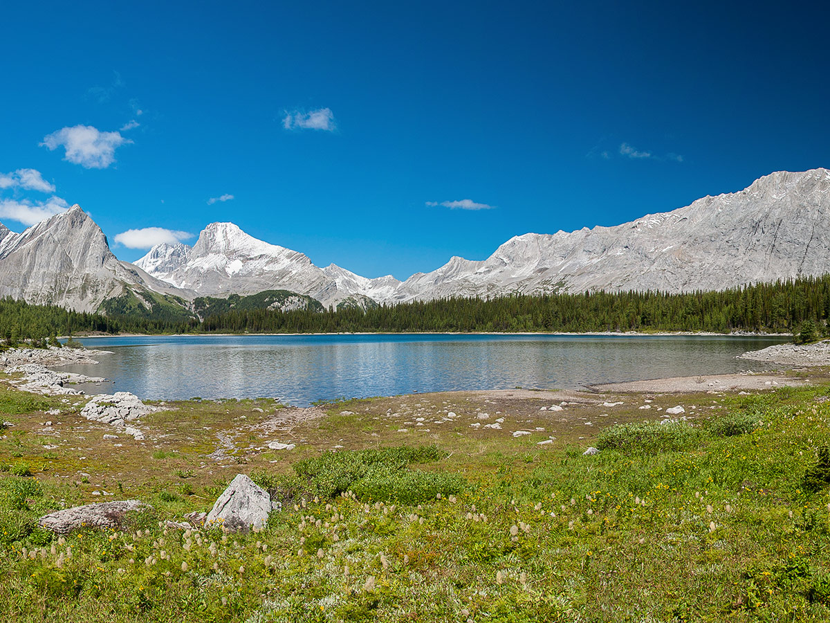
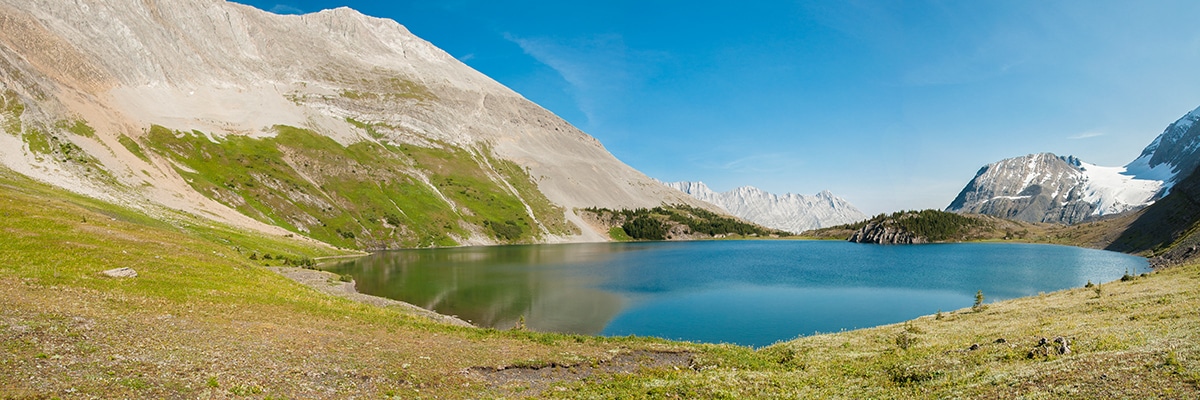
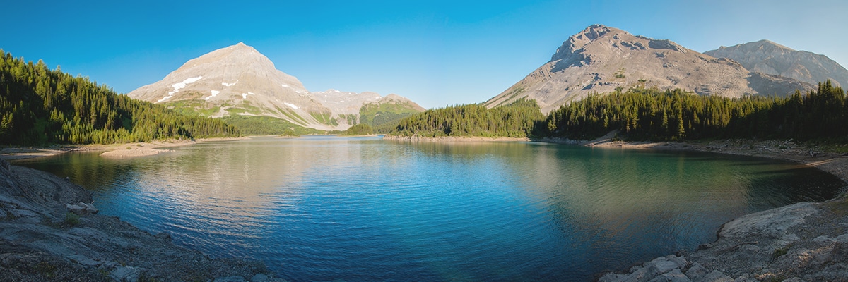
We absolutely love backpacking along Upper Kananaskis Lake out to Turbine Canyon. While there are a variety of route options, this is our preferred one.
Day 1
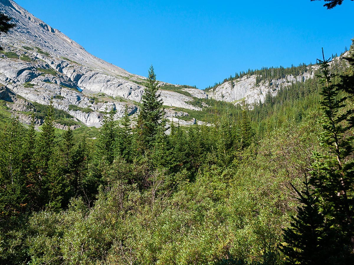
The trail to Turbine Canyon is straightforward and involves only one painful section – the ascent of an exposed avalanche slope that can be extremely hot on a sunny day.
You start out by walking along Upper Kananaskis Lake, before going right at a split in the path. If you go left you continue along Upper Kananaskis Lake and soon come to Point Campground.
After 4.5mi you come to Forks Backcountry Campground, which has 15 campsites, and is a pleasant stop. If you start late in the day, this is a good place to camp. Water is available from the river. Fires are permitted in the firepits here, and there is a pit toilet.
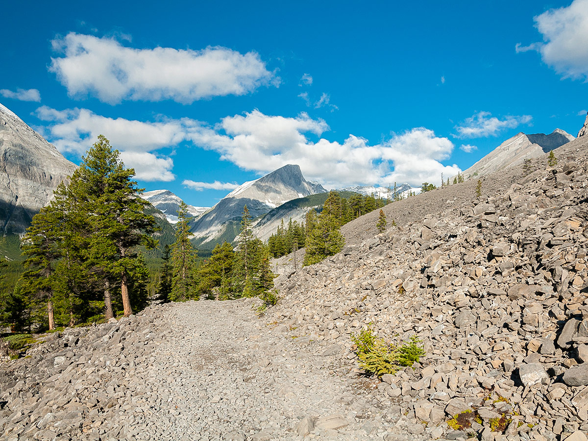
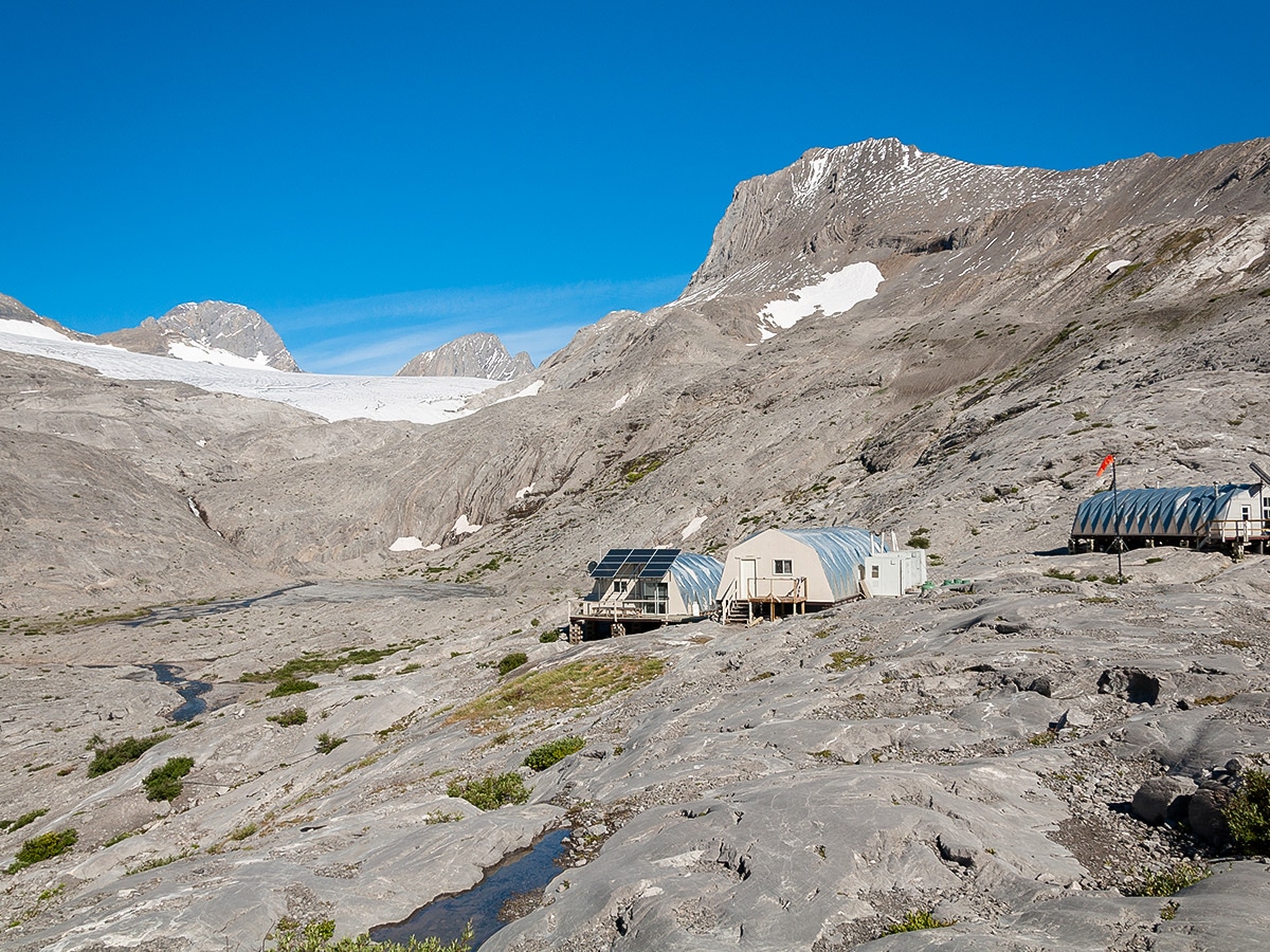
From Forks Backcountry Campground, head north along the clear trail and at 4.8mi you will come to Turbine Canyon Campground (9.4mi from your car). There are 12 campsites here, and fires are not permitted.
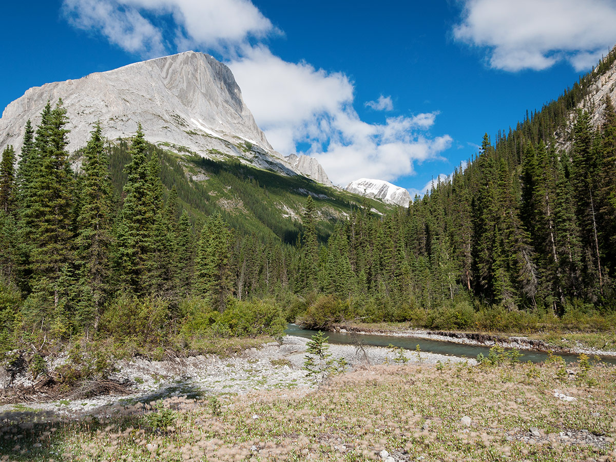
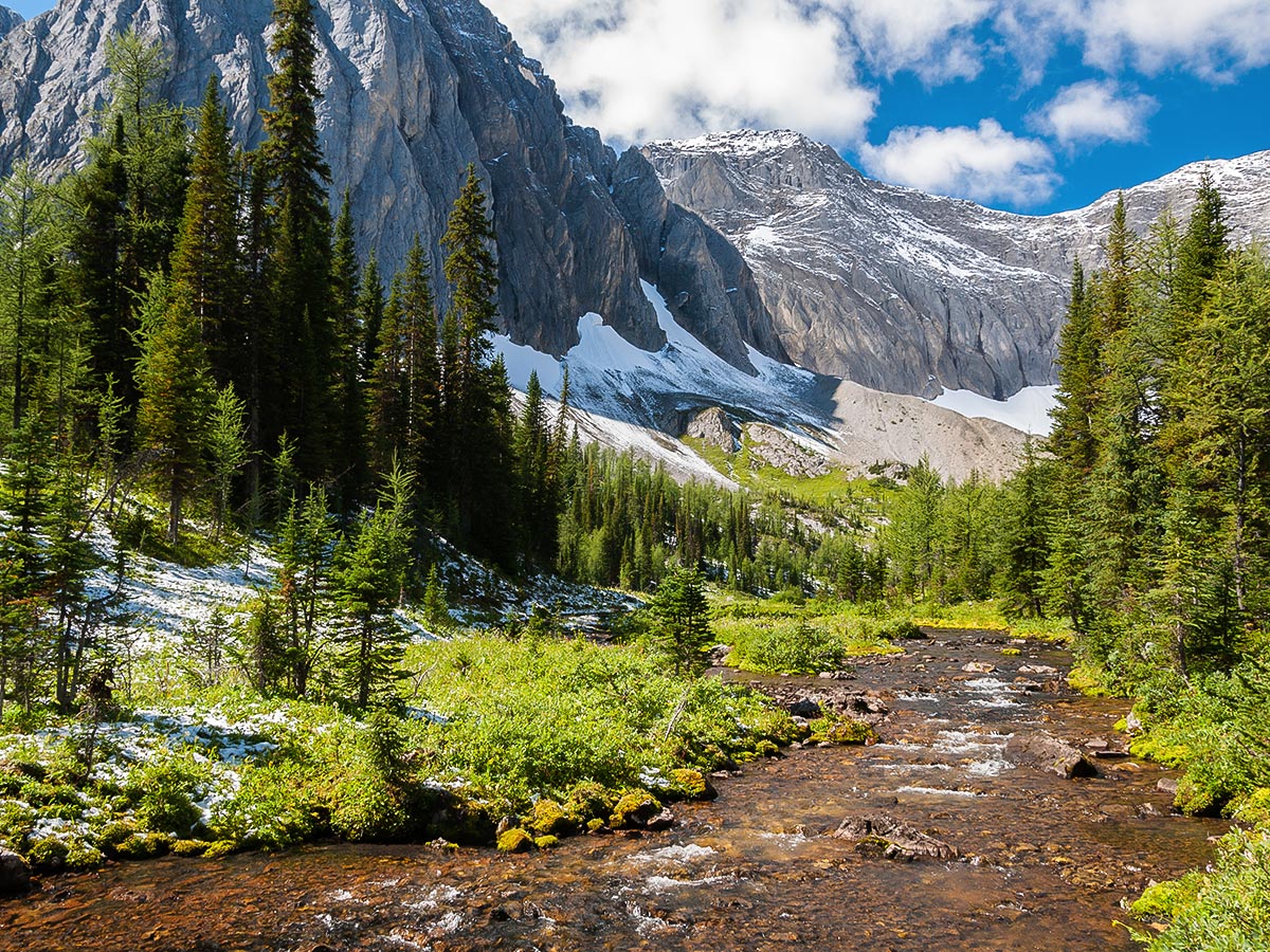
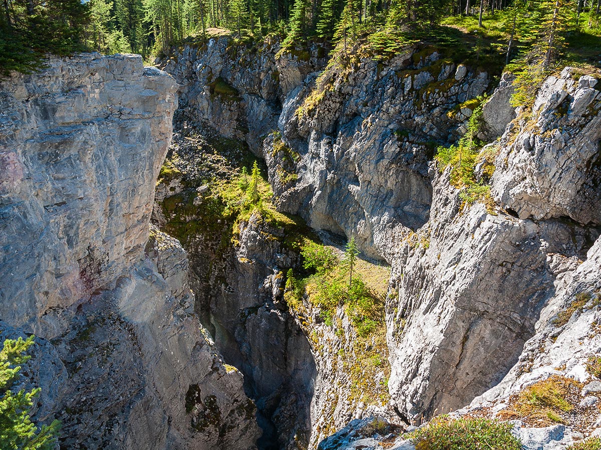
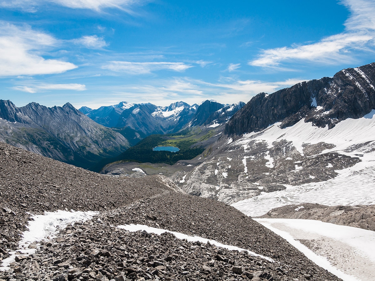
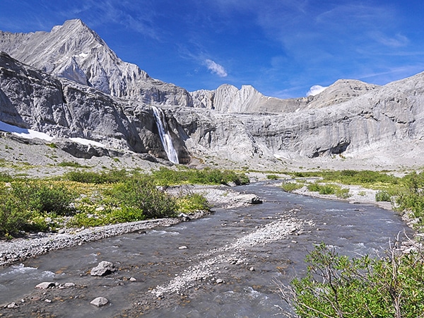
We like to start our day early so we can setup our campsite at Turbine Canyon campground and then head out on some scenic side-trips. There are two scenic and easy side trips, which can be completed in one day. The first side trip takes you to the actual Turbine Canyon, and is only a two-minute walk downstream from the campground. Trails are on both sides of Maude Brook, but the one on the south side goes further along the canyon edge.
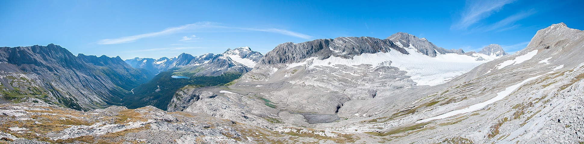
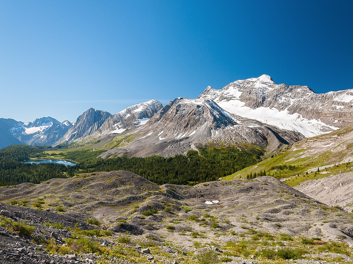
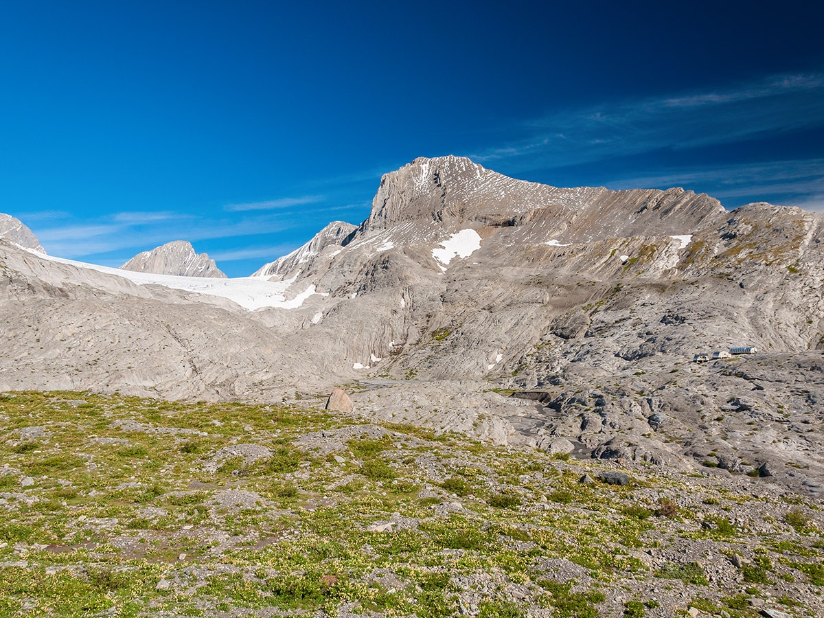
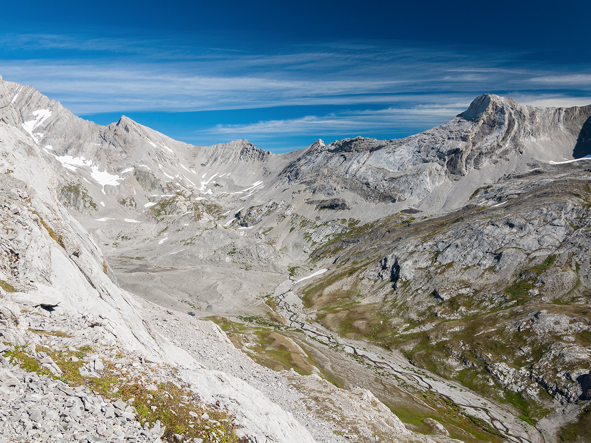
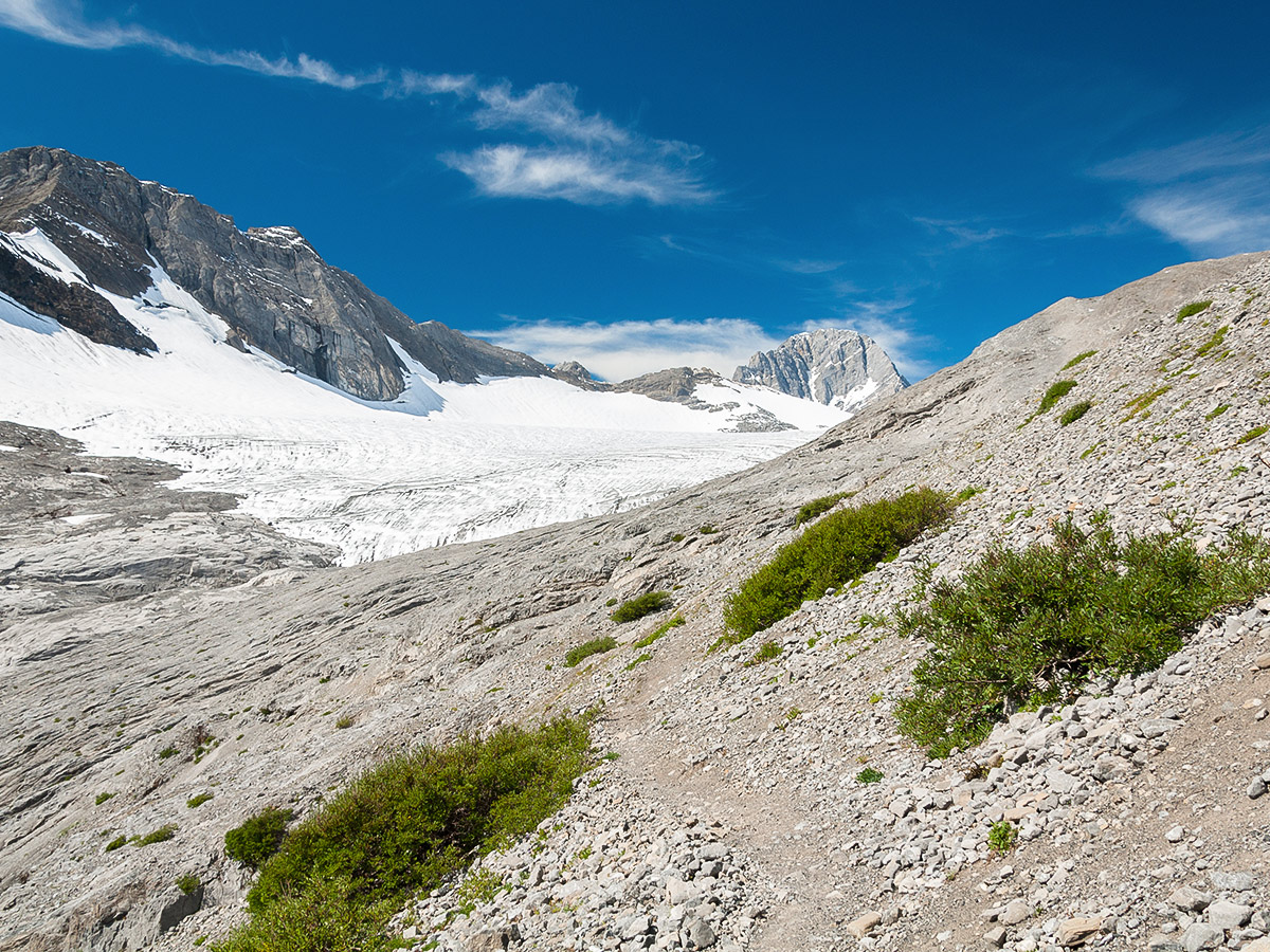
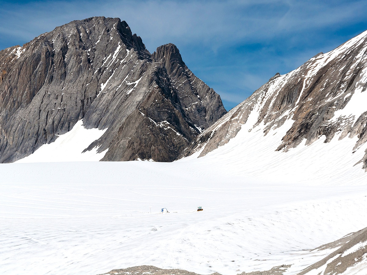
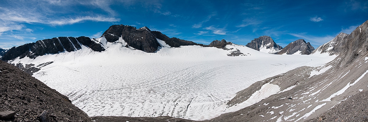
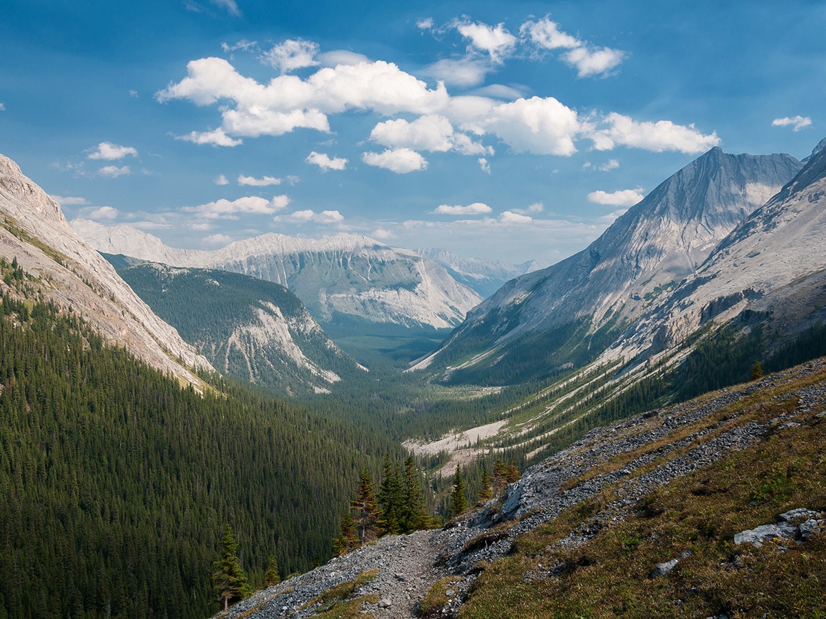
The second trip is to Haig Glacier (1.9mi), where Canadian ski teams train during the summer months. The trail starts on the north side of Maude Brook immediately before it plunges into Turbine Canyon. Initially the trail ascends through forest, but within 1.2mi, it emerges onto a terminal moraine of Haig Glacier. Visible ahead are the three huts of the ski team. To the right of the huts is a valley whose upper reaches hold the Kananaskis Glacier (or Smith-Dorrien Glacier, depending on the map/book). To the left of the huts is Haig Glacier.
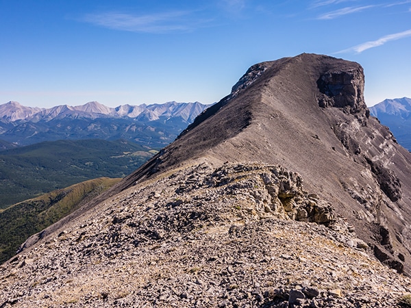
Follow cairns towards the huts, then ascend the cairned trail that starts behind the huts. The skiers use this trail to access the glacier and it is in good shape. The ascent appears steep, however it is actually quite easy, although it is not the end of the trail nor the highpoint as it would appear. The highpoint lies just 15 minutes further and not too much higher, at which point the trail descends to the glacier. A worthwhile side trip is up onto the southeastern shoulder of Mt. Jellicoe, easily accessed from the trail just north of the ski huts. Choosing your route carefully avoids any scrambling.
Return to Turbine Canyon Campground and enjoy your night in the backcountry.
Day 2
Spend day two relocating your camp to the Three Isle Lake campground. There are two options to make this journey.
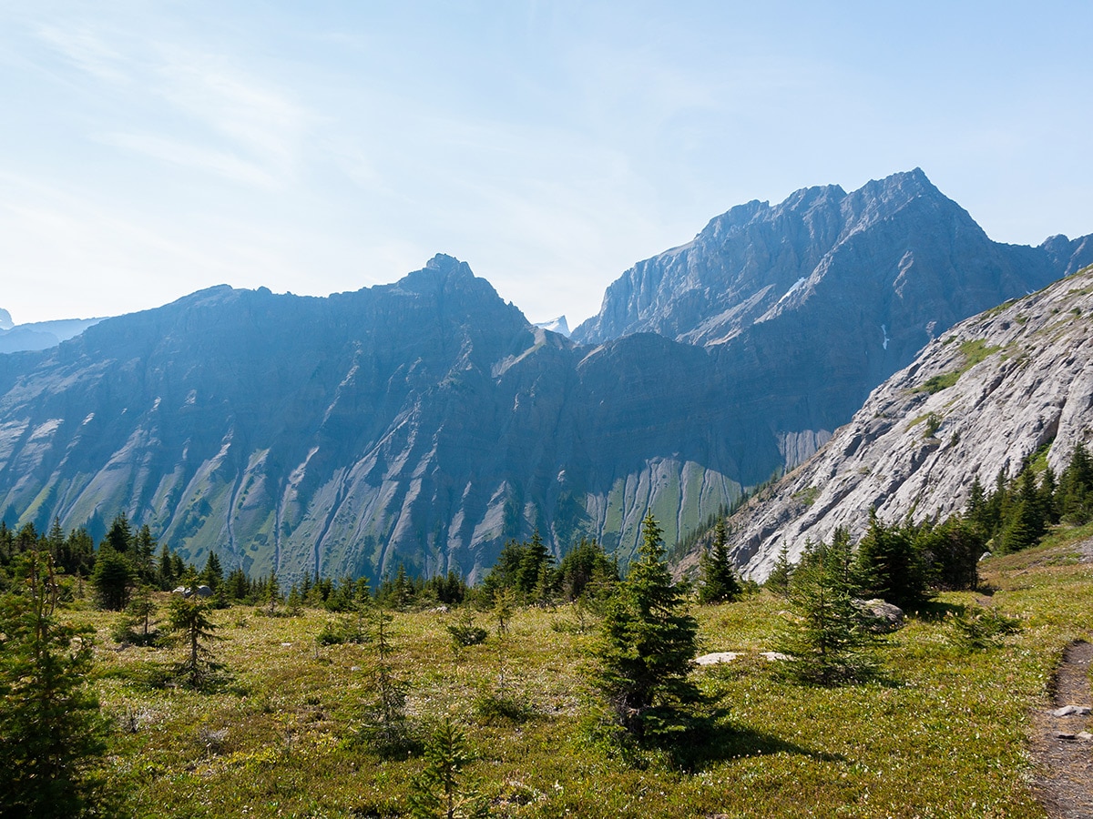
Option 1 is via North and South Kananaskis Passes. This 9.1mi route gains and drops about 2789ft, and is an unmaintained trail full of bushwhacking. Despite it’s difficult route-finding and conditions, it provides excellent views.
Option 2 is to largely retrace your steps from yesterday to Forks Campground and then go west to Three Isle Lake. This is the ‘safer’ option, and is still a very pleasant day.
On our map we show Option 2, which includes a backtrack to Forks Campground and then continued to the Three Isle Lake Campground from there.
The route to Three Isle Lake Campground follows the route you walked in to Turbine Canyon for roughly 4.7mi until you come to a junction. Go right at this junction (left takes you back to your car), and follow the clear path to Three Isle Lake Campground, which is roughly 2.2mi from the junction. Note that this route ascends a formidable headwall in the final section between Forks and Three Isle Lake Campgrounds, which will leave you puffing!
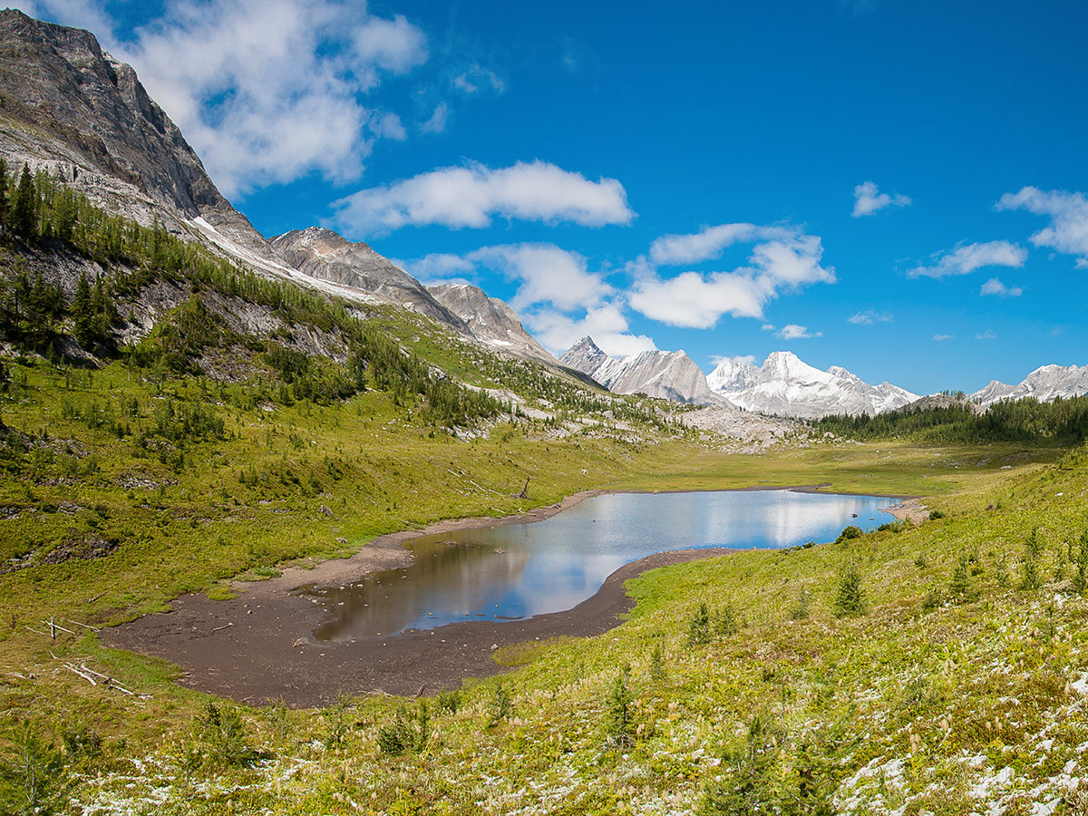
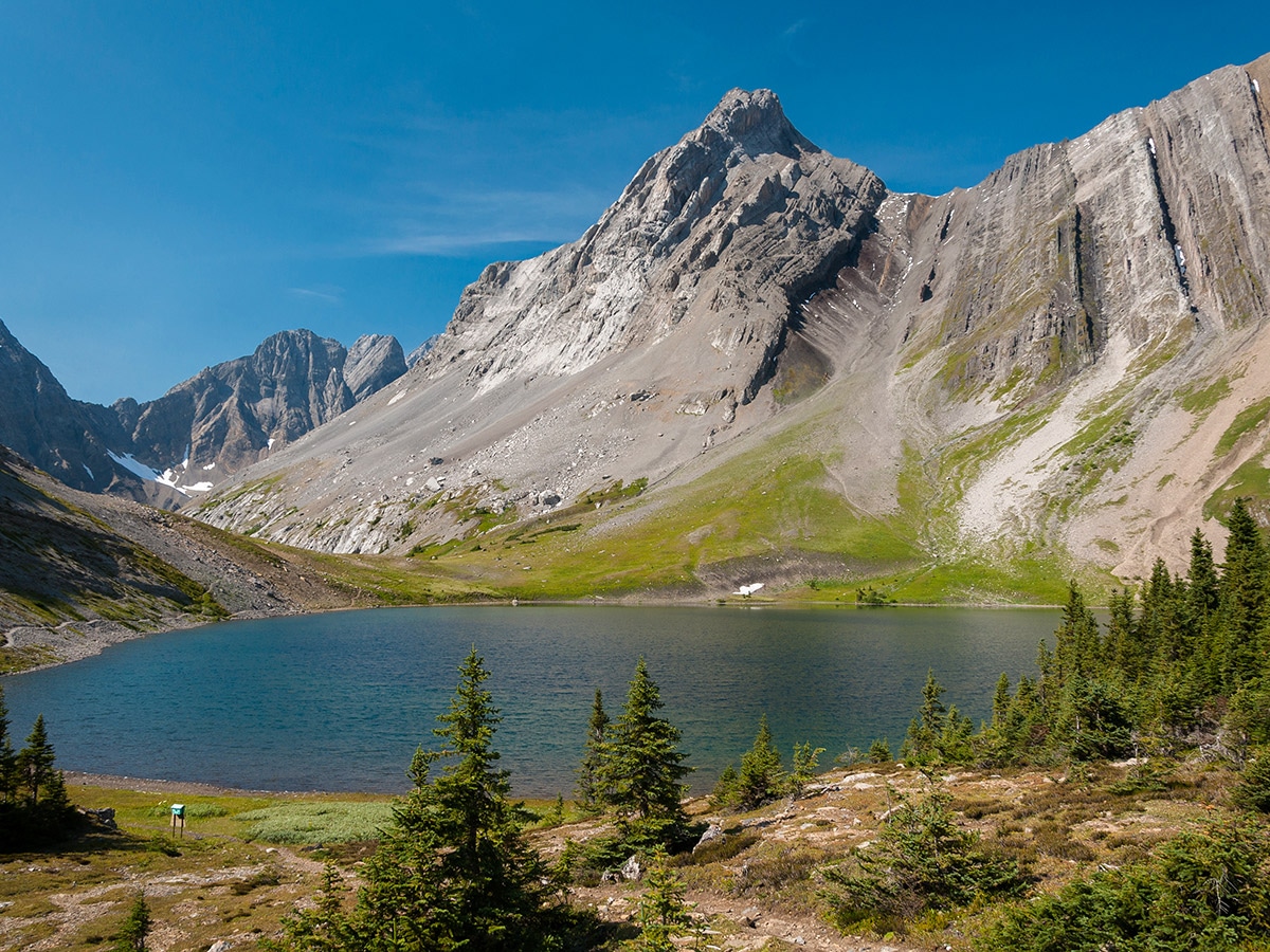
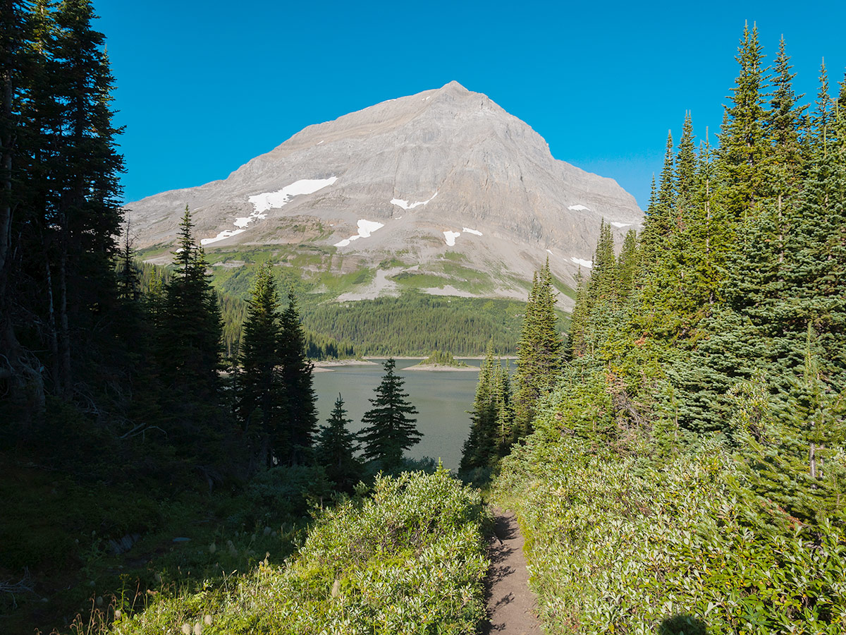
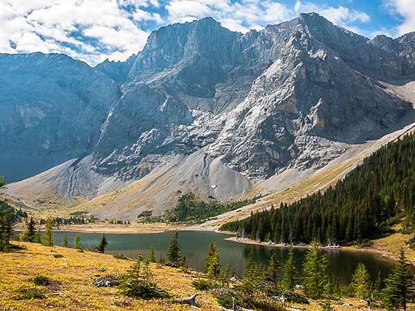
Once you get to Three Isle Lakes Backcountry Campground, setup your tent. There are 16 sites, pit toilets. Unfortunately, no fires are permitted.
If you feel like a bit more walking, the 1.2mi (one-way) trip up to the South Kananaskis Pass is a worthy objective. Choosing to relax by Three Isle Lake and enjoy a summer day is just as good.
Day 3 – 4
Our map shows a return back to North Interlakes Day Use Area along the trail we went out on.
Another option to return that would add some variety would be to continue on the southern shore of Upper Kananaskis Lake, though it should be noted that the views on the southern shores of Upper Kananaskis Lake are not as good.
Some other alternatives for backpackers who want to add another night would be to hike to Point Campground for night 3 and then do a day trip exploring over to Hidden Lake. You could also continue past Hidden Lake to the beautiful Aster Lake Campground, though that trail is unmaintained.
Sample Itinerary:
Day1: Trailhead to Turbine Canyon Campground and day trip to Haig Glacier (12.4mi / 3862ft )
Day 2: Day trip to North Kananaskis Pass and on to Three Isle Lake via Forks Campground
(9.9mi / 1969ft)
Day 3/4: Three Isle Lake back to trailhead via Forks Campground (5.9mi / 1148ft )
Insider Hints
If you choose to take the North Kananaskis Pass then up the South Kananaskis Pass from Turbine Canyon to Three Isle Lake, be prepared for a heavily forested, unmaintained route.
You can break this route up depending on campground availability and your group’s daily max distance.
Book your backcountry campgrounds in Kananaskis on The Alberta Parks website.

Similar backpacking trails to the Turbine Canyon backpacking trail
Weary Creek
A backpacking trip to Weary Creek Gap and Carnarvon Lake offers a truly wild experience in the Canadian Rockies. This…
Elk Lakes and Petain Basin
Petain Basin, just past Elk Lakes, is a wonderfully remote and isolated meadow lying at the base of some of…
Rae Lake
Rae Lake is often completed as a day-hike, however it is a great place for a quick backpacking trip. Lying…
BPC 3 years ago
This is a beautiful hike. Views from the top of North Kananaskis Pass are stunning.
Ekles 5 years ago
Awesome hike. Made it to ski huts but not enough time to get to glacier. Woke up to about 3 inches of snow in late August. Made the trip even more surreal.
Kevin Swabey 5 years ago
This hike should be listed in the Kananaskis Trail section and not Bragg Creek.
Lisa B 5 years ago
Backpacking to Turbine Canyon really does have everything, loved this trip!