Lillian and Galatea Lakes backpacking trail
View Photos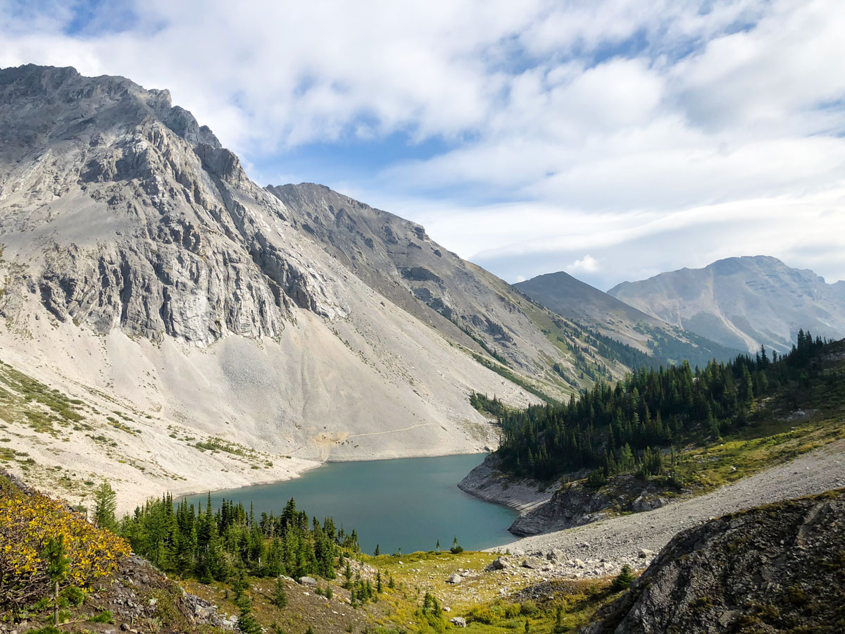
Lillian and Galatea Lakes backpacking trail
Difficulty Rating:
Another classic Kananaskis backpacking trip is the backpack to Lillian and Galatea Lakes, with a side-trip to Guinn’s Pass. For years this was a yearly Friday-night classic, finish work, get to the trailhead and get to pretty Lillian Lake. The real highlight of this backpack highlight is the easy Saturday daytrip to Upper Galatea Lakes and nearby Guinn’s Pass, both incredible places. This is another great backpack if you’re just getting into backpacking.
Getting there
From the Stoney Nakoda Casino on the TransCanada, take Highway 40 south for roughly 20.3mi. Turn right into the signed Galatea parking lot.

About
| When to do | June - September |
| Mountain Huts | No |
| Backcountry Campsites | Yes |
| Toilets | At trailhead and campground |
| Pets allowed | Yes - On Leash |
| Accommodation Type | Tent |
| Family friendly | Yes |
| Route Signage | Good |
| Crowd Levels | Moderate |
| Route Type | Out and back |
Lillian and Galatea Lakes
Elevation Graph
Weather
Route Description for Lillian and Galatea Lakes
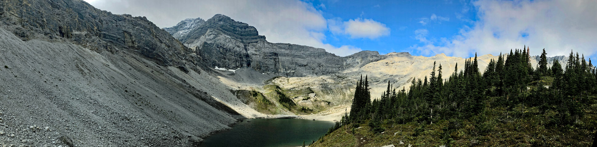
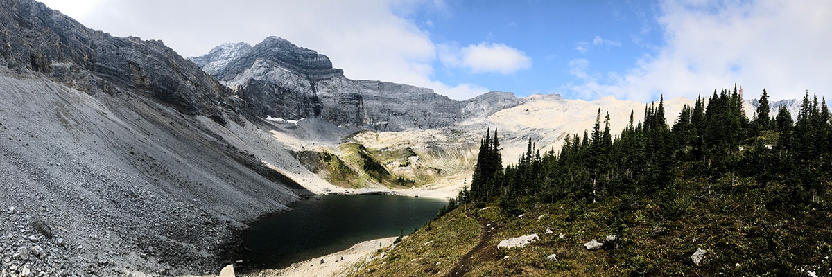
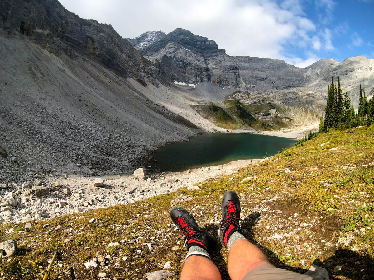
We love the backpack to Lillian Lake. While Lillian Lake is not a spectacular setting, the daytrips nearby to Galatea Lakes and Guinn’s Pass are spectacular.
Day 1
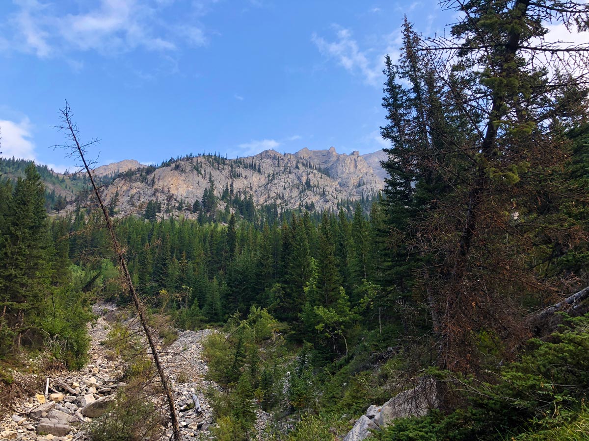
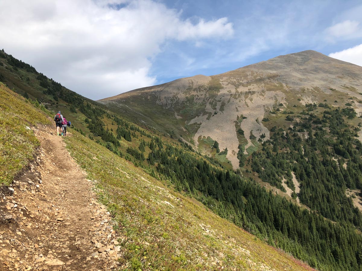
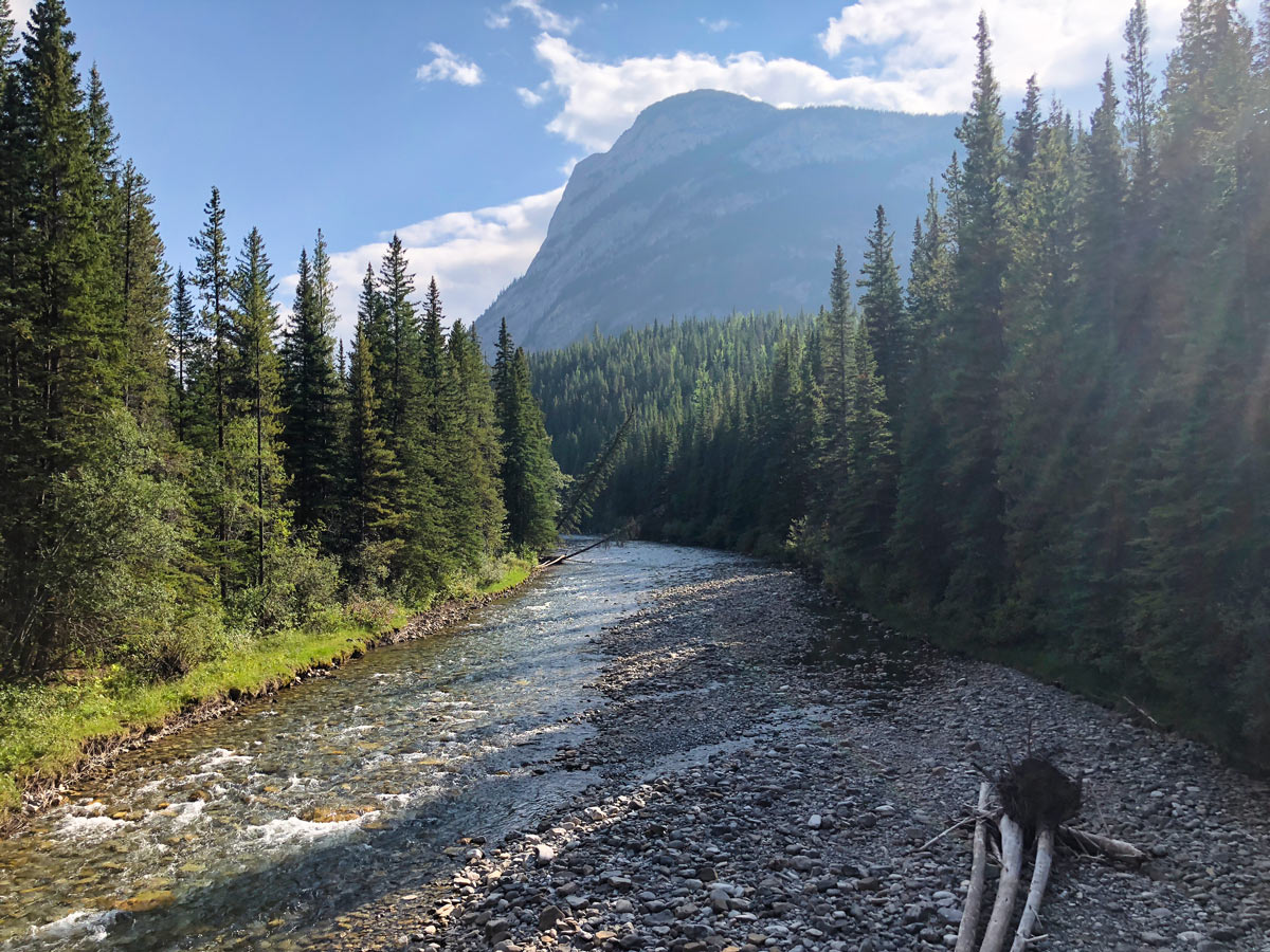
Set out from Galatea Parking Lot on the clear path that goes initially downhill before crossing a bridge over the Kananaskis River.
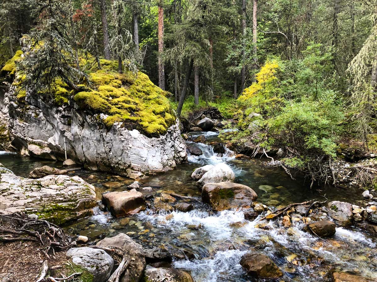
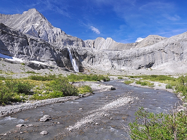
The trail then goes up the Galatea Valley, following Galatea Creek, over which you will cross and re-cross several times.
Along the way, you get some pretty river views, however most of this first section is through the forest.
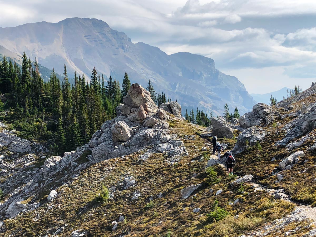
1.8mi from the car, the path will split. Take the right-hand branch and go up and away from Galatea Creek.
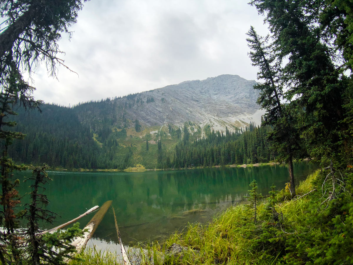
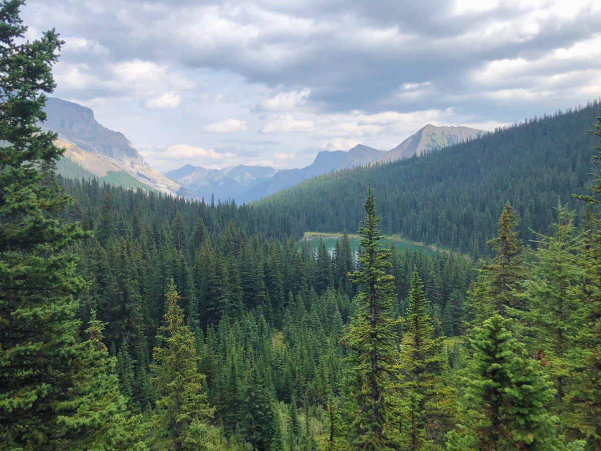
You reach the tip of Lillian Lake after anywhere from 1.5-2 hours. The hike is roughly 3.9mi while gaining 1969ft. If you aren’t a regular hiker, expect this to take a bit longer.
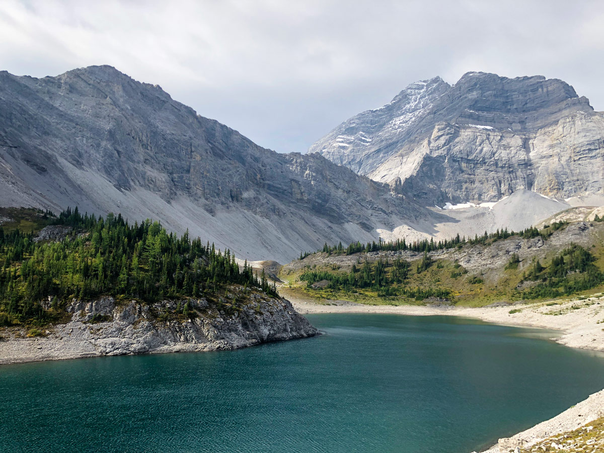
Lillian Lake is a pretty lake, and many hikers stop here. There are some nice benches along Lillian Lake, as well as the Lillian Lake Backcountry Campground, which has 17 campsites, a group fire pit and toilets.
If you started early, it may make sense to make a quick trip up to Galatea Lakes or Guinn’s Pass. We normally start the trip into Lillian Lake after work, so leave the nearby day hikes for Day 2.
Day 2
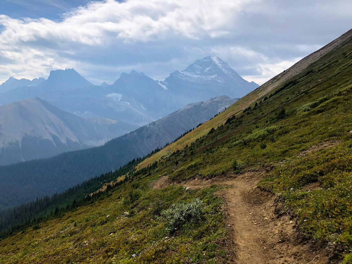
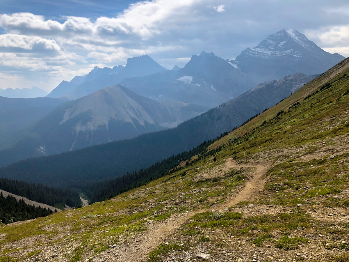
The daytrips today are spectacular! The views from Guinn’s Pass and Galatea Lakes are very special. Starting early means you get to them before day hikers arrive. Today’s route is roughly 4.5mi, with 1804ft of elevation gain.
From Lillian Lake, the path to Galatea Lakes is a bit tricky. Go through the campground and follow the signs to the washroom. You will soon see the signs pointing the direction to Galatea Lakes or Guinn’s Pass.
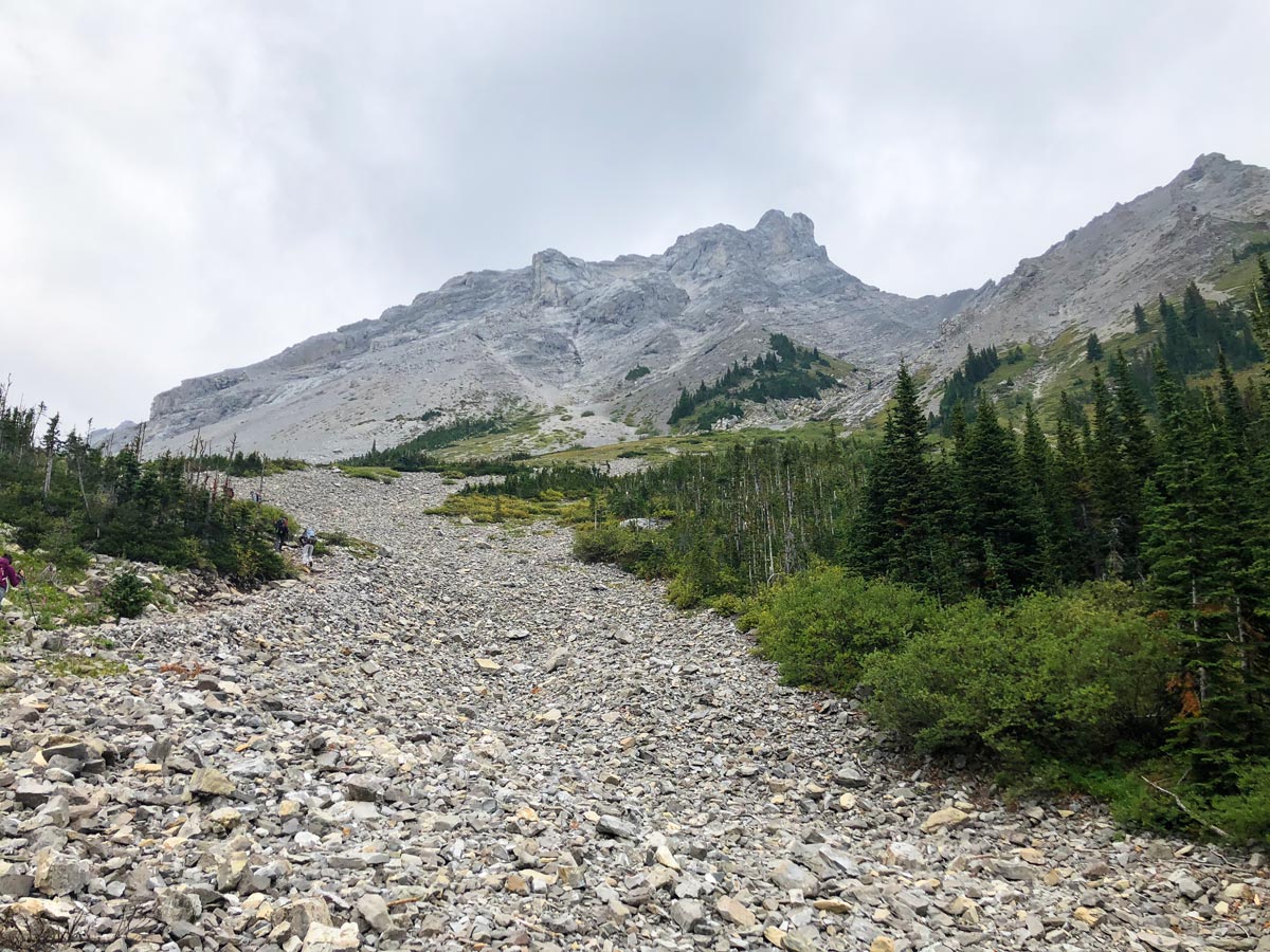
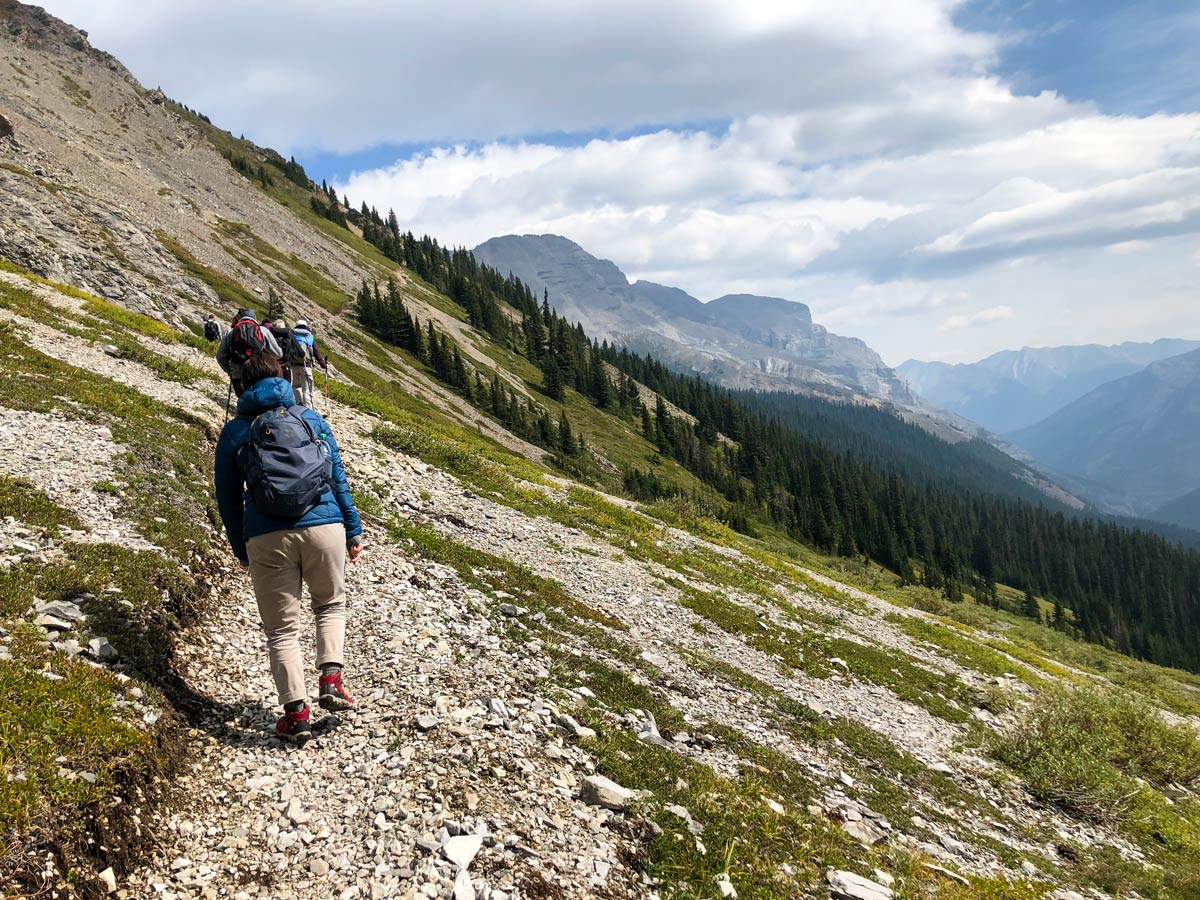
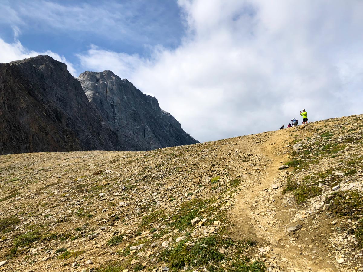
The route to Lower Galatea Lake and Guinn’s Pass starts off on the same trail. Follow this narrow path through tall brush, which is at times steep. Once you come out of the trees you continue going up, now over rocks.
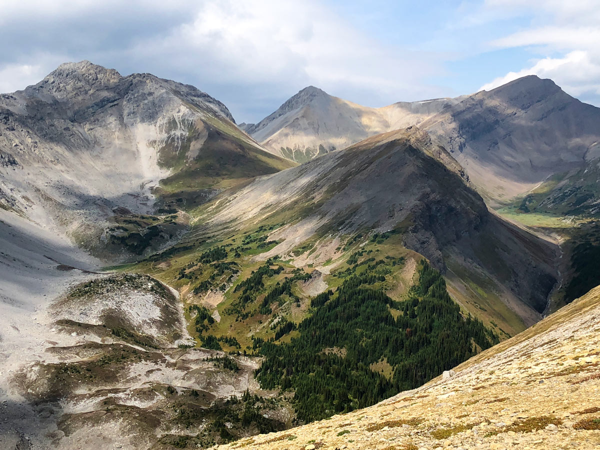
You soon come to a junction, where those wanting to explore Lower and Upper Galatea Lakes go to the left. Guinn’s Pass (1.9mi return, 787ft of elevation gain) goes up to the right.
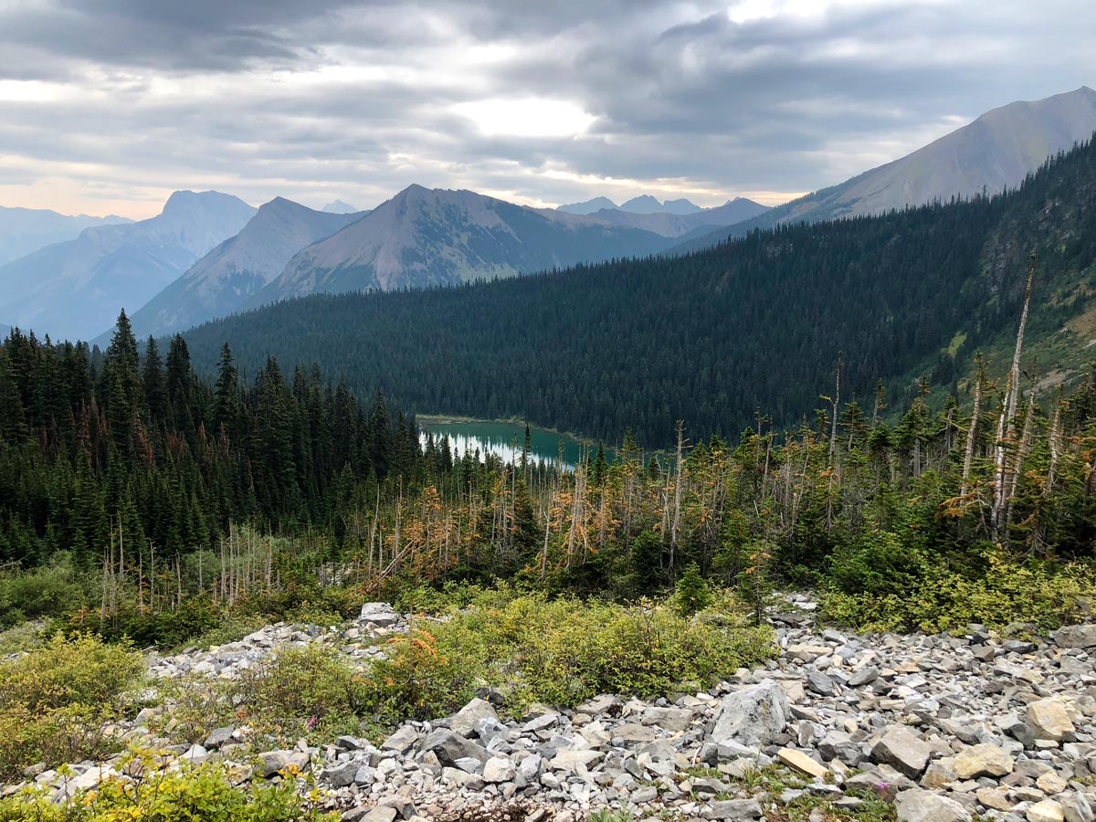
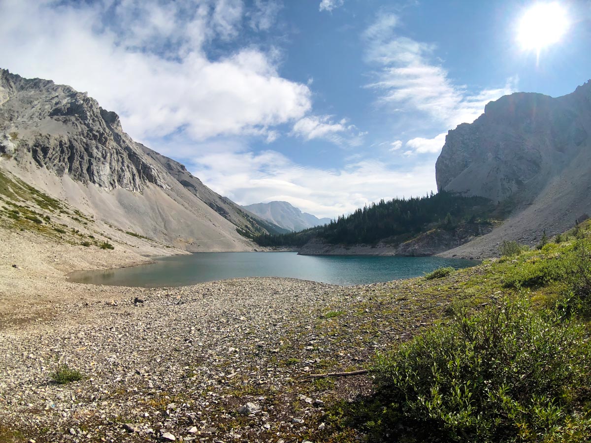
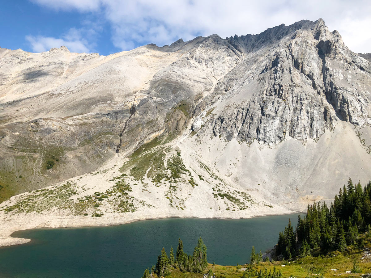
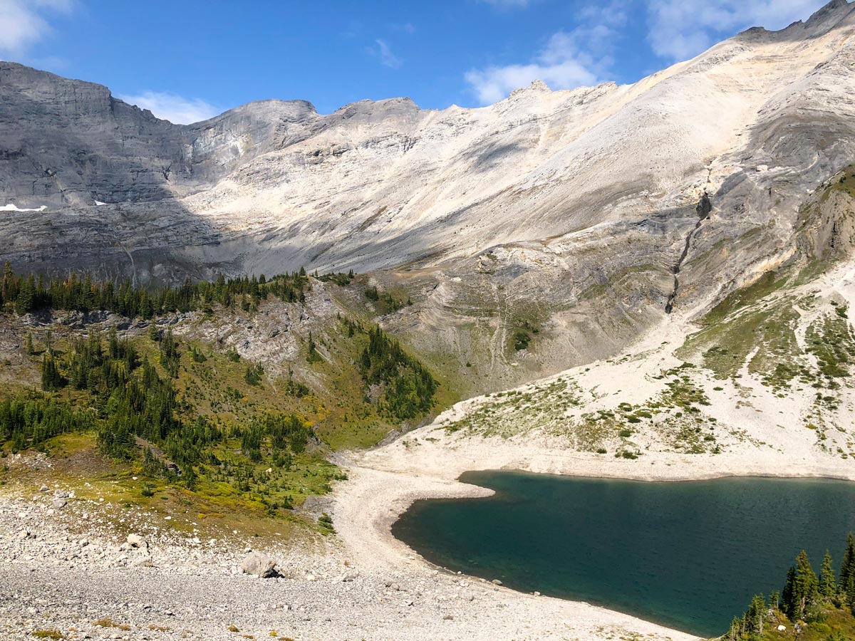
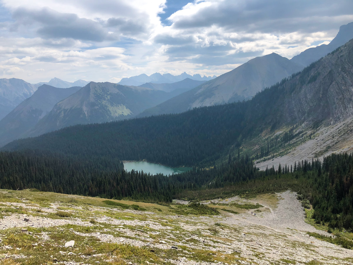
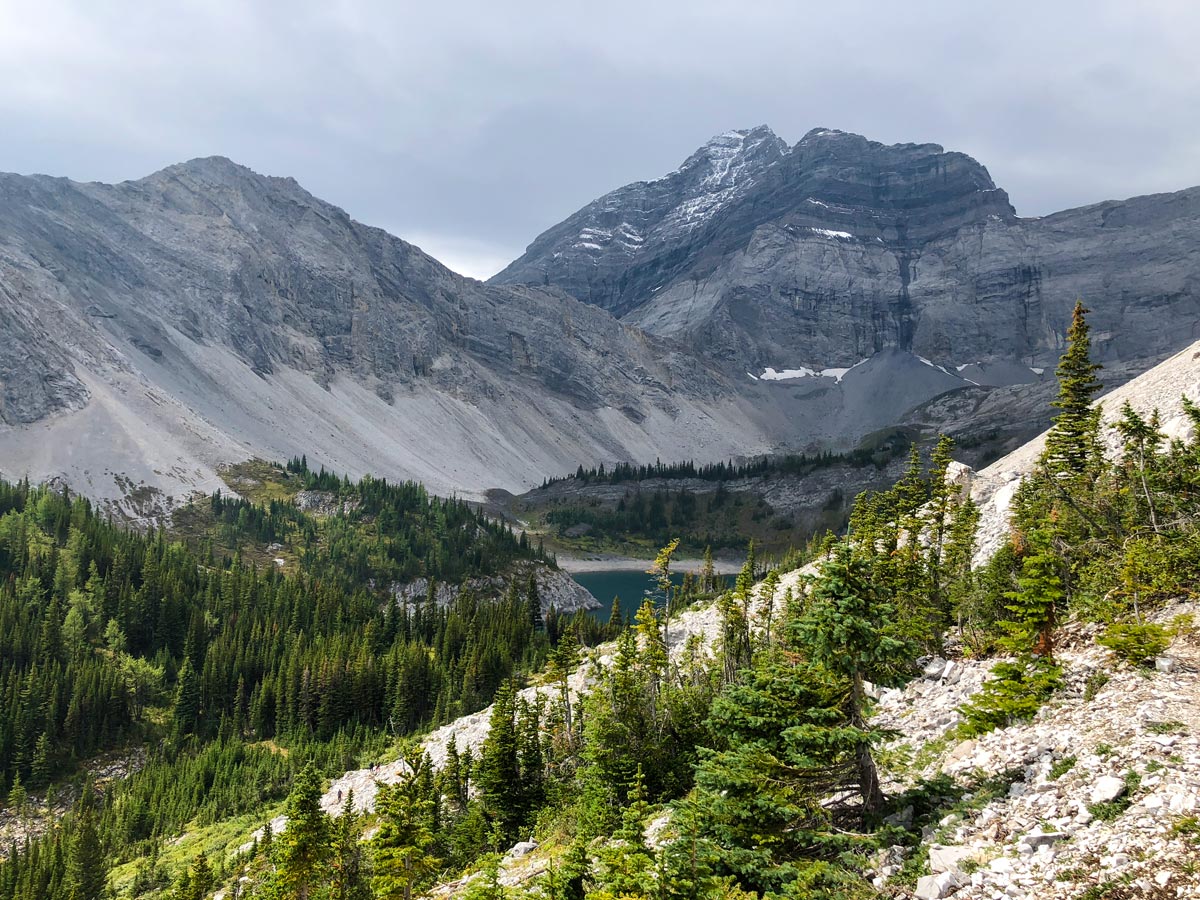
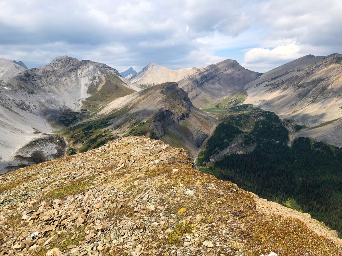
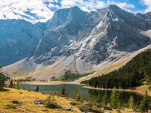
You can go either way you want, for this description go to Galatea Lakes first. Go left here and you very quickly come over a ridge and look down on Lower Galatea Lake. Follow the path here as it goes around the right-hand side of Lower Galatea Lake before going around the back of Lower Galatea Lake. The views along this part of the hike are spectacular.
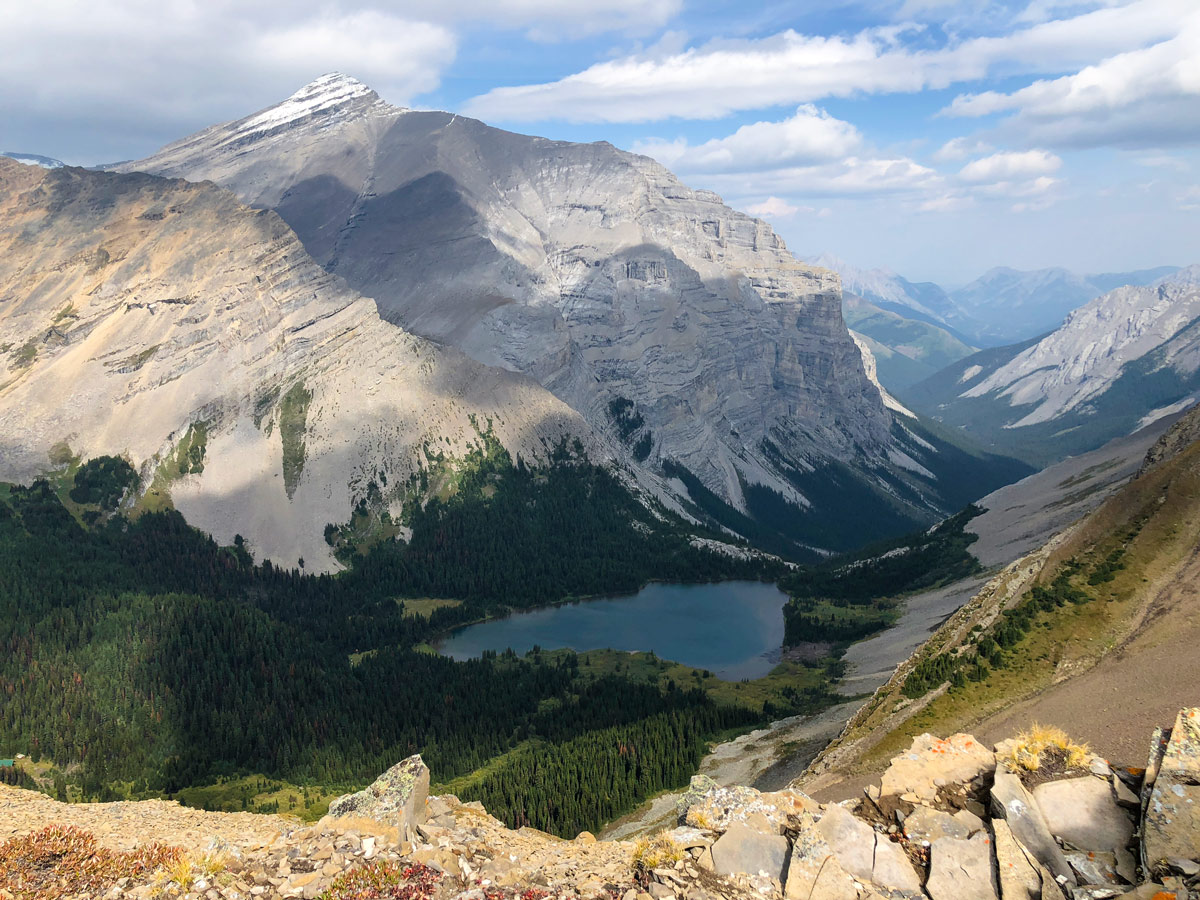
Once at the far-end of Lower Galatea Lake you hike up a short section and go right to see Upper Galatea Lake. You can hike a short distance on the right-hand side of Upper Galatea Lake.
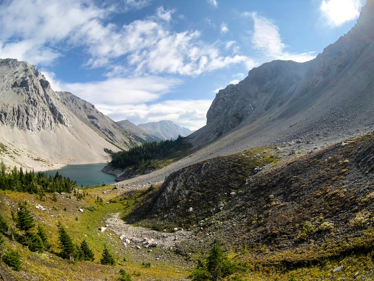
From Upper Galatea Lake, the easiest option is to return the way you came back to Lower Galatea Lake and then down to Lillian Lake.
There is also a path that continues around Lower Galatea Lake, which is shown on our map. To go around Lower Galatea Lake, take the clear path that goes around the right-hand side of the lake. When you reach the end of Lower Galatea Lake, look on your left for a path that goes through the trees. This path will take you to the junction that goes up to Guinn’s Pass. It’s very easy to miss this path, which we did, and is shown on our map.
If you miss the turn, then the route down is a very steep and loose trail. The route looks like it goes down all the way to Lillian Lake, however we went left partway down the descent and bushwhacked 656ft through the forest back to the main trail. We’d recommend against our route, though it is possible. If you make it all the back to Lillian Lake let us know!
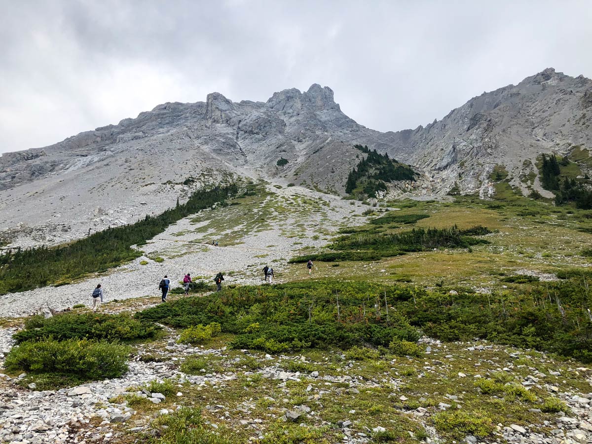
If you get back to the junction with Guinn’s Pass, take that route. The path is 0.9mi long, and gains 787ft on the way to Guinn’s Pass.
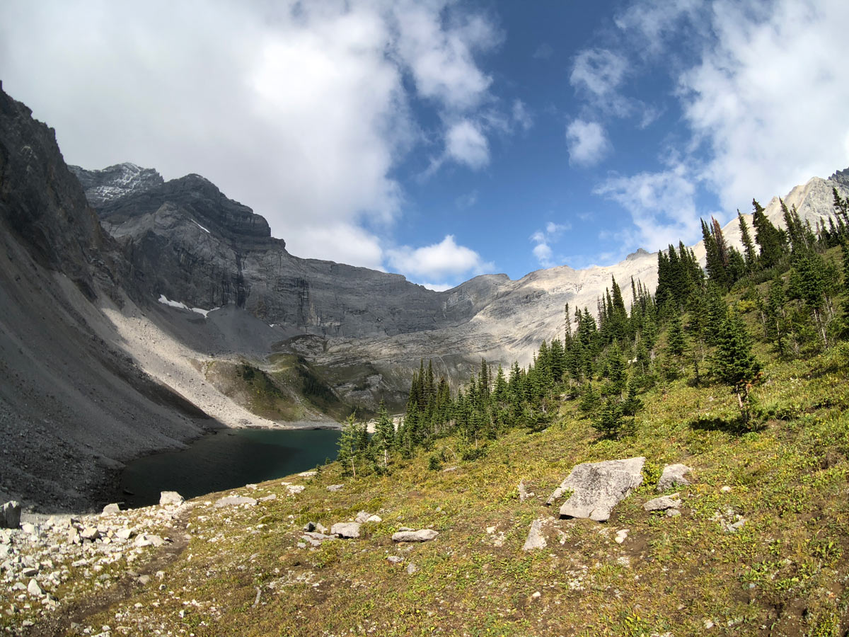
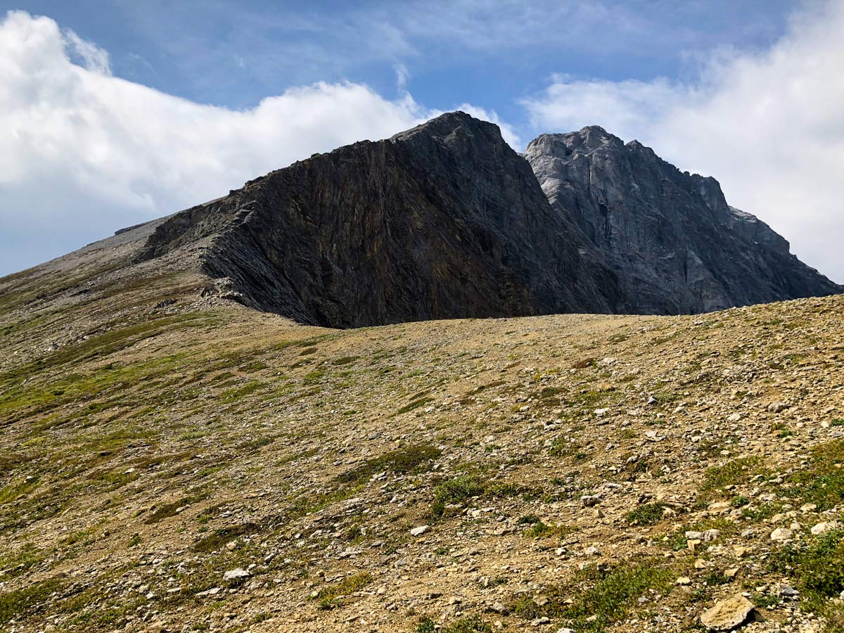
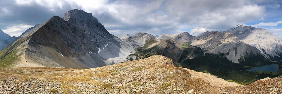
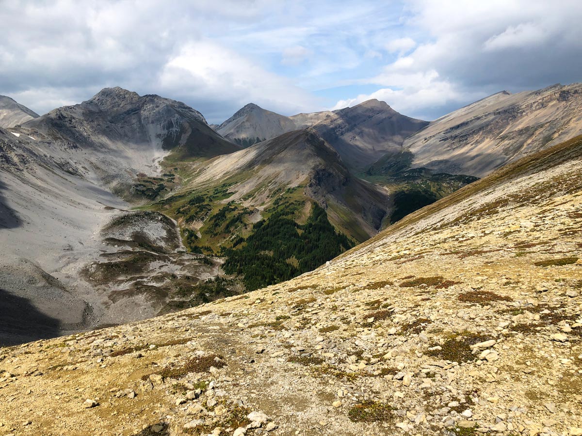
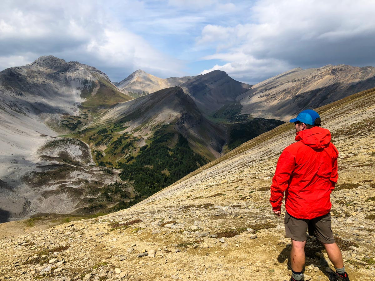
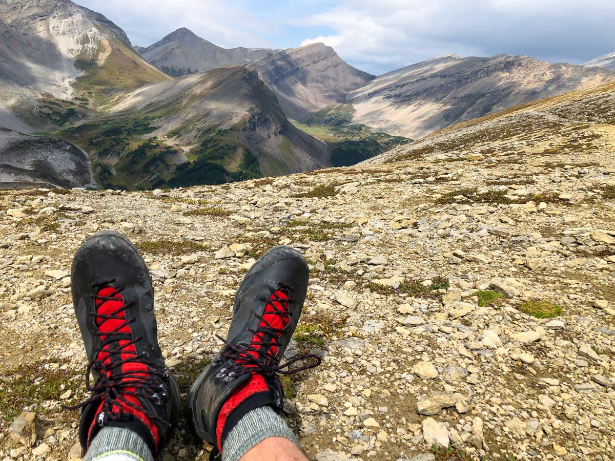
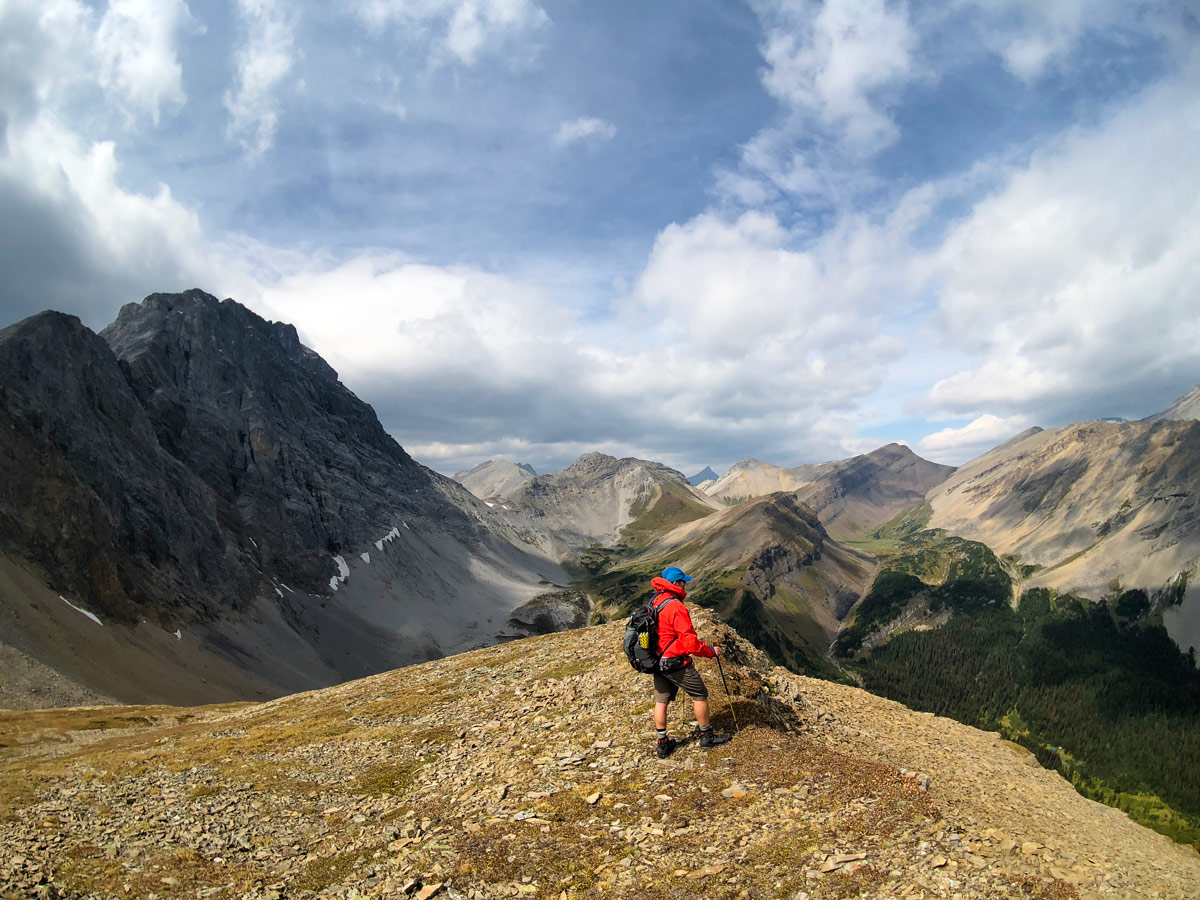
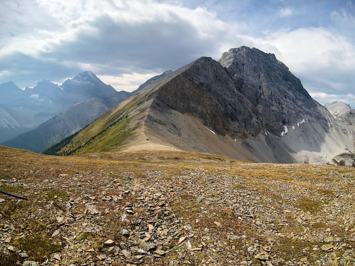
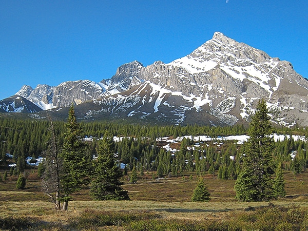
Once at Guinn’s Pass, the views are spectacular, looking across at a pretty high alpine meadow and peaks all around you. Many backpackers will continue over Guinn’s Pass down to Ribbon Lake Backcountry Camping site, roughly 2.1mi from Guinn’s Pass.
The only downside of the view from Guinn’s Pass is that you can’t see Ribbon Lake. To see Ribbon Lake, walk up Guinn’s Peak, a mountain to the right of Guinn’s Pass. You only have to hike for 820ft, during which time you’ll gain 230ft of elevation to get some incredible views. There is no trail up here, however the views are spectacular, and you can see the stunning greens of the valleys surrounding Ribbon Lake.
Return back to the junction and down to Lillian Lake.
Another option for Day 2 would be to backpack to Ribbon Lake Backcountry Campground, which is 1.4mi from Guinn’s Pass, and involves descending 1083ft, after gaining 787ft to the pass. There are 20 campsites, pit toilets and firepits
Day 3
Today is an easy 3.9mi hike back to the Galatea parking lot, retracing your steps from Day 1.
If you are starting at Ribbon Lake campground and you want to return to the Galatea trailhead, you’ll need to hike 3.2mi with 1083ft of elevation gain and 1444ft of elevation loss over Guinn’s Pass back to Lillian Lake.
If you are at Ribbon Lake, you could also go out via the Ribbon Creek trail, however you would need a car shuttle as you’d end up at Ribbon Creek parking lot near Nakiska. Going out via Ribbon Creek also has chains, which you need to use to get past one tricky section. Some people find the chains easy, others find them terrifying, it depends on your comfort with exposure. Going down with a full-pack is definitely a different experience to going up with a daypack.
Insider Hints
Book your campsite early if you want to go on weekends.
You could make a wonderful linear hike on Day 2 by hiking to either Ribbon Lake Backcountry Campground or Ribbon Creek Backcountry Campground. That would make your Day 3 roughly 6.8mi with 1926ft of elevation loss from Ribbon Lake or 5.7mi and 1017ft of elevation loss from Ribbon Creek. Note that there are some daunting chains between Ribbon Lake and Ribbon Creek, which are not good if you don’t like exposure. Down climbing with a heavy backpack, they are much more difficult. You’d also need to arrange a car shuttle.

Similar backpacking trails to the Lillian and Galatea Lakes backpacking trail
Elk Lakes and Petain Basin
Petain Basin, just past Elk Lakes, is a wonderfully remote and isolated meadow lying at the base of some of…
Rae Lake
Rae Lake is often completed as a day-hike, however it is a great place for a quick backpacking trip. Lying…
Big Elbow Loop
The Big Elbow Loop trip is a classic Kananaskis backpacking trip. This is an easy trip that takes you into…
JohnCan 4 years ago
we were really looking to this trip, now my kids wants to go back again. Checking my schedules!
Luna M. 4 years ago
It's hard to know where to look at because the scenery's stunning from every angle.
Lisa B 5 years ago
The backpack trip to Liliian and Galatea Lakes is so accessible and so close, its definitely a weekend classic, as long as you remember to book your campsites