Tonquin Valley backpacking trail
View Photos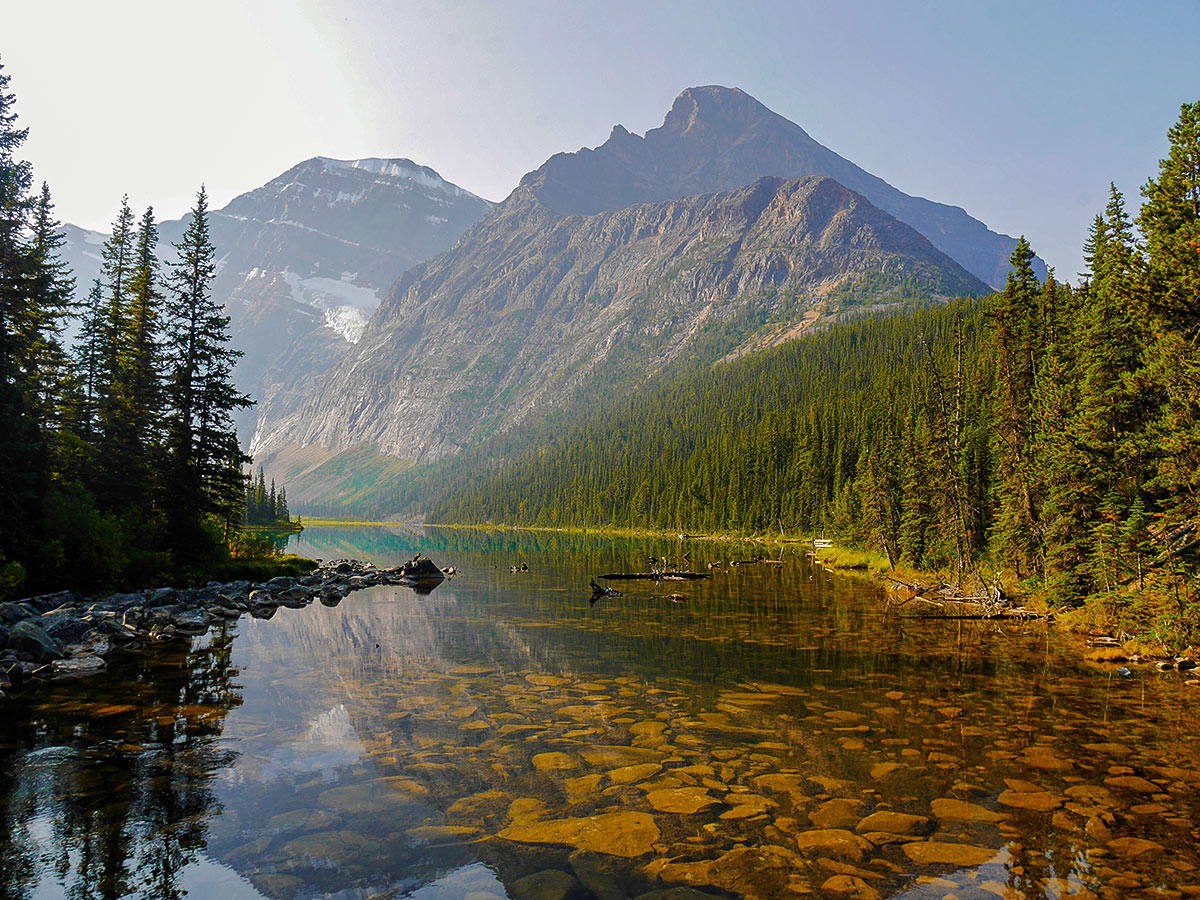
Tonquin Valley backpacking trail
Difficulty Rating:
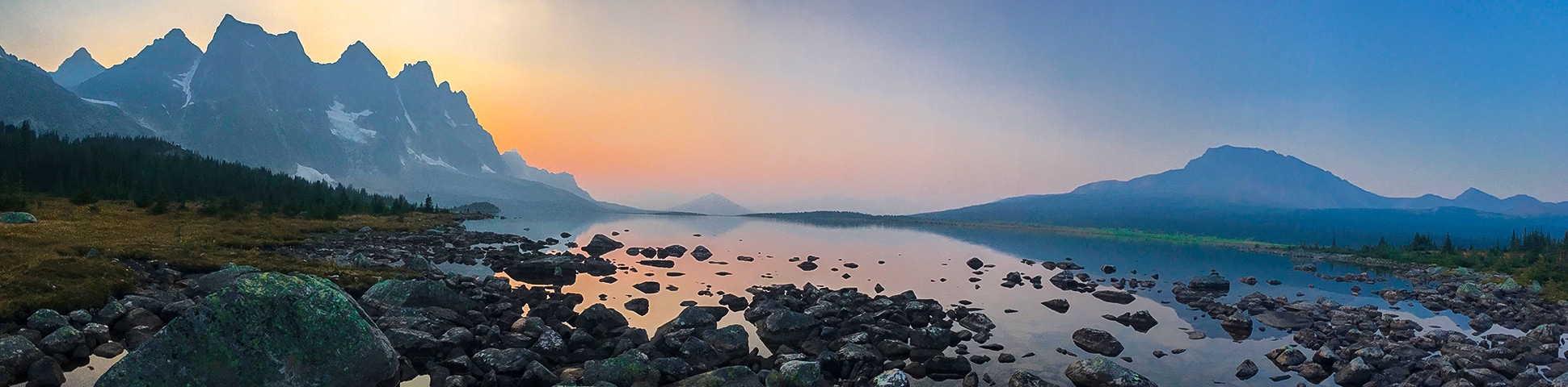
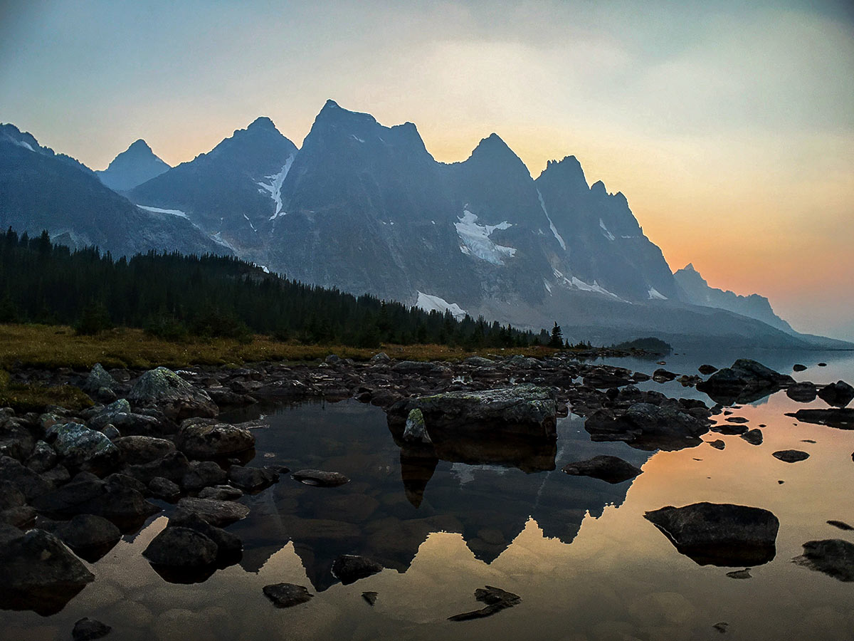
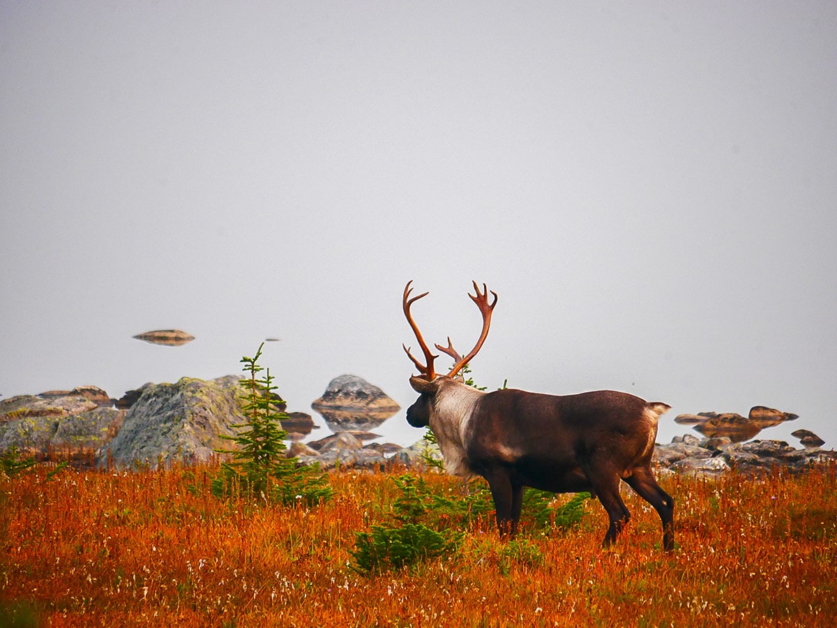
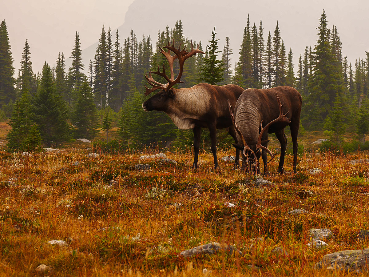
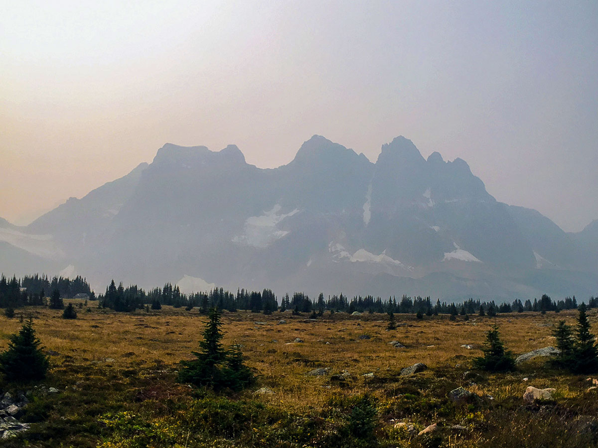
The Tonquin Valley is a backpacking paradise. The prize of the trip is the Ramparts, a series of 10 castellated peaks atop a 3281ft wall of limestone, reflected in the connected Amethyst Lakes. It is also one of the few remaining areas where it is still common to see the shy and elusive mountain caribou, an endangered species.
Getting there
This route requires a car shuttle to be done best. We prefer starting at the Edith Cavell Hostel and finishing at the Portal trailhead. To get to the Edith Cavell Hostel, from the town Jasper take the route 93 south for approximately 7.5mi, then turn right onto Mount Edith Cavell Rd. This road is extremely narrow and prohibits large camper vans and trailers. Continue along this road to the Edith Cavell Hostel, and park across the street at the Tonquin Valley/Astoria River Trailhead.

About
| Re-supply points | None |
| When to do | Summer or winter outside of seasonal closures |
| Mountain Huts | Wates-Gibson Hut, Tonquin Valley Backcountry lodge, and Tonquin Valley Adventures Lodge |
| Backcountry Campsites | Yes |
| Toilets | Trailheads, and all campgrounds |
| Pets allowed | No |
| Accommodation Type | Tent |
| Family friendly | Older Children only |
| Route Signage | Average |
| Crowd Levels | Moderate |
| Route Type | One Way |
Tonquin Valley
Elevation Graph
Weather
Route Description for Tonquin Valley
The Tonquin Valley backpacking trip can be completed in three days, but many prefer to stay longer, allowing time for day trips to the Eremite Valley and Moat Lake.
The Tonquin Valley is also unique as there are three options to do backpack in the Tonquin Valley without a tent. You can also stay in the ACC Wates-Gibson Hut or one of the more luxurious, full-service lodges: Tonquin Valley Backcountry lodge, or Tonquin Valley Adventures Lodge. If you want to tent, you need to book your campsite with Parks Canada, and do so when reservations open in January each year.
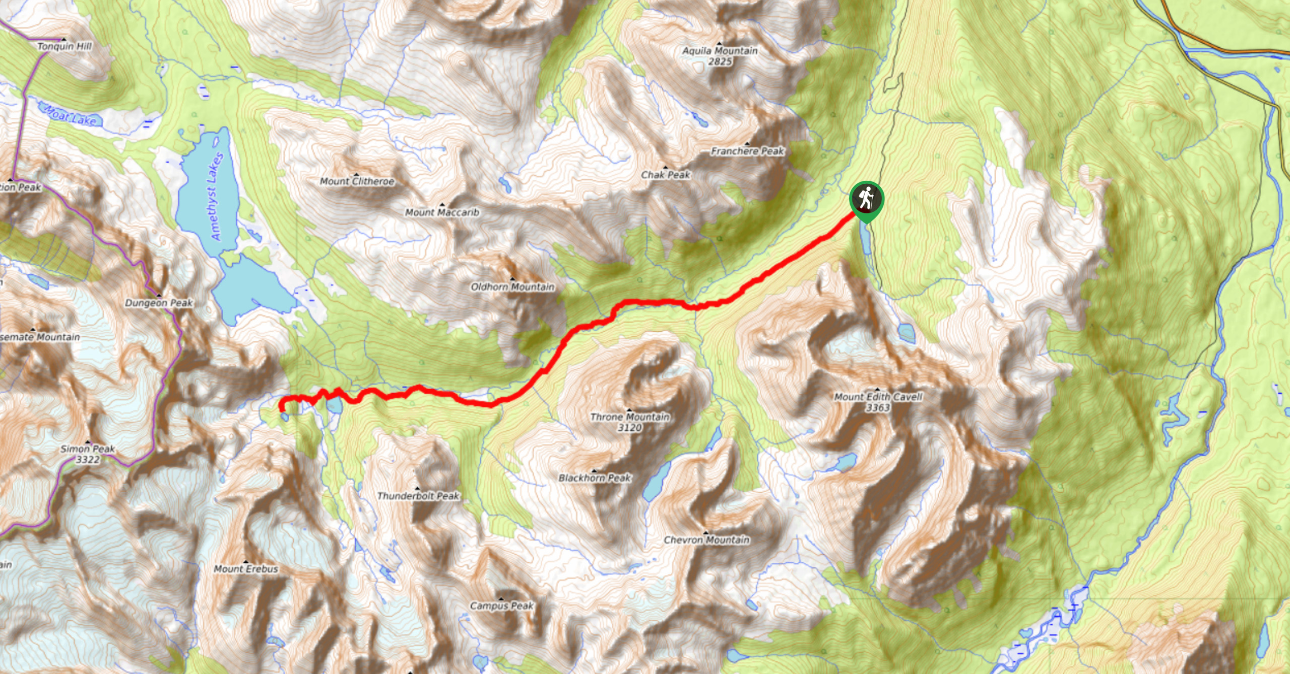
There are two points of access to the Tonquin Valley; the Astoria Trailhead, located next to the Mt Edith Cavell Wilderness Hostel, and the Portal Trailhead. We suggest having a car at either end and doing this as a one-way trip.
You can do this trip either way, but we prefer (and describe the route) starting at the Astoria trailhead. This trail leads along the Astoria River, reaching a junction, which heads directly into the Tonquin Valley, or into the Eremite Valley where you will find the Wates-Gibson Hut, operated by the Alpine Club of Canada. From the Portal Trailhead, located on the Marmot Basin Road, hikers will travel along Portal Creek to Maccarib Pass. It is a slightly longer approach with more elevation gain. You can complete the full horseshoe “loop” by leaving a car at either trailhead.
Day 1
Starting at the Astoria Trailhead, you will travel 11.8mi, over 6-8 hours to Surprise Point Campground. The trail will gain roughly 1640ft and descend 820ft along the way.
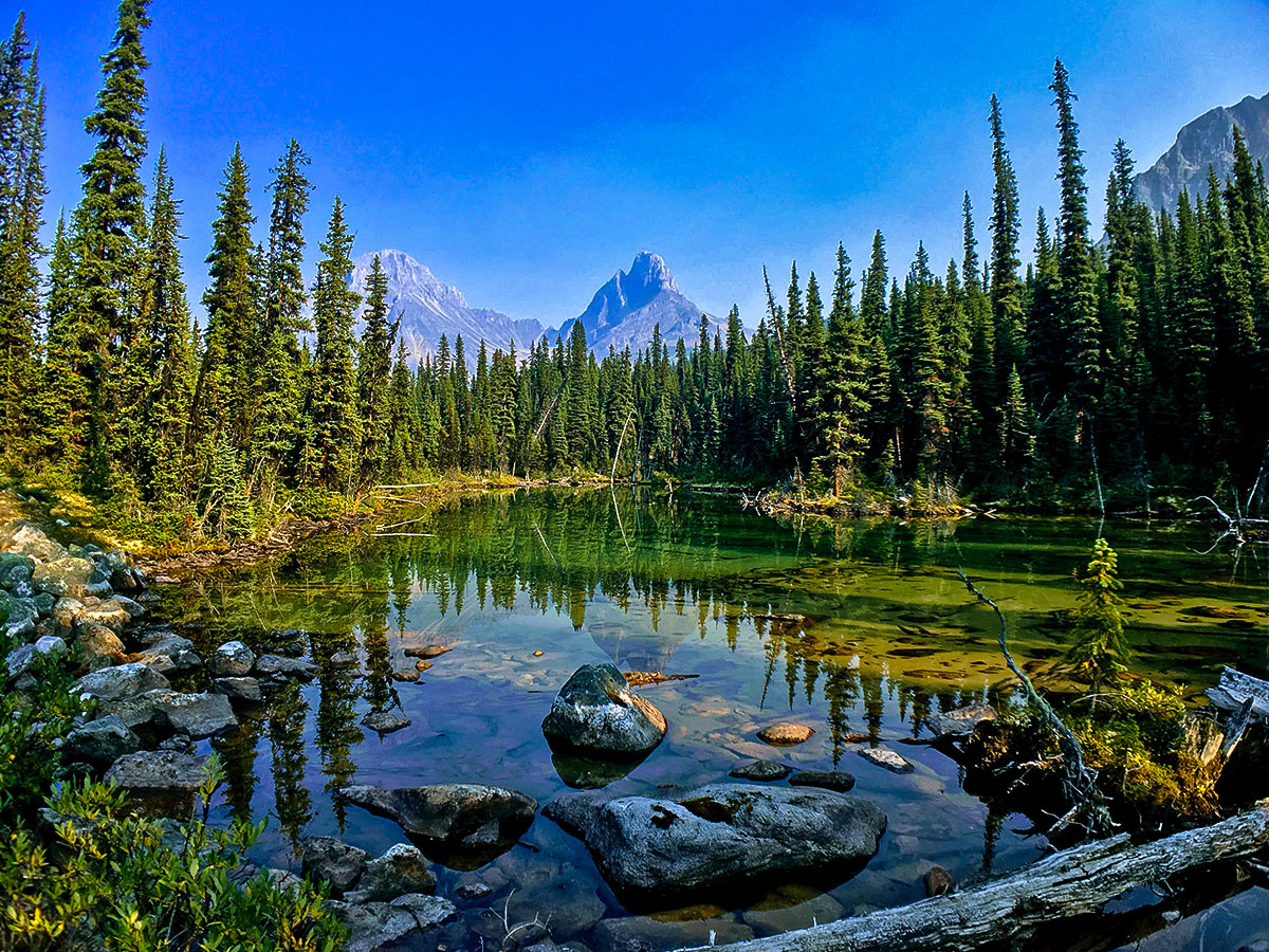
The trail starts by descending to a bridge over the outlet of Cavell Lake with a stunning view of the 11033ft Mt Edith Cavell. The next 5.1mi are an easy, and relatively flat walk on a wide, smooth path along the Astoria River. At 4.2mi you pass the Astoria campground.
In another 0.9mi you will reach a junction. You can go right and continue on the north side of the river, taking a series of steep switchbacks gaining 1312ft towards Switchback campground.
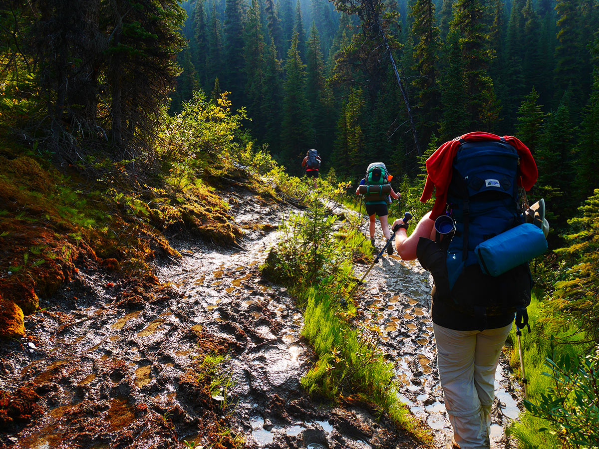
We prefer going left and crossing over to the south side of the Astoria River and following the trail that goes towards the Wates-Gibson Hut. This trail is narrow, muddy, and rooty, crossing streams and boulder fields. This will take longer than the north side. You will reach Chrome Lake roughly 4.0mi from the bridge.
Take a short break at Chrome Lake before continuing on the trail as it leaves the lake and comes to a junction. You can go left for a 0.6mi hike to the ACC Wates-Gibson hut or go right for the 1.1mi ascent to Surprise Point Campground.
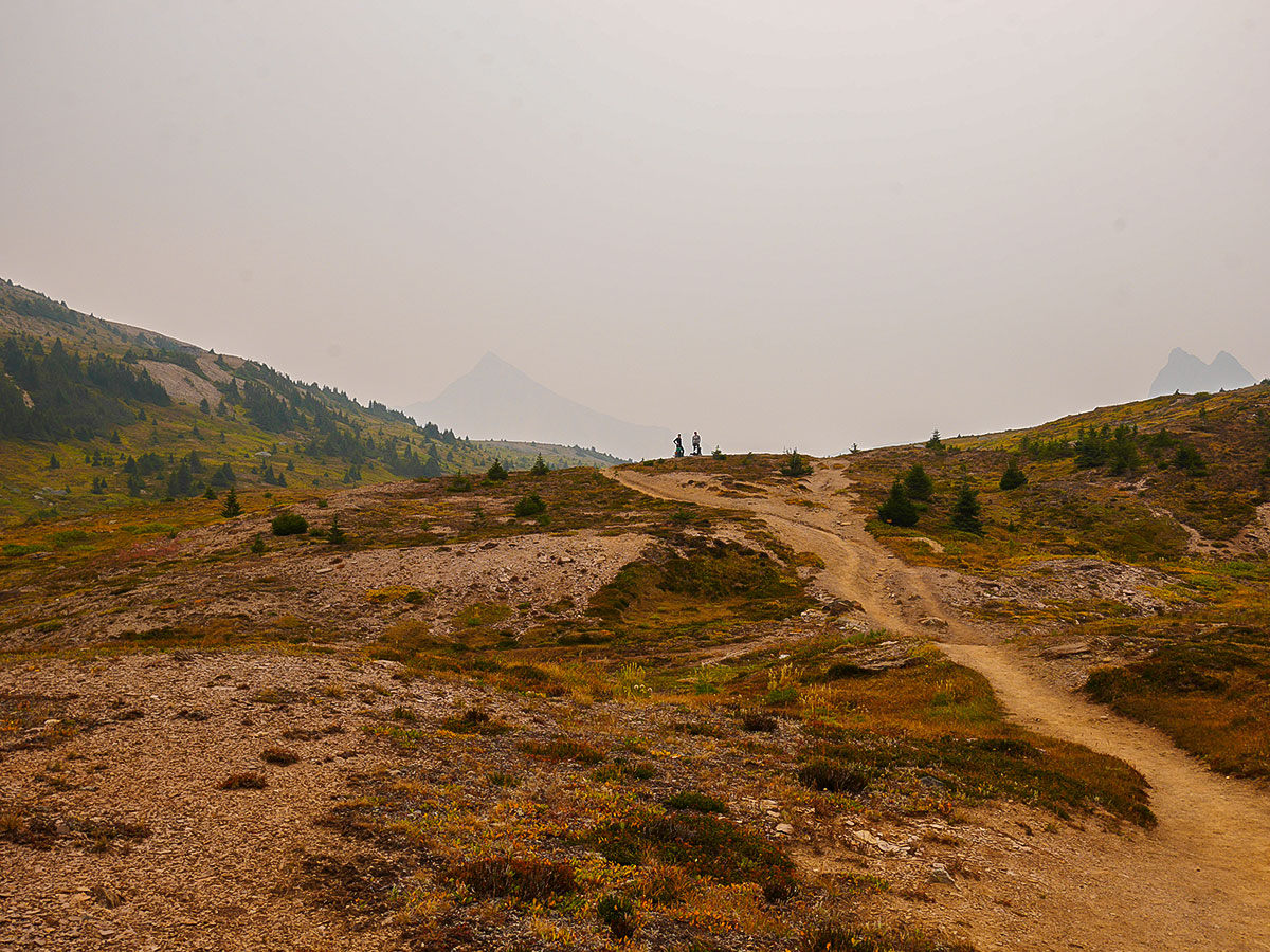
Once at the Surprise Point Campground, take the short trail past the tent pads to the southern tip of Amethyst Lakes for stunning views of the Ramparts. The wet meadows around Amethyst Lakes are prime habitat for caribou, grizzly bears and moose, so keep your senses alert.
Day 2
Day 2 is a much easier day, going from Surprise Point Campground to Maccarib Campground, covering only 5.6mi and 328ft of elevation. Allow 3- 4 hours to take a lot of time to soak in the views and relax along the route.
Follow the trail leading north away from the picnic tables of Surprise Point Campground, crossing a large, wet meadow. Tall metal markers point the way, used more by ski tourers in the winter. The trail passes the Parks Canada Warden Cabin and shortly thereafter, the Clitheroe Campground, roughly 1.4mi from the Surprise Point Campground. The Clitheroe Campground is also just before your highest point of the day.
The trail descends back down to the wet meadows in front of Amethyst Lakes, while the next few kilometres are flat, glorious hiking with The Ramparts looming over your left side. Across the lake you can see six different glaciers adorning the peaks in view.
The trail branches left to the Tonquin Valley Adventures Lodge, and then in another 0.7mi reaches Amethyst Campground. The Amethyst Campground is perhaps the most central to use as a base for day hikes, and tends to be the most fully booked. Amethyst Campground is also pretty much the midpoint for the route, and people who want to do the trip in 2-days will aim to get a night at Amethyst, as it’s 12.7mi from the Cavell Trailhead and 14.2mi to the Portal Trailhead.
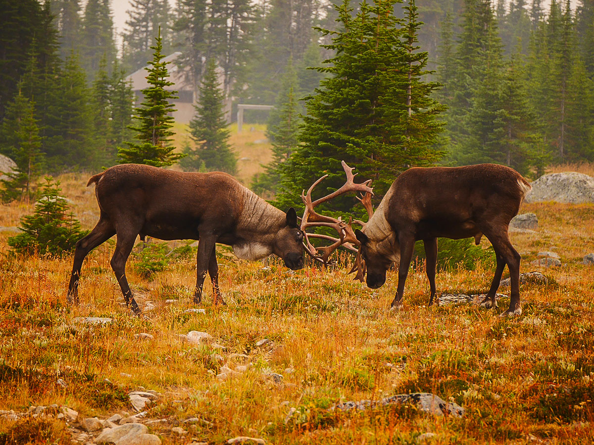
Comments in the Parks Canada visitor book indicates that herds of caribou are a common sight in the early morning around Amethyst Lake and the campground. On a recent trip we saw two male caribou practicing their battle skills less than 328ft from our trail. If you don’t manage to spot these elusive animals, watch for their large, round, two toed tracks in the muddy sections of trail.
Continue for 1.6mi past Amethyst, where you reach the Moat Lake junction. The trail to the left takes you to Tonquin Valley Adventures Lodge and the Twin Passes of Moat and Tonquin, straddling the Alberta-BC border. You can take a 0.9mi trail to go and see this lodge, and there is a trail that is roughly 1.2mi to Moat Lake as well. This is a good daytrip on a short-day.
If you don’t go explore the lodge or Moat Lake, then continue straight at the Moat Lake Junction and hike another 0.6mi, where you cross the bridge over Maccarib Creek. Many braided trails lead down from the campground to the creek, the easiest is to follow the creek until you see a bear hang.
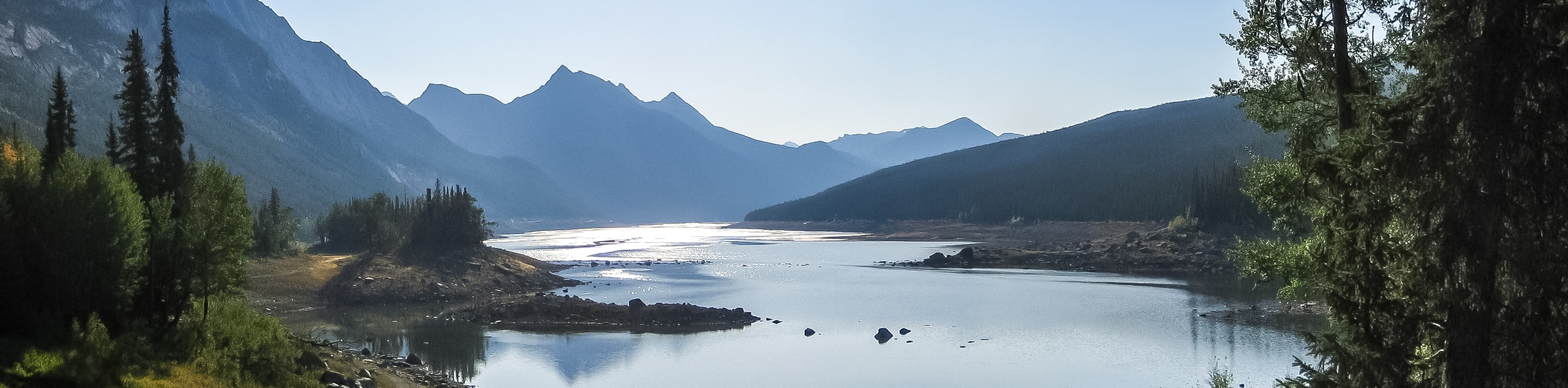
Maccarib Campground has another, more distant but no less spectacular view of the Ramparts. Just north of the campground is the grave of park warden Percy Goodair, who died just outside the door of a warden cabin here in the 1920’s. Maccarib is the Quinnipiac word for “caribou”.
Day 3
Return to the bridge across Maccarib Creek and turn left, heading up the Maccarib Valley. The third day is the longest, 11.9mi with 1339ft total elevation gain, and 3094ft elevation loss. Allow 6 – 8 hours for this section.
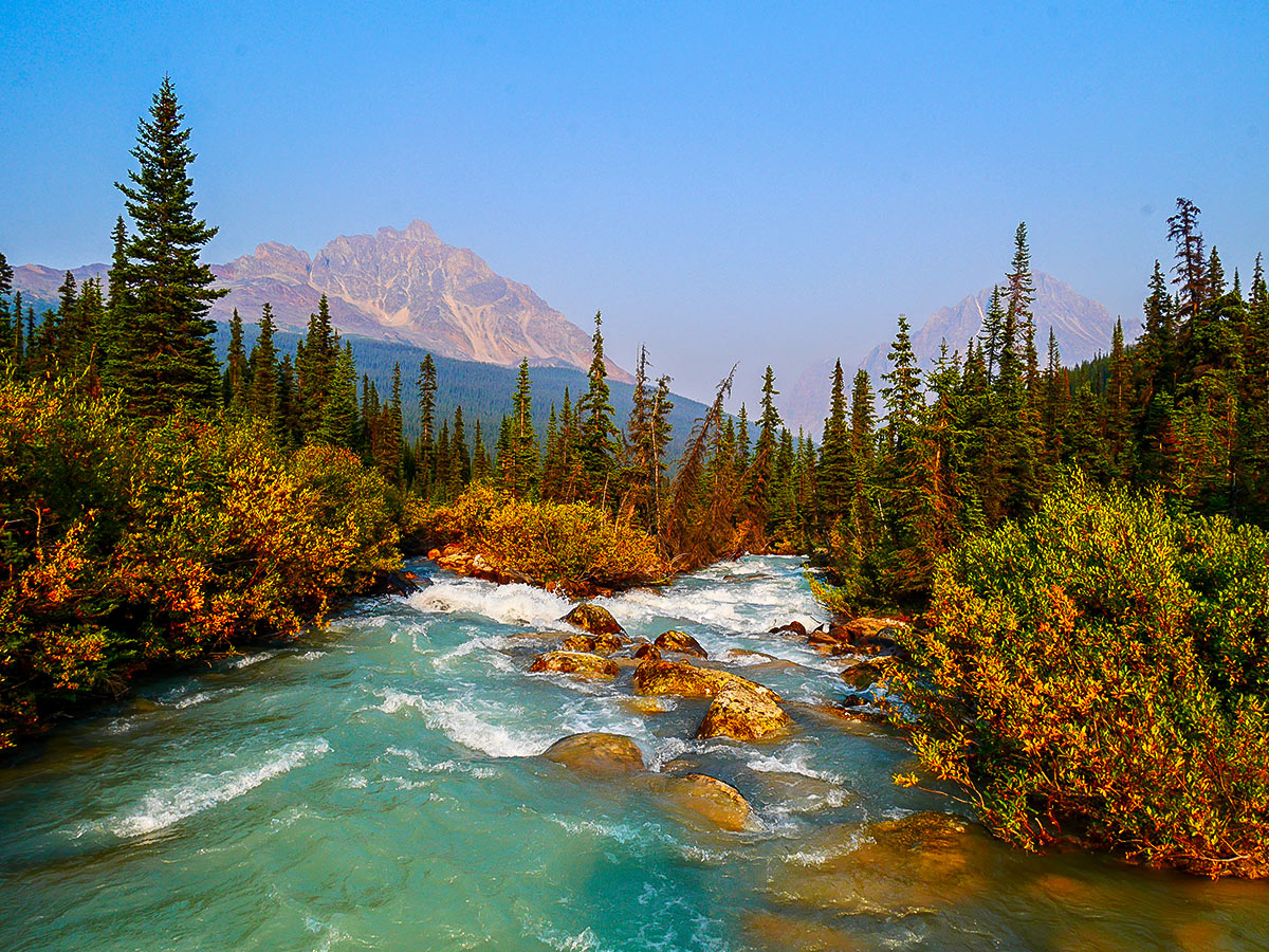
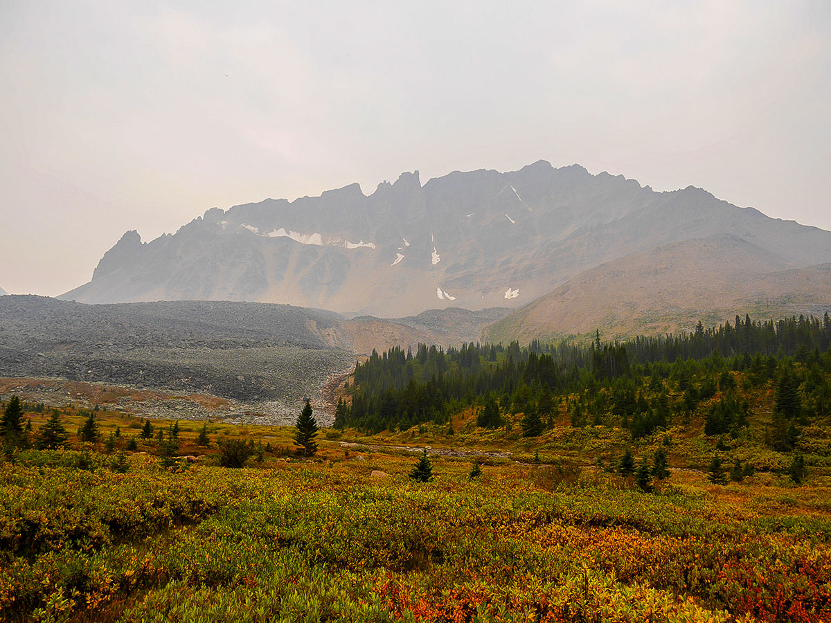
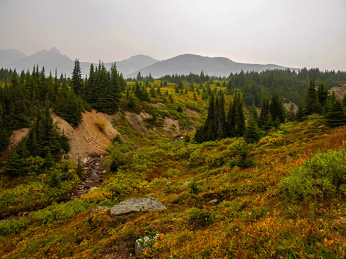
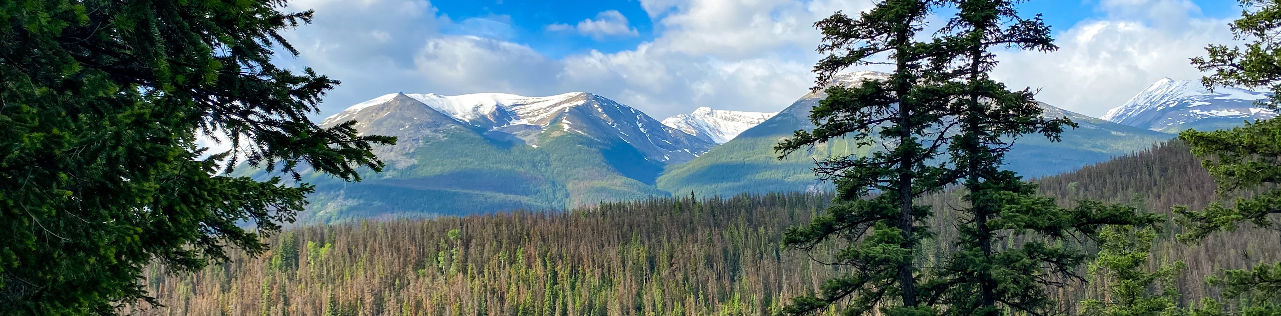
The trail winds along the valley bottom, crossing the gravelly, shifting creek bed several times. Frequent horse traffic has meant the trail has been realigned and rehabilitated several times. To your right is Mount Clitheroe and Mount Maccarib, to the left is the much higher peak of Majestic Mountain.
The route gently ascends 656ft to Maccarib Pass over 4.4mi from the campground. The pass itself is comprised of 1.2mi of tundra between Maccarib Creek and Portal Creek, an excellent spot for wildflowers in mid-summer. Continue down the steep, switch-backing trail (carefully in wet weather, when the mud is slick) to Portal Campground.
At your halfway point for the day, the trail ascends up the left side of the valley through a wide avalanche path. It then traverses the flank of Pevril Peak, allowing for spectacular views in both directions. Endangered white bark pines are common here – you may see marking tape or even bags over some branches, designed to catch and protect the seeds. The rest of the hike is a steady downhill, descending back into the trees alongside Portal Creek.
When you finally cross the bridge from the north side of the creek to the south, the end of your hike is only a few hundred meters away.
Make sure you have a car at the Portal Trailhead, or have arranged transportation, as very few cars are descending the Marmot Basin Road late in the day.
Congratulations, you’ve hiked 29.3mi and climbed over 3281ft in 3 days!
Sample Itinerary:
Note: Total GPS distance varies from each days distance due to side trips and slight route variations each day.
Day 1: Astoria Trailhead to Surprise Point Campground (11.8mi / 1624ft)
Day2: Surprise Point Campground to Maccarib Campground (5.6mi, 328ft)
Day 3 : Maccarib Campground to Portal Creek Trailhead (11.9mi, 1339ft)
Insider Hints
This area has a high amount of discrepancies in trail distance & elevations between various maps, guide books and official Parks Canada resources. In particular, the trail marker signs are very inaccurate (Maccarib Pass sign indicated its elevation to be 6749ft, while a Gem Trek map and our GPS both indicated it to be 7251ft) Take this into account when planning your days.
There are also many fairly well-established trails not indicated on Gem Trek maps (usually the most accurate and commonly available for the Rockies). Research side trips well beforehand.
If starting from the Astoria Trailhead, the Mt Edith Cavell Wilderness Hostel makes an excellent staging area a few steps from the start of your hike. Arrive a few hours early the night before, and drive up to the Mt Edith Cavell viewpoint. The Path of the Glacier Trail is a short interpretive walk to an excellent viewpoint of the mountain, Angel Glacier and the floating icebergs of Cavell Pond. If you have extra time, the Cavell Meadows hike is a short but steep 5.6mi loop through gorgeous wildflower meadows.
Bring bugspray, this route can get really buggy at certain times of the year.
If you are going to splurge, stay in Tonquin Valley Backcountry lodge, or Tonquin Valley Adventures Lodge for a wonderful, full-catered stay.
This route is best done with two cars, allowing you to park one car at each trailhead. The Portal Trailhead is just below Marmot Basin Ski Area.

Similar backpacking trails to the Tonquin Valley backpacking trail
Saturday Night Lake Loop Backpacking Trail
The Saturday Night Lake Loop is accessible from the town of Jasper and a great trip for beginners and families.…
Wates-Gibson Hut Backpacking Trail
The route to the Wates-Gibson hut covers the gorgeous southern section of the Tonquin Valley in Jasper. There is an…
Jacques Lake Backpacking Trail
Backpacking to Jacques Lake is a great way to find solitude without a lengthy mission. It is a short and…
MartiniC 4 years ago
The early morning view of the Amethyst Lake is so surreal. I'm glad I was able to capture some photographs.
JohnCan 4 years ago
One of the longest hike we have done as a family, I must say we are unbreakable after this journey!
bigfootJOE 5 years ago
This was a superb backpacking experience for me and my wife.
MountainPhoenix 5 years ago
Tonquin Valley backpacking trip was one of the most beautiful destinations I have ever been at.
SJ 5 years ago
Tonquinn Valley Backpack was one of the longer trips I have taken, but worth it for all the views!