Skyline backpacking trail
View Photos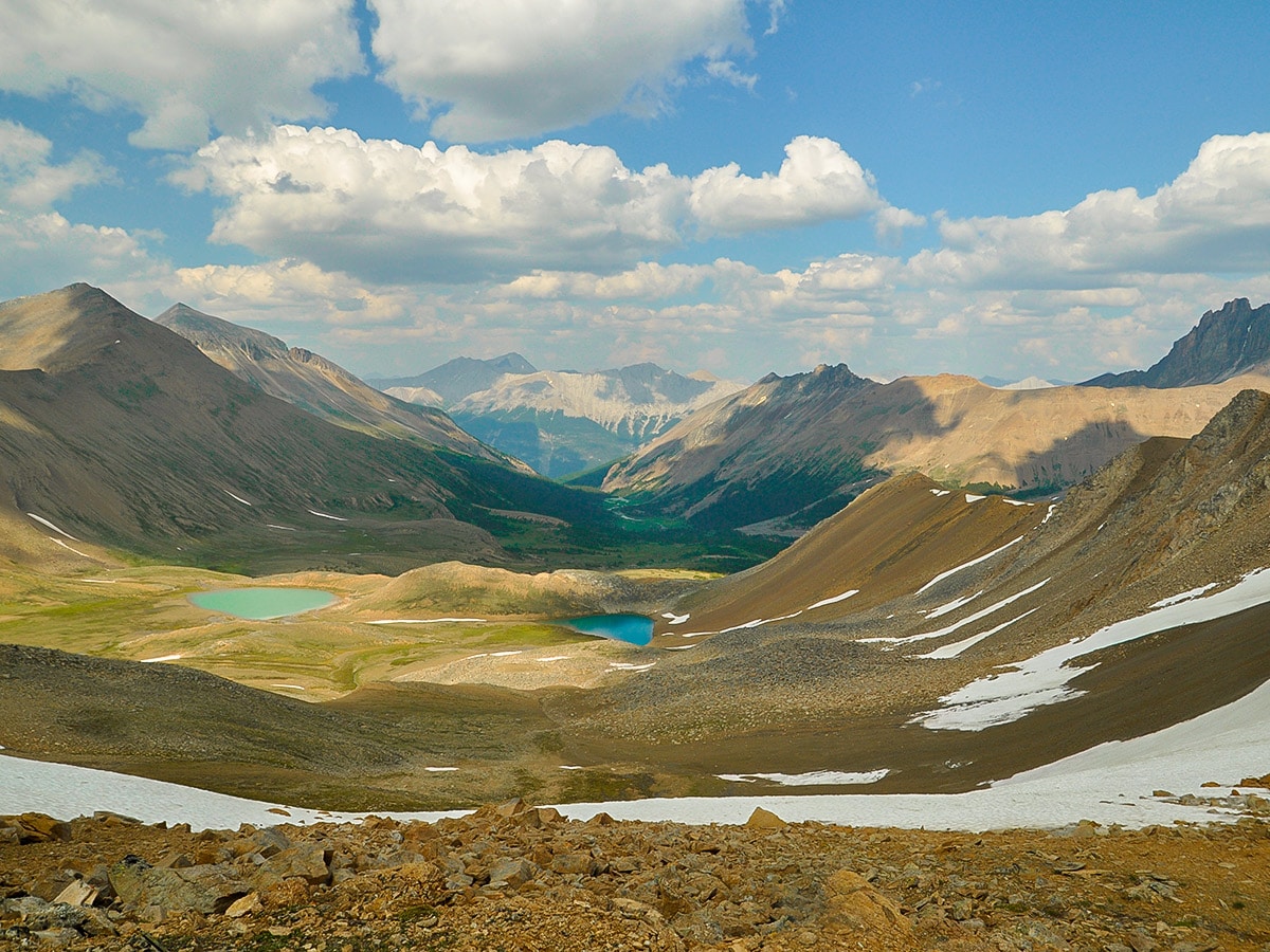
Skyline backpacking trail
Difficulty Rating:
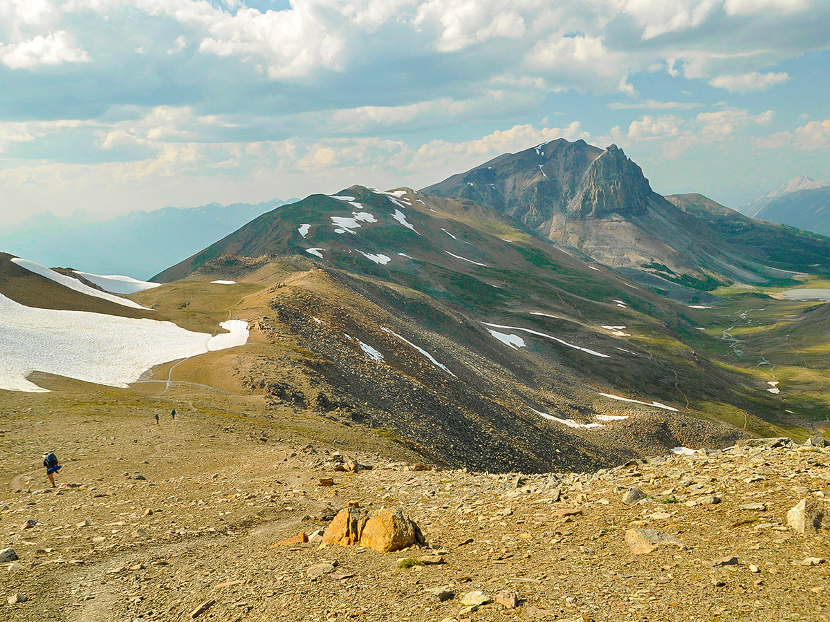
Being Jasper's highest backpacking trail, The Skyline is a great way to experience what the Canadian Rockies have to offer. Over 12.4mis of this trail are above treeline, and the majestic views continue into what seems like unreachable distances. For those new to the sterile beauty of the crumbling rocky mountains, three days spent on this trail will serve as an excellent introduction to backpacking in the Canadian Rockies, and definitely leave you wanting more!
Getting there
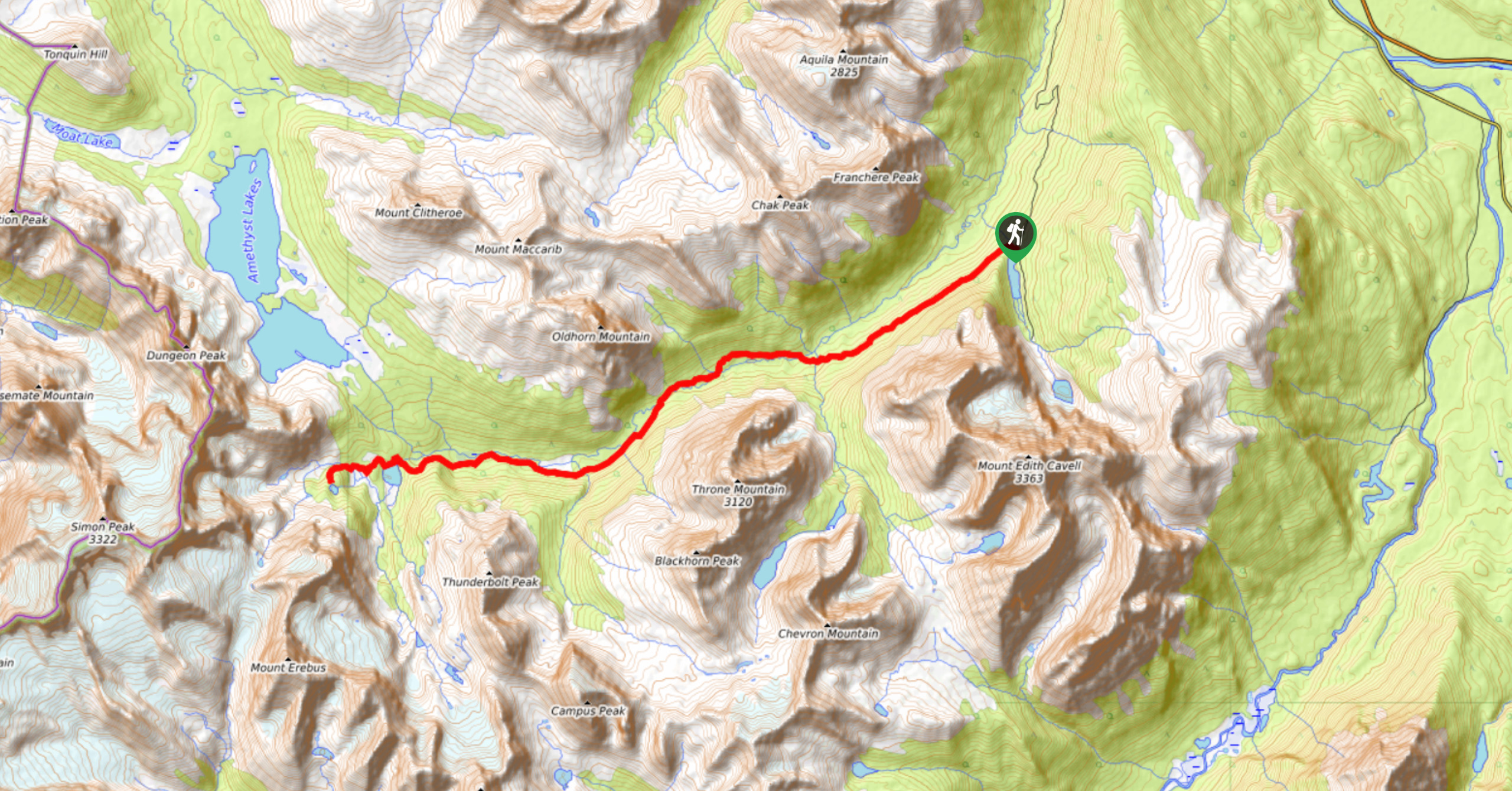
From Jasper we suggest parking your vehicle at the North Skyline trailhead (near Maligne Canyon) and taking the shuttle to the South Skyline Trailhead. See Insider Tips for notes on how to book the shuttle.

About
| Re-supply points | None |
| When to do | July - September |
| Mountain Huts | No |
| Backcountry Campsites | Yes |
| Toilets | Trailheads, All Backcountry Campgrounds |
| Pets allowed | No |
| Accommodation Type | Tent |
| Family friendly | Older Children only |
| Route Signage | Average |
| Crowd Levels | High |
| Route Type | One Way |
Skyline
Elevation Graph
Weather
Route Description for Skyline
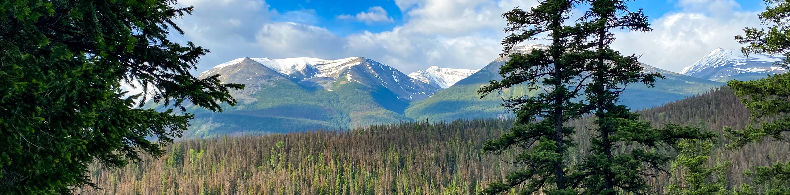
The Skyline is a wonderful backpacking trip, popular with families with older children. Enjoy breathtaking ridge traverses, descents to alpine lakes, and vast, awe-inspiring views along this trail.
Note that no fires are allowed along the trail, even at designated campsites, so be sure to carry any warm weather gear you will need. In addition, many sections of the trail are extremely exposed, allowing weather to swoop in quickly.
Though the Skyline can be completed in either direction, we suggest starting from Maligne Lake, as there will be a net elevation loss, with only 4626ft elevation gain and 6316ft elevation loss over the 27.3mi.
You must camp at designated backcountry campsites along the trail, and these must be reserved in advance. This is most easily completed through the online reservation system on the Parks Canada Website or by calling 1-877-737-3783. Since the Skyline is an extremely popular trail, campsites fill up quickly. Reservations open in January, and we suggest booking the minute reservations open for the year..
Day 1
The first day is from Maligne Lake to Snowbowl Campground, a 7.6mi hike, with 2133ft of elevation gain. Average backpackers should reach Snowbowl in about 3.5-4.5 hours.
To get to the start of the Skyline Trail, we think the best option is to leave your car at the end of the trail (North Skyline Trailhead) and take the Maligne Adventures Shuttle to the South Trailhead.
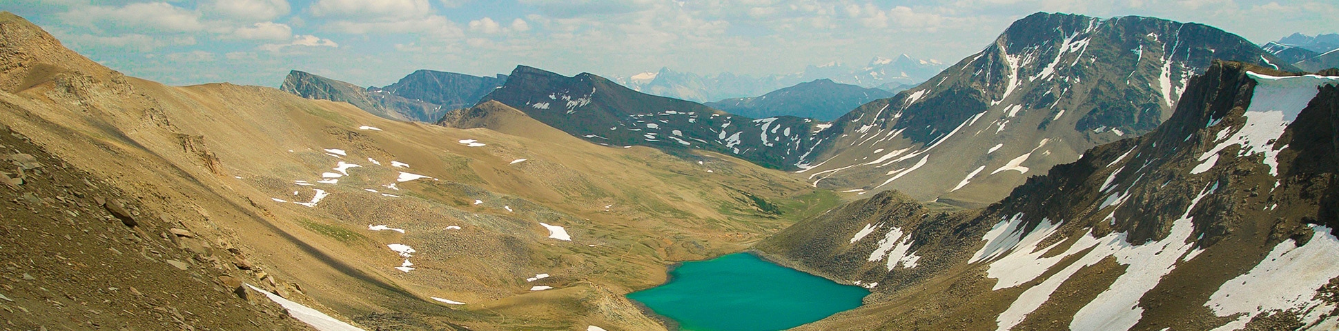
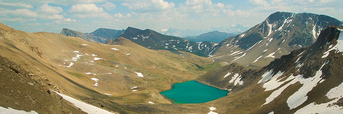
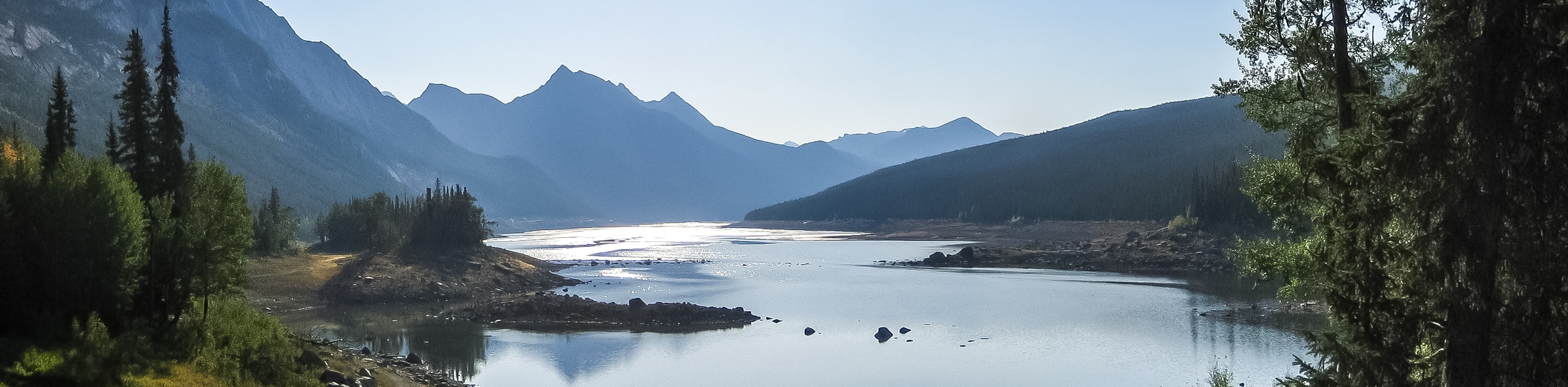
Starting at Maligne Lake, you will pass Lorraine, and Mona Lakes as you head towards Evelyn Creek Campground, reaching Evelyn Creek Campground after 4.8km. This is a small campground and is a useful place to stay if you are starting very late in the day.
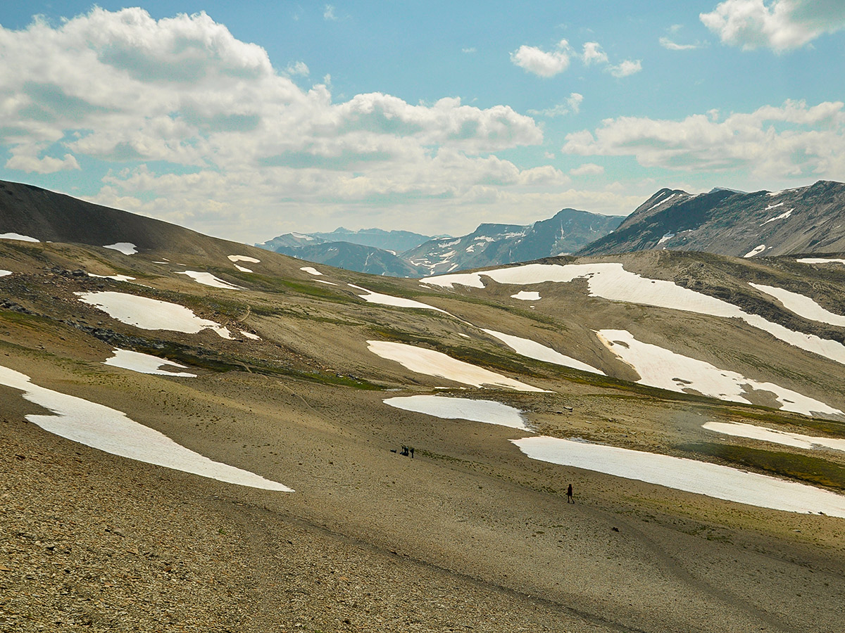
Continue past the campground, and you will gain elevation towards Little Shovel Pass and the Little Shovel Campground, which is 2.2mi after Evelyn Creek Campground. The views from near this campground are spectacular. This is another great campground if you’re starting late on the first day, though the elevation of 7316ft means it’s chilly, even in summer.
You will have gained elevation and moved into the subalpine here, and you can enjoy the beginning of The Skyline’s incredible high elevation views. You will be able to see the trail cutting through the landscape ahead as you hike towards Snowbowl Campground. You may spot a small ski cabin that is not open to summer hikers here. This historic cabin was built for backcountry skiers to seek shelter.
Snowbowl Campground is the standard 1st night campground on the 3-day Skyline backpack trip, so it’s usually pretty busy. It’s 7.6mi from Maligne Lake to Snowbowl, so you should arrive here in plenty of time.
Day 2
Today’s route is a longer day, taking you to the Tekarra campground. The route is 11.6mi, and gains 2461ft while dropping 984ft. Expect it to take 6-7 hours.
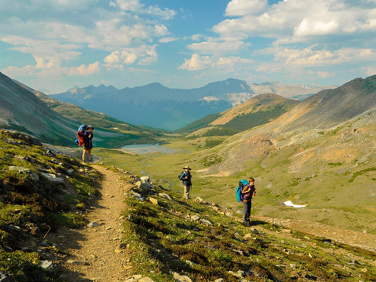
Following a night’s stay at popular Snowbowl Campground, you will pass through fields of wildflowers. As you hike along, you will pass junctions to other campgrounds, however for day two we like to continue to Tekarra, an 11.6mi hike.
On the Skyline Trail today you’ll hike up Big Shovel Pass, after which you’ll pass the Watchtower trail. This is a useful trail in case of extreme weather and you need to get down either to the lower Watchtower Campground (2.1mi) or you can descend all the way to Maligne Lake Road (8.2mi).
Further along, just before Curator Lake there is also a trail that goes down to the Icefields Parkway (Highway 93N). The Wabasso trail goes past Wabasso Lake to the Icefields Parkway and is roughly 9.8mi. This is also a useful trail if you need to bail off of the Skyline.
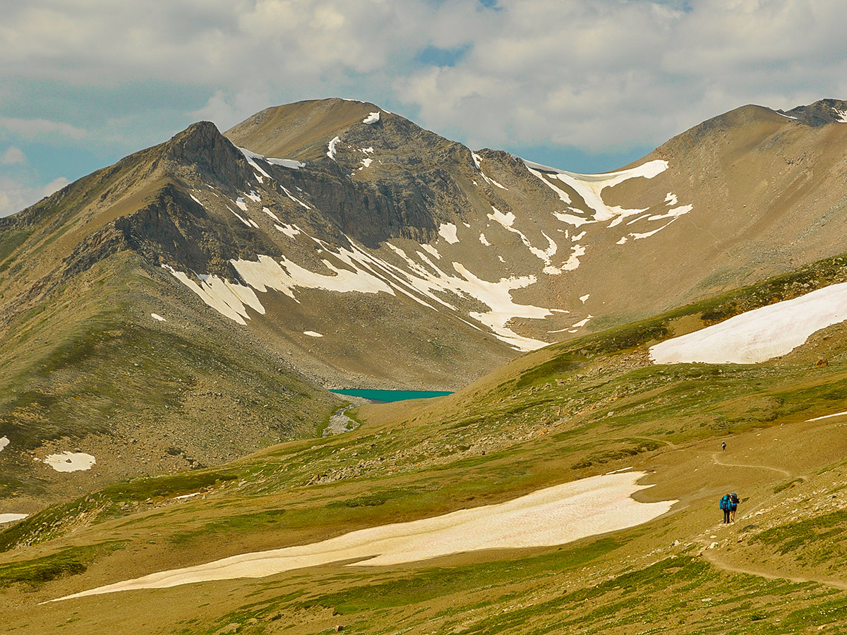
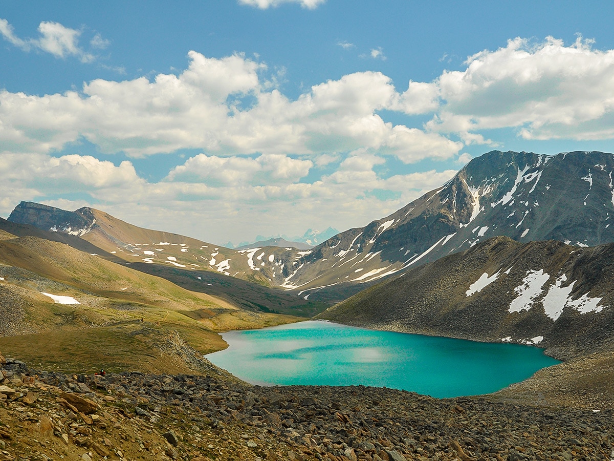
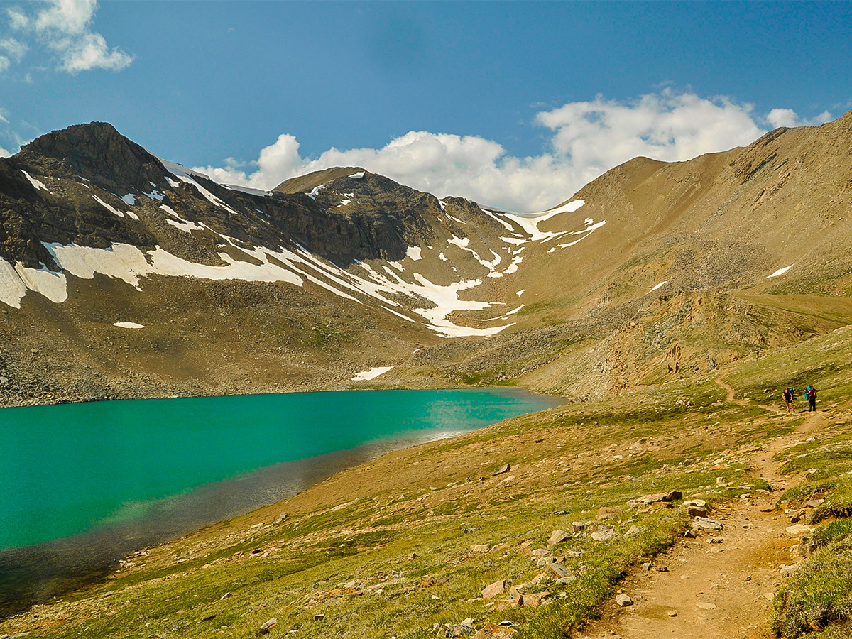
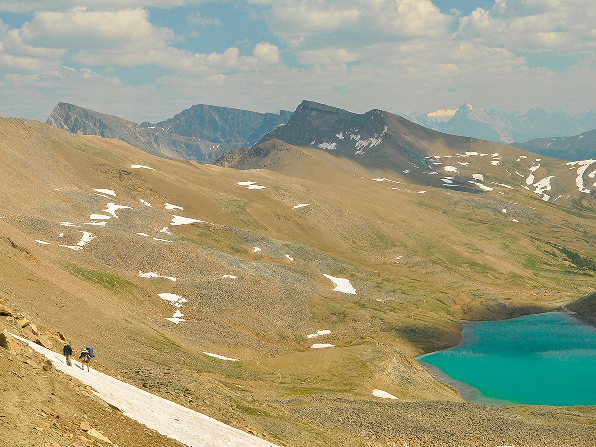
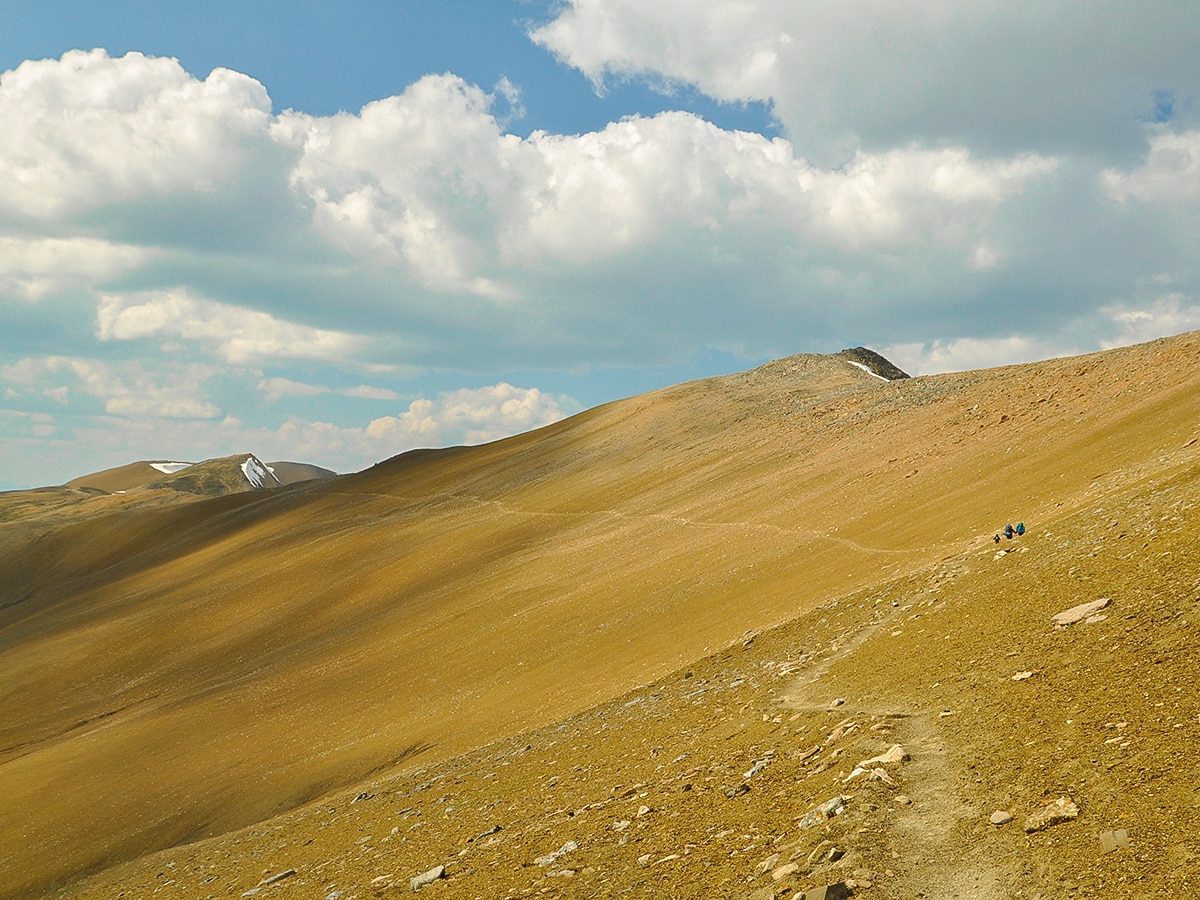
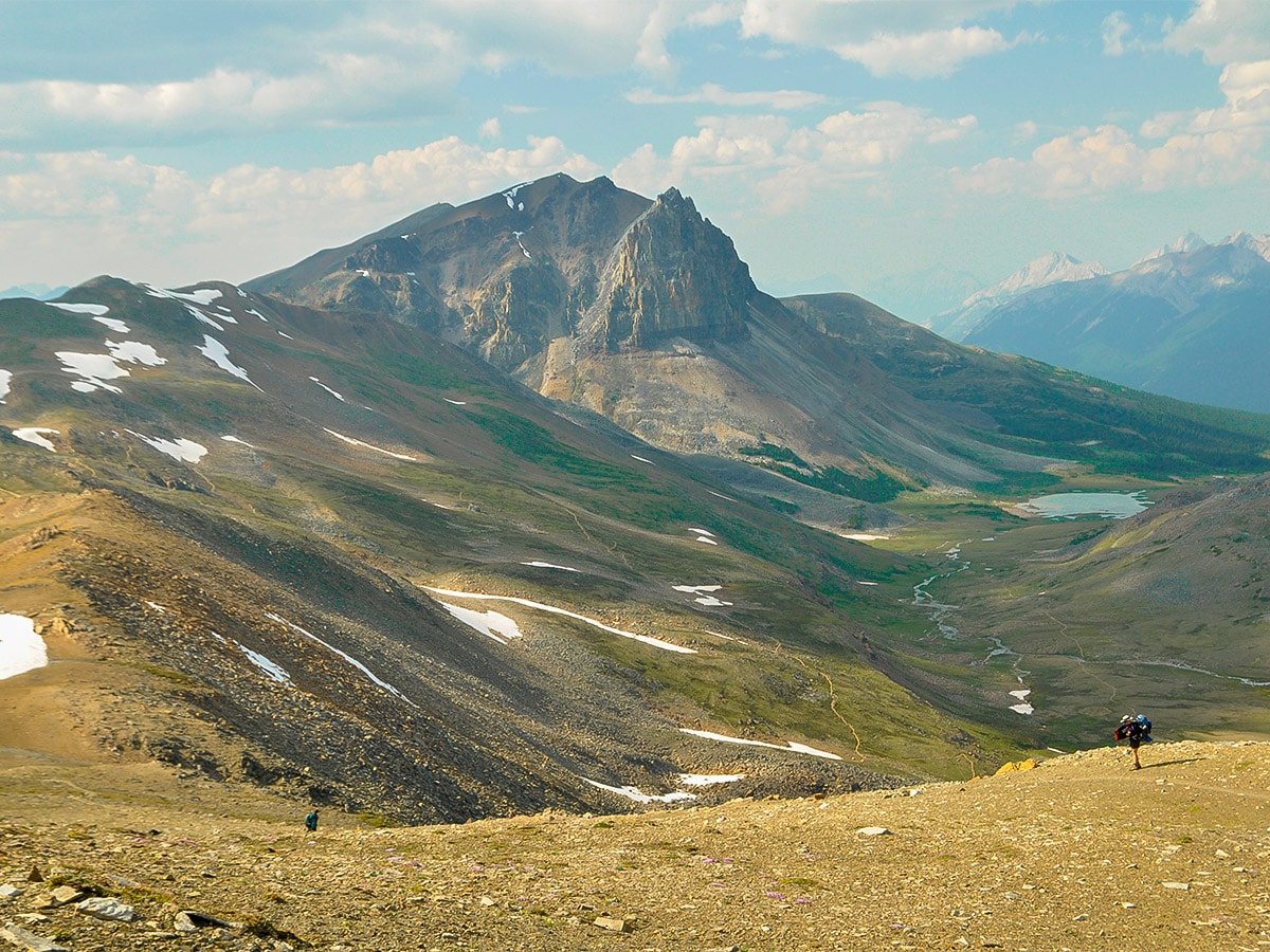
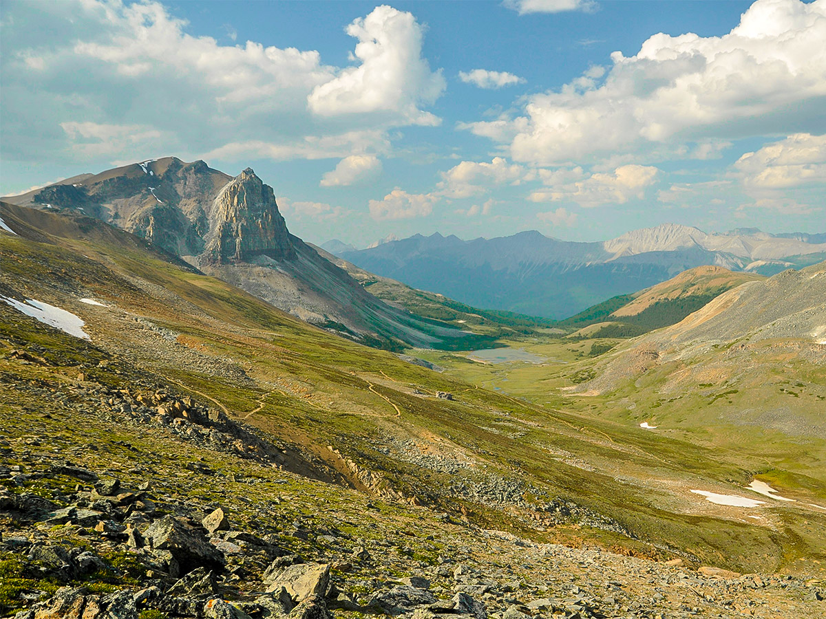
After the turnoff to Wabasso Lake, you come to the very pretty Curator Lake. There is a campground nearby, which is often used by backpackers aiming to complete the Skyline trail in 2 days (it is 13.2mi from Maligne Lake trailhead). After Curator Lake you ascend towards The Notch at 8238ft —the highest point on the trail. The views back from The Notch are spectacular, especially on clear days.
From The Notch, descend towards Tekarra Campground on a rocky trail with views of the campground’s namesake; Mount Tekarra on your left. We love Tekarra Campground and the wonderful views.
Day 3
Day 3 is the last day, and is a much easier day after the long Day 2. Today’s route is from Tekarra out to the North Skyline Trailhead (also known as the Signal trailhead). The distance is 8.2mi and the route is almost all downhill, dropping 3281ft along the way.
The route starts with some ascent through thick forest to take you back above treeline for some more nice views. The route goes along the north side of Mt Tekarra until you are walking alongside Signal Mountain.
You soon dip back into the forest and then come to a fire road. You’ll walk out the final 5.0mi on the fire road. Along the way you’ll pass the Signal Campground (22.1mi from the Maligne Lake Trailhead, and only 5.3mi to the Signal Trailhead).
Follow the fire road down and you eventually end up at the Northern Skyline Trailhead (Signal Trailhead), which is located on Maligne Lake Road. Ideally you have left your car here (and you took the shuttle to the trailhead on day 1). If you haven’t left your car, we suggest heading over to Maligne Canyon (0.7mi away) and calling a cab.
Sample Itinerary:
Note: Total GPS distance varies from each days distance due to side trips and slight route variations each day.
Day 1: Maligne Lake to Snowball Campground (7.4mi / 1916ft)
Day 2: Snowball to Tekarra Campground (11.1mi / 2280ft)
Day 3: Tekarra to Signal (North Skyline) Trailhead (8.3mi / 427ft)
Insider Hints
Shuttles to connect the two trailheads are available. We recommend leaving your car at the Signal Trailhead then shuttling to Maligne Lake to start, as it significantly reduces frustration once you have finished the trip. It also reduces the time between you finishing the trail and biting into a celebratory burger in Jasper.
Since the trail is so high, weather can have a serious impact on your success and happiness. For example, The Notch can be impassable with a large snowpack. Make sure your rain gear is in working order before you start the trail, and as with any trail in the Rockies, rain should be expected. You should also be careful of thunderstorms on this exposed trail.
Consider checking out Maligne Canyon at the end of the trip. There is also a spartan hostel nearby.
When we completed the trail, we were shocked by the number of mosquitoes. If you were planning on skipping the tent and just bringing a tarp we would strongly recommend that you reconsider. The bugs are frustrating enough during the day, and it is nice to be able to leave them behind for the night. Tenting is the only accommodation option on this trail.
When sleeping, we were also struck by how cold it got overnight. Make sure you have a solid three season sleeping bag and a nice down jacket for the evening.
You need to treat or boil all the water you drink, as it is likely that you could contract some degree of water-born illness such as Giardia if you drink straight from the water.

Similar backpacking trails to the Skyline backpacking trail
Saturday Night Lake Loop Backpacking Trail
The Saturday Night Lake Loop is accessible from the town of Jasper and a great trip for beginners and families.…
Wates-Gibson Hut Backpacking Trail
The route to the Wates-Gibson hut covers the gorgeous southern section of the Tonquin Valley in Jasper. There is an…
Jacques Lake Backpacking Trail
Backpacking to Jacques Lake is a great way to find solitude without a lengthy mission. It is a short and…
MartiniC 4 years ago
Skyline is amazing, there are variety of scenery that you'll see such as woodland, lakes and rocky mountains.
JohnCan 4 years ago
My boy scouts had fun. Perks of having three boys! It was hard but worth the experience!
MountainPhoenix 5 years ago
The Skyline trail is great. A perfect way to spend 3 days for everyone who loves the outdoors. I would not rush it to make it in 2 days, it's a lot more enjoyable when you take the time to see everything around you.