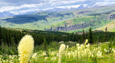
The Highline backpacking trail
View Photos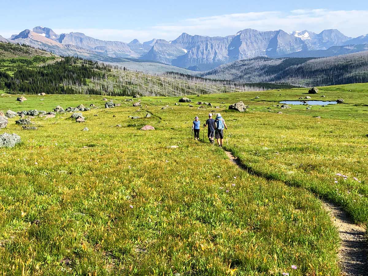
The Highline backpacking trail
Difficulty Rating:
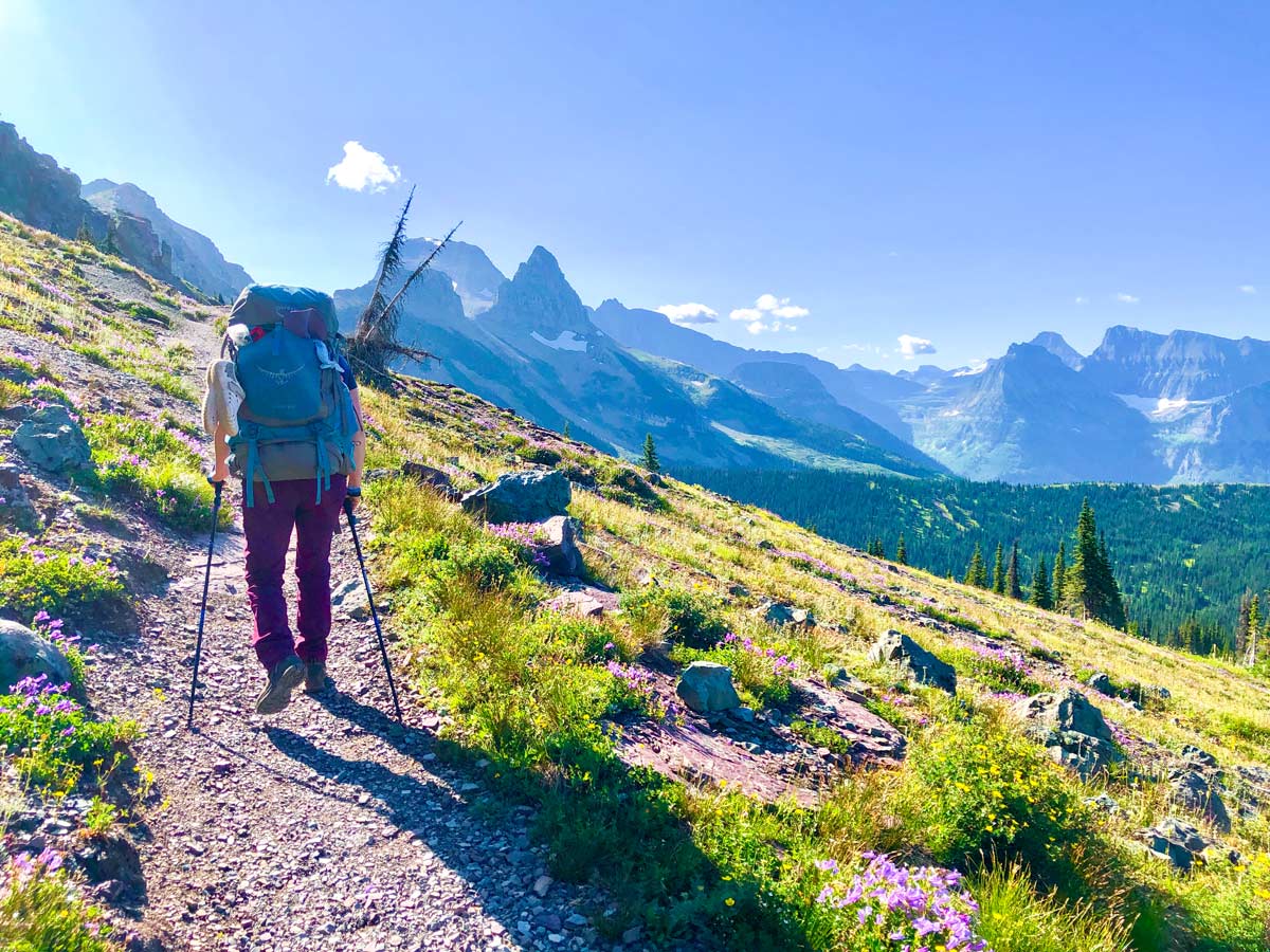
The Highline is one of Glacier’s legendary hikes along the Continental Divide, and this backpacking loop is the best way to extend the trip and enjoy the Upper Highline and get deeper into the beauty of GNP backcountry. Hiking from Logan Pass to Fifty Mountain is epic above treeline hiking, while the return journey is lower but through a burned forest offering equally scenic but different views. All in all, the extended Highline is a fantastic backpacking trip.
Getting there
Drive the Going-To-The-Sun Road towards the famous Logan Pass and park in front of the Visitor Centre. The parking lot fills up very quickly, so plan to either arrive before 8:30am or park elsewhere and take one of the many shuttles to the pass.

About
| When to do | July - September |
| Mountain Huts | Granite Park Chalet (food available) |
| Backcountry Campsites | Granite Park Chalet, Fifty Mountain, Flattop |
| Toilets | Granite Park Chalet, Fifty Mountain (Pit Toilet) |
| Pets allowed | No |
| Family friendly | No |
| Route Signage | Average |
| Crowd Levels | Moderate |
| Route Type | Circuit |
The Highline
Elevation Graph
Weather
Route Description for The Highline
Keep in mind, you will need to get a backcountry permit before camping in Glacier National Park. You can find more information on backcountry permits in Glacier National Park here.
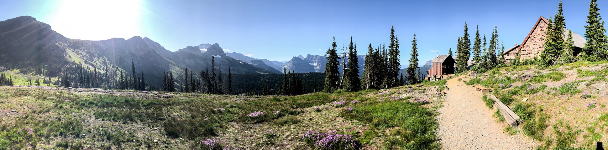
Day 1: Logan Pass Visitor Center to Granite Park Campground (7.8mi, 2825ft)
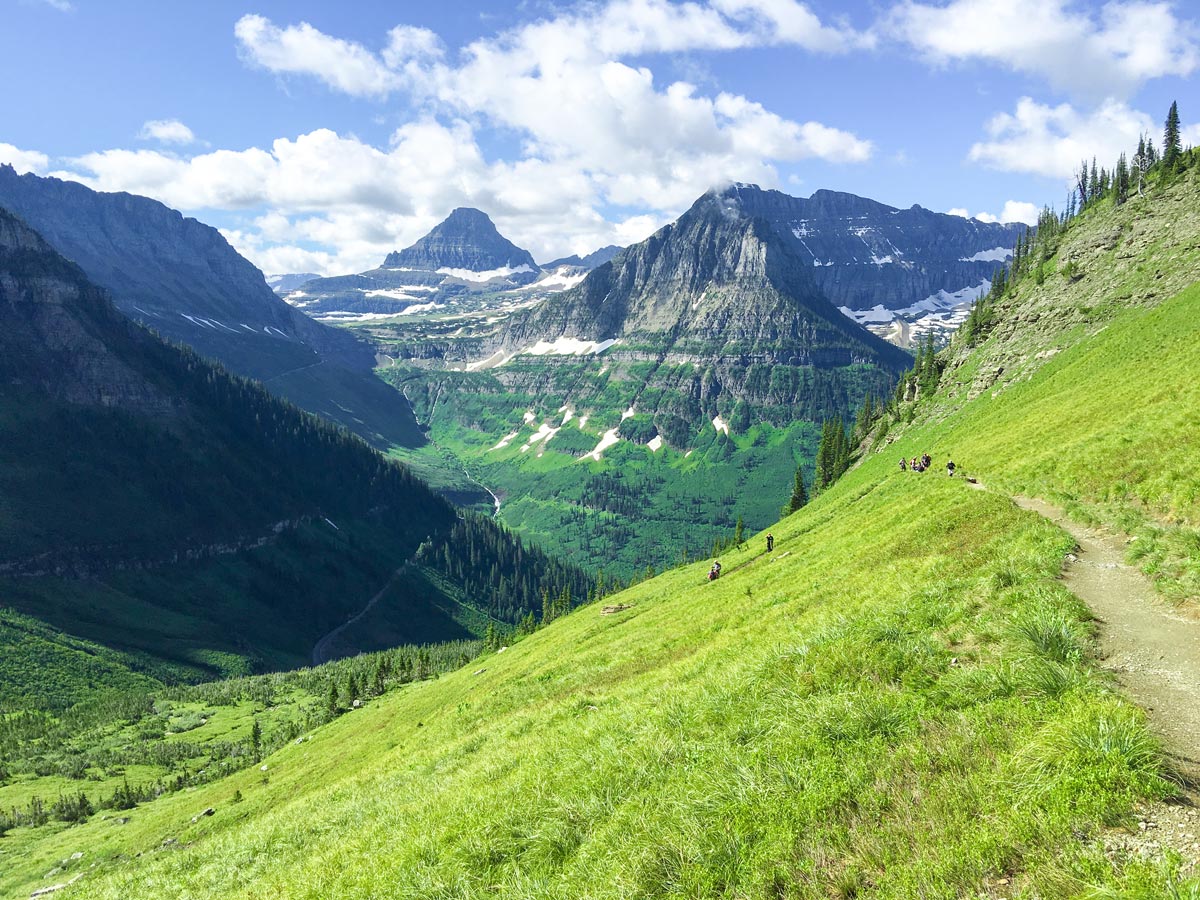
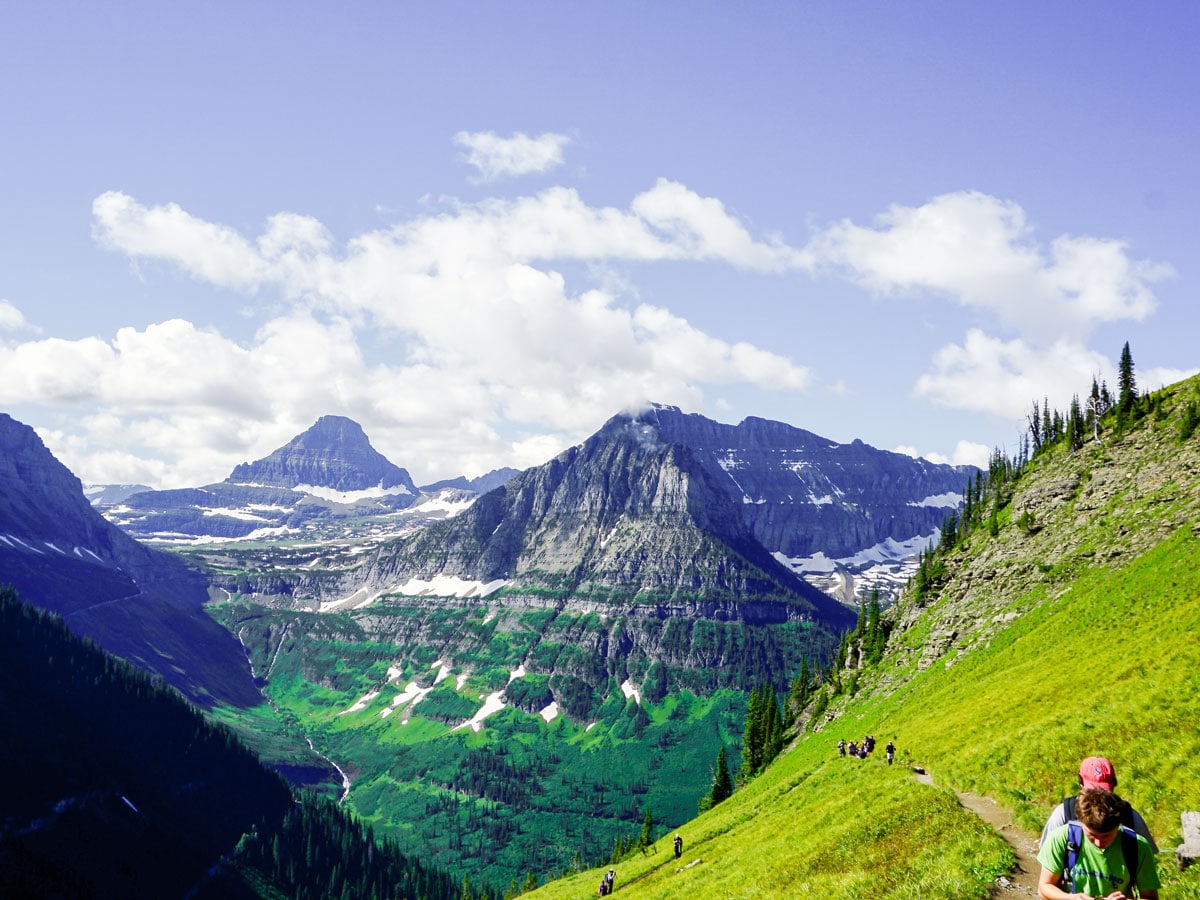
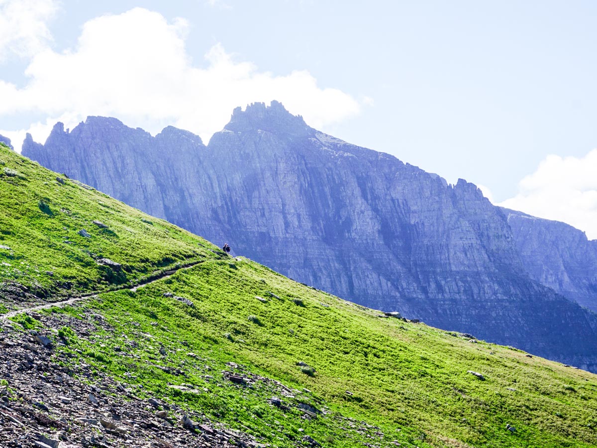
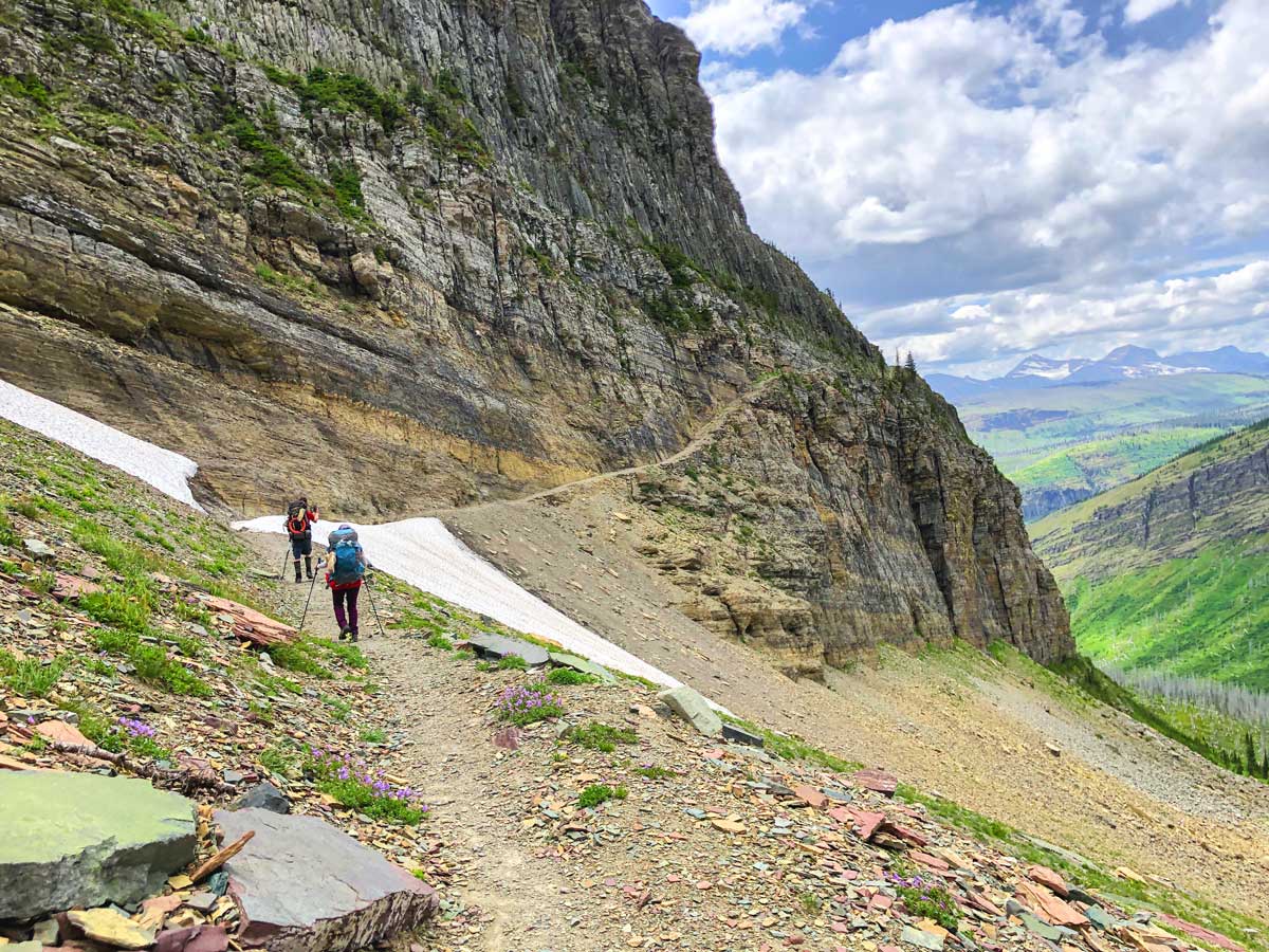
From the Logan Pass Visitor Centre, cross the parking lot and the road towards the Highline Trail sign. This hike is well signposted throughout. At first the trail passes through an alpine meadow and then hugs a rocky cliff as you hike near the road. Luckily for those afraid of heights, a steel cable handrail has been installed.
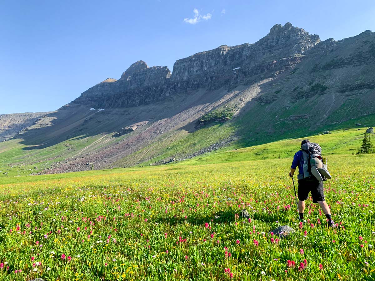
After 3.1mi you will start the first of two climbs of the day, up to Haystack Pass, reached at 3.5mi. Past Haystack Pass the trail continues flat below The Garden Wall. The views remain stunning and the grade remains flat.
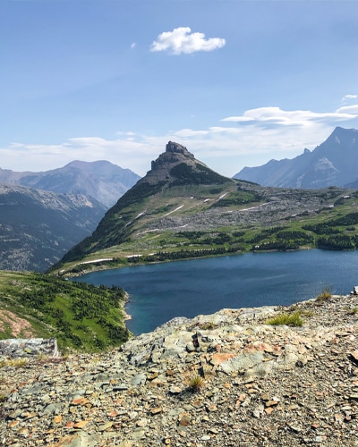
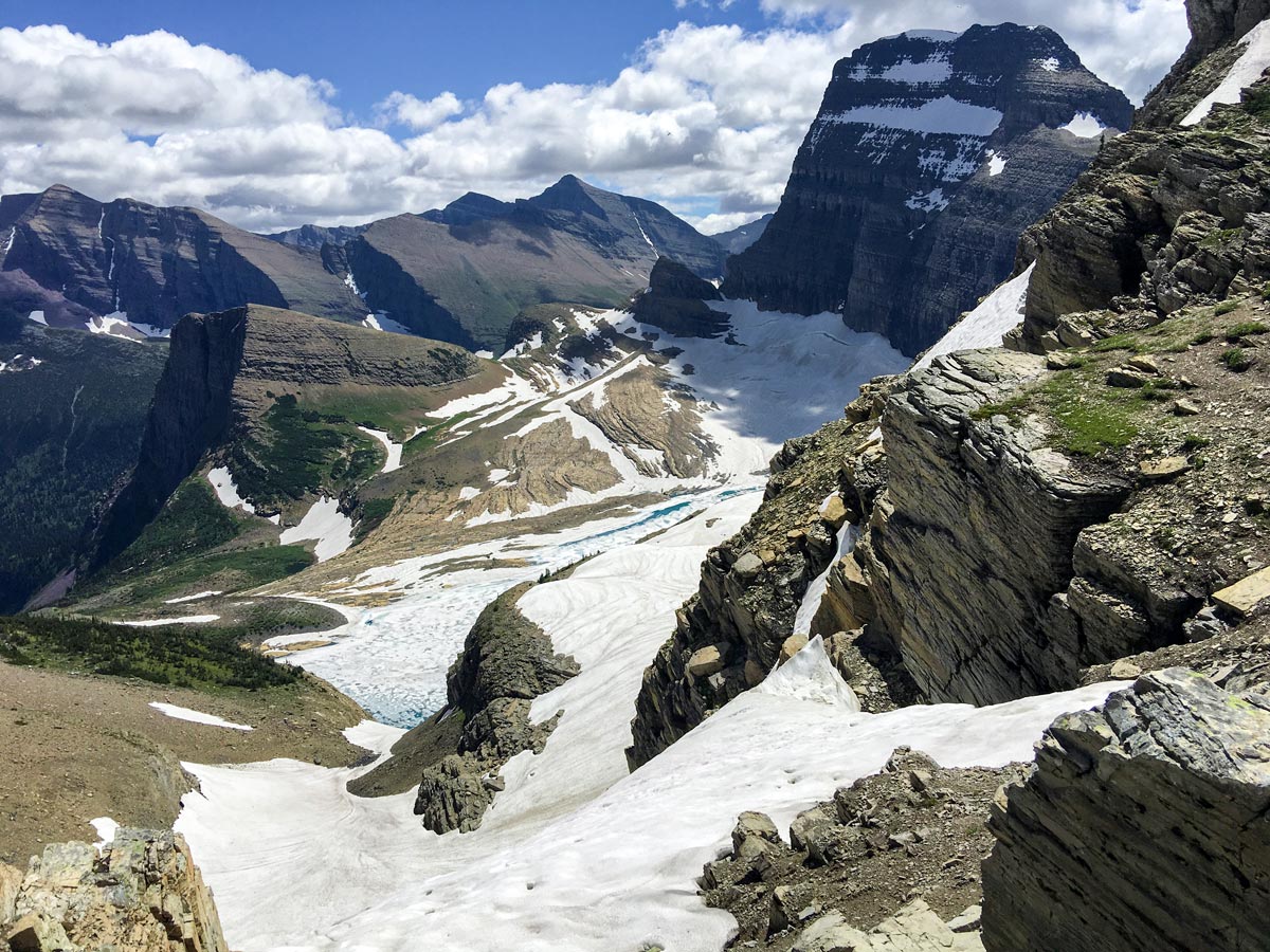
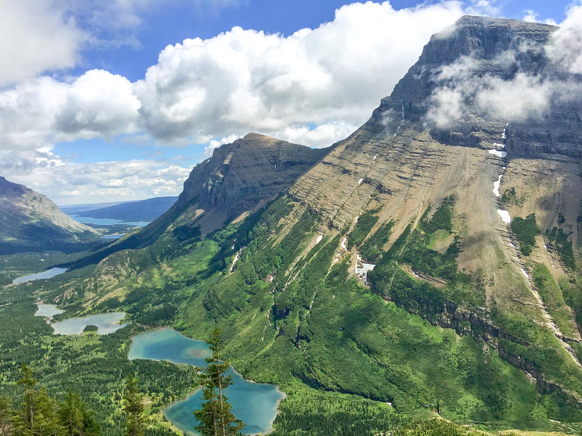
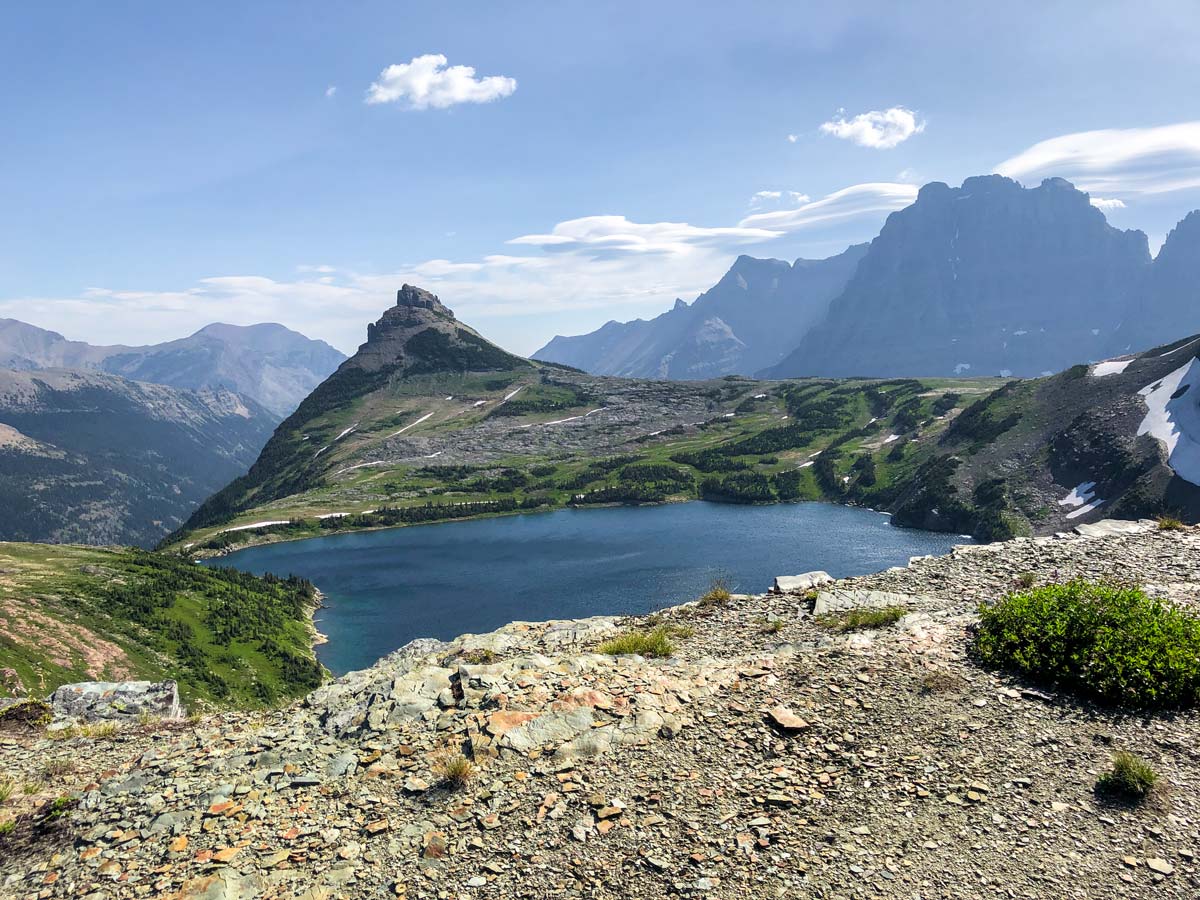
After 6.6mi there is a junction, with the right-hand path leading back up to the Garden Wall, overlooking the Grinnell Glacier. This 0.6mi trail has an extremely steep climb, rising almost 984ft, though the view down to Upper Grinnell Lake, Grinnell Glacier and Swiftcurrent Valley are worth the climb.
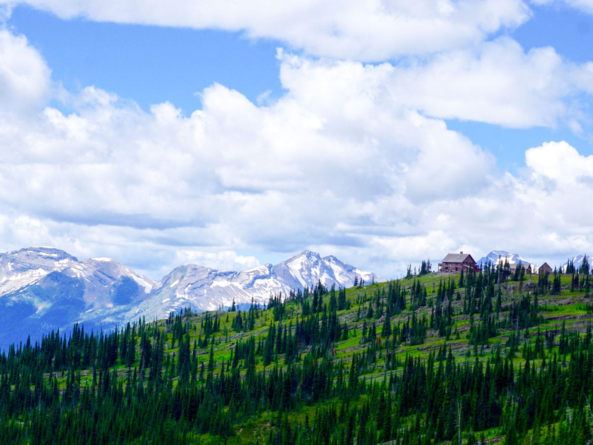
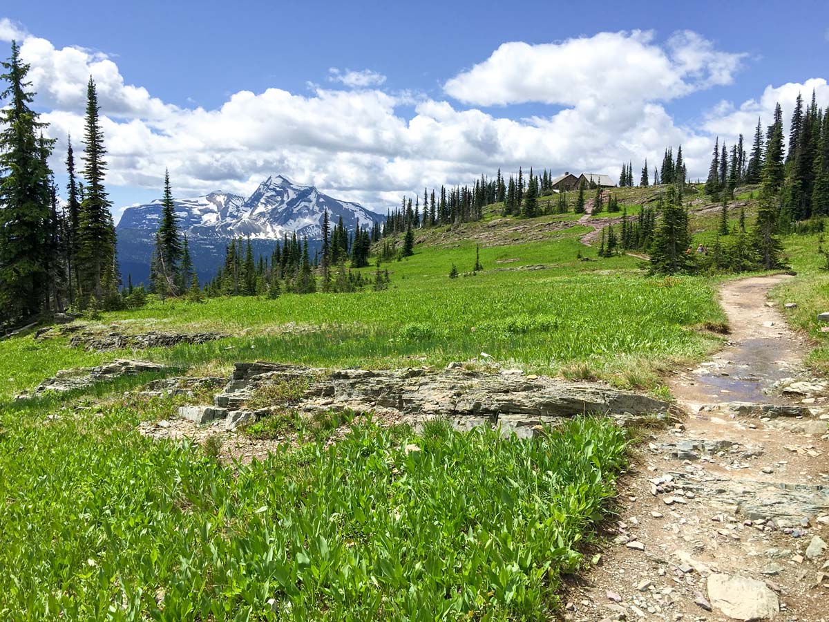
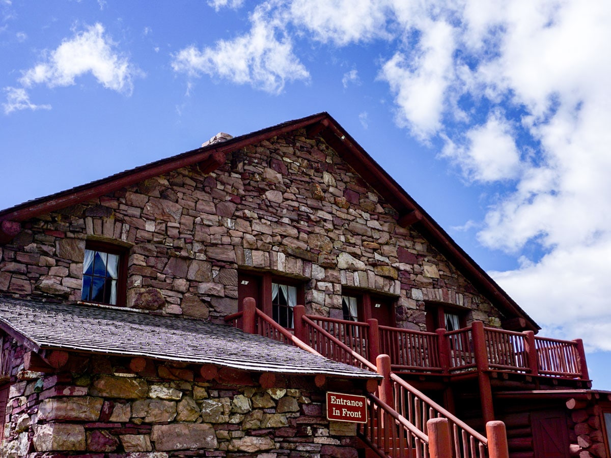
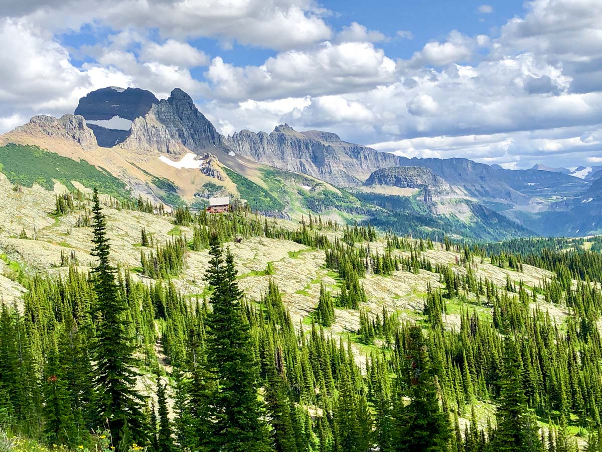
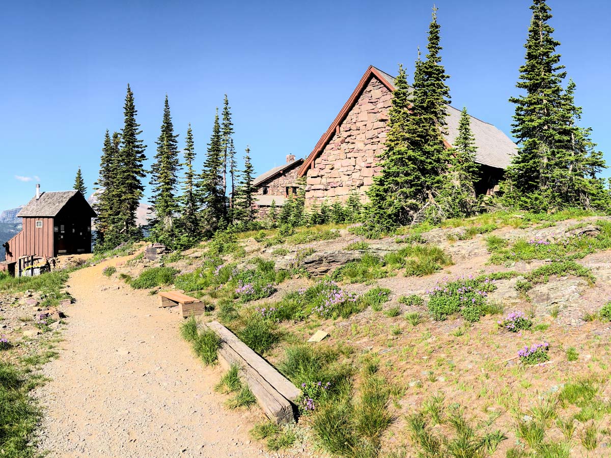
Hiking another 0.8mi from the junction you will find yourself at the Granite Park Chalet, where you can stay the night (if booked ahead). If you didn’t book, then continue on to Granite Park campground.
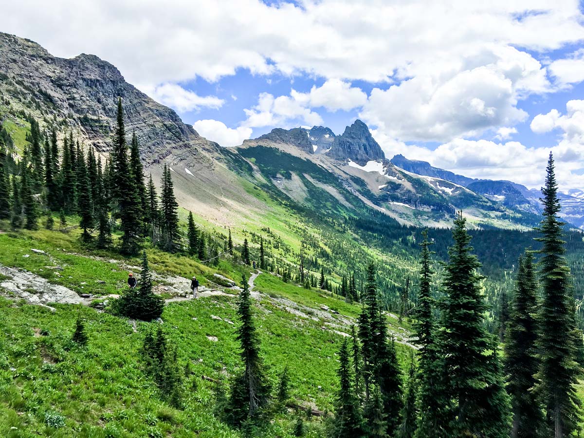
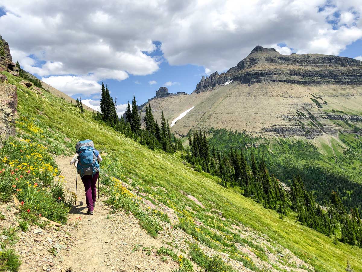
Day 2: Granite Park Campground to Fifty Mountain Campground (11.3mi, 3353ft)
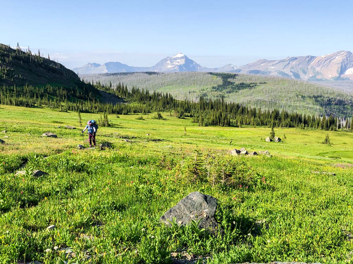
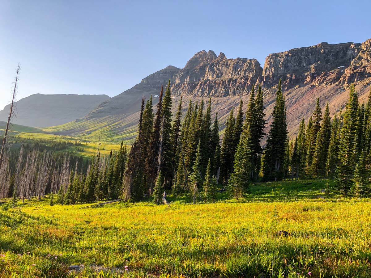
Today is another stunning day backpacking in Glacier. This part of the trail is known as the Northern Highline or Upper Highline.
You can expect the trail will be much less crowded compared to yesterday, as it is pretty much only accessible to backpackers, or very serious day hikers.
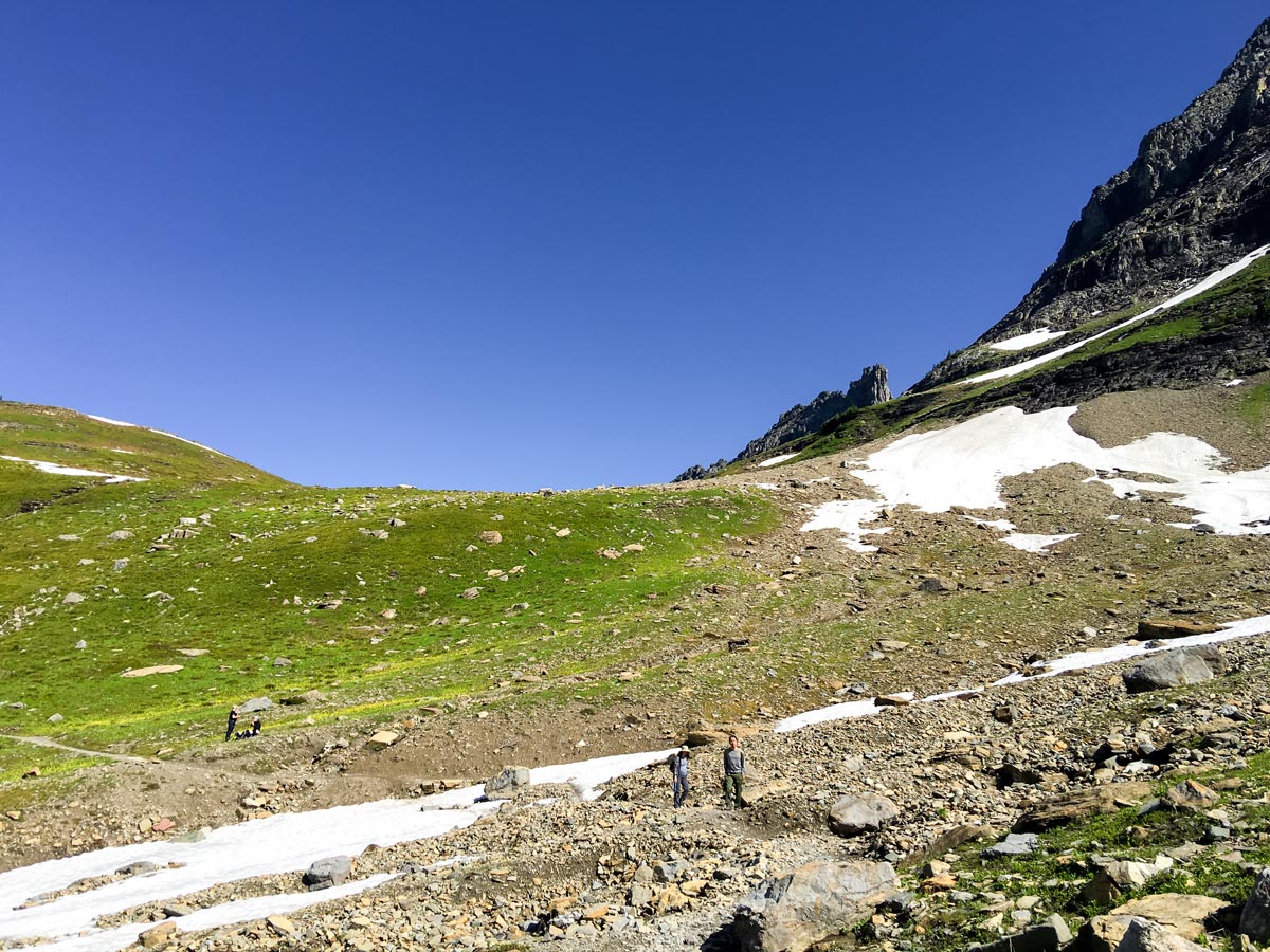
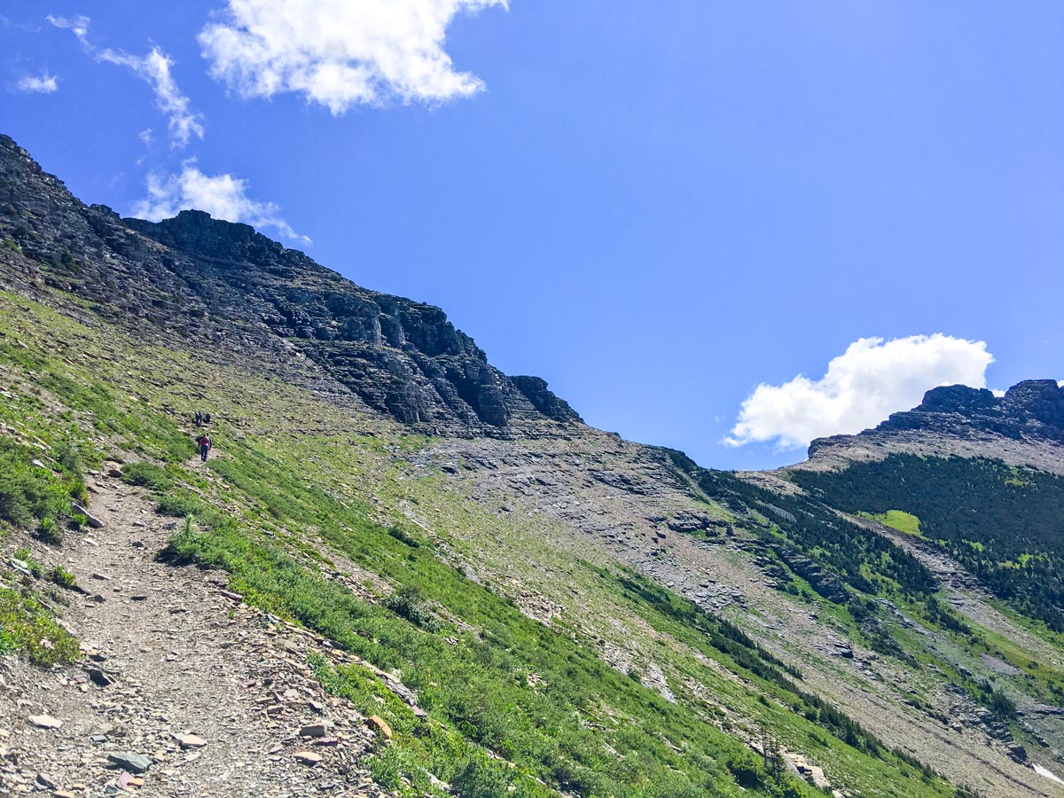
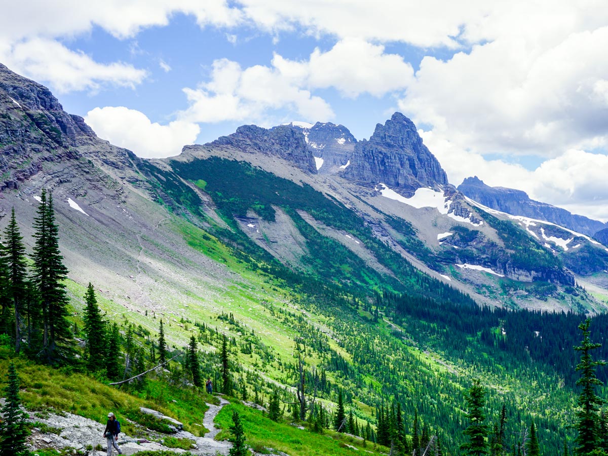
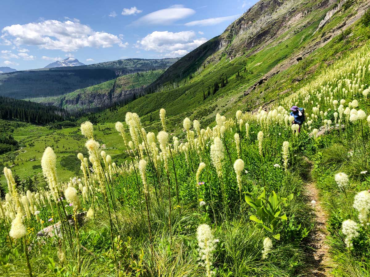
From Granite Park Campground head north on the Continental Divide Trail. It is important to be aware that early in the season there can be a sizable snow drift, known as the Ahern Drift, roughly 3.1mi from Granite Park Campground. This is a dangerous and exposed snow drift, and the NPS Rangers recommend that only those with the proper equipment and experience should cross. Check Trail Conditions on the Ahern Drift before starting out; this part of the trail is in the Lake McDonald area. In our experience while the drift remains, by late July there is typically a path down to the rocky trail below.
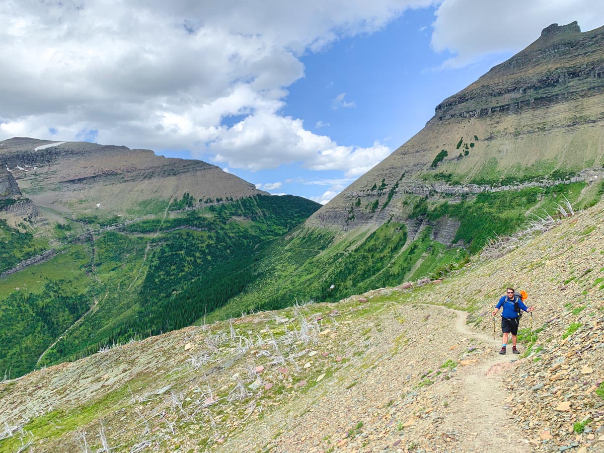
Continue heading north as the Highline weaves in and out along the flanks of the mountains that tower above.
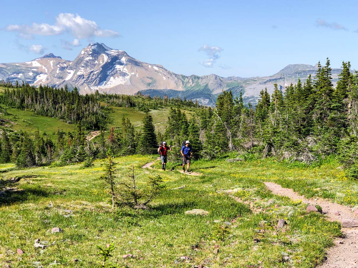
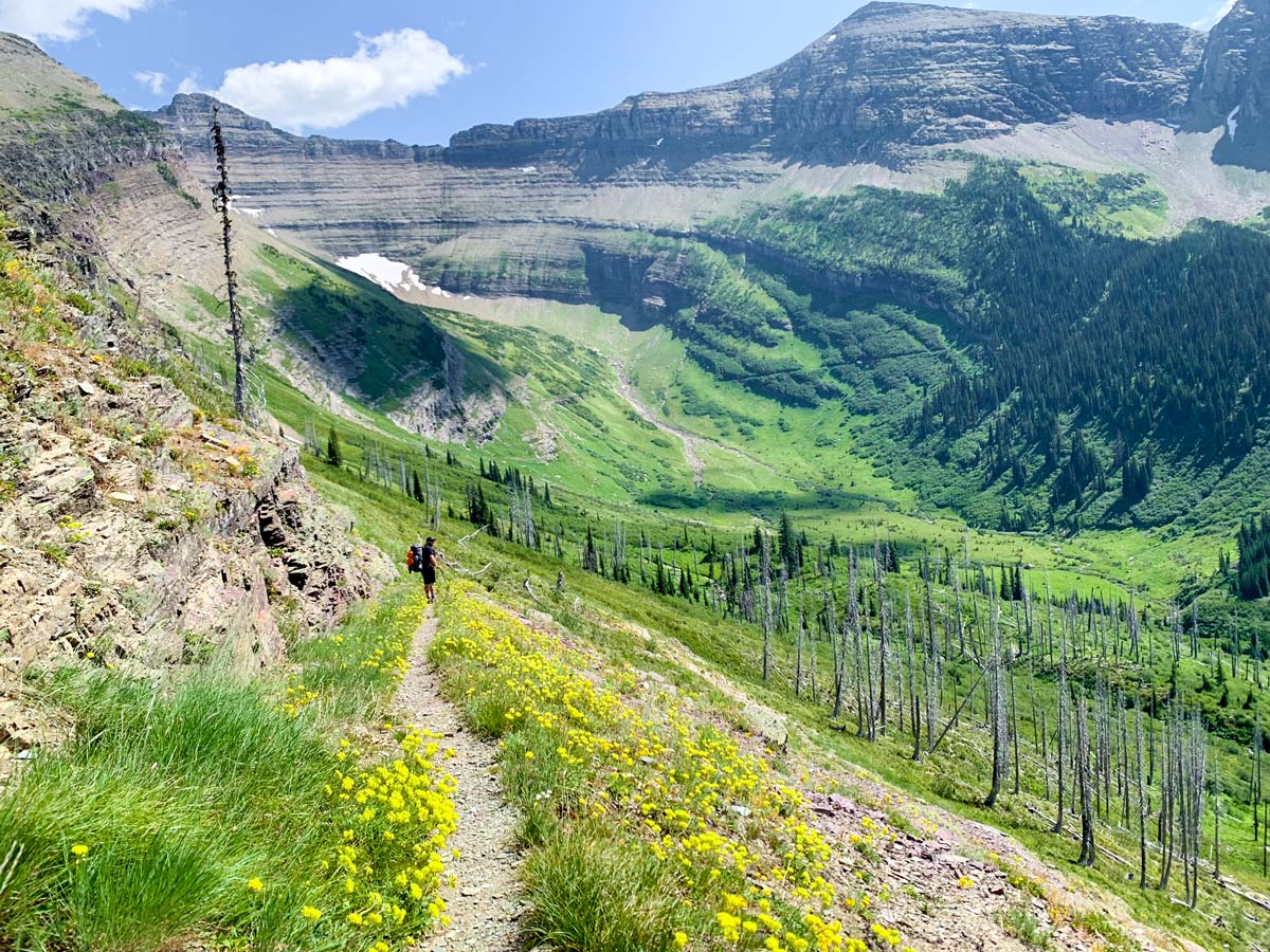
When you finally crest the ridge into the alpine bowl that holds Fifty Mountain Campground, you may never want to leave. Before you head down to Fifty Mountain, there is a spur that takes you to the Sue Lake Overlook, an absolutely stunning viewpoint. We suggest having a look, but if you’re tired you can leave it for tomorrow, as Day 3 is a shorter day.
Once you descend from the ridge, Fifty Mountain Campground is a very special place. It is named for the seemingly infinite number of peaks you can see all around you. Combined with the stunning beauty of the alpine meadow and the solitude of the wilderness, it is truly an idyllic spot to spend the night.
Day 3: Fifty Mountain Campground to Flattop Campground (6.1mi, 748ft)
After two longer days, today is an easier day. To start with, you may want to retrace your steps and hike to the Sue Lake Overlook today. This is a spectacular viewpoint and worth the diversion.
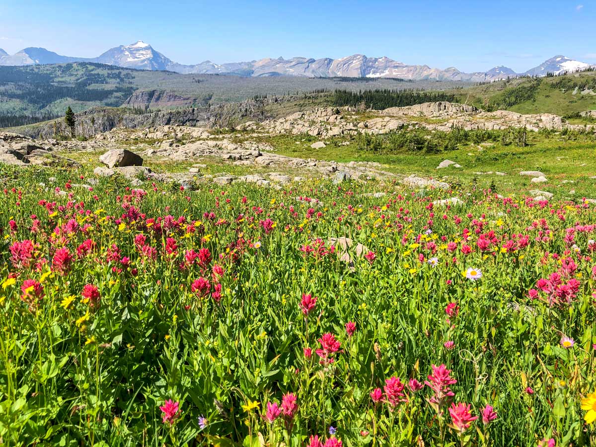
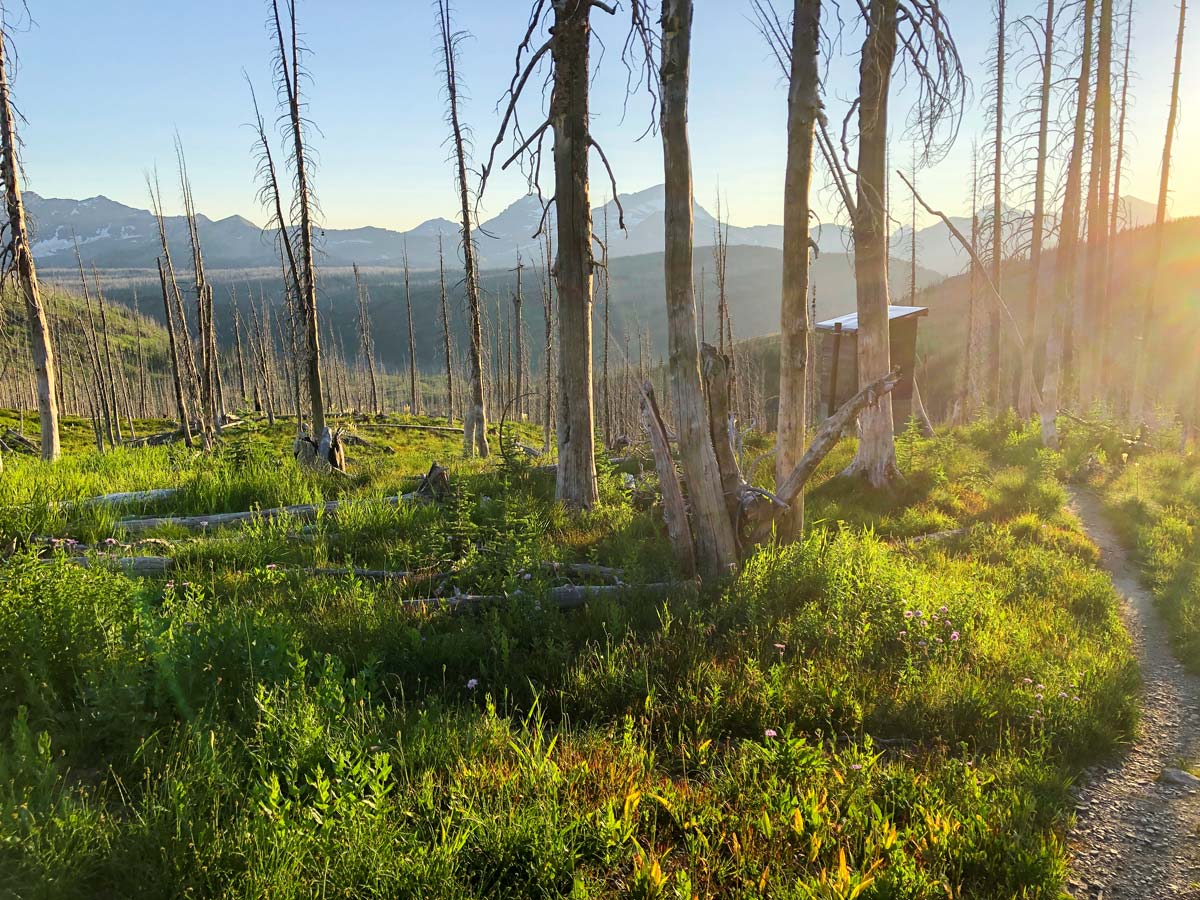
To get to Flattop Campground, follow the trail that leaves Fifty Mountain Campground heading roughly west, following the Continental Divide Trail. You descend about 492ft of elevation before a steep climb up onto the ridge of Flattop Mountain. The trail is mostly through burned area, which means you have great views along the way. It also means you are quite exposed to the weather for most of the day.
You eventually descend to Flattop Campground, which is near a small stream.
Day 4: Flattop Campground to The Loop (5.6mi, 1099ft)
For most people, today is a nice day, with an easy walk down to the Loop where you can catch the bus back to Logan Pass.
The route down from Flattop Campground is pretty steep, comparable to the route down from Granite Park Chalet to the Loop.
Initially the trail down has nice views as you continue to walk through the burn from the 2005 fire. Eventually you come to unburned forest, where the views are restricted. Quite quickly you’re back at the Going-to-the-Sun-Road, at a place called the Loop. There is a shuttle service that operates along the Going-to-the-Sun-Road, which you must catch. You’re heading east, to Logan Pass.
There is a variant here, which is to walk all the way back to Logan Pass via the Highline and Granite Park Chalet. While you walked out on the Highline on Day 1, it is a completely different walk going the other way. This is very challenging day, as it makes the total route 16.7mi, with 6414ft of elevation gain! But it’s been done, and it’s spectacular, though we don’t recommend it unless you are very fit. If you want to do this, take the signed path up to Granite Park Chalet and then head out along the Highline to Logan Pass.
Sample Itinerary
Day 1 Logan Pass Visitor Center to Granite Chalet Campground (7.8mi, 2825ft)
Day 2 Granite Chalet Campground to Fifty Mountain Campground (11.3mi, 3353ft)
Day 3 Fifty Mountain Campground to Flattop Campground (6.1mi, 748ft)
Day 4 Flattop Campground to the Loop (5.6mi, 1099ft)
Insider Hints
You need a permit for this route. We suggest getting your permit application into the lottery as soon as the lottery opens. You can find out more info backcountry permits here.
Check Trail Conditions on the Ahern Drift before starting out, this part of the trail is in the Lake McDonald area.
Many backpackers combine Days 3 and 4 into one longer day, which is 11.8mi, with 1837ft of uphill and 4216ft of descent. The only hiccup is to make sure you’re down at the Loop in time for the last shuttle. We normally aim to be at the Loop by about 3pm so there is plenty of time.
Parking at Logan Pass can be difficult, so be sure to get there early (at least 7 am to guarantee a spot).

Similar backpacking trails to the The Highline backpacking trail
Boulder Pass
Backpacking through this northern section of Glacier National Park is a very wild experience. With limited access to the area,…
Pitamakan Dawson Loop
The Pitamakan-Dawson Loop is a strenuous and rewarding backpacking trip on the east side of Glacier National Park. Setting out…
North Circle
The North Circle Loop in Glacier National Park is a strenuous and rewarding backpacking trip that takes you through some…
liwei 4 years ago
Good hike with easy trails and nice views.
LA Bright 4 years ago
It was a marvelous experience! I was amazed by alll
Kohaku Ichinose 4 years ago
Spent the night at Granite Park Chalet and it was a great experience!
dylanm 4 years ago
It was a nice hike too, but the views from Swiftcurrent Pass were so much better.
Winston M. 5 years ago
Love the terrain and the views of this hike. It was very fascinating from the beginning until the end.
peylinquartz 5 years ago
Nice moderate hike! Perfect weather. It's quite longer than other hikes in the park, and it's a bit boring in the beginning.
Kris Thimbald 5 years ago
Wicked views! We passed a lot of streams that I've lost count of, and there were several challenging sections.
Orly Thomas 5 years ago
The views of Heavens Peak were stunning! I swear, no matter how many pictures I take, they would never give justice to it!
Chris Wilson 5 years ago
Great hike. Planning to do it again with my friends next time!