North Circle backpacking trail
View Photos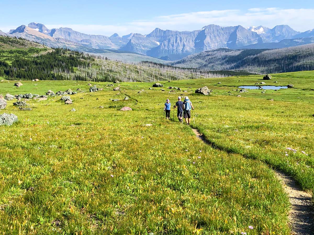
North Circle backpacking trail
Difficulty Rating:
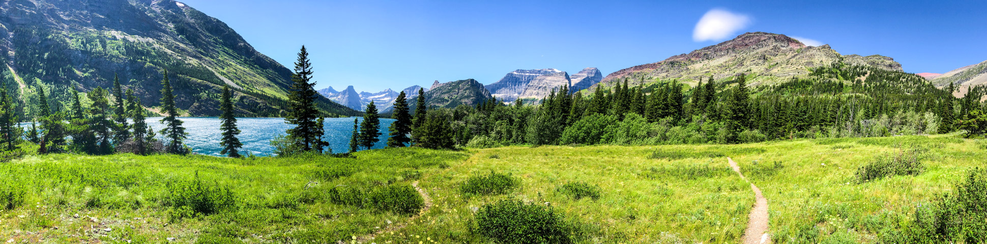
The North Circle Loop in Glacier National Park is a strenuous and rewarding backpacking trip that takes you through some of the best terrain in Glacier. This 4-6 day backpacking loop is one of the best backpacking trails in the entire US, and requires you to enter a lottery to get one of the few reservations on this epic backpacking route in Montana.
Getting there
You need to check in at the ranger station in the Many Glacier part of Glacier. You often start and finish from the parking lot by Swiftcurrent Inn, though sometimes you will start at other locations.

About
| Re-supply points | Swiftcurrent Motor Inn in Many Glacier has some options |
| When to do | July - September |
| Mountain Huts | Granite Park Chalet |
| Backcountry Campsites | Many options, our route was Elizabeth Lake Foot, Glenns Lake Head, Fifty Mountain, Granite Park Chalet |
| Toilets | At Campsites |
| Pets allowed | No |
| Family friendly | No |
| Route Signage | Average |
| Crowd Levels | Low |
| Route Type | Circuit |
North Circle
Elevation Graph
Weather
Route Description for North Circle
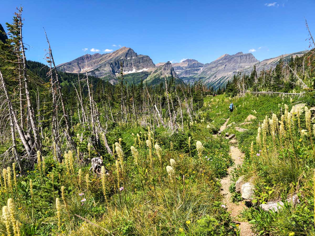
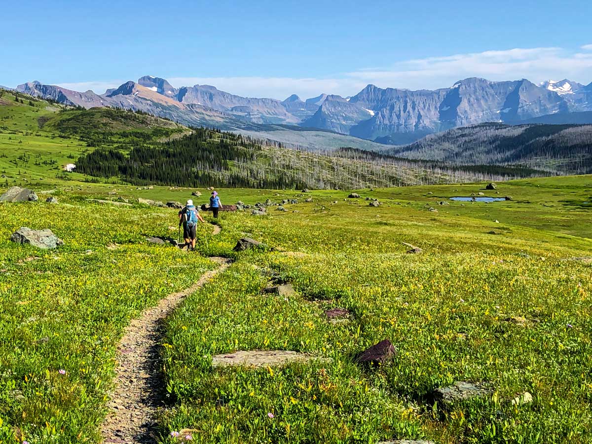
The epic North Circle Trail is one of the great backpacking trails in the Rocky Mountains. This route takes in some epic scenery, like Ptarmigan Pass, Elizabeth Lake, Stoney Indian Pass, Fifty Mountain Campground, Granite Park Chalet and Swiftcurrent Pass. Needless to say, this is one incredible trip, and many backpackers spend years applying for the lottery to backpack this route!
There are many different campgrounds on the North Circle Trail, and you can see which ones on this map of Backcountry Campgrounds and trails in Glacier National Park. Don’t expect to get the exact campgrounds you want, but Rangers do their best when they allocate permits. In addition, due to the popularity, you may end up with some pretty long days between campgrounds. We had one day that was 15.5mi and 6562ft of elevation gain. That was a killer!
The North Circle Trail typically starts at Many Glacier, though it could also start at other locations in Glacier, depending on what campsites you get in the lottery.
We will describe the common route from Many Glacier, and outline the route we did most recently.
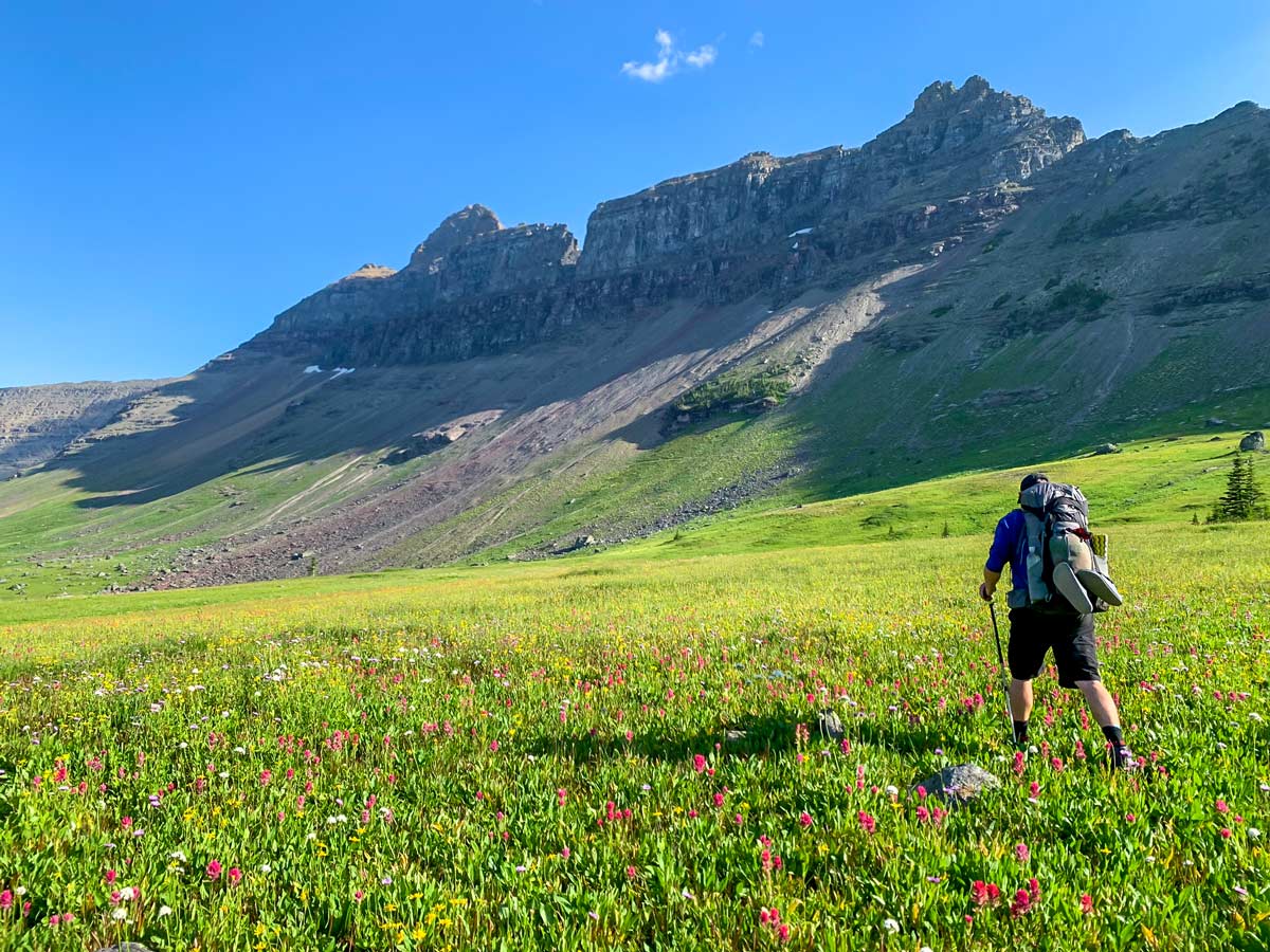
Day 1: Many Glacier to Elizabeth Lake (10.9mi, 2411ft)
Arrive at Many Glacier Ranger Station early to get your briefing and pick up your permits. You can pick up any last minute provisions at the shop at Swiftcurrent Motor Inn.
Once you’re ready to go, follow the route that heads out and is signed for Iceberg Lake/ Ptarmigan Tunnel. You can follow our route guide for Ptarmigan Tunnel for this first section.
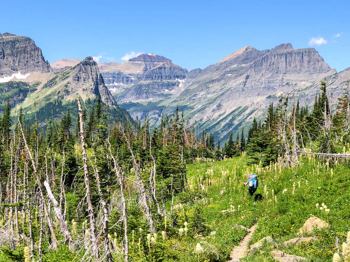
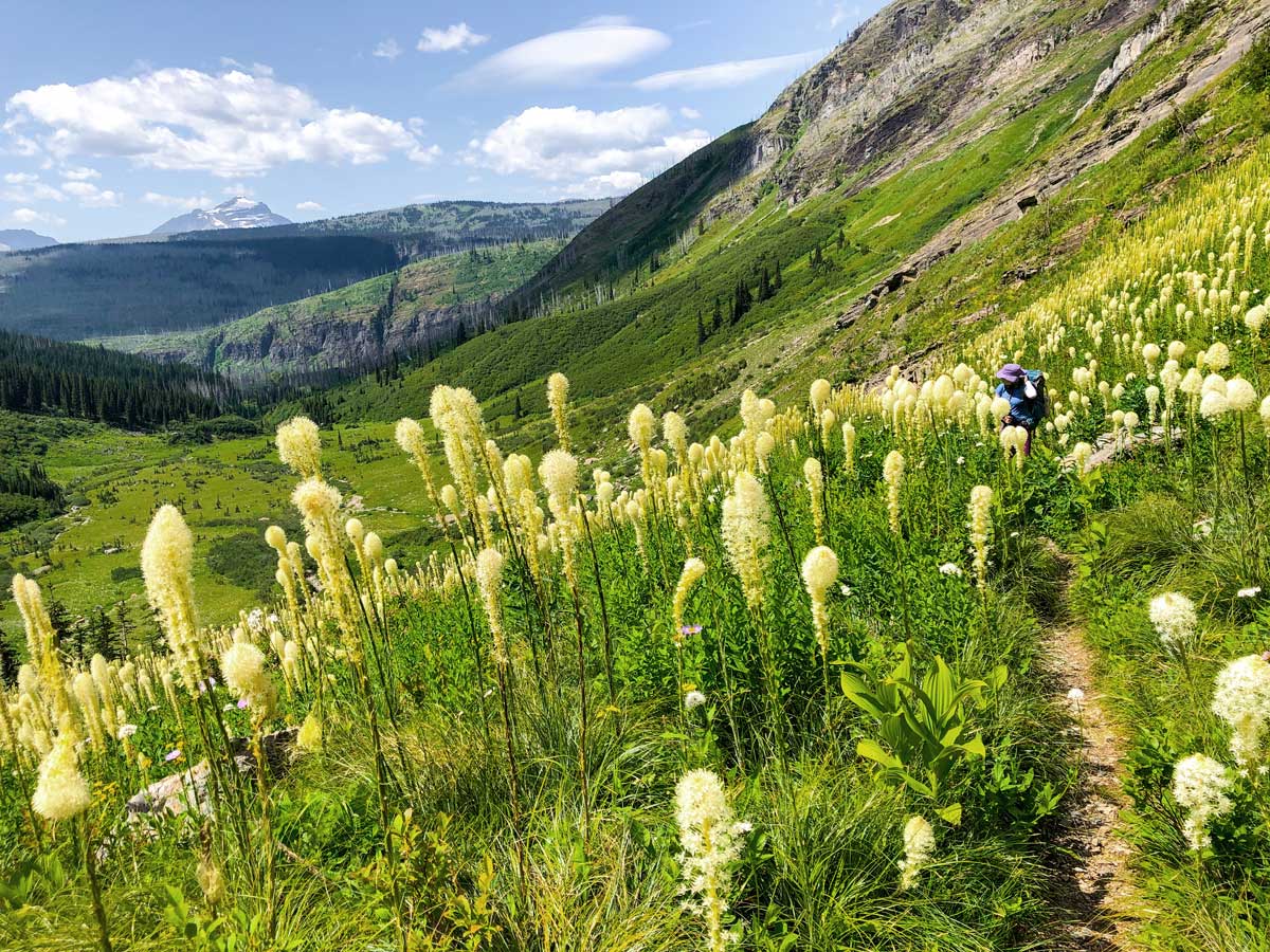
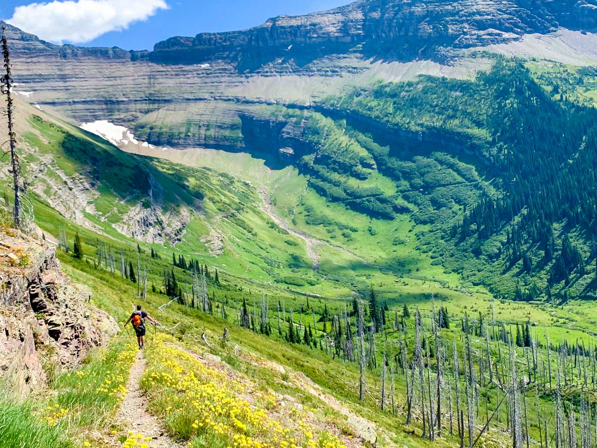
This route goes up along the side of Mount Henkel, and there are nice views as you go in and out of the trees.
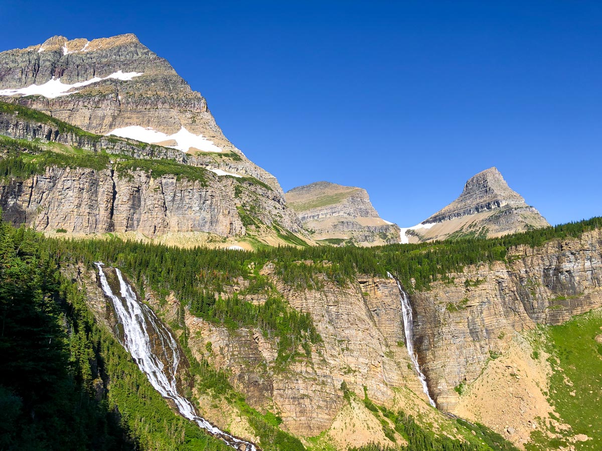
You cross over the pretty Ptarmigan Falls and just after the path splits, you’ll want to go right. The path going left going to Iceberg Lake, a fine hike. If you choose to do it, remember you can’t leave your backpacks unattended at any time in Glacier National Park.
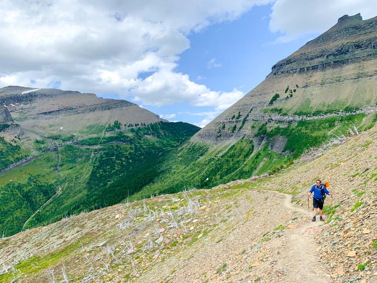
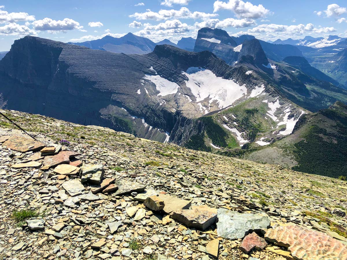
Now that you’re on the path to Ptarmigan Tunnel, follow it as it rises through the trees and some spectacular views, and you’ll soon reach Ptarmigan Lake. As you look ahead you’ll see the switchbacks that lead to a tunnel, which isn’t visible yet.
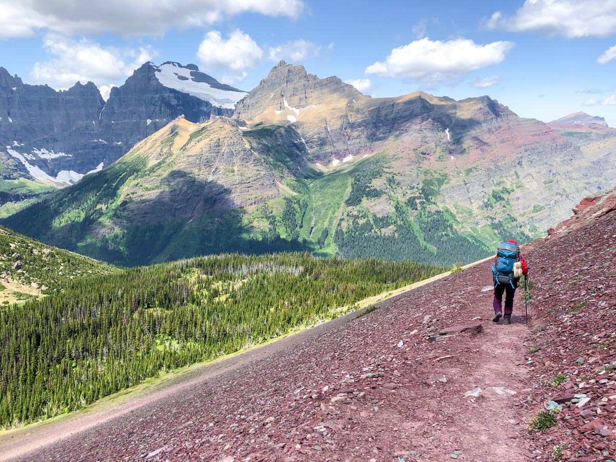
The switchbacks are tough, but as you reach the tunnel it’s all worth it. The views back to the Many Glacier Valley are spectacular. Go through Ptarmigan Tunnel and be amazed by the view.
Follow the route down through some of the prettiest red rock you’ll ever see. Marvel at how this trail was built. The view down of Elizabeth Lake is stunning, but it’s much farther than it seems. Follow the path and eventually you’ll arrive at Elizabeth Lake.
If you’re lucky, you’ll get a spot at Elizabeth Lake Head, a stunning campground with epic views (and unfortunately when we were there, epic bugs).
Day 2: Elizabeth Lake Head to Mokowanis Junction (10.2mi, 902ft)
Today is an easier day along the North Circle Trail. The route is mostly level, but does include a river crossing!
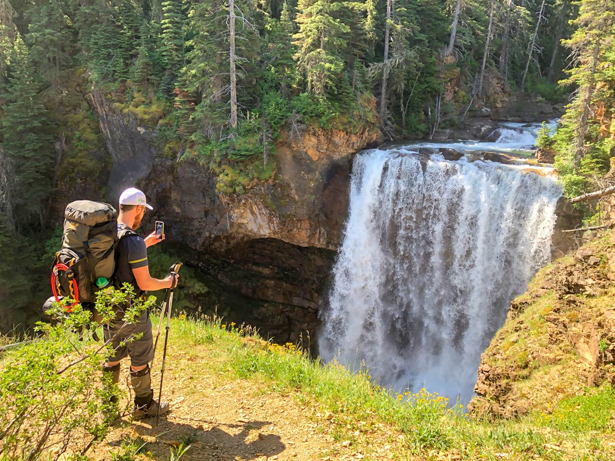
Start by walking north along the Belly River in the trees. You have some nice views, and a view of the very pretty Dawn Mist Falls, where if it is hot you can nip in for a swim below the falls, but the water is COLD!!
After about 1.6mi, you’ll see a trail goes off to the right, it heads to Chief Mountain International Highway. Don’t take this trail, but continue going ahead as the path moves away from the Belly River and heads towards Mokowanis River, which you eventually reach (roughly 3.7mi from Elizabeth Lake Head campground) at the outflow of Cosley Lake.
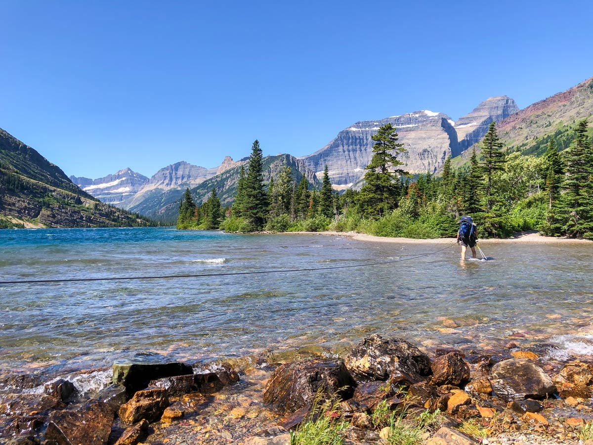
You need to ford the Mokowanis River here, it’s not very deep and there is a cable to hang onto. Make sure to unclip your buckles on your pack as you cross the river.
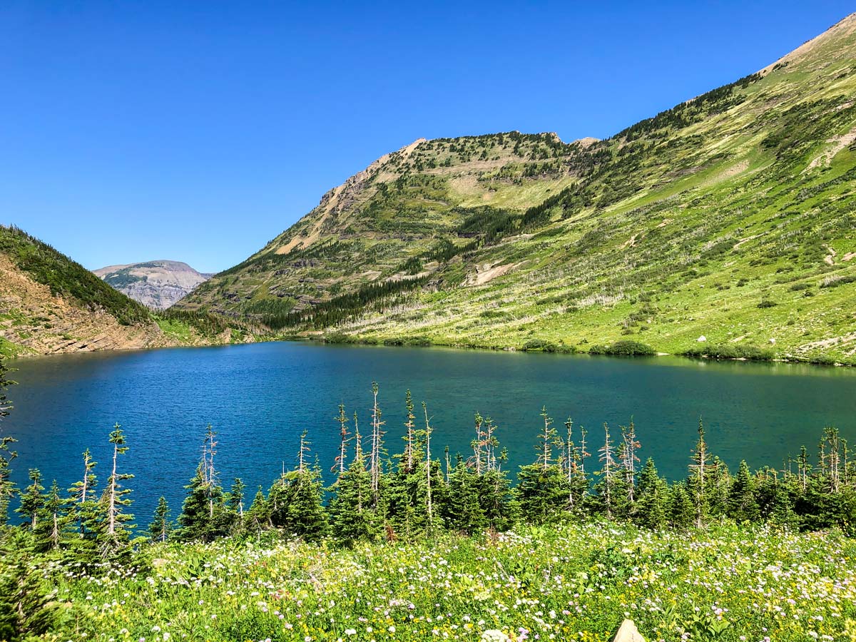
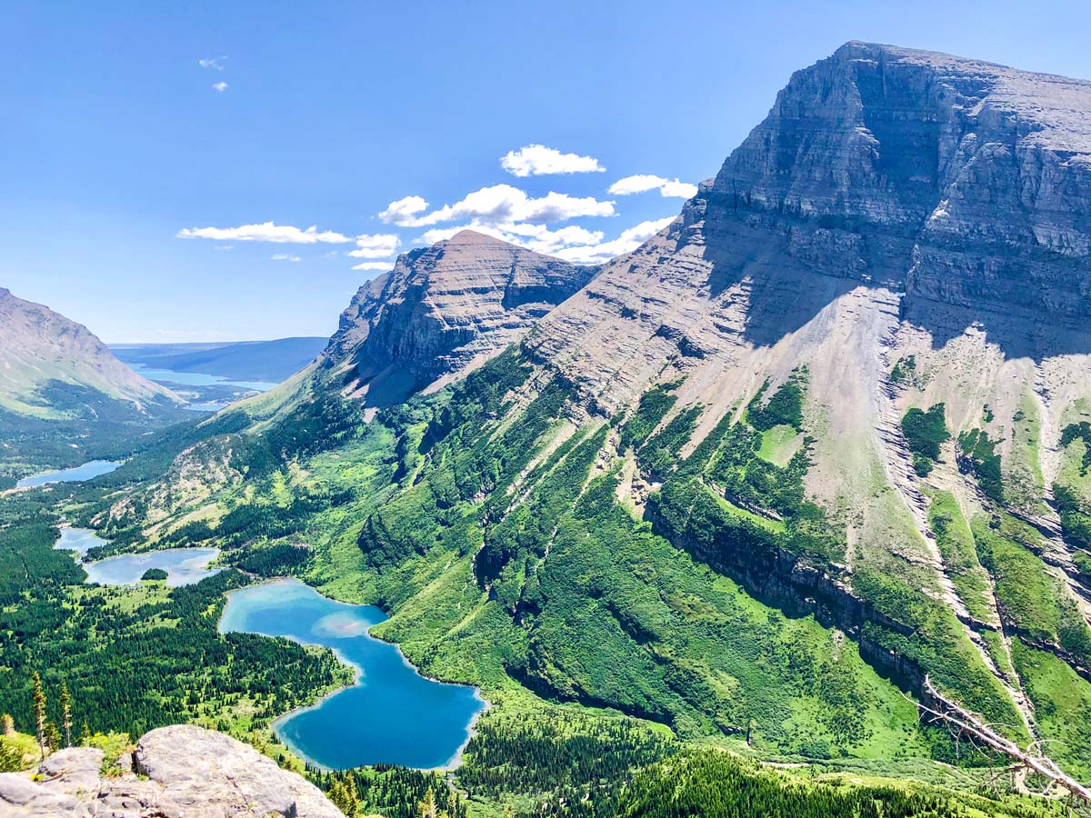
Once on the other side of the river, savour the views of Cosley Lake, it’s beautiful. This is a great place for a break while your feet dry out.
If you’re looking at the map, the next 6.2mi stretch along Cosley Lake and Glenns Lake looks incredible. In reality, you are about 328ft–656ft away from the lakes, in a forest with very limited views. This was the part of the North Circle Trail we liked least.
Follow the path and pass Cosley Lake Campground, Glenns Lake Foot Campground, Glenns Lake Head Campground and then Mokowanis Junction Campground.
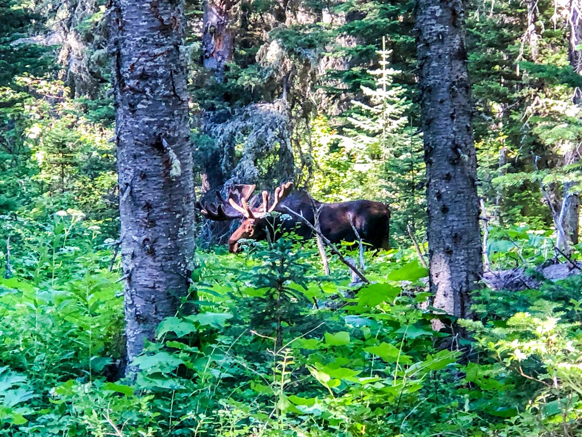
We ended up getting our permit for Mokowanis Junction Campground, which is probably the worst of the campgrounds, as there is no view. There was a bull moose that wandered through the campground for a couple of hours!
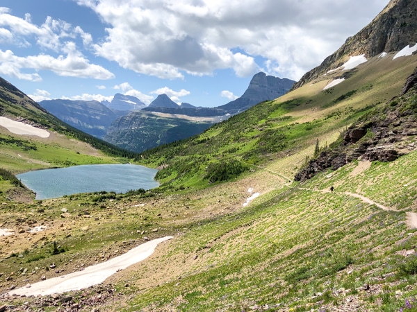
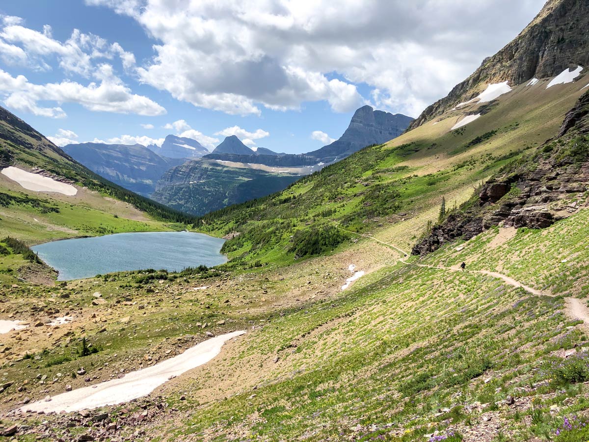
Day 3: Mokowanis Junction to Stoney Indian Lake Campground (5.2mi, 2264ft)
The route from Mokowanis Junction to Stoney Indian Lake is absolutely spectacular, and a highlight of the North Circle trail!
Note that you can combine Day 3 and Day 4 on this route into one very tough day. We’d suggest that you’d have more fun doing it over two days. Also, the campground at Stoney Indian Lake is not that great, however, the views and location are absolutely spectacular.
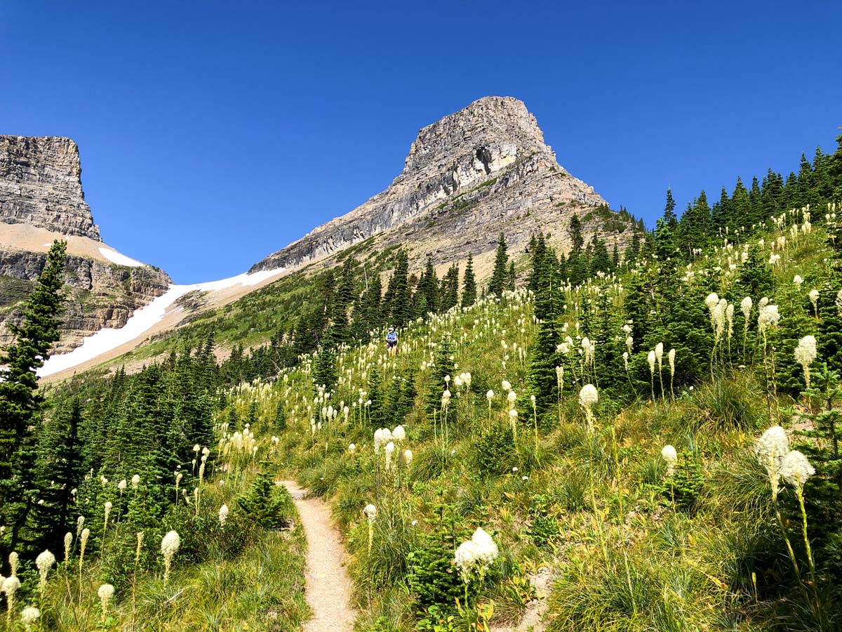
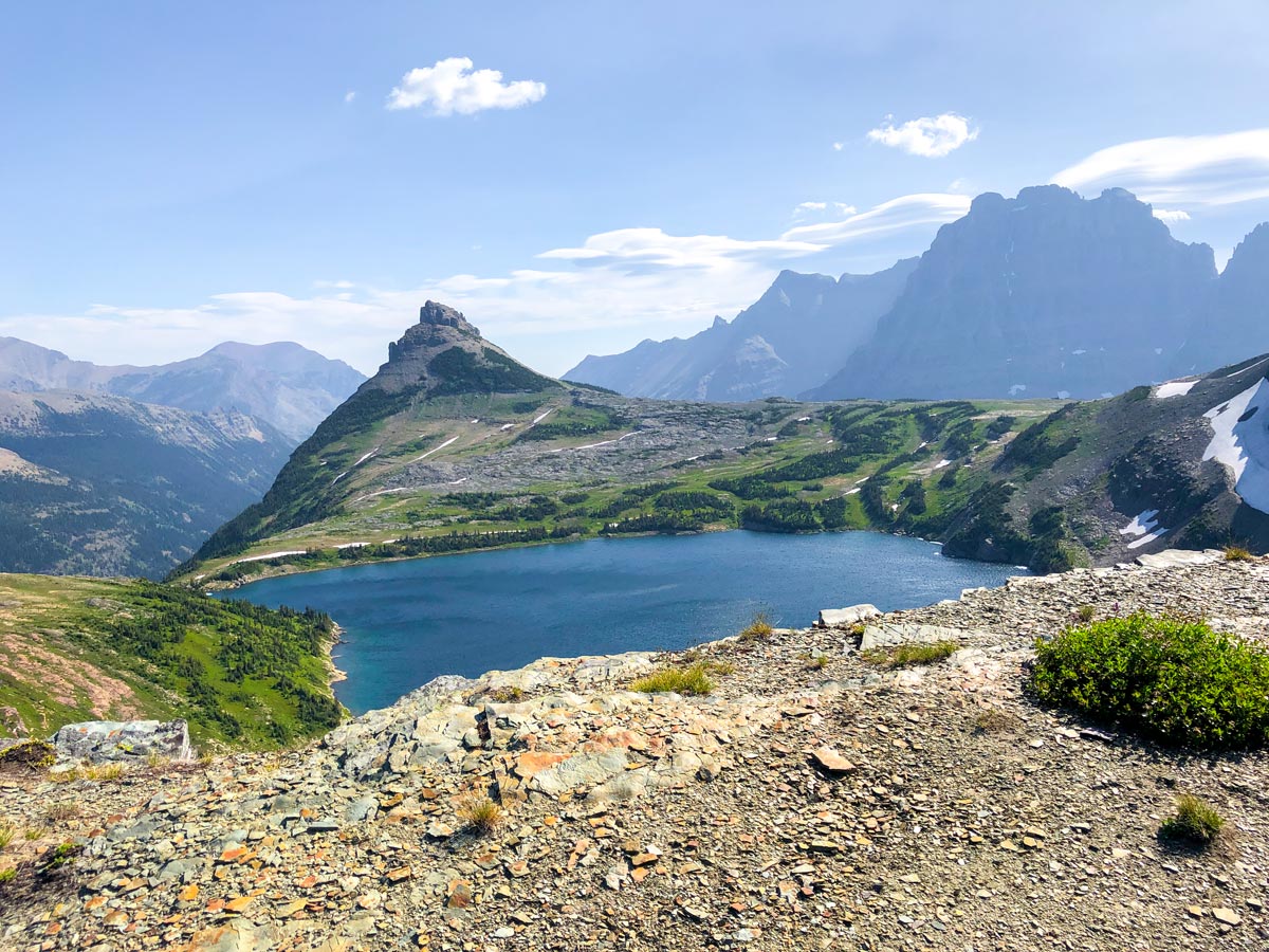
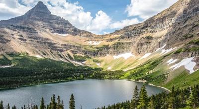
Start from Mokowanis Junction and you almost immediately start to climb. Your first objective is the beautiful Atsina Lake, which you reach in about 1.6mi. You go around the north side of Atsina Lake, and it’s stunning.
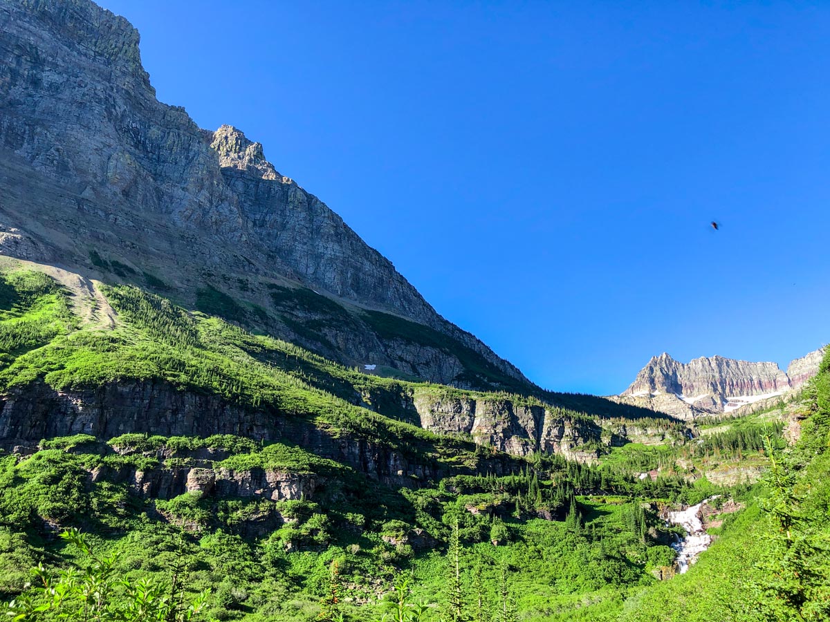
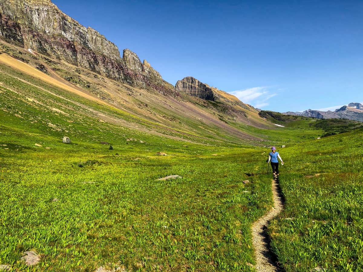
Continue on the trail as it heads south and gains elevation on a series of switchbacks, before crossing Mokowanis River. You are now walking in a beautiful high meadow, with stunning views. You pass another tarn and then switchback up to Stoney Indian Pass.
The views from Stoney Indian Pass are incredible, with Wahcheechee Mountain to your left and the Lewis Range on your right. From here, head down on the trail to Stoney Indian Lake, but beware the trail is steep. You eventually end up around the back, far end of Stoney Indian Lake.
Once at the lake, follow the path around and the campground is near the outflow of the lake. The campsite here is only ok, however the views are incredible!
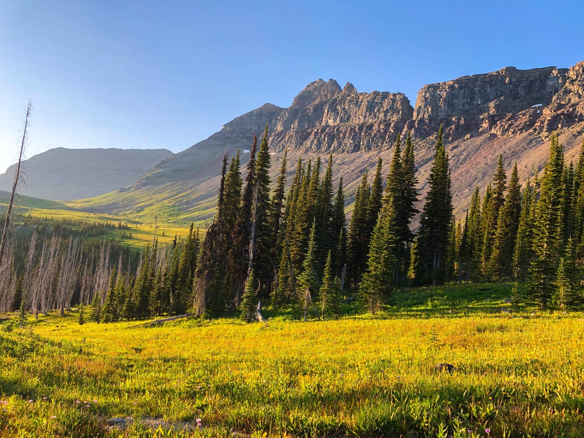
Day 4: Stoney Indian Lake Campground to Fifty Mountain Campground (7.6mi, 2756ft)
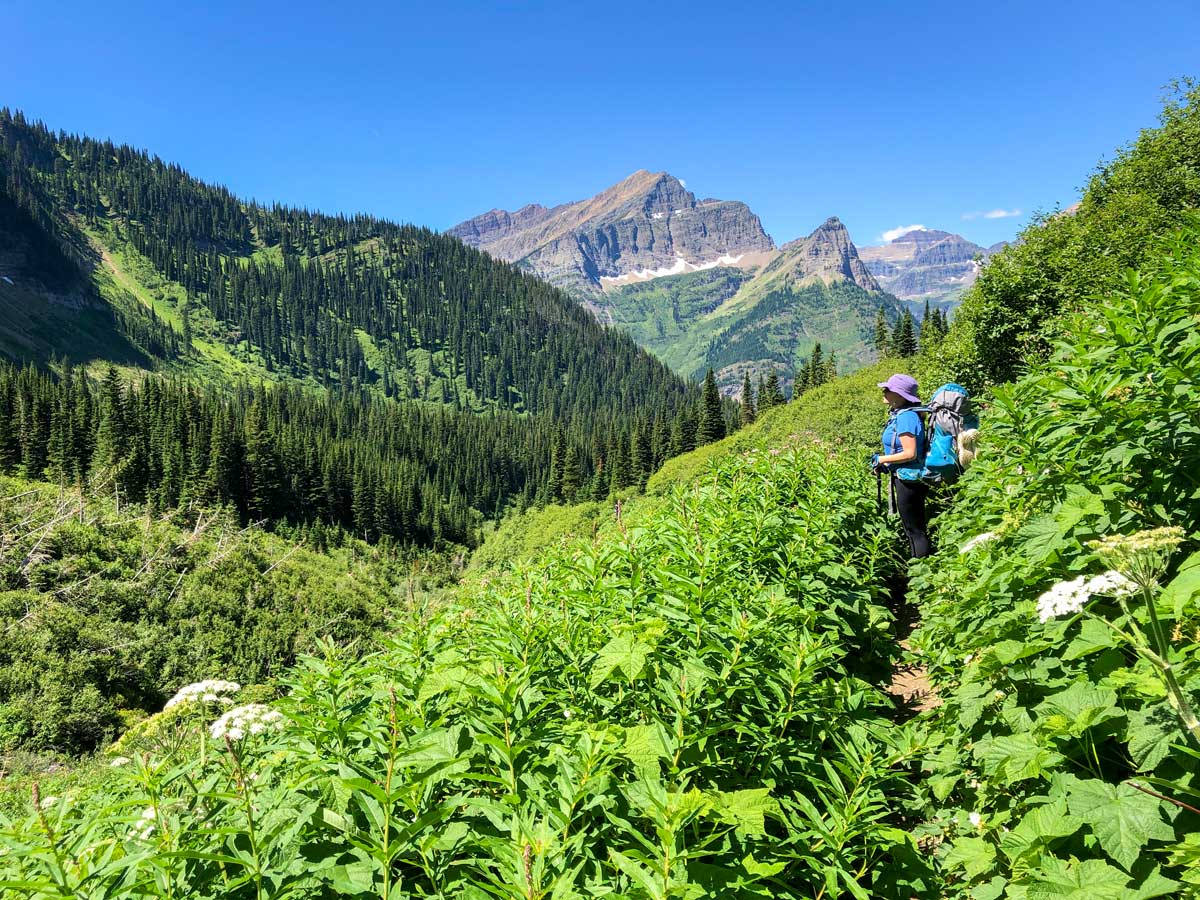
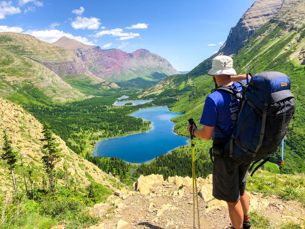
Today is a day of great variety on Montana’s North Circle Trail. From Stoney Indian Lake, hike downhill on a trail that leads to the valley bottom and the Waterton River. As you descend, the foliage gets thicker and thicker, and in our case we had to use our poles to move the foliage so we could see the trail.
Once at the valley bottom, there is a crossing trail, the epic Continental Divide Trail. If you go right, you can hike north into Canada and Waterton Lakes National Park.
Our path goes left, and soon passes a ranger cabin. While you are near the Waterton River, don’t expect to see too much of it. While you’re in the valley bottom, fill up your bottles, as water is harder to find in the alpine.
You’ll spend roughly 1.2mi walking in the valley bottom before the trail starts to rise up the flanks of Cathedral Peaks.
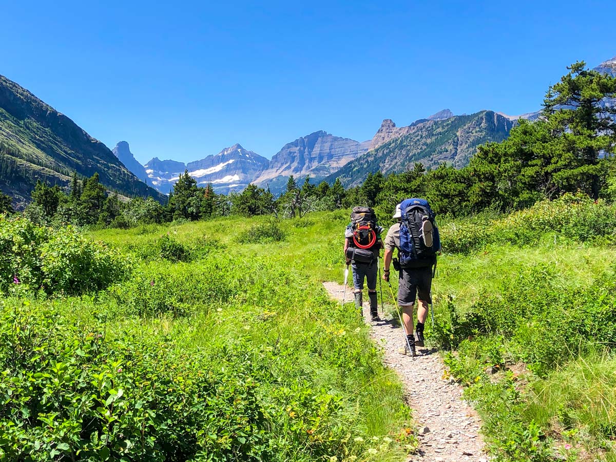
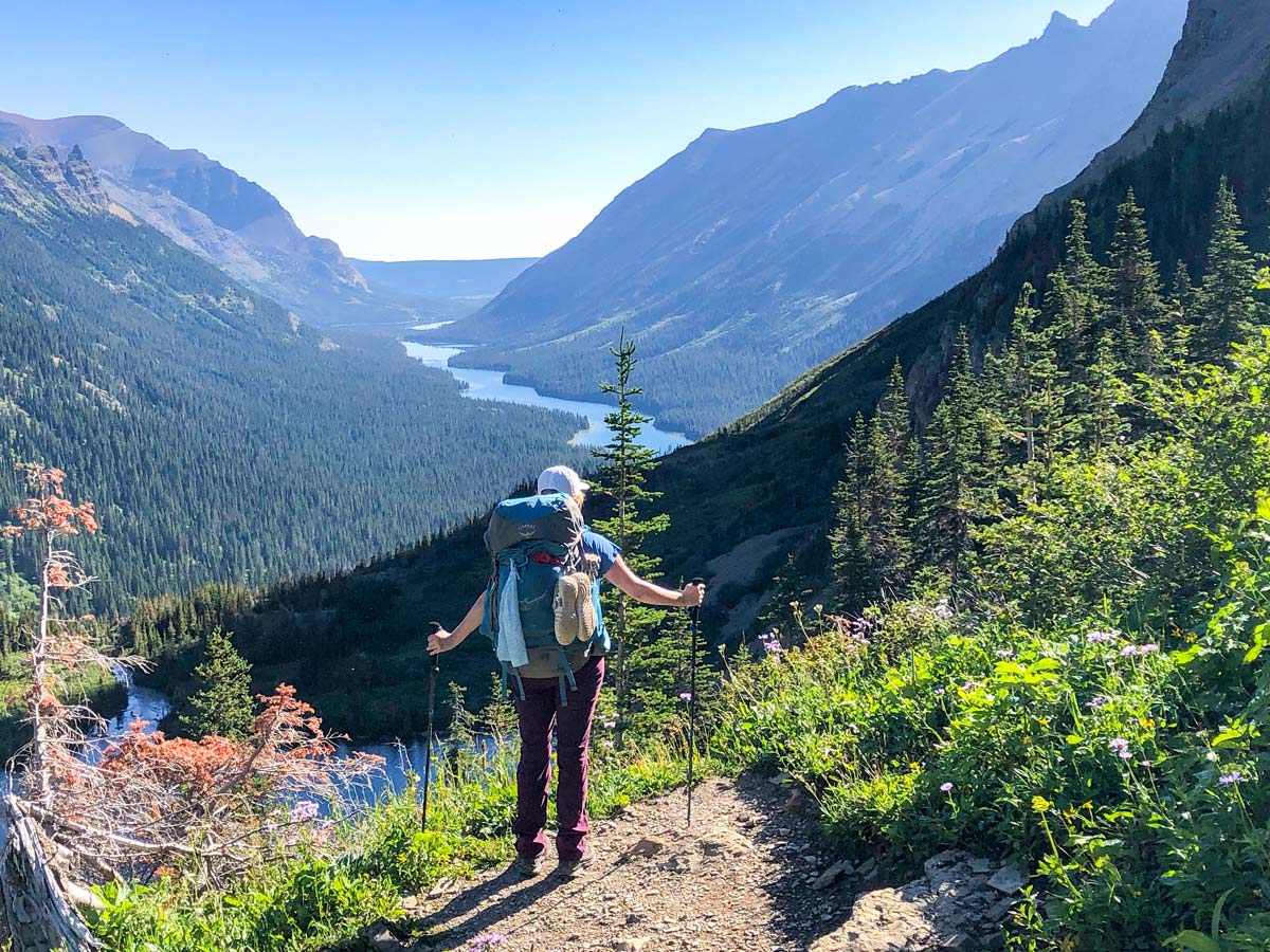
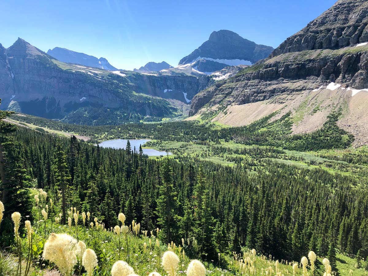
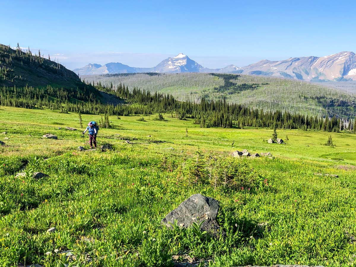
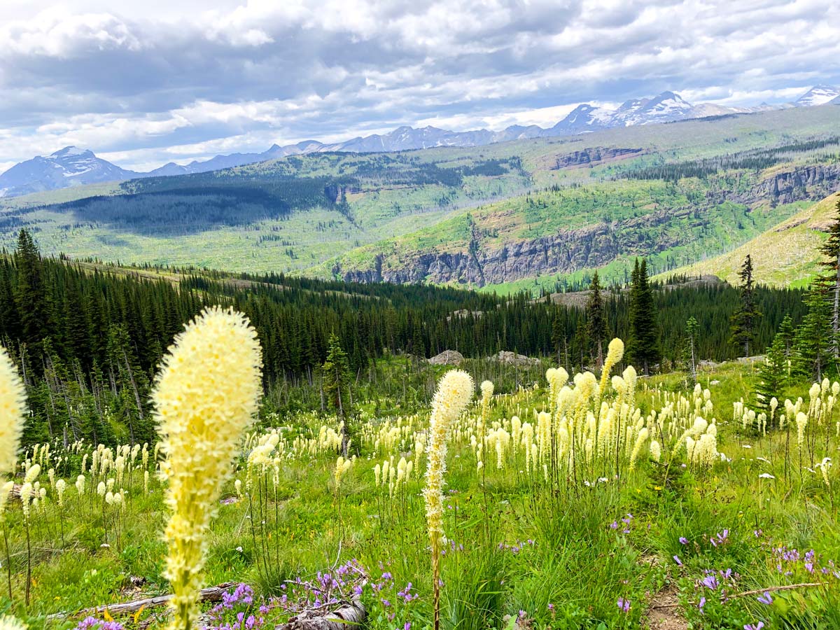
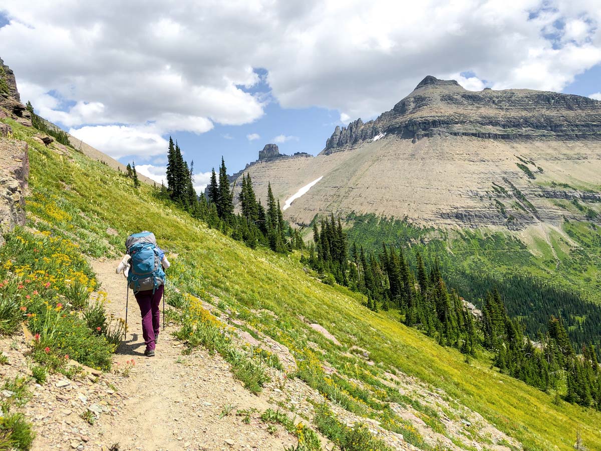
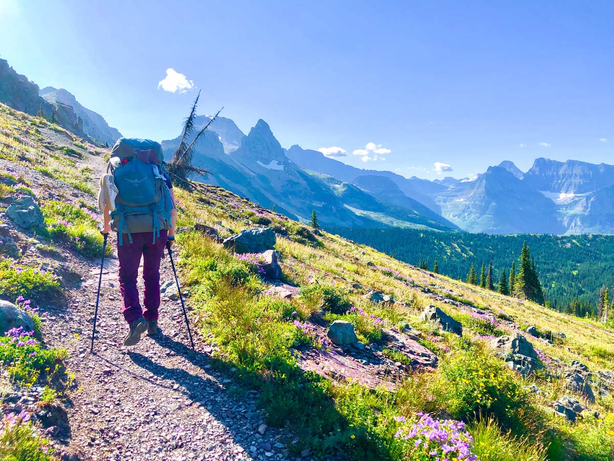
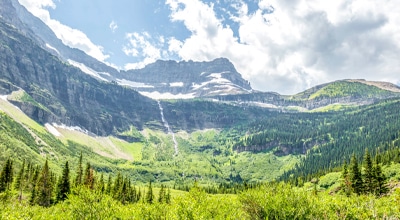
As you rise through the forest, eventually you get into the alpine, and this is one of the best parts of the North Circle Trail backpack. The views for the next 12.4mi+ are spectacular, and one of the best alpine walks in the Rocky Mountains.
You’ll pass a former stone ranger cabin that has been demolished. We stopped and marvelled at spending a summer in such an incredible location. Continue walking southeast, and if you see a stream we recommend stopping and filling your water bottles.
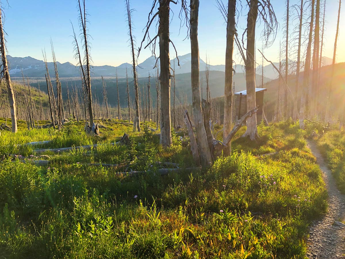
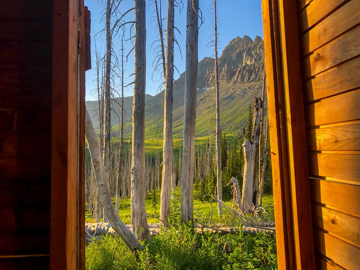
Soon you are at Fifty Mountain Campground, an absolutely spectacular campground, with enormous views.
Day 5: Fifty Mountain Campground to Granite Park Campground (12.7mi, 2526ft)
Today is another epic day backpacking along Montana’s North Circle Trail. Some say this route, known as the Upper Highline, is the best walking trail in Glacier National Park. It definitely is spectacular!
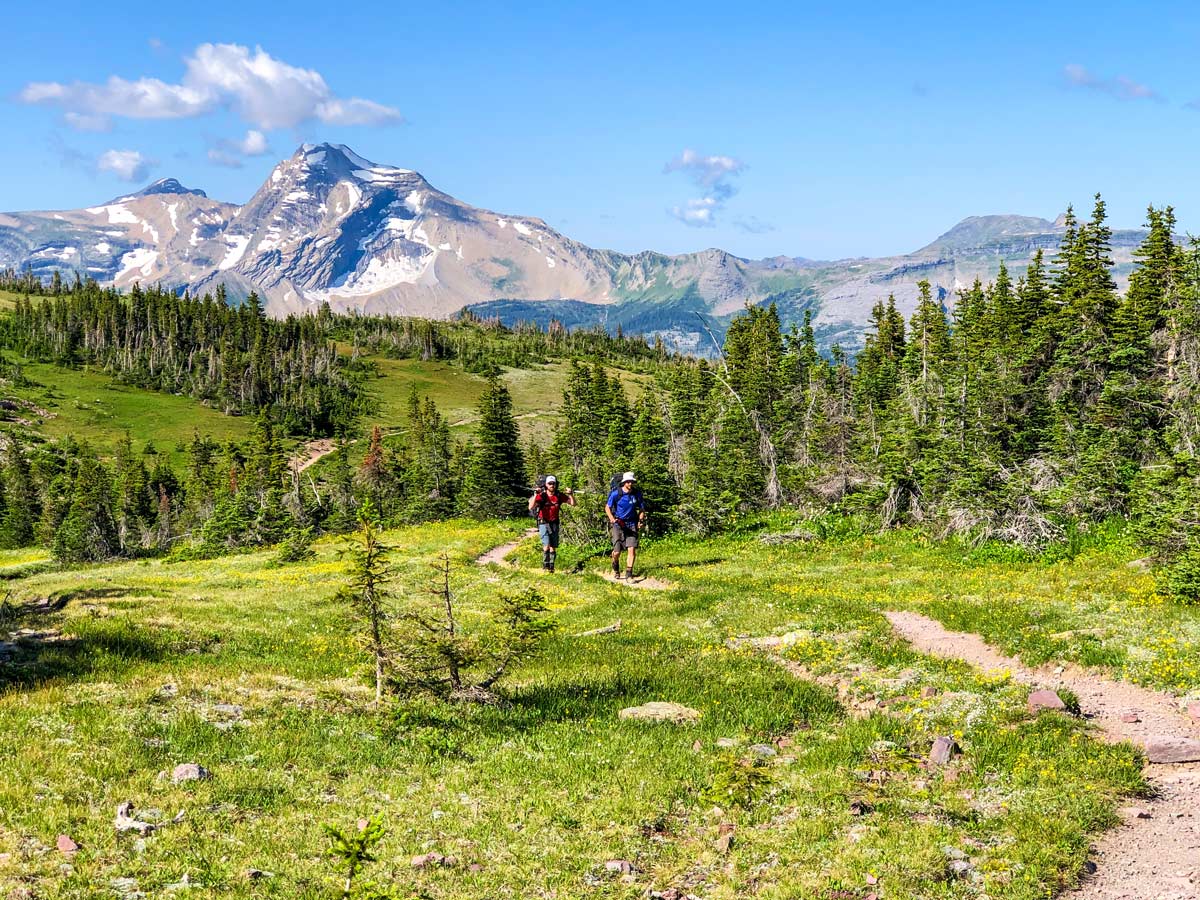
Leave Fifty Mountain Campground and walk through a meadow that is full of wildflowers early in the season. Then go right and start to climb on a clear trail.
Very soon after going right, you get the option to take the Sue Lake Overlook. Take it. The Sue Lake Overlook is spectacular, and the view is a highlight of Glacier National Park, with incredible views down to Sue Lake, which is a lake above Atsina Lake (you walked by this on Day 3).
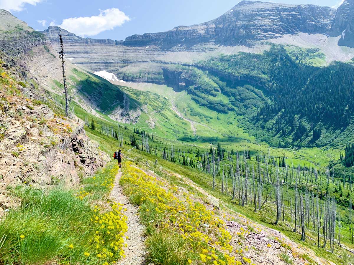
Come back down to continue on the Upper Highline Trail. The route is clear as you walk below Mt Kipp, and the views are spectacular.
After about 5.9mi you come to Cattle Queen Creek, which descends beneath Ipasha Peak. This is a great place for lunch and a fill of the water bottles.
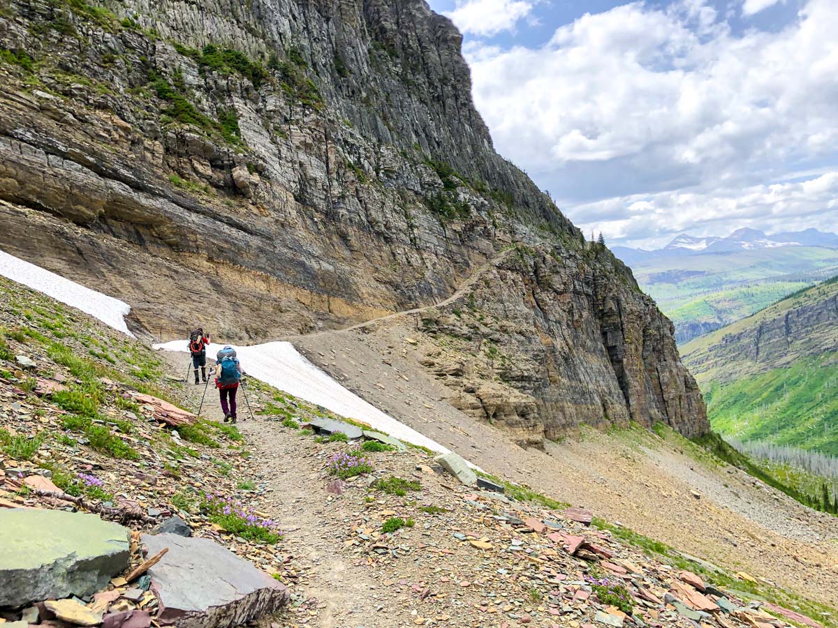
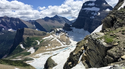
Continue on the Highline Trail as it then contours around Ahern Peak and then comes to Ahern Creek, then contours around Iceberg Peak. Note that this part of the trail has one major barrier that can be challenging, the famed Ahern Drift.
The Ahern Drift is a patch of snow that lingers well into summer. The Ahern Drift is on a steep bit of the trail, and can be very dangerous to cross, with the rangers recommending crampons and ice-axes. When we did it at the end of July, we found a clear path down to the rocky trail, and there was no danger, however we could see how this would be dangerous. Check Trail Conditions on the Ahern Drift before starting out, this part of the trail is in the Lake McDonald area.
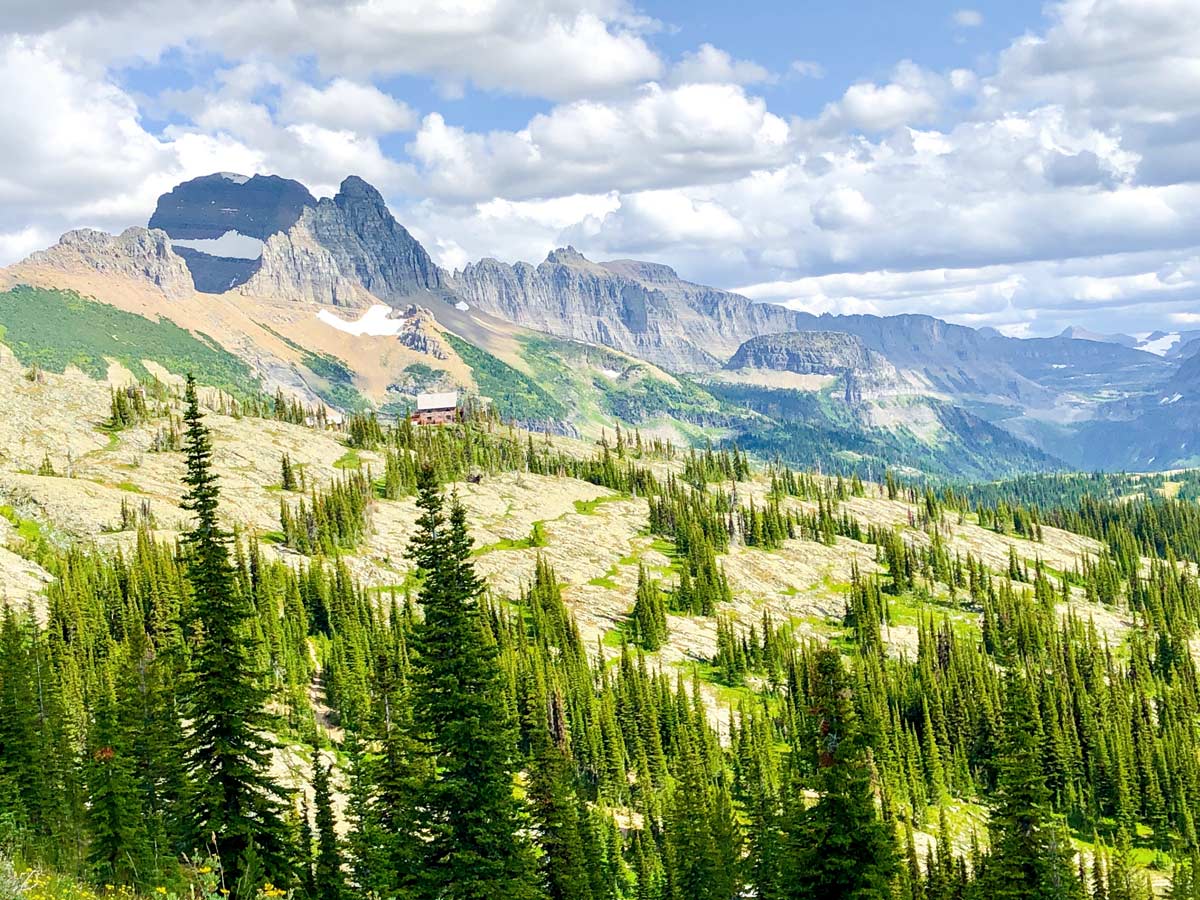
After passing the Ahern Drift, the trail leads on for about 3.1mi until it reaches Granite Park Campground. Be aware that the Granite Park Campground is still about 0.6mi from the Granite Park Chalet, and the campground doesn’t have the spectacular views of Granite Park chalet.
If possible, we’d definitely suggest booking in at Granite Park Chalet, it’s a beautiful location. You can buy backpacker meals and drinks at Granite Park Chalet.
Day 6: Granite Park Campground to Many Glacier (11.4mi, 2133ft)
Today is another great day, and if you are feeling energetic you can include a summit of Swiftcurrent Mountain.
Leave Granite Park Campground and take the signed path to Granite Park Chalet (note that the map shows the route that doesn’t go via Granite Park Chalet).
Once you get to Granite Park Chalet, buy a snack and get a seat at a picnic table and marvel at the view, it’s spectacular.
From Granite Park Chalet take the signed path to Swiftcurrent Pass. This is a pretty walk, and before you know it you’re at Swiftcurrent Pass. From here we highly recommend the walk to the summit of Swiftcurrent Mountain. It’s about 1312ft of elevation in 1.6mi, but the views are worth it.
Whether you summit Swiftcurrent or not, continue over Swiftcurrent Pass and make your way on a pretty path that contours around the flanks of Swiftcurrent Mountain and then switchbacks down to a very pretty cirque, passing Swiftcurrent Creek along the way.
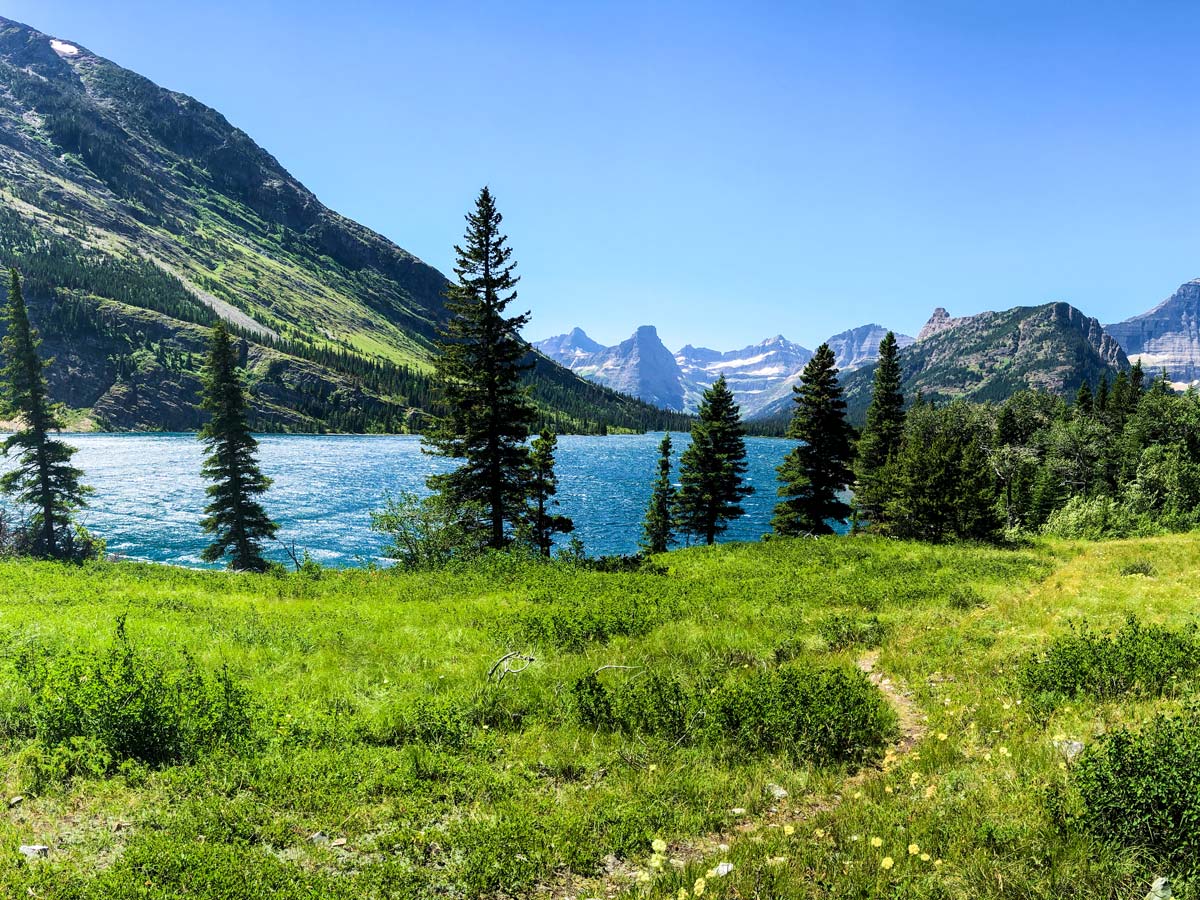
Once in the cirque below Swiftcurrent Mountain, follow the trail as it goes along a dry streambed and eventually comes to Bullhead Lake. There are fine views as you go along Bullhead Lake, and it’s also a good place for a swim on a hot day.
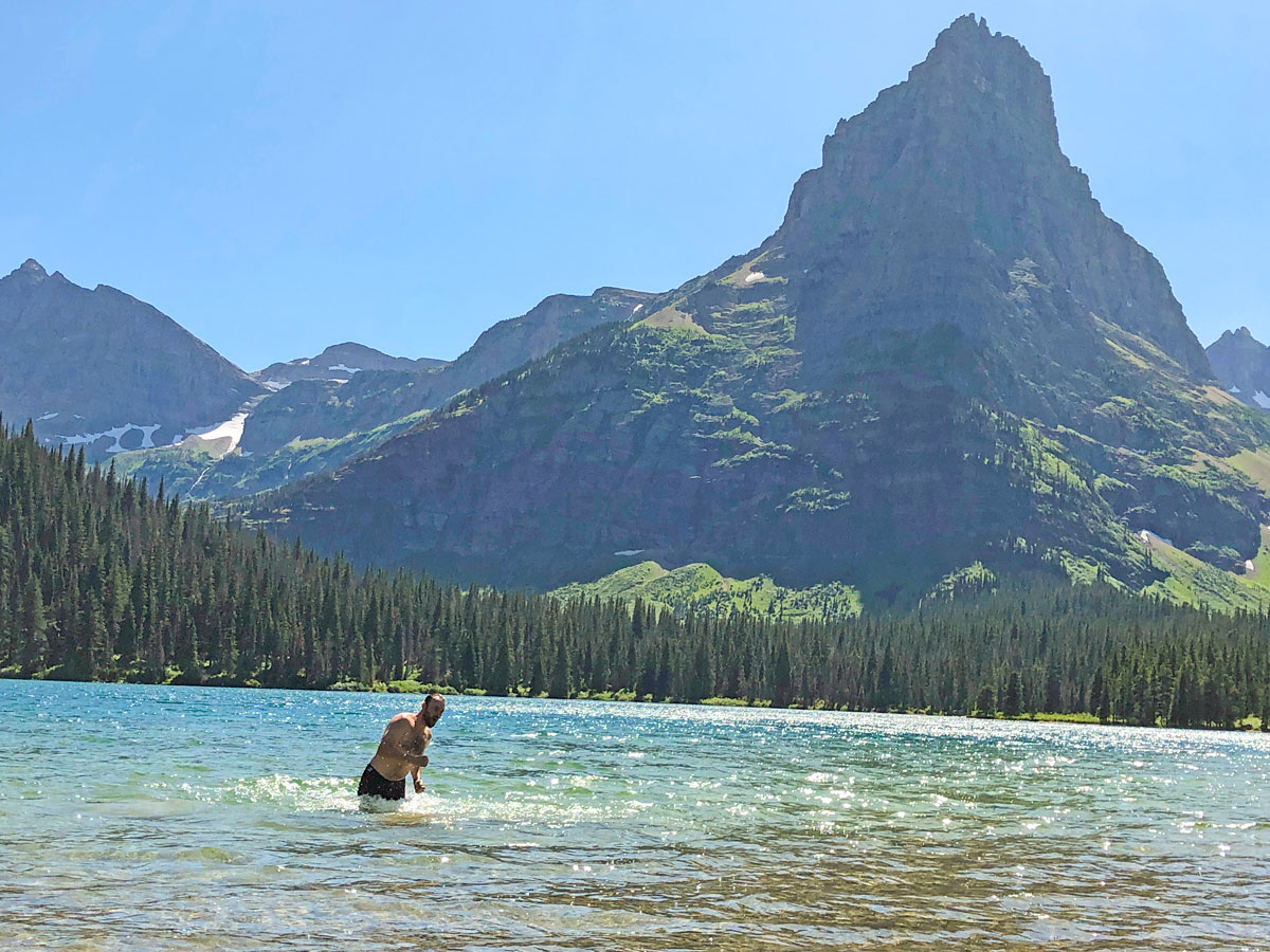
Walk another 1.6mi and come to Redrock Falls, an absolutely glorious place for a swim on a hot day. You can easily spend an hour here playing in the cool water.
From Redrock Falls, it’s an easy 2.2mi stroll back to your car in the Swiftcurrent Motor Inn parking lot.
Sample Itinerary
Day 1: Many Glacier to Elizabeth Lake (10.9mi, 2415ft)
Day 2: Elizabeth Lake Head to Mokowanis Junction (10.2mi, 902ft)
Day 3: Mokowanis Junction to Stoney Indian Lake Campground (5.2mi, 2264ft)
Day 4: Stoney Indian Lake Campground to Fifty Mountain Campground (7.6mi, 2756ft)
Day 5: Fifty Mountain Campground to Granite Park Campground (12.7mi, 2526ft)
Day 6: Granite Park Campground to Many Glacier (11.4mi, 2133ft)
Insider Hints
You need a permit for this route. We suggest getting your permit application into the lottery as soon as the lottery opens. You can find out more info backcountry permits here.
While we list actual campgrounds for the North Circle Trail, the campgrounds on your permit will vary.
Check Trail Conditions on the Ahern Drift before starting out, this part of the trail is in the Lake McDonald area.
Be aware that you have one major stream crossing near Cosley Lake. You may have other smaller stream crossings depending when you do the route.
If possible, book a night at Granite Park Chalet instead of Granite Park Campground. The chalet is spectacular.
This is a tough route, with some long days.
There is a lot of foliage on Day 2 and Day 4. You can expect foliage to cover the path and be waist to armpit height. Having poles really helps to move the foliage to see the trail.

Similar backpacking trails to the North Circle backpacking trail
The Highline
The Highline is one of Glacier’s legendary hikes along the Continental Divide, and this backpacking loop is the best way…
Boulder Pass
Backpacking through this northern section of Glacier National Park is a very wild experience. With limited access to the area,…
Pitamakan Dawson Loop
The Pitamakan-Dawson Loop is a strenuous and rewarding backpacking trip on the east side of Glacier National Park. Setting out…
jkobrynich 2 years ago
Awesome backpacking trip. You will not be disappointed.
Rob Silvermann 4 years ago
One of the premiere backpacking loops in the US! An amazing trail with a amazing views and wild life.