Sawback Backpacking Trail
View Photos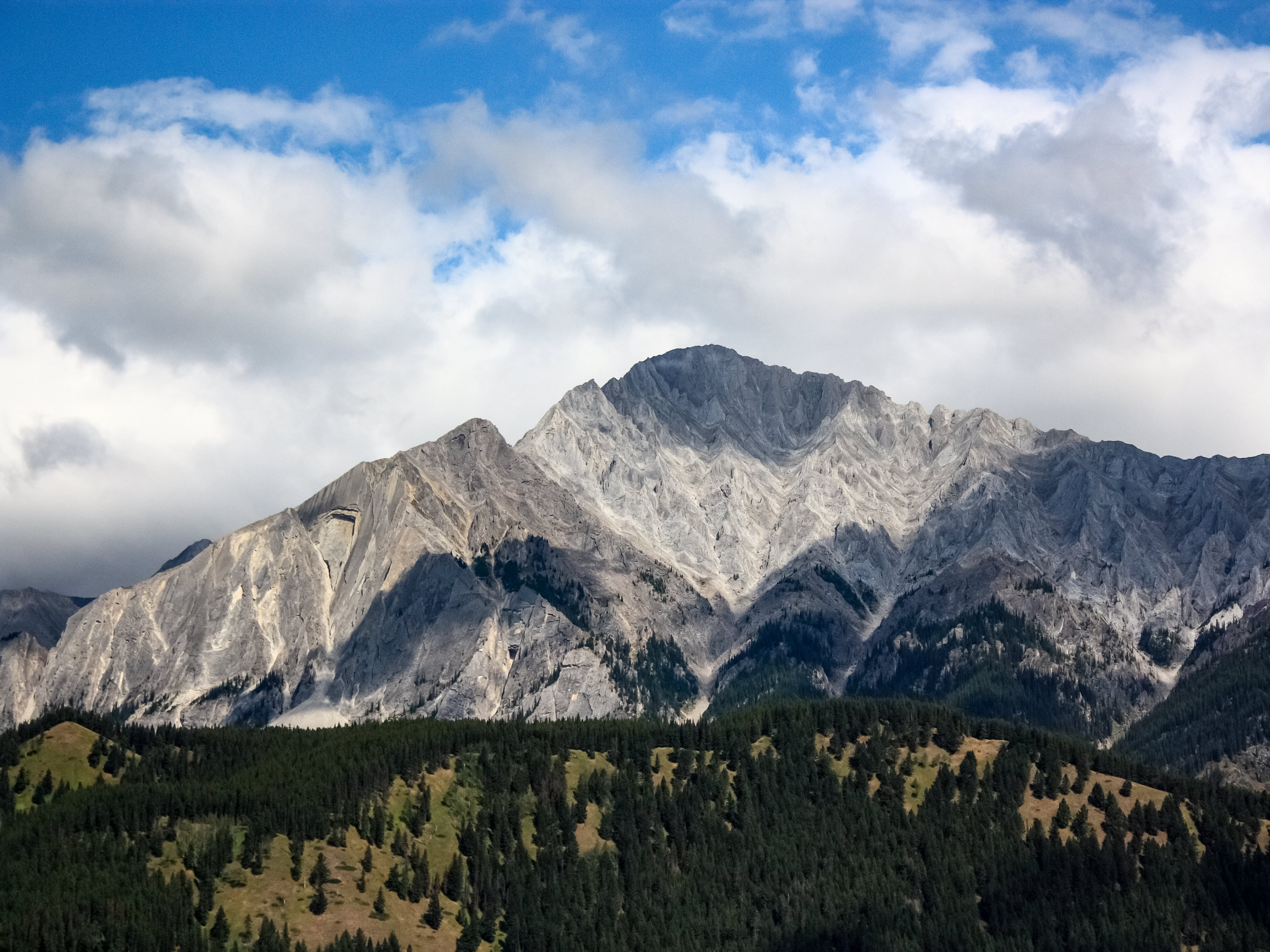
Sawback Backpacking Trail
Difficulty Rating:
The Sawback Trail is a popular multi-day trip in Banff National Park. It has endless variations and itinerary options, which makes it excellent for those searching for a unique experience in the backcountry! This trail becomes fully booked every summer through the Parks Canada online booking system. Many sites are only equipped with five tent pads, which makes it difficult to get a spot. Luckily, there are many different options, and if you plan ahead, you’re in for the trip of a lifetime. Climb mountain passes, relax at alpine lakes, and travel through wildflower meadows and diverse forests on this bucket list trail.
Getting there
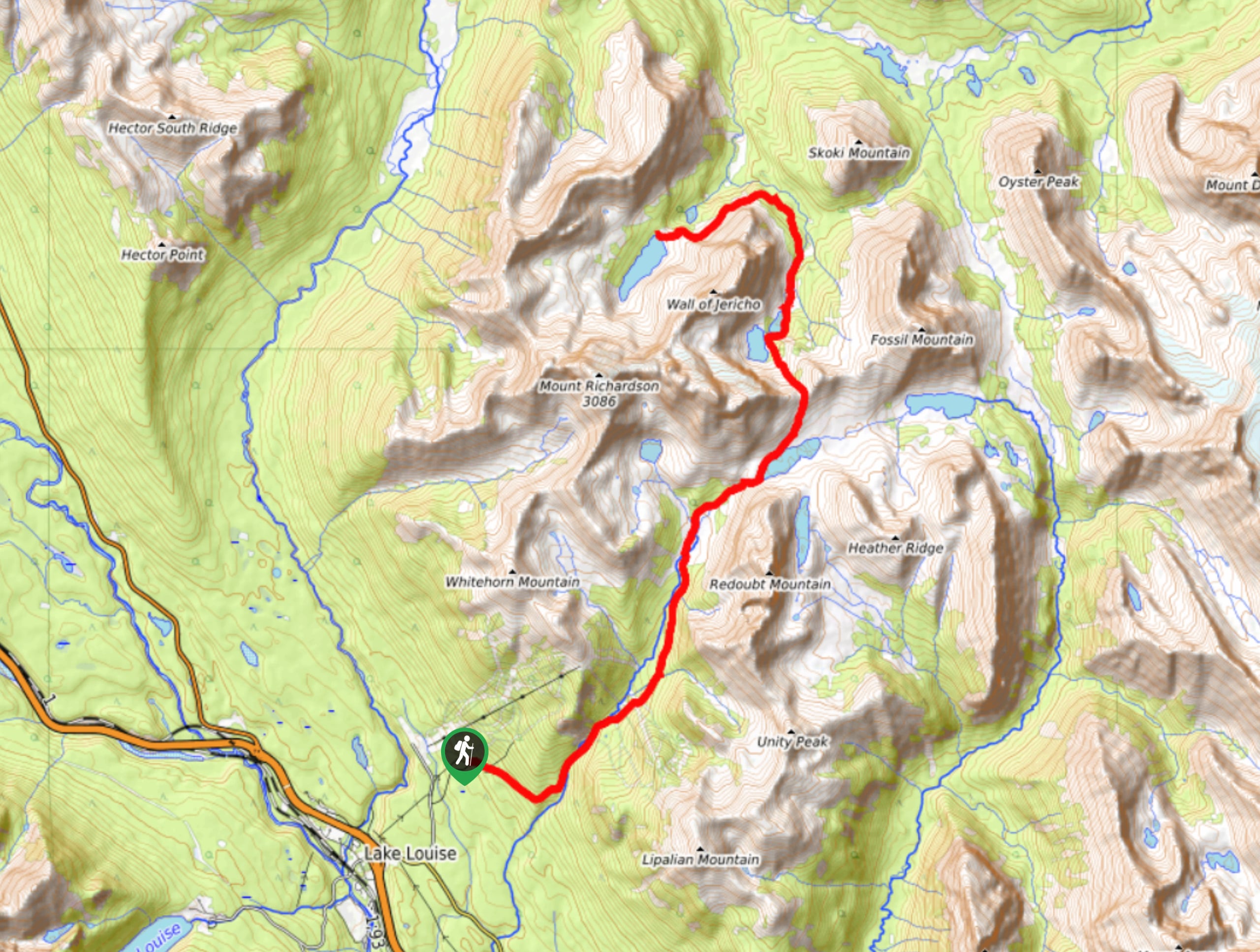
The Sawback Trail backpacking route is a one-way point-to-point trail that requires most hikers to leave a car at one end before returning for the other. There are shuttles between both destinations, so another option is to leave a car at one trailhead and return to the other via shuttle. The two main trailheads are Fish Creek parking lot in Lake Louise and Mount Norquay in Banff.
To get to Fish Creek parking lot at the northern point of the trail, take the Trans-Canada Highway westbound from Banff. Travel 35.4mi before reaching the exit for Lake Louise Village. Turn right off the ramp and drive towards the Lake Louise Ski Resort. You will pass the entrance to the Bow Valley Parkway and take your next right onto Fish Creek Road. Signs for Skoki Lodge will lead you to the parking lot on the gravel road.
To get to Mount Norquay parking lot at the southern point of the trail, take Lynx street in Banff towards the Trans-Canada Highway. Continue on the overpass for the highway onto Mount Norquay Road. Follow the steep switchbacks until you reach the parking lot. Watch for bighorn sheep and bears as they love to travel between the switchbacks on this road.

About
| When to do | June-September |
| Backcountry Campsites | Mount Cockscomb Fm10, Mystic Junction Fm19, Mystic Valley Mi22, Larry’s Camp Jo9, Luellen Lake Jo19, Johnston Creek Jo18, Badger Pass Junction Jo29, Wildflower Creek Ba15, Baker Lake Ba11, Hidden Lake Sk5 |
| Pets allowed | Yes - On Leash |
| Family friendly | Older Children only |
| Route Signage | Average |
| Crowd Levels | Moderate |
| Route Type | One Way |
Sawback Backpacking Trail
Elevation Graph
Weather
Sawback Trail Backpacking Trail Description
The Sawback Trail backpacking route doesn’t quite hold the same status as Mount Assiniboine, Egypt Lake, or The Rockwall, yet it is just as popular. As bloggers and Instagrammers flock to other trails in the area, the Sawback Trail tends to be neglected. Its bookings tell a different story because this trail is almost impossible to reserve without the appropriate planning. The Sawback Trail is generally fully booked for the season as soon as the Parks Canada reservations system opens in January.
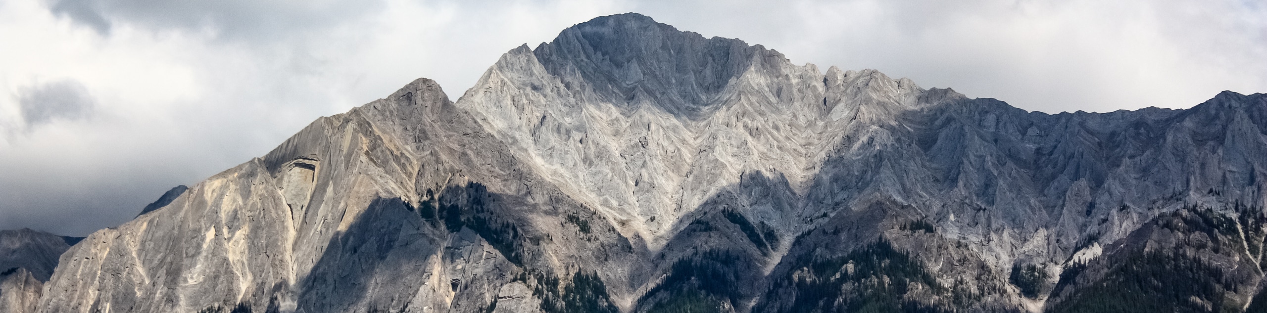
The trail’s solid bookings are a tell-tale sign that it is worth the planning. This trail has endless route variants and boasts a unique rocky mountain experience. You will travel through remote wilderness between Banff and Lake Louise, paralleling the Trans-Canada Highway. The roughly 44.1mi trail—depending on your route—takes hikers from the bottom of valleys to the top of high passes and everything between. You will travel along creeks, through wildflower meadows, between wildlife corridors, and next to alpine lakes on this memorable journey.
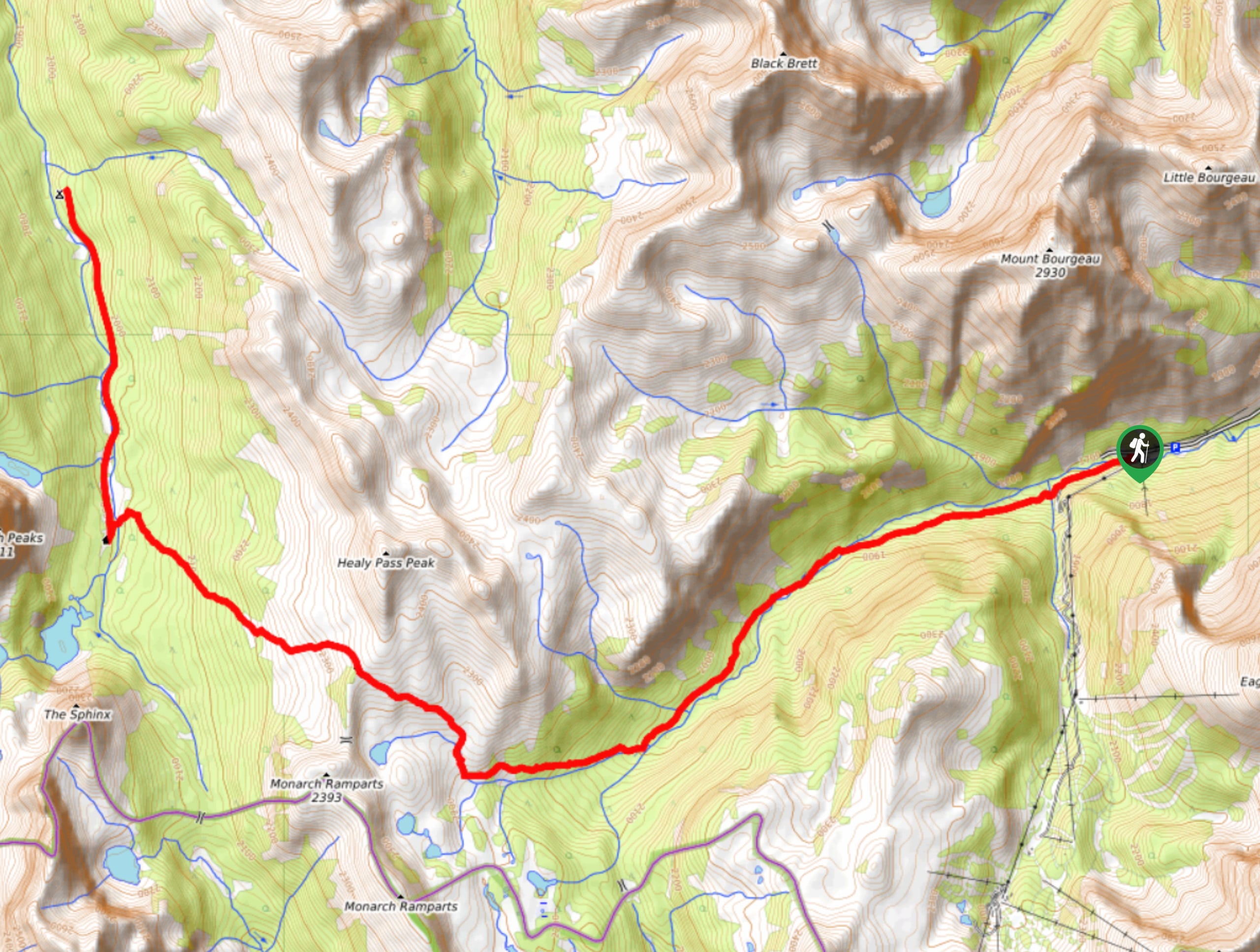
The trail is most commonly hiked from south to north beginning in Banff. Starting at Mount Norquay takes hikers through the forest in the Mystic Valley along Forty-Mile Creek to Mystic Junction and Mystic Valley Camps. Hike through the woods, taking a slight detour to the incredible Mystic Lake before summiting Mystic Pass. Be sure to turn back for jaw-dropping views as you crest Mystic Pass.
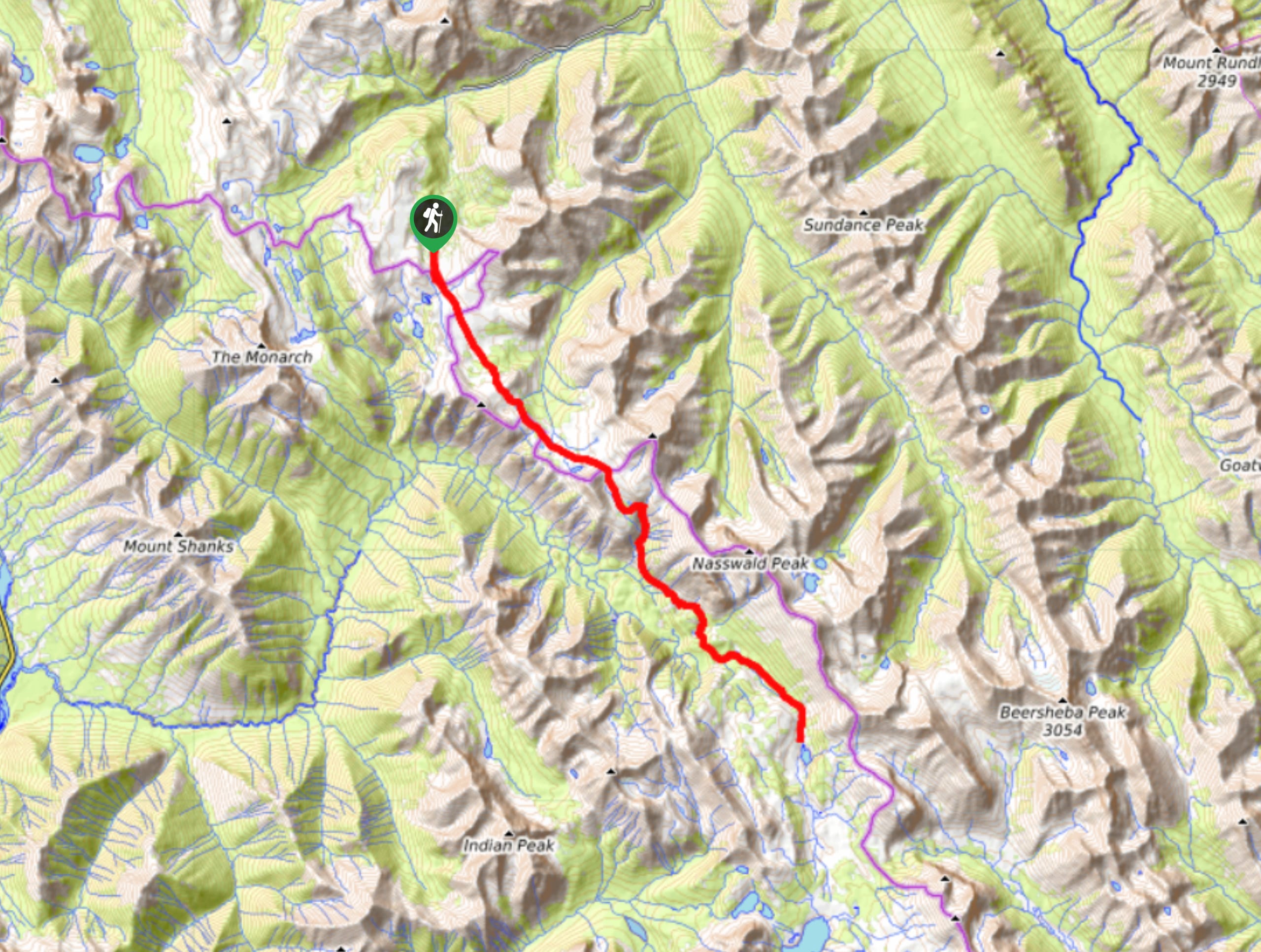
Descend Mystic Pass and continue through boulder fields below the Sawback Range and into Johnston Creek valley. Make your way to Luellen Lake, which is one of the very few campgrounds that is set right at the shores of the lake. Moving on from Luellen Lake, make your way past Badger Pass Junction campground and over Pulsatilla Pass. You will hike past the beautiful and pristine Pulsatilla Lake at the top of the pass. Head down to Wildflower Creek for a quiet night in the woods. From here, continue north into the Skoki area, where many trails collide. Stay on the main trail that winds past one of the area’s prized landmarks, Baker Lake. Hike beyond Baker Lake to the quaint Hidden Lake. Make your way to Fish Creek parking lot on the final day.
Sample Itinerary:
- Day 1
Mount Norquay Trailhead to Mystic Valley
Distance: 11.1mi
Elevation gain: 1535ft
Campground: Mystic Valley Mi22 - Day 2
Mystic Valley to Luellen Lake
Distance: 11.0mi
Elevation gain: 2205ft
Campground: Luellen Lake Jo19 - Day 3
Luellen Lake to Wildflower Creek
Distance: 9.5mi
Elevation gain: 1670ft
Campground: Wildflower Creek Ba15 - Day 4
Wildflower Creek to Hidden Lake
Distance: 8.3mi
Elevation gain: 1552ft
Campground: Hidden Lake Sk5 - Day 5
Hidden Lake to Fish Creek Trailhead
Distance: 4.5mi
Elevation gain: 0ft
Campground: None
Insider Hints
In the summer months Mount Norquay offers a shuttle from town to the parking lot. Roam Transit offers a bus service between Banff and Lake Louise Village, and the Lake Louise Ski Resort hosts a free shuttle from the village to the resort. We suggest leaving a vehicle at the Lake Louise end of the trail to avoid some gruelling extra mileage down the gravel road.
Similar backpacking trails to the Sawback Backpacking Trail backpacking trail
Pharaoh Creek Backpacking Trail
The Pharaoh Creek backpacking trail follows the same route that many take to reach Egypt Lake and it’s cascading counterparts.…
Og Lake Backpacking Trail
The Og Lake backpacking trail is a great option for those who can’t make a reservation at the busy Lake…
Merlin Lake Backpacking Trail
The backpacking route to the Merlin Lake Trail follows the main Skoki route and covers all the popular landmarks in…
Comments