Bryant Creek Shelter backpacking trail
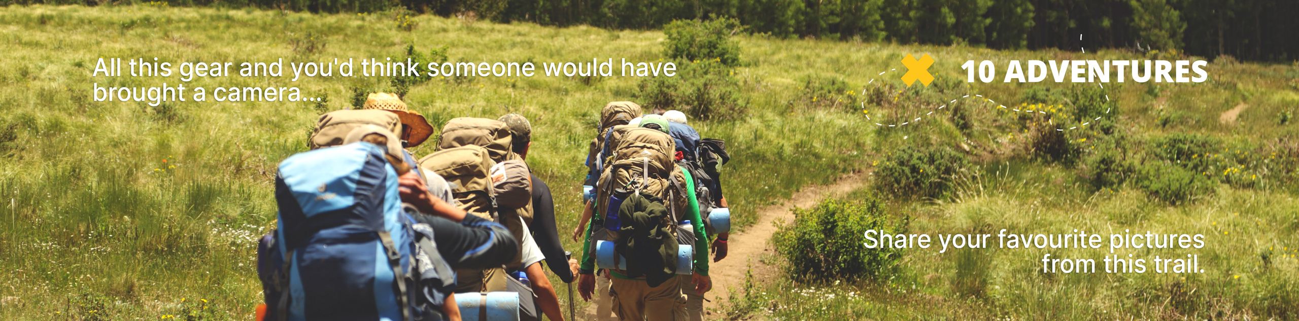
View Photos
Bryant Creek Shelter backpacking trail
Difficulty Rating:
The hike to the Bryant Creek Shelter is a simple and well-marked backpacking trail that is excellent for all abilities. Staying at the shelter makes for a uniquely different backcountry experience. There are excellent day hikes that leave from here, and this is an excellent jumping-off point for Mount Assiniboine.
Getting there
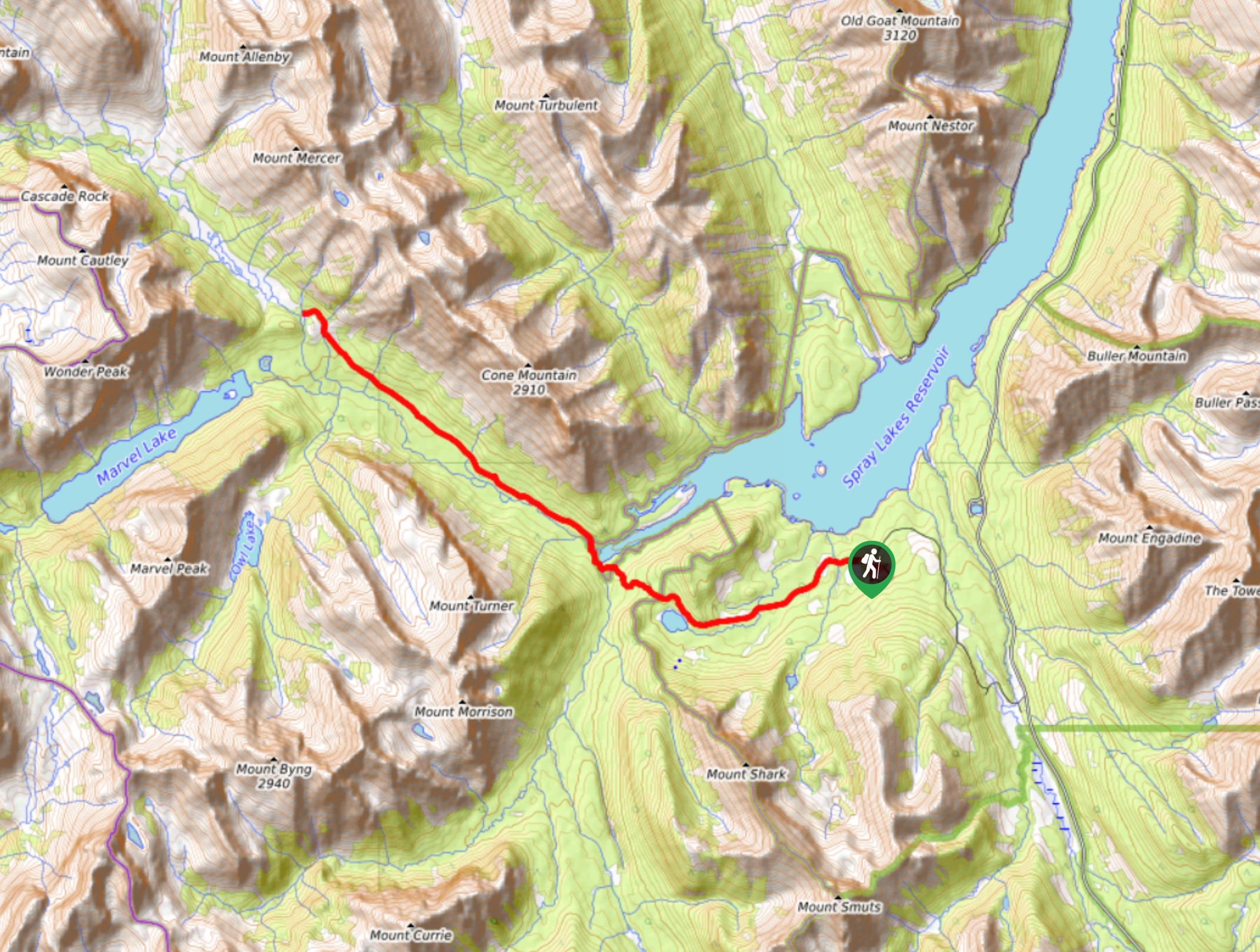
To get to the Bryant Creek Shelter Trailhead from the town of Canmore, follow signs for the Canmore Nordic Centre out of town. Continue past the Nordic Centre on Spray Lakes Road, which turns to a gravel road called Smith-Dorrien Spray Trail. This is graded and maintained. Stay on this road for 23.0mi until you come to a turn-off for Mount Shark Trailhead. Turn right onto the road, continuing beyond Mount Engadine Lodge and across the bridge. You will see a helipad; however, stay on the road and park at the regular visitor parking.

About
| When to do | June-September |
| Backcountry Campsites | Bryant Creek Shelter |
| Pets allowed | No |
| Family friendly | Yes |
| Route Signage | Average |
| Crowd Levels | High |
| Route Type | Out and back |
Bryant Creek Shelter
Elevation Graph
Weather
Bryant Creek Shelter Backpacking Trail Description
The Bryant Creek Shelter is operated by Parks Canada along with the other campgrounds on this side of Mount Assiniboine. Staying at a shelter is similar to a backcountry alpine hut but with fewer amenities. The Bryant Creek Shelter is a great getaway for large groups, hikers who are concerned about carrying weight, those who don’t are looking to try backpacking, and those who just enjoy the comforts of a shelter in the unpredictable weather of the Canadian Rockies.
This hike is roughly 8.3mi each way with rolling elevation and very well-maintained trails. There are other campgrounds on this trail that are mainly used by Mount Assiniboine hikers. Spending a night or two at the Bryant Creek Shelter is a great way to explore the southern Mount Assiniboine area by day hiking from the shelter.
Remember that staying at a shelter requires some etiquette, and it is important to respect others that will be sharing such a small space. Keep your belongings tidy and within a central space to your bunk. Do your part with the shelter chores such as getting water, chopping wood, and stoking the fire.
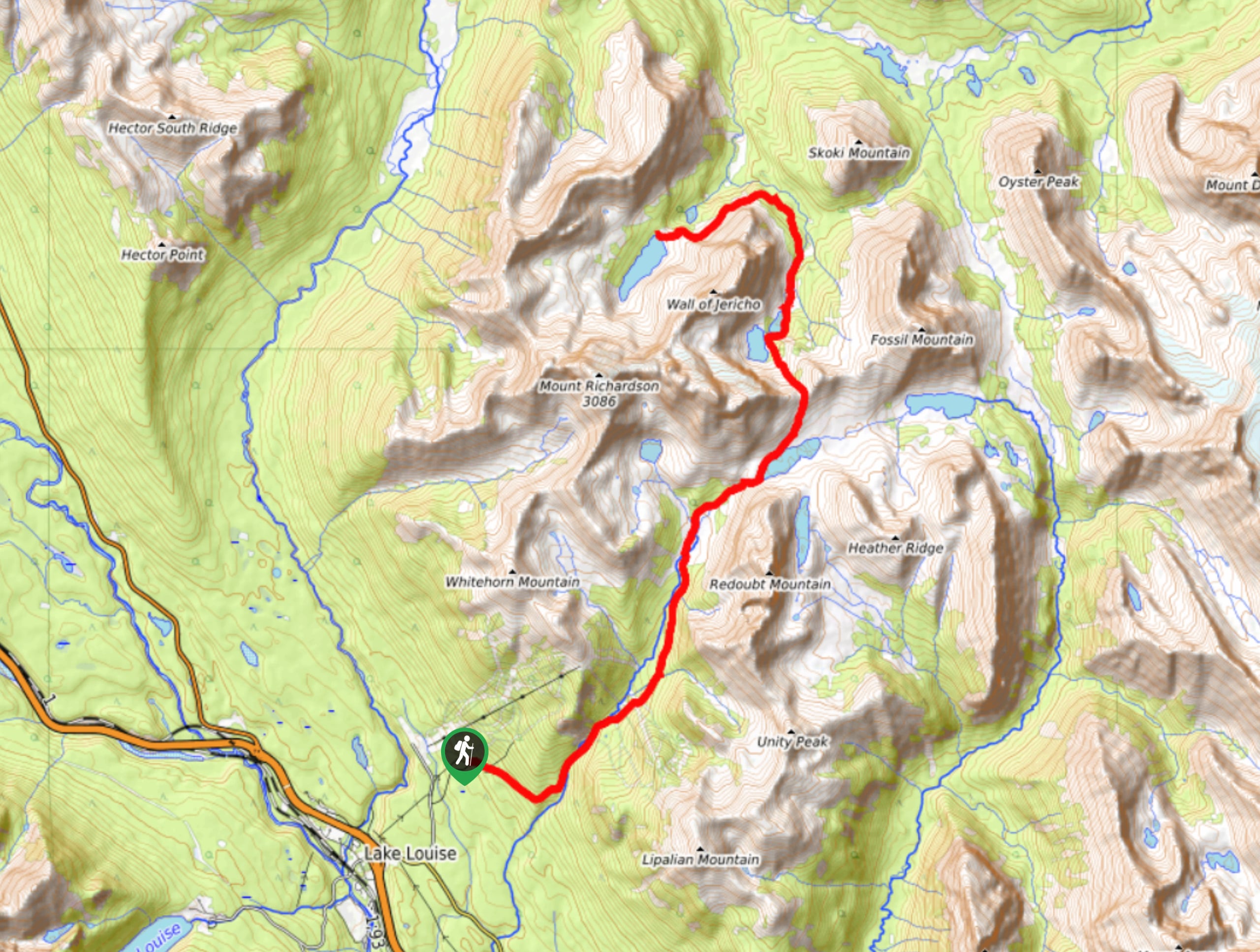
Day 1: From Mount Shark Trailhead to Bryant Creek Shelter
Bryant Creek is known as the easier way to get into the central Mount Assiniboine area. Mount Assiniboine Provincial Park is most commonly accessed from Sunshine Village Ski Resort to the north or Bryant Creek to the south. There are some difficult and funky routes leading into the area from the west for those who are looking for more adventure. Hiking into the Bryant Creek Shelter follows a steady, wide trail and is easy to follow.
Beginning at Mount Shark Trailhead, take the trail at the end of the lot. Follow the Parks Canada signs for Bryant Creek. This is a popular cross-country ski area in the winter, so as you hike, there will be many junctions and trail signs for the first few kilometres. Follow the wide dirt road trail for about 6km until it narrows slightly, and the trees begin to close in.
After roughly 2.2mi beyond this point, you will come across Big Springs Campground. This is a quiet site with 5 tent pads, a cooking area, and a pit toilet. Take a rest here if you need it. There is a small side trail about 984ft long that leads up the stream of big springs to a cascading waterfall at the spring’s source.
Continue on the simple forested trail for a few more km, where you will find a junction and trail to Marvel Lake Campground. This camp is not at the lake, so don’t be deceived. You are almost at your destination! From the trail to Marvel Lake Campground, stay on the main trail to reach the junction for the Bryant Creek Shelter. This is close to McBride’s Camp and the Bryant Creek Warden Cabin. This area is home to an expansive meadow surrounded by rising peaks.
Take the trail at the signed junction for Bryant Creek Shelter and arrive at your destination within a few minutes.
Bryant Creek Shelter
This shelter is situated at one of the main junctions along the Mount Assiniboine route. You are close to multiple campgrounds and a warden cabin where trails collide. The shelter is operated by Parks Canada and is accessible year-round. You will find a wood stove and wood here with an axe and some basic items like a broom and shovel. Bring everything else that you need because this shelter is not equipped with kitchen items or foam mattresses.
Campground details
- Tent pads: 12 spaces on platforms
- It costs $11.96 to reserve with Parks Canada
- Site Fee: $10.02 for backcountry permit and $6.95 for cabin fee per person/night
- Fire pit: Woodstove
- Dogs allowed: No
- Campfire allowed: Indoor wood stove
- Maximum stay: 3 nights
- Maximum group size: 10
- Allowed per tent pad: N/A
Day 2: From Bryant Creek Shelter to Mount Shark Trailhead
After spending the night or two and hopefully exploring the area, it is time to return. The 13.4km hike back to the car awaits, and you already know the route. The unassuming forest and flat enough trail might seem a bit difficult on your return. You may have put your body through some torment, hunting for views and exploring lakes and creeks.
From the shelter, take the small trail with signs to Mount Shark. This will connect to the main trail, where you came from on day one. Follow the signs and continue along the route towards Mount Shark Trailhead.
Sample Itinerary:
Backpacking to the Bryant Creek Shelter is straightforward from Mount Shark. It is a simple trail that leads directly to the shelter in the valley bottom. We recommend spending two nights at the Bryant Creek Shelter to give yourself enough time to explore what the area has to offer. The shelter is a great place to set up a base for hiking around the Assiniboine area.
- Day 1
Trailhead to Bryant Creek Shelter
Distance: 8.3mi
Elevation gain: 1220ft
Campground: Bryant Creek Shelter - Day 2
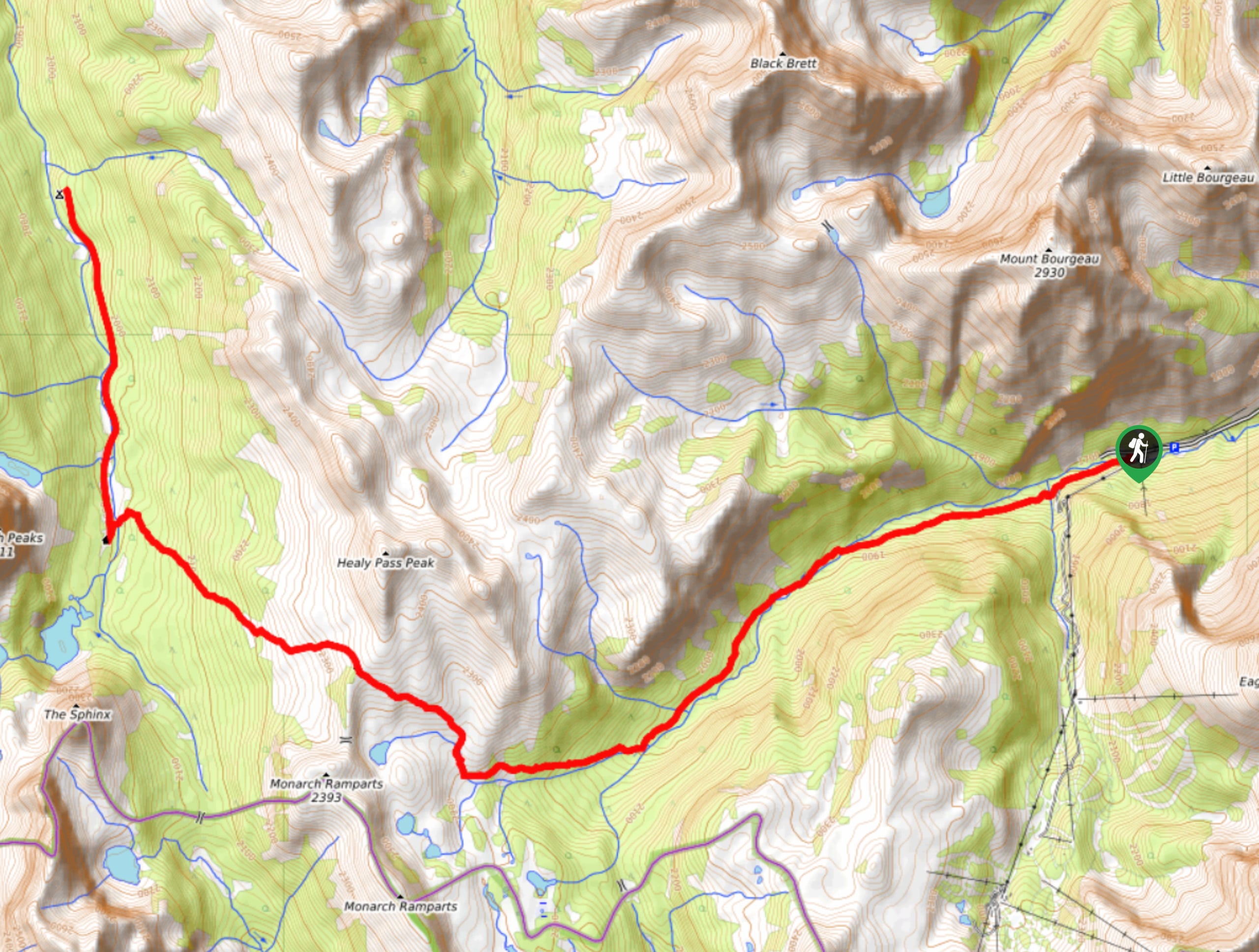
Bryant Creek to Wonder Pass + Return
Distance: 11.2mi
Elevation gain: Approx. 1804ft
Campground: Return to Bryant Creek Shelter - Day 3
Bryant Creek Shelter to Trailhead
Distance: 8.3mi
Elevation gain: 1220ft
Campground: Bryant Creek Shelter
Backpacking Trail Highlights
Bryant Creek Junction
The Bryant Creek Junction is where many trails in the area converge in an expansive meadow. There are multiple campgrounds along with the shelter and a warden’s cabin. Head to the junction from the shelter and take in the views.
You’ll see hikers and horse teams coming in and out of the trail system here. Trails to Marvel Lake and Wonder Pass, Assiniboine Pass, Allenby Pass, and Mount Shark all converge here.
Mount Assiniboine Provincial Park
You are at the cusp of Mount Assiniboine Provincial Park here. It lies just on the border of Banff National Park, and those who continue their hike all the way to Sunshine Village Ski Area will enter Mount Assiniboine Provincial Park before re-entering Banff National Park again.
Mount Assiniboine stands at a staggering 11870ft in a form that resembles the Matterhorn of Europe. This is a popular destination for hikers, backpackers, mountaineers, and historians alike. The central Assiniboine area is located around Lake Magog, which is host to the picturesque backdrop of Mount Assiniboine. The historic Assiniboine Lodge is located here along with a BC Parks campground and a cluster of huts for rent. Be sure to buff up on your history and make an attempt to hike into the central area.
Insider Hints
Always carry bear spray and make lots of noise, many grizzlies enjoy this area
Be sure to book the shelter in advance through Parks Canada
Bring all your cookware and comforts for sleeping, this shelter is not equipped
It is a long drive back to Canmore, so leave some snacks behind for your return to the parking lot
If you head out for a day hike, leave most of your gear at the shelter until you return
Similar backpacking trails to the Bryant Creek Shelter backpacking trail
Pharaoh Creek Backpacking Trail
The Pharaoh Creek backpacking trail follows the same route that many take to reach Egypt Lake and it’s cascading counterparts.…
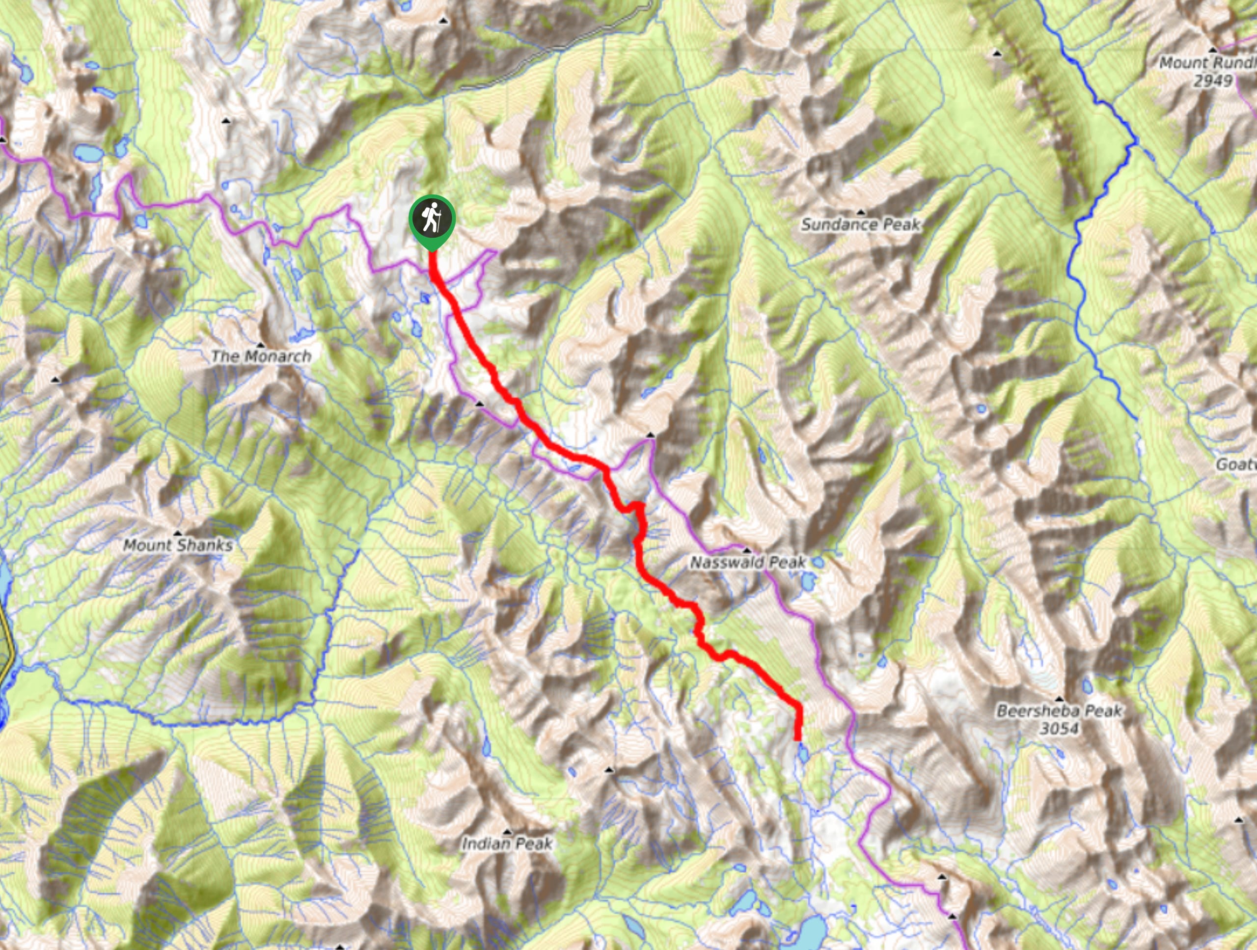
Og Lake Backpacking Trail
The Og Lake backpacking trail is a great option for those who can’t make a reservation at the busy Lake…
Merlin Lake Backpacking Trail
The backpacking route to the Merlin Lake Trail follows the main Skoki route and covers all the popular landmarks in…
Comments