

Rattlesnake Ledge Trail
View PhotosRattlesnake Ledge Trail
Difficulty Rating:
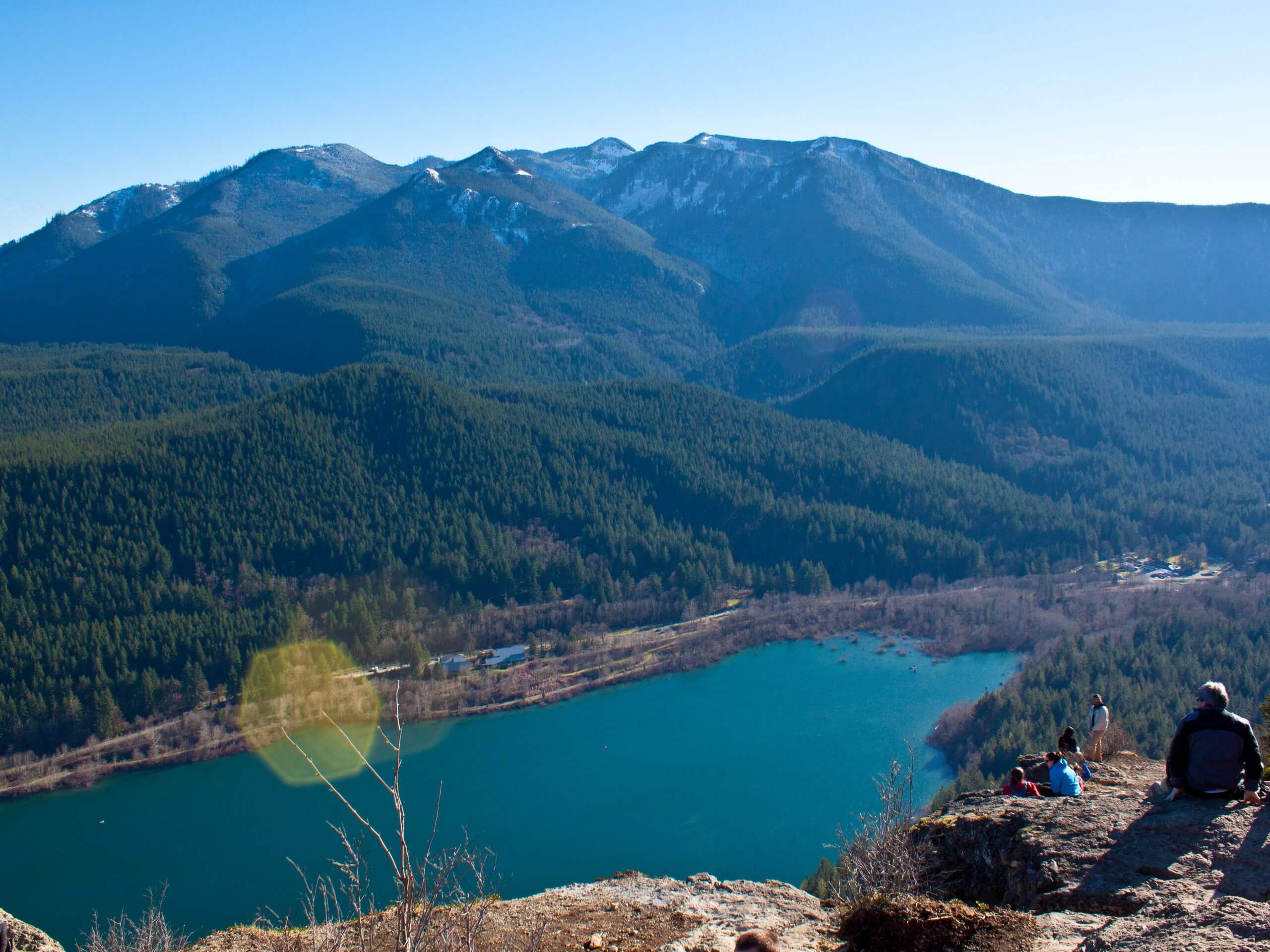
Rattlesnake Ledge Trail is an 5.3mi heavily trafficked out and back trail in Mount Baker-Snoqualmie National Forest that is rated as moderate. This popular hike leads you from the blue shores of Rattlesnake Lake up to an impressive viewpoint with broad views over the lake and the surrounding mountains of the Rattlesnake Mountain Scenic Area. While the trail does require a bit of a climb on steeper sections, it’s technically simple and favored by intermediate hikers. The trail is well-maintained and easy to follow.
Getting there
The trailhead for the Rattlesnake Ledge Trail is off Cedar Falls Road on the northeast side of Rattlesnake Lake. There is a parking area and washrooms.
About
| Backcountry Campground | No |
| When to do | April-November |
| Pets allowed | Yes - On Leash |
| Family friendly | Older Children only |
| Route Signage | Average |
| Crowd Levels | High |
| Route Type | Out and back |
Rattlesnake Ledge Trail
Elevation Graph
Weather
Rattlesnake Ledge Trail Description
This trail begins at the calm shores of Rattlesnake Lake and climbs up the side of Rattlesnake Mountain to a ledge with a jaw-dropping view. The Rattlesnake Ledge Trail is a bang-for-your-buck outing and a great choice for hikers who want elevated views. While delivering a great viewpoint, you won’t need to contend with any technically difficult sections.
Once you’re finished, dipping your feet into the cool Rattlesnake Lake will feel incredible! This trail does get busy, so we recommend hiking early in the morning or later in the afternoon if possible to avoid the crowds.
The trail begins from the parking area, heading to the right following the lakeshore. There is a marker for the trail you can look for. The trail wraps around the lake and another trail marker marks the official start of the trail (last chance for the bathroom here, just to the left).
You’ll quickly come to a junction with an old unmaintained service road- continue straight up the dirt path and climb gradually up a wide switchback. You’ll walk above the shore of the lake, discovering the first viewpoint over the mountains to the southeast.
Hike through a set of wide switchbacks. After the second, you’ll reach a clearing in the trail with nice views. Cross a bridge over a ravine, which is usually dry unless there have been heavy rains recently. The ledges are coming up, as are some rocky sections. Just take your time and watch your step.
Around the corner of the middle switchback, you’ll reach the first ledge, where Mount Si can be seen. Shortly after this point, you’ll pass an overlook trail marker, signalling that you’re nearing the top.
Enjoy a break at the middle ledge, then push on to the top ledge. While enjoying the view, try not to get too close, and keep any children with you close. The trail keeps on going from here, leading all the way up Rattlesnake Mountain. On the ledge, look over Rattlesnake Lake and the mountains beyond before retracing your steps back to the parking lot.
Hiking Route Highlights
Rattlesnake Lake
Back in the early 1900s, the town of Moncton stood around the northern shore of Rattlesnake Lake. This town was destroyed by flooding in 1915, and nothing remains of the town. While that somewhat dark history exists, today the area is enjoyed by adventurers all year round. The lake is a popular fishing spot and the hike to the overlooking ledge is enjoyed by many throughout the year. The shore is also used for slacklining and picnicking.
Frequently Asked Questions
Can you swim in Rattlesnake Lake?
Yes, you can swim in Rattlesnake Lake.
Are there rattlesnakes at Rattlesnake Lake?
Thankfully, there are no rattlesnakes at the lake. The lake was named for the sound that dried seed pods made in the wind.
Insider Hints
There are no lifeguards on duty at the lake, so swim with caution.
This trail is accessible in the winter, but the trail can get icy.
Bring a picnic lunch for after the hike- the lakeshore is a great place to relax!
Similar hikes to the Rattlesnake Ledge Trail hike

Lakes Dorothy, Bear, Deer, and Snoqualmie Hike
The Lakes Dorothy, Bear, Deer, and Snoqualmie Hike provides access to Lake Dorothy, Bear Lake, Deer Lake, and Snoqualmie Lake.…

Gold Creek Trail to Joe Lake
Gold Creek Trail to Joe Lake is not a hike for the faint of heart. This lightly trafficked trail is…

Basin Lake via Bullion Basin Trail
Basin Lake via Bullion Basin Trail is a 12.2mi hike that, with 2900ft of elevation gain,…


Comments