Sulphur Mountain Snowshoe
View Photos
Sulphur Mountain Snowshoe
Difficulty Rating:
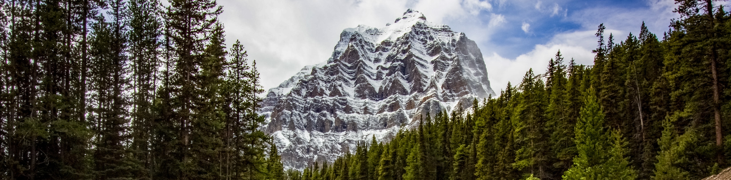
Snowshoeing the Sulphur Mountain Trail via Cosmic Ray Road will take you from valley bottom to the summit of Sulphur on a rarely visited route. Avoid the crowded front side of Sulphur Mountain and find solitude on Cosmic Ray Road. You’ll begin at Cave and Basin National Historic Site before gaining elevation and views of the Sundance Range. After gaining the summit, you’ll descend via the main trail towards the Town of Banff.
Getting there
From the Town of Banff, take Banff Avenue southbound towards the Bow River. Cross the Bow River Bridge and turn right onto Cave Avenue. Follow this road until you reach the parking lot for Cave and Basin National Historic Site. Park here, and walk towards the historic site, continuing past the building on the right to the Sundance Trail that will join Cosmic Ray Road.

About
| When to do | December-March |
| Backcountry Campsites | No |
| Pets allowed | Yes - On Leash |
| Family friendly | Older Children only |
| Route Signage | Average |
| Crowd Levels | Moderate |
| Route Type | One Way |
Sulphur Mountain Snowshoe
Elevation Graph
Weather
Sulphur Mountain Snowshoe Trail Description
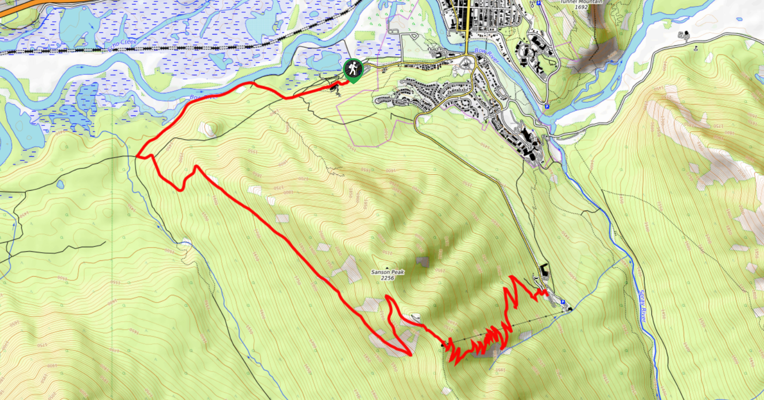
The Sulphur Mountain snowshoe trail leads from the marsh area of Cave and Basin along the Sundance Trail and up the less-frequented backside of Sulphur Mountain. This trail will be much more quiet and serene than the busy frontside trail that you will use to descend. You’ll find expansive views of the Sundance Range on your way up before reaching 360-degree mountain views at the summit of Sulphur Mountain.
From Cave and Basin, travel 1.5mi along the Sundance Trail. This is a multi-use and well-maintained trail, so watch for others. You will see hikers, horses, fat bikes, and cross-country skis. Come to a sign for Sulphur Mountain on the left side of the trail and begin your ascent to the summit.
The remaining 3.6mi to the summit rises steadily and can become strenuous. The trail keeps a steady grade, but this means that there aren’t many flat spots for breaks. Continue at your own pace on the wide trail. The views increase as you gain elevation and will keep you motivated to reach the top.
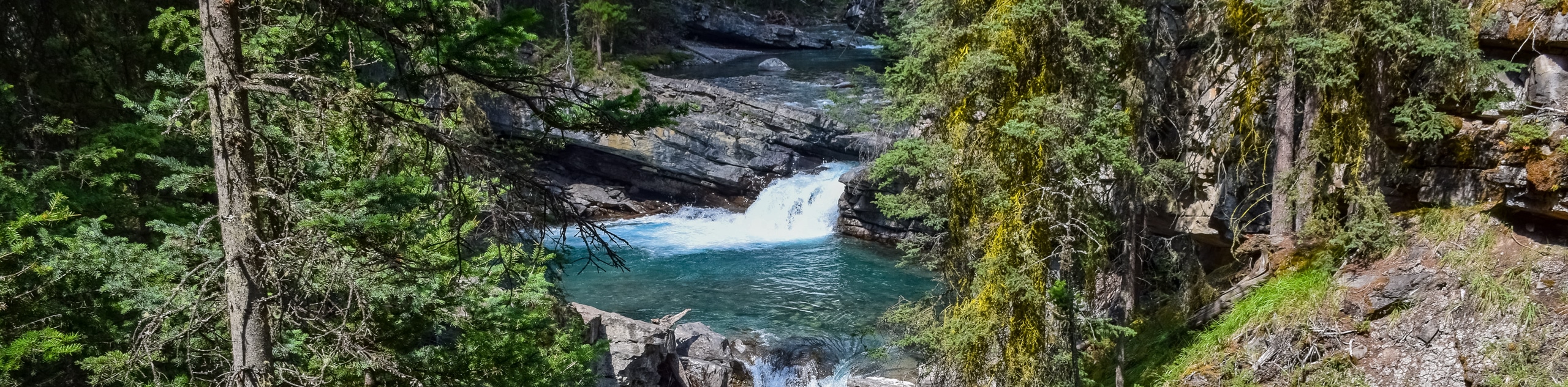
Some benches and stairs will come into view as you reach the gondola station. Take the wooden boardwalk 1.1km from the gondola station to the historic Cosmic Ray Station. Take in the views and head down to the gondola. Pass the main station to the platform and start down the trail switchbacking down to the parking lot. This part of the trail is entirely in the forest and passes a small path leading to a waterfall.
You will end your hike in the Banff Upper Hot Springs parking lot. Take advantage of the healing mineral waters after your trek to relax and recover while enjoying views of Mount Rundle.
Similar Snowshoe Trails to the Sulphur Mountain Snowshoe Snowshoe Trail
Shadow Lake Snowshoe
The Shadow Lake Snowshoe Trail is rated as difficult due to its distance. It is a well-graded trail that leads…
Moraine Lake Road
The multi-use Moraine Lake Road snowshoe sees cross-country skiers, ski tourers, snowshoers, and sometimes even fat bikers! This is an…
Johnston Canyon to Ink Pots
The snowshoe trail from Johnston Canyon to the Ink Pots takes adventurers through the incredible icy landscape of Johnston Canyon…
Comments