Longs Peak Scramble
View Photos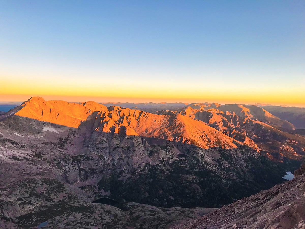
Longs Peak Scramble
Difficulty Rating:
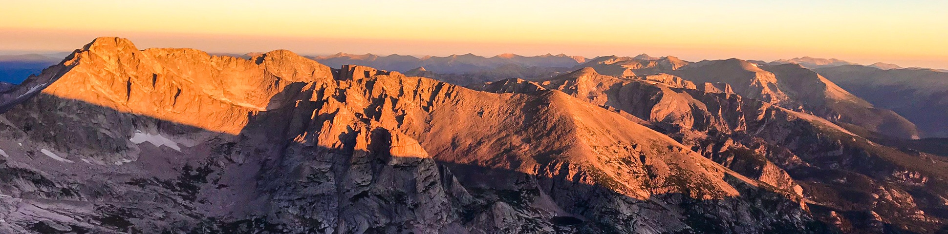
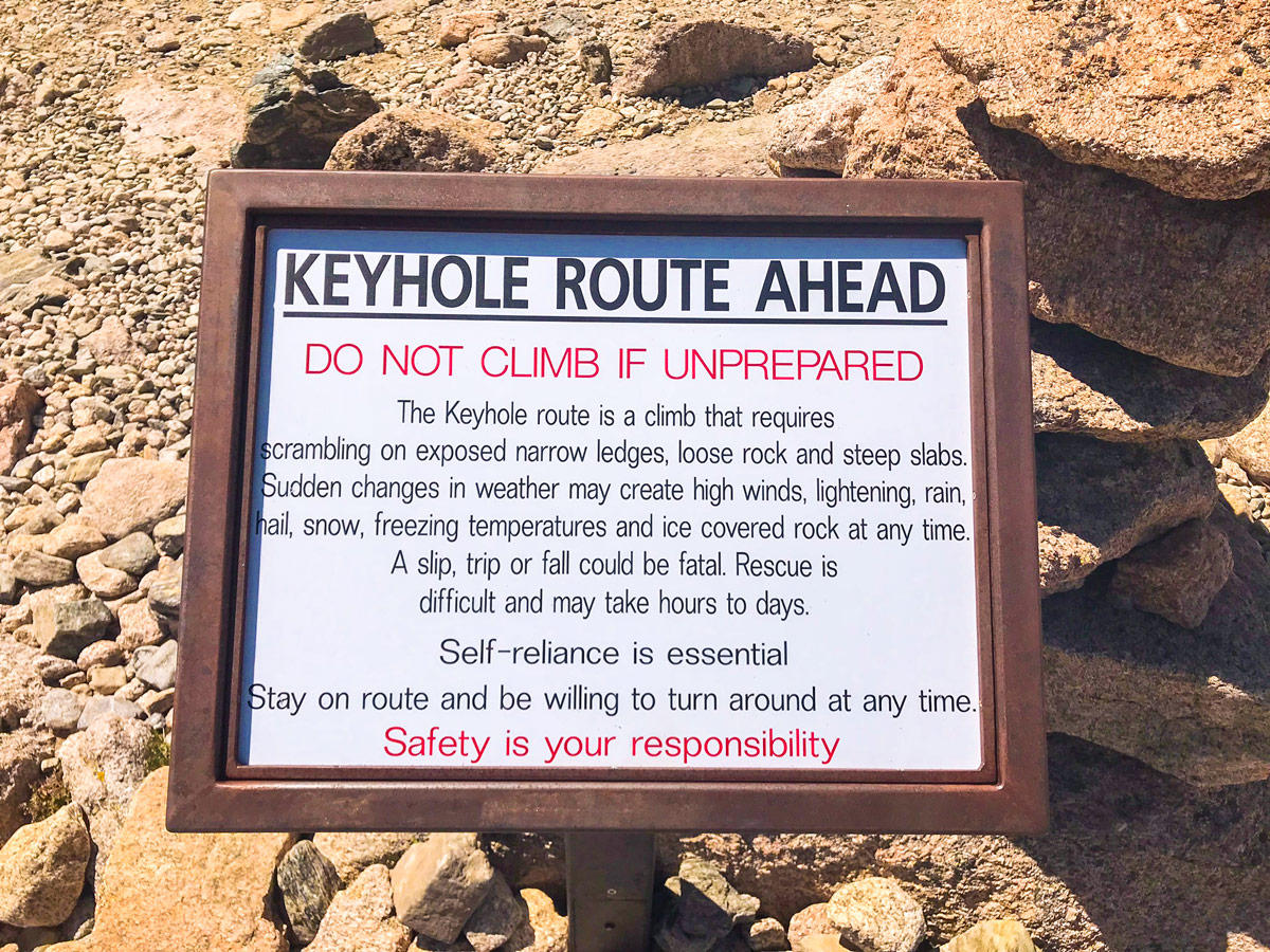
Longs Peak is one of Colorado’s most popular 14ers and is the highest point in Rocky Mountain National Park. Many people think of Longs Peak as a hike, but it’s actually a scramble. Despite its popularity, it is also one of the most difficult Class III 14er scrambles in Colorado. The majestic scramble is worth every ounce of sweat and perseverance but do not underestimate its difficulty.
Getting there
From Estes Park, take highway 7 / S St Vrain Ave. south out of town. Turn onto Longs Peak Rd. to the Longs Peak Trailhead.

About
| When to do | April to November |
| Backcountry Campsites | Camping is allowed in the backcountry, permits are required and can be obtained at the NP Visitors Center. |
| Toilets | Yes, primitive pit toilet |
| Pets allowed | Yes - On Leash |
| Family friendly | No |
| Route Signage | Good |
| Crowd Levels | High |
| Route Type | Out and back |
Longs Peak
Elevation Graph
Weather
Route Description for Longs Peak
Longs Peak is on most people’s bucket list when they come for a hike in Rocky Mountain National Park. Unfortunately, Longs Peak is often attempted by inexperienced scramblers who think that this is a hike.
The trail up Longs Peak begins at the Longs Peak Ranger Station / Trailhead. Initially, the trail travels through a dense pine forest, with brief encounters with Alpine Brook. The trail quickly gains elevation with a series of switchbacks then eventually crosses over a log bridge with warning signs for entering the alpine tundra and lightning storms. The trail rises above tree line shortly after the bridge.
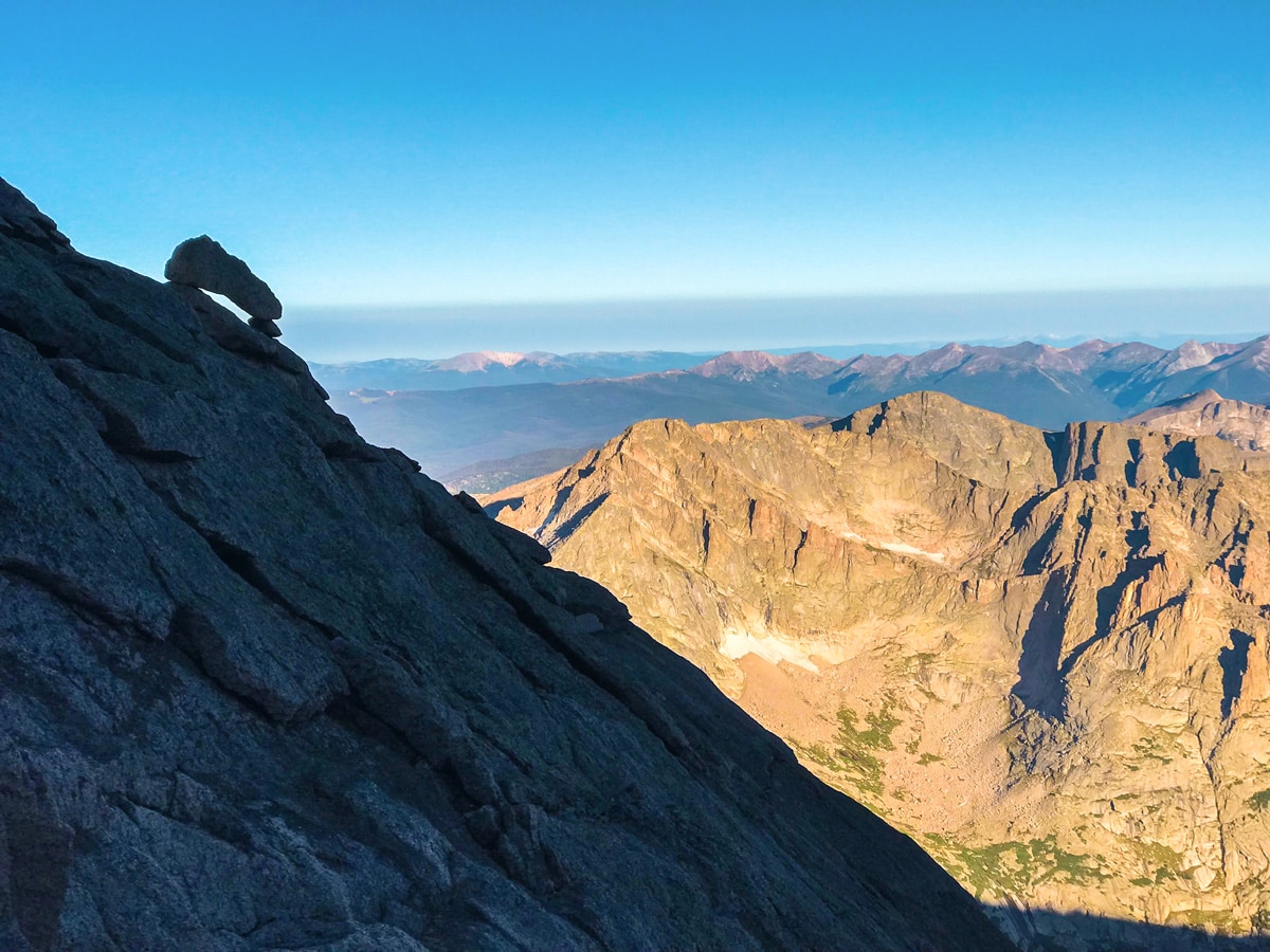
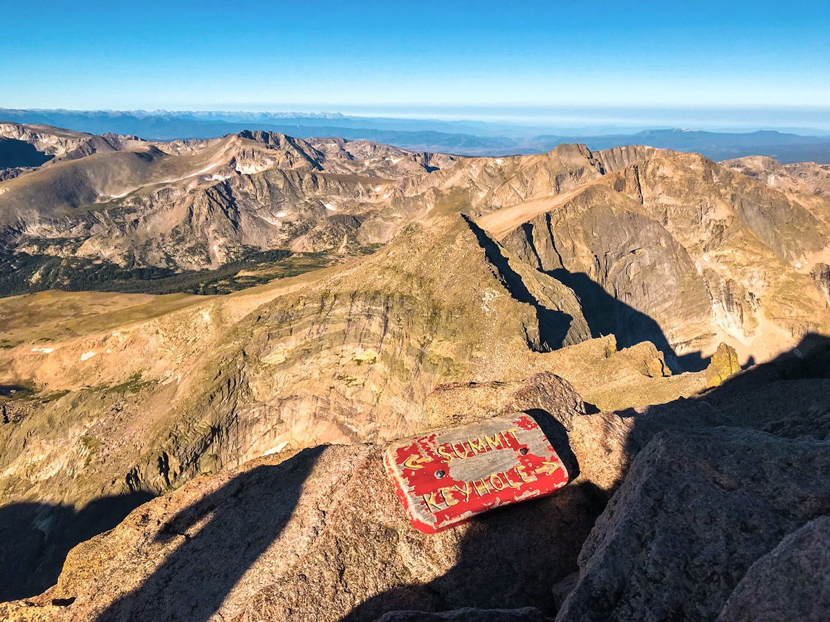
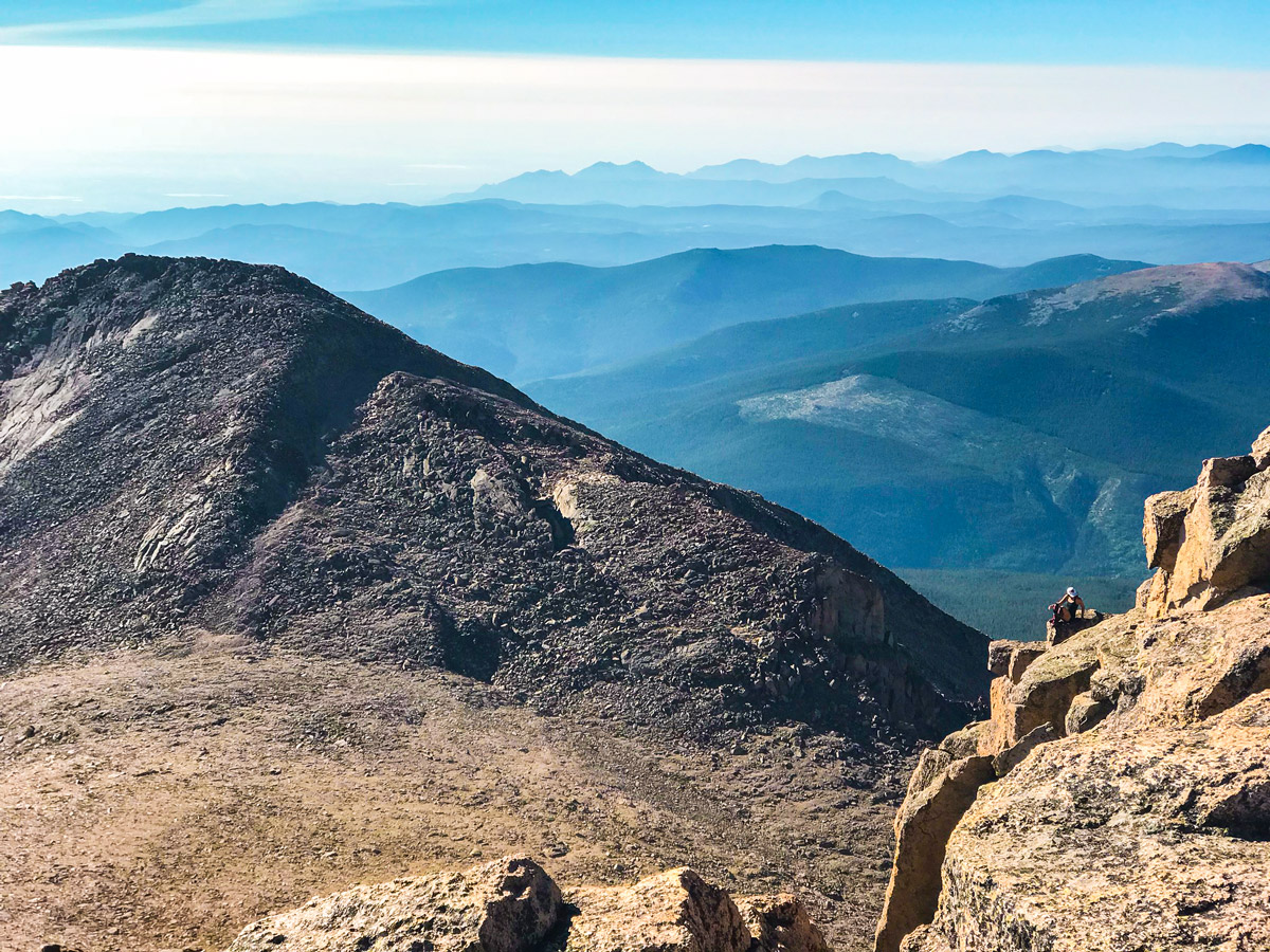
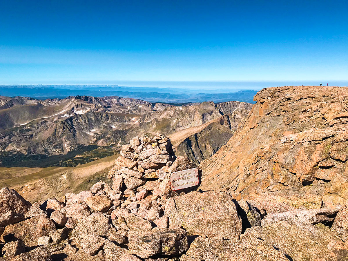
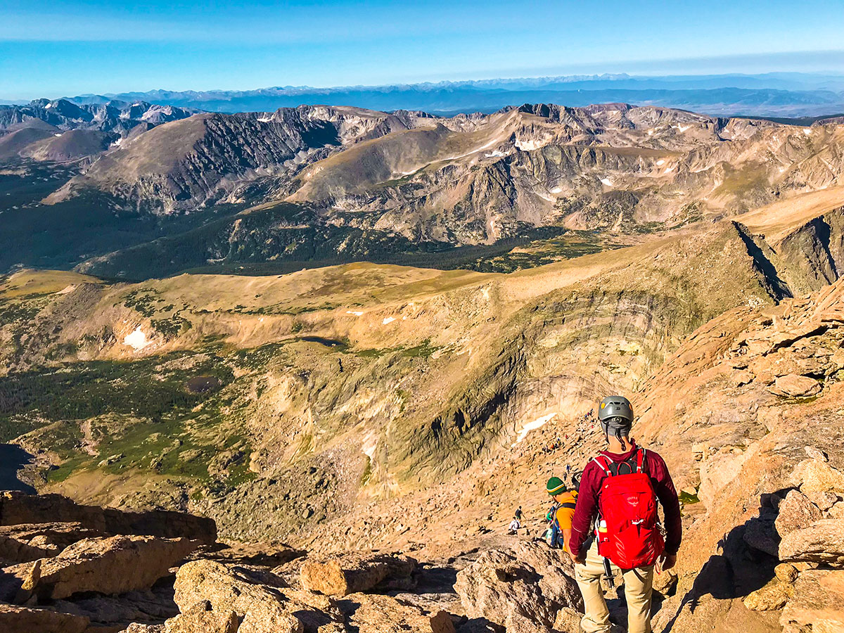
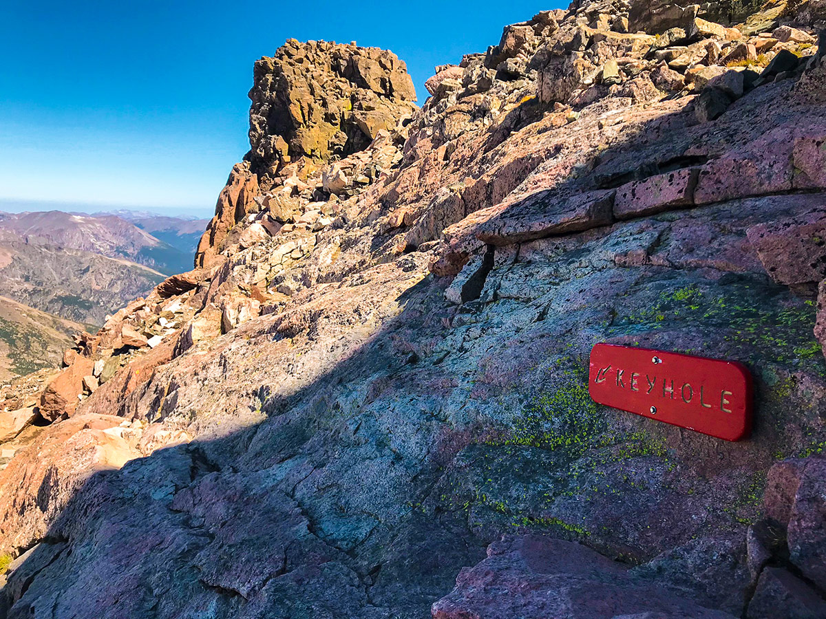
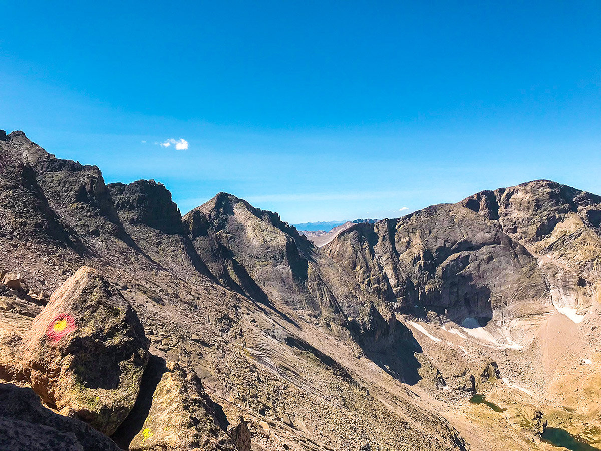
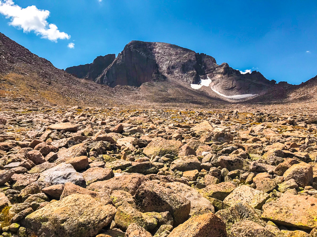
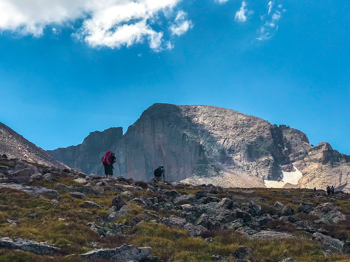
Follow the signs along the trail for the Keyhole Route or Longs Summit. A junction in the trail will arrive at Mills Moraine with a split for Chasm Lake trail or to continue towards the summit. Continue right to climb towards the summit, over Granite Pass and eventually arriving at the Boulder Field. The quick hiking pace will be lost, as you are forced to boulder hop following cairns along the way. Boulder hopping leads to scrambling on steeper terrain as you climb to the prominent “Keyhole” formation just above.
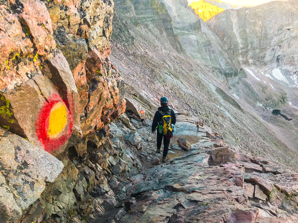
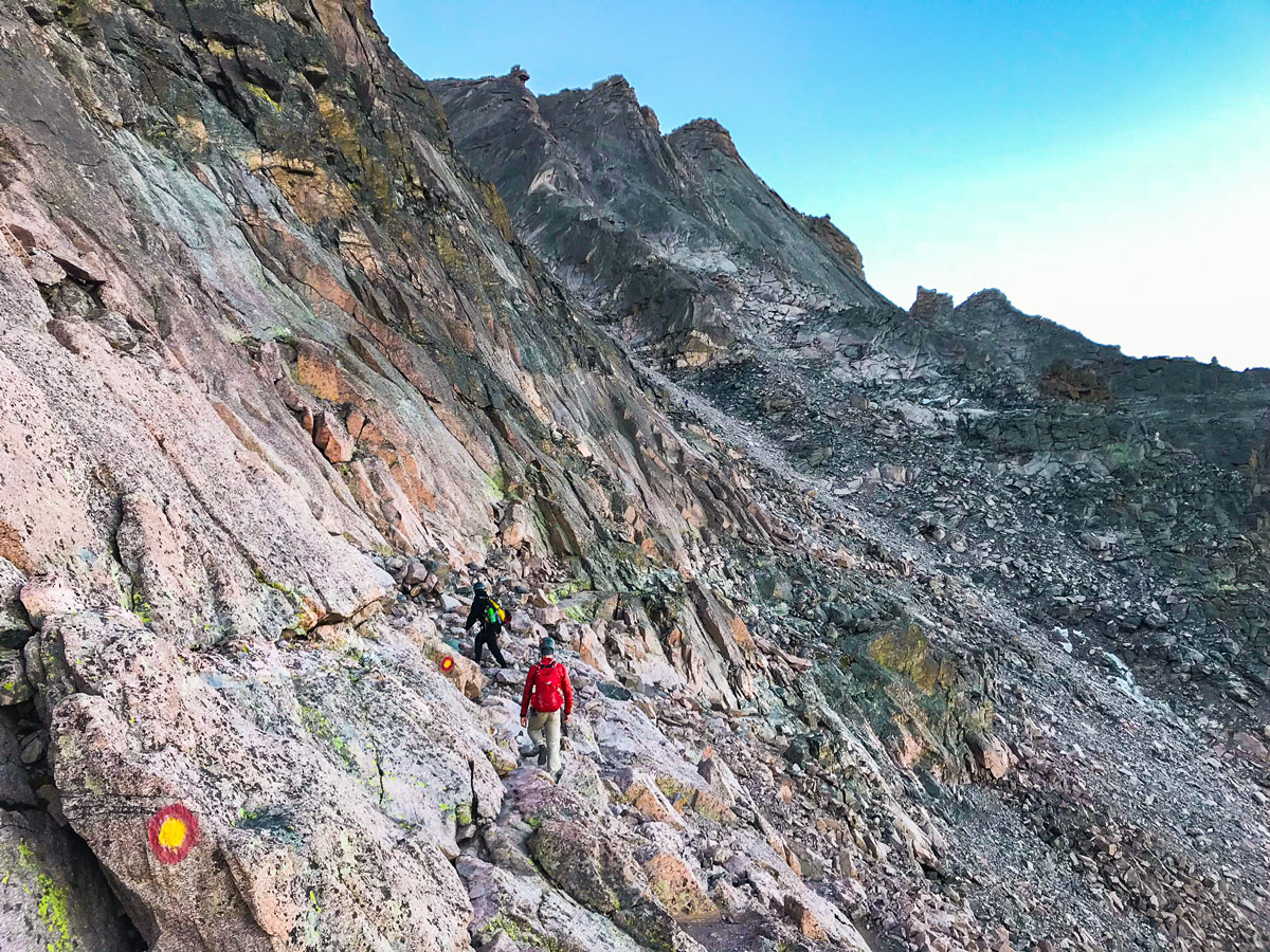
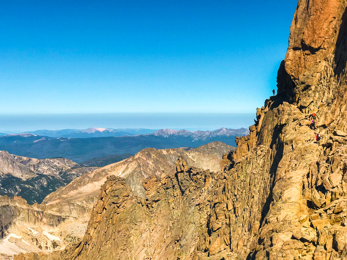
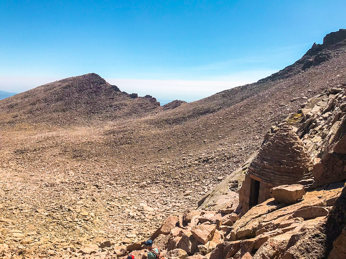
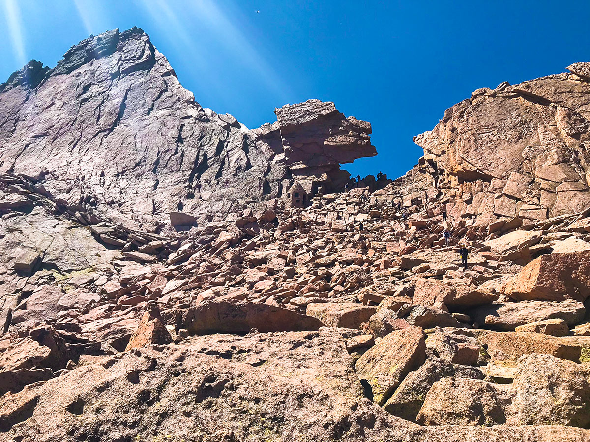
To the left of the “Keyhole” is Agnes Vaille Memorial shelter. Crossing through the “Keyhole”, you enter the Class III terrain, with a section known as “The Ledges”. Follow the painted bulls-eyes on the rock, traversing across the steep rock face. The next obstacle is 600 vertical feet climb up a steep, loose rock section called “The Trough”. At the top of “The Trough” is a short but technical scramble to a notch in the rock face.
Next up is the feared “Narrows” which is similar to “The Ledges”, but has more exposure, and less margins for error. At the end of the “Narrows”, is a steep scramble over some large boulders to the final section of the climb.
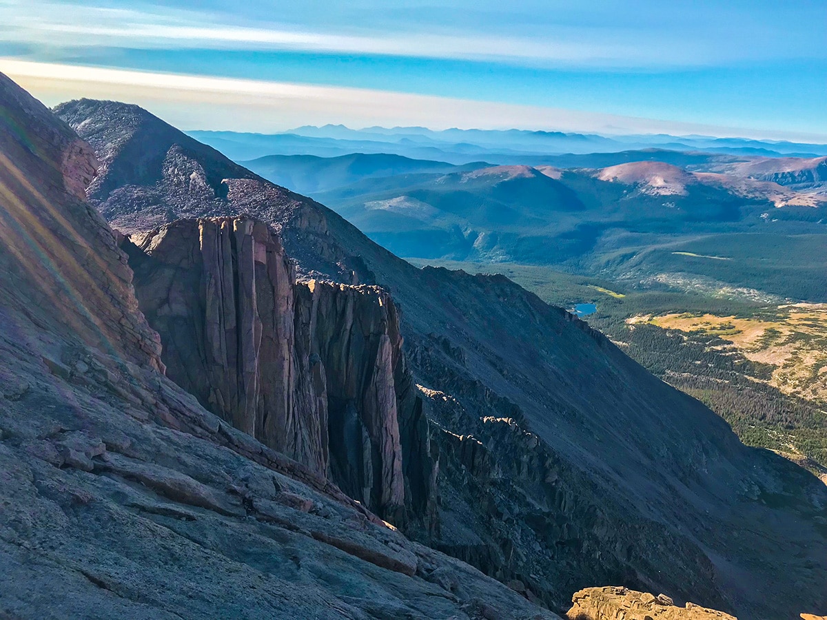
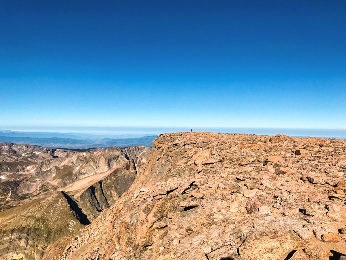
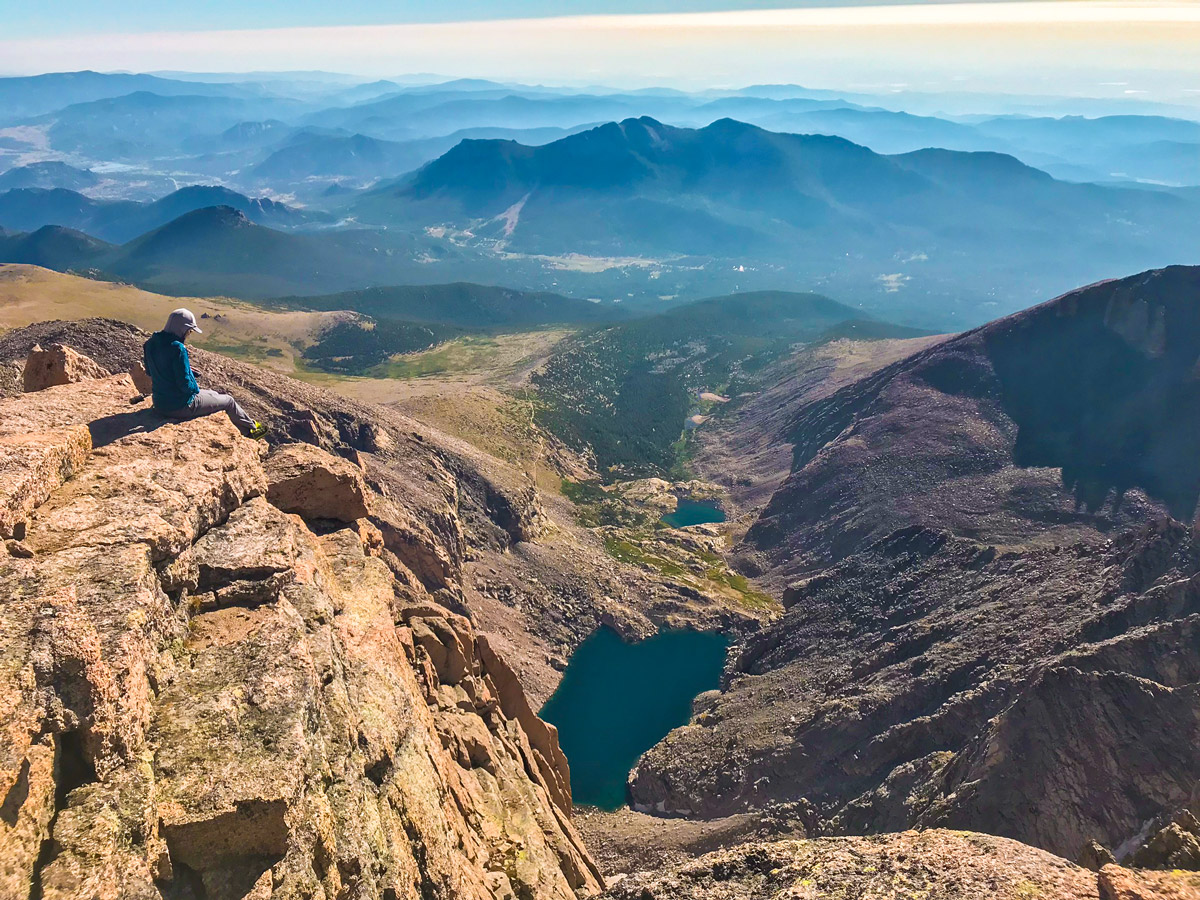
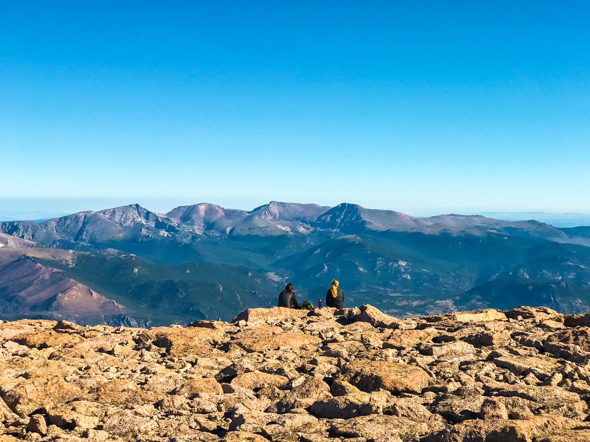
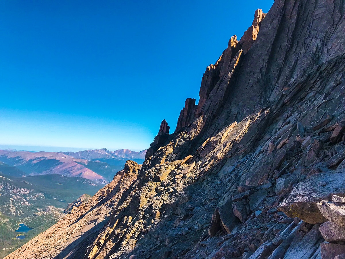
“Homestretch” as it is called, is an intimidating ramp that seems to get steeper and steeper the higher it climbs. Overall, the scrambling and climbing is straight forward and not as bad as it seems from the bottom, but this is also a place where any mistake could be life-threatening. The ramp spits you out on top of the summit almost instantly. The summit of Longs Peak is like standing on another planet. The top is weirdly flat and spacious, being compared to a football field in the sky. And despite the large number of people on the summit at any given time, there is enough room on the top, where you can hike around and find a spot that gives you the feeling of being alone on the summit. You can peer over the edge of the Diamond to the east and see Chasm Lake over 1000ft below you!
To get down off of Longs Peak, you will need to follow the same way you came up. This will require some down climbing, butt sliding, boulder hugging and any other method you can think of to get you down safely!
Insider Hints
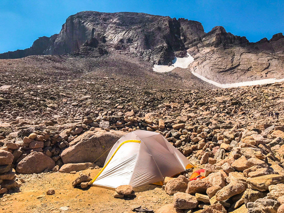
Backcountry camping is located at various sections along the trail but require a permit. Plan ahead and secure a permit before the limited spots become unavailable.
Start this hike early to avoid afternoon thunderstorms! We recommend starting no later than 2am!
Sleep in your car at the trailhead parking lot the night before the big day!
Comments