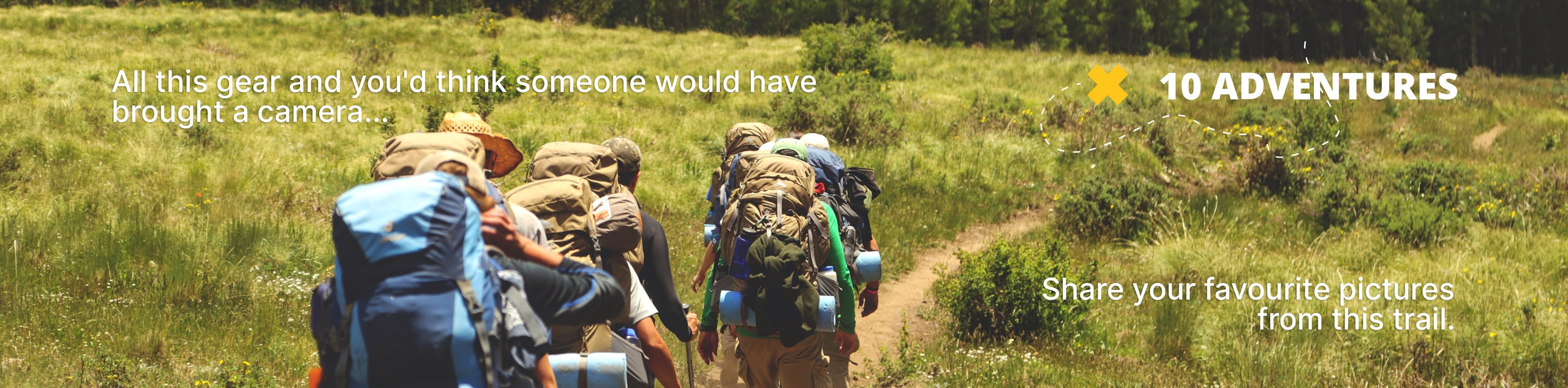
Pyramid Mountain Scramble
View Photos
Pyramid Mountain Scramble
Difficulty Rating:
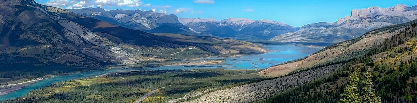
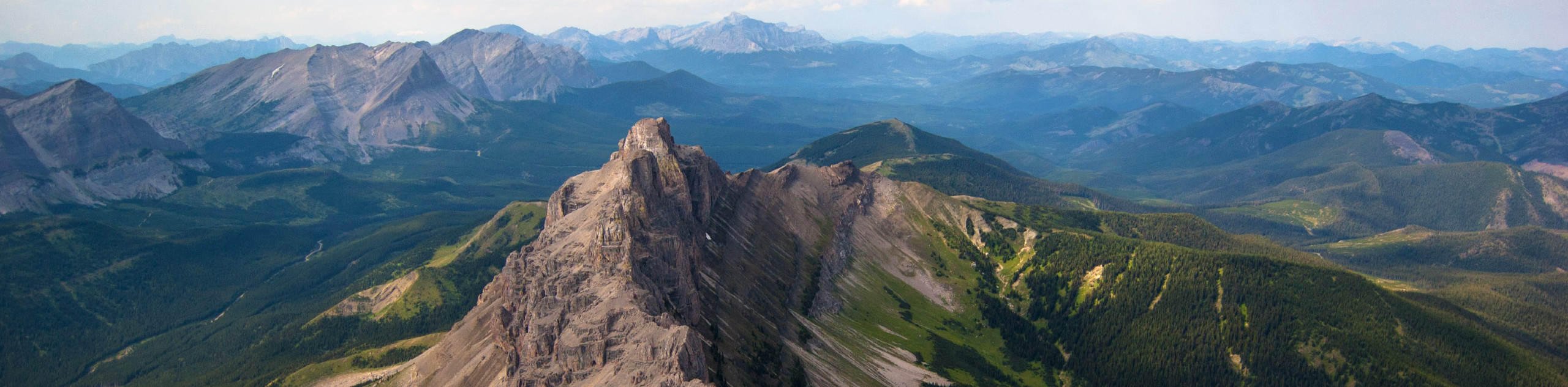
The famous Pyramid Mountain is one of Jasper’s premier landmarks. It casts unforgettable reflections on nearby Pyramid and Patricia lakes as it stands tall above. This scramble route requires a full day’s effort and will leave your legs screaming by the time you finish up the lengthy distance and elevation gains required to reach the summit.
Getting there
To get to Pyramid Mountain Trail, head northbound on Connaught Drive in downtown Jasper and take a left on Pyramid Mountain Road. There are plenty of signs in town, so you should have no troubles here. Continue past the Patricia Lake viewpoint to the Pyramid Lake parking.

About
| When to do | June-September |
| Backcountry Campsites | No |
| Pets allowed | Yes - On Leash |
| Family friendly | No |
| Route Signage | Poor |
| Crowd Levels | Low |
| Route Type | Out and back |
Pyramid Mountain Scramble
Elevation Graph
Weather
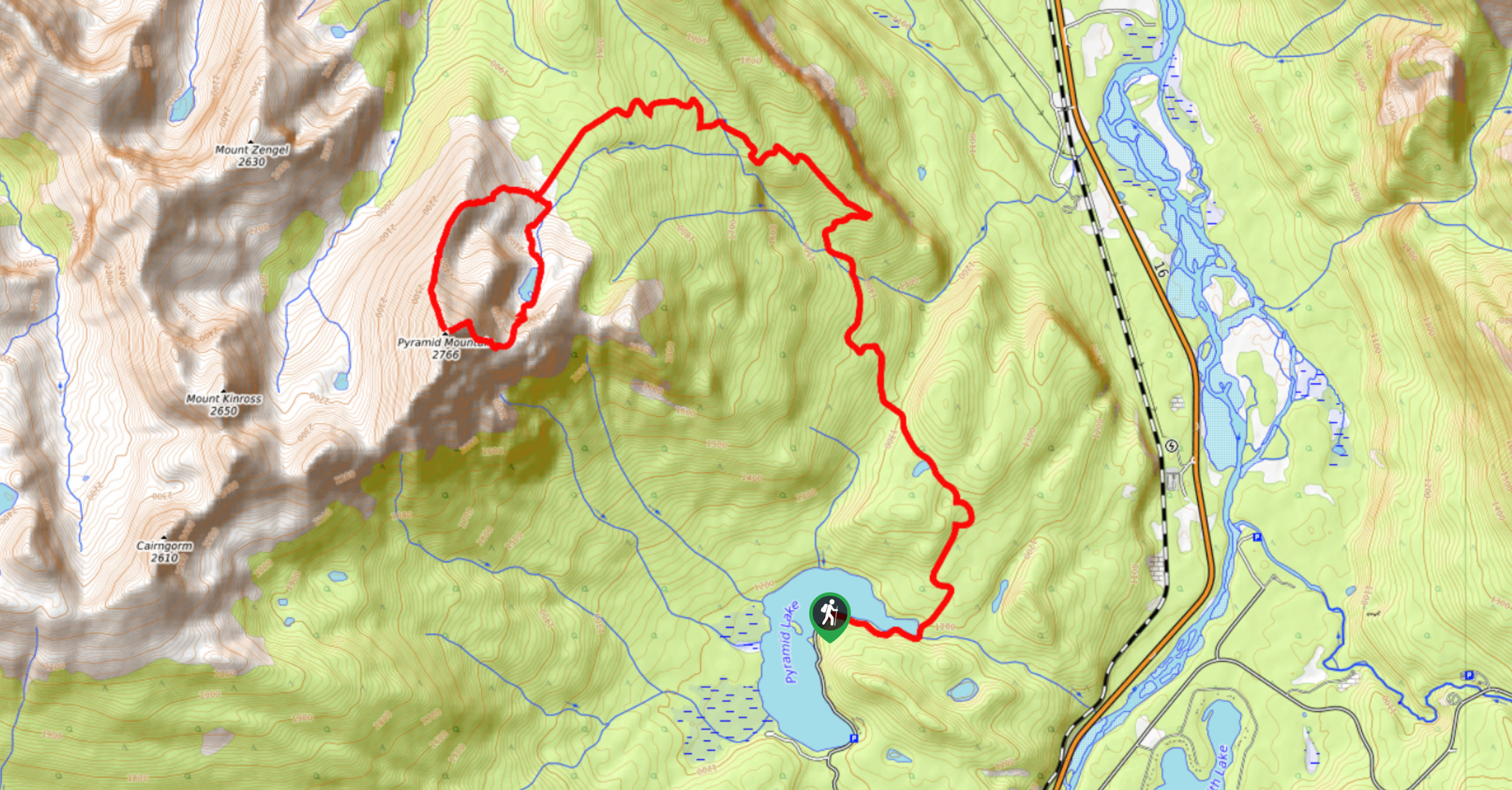
Pyramid Mountain Scramble Trail Description
From the Pyramid Mountain parking lot, walk to the looker’s right of the lake, finding Pyramid Mountain Fire Road. This is where most adventurers choose to ride their bikes. There is an option to ride the fire road section of this trail which saves a lot of time and effort. This is a long, strenuous day, so cutting some effort out is a smart idea.
Most visitors will be stopping at the lake and enjoying some easy strolls in the area. Those who choose to tackle Pyramid Mountain are in for a big adventure. This is an exhilarating day out reserved for truly zealous adventurers.
Head up the fire road for 5.0mi until you come to a fork in the trail. This trail to the right leads to the scenic Palisade Lookout. The Pyramid Mountain trail stays off to the left. The trail steepens here, gaining a few hundred more metres before you’ll have to dismount your bike and begin your hike.
There is a meadow where the fire road ends that opens up and gives you a great vantage point to the scramble route ahead. You’ll be able to see the entire route and get a good idea of what you’re in for. Continue along the trail and find a cairn. Follow the trail to the left along a drainage.
Stay on the clear trail as you make your way above the treeline where panoramic views will come into sight. Look for Mt. Zengel and Mount Cairngorm across the valley. The route is clear for the entire way as you crest the ridge and make your way to the summit. Those looking to extend their trip can descend to the beautiful alpine tarn below losing elevation gain. This means you will have to gain some elevation to get back to the ridge for your descent.

Similar Scrambles to the Pyramid Mountain Scramble Scramble
Morro Peak Scramble
Morro Peak is a simple scramble rated easy. It is a moderately trafficked trail just outside of the Town of…
Crowsnest Mountain
Crowsnest Mountain is a popular scramble that requires a good understanding of the route before departure. This trail is a…
Bertha Peak Trail
The Bertha Peak Trail will challenge even the hardiest hikers. You’ll gain wonderful lake vistas of Bertha Lake, and your…
Natethewiz 2 years ago
Amazing view at the summit and during the asceny. Difficult hike/easy scramble, depends how you see it. For an experienced hiker, not as hard as described. The downside is the very long approach. I recommend having a mountain bike and doing not only the first 8 km by bike but also the next 4 that lead to the beginning of the ascent. Else the approach is long and dull. I didn't feel comfortable coming down with the loop on the map, so I retraced my steps instead from the summit. Met only one couple doing the same hike. It's a hidden gem, everyone knows the mountain, no one knows you can hike it.