Tioga Pass Road to Yosemite Valley
View Photos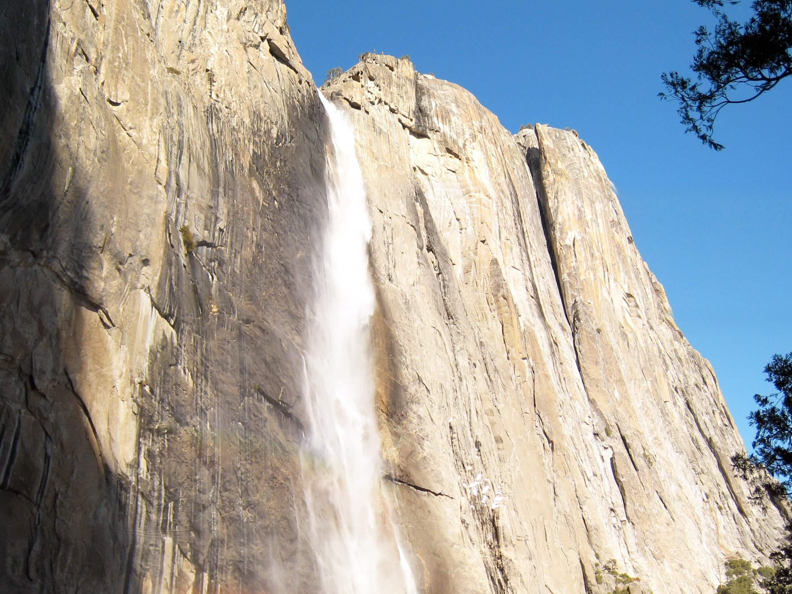
Tioga Pass Road to Yosemite Valley
Difficulty Rating:
The Tioga Pass Road to Yosemite Valley is a one-way adventure that stretches from Yosemite Valley’s northern rim all the way down to the valley floor. Ideal for intrepid adventurers, this path exhibits the beauty and grandeur of the famous National Park.
Getting there
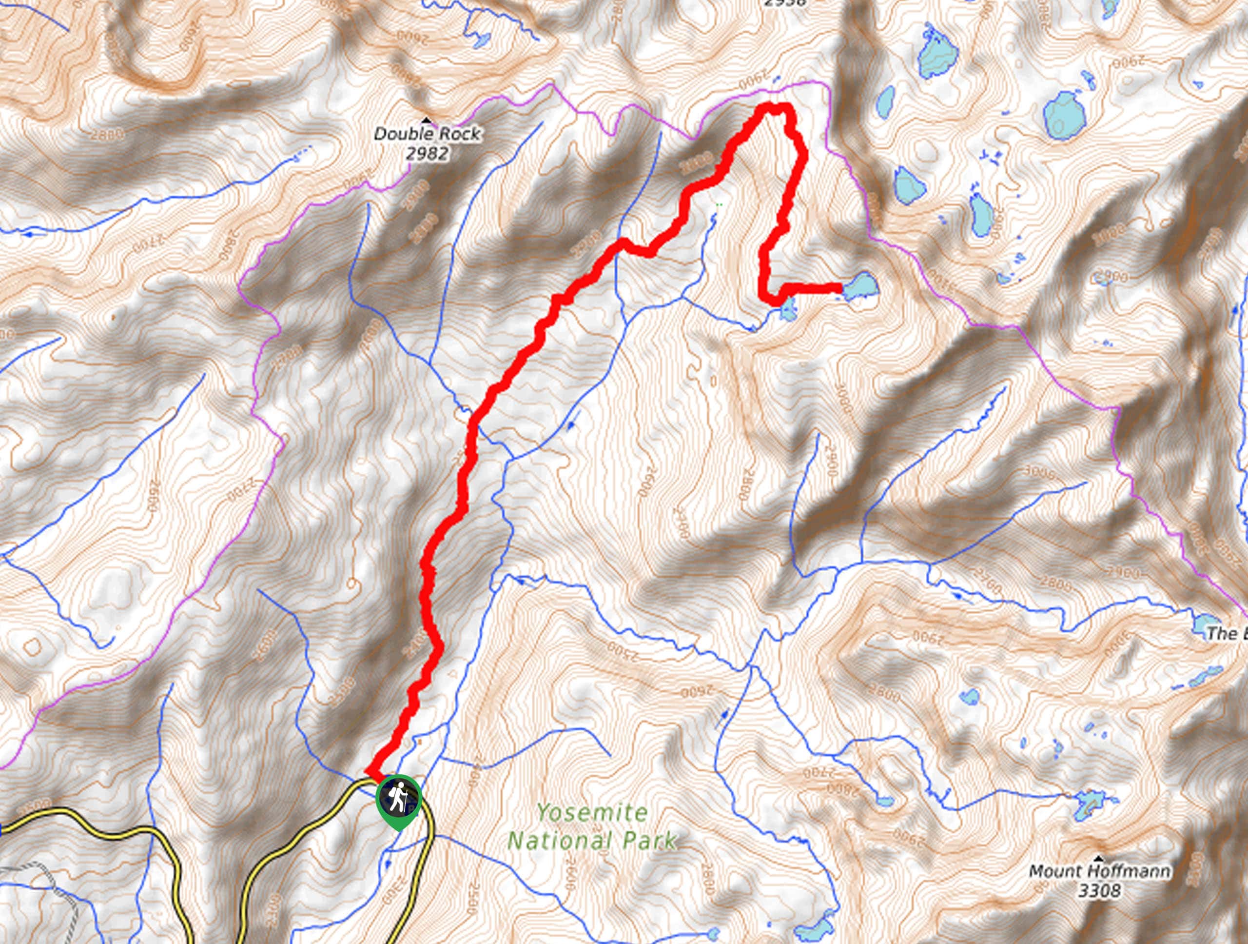
The Tioga Pass Road to Yosemite Valley departs from the Porcupine Creek Trailhead off Tioga Pass Road.

About
| Backcountry Campground | Backcountry Camping, Wilderness Permit Required. |
| When to do | Tioga Pass Road to Yosemite ValleyMay-October |
| Pets allowed | No |
| Family friendly | Older Children only |
| Route Signage | Average |
| Crowd Levels | Moderate |
| Route Type | One Way |
Tioga Pass Road to Yosemite Valley
Elevation Graph
Weather
Tioga Pass Road to Yosemite Valley Description
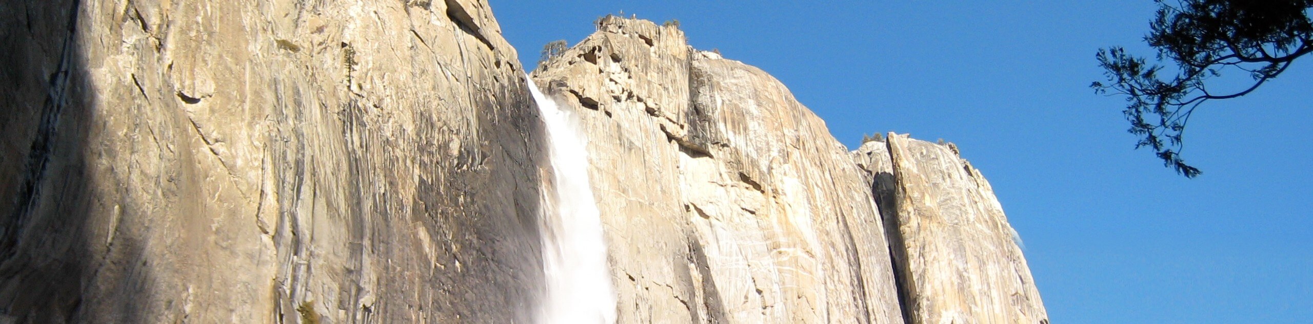
Seeking a refreshing hike in Yosemite? The Tioga Pass Road to Yosemite Valley is a wonderful one-way adventure that delivers awe-inspiring scenery every step of the way. Revel in the sights of the granite domes that line the horizon, before scaling the sides of the valley walls along the profile of one of North America’s tallest waterfalls. With ample scenery to admire, this trek is anything but mundane! Wear layers and comfy footwear, and don’t forget to bring water, snacks, and your camera. Note: you will have to arrange for pickup or leave a car at the Upper Yosemite Falls Trailhead. Additionally, the National Park charges an entrance fee; refer to the Wilderness Permit Required for more info.
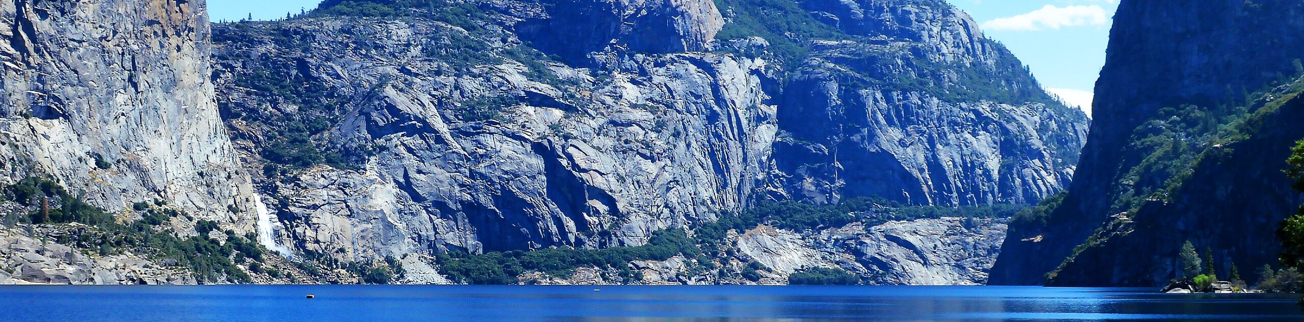
Your exciting journey along the Tioga Pass Road to Yosemite Valley begins from the Porcupine Creek Trailhead. From here, begin hiking south along the North Dome Trail. Follow this path through meadowlands and mixed pine forests, before diverting right onto an unnamed path to wander along Lehamite Creek. This path will track southwest over Indian Canyon Creek and over to Yosemite Point. Revel in the inspiring views of North Dome, Clouds Rest, and Half Dome, then continue west over to the top of Yosemite Falls.
From atop the falls, you will be granted amazing sights of the surging cascades and the bustling valley below. From here, hook onto the Upper Yosemite Falls Trail and navigate several switchbacks down to the trailhead that marks the end of your adventure.
Similar hikes to the Tioga Pass Road to Yosemite Valley hike
Beehive Meadow Trail
The Beehive Meadow Trail is an amazing adventure in Hetch Hetchy that travels through diverse terrains. Cross the O’Shaughnessy Dam,…

Chain Lakes Hike
Explore one of the more secluded trails in Yosemite National Park along the Chain Lakes Hike. This wonderful trail exposes…
Grant Lakes Hike
Immerse yourself in Yosemite’s high country along the Grant Lakes Trail. This epic hike exhibits the grandeur and diversity of…
Comments