Tioga Pass Road to Yosemite Falls Hike
View Photos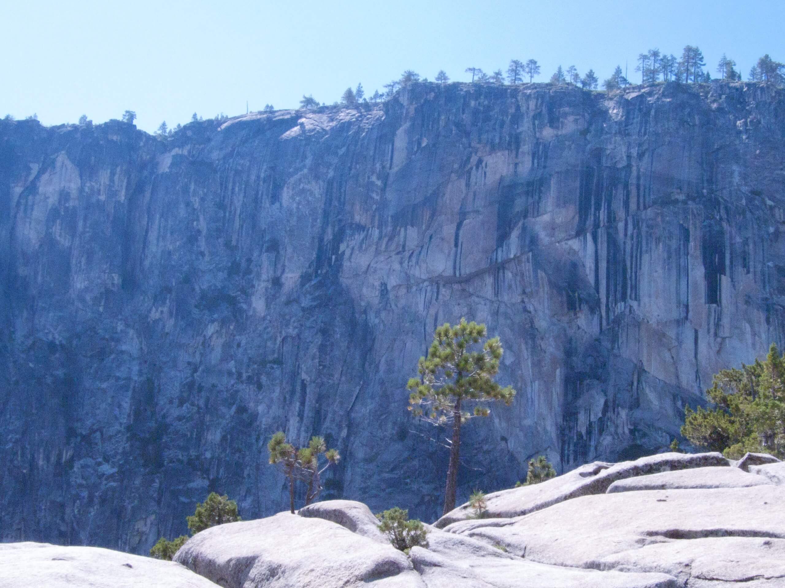
Tioga Pass Road to Yosemite Falls Hike
Difficulty Rating:
The Tioga Pass Road to Yosemite Falls Hike is an amazing adventure that exhibits the beauty of Yosemite’s high country. Let the epic panoramas of the Sierra Nevada Mountains motivate you, as you wander all the way to the northern rim of Yosemite Valley.
Getting there
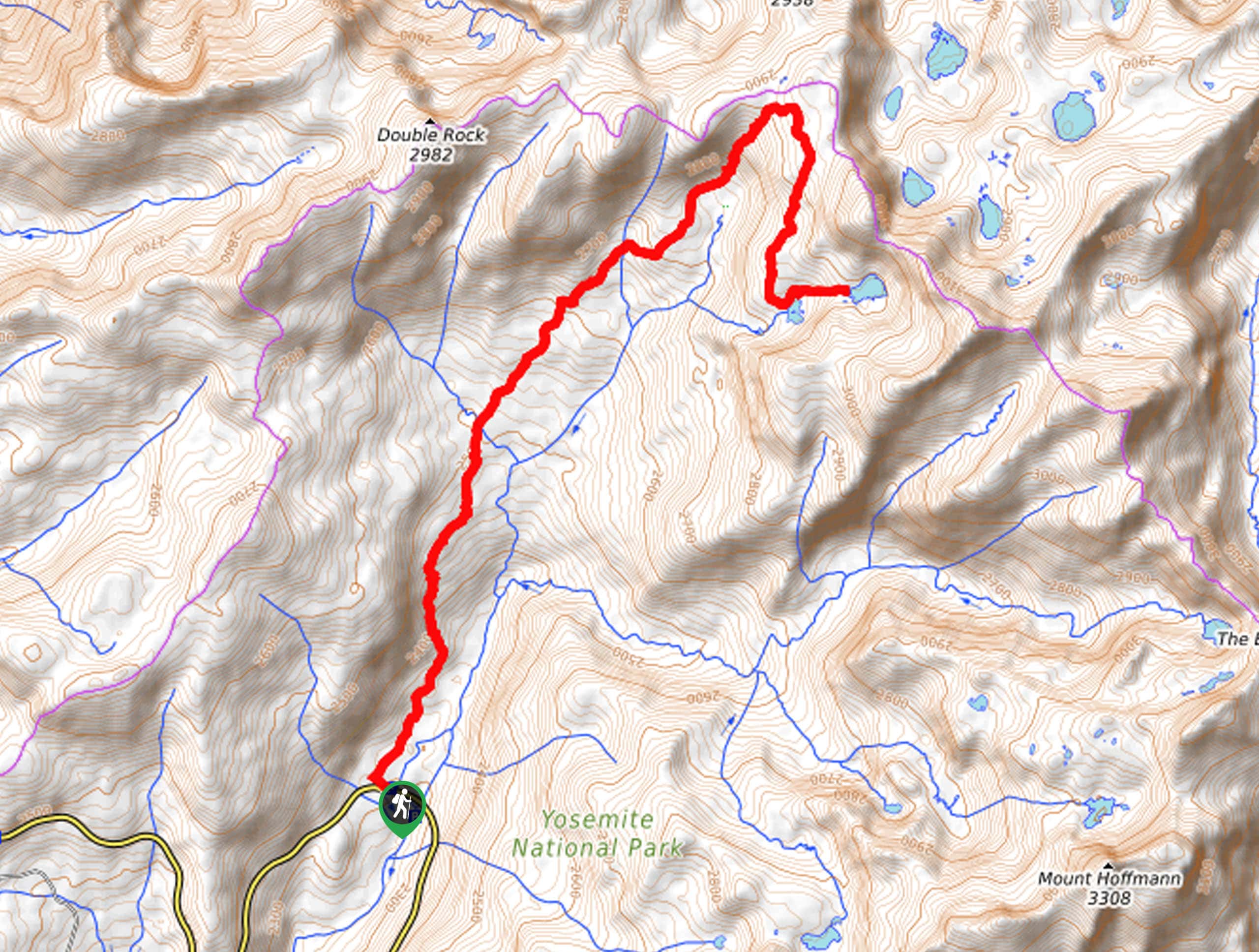
The Tioga Pass Road to Yosemite Falls Hike departs from the Yosemite Creek Trailhead off Tioga Pass Road.

About
| Backcountry Campground | Backcountry Camping, Wilderness Permit Required. |
| When to do | April-October |
| Pets allowed | No |
| Family friendly | No |
| Route Signage | Average |
| Crowd Levels | Moderate |
| Route Type | Out and back |
Tioga Pass Road to Yosemite Falls Hike
Elevation Graph
Weather
Tioga Pass Road to Yosemite Falls Hike Description
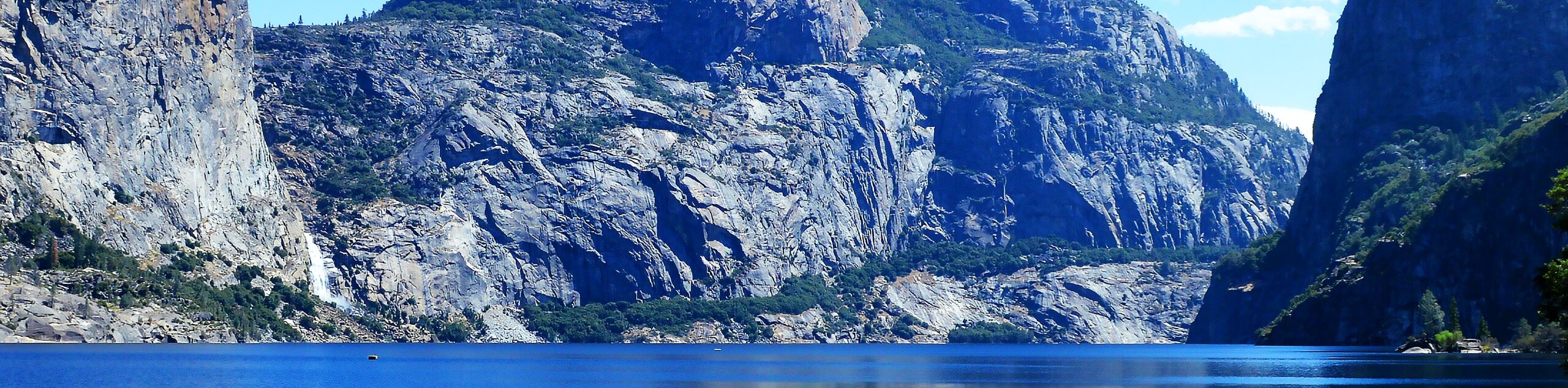
Immerse yourself in Yosemite’s high country along this demanding day-hike. Revealing awesome scenes of the encompassing granite peaks, picturesque streams, and famous cascades, this trek is anything but dull! Due to the trail’s length, we strongly suggest leaving in the morning to avoid having to complete the return leg in the dark. Additionally, as this path travels through diverse landscapes, we encourage you to wear layers and bring sun protection! Note: a trail GPS is not necessary, but will prove to be extremely useful! The National Park charges an entrance fee; check out the NPS website for additional details.
Setting out from the trailhead, the Tioga Pass Road to Yosemite Falls Trail tracks south along Yosemite Creek Trail. Continue along this path to the Old Tioga Road, which you will follow until you reach the Yosemite Creek Trailhead and Campground. From here, follow the Yosemite Creek Trail southwest to weave through the meadows and mixed conifer forests. This path follows Yosemite Creek for the entire hike, so if you find yourself getting off track, just continue along the creek.
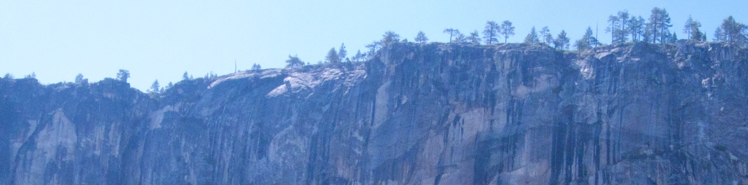
Eventually, the route will guide you to the famous Yosemite Falls. Note: the granite boulders atop the cascades are slippery when wet! Admire the grandeur of the waterfall from the overlook and you will also be granted knee-buckling views of the valley below. Take some time to appreciate the dramatic landscape, before retracing your steps along the path back to the trailhead.
Similar hikes to the Tioga Pass Road to Yosemite Falls Hike hike
Beehive Meadow Trail
The Beehive Meadow Trail is an amazing adventure in Hetch Hetchy that travels through diverse terrains. Cross the O’Shaughnessy Dam,…

Chain Lakes Hike
Explore one of the more secluded trails in Yosemite National Park along the Chain Lakes Hike. This wonderful trail exposes…
Grant Lakes Hike
Immerse yourself in Yosemite’s high country along the Grant Lakes Trail. This epic hike exhibits the grandeur and diversity of…
Comments