Tenaya Lake and May Lake Loop
View Photos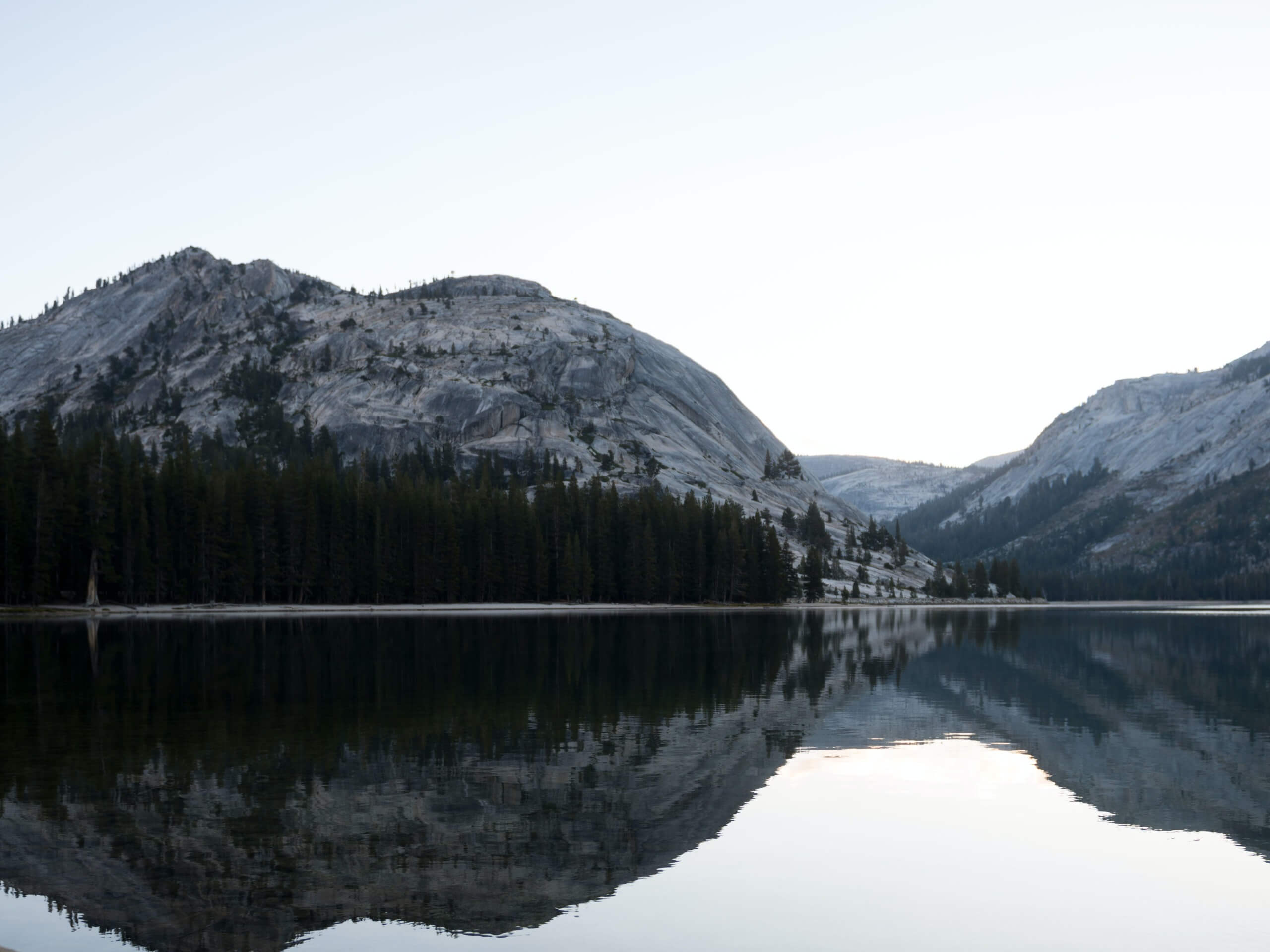
Tenaya Lake and May Lake Loop
Difficulty Rating:
Hiking the Tenaya Lake and May Lake Loop is an incredibly scenic adventure. Explore Yosemite’s high country and revel in the views of shimmering alpine lakes hemmed in by granite bluffs. This trek is a guaranteed winner in our books!
Getting there
Access the Tenaya Lake and May Lake Loop from the Clouds Rest and Tenaya Lake Parking Lot off Tioga Pass Road.

About
| Backcountry Campground | Backcountry Camping, Wilderness Permit Required |
| When to do | May-October |
| Pets allowed | No |
| Family friendly | Older Children only |
| Route Signage | Average |
| Crowd Levels | Moderate |
| Route Type | Circuit |
Tenaya Lake and May Lake Loop
Elevation Graph
Weather
Tenaya Lake and May Lake Loop Description
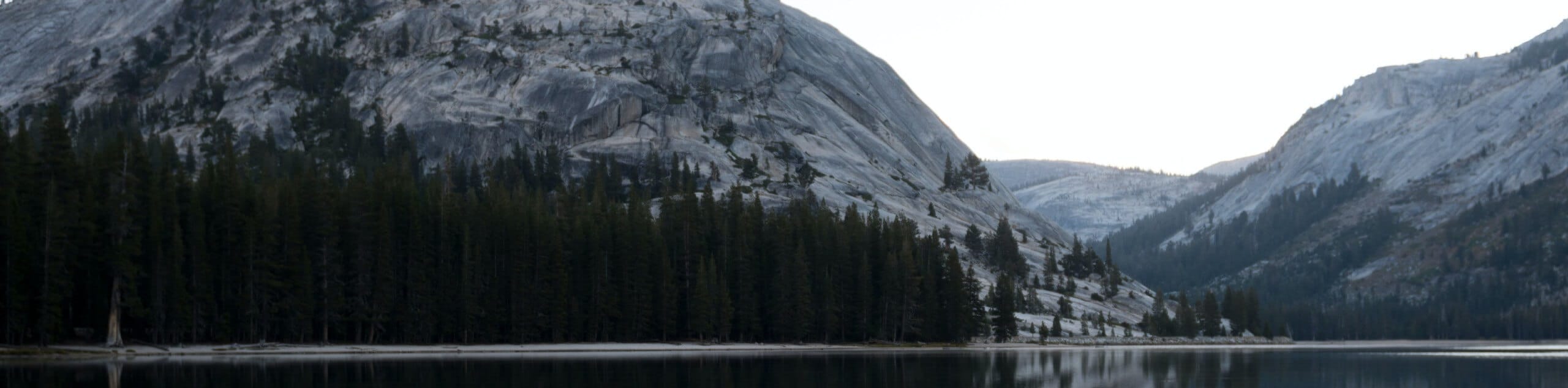
The Tenaya Lake and May Lake Loop is a stunning hike that exhibits the beauty and grandeur of the Sierra Nevada Mountain Range. Wander through sweet-smelling mixed pine forests to the shores glittering alpine lakes that are often littered with amazed hikers and lucky backpackers. Be sure to charge your camera for this one! We recommend this hike in the spring, when the snow-melt streams are surging and the granite peaks are capped with snow—just make sure to wear sturdy footwear as the route is rocky and uneven. Note: the National Park charges an entrance fee; refer to the NPS website for additional details.
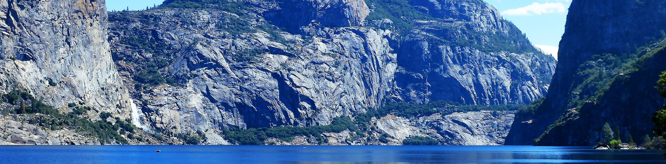
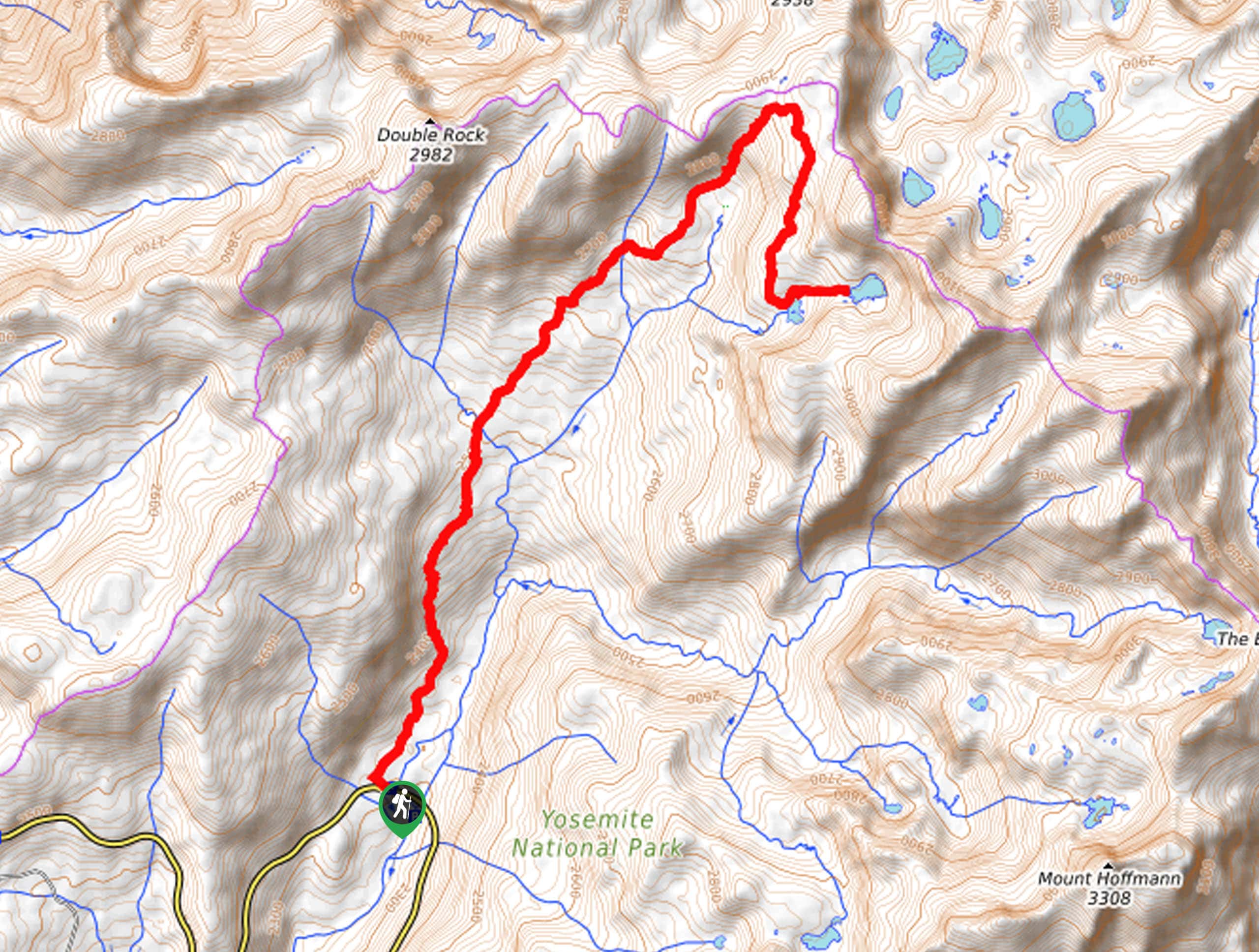
Embark on your adventure along the Tenaya Lake and May Lake Loop from the Clouds Rest Parking Lot. From here, head left along the shoulder of Tioga Pass Road until you reach the May Lake Trailhead. Turn right here and begin hiking up the May Lake Trail. The path will gradually climb to the second May Lake Trailhead, where the terrain will become increasingly intense. Soon you will ascend the ridge to May Lake, a charming alpine lake with busy campsites along the shoreline. Revel in the beauty of the shimmering waters bounded by verdant pines and Mount Hoffmann.
From here, follow the Glen Aulin-May Lake Trail east through mixed pine forests lined with granite outcrops. Follow this route to the next junction, where you will be redirected southwest along the Murphy Creek Trail. Wander this path along the snowmelt stream, turning right onto the Tioga Pass Road at the trail’s end and following it back to the car park.
Similar hikes to the Tenaya Lake and May Lake Loop hike
Beehive Meadow Trail
The Beehive Meadow Trail is an amazing adventure in Hetch Hetchy that travels through diverse terrains. Cross the O’Shaughnessy Dam,…

Chain Lakes Hike
Explore one of the more secluded trails in Yosemite National Park along the Chain Lakes Hike. This wonderful trail exposes…
Grant Lakes Hike
Immerse yourself in Yosemite’s high country along the Grant Lakes Trail. This epic hike exhibits the grandeur and diversity of…
Comments