
Stanford Point Trail
View Photos
Stanford Point Trail
Difficulty Rating:
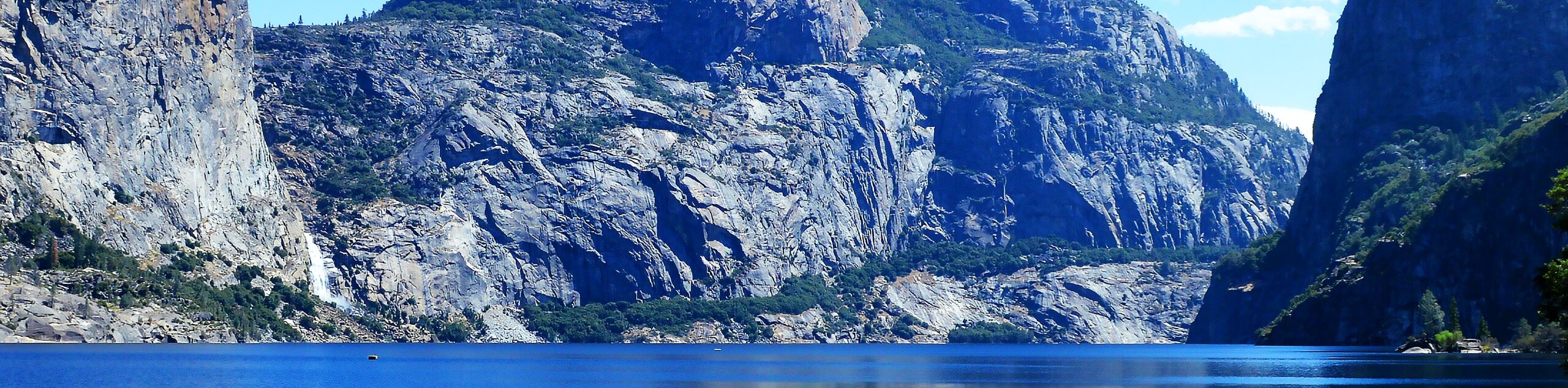
The Stanford Point Trail is another epic overlook of Yosemite Valley featuring amazing views of El Capitan, Half Dome, and the Merced River running below. The Stanford Point Trail is yet another amazing adventure through the serene wilderness of Yosemite to an epic overlook of the granite oasis. Revel in the vistas of Yosemite Valley, Half Dome, El Captain, and countless other granite peaks that line the horizon.
Getting there
The Stanford Point Trail departs from the Pohono Trailhead off Wawona Road near the Tunnel View.

About
| Backcountry Campground | No |
| When to do | Stanford Point Trail Year-round |
| Pets allowed | No |
| Family friendly | No |
| Route Signage | Average |
| Crowd Levels | Low |
| Route Type | Out and back |
Stanford Point Trail
Elevation Graph
Weather
Stanford Point Trail Description
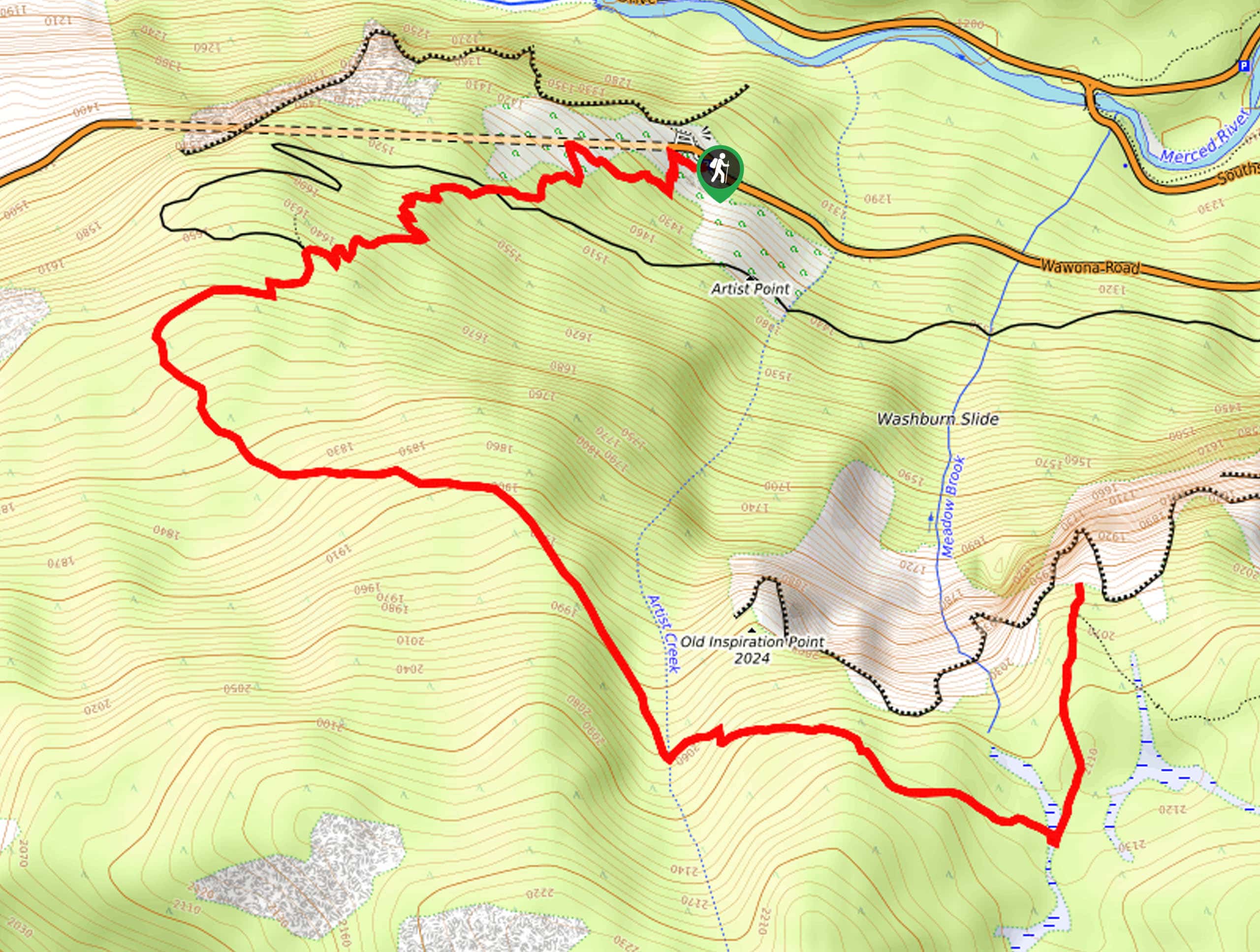
The Stanford Point Trail, though one of many scenic treks that boasts sweeping valley views, is one of the few treks in the valley that can be conquered year-round. This versatile trail can be enjoyed with a pair of snowshoes or microspikes in the winter months for a more demanding adventure. Wander through mixed pine forests up to the granite overlook, but don’t get too close to the edge! Note: the National Park charges an entrance fee; refer to the NPS website for the pricing guide.
Setting out from the Pohono Trailhead, your journey along the Stanford Point Trail begins with a steep climb to the southwest. Carefully navigate a set of seemingly never-ending switchbacks up to Inspiration Point, which reveals breathtaking views of the valley and Bridal Veil Falls. Departing from Inspiration Point, the path will curve east and continue to climb through an enchanting forest and some exposed terrain. Be sure to enjoy the sweet smell of the Jeffrey pines as you hike through the area.
Passing Old Inspiration Point and crossing over Meadow Brook, you will soon reach Stanford Point. Let the dramatic landscape overwhelm you, as you revel in the grandeur of the granite dome and peaks that line the horizon. After appreciating the scene, retrace your footing along the path back to the trailhead.
Similar hikes to the Stanford Point Trail hike
Beehive Meadow Trail
The Beehive Meadow Trail is an amazing adventure in Hetch Hetchy that travels through diverse terrains. Cross the O’Shaughnessy Dam,…

Chain Lakes Hike
Explore one of the more secluded trails in Yosemite National Park along the Chain Lakes Hike. This wonderful trail exposes…
Grant Lakes Hike
Immerse yourself in Yosemite’s high country along the Grant Lakes Trail. This epic hike exhibits the grandeur and diversity of…
Comments