Ostrander Lake Trail
View Photos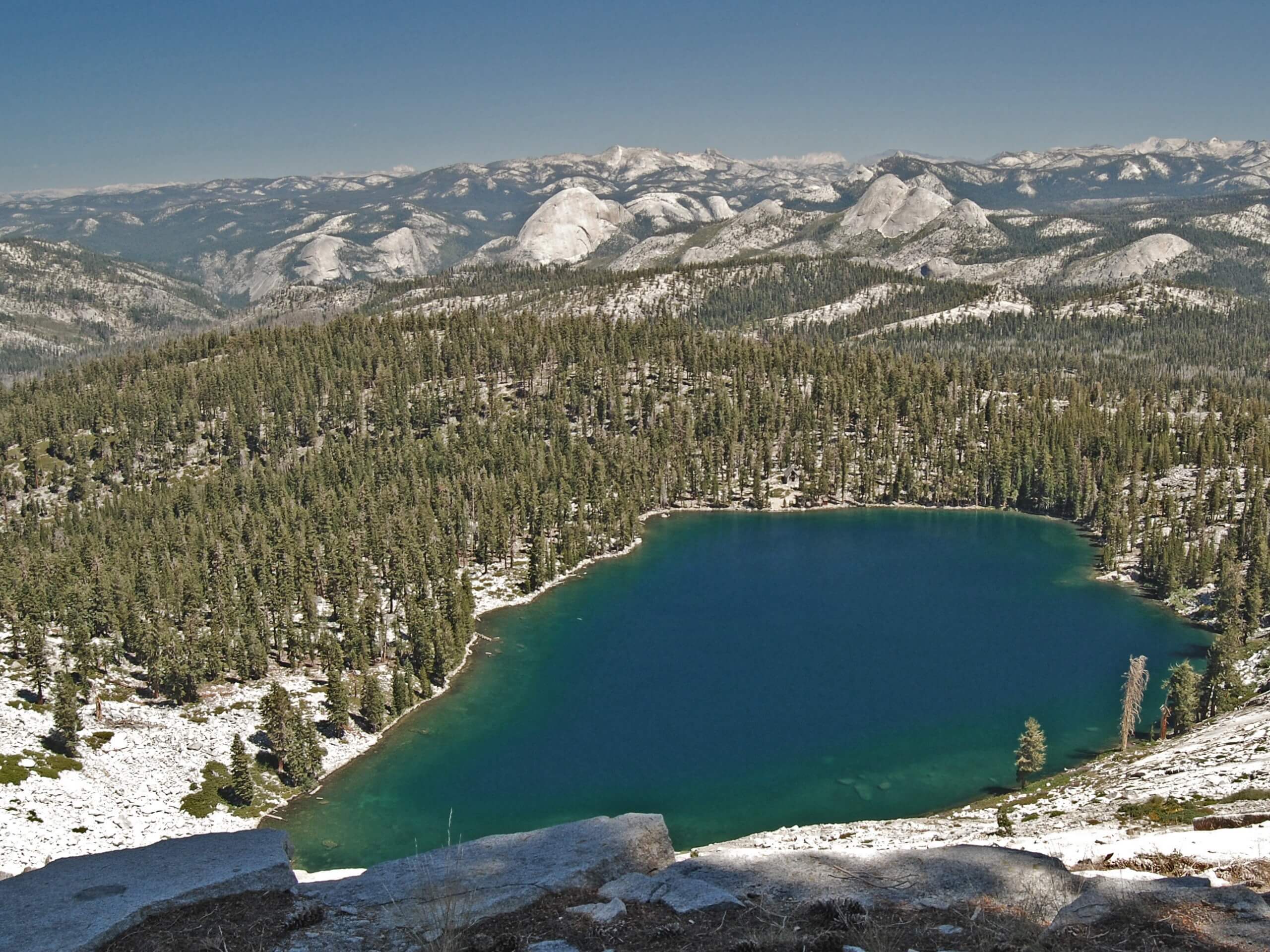
Ostrander Lake Trail
Difficulty Rating:
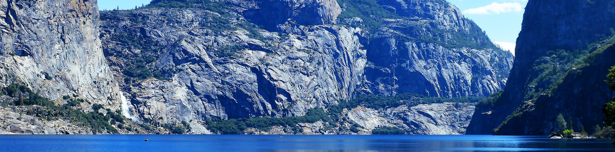
Hiking the Ostrander Lake Trail is a charming experience through wildflower meadowlands, granite gardens, and mixed pine forests to the shimmering lake. This lovely adventure exhibits breathtaking scenery that will be sure to motivate even the most discouraged hikers along the way. We love this trek, and we know you will too!
Getting there
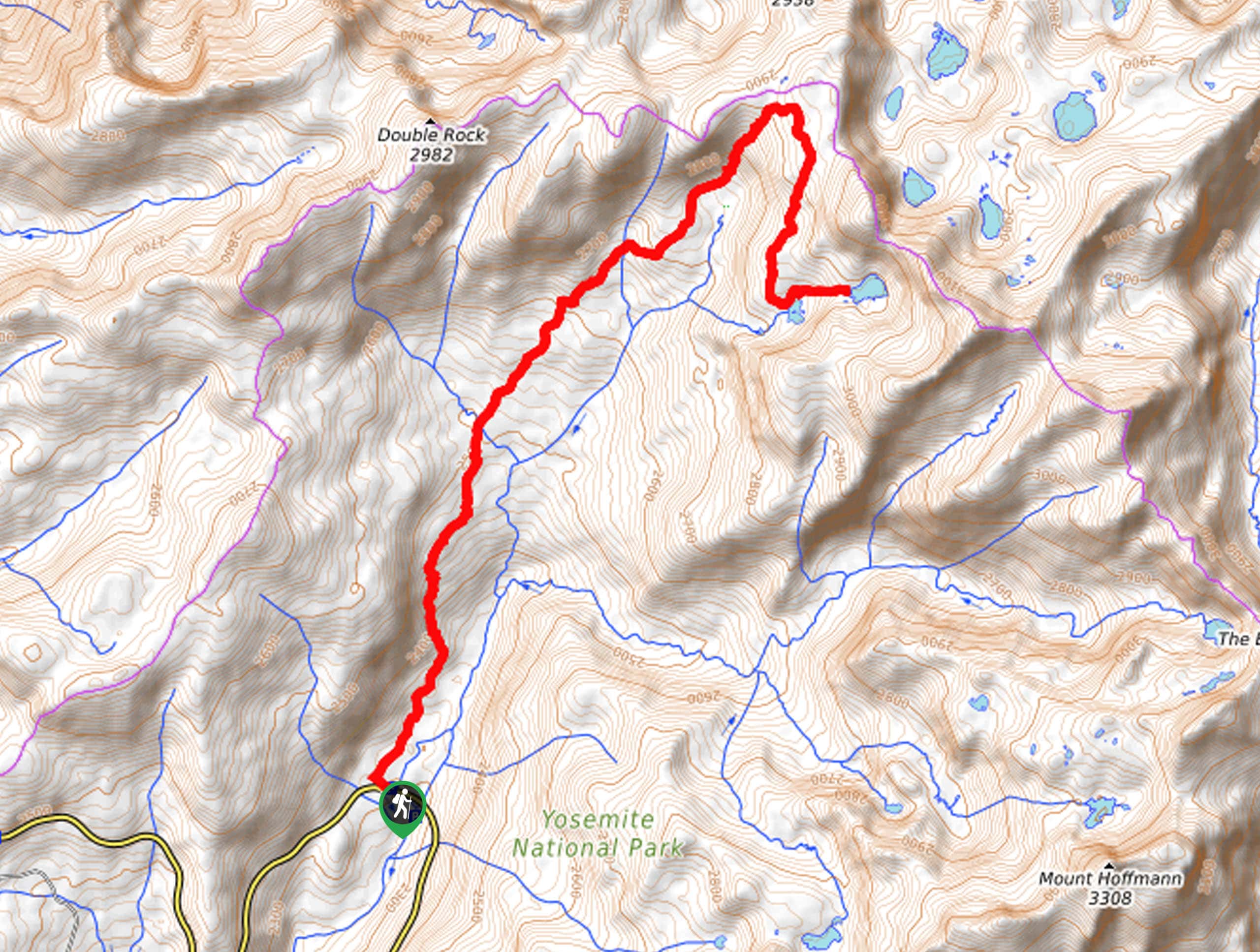
The Ostrander Lake Hike departs from the Ostrander Lake Trailhead off Glacier Point Road.

About
| Backcountry Campground | Dispersed Backcountry Camping, Wilderness Permit Required. |
| When to do | March-October |
| Pets allowed | No |
| Family friendly | Older Children only |
| Route Signage | Poor |
| Crowd Levels | Moderate |
| Route Type | Out and back |
Ostrander Lake Trail
Elevation Graph
Weather
Ostrander Lake Trail Description
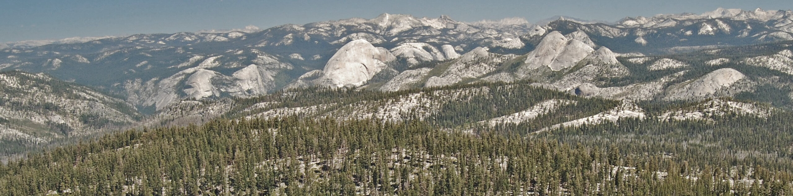
The Ostrander Lake Trail is an excellent hike for those seeking a longer, more secluded adventure in Yosemite. Wander through meadowlands abundant with wildflowers and enjoy the sights of Half Dome as you make your way to Ostrander Lake and the Ski Hut. While the exposed terrain provides stunning panoramic views, it also fosters hot trail conditions in the summer months, so make sure you wear sun protection to beat overexposure. Additionally, the route is rocky in sections, so we strongly suggest a pair of sturdy footwear to avoid a rolled ankle. This trail is only accessible when Glacier Point Road is open and the National Park charges an entrance fee, so make sure to refer to the NPS website for additional information.
Embark on your adventure along the Ostrander Lake Hike from the trailhead off Glacier Point Road. From here, use the trail GPS to wander south through meadowlands that are abundant with wildflowers. Soon after your departure from the trailhead you will reach an intersection and keep left. The easy-going, flat terrain will soon come to an end at the next junction, where you will again veer left and follow the Ostrander Lake Trail as it begins to climb. Heading east to another intersection, keep right to begin your final ascent to the lake.
Mind your footing on the rocky terrain and you will soon reach the Ski Hut and lake. Explore the lake’s shore and revel in the sights of the granite peaks that frame the backdrop behind the water. Grab a seat on the giant log overlooking the shimmering waters and take some time to rest and rehydrate. When you are ready, head back the way you came to the trailhead.
Similar hikes to the Ostrander Lake Trail hike
Beehive Meadow Trail
The Beehive Meadow Trail is an amazing adventure in Hetch Hetchy that travels through diverse terrains. Cross the O’Shaughnessy Dam,…

Chain Lakes Hike
Explore one of the more secluded trails in Yosemite National Park along the Chain Lakes Hike. This wonderful trail exposes…
Grant Lakes Hike
Immerse yourself in Yosemite’s high country along the Grant Lakes Trail. This epic hike exhibits the grandeur and diversity of…
Comments