
Mount Dana hike
View Photos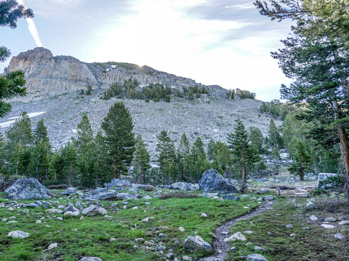
Getting there
Head to the eastern gate of Tioga Road (Highway 120) and park in the small parking lot or along the road.

About
| When to do | June through September |
| Backcountry Campsites | No |
| Toilets | Near Trailhead |
| Family friendly | No |
| Route Signage | None |
| Crowd Levels | Moderate |
| Route Type | Out and back |
Mount Dana
Elevation Graph
Weather
Route Description for Mount Dana
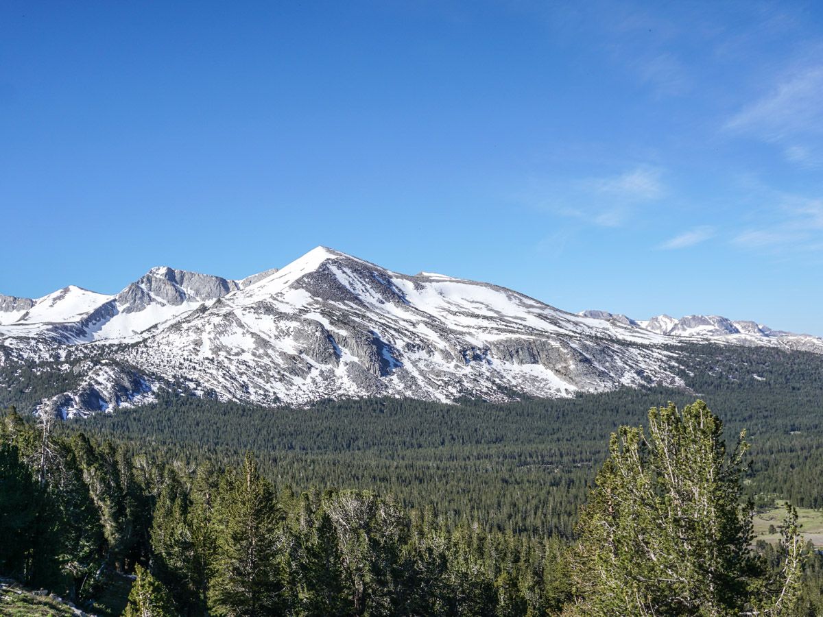
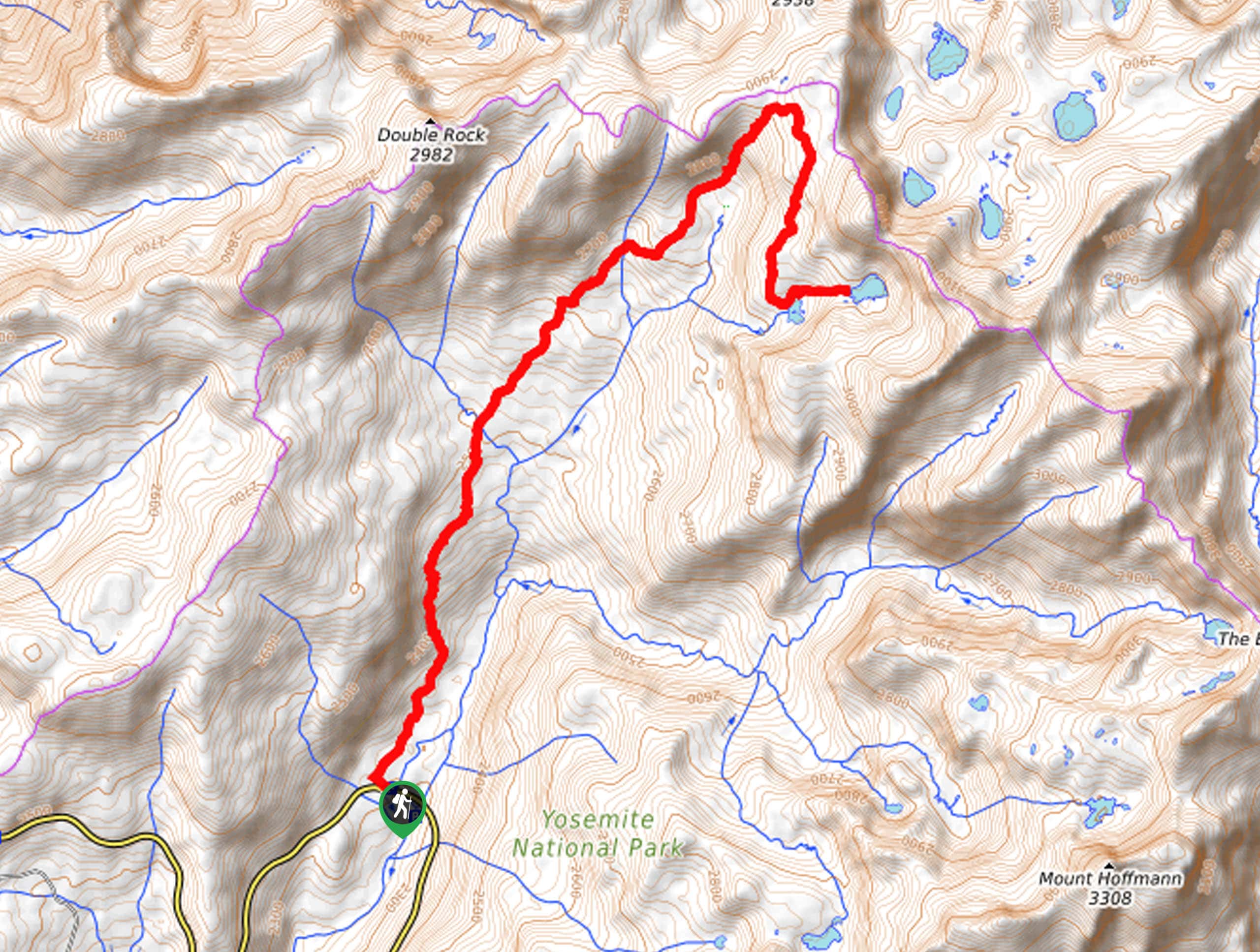
Park as close as you can to the eastern park entrance along Tioga Rd. Walk to the gate itself, then head south towards the visible peak of Mt. Dana. The path is directly in line with the gate. This is an unofficial path so don’t expect the rangers to be able to answer many of your questions.
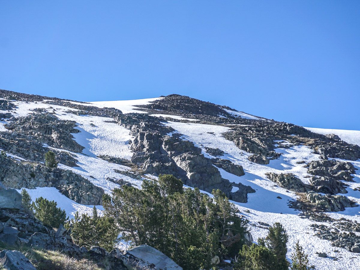
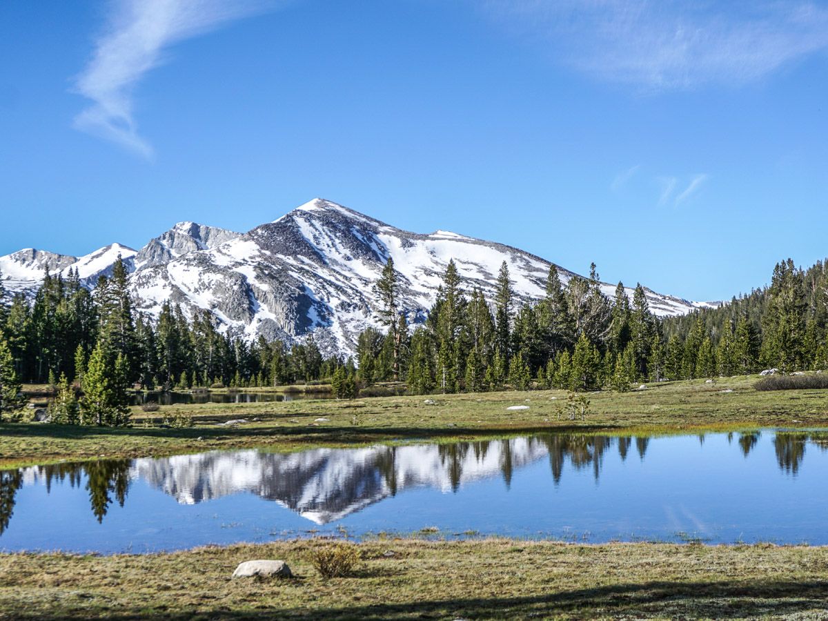
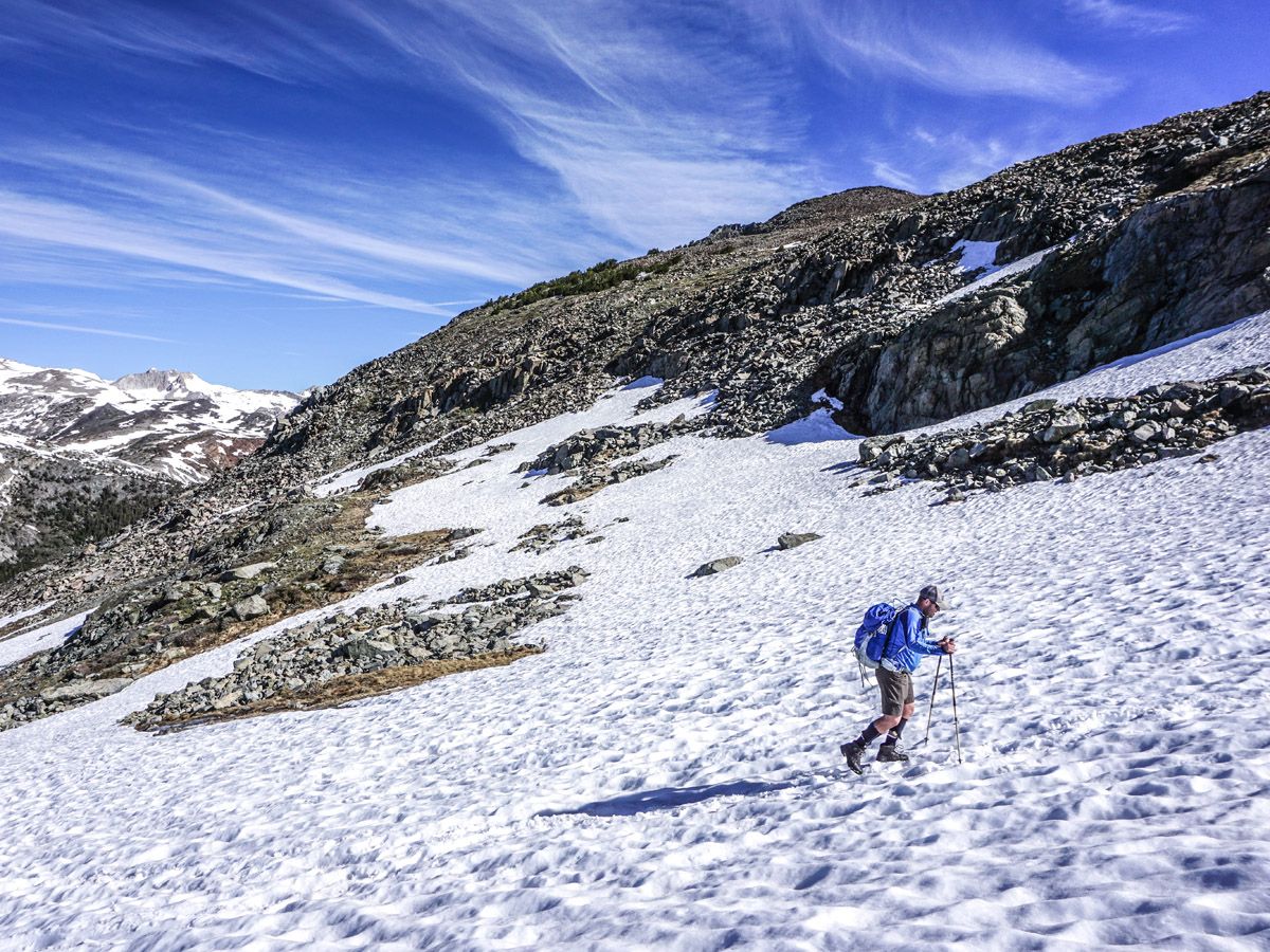
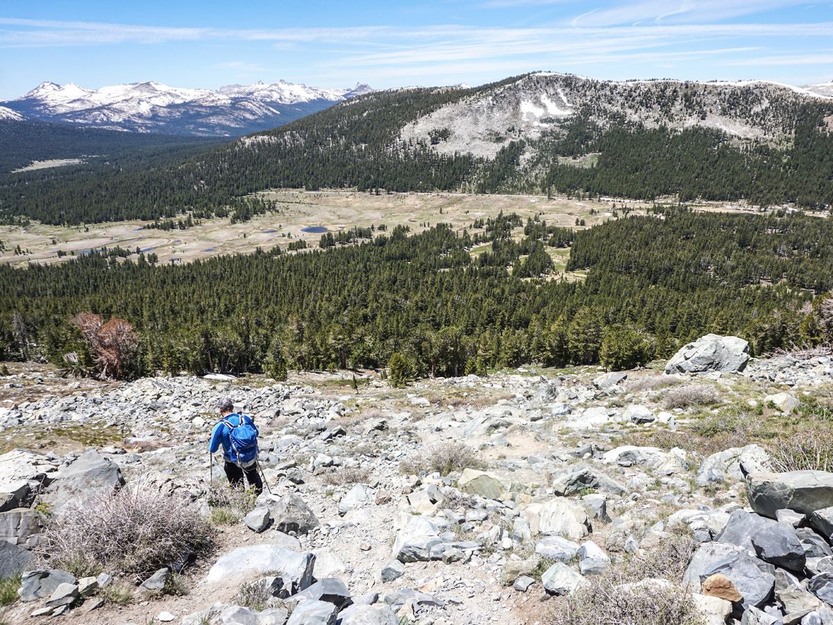
You will stroll past meadows and lakes as you approach the beginning of the climb. The first part of the ascent is in the shade, but it’s still quite steep. As you leave the trees, snow banks appear if it is early in the season – start thinking about your route as they can make route finding difficult. Our general rule of thumb is to avoid the snow as much as possible on the ascent, as it can be slippery and risky, especially if steep. Descending, however, can be made much easier by glissading, sliding down with your feet. Beware of descents where you are punching through the snow, as you can easily injure your legs or get your foot wedged on rocks.
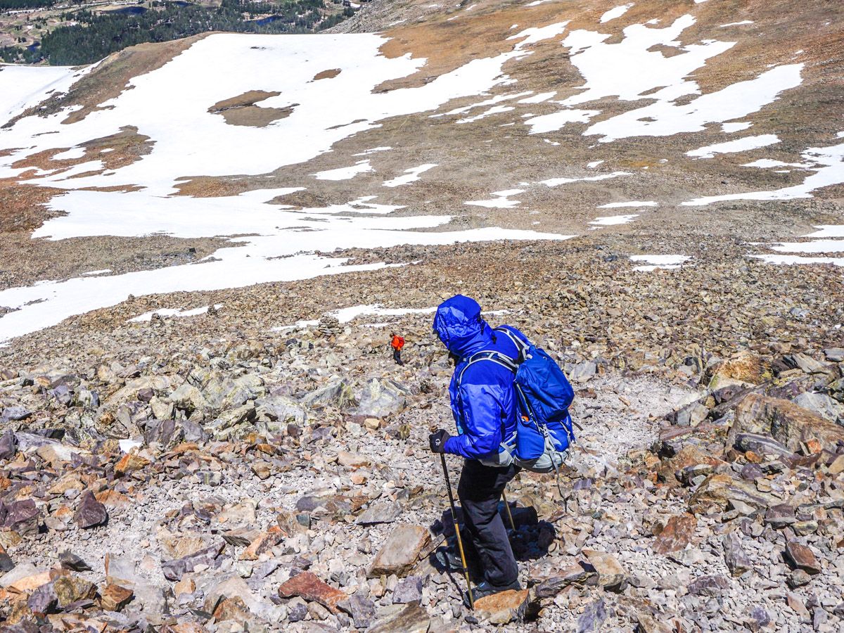
As you climb you will gain a shoulder and you can see a peak to your left, however the main objective is to the right. Continue to ascend to your right on the quickly fading path. After you cross a level area there are many paths to the summit. Pick the most travelled and, again, avoid the snow.
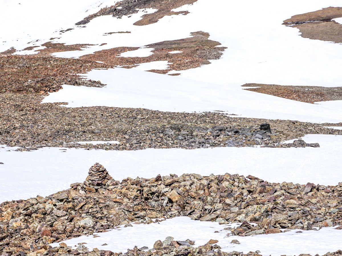
Closer to the summit the climb gets steeper and turns into a light scramble. You may encounter some scree and have to use your hands. Hiking poles could be helpful for those unsure on their feet. The best path seems to be marked by enormous Cairns on the right-hand side of the mountain.
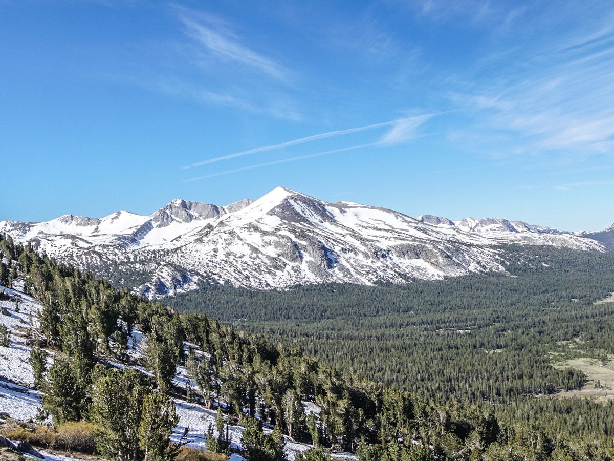
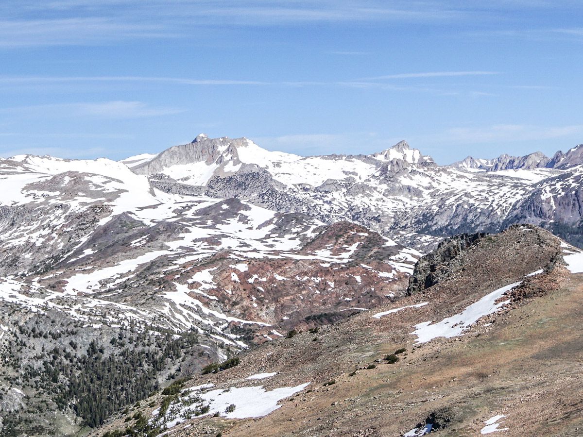
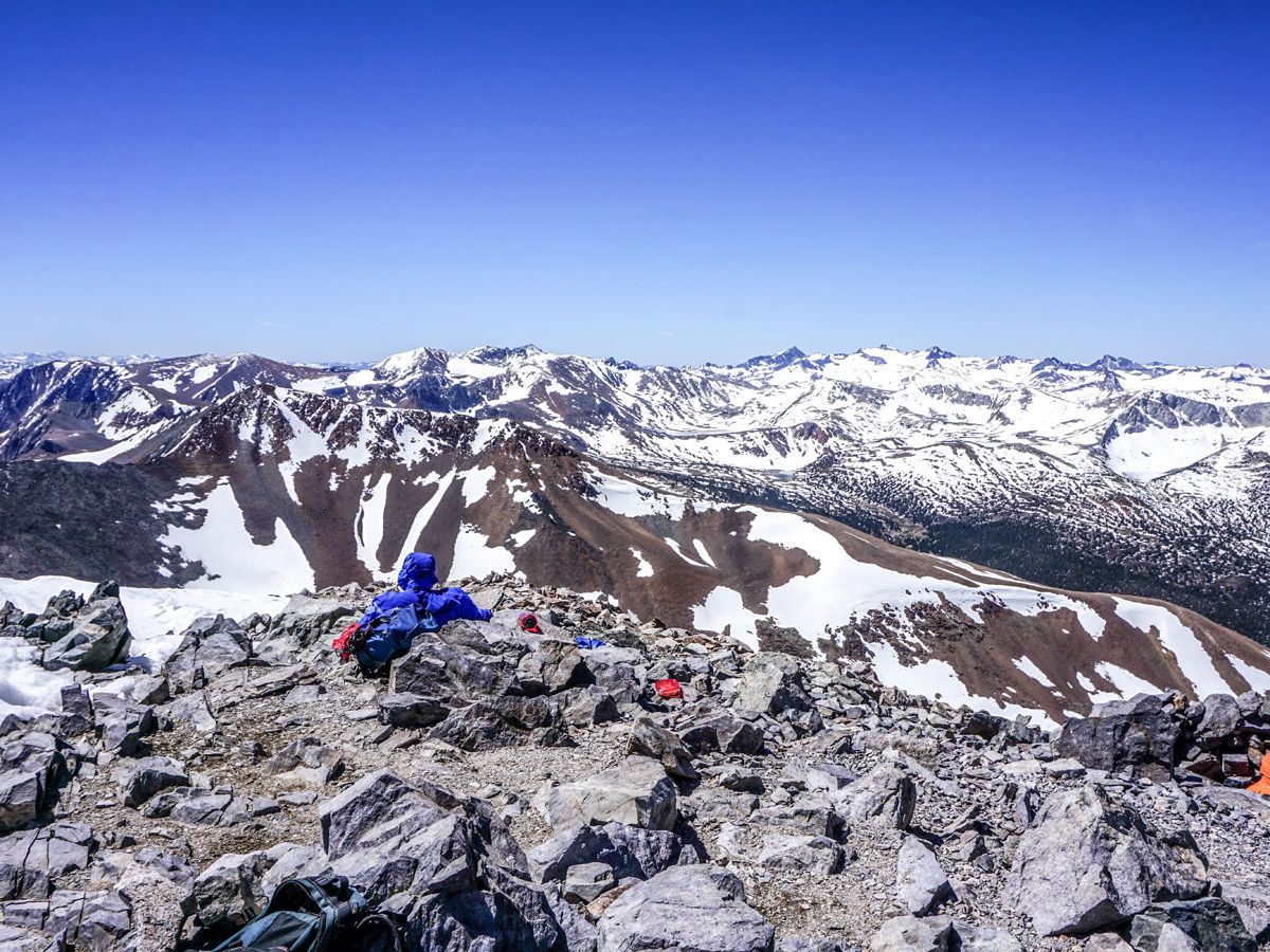
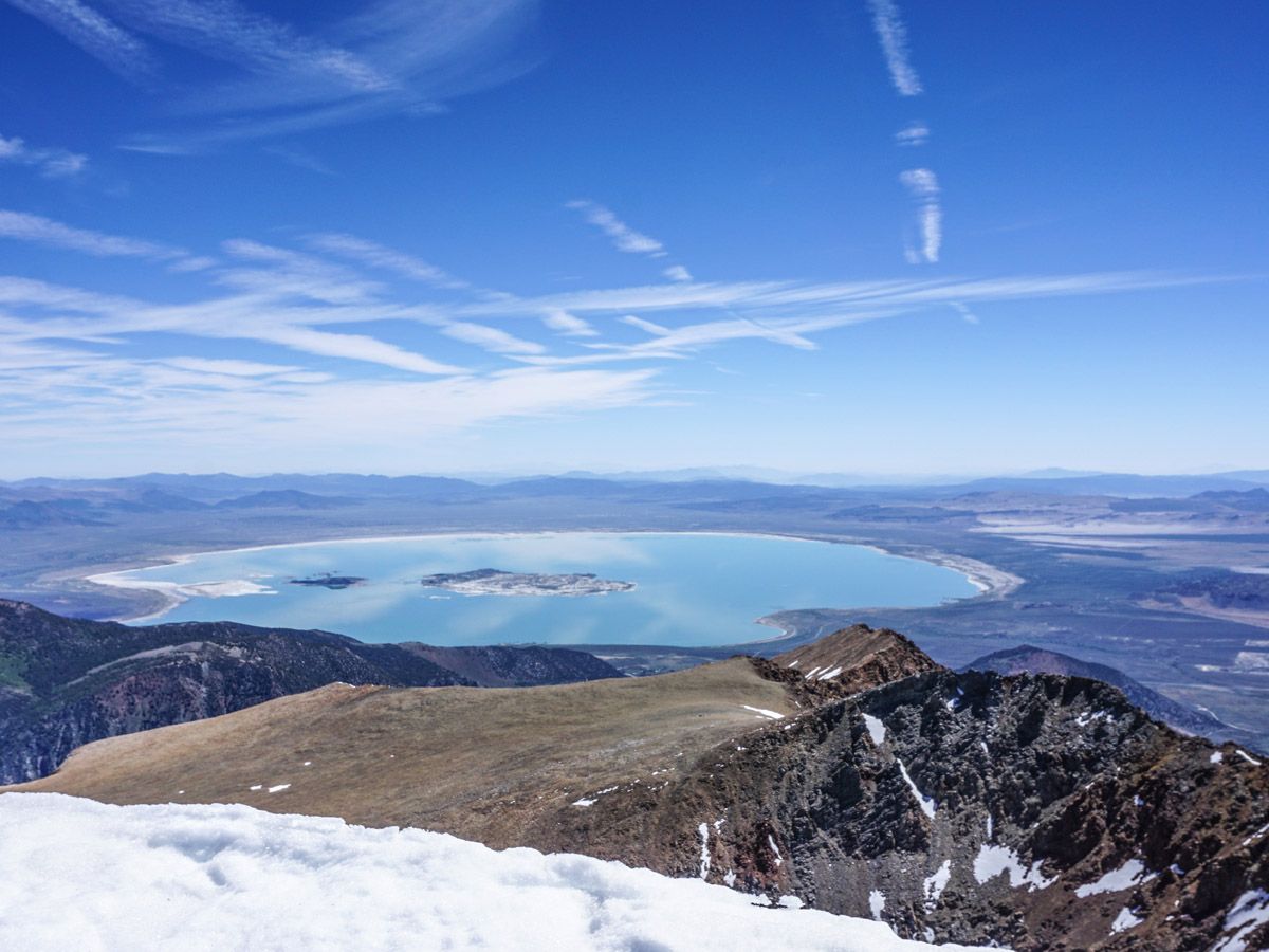
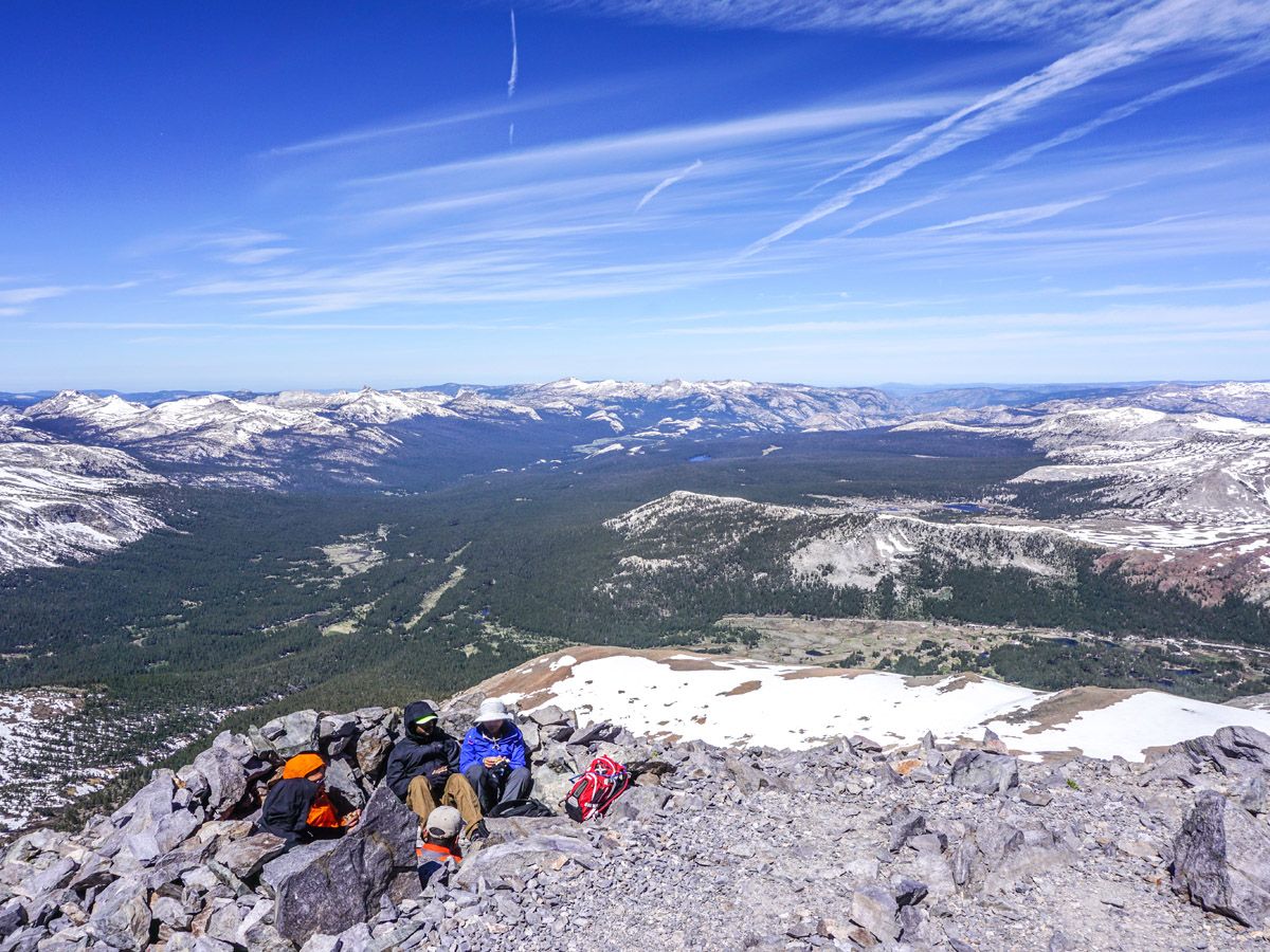
On top of the summit the views are gorgeous. You are right on the edge of Yosemite Park (literally straddling the boundary) and you can see down into Lee Vining and Mono Lake. If there is snow, please DO NOT stand on this cornice. It can break off and send you tumbling down several thousand feet. To our surprise we saw footmarks on the cornice.
A small shelter has been made at the summit to get you out of the wind, but if you use this you are looking into a wall of rocks. It’s probably going to be windy at 13123ft, so bring extra layers to be able to soak in the view instead. Go down the way you came up and head towards the visible park gate and parking lot.
If you want to find more great hikes in Yosemite, check out Clouds Rest, Sentinel Dome, Yosemite Valley or Panorama Trail!
Insider Hints
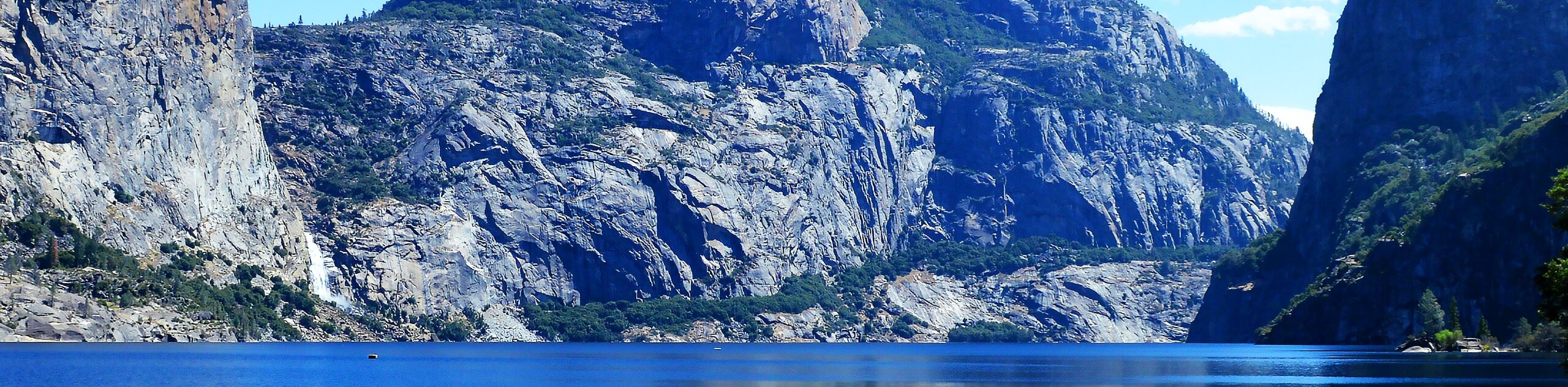
The drive east past the park gate on Highway 120 is incredible, one of our favorites. Go all the way down to an intersection. You can go left to check out Lee Vining but we suggest going right. Head South on Highway 395 and take your first right on Highway 158 heading out to Silver Lake. This is beautiful as you pass Grant Lake, then Silver Lake and finally come to the town of June Lake, a favorite of ours. There’s a fine brewery here and it’s a great place for a break. Continue on the 158 and hit Highway 395. Head North, and go right when you see Mono Basin Road (highway 120 again) to see the Tufa on Mono Lake at the South Tufa Area.

Similar hikes to the Mount Dana hike
Beehive Meadow Trail
The Beehive Meadow Trail is an amazing adventure in Hetch Hetchy that travels through diverse terrains. Cross the O’Shaughnessy Dam,…

Chain Lakes Hike
Explore one of the more secluded trails in Yosemite National Park along the Chain Lakes Hike. This wonderful trail exposes…
Grant Lakes Hike
Immerse yourself in Yosemite’s high country along the Grant Lakes Trail. This epic hike exhibits the grandeur and diversity of…
yanagichan 4 years ago
This trips gives you a backcountry experience with breathtaking views, It was so nice to get you away from all the crowds.
lemontree 4 years ago
Gorgeous hike. Lots of scenery to see.
Nora T. 4 years ago
I had an exceptional time on our Yosemite. The trip itself was incredible.
Stumpyboots 4 years ago
Nature rewards me with great scenery. Amazing!
Jellybean 4 years ago
Pretty windy the whole way, which made it nice since I went midday. Definitely recommend. The views from the top are amazing!
TailBlazer 4 years ago
What an amazing experience!! Everyone part of it will encourage you to go further because of it's spectacular views.
Stewart Graham 4 years ago
The view from the top is amazing and very good challenging hike at Yosemite park.
footfall 4 years ago
A pleasant summit far from the crowds of Yosemite Valley. I highly recommend this peak to anyone.
Stewart M. 4 years ago
Awesome hike. Glad to see the snow, trails were a little slippery. Some microspikes would help.
orlando f. 4 years ago
Th second highest peak in Yosemite did not dissapoint! The views here are remarkable!