Four Mile Trail
View Photos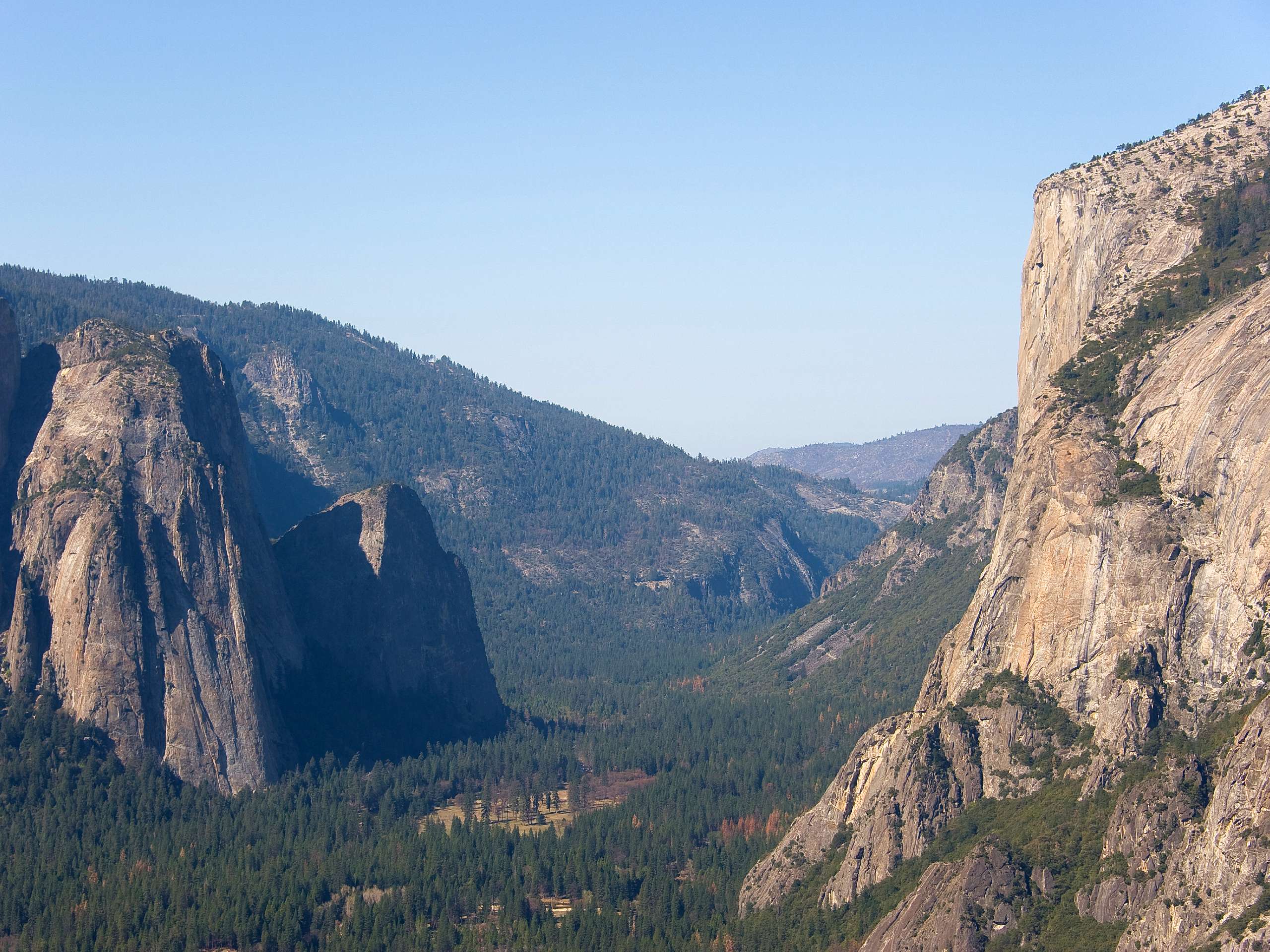
Four Mile Trail
Difficulty Rating:
The Four Mile Trail in Yosemite National Park offers hikers a wonderful trail with lots of views and two highlights of Yosemite: Yosemite Valley and Glacier Point. While it’s great as an out-and-back route, many hikers choose to take a bus or use a second car to go one-way.
Getting there
Head to Four Mile Trailhead along Southside Drive to set out on this route.

About
| Backcountry Campground | Yosemite Valley campgrounds |
| When to do | April to October |
| Pets allowed | Yes - On Leash |
| Family friendly | No |
| Route Signage | Average |
| Crowd Levels | Moderate |
| Route Type | Out and back |
Four Mile Trail
Elevation Graph
Weather
Four Mile Trail Description
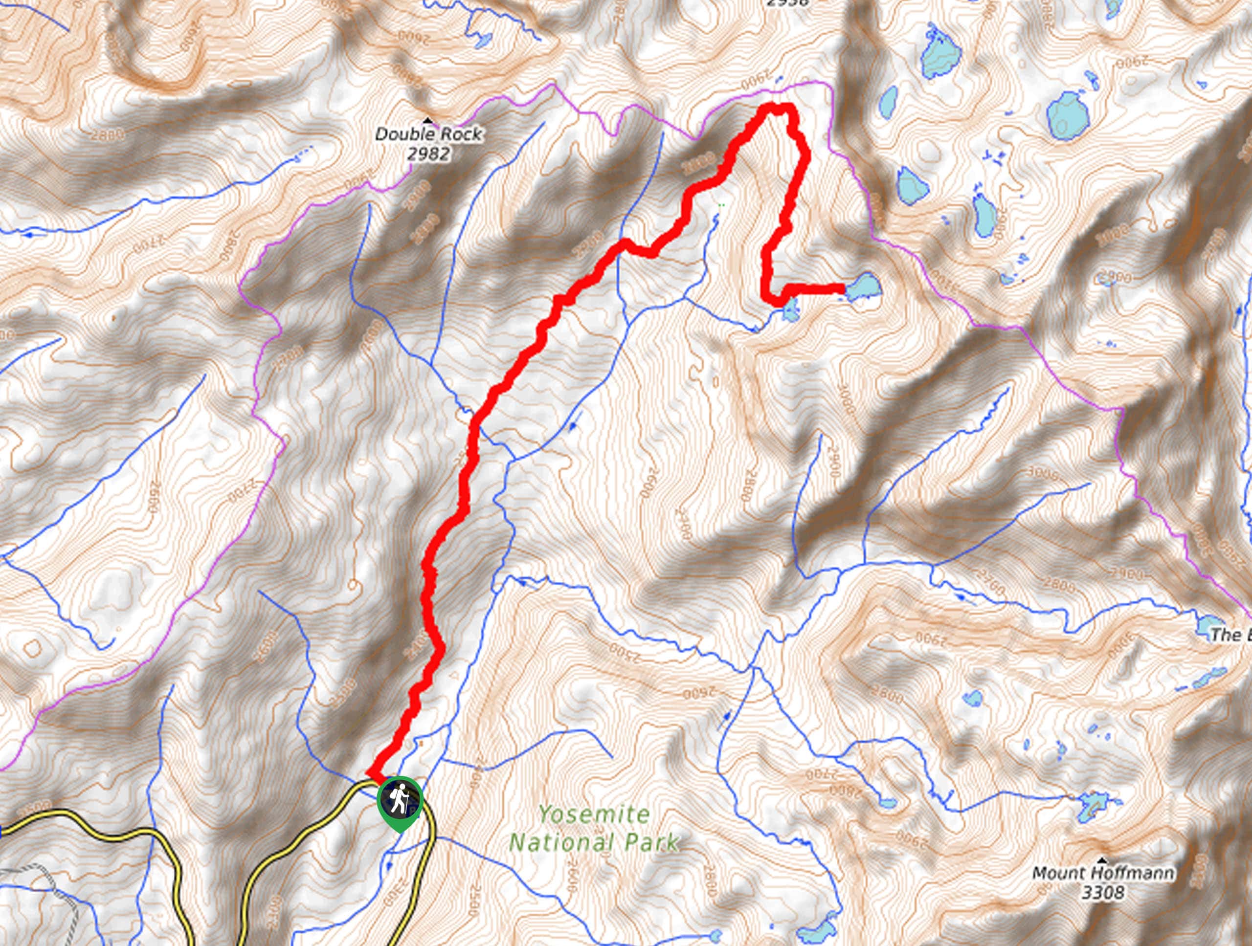
The first decision in hiking the Four Mile Trail is whether to go in one direction or go out and back. We share this as an out-and-back, from Yosemite Valley up to Glacier Point and back down, but this can also be done as a one-way. If you’re doing it as a one-way, either book a one-way bus ticket or have a car at both ends of the trail. Side note: if you’re wondering why a 9.2mi trail earned the name Four Mile Trail, it’s because it’s just over four miles one way.
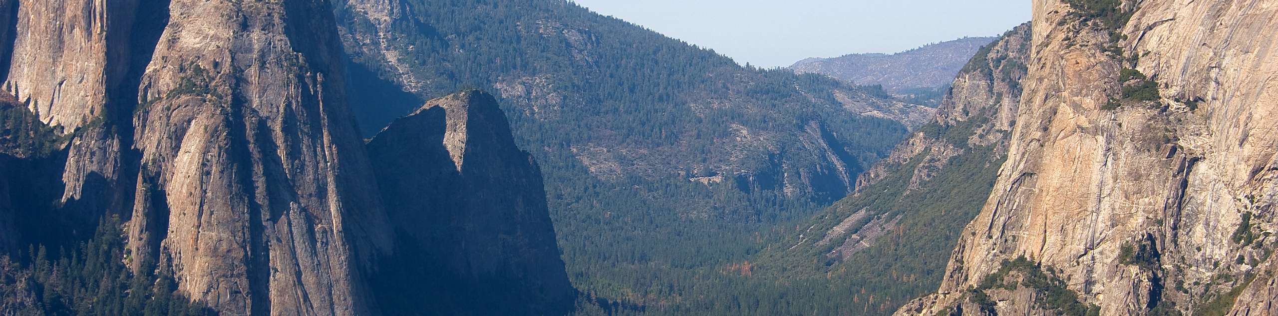
This hike starts at the Four Mile Trailhead on Southside drive at the base of Sentinel Rock. Follow the trail and almost immediately start gaining elevation through a series of switchbacks.
You’ll soon come to a fairly level traverse below Sentinel Rock that heads to the Northeast, with nice views across Yosemite Valley, and in spring, you’ll see Yosemite Falls gushing out high above the valley.
Continue on this trail before you start another long series of switchbacks to gain elevation. Around halfway up, you’ll have the option to take a quick detour to Union Point, a lovely viewpoint with vistas stretching out over the Yosemite Valley.
From Union Point, continue on the Four Mile Trail as you immediately head up your final set of switchbacks. From the switchbacks, the final section of the Four Mile Trail takes you to Glacier Point—the true highlight of the hike.
Glacier Point boasts one of the finest views in Yosemite National Park (and all of North America), with Half Dome dominating the view of the Yosemite Valley and beautiful waterfalls, which are best in spring.
There is a washroom and snacks at Glacier Point, and it’s definitely worth a longer break to soak in the view. To get back to Yosemite Valley, return the way you came, walking back down the Four Mile Trail.
Insider Hints
The Four Mile Trail doesn’t have a lot of shade, so this is not the best choice of trails on very hot days.
Parts of the Four Mile Trail are quite steep, and people who don’t love heights have said it was a bit overwhelming. If you don’t like heights, then the Four Mile Trail may not be the best trail to do.
The descent from Glacier Point is tricky at times, even in dry weather, and poles make it significantly safer and easier on the knees. If there is one hike in Yosemite to bring poles, Four Mile Trail is it.
This isn’t a great hike to do in wet weather, especially coming back down, where sections are quite steep and can get even more slippery when wet.
A bus runs from Yosemite Valley to Glacier Point, and you can get a one-way fare. If you’re doing this, we suggest taking the bus to Glacier Point and walking back.
Similar hikes to the Four Mile Trail hike
Beehive Meadow Trail
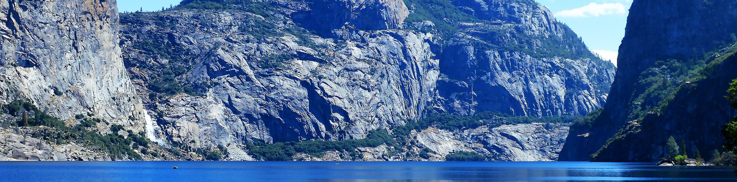
The Beehive Meadow Trail is an amazing adventure in Hetch Hetchy that travels through diverse terrains. Cross the O’Shaughnessy Dam,…

Chain Lakes Hike
Explore one of the more secluded trails in Yosemite National Park along the Chain Lakes Hike. This wonderful trail exposes…
Grant Lakes Hike
Immerse yourself in Yosemite’s high country along the Grant Lakes Trail. This epic hike exhibits the grandeur and diversity of…
Comments