
Yoho Lake Hike
View Photos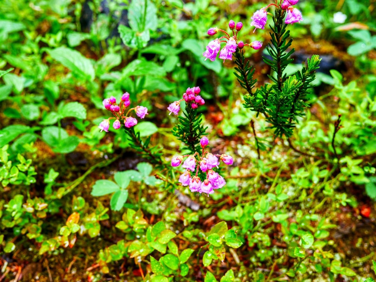
Yoho Lake Hike
Difficulty Rating:
Yoho Lake is one of the shorter hikes in Yoho National Park, and it’s a great opportunity to get away from the crowds. You’ll find excellent views of Takakkaw Falls - for those who don’t want to make the trip up to the Iceline Trail - and it finishes at a peaceful backcountry lake. It’s rare to find an easy hike with low crowds, so take advantage of this awesome trail!
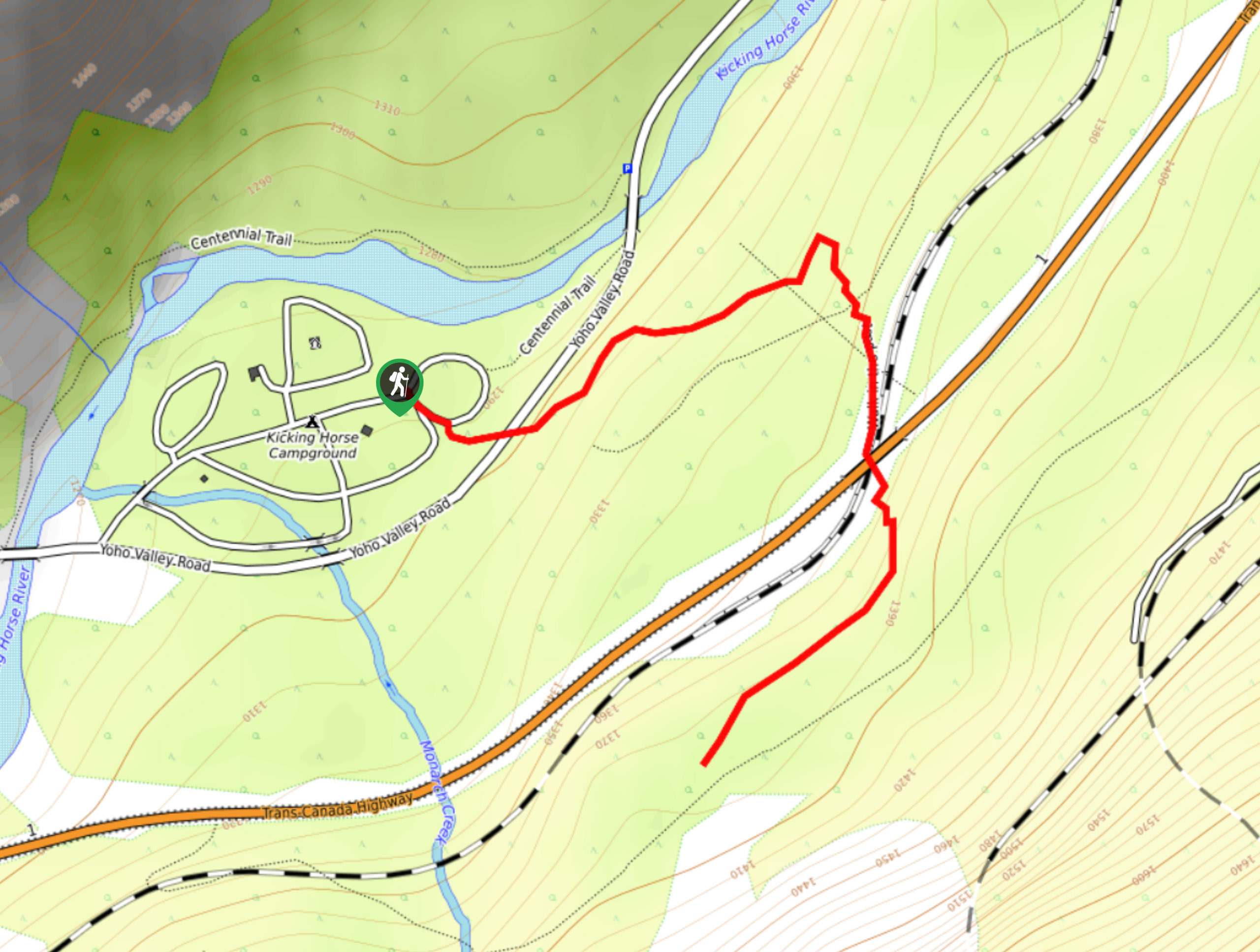
Getting there
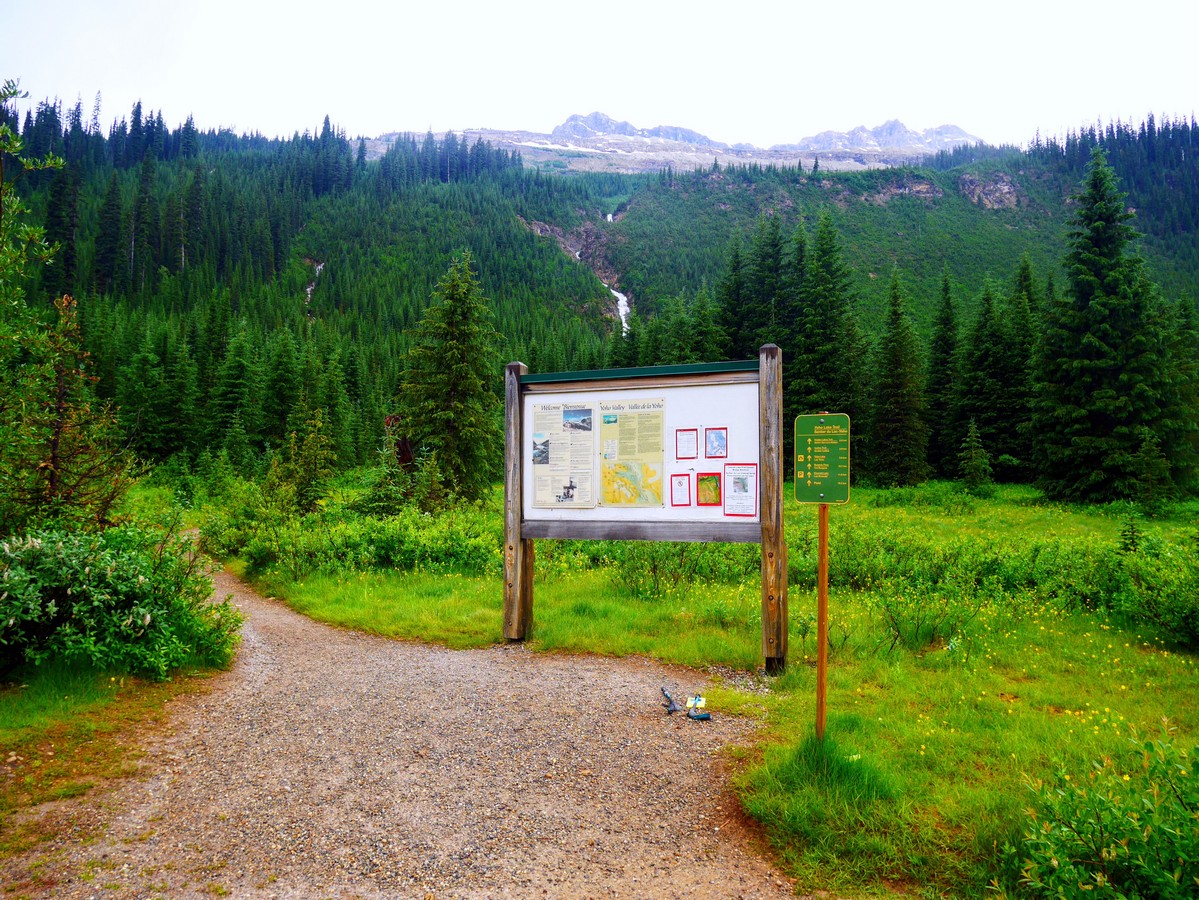
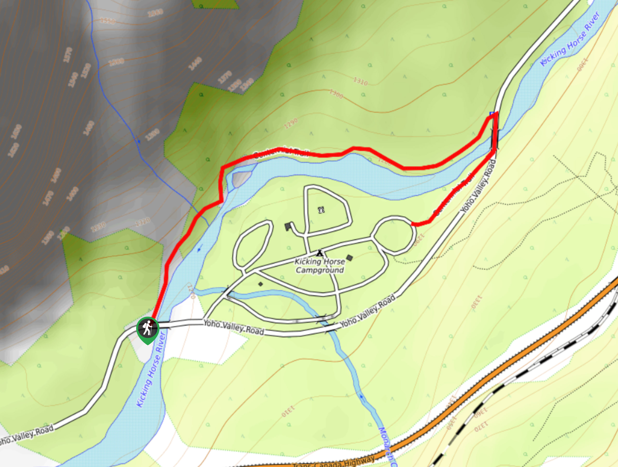
To start the Yoho Lake hike, from Banff, go west on the Trans-Canada Hwy. From the AB/BC border, continue 8.0mi west turn on Yoho Valley Rd. Go 7.9mi to the HI Hostel. Trailhead is here, but parking is guests only. Go 2297ft down and park at the Takakkaw Falls Day Use parking lot, then walk back to the hostel.

About
| When to do | July to September |
| Backcountry Campsites | Yes, at Yoho Lake |
| Toilets | Yes, at trailhead and at the lake |
| Family friendly | Yes |
| Route Signage | Average |
| Crowd Levels | Low |
| Route Type | Out and back |
Yoho Lake Hike
Elevation Graph
Weather
Yoho Lake Hike Description
The trailhead is at the back of the Whiskey Jack Hostel parking lot – the same as for the Iceline, with which you share the first 0.8mi of trail. An old wooden pipe lingers on the side of the trail – the water supply for the original hostel.
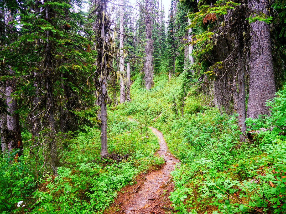
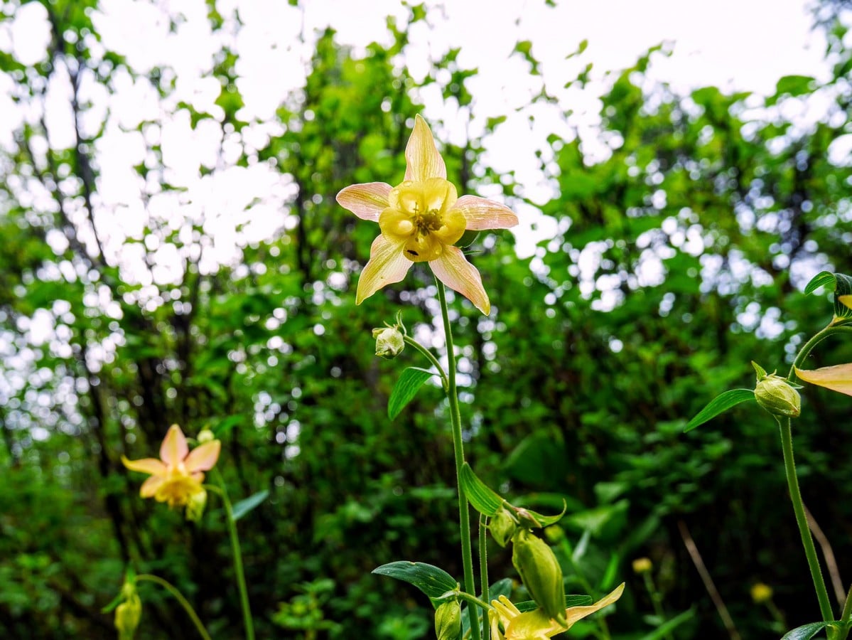
Almost immediately you start to switchback up the side of the Yoho Valley in dense subalpine forest. Wildflowers dot the edge of the trail, making the most of the little bit of sunlight they get here. There is an unusual form of columbine (a wildflower) to be found here. It’s a hybrid of the (eastern) yellow columbine and the (western) red columbine, making a lovely pinkish flower. It’s only found where the two species’ territories overlap.
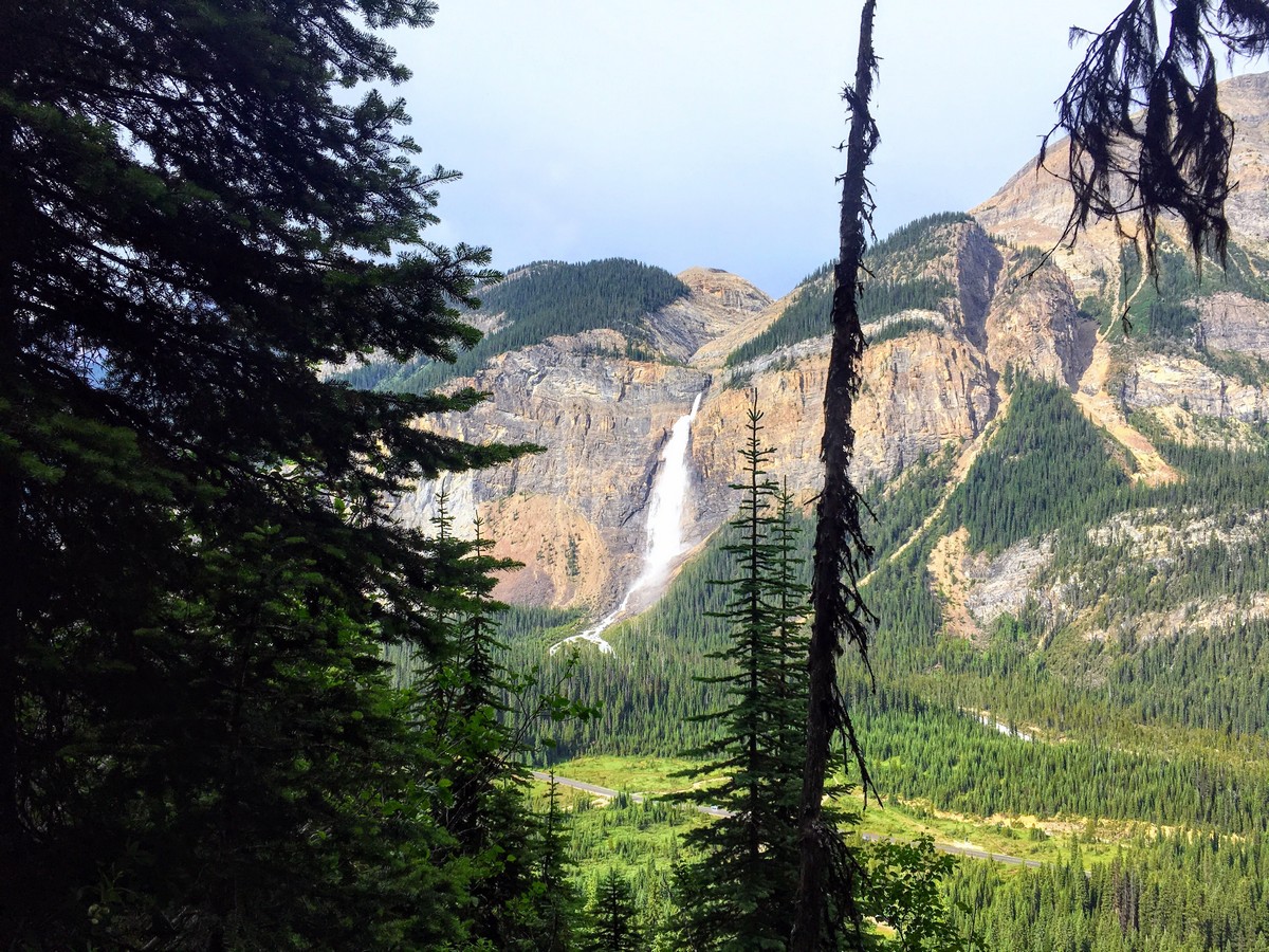
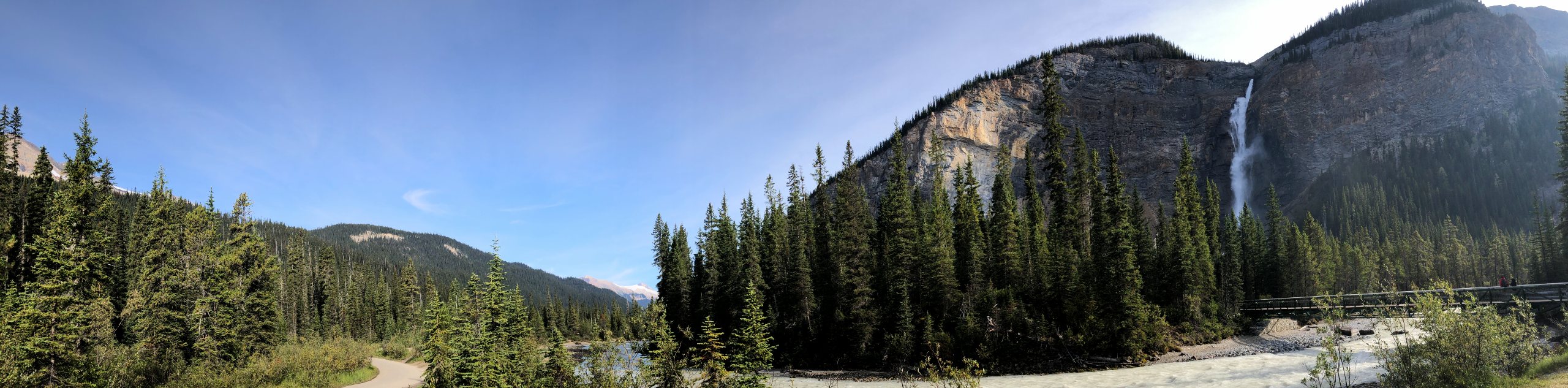
Almost all your elevation gain is done in this first 0.8mi; although, it may feel like much more. When you pause to catch your breath, make sure to look back across the valley for elevated views of Takakkaw Falls. Upon first seeing these falls in 1886, Canadian Pacific Railway president William Cornelius Van Horne named them Takakkaw, loosely translating from Cree to “it is magnificent”.
At 0.7mi a side trail branches to the left, leading to Hidden Lakes a short distance away. This trail is extremely rough, and muddy, and the lake itself is rather average by Canadian Rockies standards.
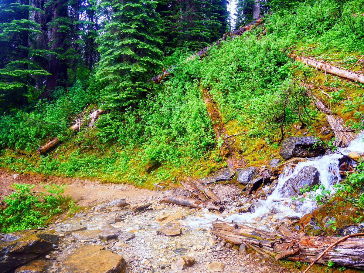
After 20 switchbacks, you’ll walk directly uphill for a short distance, next to a large, overgrown avalanche path – probably the one that destroyed the original hostel in 1967. This section of the trail can be slippery and muddy, and turns into a natural watercourse in rain, so take care. You’ll reach a junction with a trail sign – Iceline Trail to the right, Yoho Lake straight on.
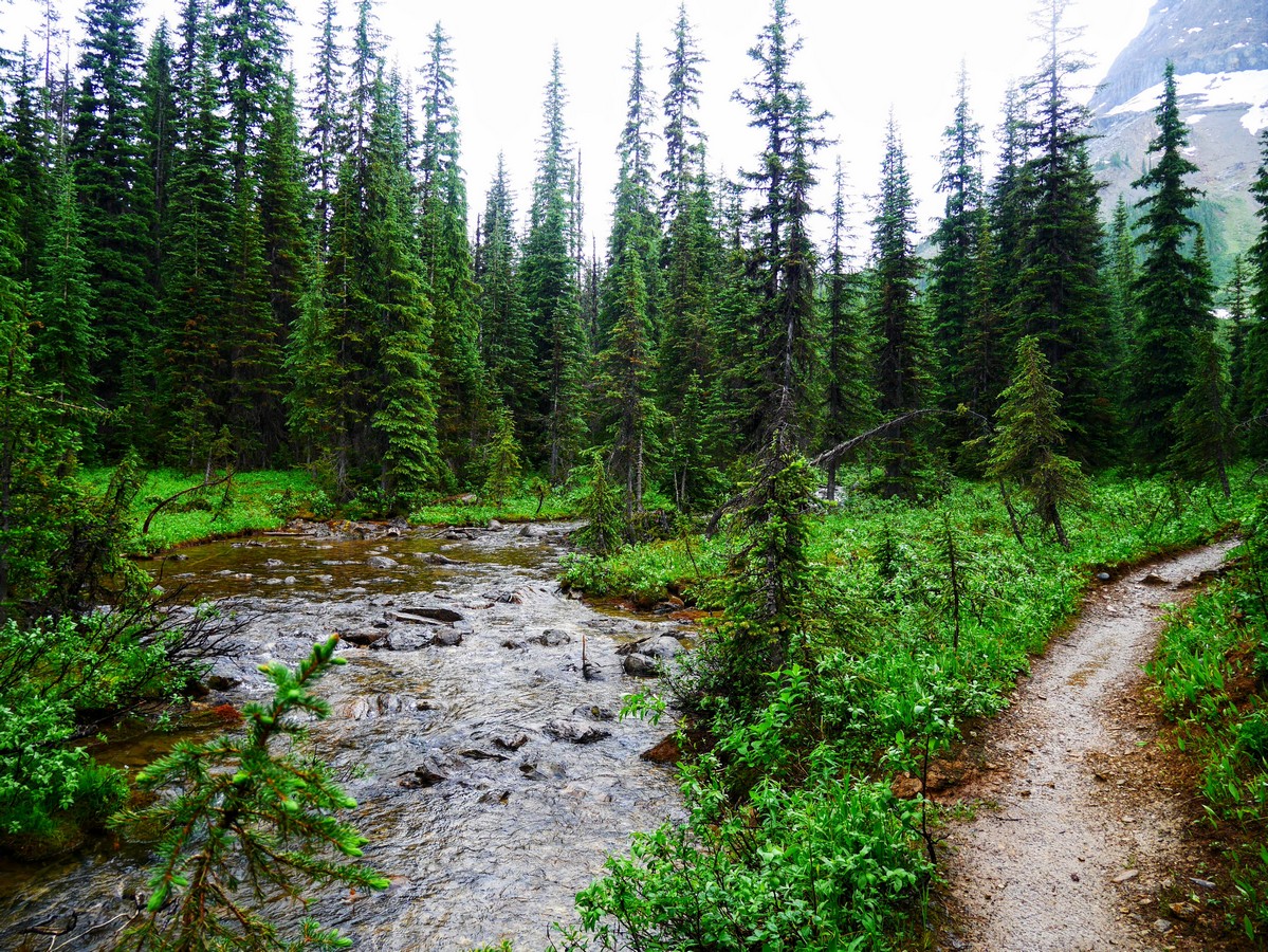
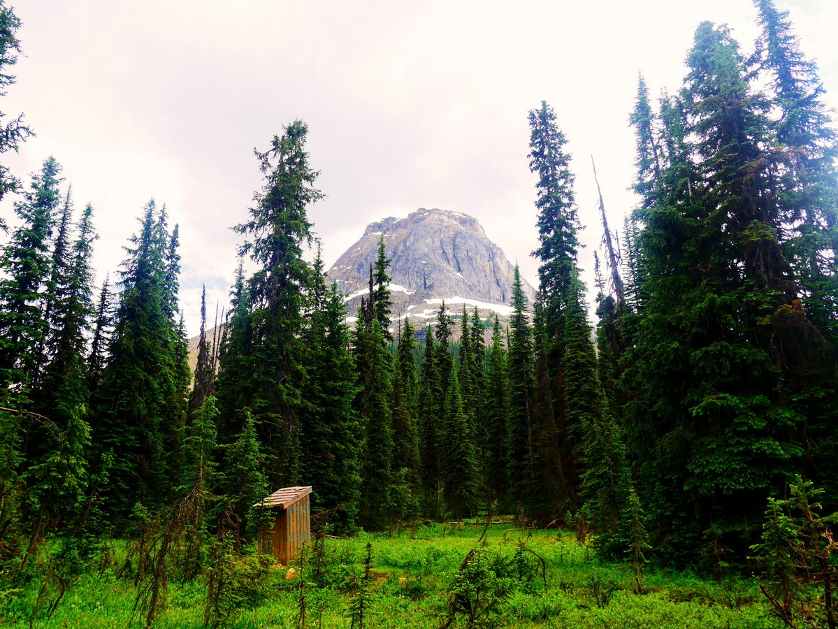
After this the trail is easy going, traversing along the terrace of the Yoho Valley through a spruce and fir dominated forest. Trees that have escaped the destruction of avalanches have grown large and old here, some of them reaching diameters of 0.7mi. Five small creeks cut across the trail but are easily passed with some careful foot placement. A healthy population of weasels live here, judging by the multiple carefully placed scats on prominent rocks along the trail. The roaring sound of the waterfall gradually fades away as you ascend a slight hump, then descend into a more open subalpine forest. This is the wide, flat expanse of Yoho Pass.
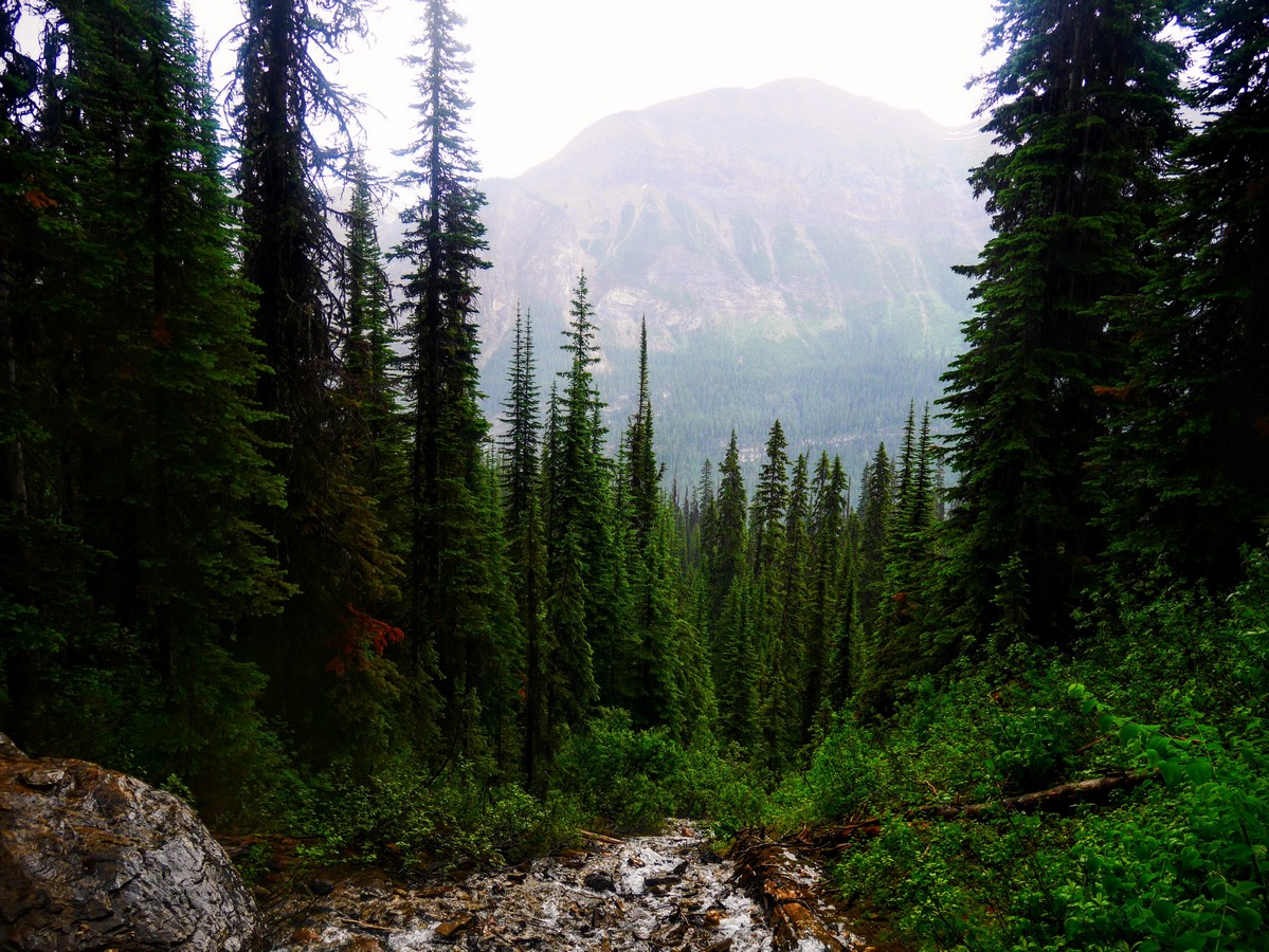
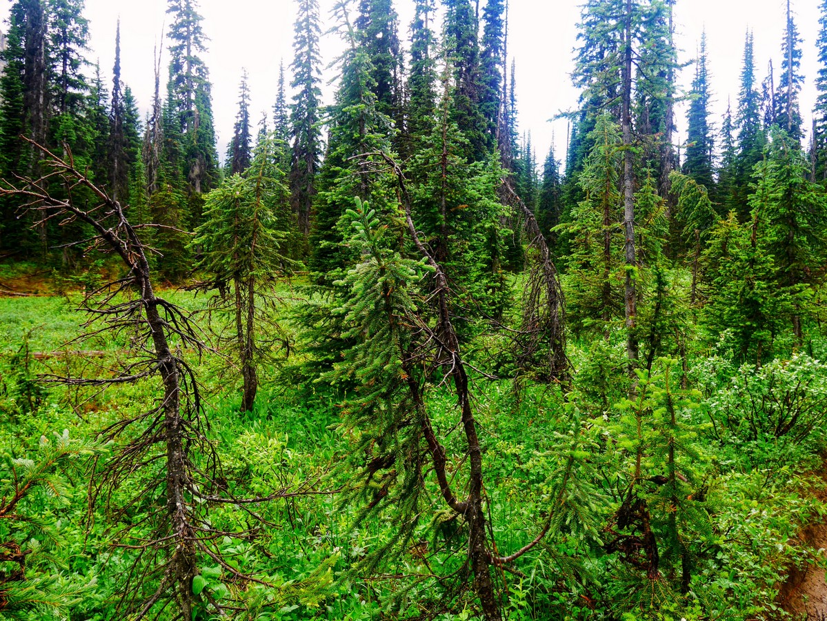
Snow can linger late here, and many of the trees show evidence of this. Kruppelholz (a German term meaning “crippled wood”) is a name for the gnarled, stunted spruce and fir trees that grow near the tree line in mountainous environments. Winter snow in these areas protects the tree from the harsh, cold air, so the trees tend to grow outwards, and not up, above the snow. Patches of Kruppelholz indicate areas where snow tends to accumulate, and the height of the trees can give an indication of the average depth.
As the forest canopy opens up, opportunistic alpine wildflowers abound. Glacier lily, western anemone, alpine globeflower, and pink & white mountain heather pop up in moist patches where snow has recently melted. When you feel the first sting of a mosquito bite, you’re almost there.
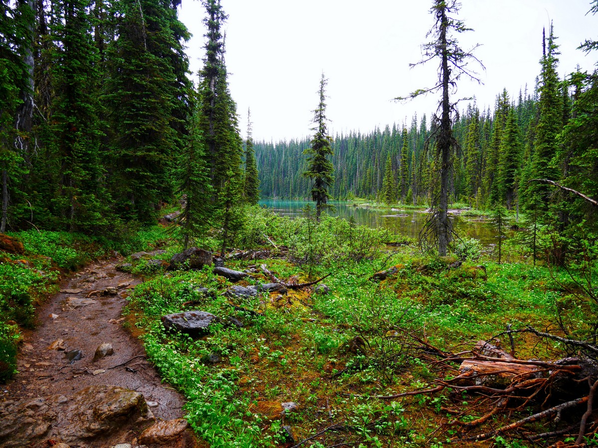
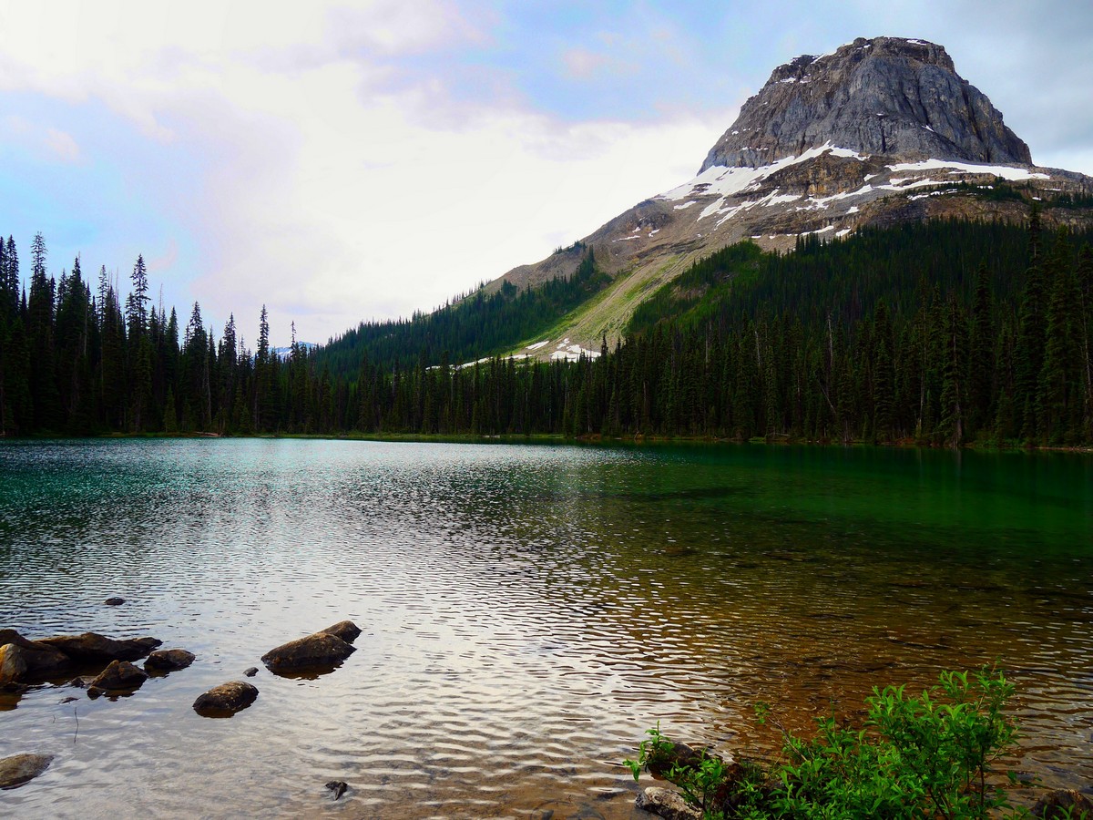
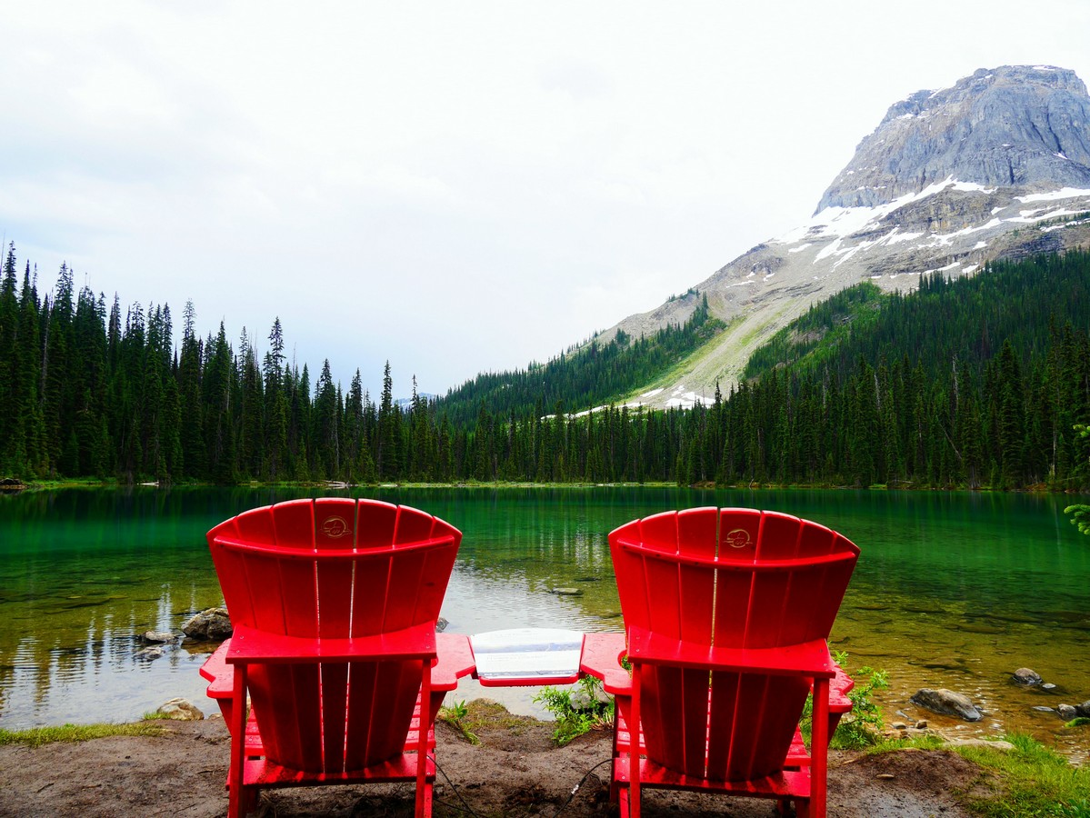
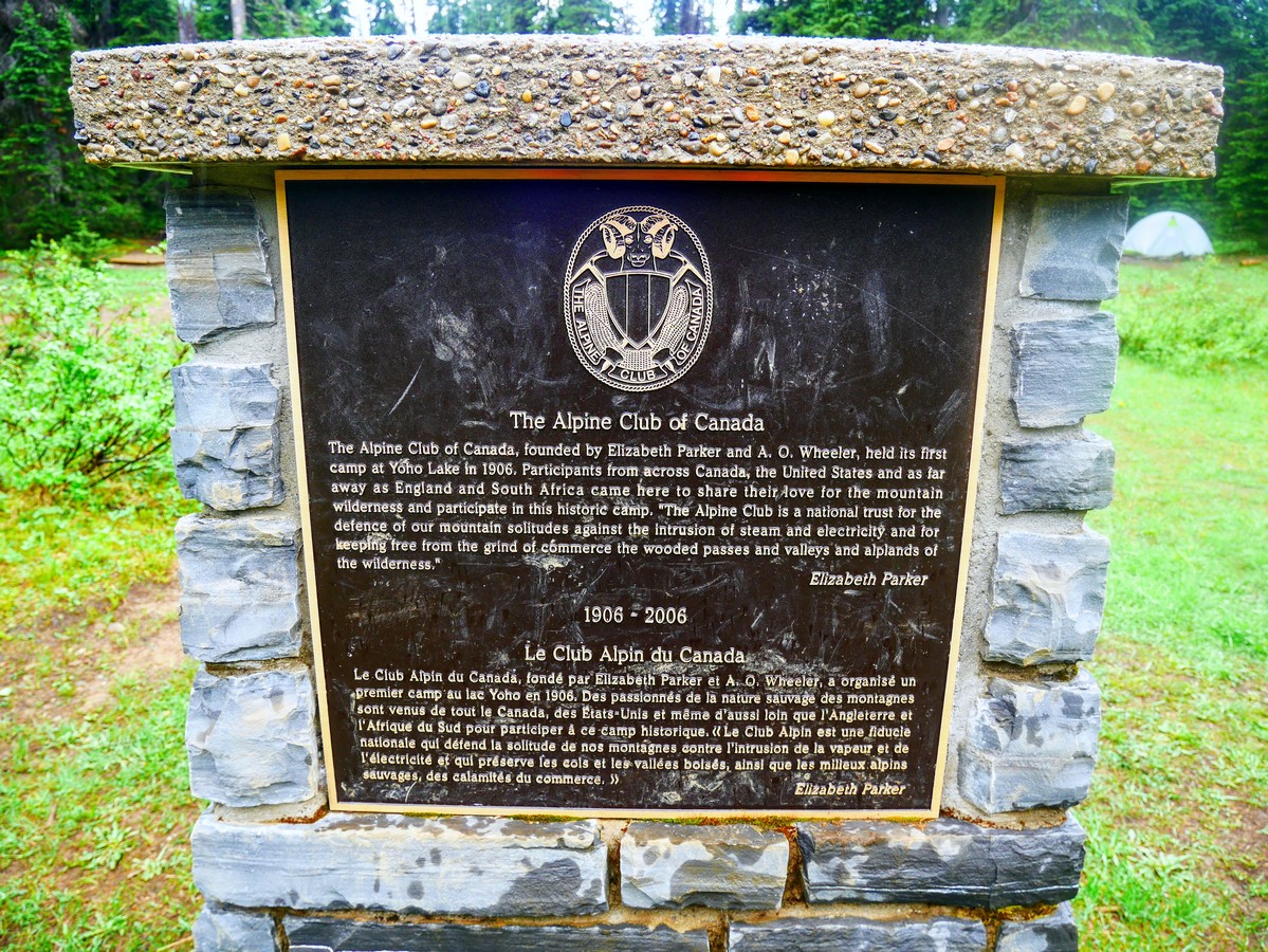
A deep emerald green, Yoho Lake peeks out through the trees as you traverse narrow bridges over its wetlands. Travelling a little further along the lakeshore you reach the Yoho Lake backcountry campground. This was the site of the first mountaineering camp of the Alpine Club of Canada in 1906, giving early alpinists easy access to the peaks of Mt Wapta (south) and Michaels Peak (north). The picnic tables at the campground may tempt you, but if you continue around to the north end of the lake you’ll find a pair of Parks Canada’s red chairs, with a stunning view of Mt Wapta reflected in the tranquil waters of the lake.
The easiest option is to return the way you came. For the more adventurous, following the trail past the end of the lake takes you on the Highline Trail, connecting with the Iceline Trail in 1.5mi. If you return that way, you can make it a loop trail. The higher elevation and greater exposure make this a better trip for late summer in good weather.
Insider Hints
Bring bug spray! Mosquitos love the damp subalpine meadows of Yoho Pass, and backcountry campers may be spotted wearing full bug nets while cooking.
From the campground, the official summit of Yoho Pass is 2297ft further west. Unlike most passes, this is completely forested and offers no views. Avoid, unless completing a longer trip to the Wapta Highline or down to Emerald Lake.
The HI Whiskey Jack Hostel offers affordable, hostel style accommodation right at the trailhead.

Similar hikes to the Yoho Lake Hike hike
Takakkaw Falls Hike
The Takakkaw Falls Hike is really more of a short walk than a true hike; however, the views that can…
Centennial Trail
Hiking the Centennial Trail is a short, family-friendly experience in Yoho National Park that will lead you along the winding…
A Walk in the Past Trail
The Walk in the Past Trail is a quick and easy hiking route in Yoho National Park that will lead…
YukihiroSato 4 years ago
Excellent hike. Not too exhausting but incredible views.
Tara Green 4 years ago
Great trail and a must-do if at Yoho National Park
RandyO 4 years ago
This hike holds a special place to my heart. Had a wonderful time with my family.
WendyMag. 4 years ago
The trail-head is clearly marked at the south end of the parking area past spectacular Takakkaw Falls. Elevation is gained on the trail to Yoho Lake, not too crowded. Worth the trail.
Ethan Welch 4 years ago
Takakkaw Falls was magical! The water is flowing enormously and I'm so happy we got to see it that way.
matsuomako 4 years ago
I love it so much! It is so quiet and peaceful!
Nathan R. 5 years ago
Nice backcountry experience. The lake looks exceptional.
monicaovabrava 5 years ago
Simply breathtaking! The water the mountain peaks are beautiful. The trail was reasonably good to take with younger kids.
hikertom12 5 years ago
Good way to see the falls minus some of the crowds. Not much elevation, bring a rainjacket in case of unfortunate surprises, though.
Arabella Houston 5 years ago
This lake is worth the visit. It's simple yet captivating.