Osprey Falls Via Old Bunsen Peak Road
View Photos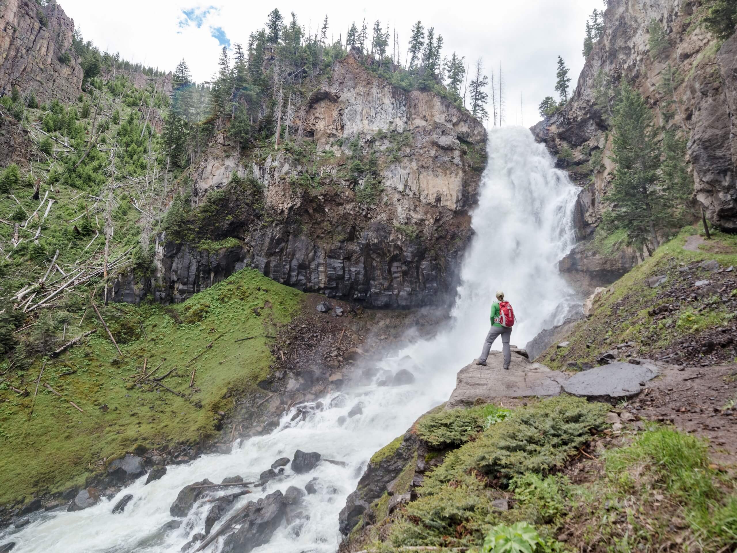
Osprey Falls Via Old Bunsen Peak Road
Difficulty Rating:
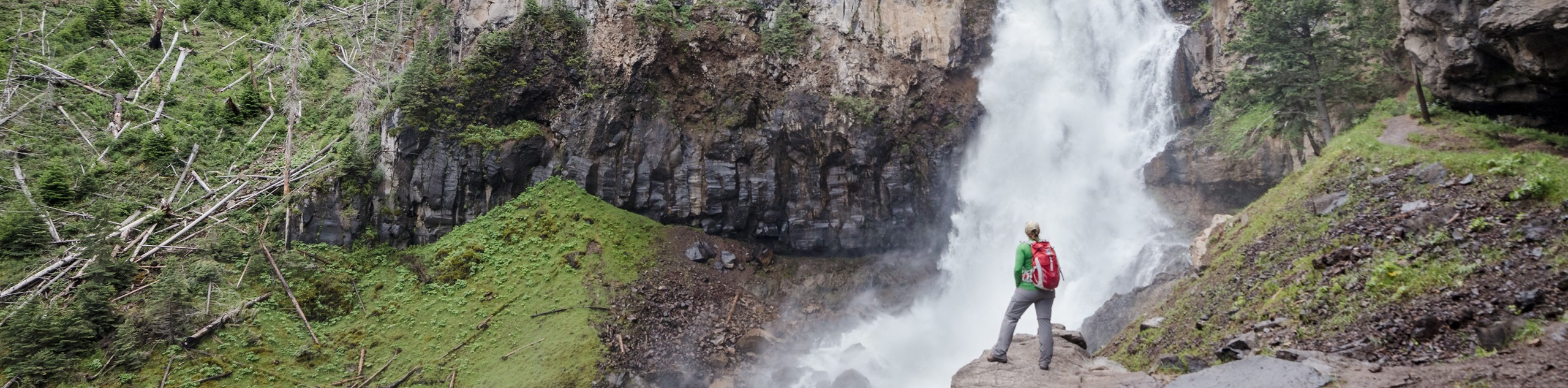
The hike to Osprey Falls via Old Bunsen Peak Road is a lovely hike in Yellowstone National Park. This out-and-back trail brings you to a 150ft tall waterfall along the Gardner River. This trail is moderately challenging. Due to wildlife in the area, dogs are not permitted on this trail.
Getting there
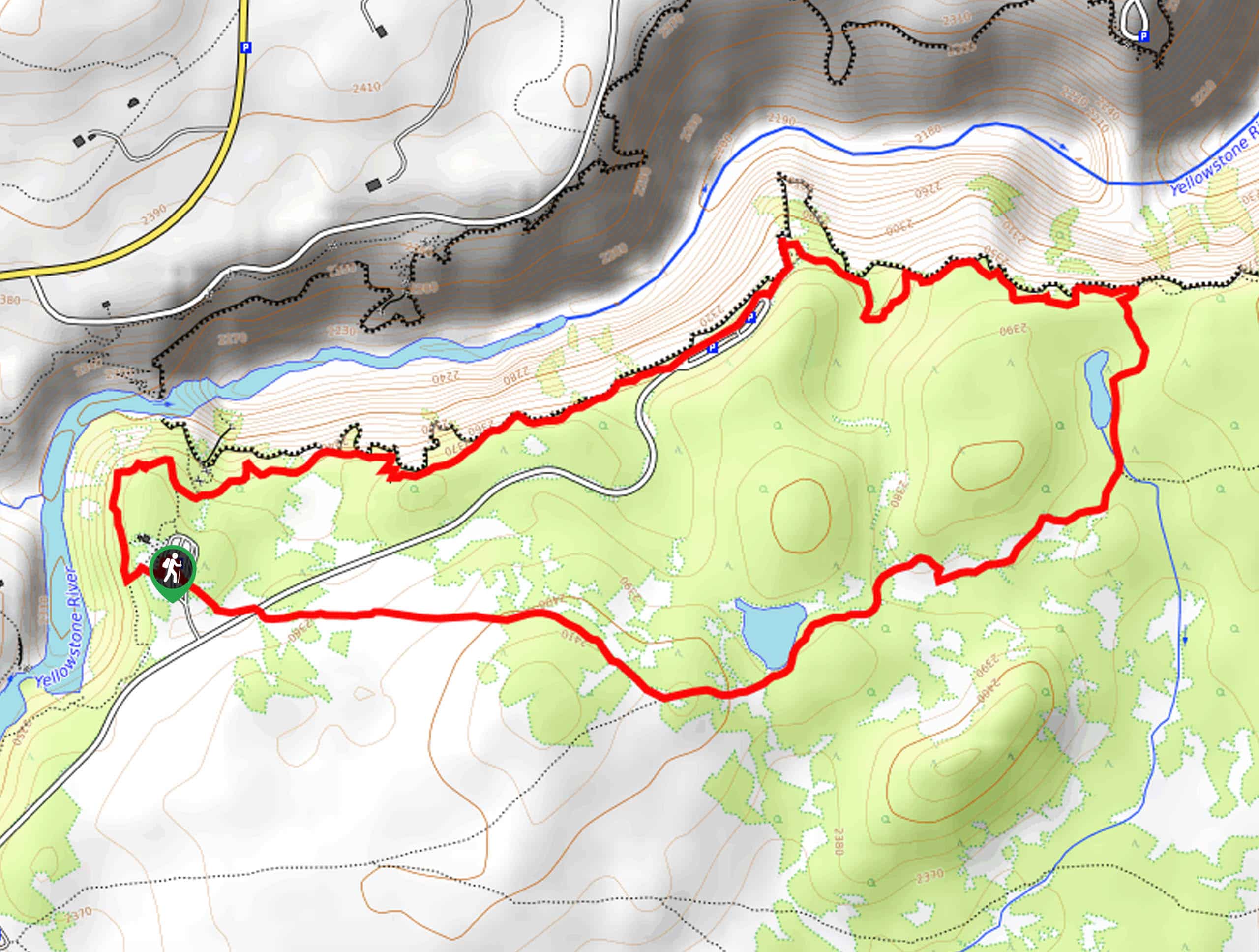
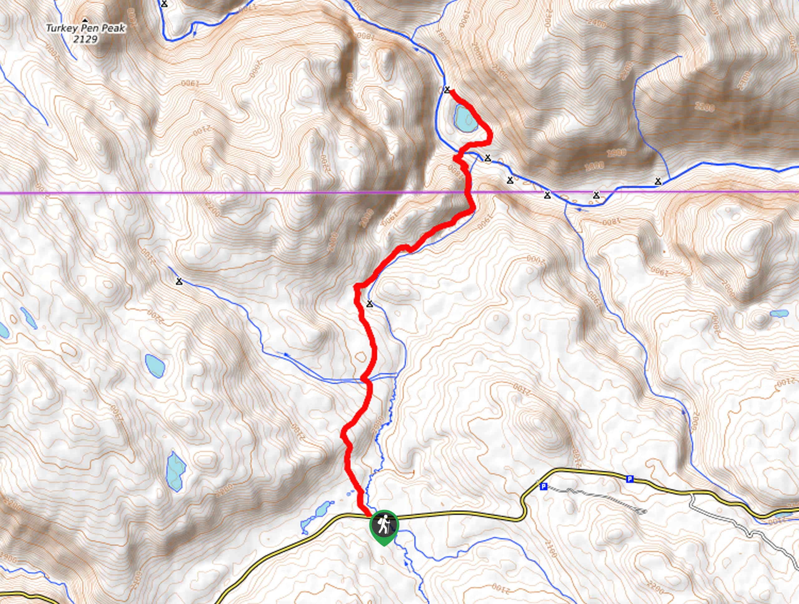
This hike begins at the Bunsen Peak Trailhead on Grand Loop Road.

About
| Backcountry Campground | No |
| When to do | May to October |
| Pets allowed | No |
| Family friendly | Older Children only |
| Route Signage | Average |
| Crowd Levels | Moderate |
| Route Type | Out and back |
Osprey Falls Via Old Bunsen Peak Road
Elevation Graph
Weather
Osprey Falls Via Old Bunsen Peak Road Description
The Osprey Falls Trail is a gorgeous route in Yellowstone National Park. This trail is mostly flat until the last mile, when the trail descends to the bank of the Gardner River. The descent down to the Gardner River is steep, loose, and narrow; we strongly recommend bringing along a set of hiking poles to provide balance and support on this section. You will need proper, supportive hiking footwear and lots of snacks and water to fuel your adventure to hike this route. As with any hike in Yellowstone National Park, be sure that everyone in your hiking party is familiar with bear safety protocols. At least one member of your group should carry bear spray and know how to use it properly. If you do encounter wild animals, do not approach or feed them and be sure to admire them from a safe distance. Osprey Falls itself is a stunning, 150ft tall waterfall along the Gardner River named for the abundance of osprey who live and hunt in the river canyon.
Beginning at the Bunsen Peak Trailhead, follow the Old Bunsen Peak road as it curves around the south face of Bunsen Peak. Just over three miles in, the trail will divide. At the divide, take the path on your right to descend down a series of steep switchbacks to Osprey Falls.
Enjoy a well-deserved rest at the base of these incredible waterfalls. When you are ready to head home, simply retrace your steps back to the Bunsen Peak Trailhead, where you began.
Similar hikes to the Osprey Falls Via Old Bunsen Peak Road hike
Clear Lake and Artist’s Point Loop
The Clear Lake and Artist’s Point Loop is an easy, scenic hiking circuit in Yellowstone. This trail features incredible views…
Turbid Lake Trail
The Turbid Lake Trail is an adventurous hike in Yellowstone. This trail is not well maintained and requires navigation and…
The Crevice Lake Trail
The Crevice Lake Trail is a gorgeous hike in Yellowstone. This trail can be done as a day hike or…
Comments